Get Lost Mountaineering
You are here: England » Peak District » Buxton to Leek and Ashbourne
Chrome Hill & Parkhouse Hill from Earl Sterndale (Revised April 2022)
Chrome Hill & Parkhouse Hillfrom Earl Sterndale (Revised April 2022)
Start/Finish
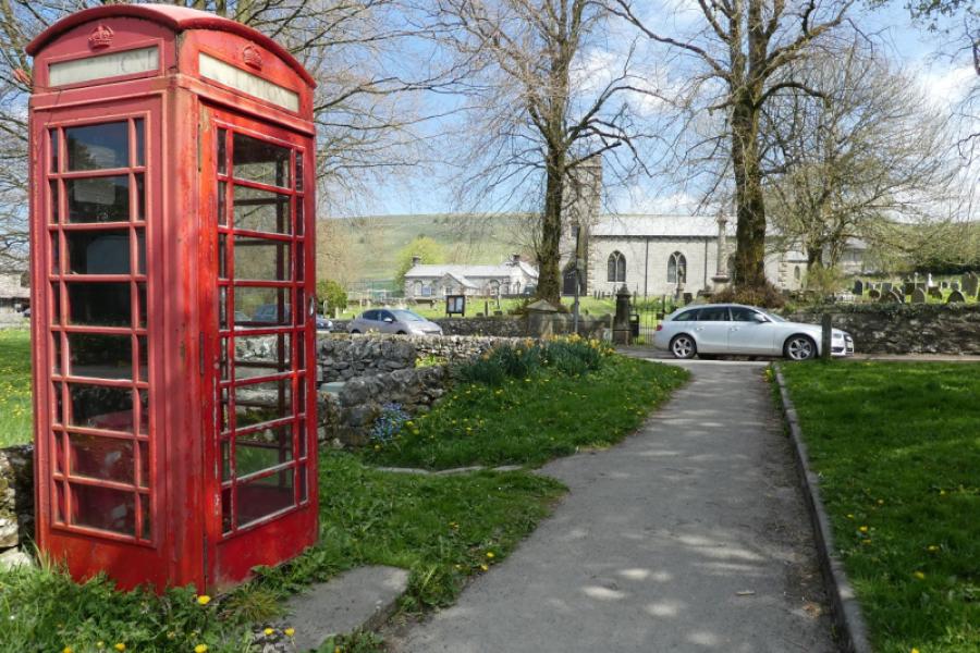
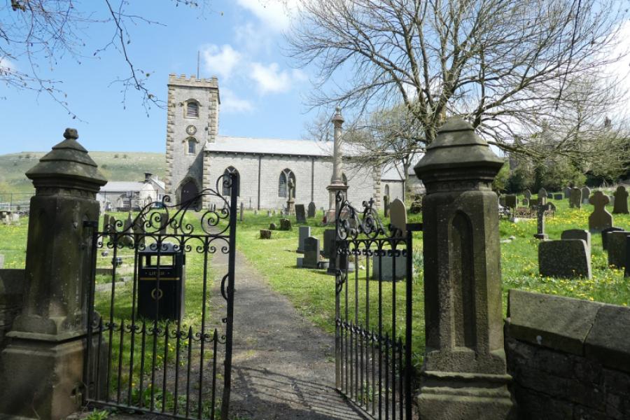
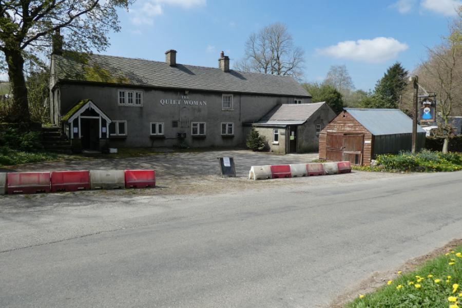
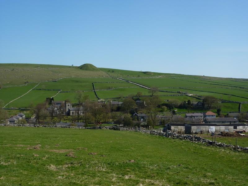
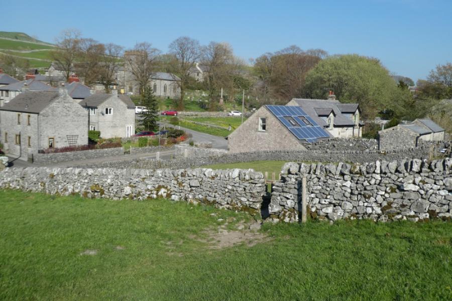
Earl Sterndale village where there is usually plenty of street parking available, often near the church which sits by a triangular village green. There is no car park and no public toilet facilities. The church is at SK 091 671 and the Quiet Woman Pub is opposite at SK17 0BX. Earl Sterndale is situated to the west of the Ashbourne to Buxton, A515, road. Those driving south along this road should take the B50503 (right turn) at Brierlow Bar, about 2 miles from the built up area of Buxton. Be careful not to take the Harpur Hill road which is at the same junction. Drive down the B5053 for about 2 miles then turn left at the crossroads and into Earl Sterndale. Those driving north, on the A 515, should go past Newhaven then turn off, left, after about 2 miles, at Parsley Hay. In less than a mile, give way at a T junction. Turn right here and continue, over two crossroads, to Earl Sterndale. For those coming from the south, there are toilets at the Parsley Hay Visitor Centre (about ten minutes drive from Earl Sterndale) which has variable opening hours.
Distance/Time
10 km About 4 – 5 hours
Peaks
Hitter Hill, c 370 m, c SK 087 667.
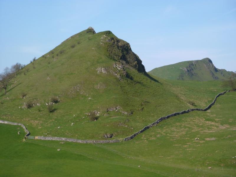
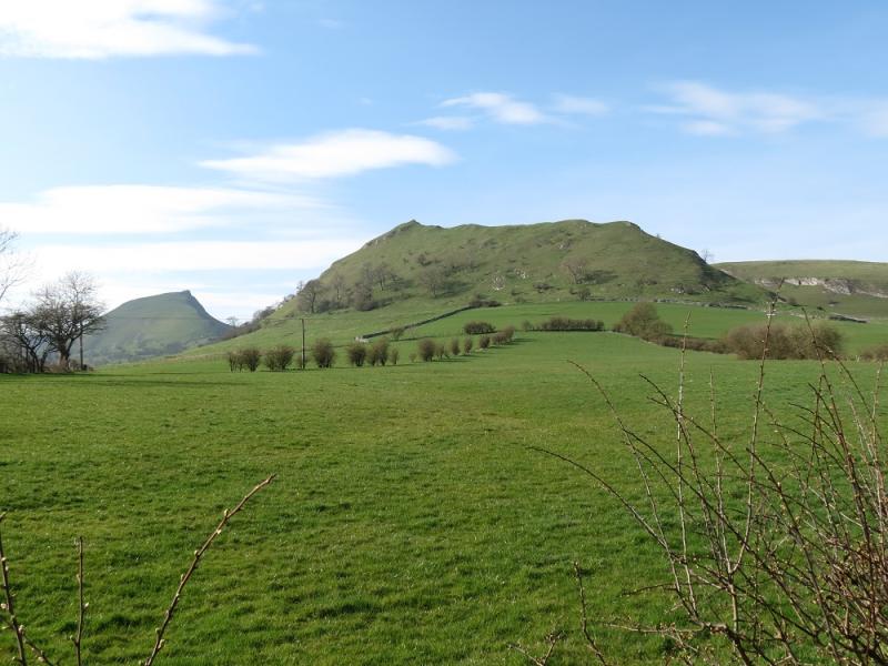
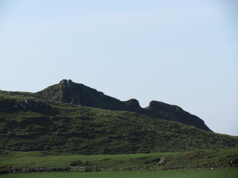
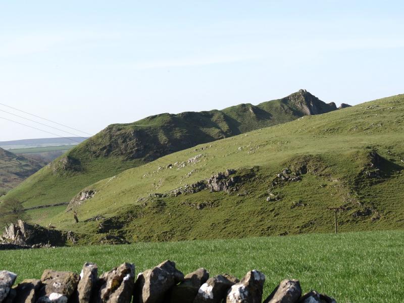
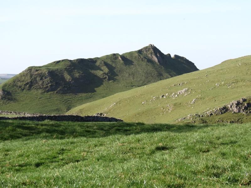
Parkhouse Hill, c 375 m, SK 079 669.
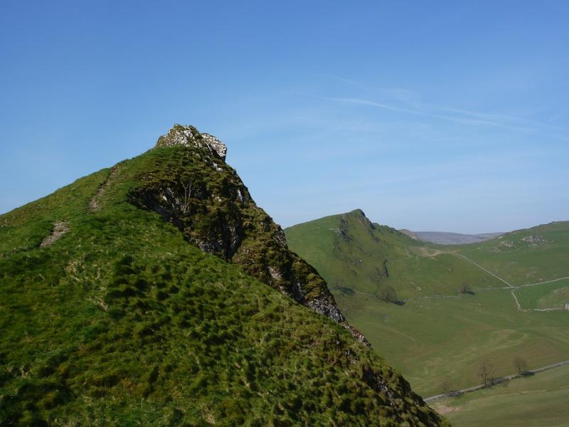
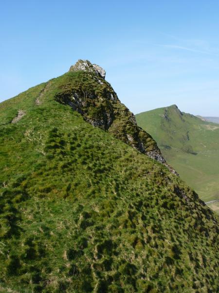
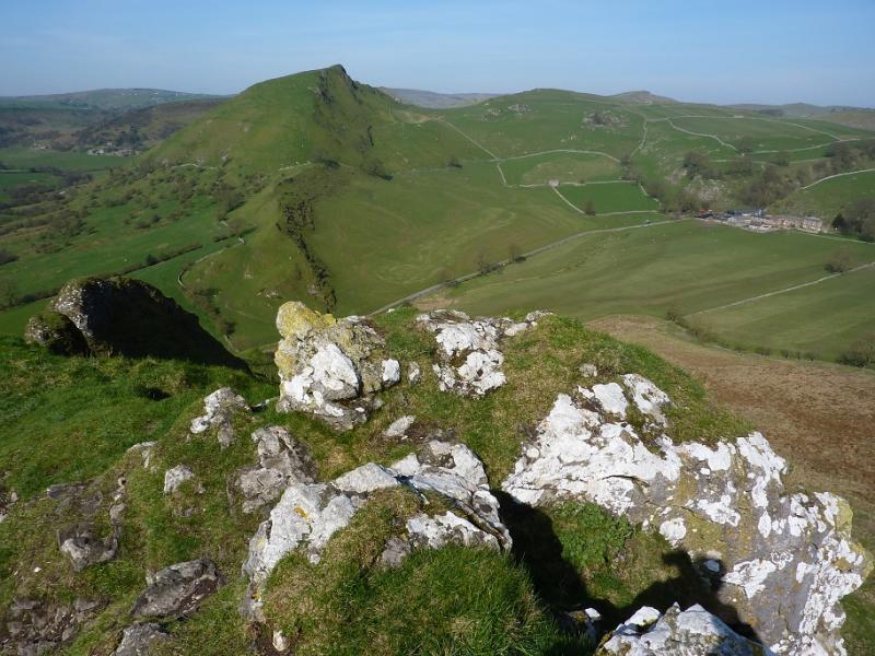
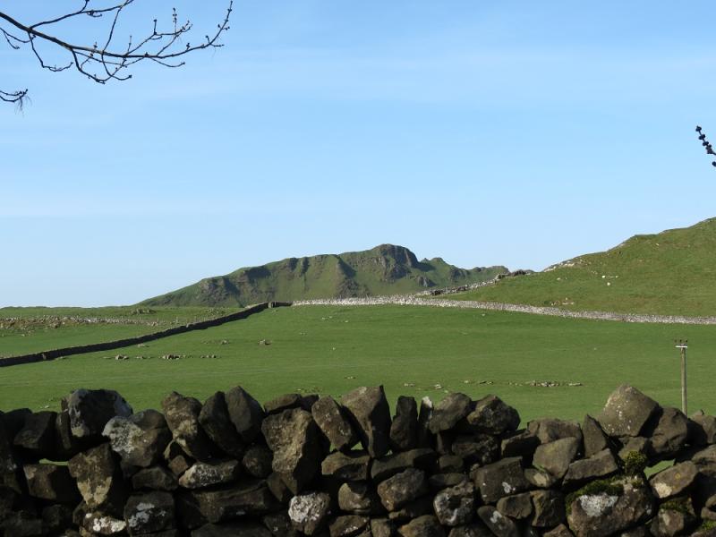
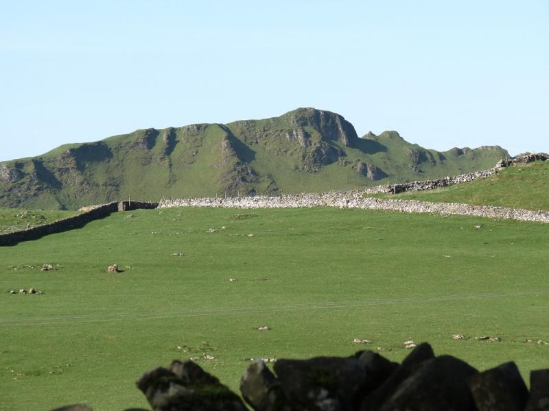
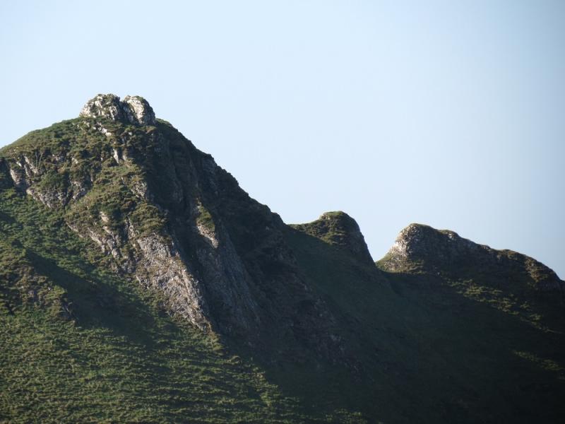
Chrome Hill, 424 m, SK 069673.
Tor Rock, c 430 m, SK 065 679.
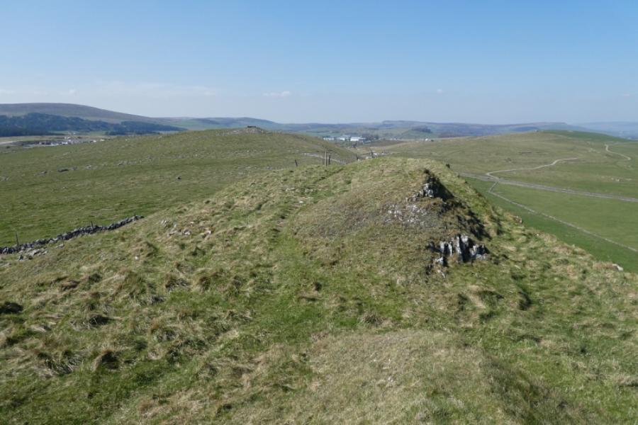
High Edge, c 465 m, SK 063 688. OS Outdoor Leisure 24: White Peak
Introduction
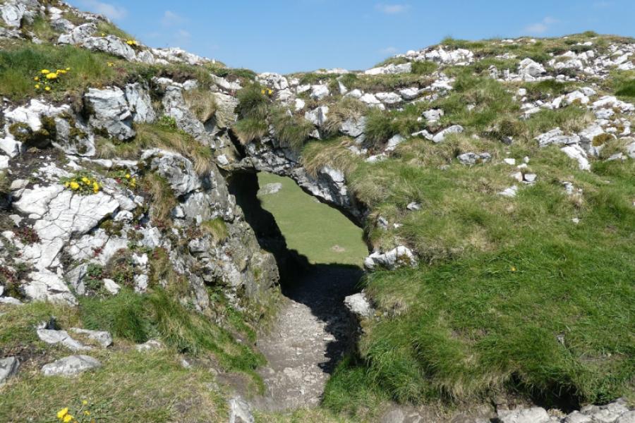
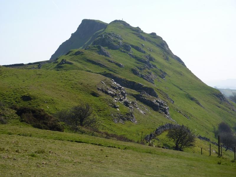
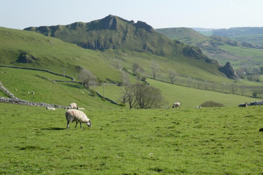
This is a gem of a walk in beautiful limestone country although it is quite strenuous. 5 tops including the dramatic Parkhouse Hill and Chrome Hill plus the lovely walk down Dowel Dale. As an extra bonus, there is a limestone arch, a small cave and a pothole plus another pleasant dale. The scenery around here is very similar to that of the Northern Pennines around Middleton-in-Teesdale. Much of this walk was closed off before the change in access at the turn of the century. Both Chrome Hill and Parkhouse Hill become more serious undertakings in wet, windy and, especially, icy weather. Parkhouse Hill is the rockier of the two and many will want to take the easier alternatives given in the route. For those with the skill and expertise, there are many scrambling opportunities (all avoidable) on Parkhouse Hill. The only pub in Earl Sterndale is called the Quiet Woman which was closed on 29/4/22 with no proposed re-opening date. Legend has it that a former landlord had a nagging wife and one day, in desperation, cut off her head making her “quiet”!
Route
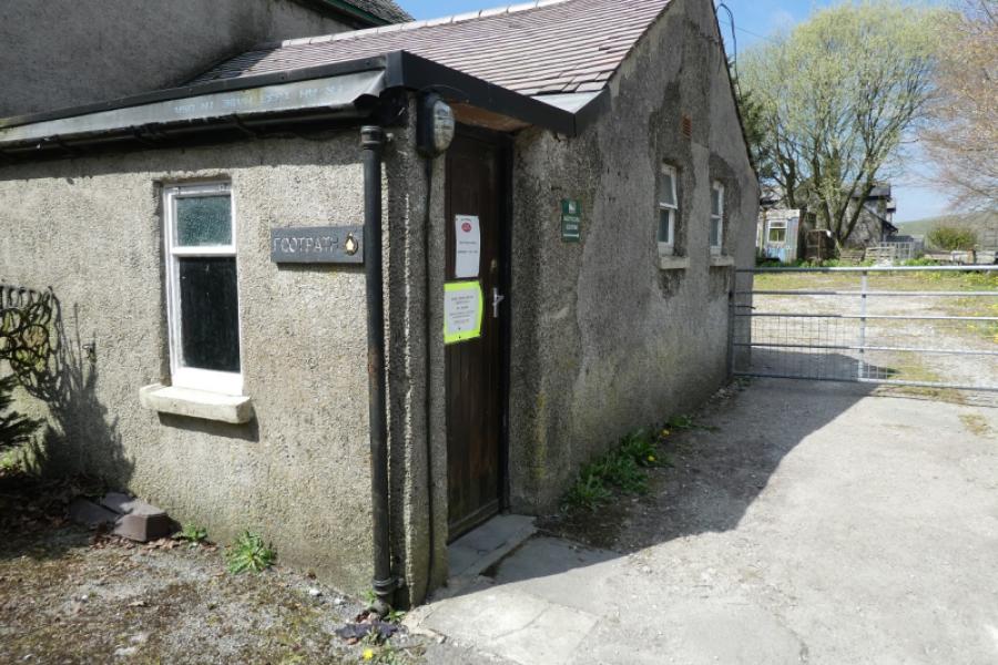
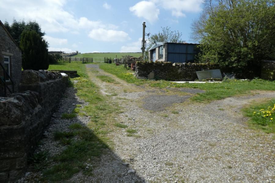
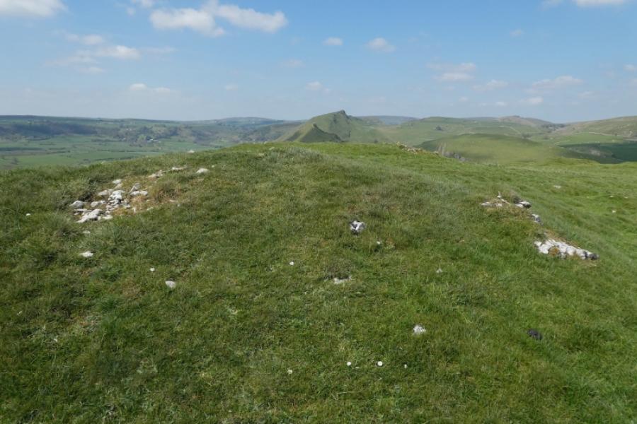
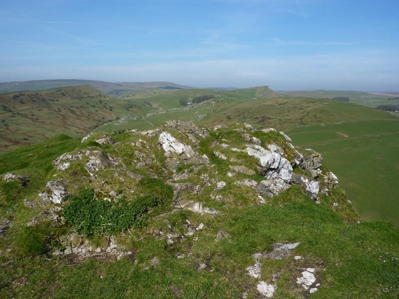
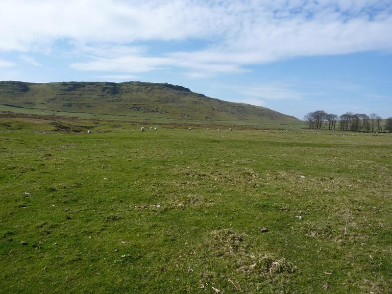
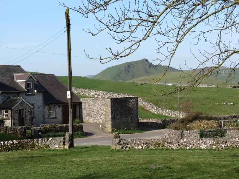
(1) With the Quiet Woman pub directly in front of you go right across the front of the pub where there is a footpath sign and a sign for a recycling centre. There is a fingerboard just beyond here. Go uphill, initially beside the pub, crossing two walls to reach the open hill. Continue to the top (there is no public path but it is open ground) which is on a small plateau, with a small scattering of stones (no obvious cairn) marking the summit of Hitter Hill, c 370 m, and gives good views across to Parkhouse Hill and Chrome Hill.
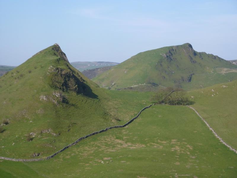
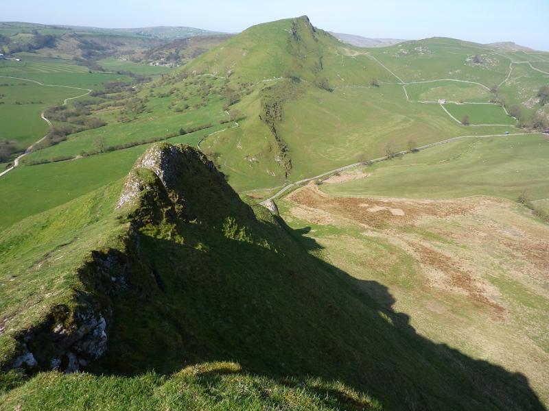
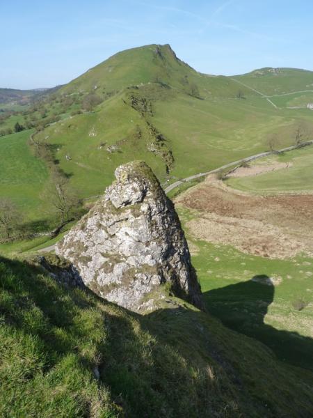
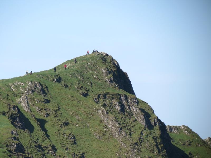
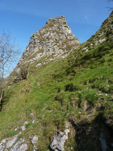
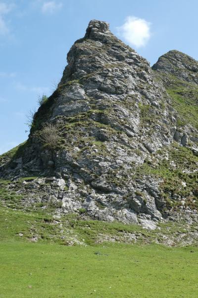
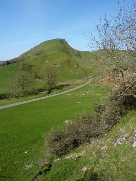
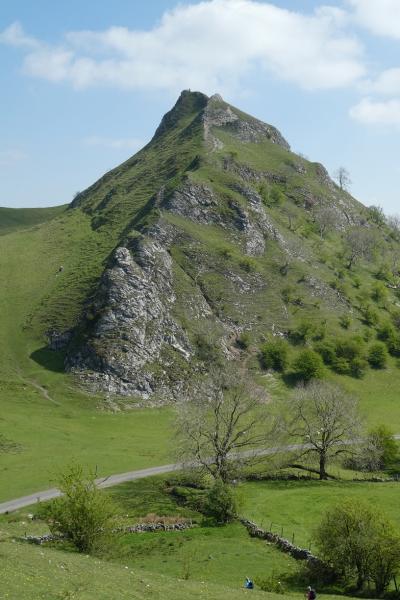
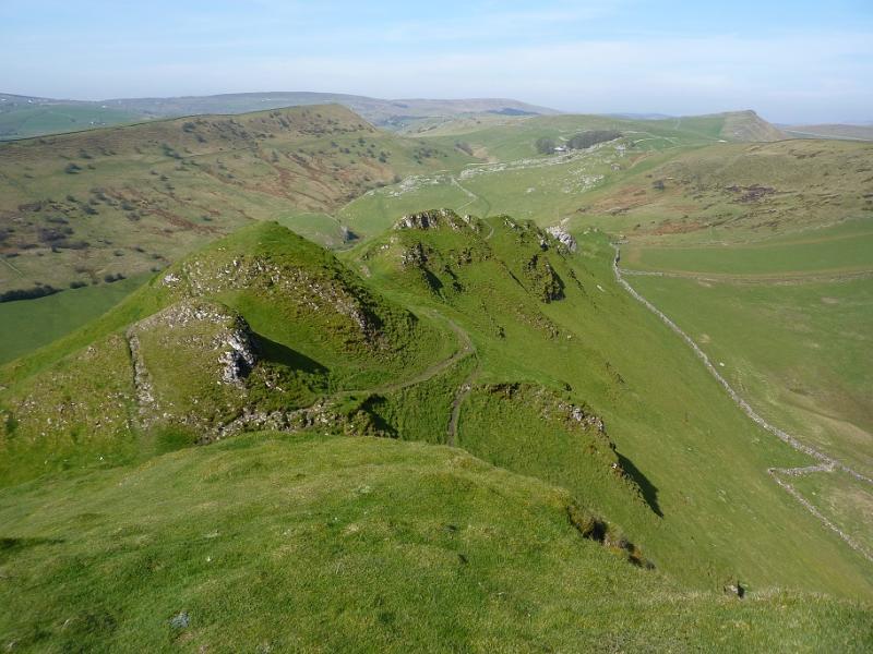
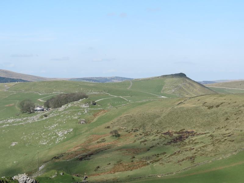
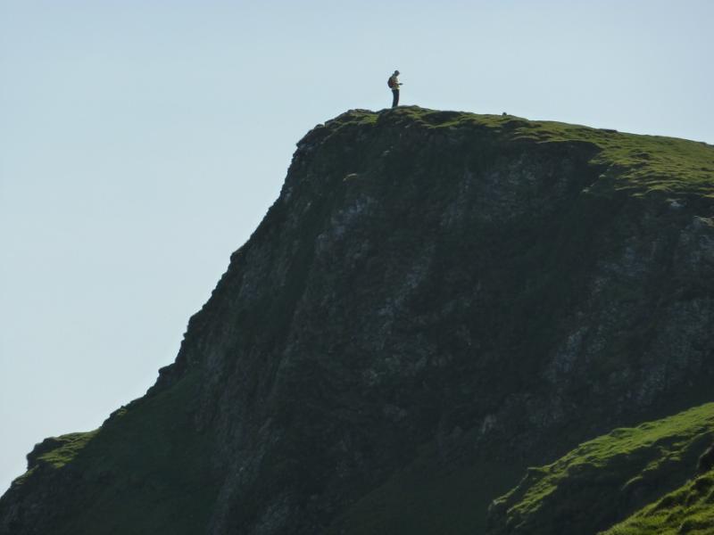
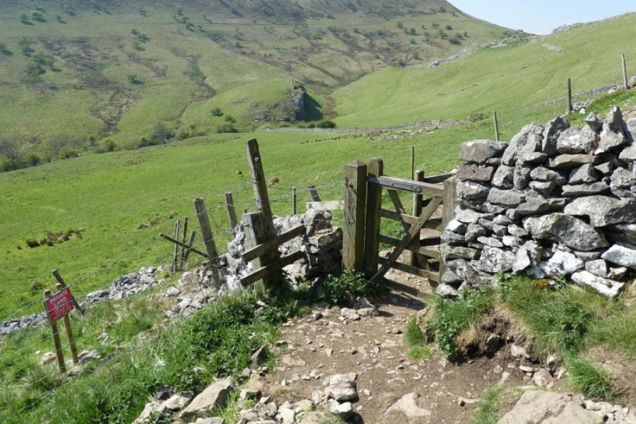
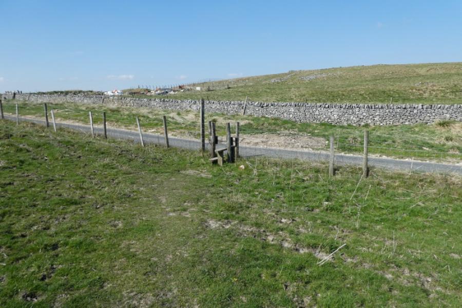
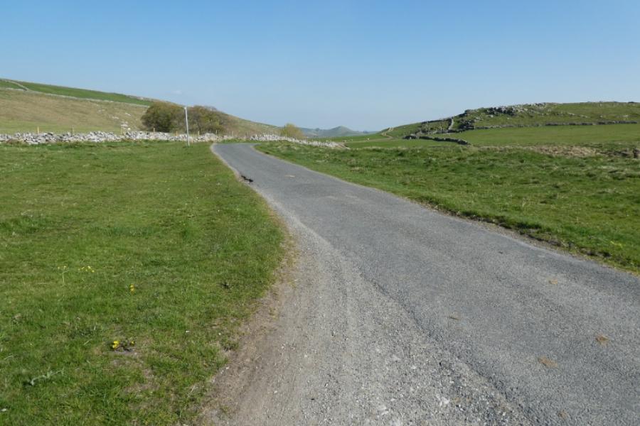
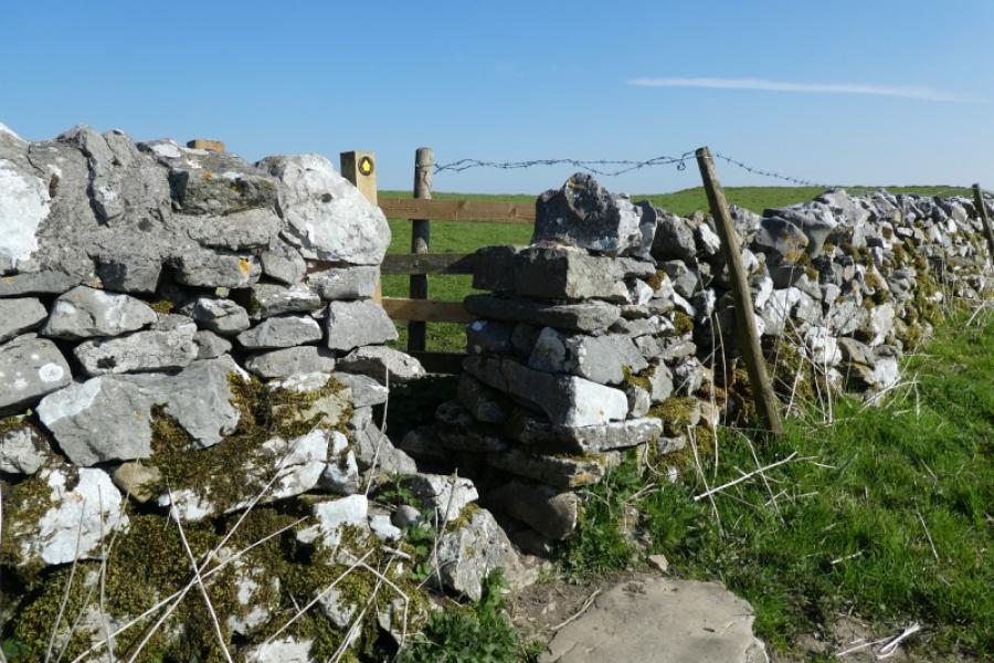
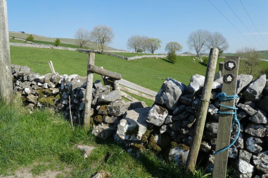
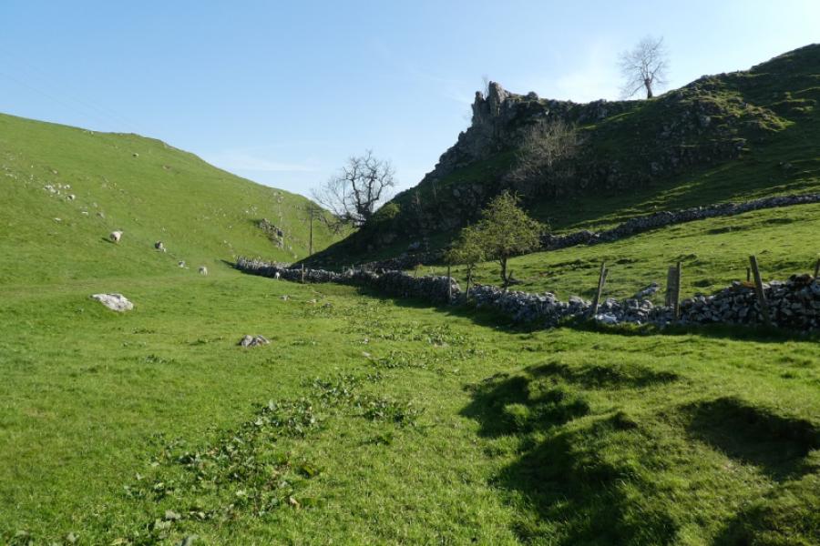
(2) Descend roughly NW/NNW to meet a stone wall on the right. Follow this down to where there is a stile which will be used on the return route. Opposite this stile is an obvious grassy path which descends to another stile and then to the road just to the left, S, of a line of trees. Cross the road and go through the gate on the other side then across the field to another gate. Go straight on, heading for the nose of Parkhouse Hill. The next gate is by a much larger metal gate and one is now at the foot of the open hill. Pick a way up the hill, on good grassy slopes, which is steeper lower down before becoming less steep and soon reach the limestone outcrop (no cairn) which is the summit of Parkhouse Hill, c 375 m.
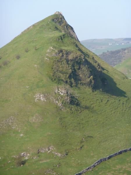
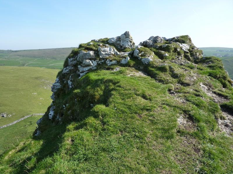
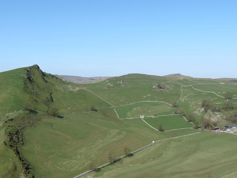
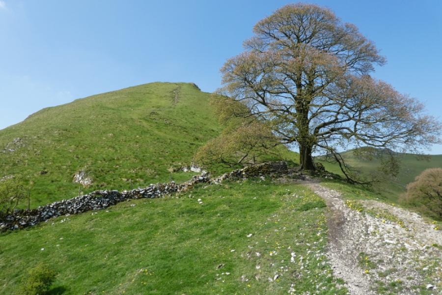
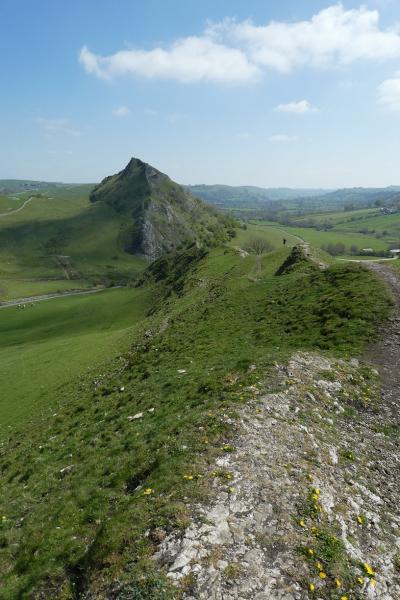
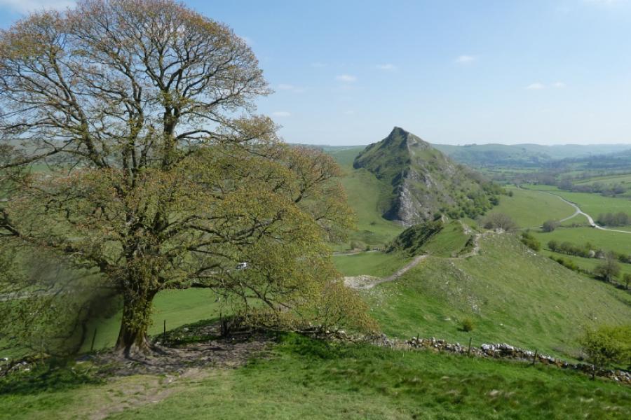
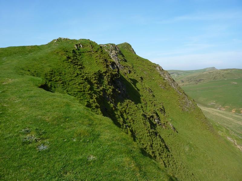
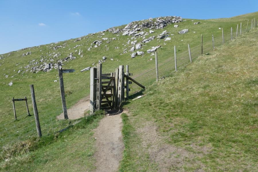
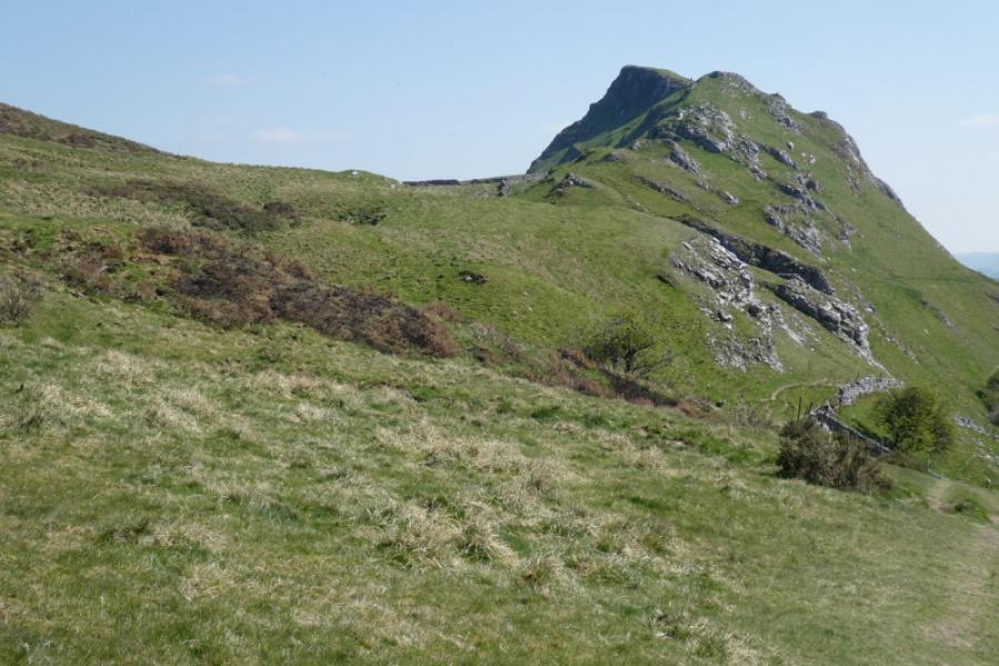
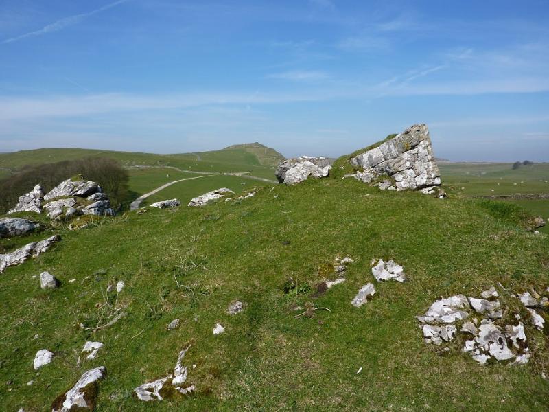
(3) To descend, continue along the crest heading roughly west. Initially the path is on the left of the crest. About halfway down, the path switches to the right of the crest then divides. The left branch goes around the last pinnacle and is steep and loose. The easier option is to leave the crest and descend right down easier grassy ground to the meadow below. Both routes lead to the minor road between Parkhouse Hill and Chrome Hill. Walk a little way up, N, the road towards the farm (Dowal Hall) to reach a cattle grid where the path up Chrome Hill starts. The footpath goes left initially before coming back to the crest. A fainter path folows the crest. The easier path and the fainter crest path converge just before a large tree where there is a stile. Continue up to the top where a minor limestone outcrop (no cairn and smaller than on Parkhouse Hill) marks the summit of Chrome Hill, 424 m.
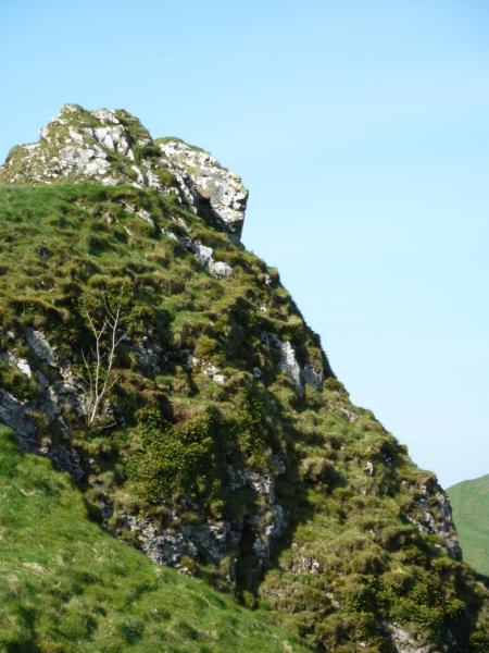
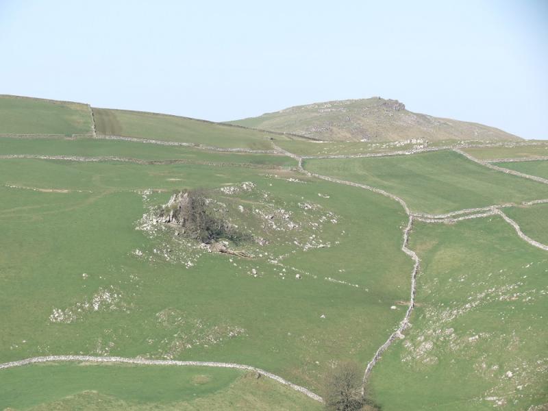
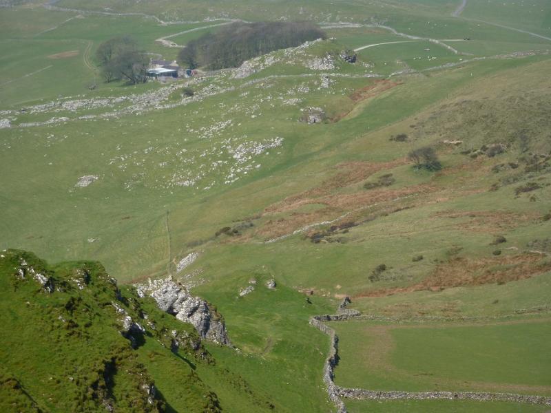
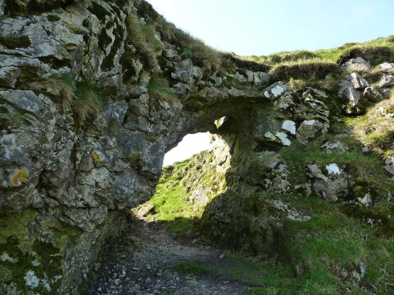
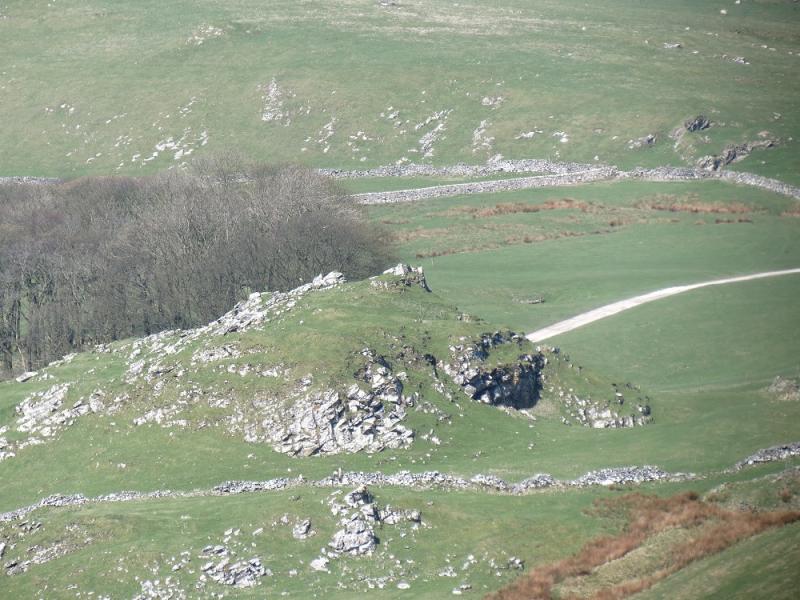
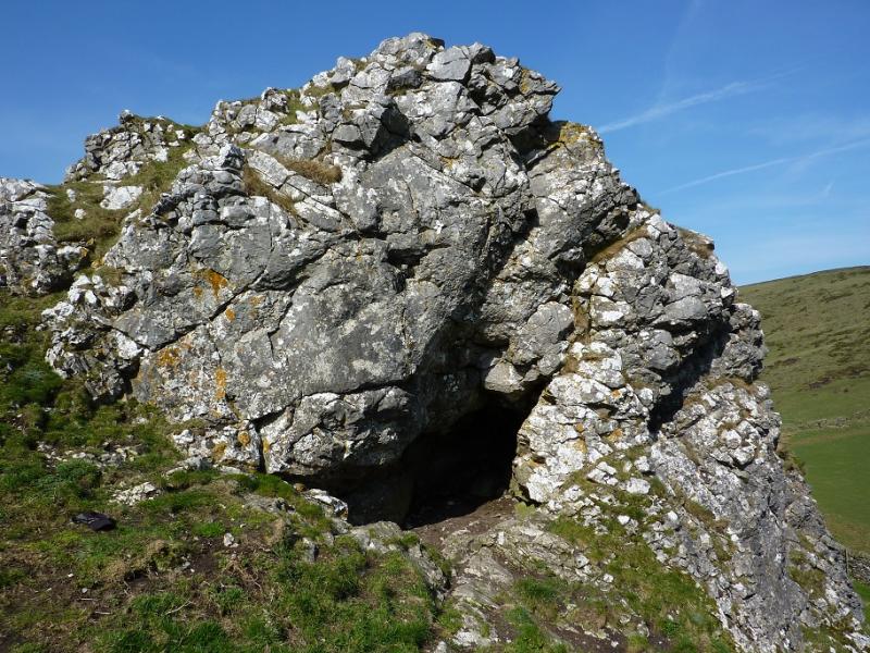
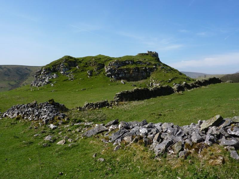
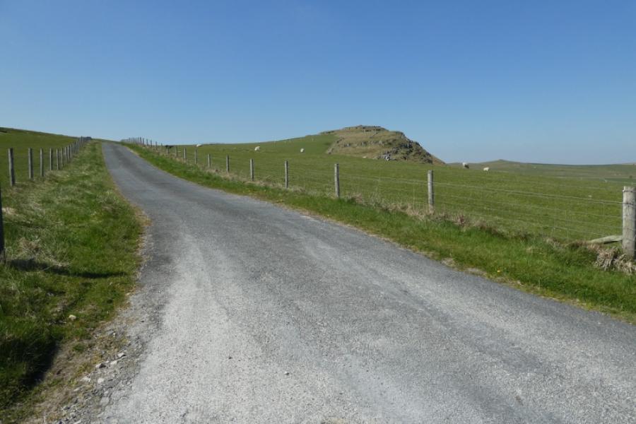
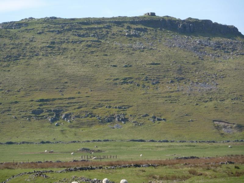
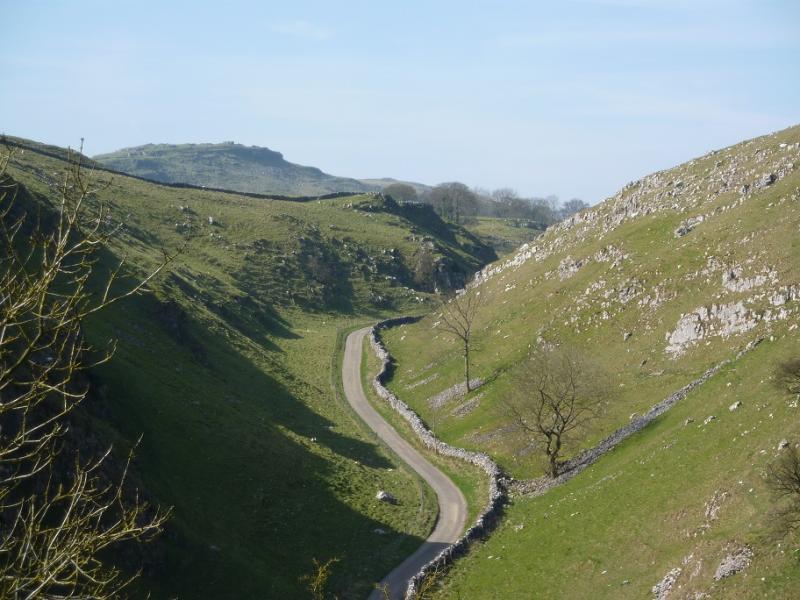
(4) To descend, continue along the crest which gradually curves around to the NW and has a distinct path weaving its way down. After about 100 m there is a hollow to the right of the path which has a limestone arch above it. Further down, where the path is on the right of the crest is a small open cave/recess which is large enough to shelter 5 or 6 people. Just beyond is the final outcrop which can be avoided on the left or right (path). The path then drops down, near to a stream (dries up in the summer) to reach a gate then climbs gently to a stile where a finger points uphill alongside a fence. There are some marker posts to follow and the path drifts left higher up. Strictly speaking, the path passes to the NE of Tor Rock. It used to be a very short diversion through broken walls, with little ascent, to reach its grassy/rocky plateau which is the summit (no cairn) of Tor Rock, c 430 m, but on 29/4/22, the walls had been rebuilt and a new, locked gate had to be climbed over to get to the summit which is a good viewpoint for Chrome Hill.
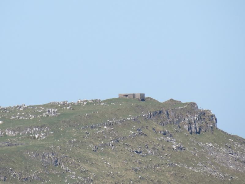
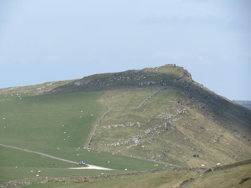
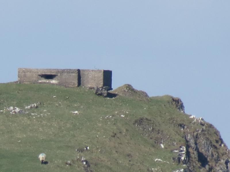
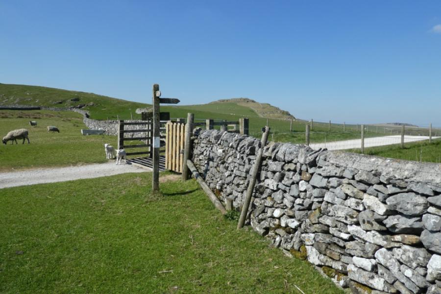
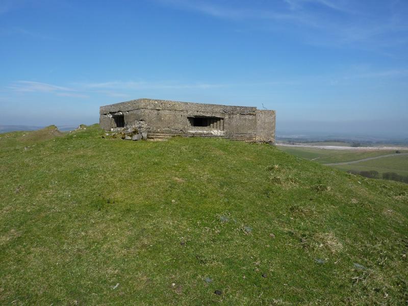
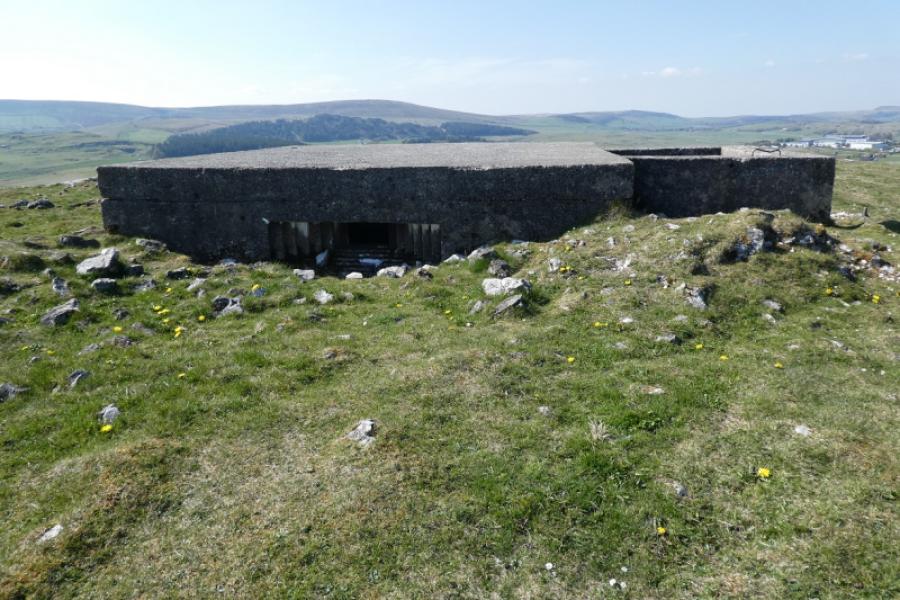
(5) Return to the path and follow it, by a wall, to the track which comes from Stoop Farm then follow the track right, N, to the minor road. Turn left here. High Edge is ahead to the right. Walk up the road to where it meets another road. Either climb over the gate before the wall leading towards the summit and follow the wall up. Alternatively, go past the wall and go up its left side (wall on right) but this will mean stepping over a barbed wire fence which is easiest to cross at its highest point. Reach the large square concrete “pillbox” structure which is the summit of High Edge, 465 m.
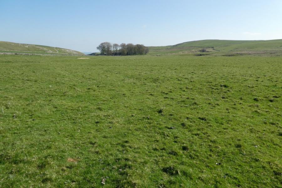
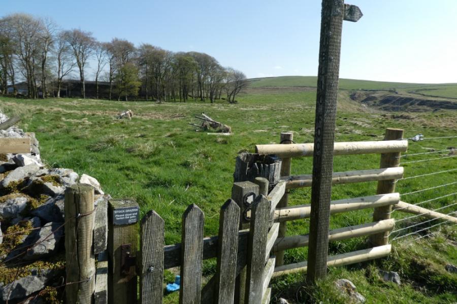
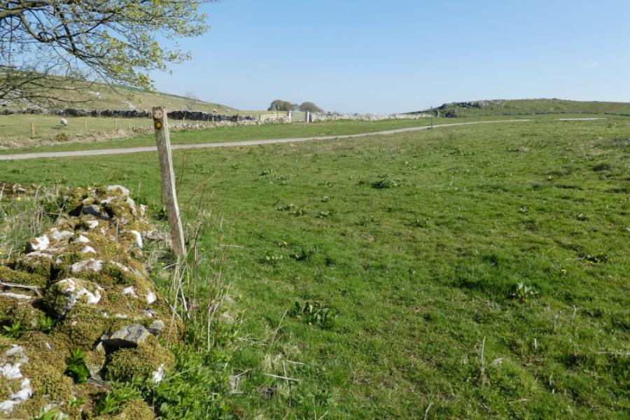
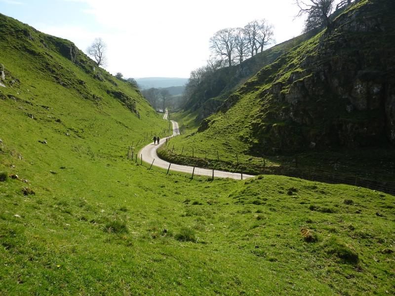
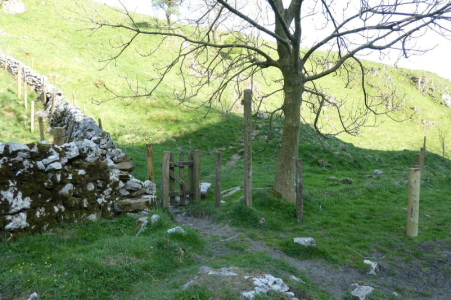
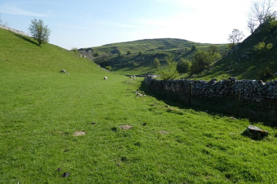
(6) From the top, go NW to intersect with the diagonal path from the road which means crossing or recrossing the barbed wire fence. Once on the public footpath, follow it roughly N as it makes a descending traverse to the minor road. Before the path starts to descend there seems to be nothing to prevent one leaving the path and staying on the crest of High Edge, where there is another pill box, before returning to the path and following it down to the road. Turn right, E, on the road and follow it for about 600 m to where a track on the left, a path on the left and a path on the right intersect with the road. One should see a small wood set back on the right. Take the path on the right, S, which is well posted across the field and passes close to SE corner of the small wood (on your right). When a track is crossed, just before Greensides Farm, take the signed path which passes to the right, SW, of the small wood and farm. This path is not very distinct but soon reaches the track from the farm and then the minor road. Turn left, E, on to the road and follow it down through the miniature, but very picturesque Dowal Dale. After about 1 km, take the signed path which goes off left just before the road swings right, ascending slightly to reach a wall before crossing an open field, shadowing the wall on the left, to the N of spot height 357. There is a marker post about halfway across the field but, on 29/4/22, the post was lying on the ground and not easy to spot. Continue ahead to the obvious metal gate and cross the stile. Continue to reach a gate where a sign directs you to follow the side of the field and not the track over the wall. Further down, you do join the same track heading E towards the road. Follow this almost to the road where there is a stile and fingerboard. Take the path, S, not to the road but down the pleasant grassy dale where there is little hint of a path. Stay on the left of the wall to reach a gate by Glutton Grange farm. Turn left, fingerboard, and walk through the farm to the road. Turn right, S, and walk for about 200 m to reach the gate at the bottom of Hitter Hill walked through earlier. Take the path up across the NW flank of Hitter Hill, crossing a wall en route, to reach the stile referred to earlier. Cross the wall here (shown on map) and walk straight across the field then drift right keeping roughly halfway between the walls either side. There are no marker posts but a short line of old fence posts can be followed. Do not try and reach the road below but continue to reach a gate about 20 m up from the road. Keep going ahead through 4 gates in total to reach the side of the pub.
Notes
(a) This walk took place on 29th March, 1st April, 2012 and 29th April, 2022.
(b) For the best scrambling, the route seems better in reverse. This will give a little scrambling up Chrome Hill and much more up Parkhouse Hill especially on the bottom pinnacle although that is now loose and vegetated.
Photos - Hover over photo for caption. Click on to enlarge. Click on again to reduce.