Get Lost Mountaineering
You are here: Scotland » 04 Loch Leven and Loch Linnhe to Loch Ericht » Mamores to Corrour
Central Mamores: Am Bodach & Sgor an Iubhair
Central Mamores: Am Bodach & Sgor an Iubhair from Kinlochleven
Start/Finish
Grey Mares Waterfall car park, Kinlochleven. From bridge over River Leven, go N then take first right (signed Grey Mares Waterfall). At end of the street there is a white church, go right and the car park is almost immediately on the left.
Distance/Time
13 km Approx 7 hours
Peaks
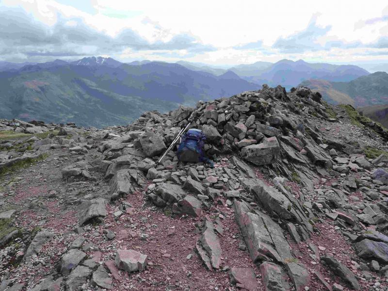
Am Bodach, 1032 m, NN 176 650.
Sgor an Iubhair, 1001 m, NN 165 655. OS sheet 41.
Introduction
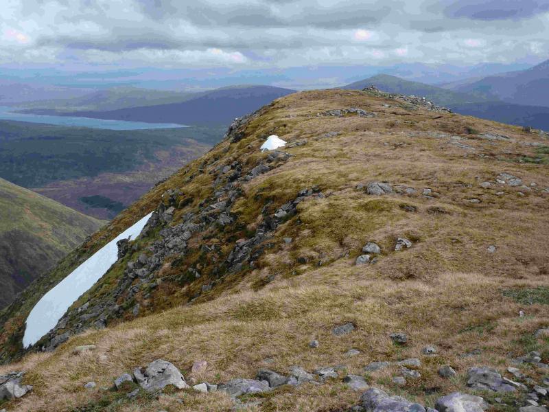
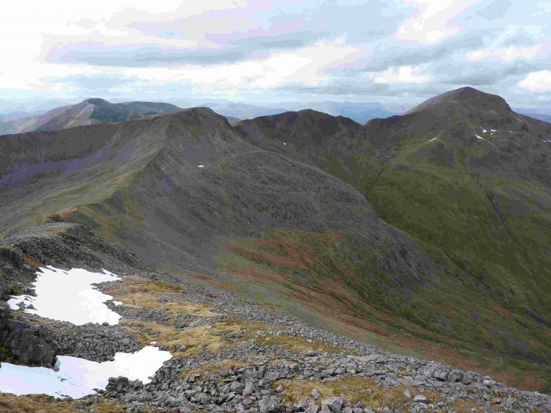
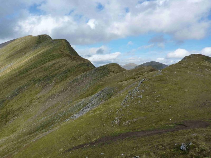
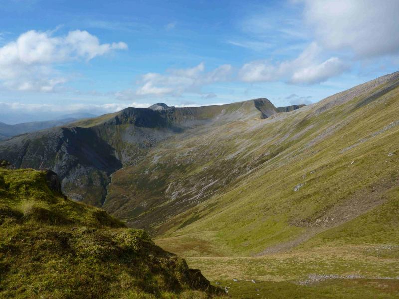
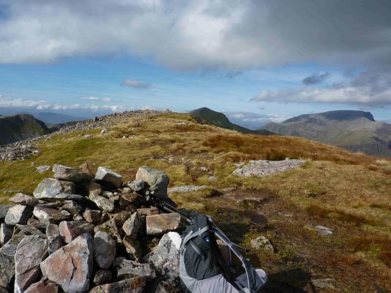
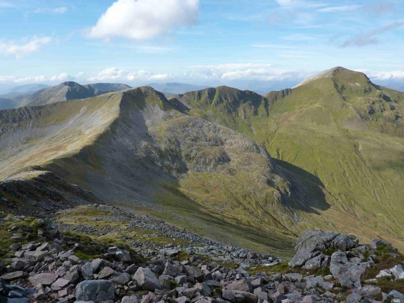
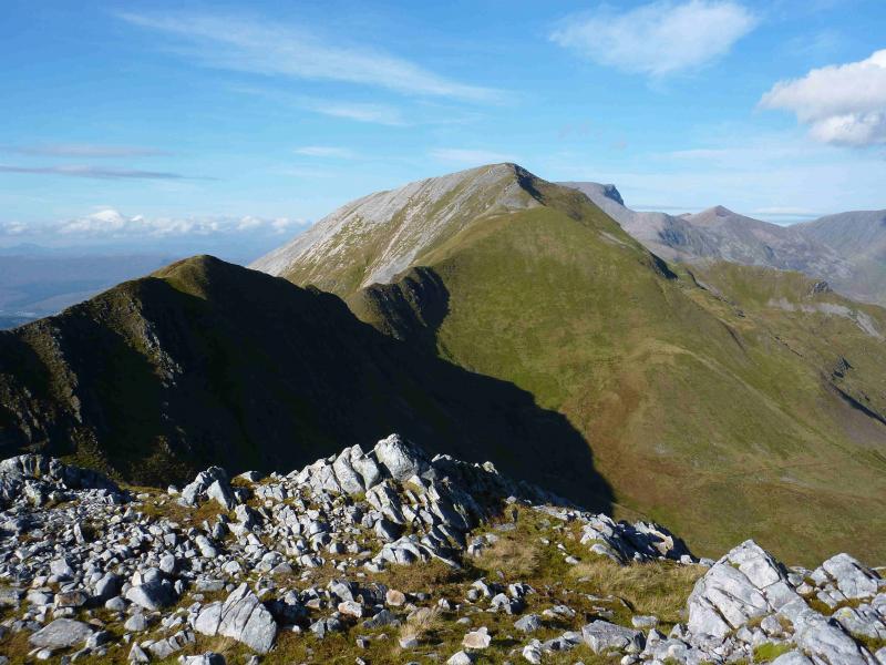
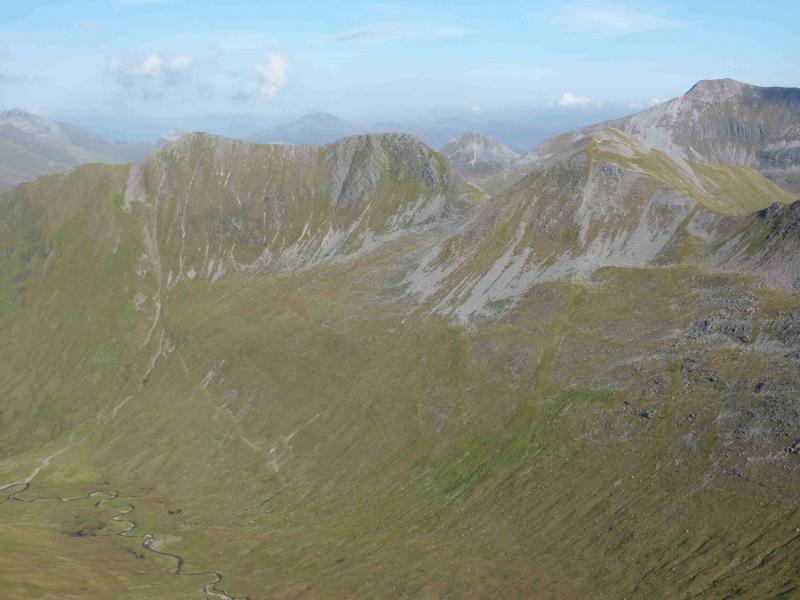
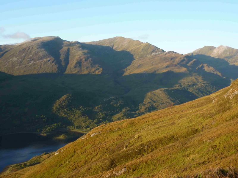
Outstanding views in all direction from this walk especially down the full length of Loch Leven but also to the Glencoe peaks, Ben Nevis, Aonach Beag, Grey Corries, Bidean nam Bian, Buachaille Etive Mor and even Schiehallion. The ascent of Am Bodach by its S/SE ridge is rough, especially lower down but it is a fine ridge ascent albeit steep in places. Lower down, there are no paths but they gradually appear as height is gained. The descent of Sgor an Iubhair, by its SW/S ridge, has only a faint path at the top and nothing lower down where there is deep heather on steep ground making this descent quite unpleasant and only for the experienced.
Route
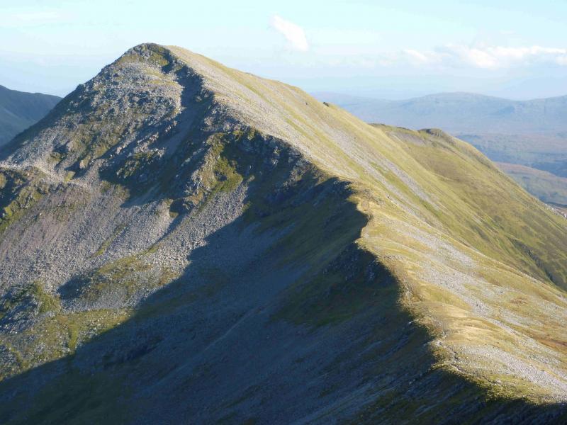
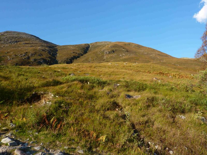
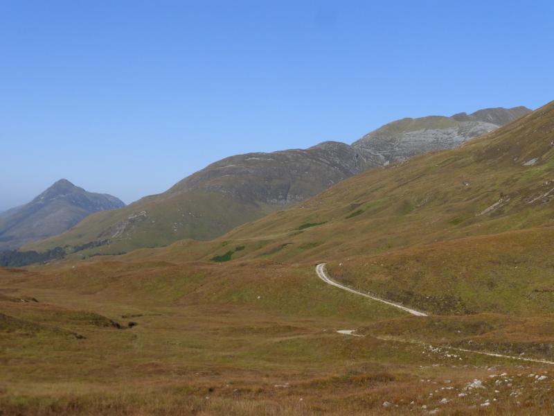
(1) Walk up the obvious signed footpath at the side of the car park. At the end of the path, go left (white arrow). Follow way marked path, steep, stony and loose in places, up to join the tarmac road about 50 m below Mamore Lodge. At the entrance to the hotel (closed on 6/5/11, possibly permanently) go right, past the bungalow to the T junction. Turn left and walk gently uphill, on the good track, for about 300 m, until there are scattered birch trees on the right. Go through these trees on rough grass for about 30 m (over an old iron fence – mainly fallen down) to reach a sloping clearing of rough grass. This is shown on the 1991 OS Map 41 (1:50000). Pick a way NE to reach the well defined SE ridge of Sgorr an Fhuarain which is well seen from Kinlochleven. Ascend this ridge on rough grass (gets shorter higher up). The crags, well seen from below, are easily outflanked but there are a few steep sections of grass. In summer conditions, these should not present any problems. A succession of shoulders are passed. After much climbing, a flattish section is reached just beyond a traversing rocky ridge on which sits a small cairn overlooking Kinlochleven. This can be missed but is obvious once above it and looking back. Continue upwards with the ridge narrowing and a good path appearing. A tiny lochan nestles in one of the hollows from where there are fine views of Na Gruagaichean and its top. Eventually, the short summit ridge is reached with a cairn at its start and, about 100 m further, the large summit cairn of Am Bodach, 1032 m.
(2) Descend W then WNW, on a good path, down a well defined, but stony, ridge to a bealach. Ascend the other side, still on the good path, which gradually curves N to reach the medium summit cairn of Sgor an Iubhair, 1001 m.
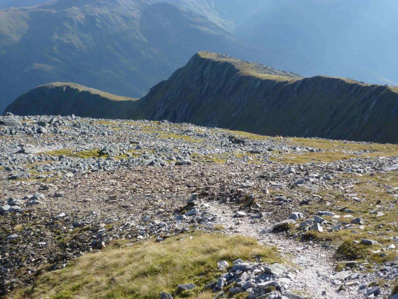
(3) Descend, fairly level at first, SW then SE down the well defined ridge which would have been seen all the way from Am Bodach. There is a faint grassy path higher up but this soon peters out. Much of the descent is on stony, heathery ground which is steep in places. Aim for the Mamores Lodge track/West Highland Way where it meets the stream coming down the large corrie to the E. Once on the track, turn left, E, and follow it until the sign post (thistle = West Highland Way) indicates a path off to the right. Follow this down to the road. Turn left and follow the road into Kinlochleven.
Notes
(a) This walk took place on 28th September, 2011.
(b) About 2 km of walking and some ascent can be saved by driving up the tarmac track to the Mamores Lodge Hotel (now closed) where one can park. To return to the car, stay on the Mamores Lodge track and ignore the West Highland Way footpath described above.
(c) It is amost certainly easier to descend from Sgor an Iubhair by returning to the bealach between it and Am Bodach then descending S to reach the path shown on the path which goes down the corrie following the course of the main burn.
Photos - Hover over photo for caption. Click on to enlarge. Click on again to reduce.