Get Lost Mountaineering
You are here: Scotland » 08 Cairngorms and Buchan » Eastern Cairngorms to Lecht Road
Cnap Chaochan Aitinn
Cnap Chaochan Aitinn from Tomintoul
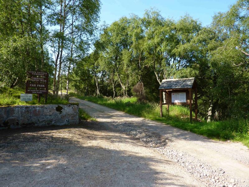
Start/Finish
The Queen Victoria viewpoint car park in Tomintoul. If approaching from S, go along main street but do not turn left for the A939 Dufftown & Ballater road. Instead, continue forward and turn right, into Delnabo Road. If you miss this turn, you will end up at the Glen Livet Estate office which is a little further on the main street extension. The signposted car park is about 30 m up a track which forks left by a white house on the right.
Distance/Time
22 km by bike all the way Approx 4 hours by bike, 7 hours if walking.
Peaks
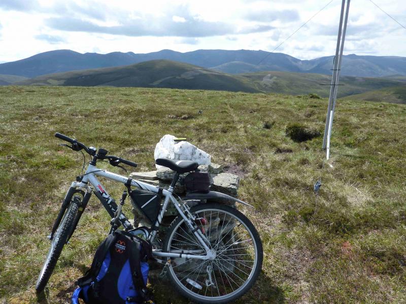
Cnap Chaochan Aitinn, 715 m, NJ 145 099. OS sheet 36.
Introduction
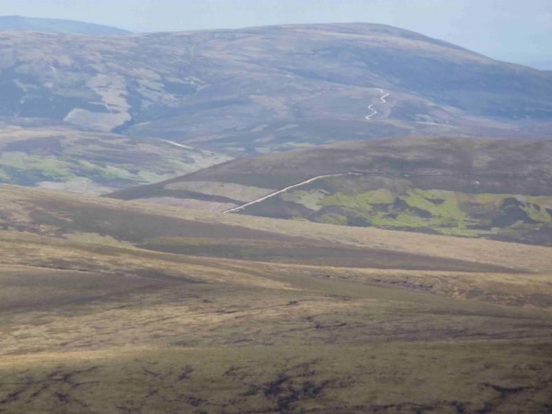
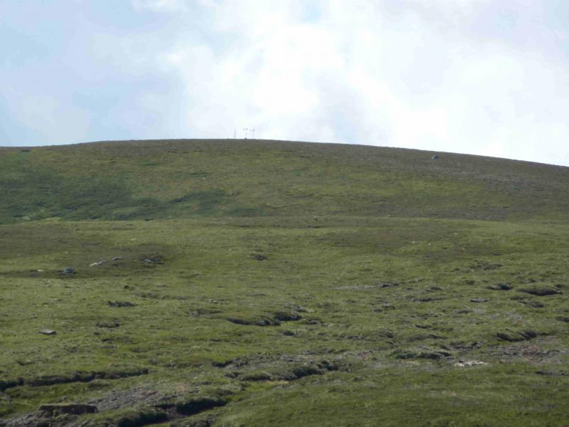
A pleasant half day in the eastern foothills of the Cairngorms. The route includes tracks varying from good to fair with some time on a tarmac road. It is possible to cycle to within 20 m of the summit and easy to push the bike the rest of the way. Some of the outward gradients are steep and many will get off and push but enjoy the free wheeling return by way of compensation. The four major climbs are from the bridge over the River Avon to Wester Gauling, up Carn an t-Sleibhe, SW from before Geal Charn to near the NW bealach of Cnap Chaochan Aitinn and the final ascent to the summit. The summit is not in view at the start. On a clear day, Cnap Chaochan Aitinn can be recognised, from some distance, by some obvious small aerials on its top. The views are extensive to Ben Avon, Beinn a' Bhuird, Beinn Chaorrain and Beinn Mheadhoin plus many of the Speyside moorland hills such as Geal Charn and Morven. Photographers wanting good pictures of Ben Avon and Beinn a' Bhuird need to consider that they are virtually due S of Cnap Chaochan Aitinn which means the sun will be shining directly into the camera at midday.
Route
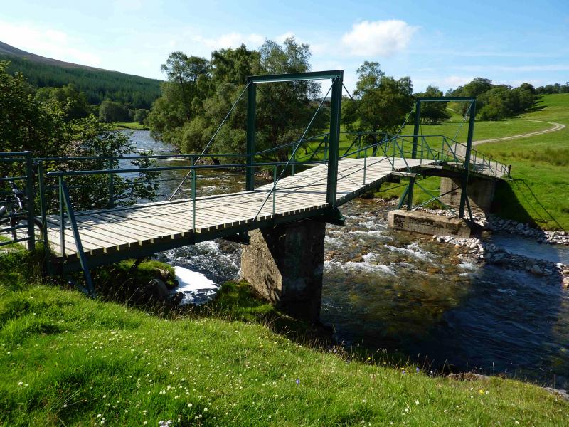
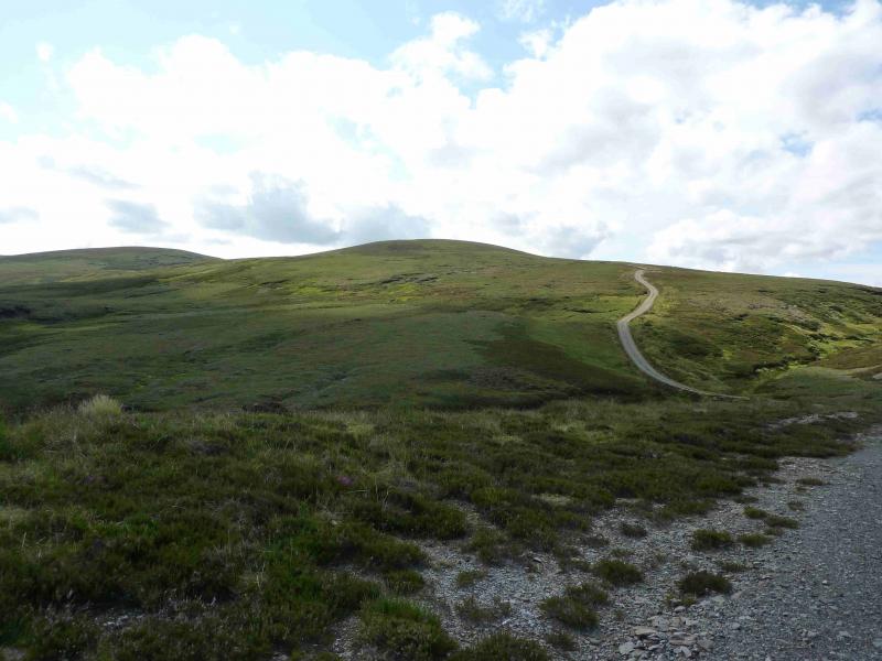
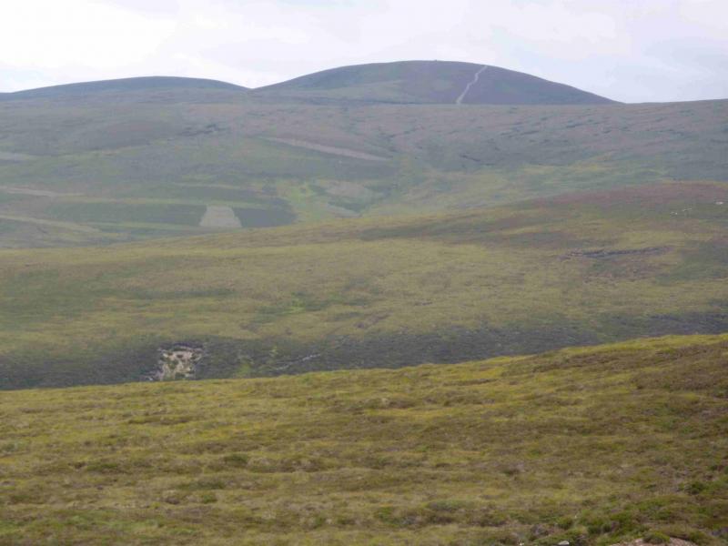
(1) Cycle S out of the car park, shadowing the River Avon, on an undulating track which, in about 2.5 km, reaches the tarmac road from Delnabo. Follow this S, by the River Avon, for about 1.5 km to reach the bridge across the river. This point is not far beyond the high gates by a small settlement where there is also a pedestrian gate for cyclists. The bridge is a kind of “suspension” bridge but from poles not cables. Cross the bridge and continue along the track which climbs to the house at Wester Gauling, passing to the right of the house. Just beyond the house, a grassy track goes straight on but the main track goes left before turning back S. This section of track is the grassiest of the whole route and lasts until the next gate when the gravel track resumes and continues W, through a picturesque wood by a stream, before turning S to cross the stream which should not pose any crossing problems. Another, and rougher, track goes off right just before the stream. There is now a sustained climb over Carn an t-Sleibhe with a slight descent beyond. Another track junction is soon reached; continue roughly S, ignoring the track which descends SE on the left. Soon the track almost levels off on the NW shoulder of Cnap Chaochan Aitinn and the final track goes off left, initially quite steeply, heading for the summit. When this levels off, the summit is 20 m to the left. It has 2 small wind generators next to a small aerial and a taller aerial, slightly S, near to the small well built cairn which marks the summit of Cnap Chaochan Aitinn, 715 m.
(2) Return by the same route but stay on the tarmac road and pass through Delnabo. Recross the river and a short road climb leads back to the start.
Notes
(a) This cycle/walk took place on 30th July, 2011 and 7th April, 2004.
(b) Keen students of cartography will notice that the Corbett, Geal Charn lies about 6 km to the NW. About halfway, in between there is a feature called “The Castle” which is a deep gorge worthy of investigation and is the subject of a separate walk. The side of the gorge is very steep, almost vertical in places, on the Cnap Chaochan Aitinn side so great care would need to be exercised if detouring to the gorge on this walk.
Photos - Hover over photo for caption. Click on to enlarge. Click on again to reduce.
 & River Avon from Little Geal Charn.jpg)