Get Lost Mountaineering
You are here: Scotland » 09 Glen Roy to the Monadh Liath and Strathspey » Aviemore to Inverness
Carn nan Tri-tighearnan
Carn nan Tri-tighearnan from Ruthven (north of Aviemore)
Start/Finish
The farm almost at the end of the minor road (off the A9, N of Tomatin) at NH 813 330. Drive N up the A9 from Aviemore. About 2 km past Tomatin, take the minor road on the right, going E, just before the A9 reaches Dalmagarry and about 2 km before Loch Moy. Drive down this road, almost to its end, and park near the buildings at Ruthven which are just over the burn.
Distance/Time
16 km Approx 5 hours
Peaks
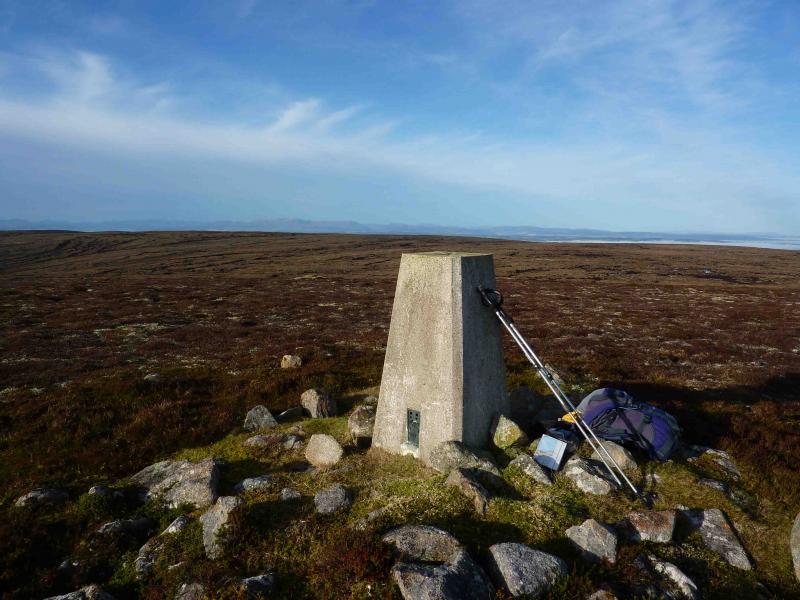
Carn nan Tri-tighearnan, 615 m, NH 823 390. OS sheet 27.
Introduction
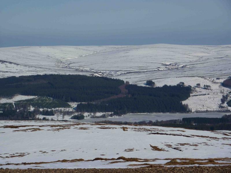
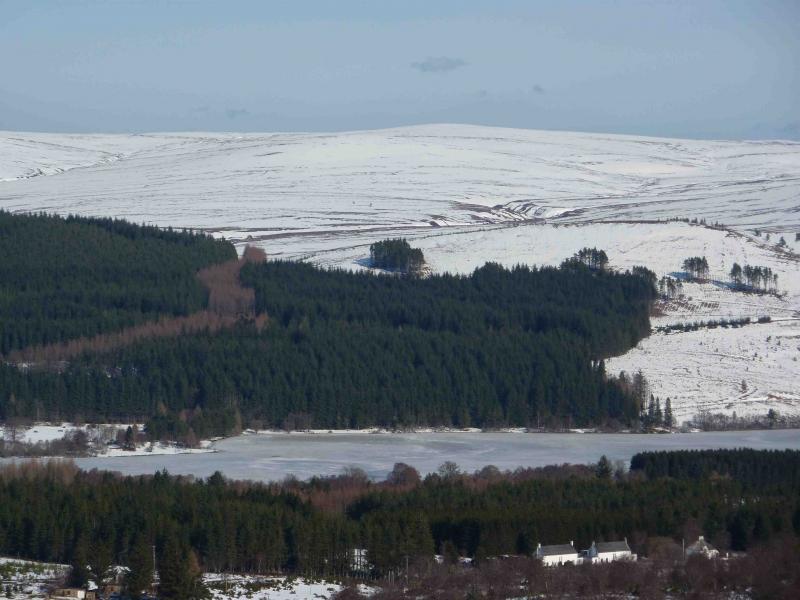
This is a fairly easy walk to navigate as there is a good track most of the way to this Graham. In fine weather, there are good views of the Moray Firth, Cromarty Firth, Ben Wyvis and beyond. The track can be cycled although there are a few steep sections.
Route
(1) Walk back along the road and head up the track (NW initially) just before the burn. Ignore the right fork after about 300 m and the left fork after about 800 m. The obvious flat area on the map at about NH 815 343 is now a lochan. Continue on the track as it heads N then meanders eastwards gaining height. When the track straightens and heads N then curves downhill NE to a junction with another track at about NH 810 354, go left onto this new track which climbs WNW. (the 1996 OS 1:50000 map shows this track as a path). Follow this track which soon levels off and heads N. At the end of this straight, the track points to Carn nan Tri-tighearnan before turning E and then N again to where the map shows it ends at about NH 815 373. (The track does not actually end here but continues down W to the Allt Odhar track coming up from Moy.) Follow this track past its shallow ford over the upper Allt Odhar then climb up to the highest point on the track just beyond the ford.
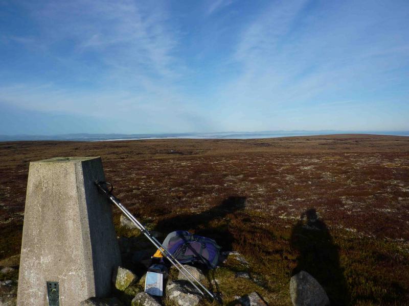
(2) There is a gap in the high bank on the right of the track, behind which is a faint path which heads roughly N but soon becomes intermittent. Continue and cross a deep grassy gully. Continue, over rough ground, to the next burn which rises from the SE flank of Carn Monadh nan da Allt. Ascend the E side of the burn on intermittent paths until past Carn Monadh nan da Allt then head NE across gently rising slopes to the summit trig point of Carn nan Tri-tighearnan, 615 m, which sits on a fairly featureless plateau. In clear weather, the trig point on Carn an Uillt Bhric to the E is visible. Return by the same route.
Notes
(a) This walk took place on 9th November, 2009.
(b) It is also possible to ascend from Daless at NH 862 383 but this route can be quite boggy and involves a longer drive.
Photos - Hover over photo for caption. Click on to enlarge. Click on again to reduce.