Get Lost Mountaineering
You are here: Scotland » 10a Morvern, Sunart, Ardgour and Moidart » Loch Linnhe to Loch Shiel
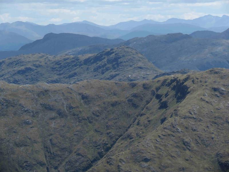
Stob a' Bhealach an Sgriodain
Stob a' Bhealach an Sgriodain from Callop, near Glenfinnan
Start/Finish
About 2 miles before Glenfinnan, the A 830, Fort William to Mallaig road passes under a railway bridge. About 200 m further on is a gravel track on the left. Turn in here and follow the track to the junction. Turn right and park almost immediately in the car park by the river. If full, there are other possibilities for parking close by.
Distance/Time
36 km (of which about 24 km can be cycled). Approx 8 hours.
Peaks
Stob a' Bhealach an Sgriodain, 770 m, NM 874 727. OS sheet 40.
Introduction
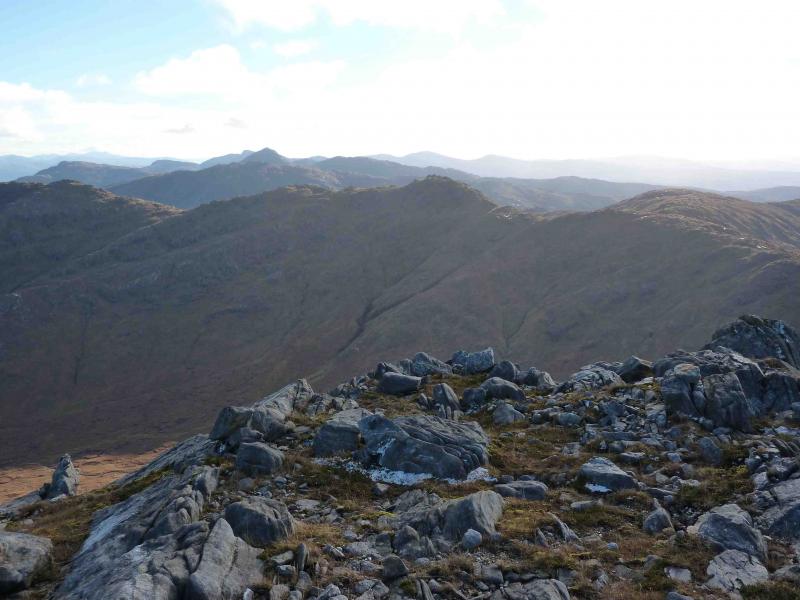
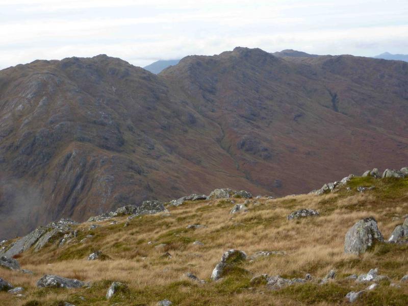
This is the highest point of the long ridge which runs between Cona Glen and Glen Scaddle. It is an excellent viewpoint for all the other hills in the area. On a clear day, one can see Ben Nevis and beyond. Much of the walking is on rough, pathless terrain which makes the day a very strenuous one.
Route
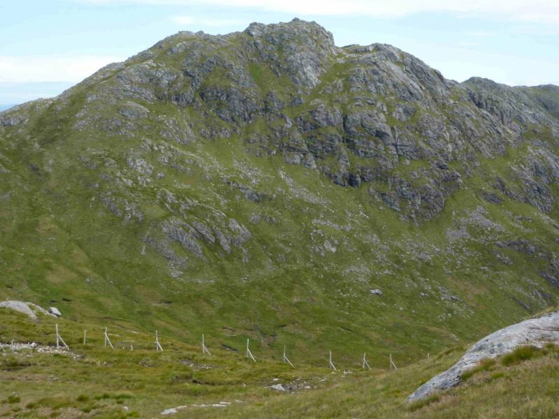
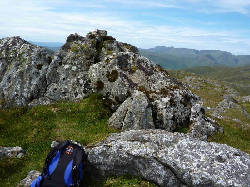
(1) Turn right out of the car park and cycle along the good track for about 12 km. There is a significant climb soon after the start followed by a descent to Loch Shiel after which the N ridge of Sgurr Ghiubhsachain starts – a fine route for another day. Soon after, there is a long section of up and down before a long descent out of the forest to reach Scamodale where there is a track going off left just before a bridge, over a wide river, with another track not far after the bridge. Neither the jetty nor house are likely to be seen. Take the first track, before the bridge, and cycle less than 100 m to a wide clearing which may have piles of stones and gravel in it. Cycles may be left here. Continue along the track which starts to climb gently uphill. Soon reach a junction. Bear left and follow the track for some distance to its end at a large turning circle in the forest. A short track goes right for about 20 m here. At its left hand corner was a small cairn on 25/7/11. From this corner an overgrown and faint grassy track goes off and crosses the stream in about 60 m. Across the stream, the track is more distinct but still overgrown. Follow this track up through the forest until it exits the forest. From here, climb uphill and follow a stream up towards the Druim Tarsuinn ridge above. The going is now pathless and one must pick what ever way seems best. Once on the ridge, turn SE and follow some old fence posts along the undulating crest to the Bealach an Sgriodain. By now other lines of fence posts will have been noticed so one should note which line to follow for the descent. Ascend SE, following the fence posts but they veer off left just below the summit, to reach the small cairn on an outcrop which is the summit of Stob a' Bhealach an Sgriodain, 770 m.
(2) Return by the same route.
Notes
(a) This walk took place on 25th July, 2011.
(b) A shorter, easier approach, goes S from Callop and across upper Cona Glen.
Photos - Hover over photo for caption. Click on to enlarge. Click on again to reduce.