Get Lost Mountaineering
You are here: Scotland » 10a Morvern, Sunart, Ardgour and Moidart » Loch Linnhe to Loch Shiel
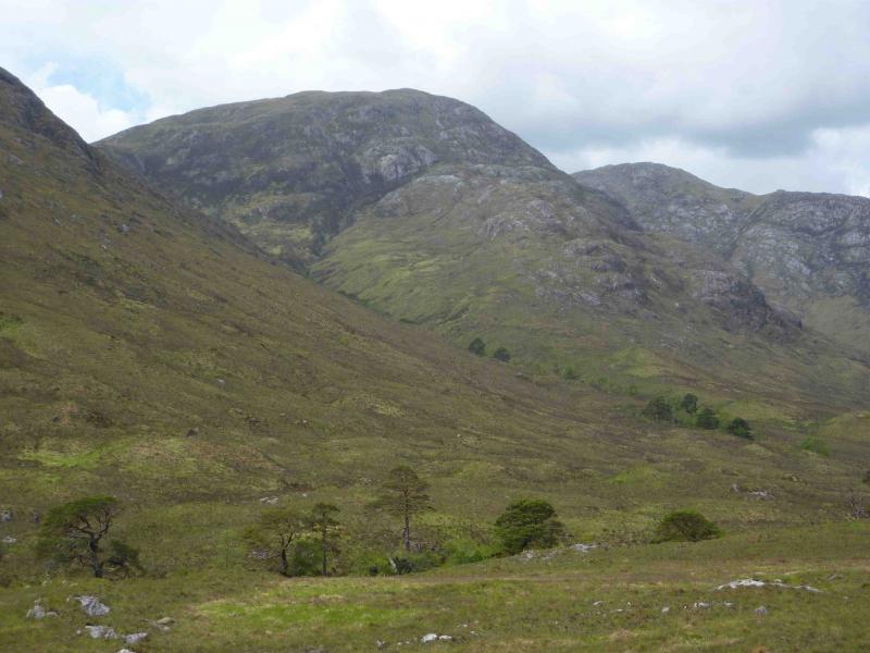
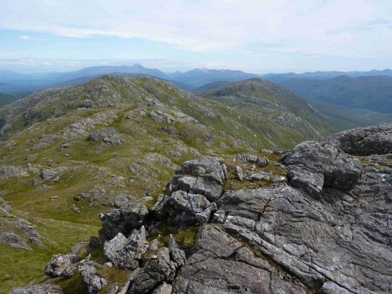
Stob Mhic Bheathain
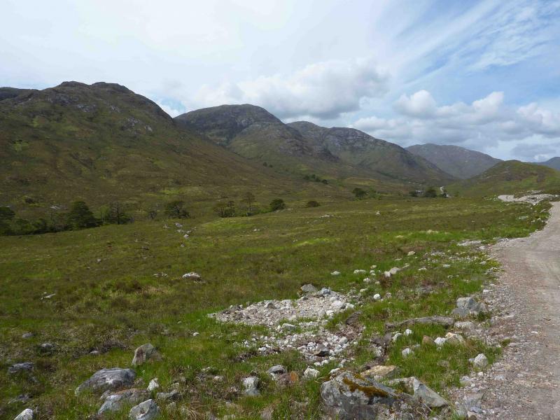
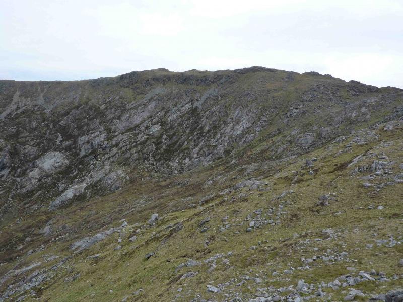
Stob Mhic Bheathain from start of Cona Glen at Inverscaddle
Start/Finish
Entrance to Cona Glen, where there is a sizeable parking area, on the A 881 on the W side of Loch Linnhe about 6 km N of the Corran ferry.
Distance/Time
27 km (20 km can be cycled) Approx 7 hours if bicycle used
Peaks
Stob Mhic Bheathain, 721 m, NM 914 713. OS sheets 40 & 41.
Introduction
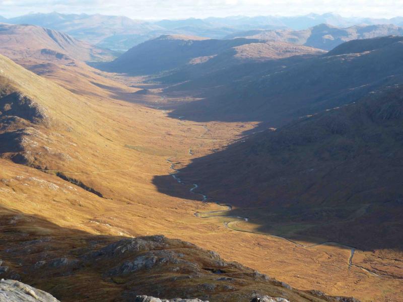
This is a gem of a mountain. It is approached via a lovely fairly natural glen and the ridge to its summit has plenty of easy angled slabs. The river crossing is only easy in a dry spell. The views are excellent: virtually all the peaks W of Loch Linnhe plus many of those E of Loch Linnhe especially Ben Nevis and the Glencoe peaks. Its summit is within “spitting distance” of Carn na Nathrach and Sgurr Dhomhnuill. Save this mountain for a good day! The only problem is the river crossing which is only easy in a dry spell.
Route
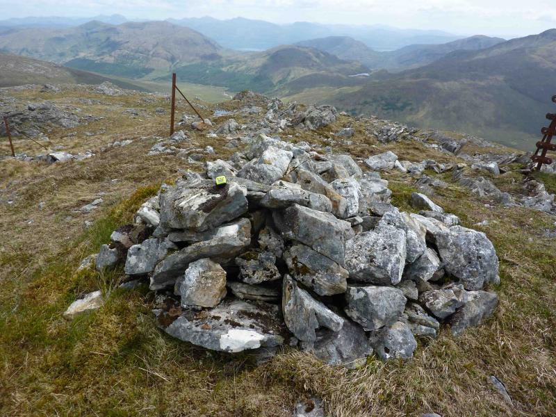
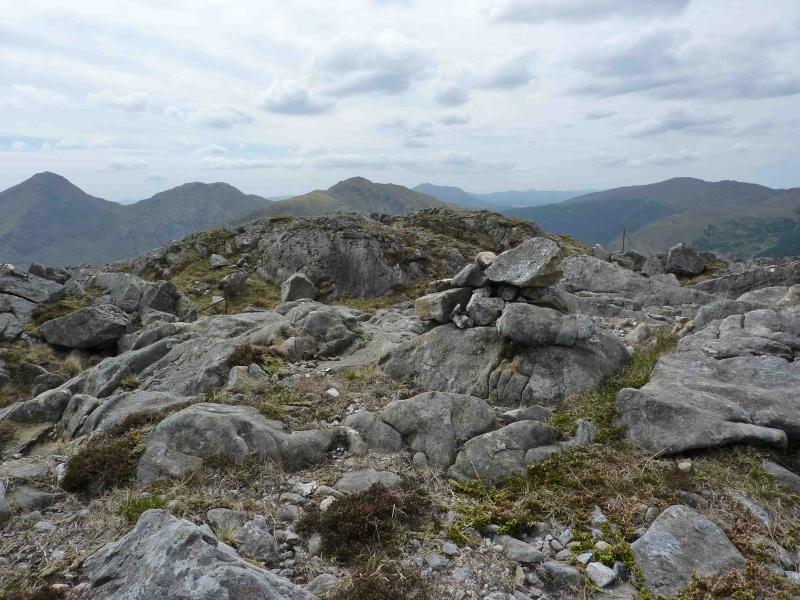
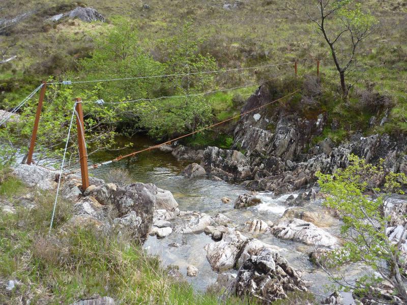
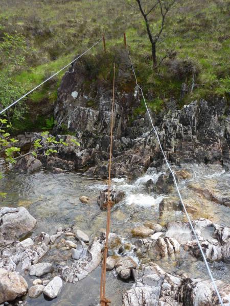
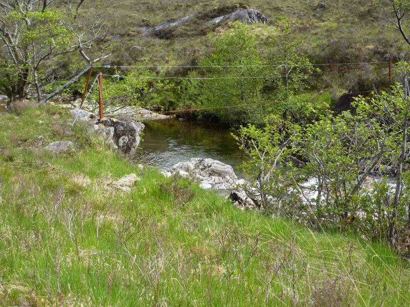
(1) Cycle along the track on the N side of the Cona Glen. This is a tarmac road initially but becomes a track after the last house. The track goes through natural woodland before emerging into the open glen. There are two steep hills before the cottage at Corrlarach then quite a few little hills as the track crosses several minor ridges. A lot of the track is almost level. When the hillside tress on the S side of the river finally peter out, a small knoll, the Hine Knoll, is seen ahead. If the river is low, leave the bicycle on the left of the knoll. If the river is not low, either look for a wire bridge about 30 m back from a “passing place” on the left just before the knoll. Those familiar with the Steall (Glen Nevis) wire bridge will realise that this one is much more flimsy. The hand wires, in particular, are not much thicker than coat hanger wire! On 3/6/10, one of the handwires had lost some of its tension just to add to the exhilaration.! The wire bridge is about 8 m long and crosses about 4 m above some rapids which you would not want to fall into in spate conditions. The only alternative is to push further upstream in the hope of finding a better crossing there. Once across the river, head for the obvious NE ridge of Stob Mhic Bheatain. Lower down, it can be boggy, but as soon as some height is gained, the going is much better. Higher up, much of the rock is actually made up of easy angled slabs which can easily be walked up when dry. There is more than a hint of a path in places. Once the angle eases, drift right onto the summit ridge where there is a line of old fence posts. There are three highest points of which the E and W tops are clearly higher than the central. The W top appears to be the higher, so making it the summit of Stob Mhic Bheathain, 721 m, but one cannot be sure as they are so close in height, whereas the E top has the much larger cairn. Go to both and you can’t go wrong, they are only just over 100 m apart with hardly any drop between them – two small drops either side of the central top.
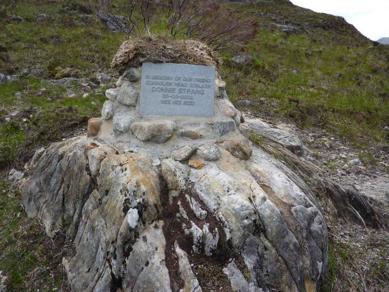
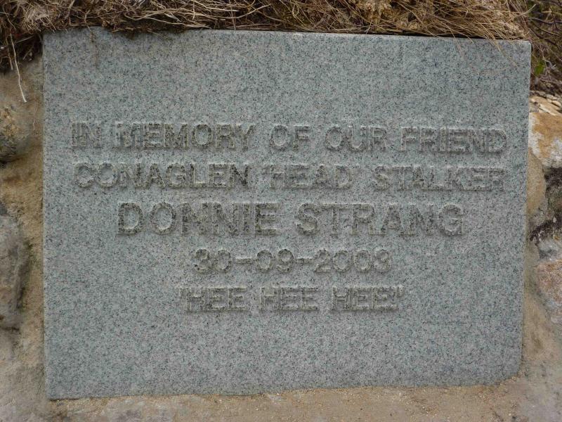
(2) Descend by following the fence posts W down into a shallow bealach and either go to the next top then down its easy angled NE ridge or cut the corner to the ridge from the bealach. At the foot of the ridge is a memorial to a former Head Stalker. Cross the river, retrieve the bicycle and cycle back to the start.
Notes
(a) This walk took place on 4th June, 2002 and 3rd June, 2010. The wire bridge was crossed in 2002, very slowly!
(b) It is also possible to access these hills from the Glen Scaddle side by cycling up Glen Scaddle. There is a good track which goes far up the glen, initially on the S side before crossing to the N after going through a long planatation, before petering out about 1 km past the locked cottage at Tighnacomaire. This route does not involve any river crossings but the ascent is far less attractive.
Photos - Hover over photo for caption. Click on to enlarge. Click on again to reduce.