Get Lost Mountaineering
You are here: Scotland » 17 Islands » Skye
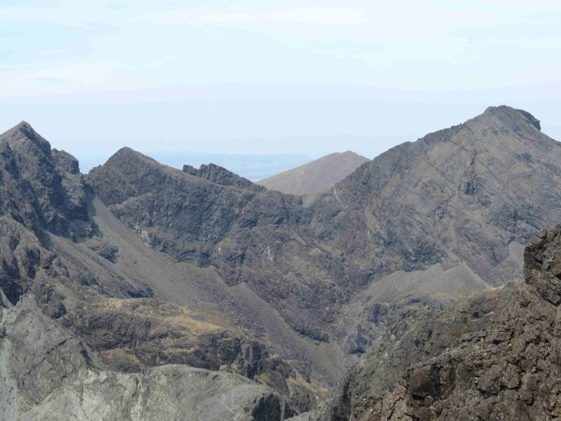
Sgurr a' Mhadaidh, Sgurr a' Greadhaidh, Sgurr Thormaid & Sgurr Na Banachdich
Sgurr a' Mhadaidh, Sgurr a' Greadhaidh, Sgurr Thormaid & Sgurr Na Banachdich from Glenbrittle Youth Hostel
Start/Finish
Glenbrittle Youth Hostel. Plenty parking is usually available.
Distance/Time
12 km. About 9 hours.
Peaks
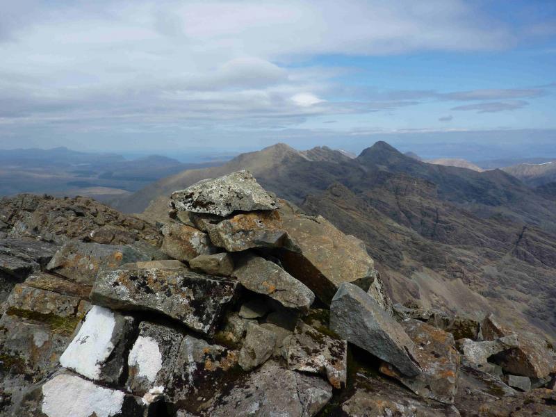
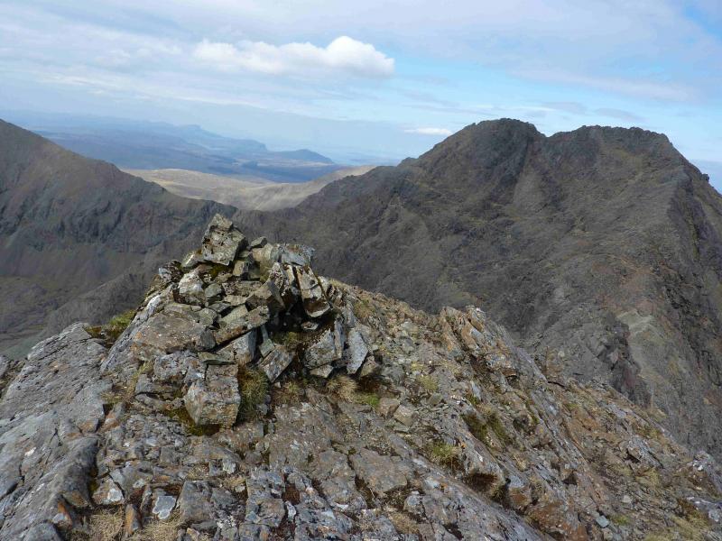
Sgurr a' Mhadaidh, 918 m, NG 446 235.
Sgurr a' Greadhaidh, 973 m, NG 445 232.
Sgurr a' Greadhaidh South Top, 970 m, NG 445 230.
Sgurr Thormaid, 926 m, NG 441 226.
Sgurr na Banachdich, 965 m, NG 440 224.
Sgurr na Banchdich Central Top, 942 m, NG 441 223. OS sheet 32 but see below.
Introduction
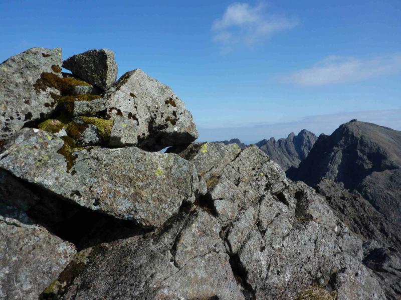
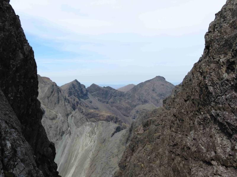
This is a fine walk/scramble over the central Cuillin. It is not for the inexperienced especially in bad weather. In good weather the views are tremendous looking both ways along the ridge, down to Coruisk and Blaven and also to the islands. OS sheet 32 covers the walk but some will prefer the Harvey map of the Cuillin. The SMT used to publish a very good map of the main Cuillin (not including the Blaven range) which had the contour map on one side (unfortunately without grid lines!) and a diagram map on the reverse similar in style to that used in the SMC Munros book. In clear weather, the diagram map is probably the most useful as the others can be over powering with all their contours. There are many guide books for Skye but the most popular and comprehensive seems to be the SMC Skye Scrambles and is well worth buying. Note that a compass is unreliable on the Cuillin so be extra prepared in bad weather to cope without one. A compass needle may spin. It is likely that guided parties will be encountered along this route especially from late Spring to early Autumn. Most of these will be fine but, unfortunately, a few guides think they own the Cuillin and expect others to fit in with them. The casual walker/scrambler has as much right to be there as the guided walker. Some guides will ask you to keep away from their party. You don't have to. In the Cuillin, you can walk where you like, when you like and at what pace you like. You can walk in front of a group, behind a group or mixed in with a group as it suits you. Some guides are very touchy about being followed by non-clients and may indulge in childish tactics such as holding their party up until you are well past just in case you learn their route for free. Often, the clients are worse than the guides and expect their own little mobile bubble of exclusivity on the Cuillin! They can be quite hostile to other walkers who they think are getting for free what they have paid for.
Route
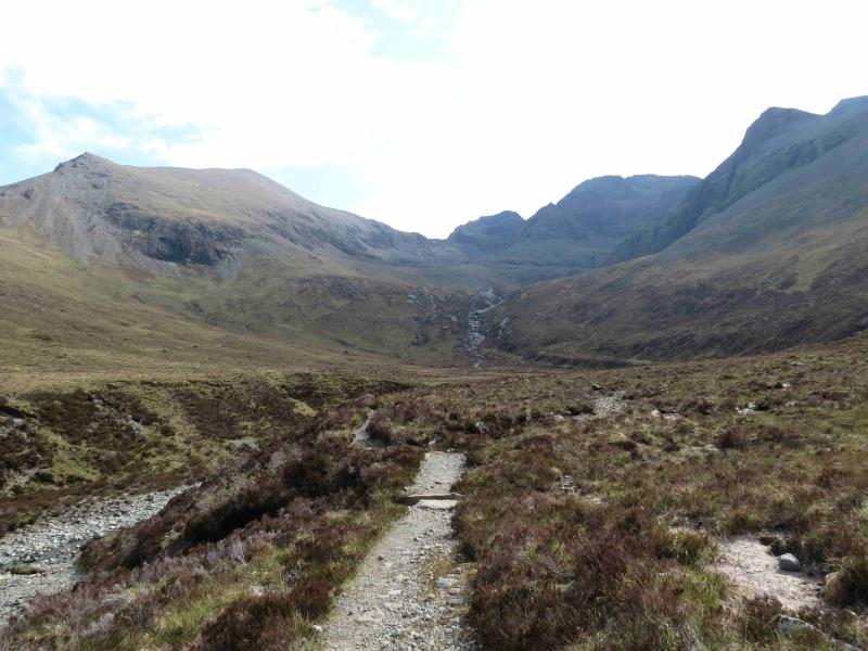
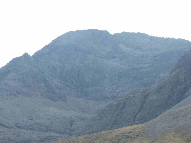
(1) From the youth hostel, follow the obvious path on the S side of the Allt Coire Greadhaidh. The path is very good lower down but deteriorates slightly higher up. Note another path forking right up Coir an Eich between An Dallaid and Sgurr nan Gobhar as this will be used on the return. The path follows the main burn to just below a pass on the ridge (more like a notch) called An Dorus. Ascend into An Dorus, on scree in places. The last 40 – 50 metres would involve some scrambling on basalt intrusions on the left but just below these, a path goes off left and ascends Sgurr a' Mhadaidh. There are various options, some harder than others, but good route finding should only involve easy scrambling before one reaches the medium cairn which marks the summit of Sgurr a' Mhadaidh, 918 m.
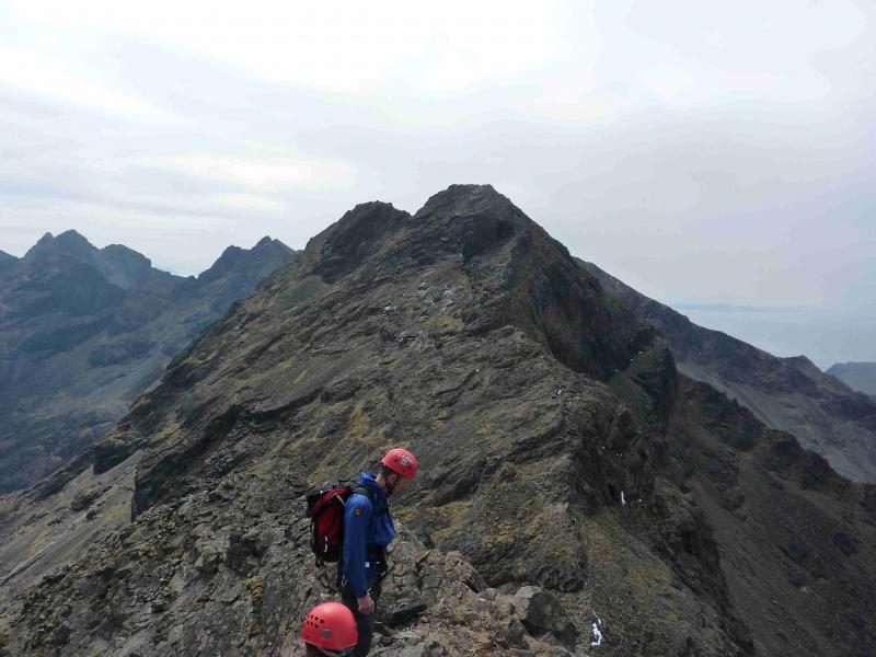
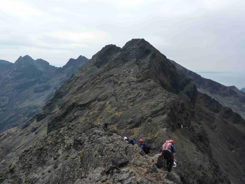
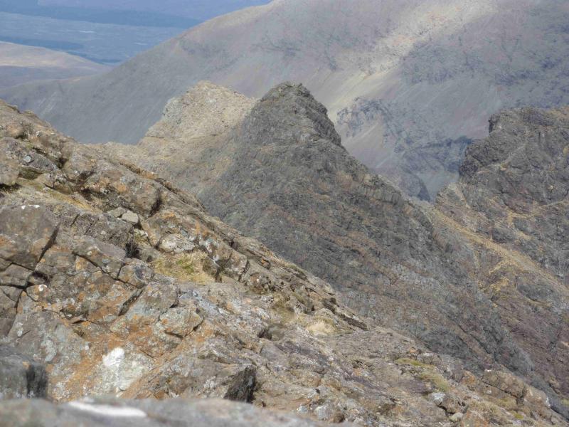
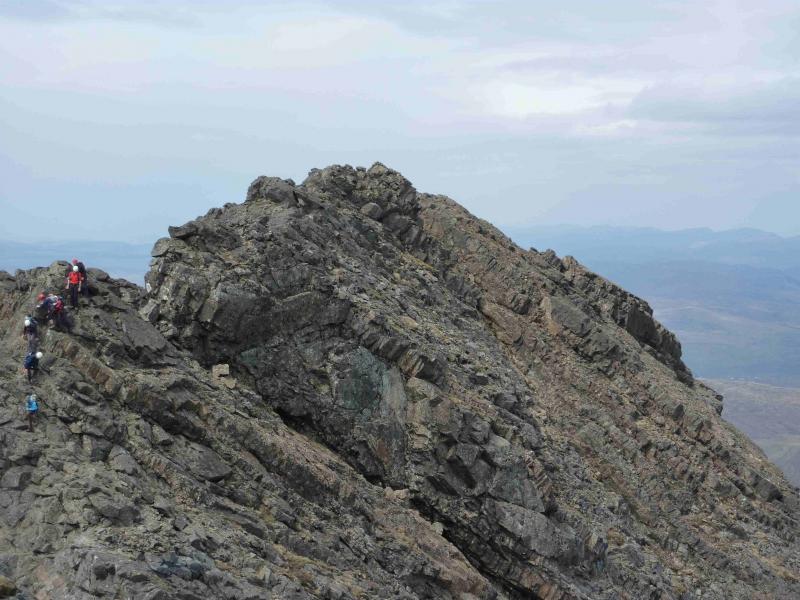
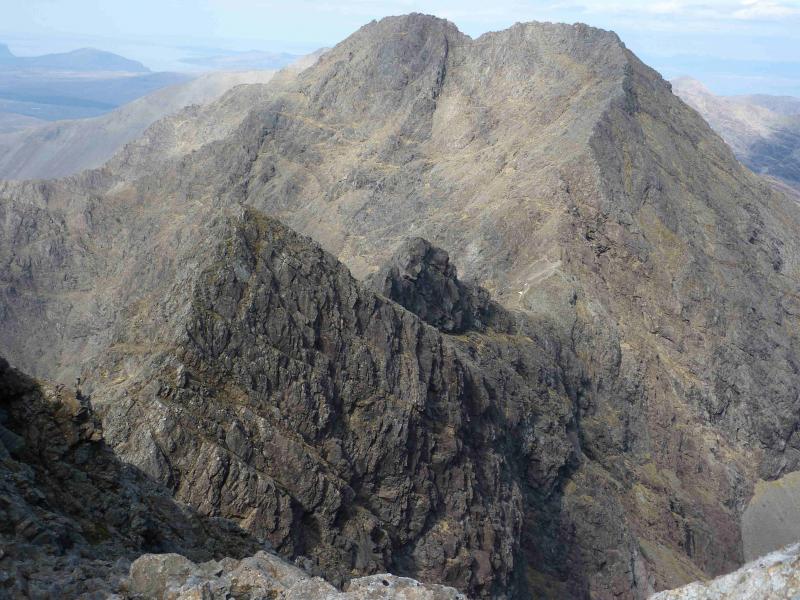
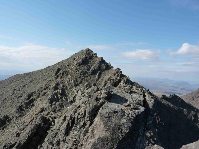
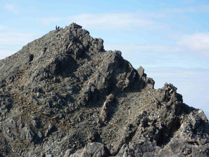
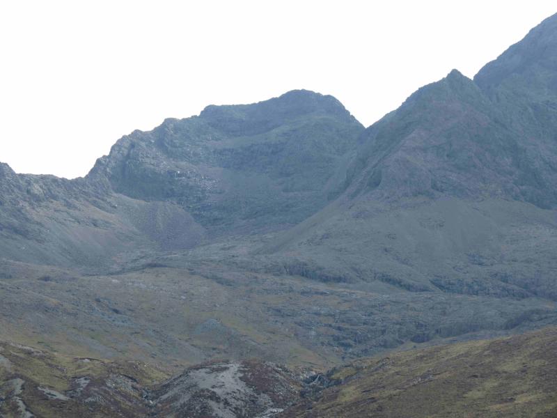
(2) Either retrace to just below An Dorus then scramble up the basalt ribs into An Dorus or (harder) take a more direct and exposed line directly into the gap. An Dorus is a deep cleft with little room in it but it is a safe place to stand for a while. The route south looks daunting especially as most of the rocks look wet and slippery but there is one route up which is much easier than the others. Facing the wall to the south in the top of the gap, there is a sort of ledge about 2 metres to the right. Above here, a steep (but not vertical) rocky groove about a metre wide slants back left. Get on to the ledge using high holds from the top of the gap then climb the groove on big reassuring holds to quickly reach the top, it is only about 3 – 4 metres up from the gap. Once up, an obvious path leads to some sloping slabs where one will soon find the easiest way up with both a foothold and hand hold – it is only about a metre up. Continue on a fairly obvious path with a few alternatives here and there. On the right, near An Dorus, is a steep and narrow gully called Eag Dubh which is graded slightly easier than An Dorus if you are thin! Ahead on the path is a massive chunk of rock known as the Wart. Go past this and ascend to the medium cairn which marks the summit of Sgurr a' Ghreadaidh, 973 m. If in places, the crest seems too hard, look for a path just below on either side. This may mean scrambling on some easy ledges.
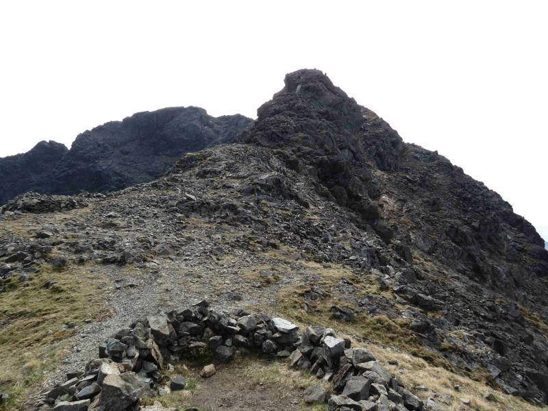
(3) Continue S, either on the crest or below, to reach the small cairn which marks the summit of Sgurr a' Ghreadaidh South Top. There seem to be two tops here so best to visit both – they are quite close to each other.
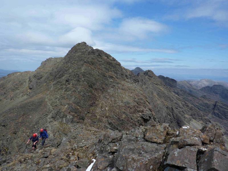
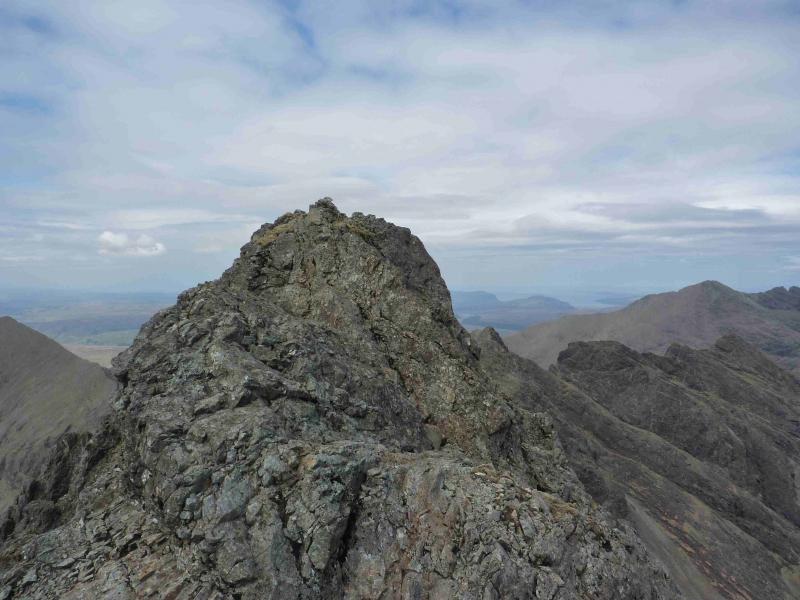
(4) Descend, mainly SW, either on the crest or just below on a path. It can be as hard or as easy as you wish but some scrambling will be involved. Eventually reach a bealach where one can safely rest. Continue up the other side, as before, to reach the small cairn which marks the summit of Sgurr Thormaid, 927 m, which is quite a pointed peak.
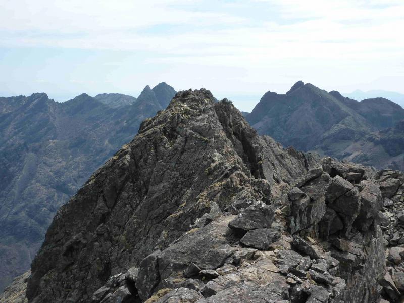
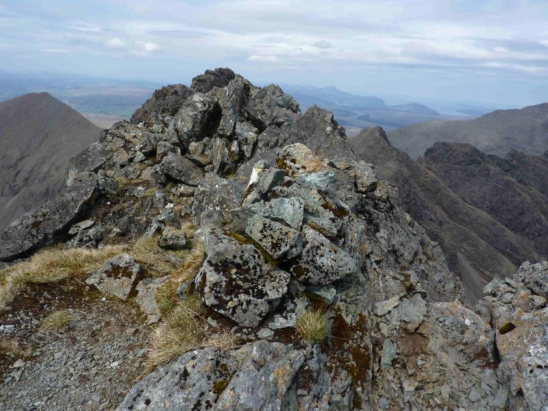
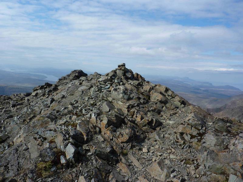
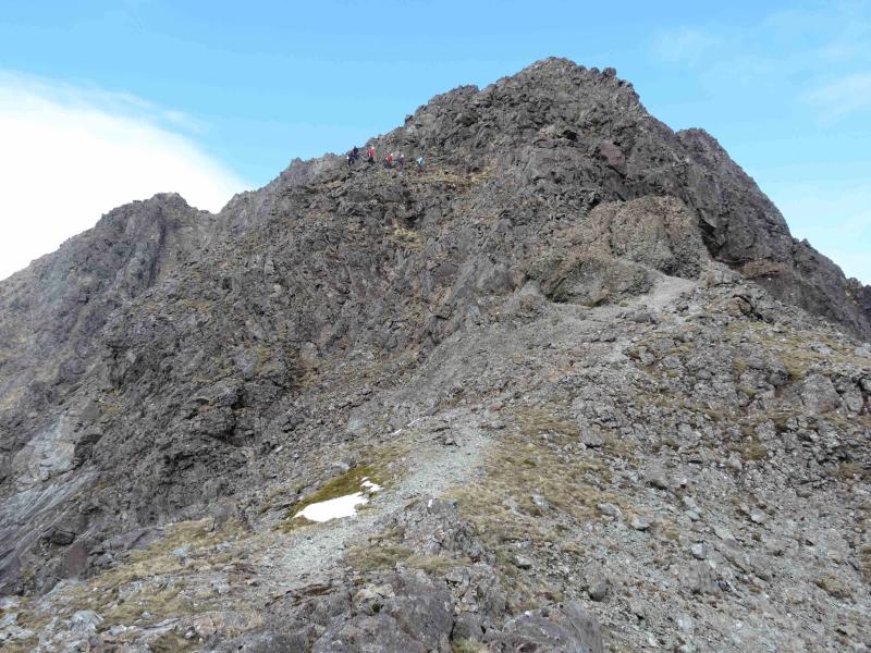
(5) Descend the other side. This is probably the trickiest descent of the route so take care and look around for the easiest way if the crest is not for you. Route finding is particularly important lower down as one approaches the bealach as the ridge narrows and one has to pick a way to the right to continue easily through the small bealach. Ascend the other side. There is a choice of routes but the easiest is probably over to the right where a path picks its way up a short stone chute. Once at the top, go left easily to reach the medium cairn which is the summit of Sgurr na Banachdich, 965 m.
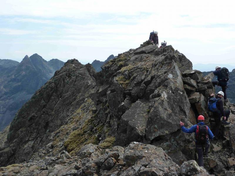
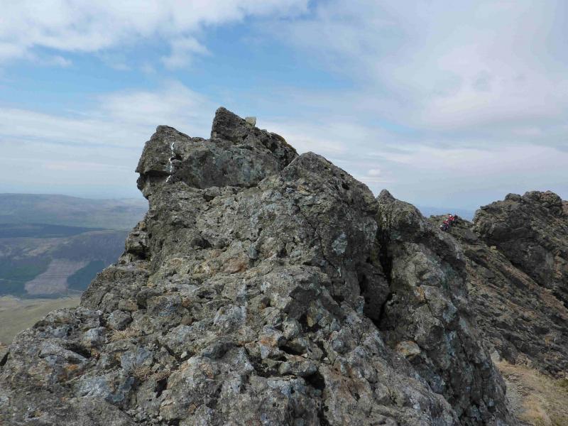
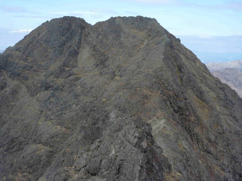
(6) The direct continuation, along the crest, to the Central Top may be too daunting for some so drop down on the Glenbrittle side and go past the top before scrambling up a narrow groove which slants back left. A faint path leads into it at the bottom and out of it at the top. Easily clamber over a few rocks to reach a small cairn which is the summit of Sgurr na Banachdich Central Top, 942 m.
(7) Retrace to the bottom of the groove then head NW, traversing across the flank of Sgurr na Banachdich to reach its long W ridge (leading to Sgurr nan Gobhar). Once the ridge is reached, follow a path on its N side to the first dip where the path goes off the ridge and down, roughly NW, Coir an Eich. The path is very distinctive in its upper reaches but there are a few steeper sections through fine scree which need care. Lower down, it becomes difficult to follow in places but the burn is a good guide. Once out of the scree and on to the grass, it is a pleasant stroll down to join the outward route.
Notes
(a) This walk took place on 23rd July, 2000 and 21st May, 2012.
(b) Many will climb these peaks as part of the Cuillin Ridge traverse and more likely in the S – N direction.
Photos - Hover over photo for caption. Click on to enlarge. Click on again to reduce.