Get Lost Mountaineering
You are here: Scotland » 17 Islands » Skye
Sgurr Dubh Mor
Sgurr Dubh Mor from Glenbrittle
Start/Finish
Glenbrittle BMC Memorial Hut (next to Mountain Rescue) or car parking before Glenbrittle Campsite. Parking inside the campsite grounds is charged.
Distance/Time
12 km. About 8 hours but depends very much on scrambling ability.
Peaks
Sgurr Dubh an Da Bheinn, 938 m, NG 455 204.
Sgurr Dubh Mor, 944 m, NG 457 205. OS sheet 32 but see below.
Introduction
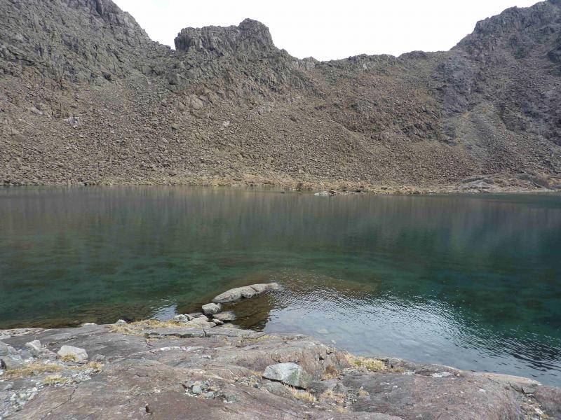
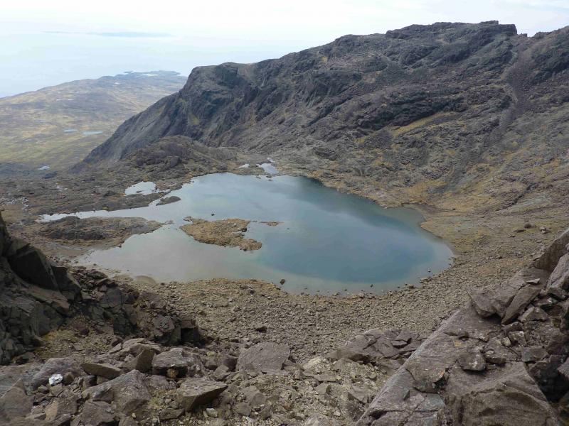
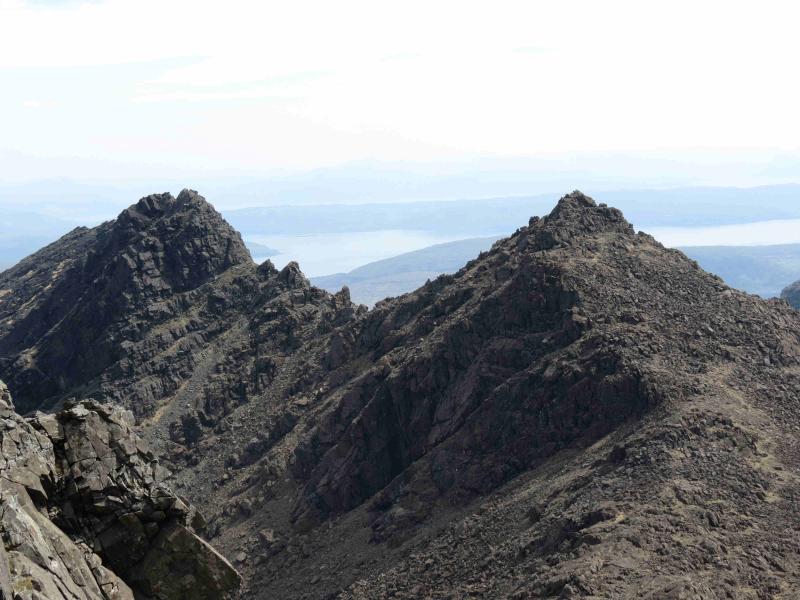
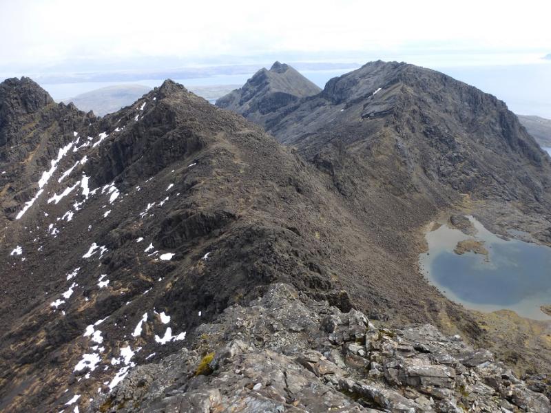
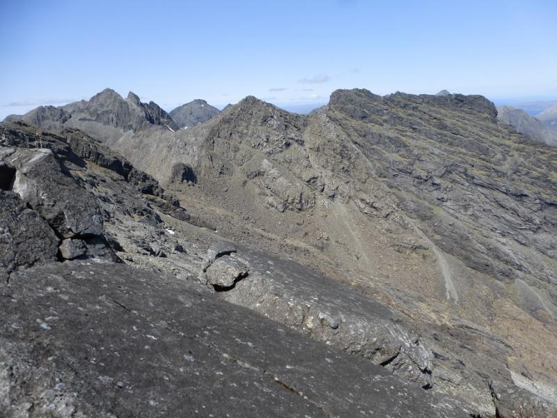
Only two Munro peaks lie off the main Cuillin Ridge: Sgurr Alasdair and Sgurr Dubh Mor. This walk involves scrambling, much of it easy but there are options of varying difficulty on Sgurr Dubh Mor, all seemingly with good paths so care and good route finding are essential. Many get off route going to Loch Coir a' Ghrunnda so even the walking needs care. Wet weather and poor visibility make this a much more demanding route. OS sheet 32 covers the walk but some will prefer the Harvey map of the Cuillin. The SMT used to publish a very good map of the main Cuillin (not including the Blaven range) which had the contour map on one side (unfortunately without grid lines!) and a diagram map on the reverse similar in style to that used in the SMC Munros book. In clear weather, the diagram map is probably the most useful as the others can be over powering with all their contours. There are many guide books for Skye but the most popular and comprehensive seems to be the SMC Skye Scrambles and is well worth buying. Note that a compass is unreliable on the Cuillin so be extra prepared in bad weather to cope without one. A compass needle may spin. In spate conditions, the Allt Coire Lagan may be very difficult to cross. The views on this walk are absolutely stunning, not just of the Cuillin peaks but also of Coir a' Ghrunnda, which many regard as the most attractive corrie in the southern Cuillin, as well as the islands of Soay, Rum, Eigg and Canna, however this is not a walk for the inexperienced especially in bad weather.
Route
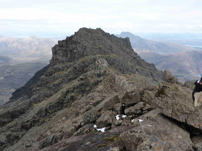
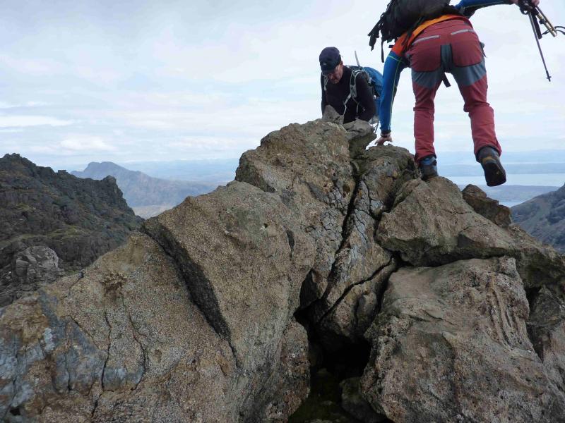
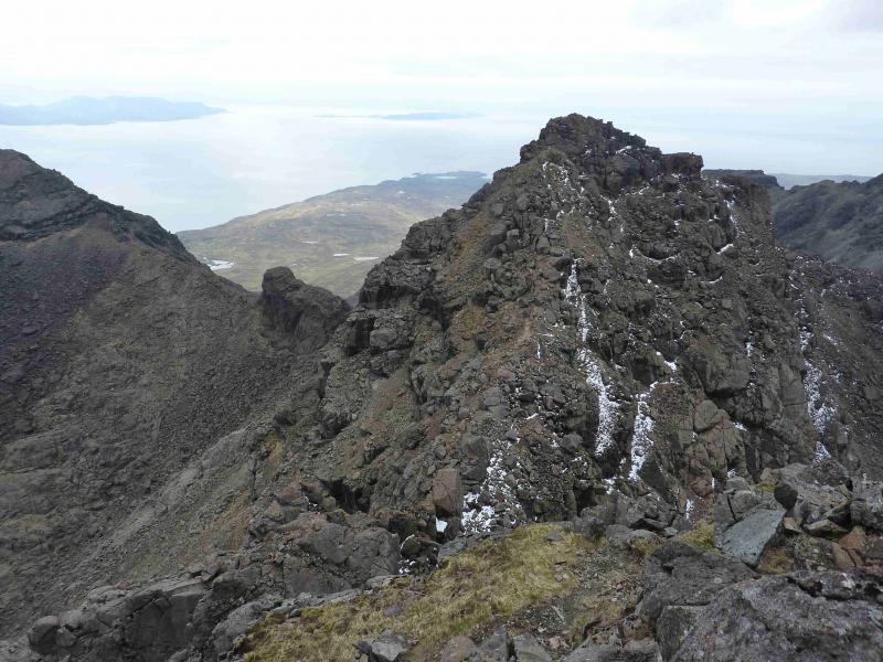
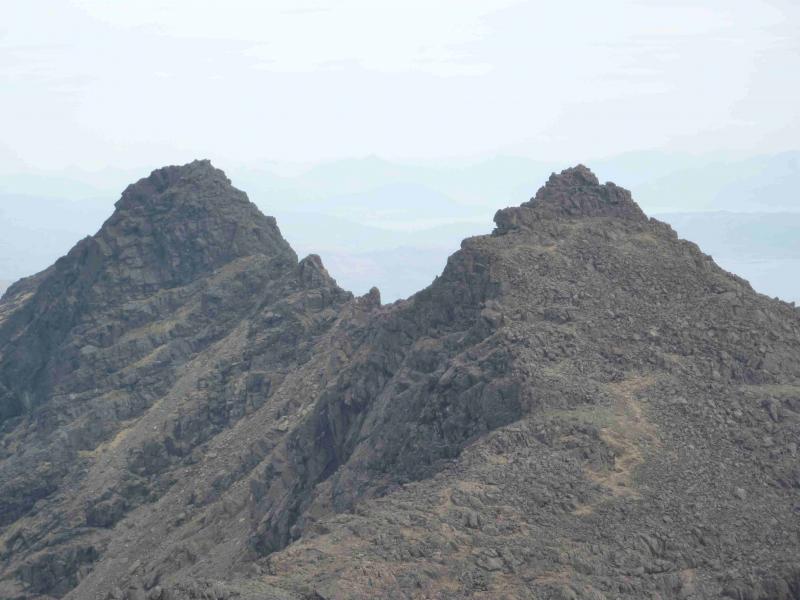
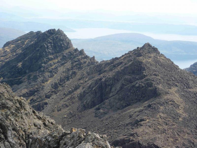
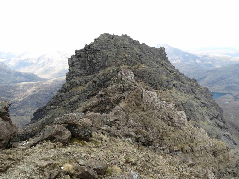
(1) From the Glenbrittle hut, walk down the road until it turns right and a track goes on ahead. Follow the track which soon climbs past the campsite. Almost immediately, leave the track and follow a good path E, cobbled in places towards Coire Lagan. In about 500 m, the path splits so take the right fork which descends slightly to cross a burn. If this burn is difficult to cross then the next will be much harder. Continue past a small lochan and cross a minor stream just before the Allt Coire Lagan which, in spate, can be a very difficult crossing. Continue on the distinct path. Further on, the path splits again so take the left fork which climbs around the foot of Sron na Ciche and into the lower part of Coir a' Ghrunnda. The path is easily followed until it levels out on a short grassy section (often boggy). Many go astray here but the path is still there, it is just well to the left just below the rock and distinct once reached. The golden rule here is do not cross a burn before Loch Coir a' Ghrunnda. The path continues and a few options are possible to avoid a boulder field higher up. Beyond the boulder field a rock band seems to bar progress to the last terrace below the ridge so follow the path just to the left, W, of the burn but do not cross it. A waterfall through the slabs should be reached. Go right to the foot of the rock band on the left of the waterfall where a narrow groove on the left should be seen which ascends a weakness in the rocks. Further left is a wider “gully” but the groove is the easier option. Ascend this then walk the short distance to Loch Coir a' Ghrunnda which is a lovely spot to rest. Make a note of how to reach the groove on the way down. From the loch, pick a way, roughly E, to the main ridge, aiming for the N side of Caisteal a' Garbh Choire which is a prominent buttress on the ridge. In clear weather it is unmistakeable. There are hints of paths up to the ridge but it is very stony with some quite large boulders to clamber around. As one gets closer, aim for the “keyhole” boulder below Caisteal a' Garbh Corrie (there are actually two such boulders as one gets closer still). Once on the ridge, ascend N up rocky, but relatively easy ground, with some occasional and enjoyable easy scrambling. It is one of those ascents where the route is not obvious from below but becomes obvious as one ascends. Soon reach a medium cairn which marks the summit of Sgurr Dubh an Da Bheinn, 938 m.
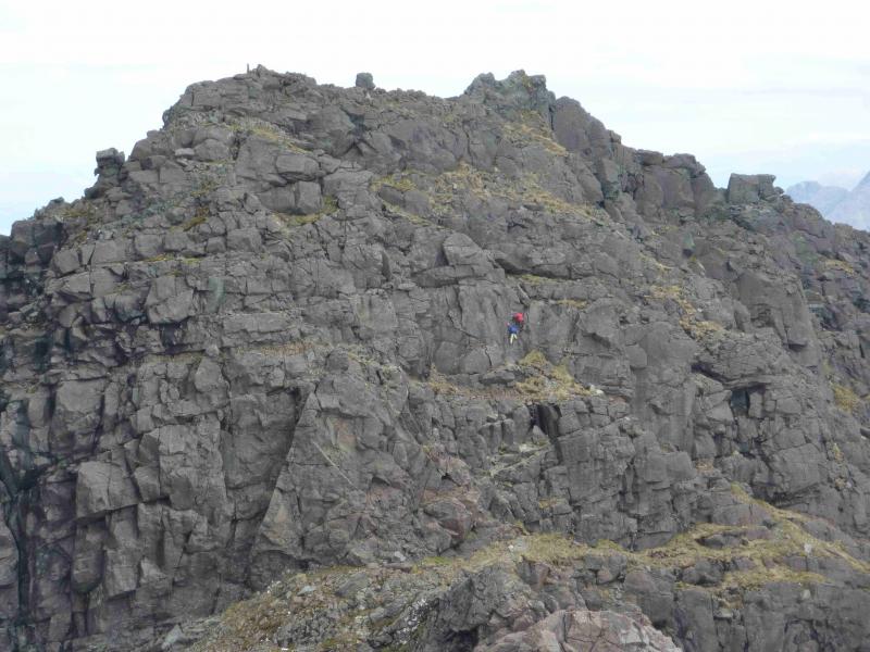
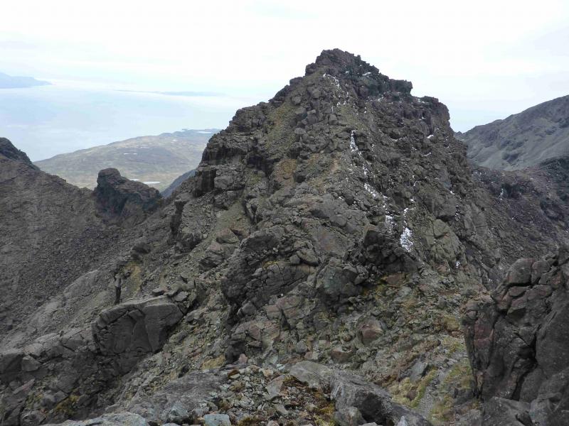
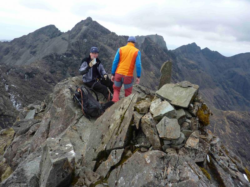
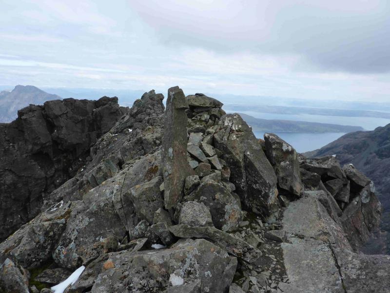
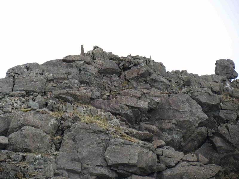
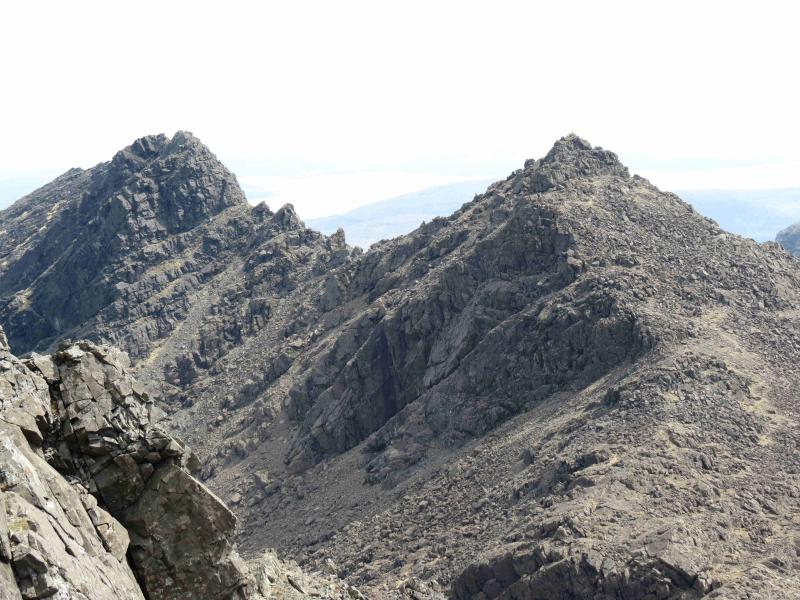
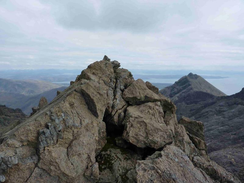
(2) In clear weather, much of the route to Sgurr Dubh Mor can now be seen so descend carefully down the well defined rocky ridge, roughly ENE, past a bivouac spot where rucsacs can be left, to reach the bealach between the two peaks. An obvious path ascends the other side but care is now needed as quite a few paths have developed and soon can lead the unwary and inexperienced into very tricky situations. Generally, the easiest routes will be to the right, S, where there is more grass and less rock and the most difficult routes, with much exposure, will be to the left, N. Even the easiest routes will require some scrambling however, most of the route is a walk. Be sure to remember the way back down! Soon the narrow crest is reached where there is a small cairn which marks the summit of Sgurr Dubh Mor, 944 m. Another small cairn lies about 50 m further along the crest and seems to be of similar height so, perhaps, should also be visited.
Notes
(a) This walk took place on 20th May, 2012.
(b) Those traversing the Cuillin ridge will have to leave the ridge at Sgurr Dubh an Da Bheinn to detour to Sgurr Dubh Mor then return. This, in good weather, can take up to two hours. This route was walked on 28th May, 1989.
(c) The “classic” route to Sgurr Dubh Mor is to start in Coruisk (boat from Elgol, walk around the coast or cross the ridge) then ascend the Dubh Ridge to Sgurr Dubh Beag on continuous slabs. In dry, clear weather, this should be within the capability of an experienced scrambler or low grade climber. From Sgurr Dubh Beag, one can abseil down or retreat a few hundred metres and walk below the ridge then continue to Sgurr Dubh Mor with some more scrambling. From here, use the route above to go to Sgurr Dubh an Da Bheinn and return to Glenbrittle. Full details can be found in appropriate guide books. There are logistical problems with this route and two cars are essential. From Glenbrittle, it is a long drive to Elgol and a car has to be retrieved at the end of the day so the day can easily stretch to 13 hours or longer. This route was walked on 25th July, 2000.
Photos - Hover over photo for caption. Click on to enlarge. Click on again to reduce.