Get Lost Mountaineering
You are here: Scotland » 17 Islands » Skye
Sgurr Sgumain via Sron na Ciche Ridge
Sgurr Sgumain via Sron na Ciche Ridge from Glenbrittle
Start/Finish
Glenbrittle BMC Memorial Hut (next to Mountain Rescue) or car parking before Glenbrittle Campsite. Parking inside the campsite grounds is charged.
Distance/Time
8 km. About 6 hours.
Peaks
Sgurr Sgumain, 947 m, NG 448 206. OS sheet 32 but see below.
Introduction
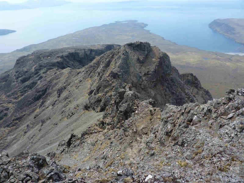
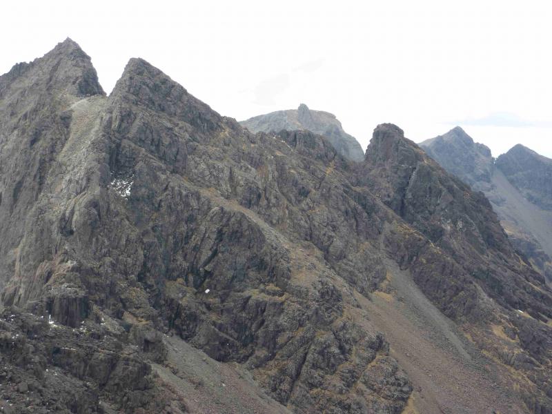
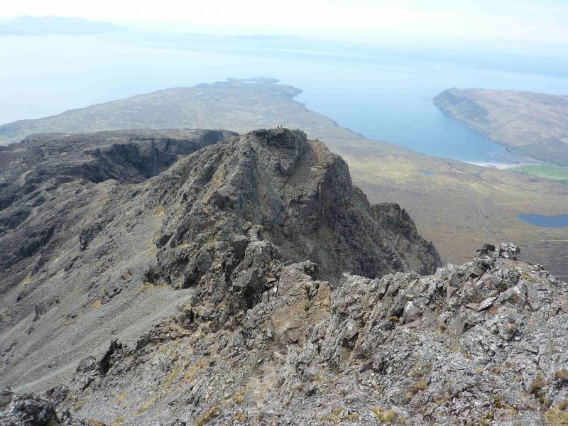
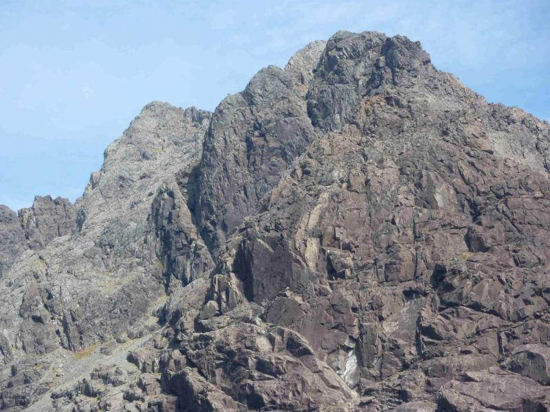
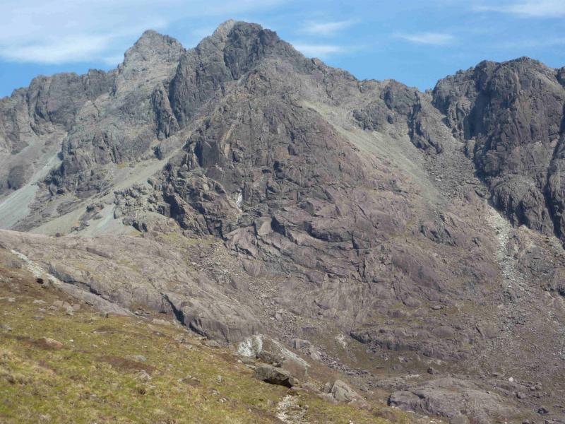
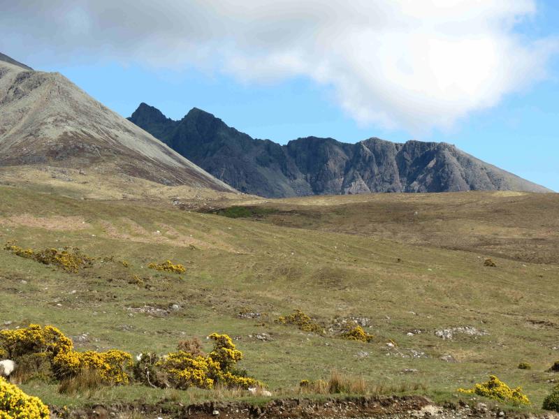
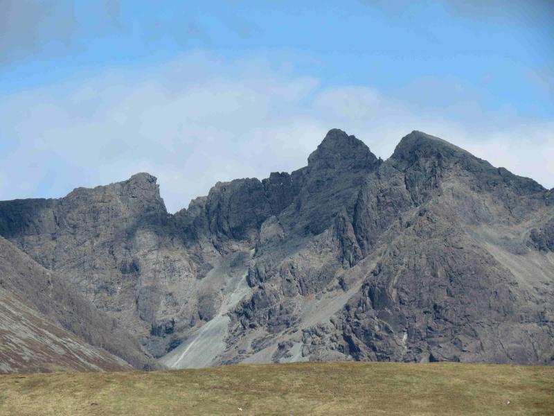
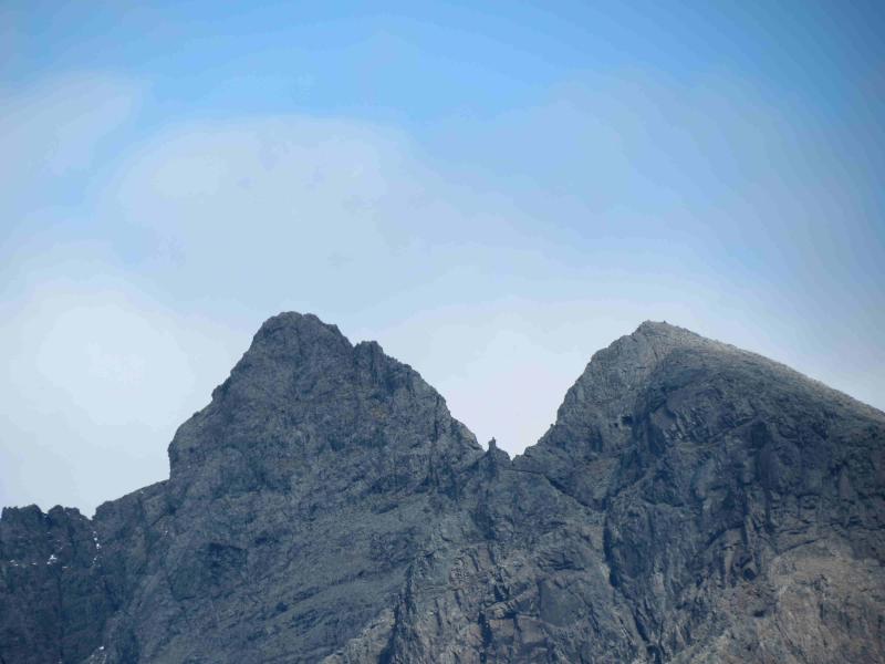
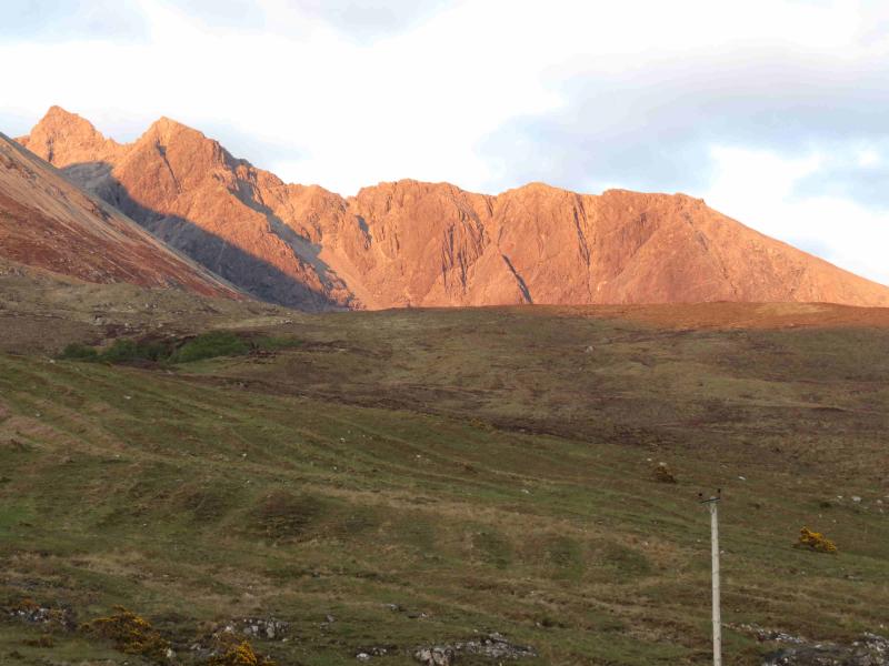
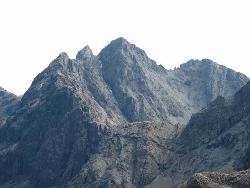
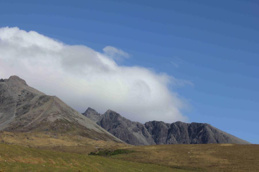
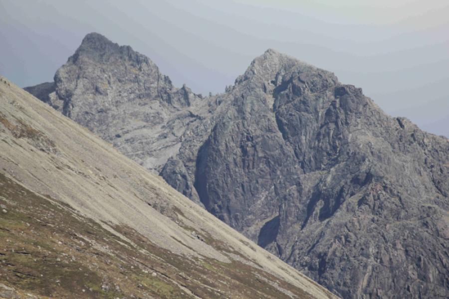
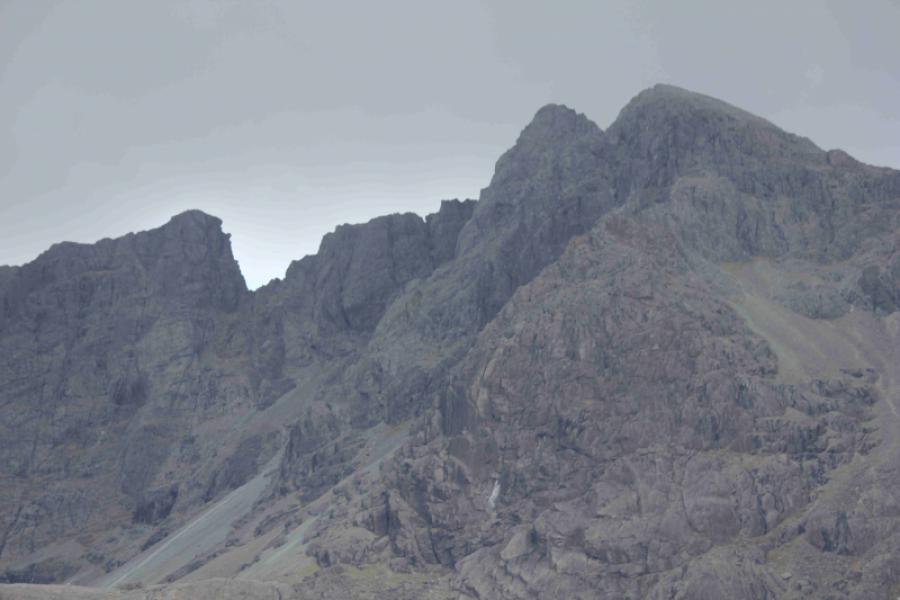
Only two Munro peaks lie off the main Cuillin Ridge: Sgurr Alasdair and Sgurr Dubh Mor. Sgurr Sgumain also lies off the main ridge but it is a subsidiary top of Sgurr Alasdair. The two adjacent, triangular, jagged peaks are well seen from the Glenbrittle hut with Sgurr Alasdair on the left and Sgurr Sgumain on the right. OS sheet 32 covers the walk but some will prefer the Harvey map of the Cuillin. The SMT used to publish a very good map of the main Cuillin (not including the Blaven range) which had the contour map on one side (unfortunately without grid lines!) and a diagram map on the reverse similar in style to that used in the SMC Munros book. In clear weather, the diagram map is probably the most useful as the others can be over powering with all their contours. There are many guide books for Skye but the most popular and comprehensive seems to be the SMC Skye Scrambles and is well worth buying. Note that a compass is unreliable on the Cuillin so be extra prepared in bad weather to cope without one. A compass needle may spin. In spate conditions, the Allt Coire Lagan may be very difficult to cross. The views on this walk are absolutely stunning, not just of the Cuillin peaks but also of Coir a' Ghrunnda, which many regard as the most attractive corrie in the southern Cuillin, as well as the islands of Soay, Rum, Eigg and Canna, however this is not a walk for the inexperienced especially in bad weather. On the ascent of Sgurr Sgumain, there is a very good view of the Cioch – a great chunk of rock which sticks out from the slabs of Sron na Ciche. A scene in the film “Highlander” featured a sword fight on the Cioch but it is only a place for experienced rock climbers. Sron na Ciche is one of the most popular climbing areas in the Cuillin with many famous routes.
Route
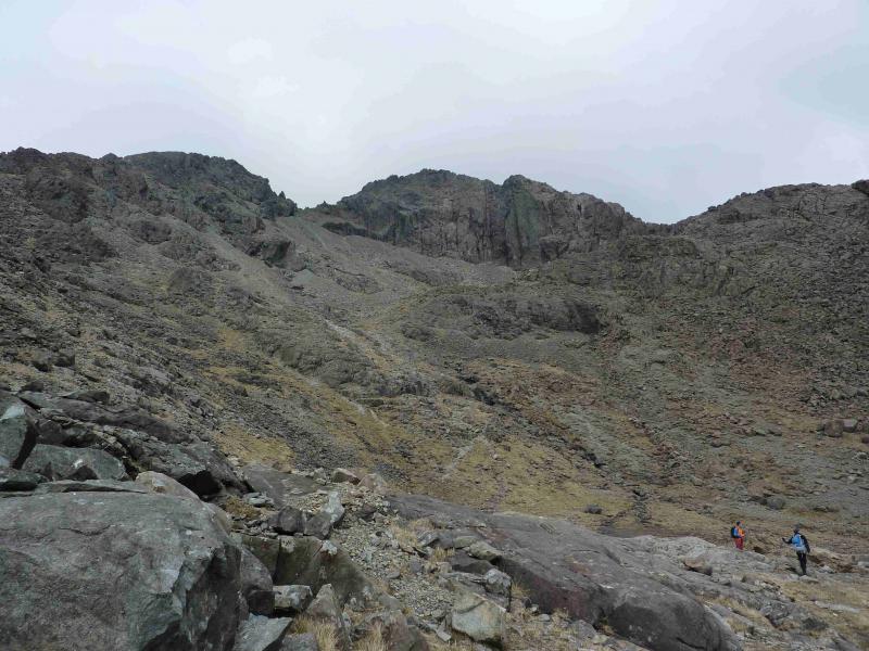
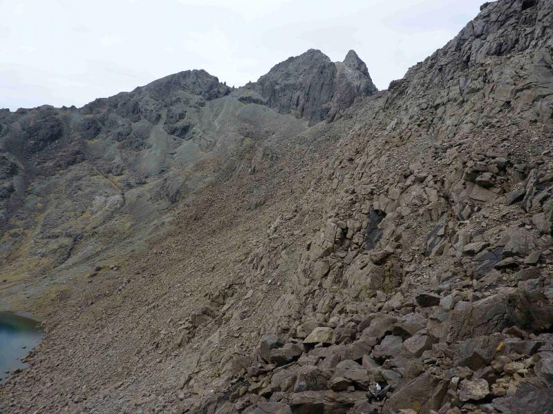
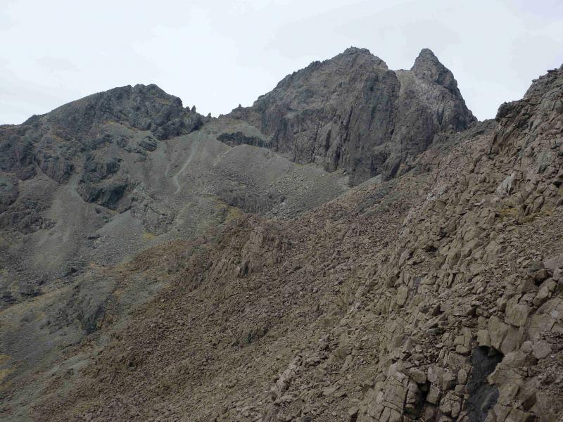
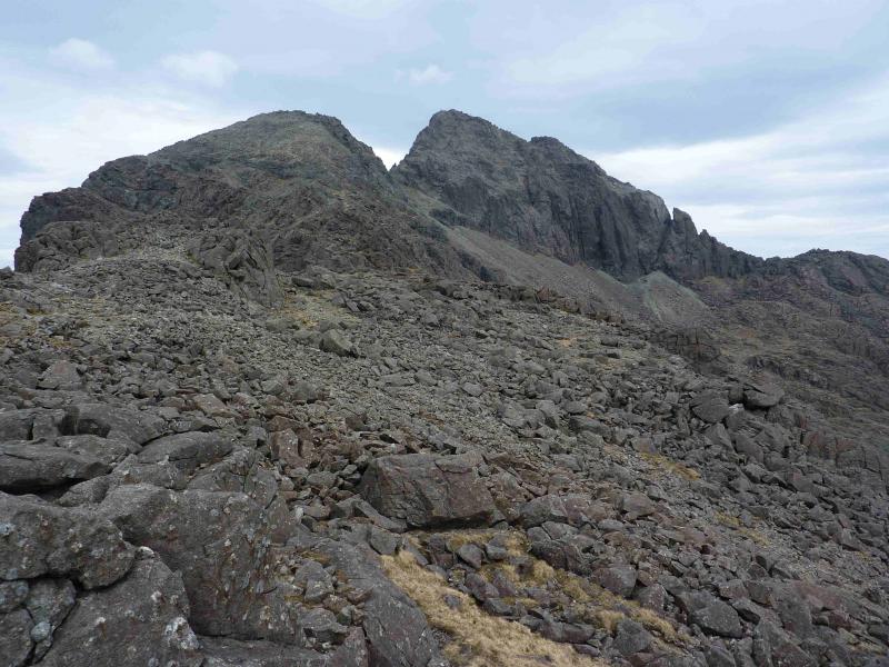
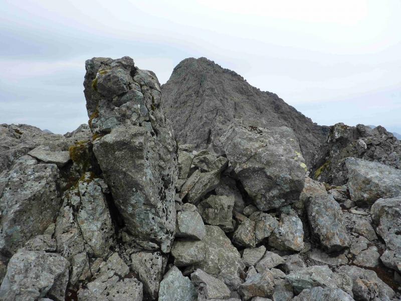
(1) From the Glenbrittle hut, walk down the road until it turns right and a track goes on ahead. Follow the track which soon climbs past the campsite. Almost immediately, leave the track and follow a good path E, cobbled in places towards Coire Lagan. In about 500 m, the path splits so take the right fork which descends slightly to cross a burn. If this burn is difficult to cross then the next will be much harder. Continue past a small lochan and cross a minor stream just before the Allt Coire Lagan which, in spate, can be a very difficult crossing. Continue on the distinct path but leave it at any suitable point to ascend Sron na Ciche. The earliest opportunity is just after crossing the Allt Coire Lagan and gaining the low grassy ridge at the foot of Sron na Ciche. Alternatively, continue further and pick a route uphill before turning into Coir a' Ghrunnda. There are no paths up Sron na Ciche shown on the map but there are quite a few on the ground which have probably been created by climbers walking off after climbing on Sron na Ciche. Pick a way up, trying to stay on the grass and out of the scree until the grass runs out. A large outcrop high up can be aimed for and there is the occasional cairn. Once the angle eases, a few boulder fields are crossed. It is easy to follow the edge in places but it is the top of a very steep cliff. The more obvious paths are set well back from the edge. Sgurr Sgumain will be clearly in view on a good day but the final section seems to be barred by a descent down a cliff especially nearer the edge. Go around the cliff on the right (Coir a' Ghrunnda side) and then walk left, under the cliff, to the top of the Sgumain Stone Chute where there is a sizeable cairn. From here a path heads towards Sgurr Sgumain but seems to stop at some small boulders. Continue into the boulders and the path soon reappears then leads easily to the small cairn which marks the summit of Sgurr Sgumain, 947 m. Look Behind for the Cioch on the ascent.
(2) Return the same way, probably finding a shorter detour around the cliff near the top of the Sgumain Stone Chute. Walk down the Sron na Ciche ridge. The advantage of height makes it easier to locate the grassy sections than on the ascent.
Notes
(a) This walk took place on 22nd May, 2012.
(b) Experience scramblers can continue to Sgurr Alasdair and even Sgurr Thearlaich and maybe even around Coire Lagan to Sgurr Mhic Choinnich. Details of this extension are in the Skye Scrambles book.
(c) An alternative descent is to retrace to the cairn at the top of Sgumain Stone Chute and descend to Coire Lagan, passing close to the Cioch, then follow the path back to Glenbrittle. From the cairn, it is also possible, with care, to descend to Loch Coir a' Ghrunnda but one needs to know the way through the upper rock band in the corrie to be able to use this alternative.
Photos - Hover over photo for caption. Click on to enlarge. Click on again to reduce.