Get Lost Mountaineering
You are here: Scotland » 17 Islands » Skye
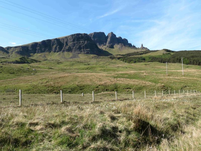
The Storr and Hartaval
The Storr and Hartaval from The Storr car park on A 855
Start/Finish
Small car park on the A855 about 7 miles N of Portree at about NG 507 527.
Distance/Time
12 km. Approx 6 hours.
Peaks
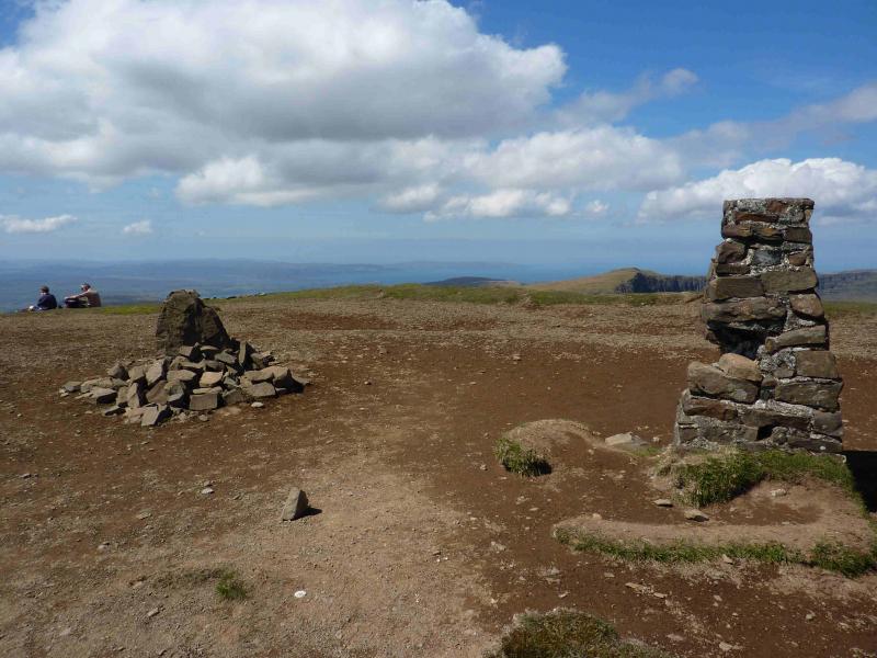
The Storr, 719 m, NG 495 540.
Hartaval, 669 m, NG 480 232 551. OS sheet 23.
Introduction
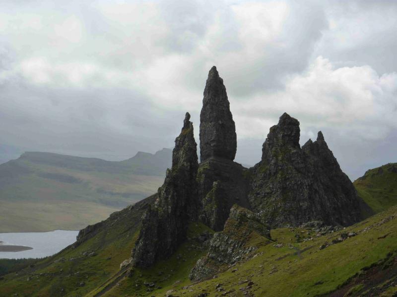
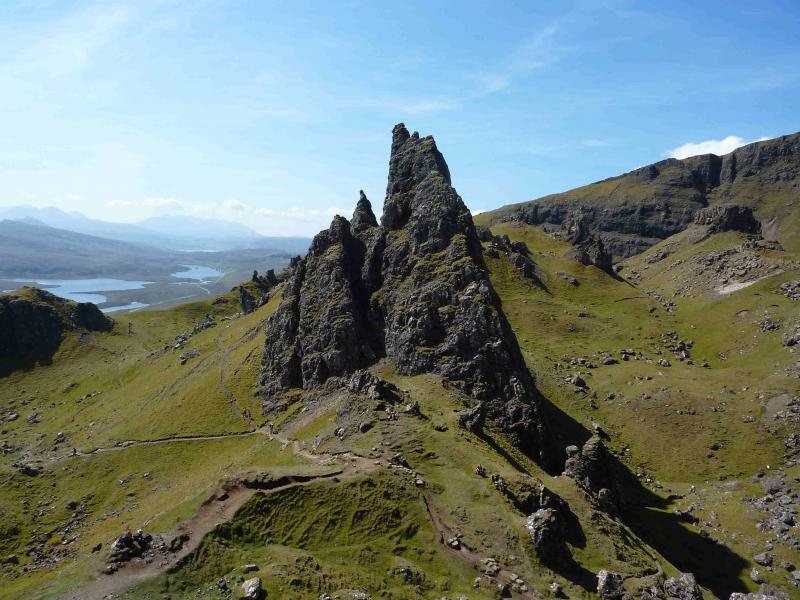
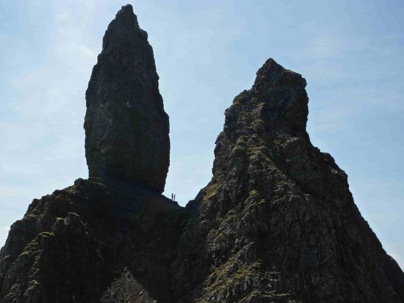
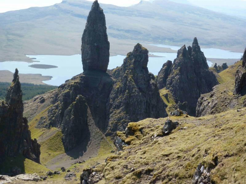
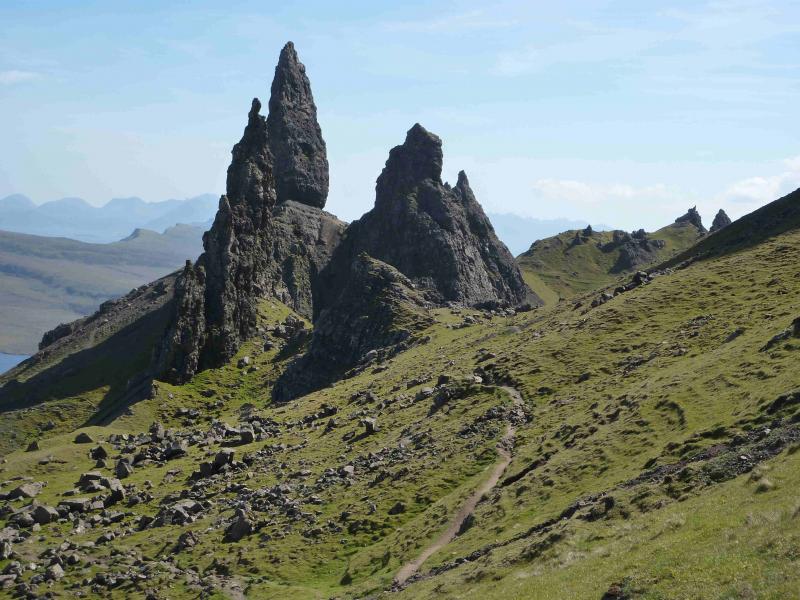
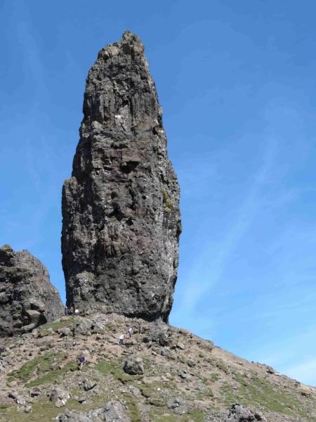
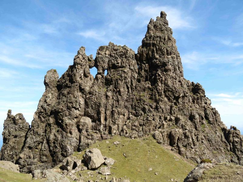
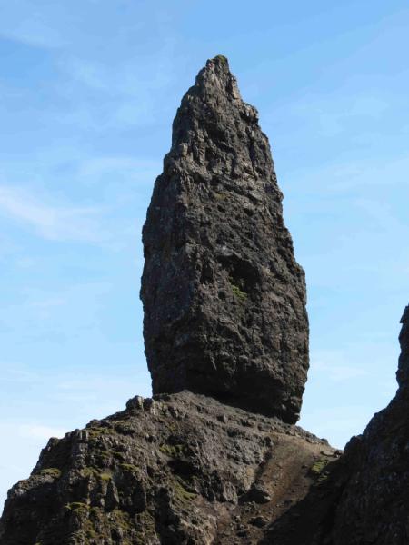
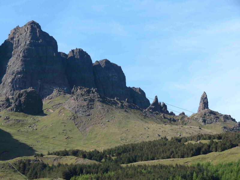
These two hills can offer a good day when higher hills, especially when the Black Cuillin are in cloud. They offer generally easy walking with very good views N and S along the Trotternish ridge and to the coast and islands such as Raasay and Rona. The highlight, though, is undoubtedly, the area known as “The Sanctuary” with its natural rock “sculptures” of which the most famous is the “Old Man of Storr” which is usually seen on the approach from Portree. (This should not be confused with the Old Man of Stoer in Sutherland which is a sea stack).
Route
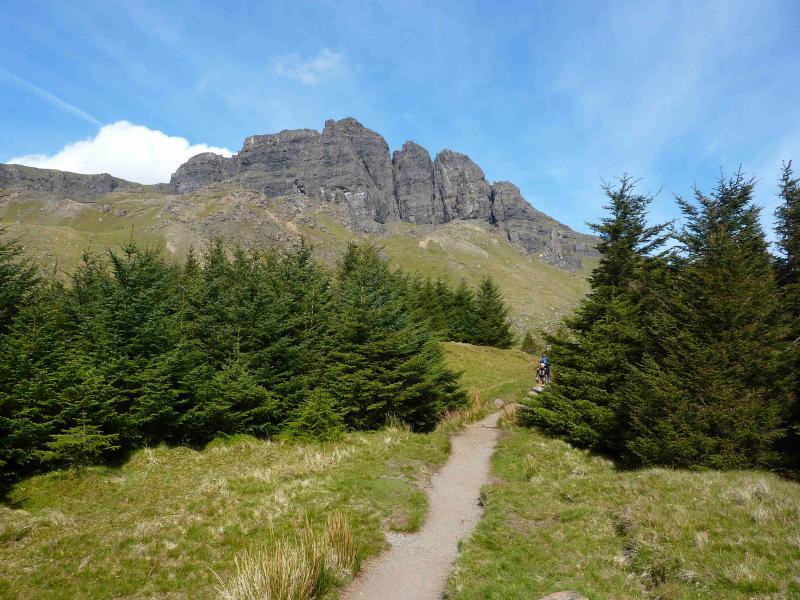
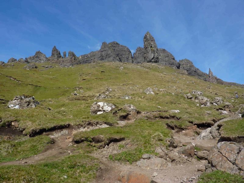
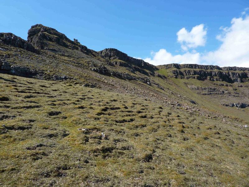
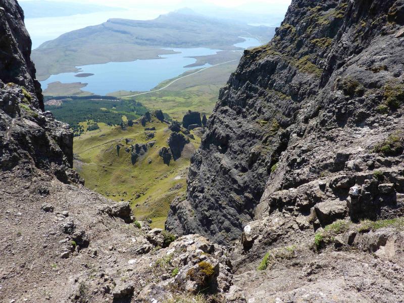
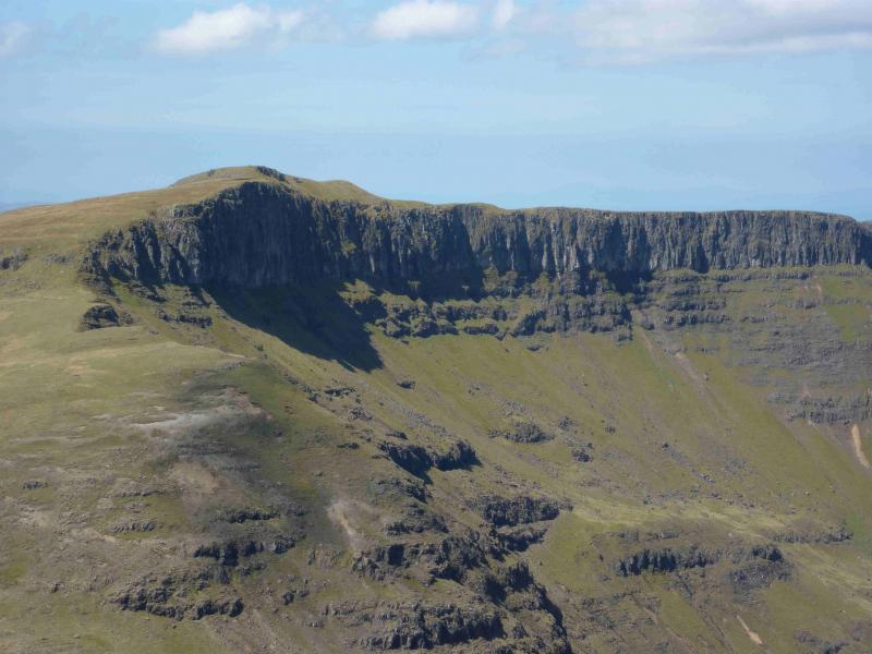
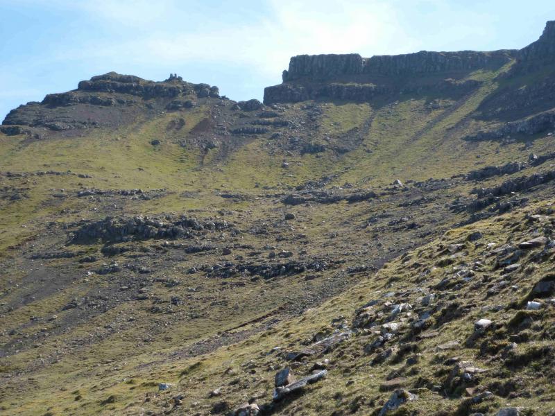
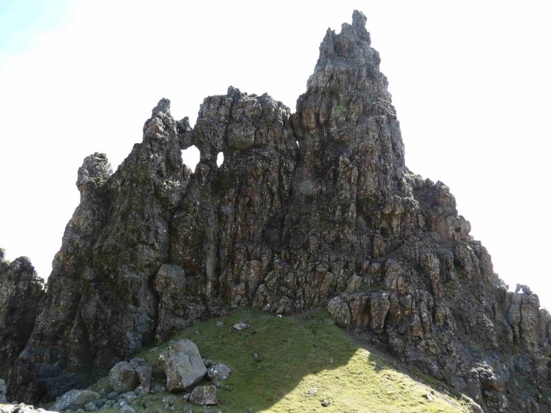
(1) From the small car park, follow the obvious, much improved, path through the wood to emerge below the Sanctuary. Continue on the path with a choice of passing below or above the strange shape, with “windows” which some call “the cathedral”. Continue to a low barbed wire fence where there is a choice of two crossings but only the lower one is free of barbed wire. Continue along the path below the impressive cliffs of The Storr. When there is a break in the cliffs, through which the path goes, it is possible to leave the path and ascend above the cliffs, or below them on their E side, to reach the summit trig point of The Storr, 719 m. An alternative route goes roughly SW up the grassy corrie to go through the same gap as the cliff route. Another alternative is to continue further along the path and ascend the gentle ridge, which is cairned, at the back of the grassy corrie.
(2) Descend NW down easy stony, grassy slopes to reach the wide grassy Bealach a' Chuirn. Ascend roughly NW up easy grassy slopes following the obvious line of the cliff edge on the right, NE, to reach the medium summit cairn of Hartaval, 669 m. A line of old metal fence posts can be followed for the middle part of the ascent.
(3) Descend roughly SE back to the Bealach a' Chuirn then head roughly NE to traverse the N ridge of The Storr to reach the gentle ridge described on the outward route then descend to meet the main path back across the bottom of the grassy corrie to The Sanctuary and thence back to the start. Note that the path goes through a short cliff just before the ascent ridge up the Storr and care is needed here as there are some false paths.
Notes
(a) This walk took place on 11th May, 2011 and 24th May, 2012.
(b) This route can be very challenging in mist, especially from The Storr to Hartaval and, more so, the return to The Sanctuary. Take extra care when navigating back from Bealach a' Chuirn as a wrong turn here can lead one down steep craggy valleys which may have to be reclimbed.
(c) An alternative route back is to descend Harteval to the fence posts then follow these down and across the SW end of Bealach a' Chuirn. This route has not been checked but the fence posts seem to go across the bealach and some way up the other side. Their line seems to be towards Bealach Beag where it looks like a burn can be followed through a weakness in the cliffs. Some guide books refer to a faint path by the burn which then heads towards the edge of the forest and back to the road. In clear weather, Bealach Beag is easily seen from Harteval.
Photos - Hover over photo for caption. Click on to enlarge. Click on again to reduce.