Get Lost Mountaineering
You are here: Wales » North Wales » Snowdon Range
Snowdon Full Horseshoe from Pen-y-Pass
Snowdon Full Horseshoe from Pen-y-Pass
Start/Finish
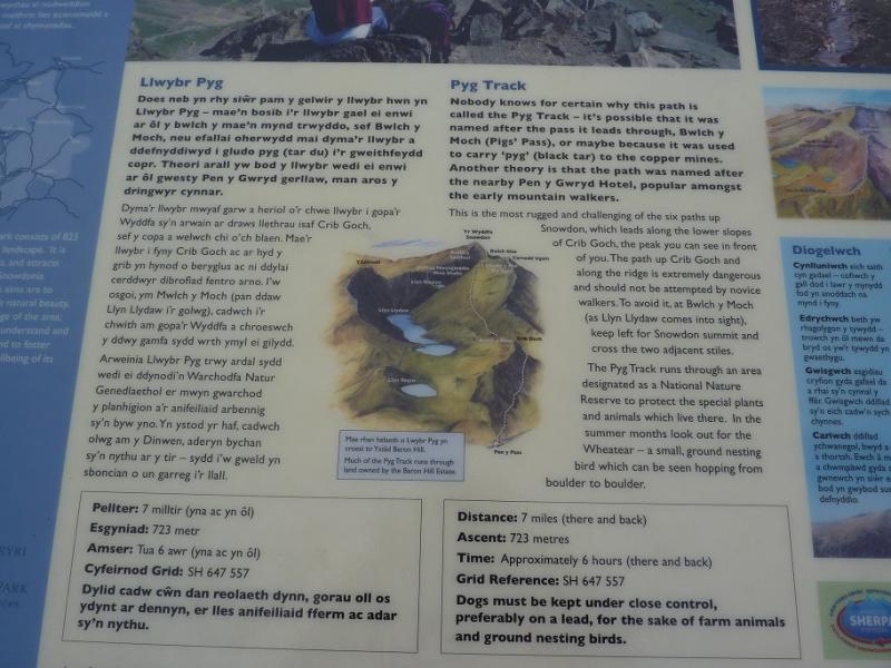
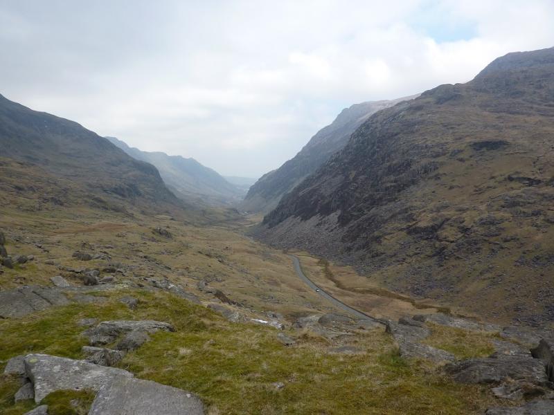
Car park at Pen-y-Pass about 8 km S of Llanberis on A 086. Expensive (£10 per day) for cars but should be free for bikes. It is possible to get a mini-bus, called a Sherpa, from Llanberis (and other places) for about £1 per journey. Timetables are freely available from the local Tourist Offices.
Distance/Time
12 km Approx 8 hours
Peaks
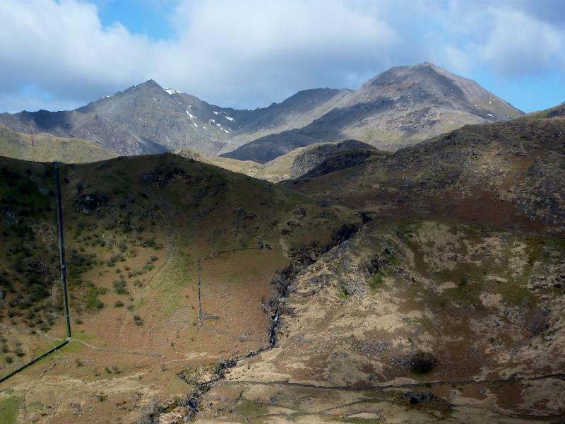
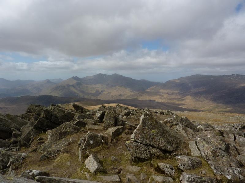
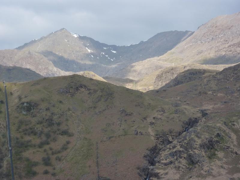
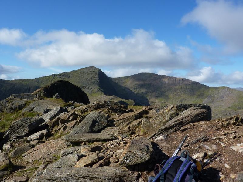
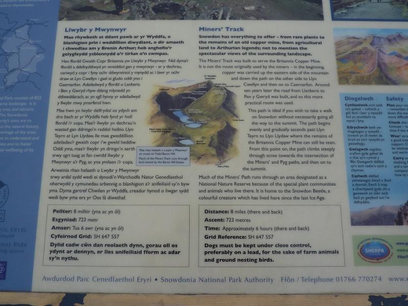
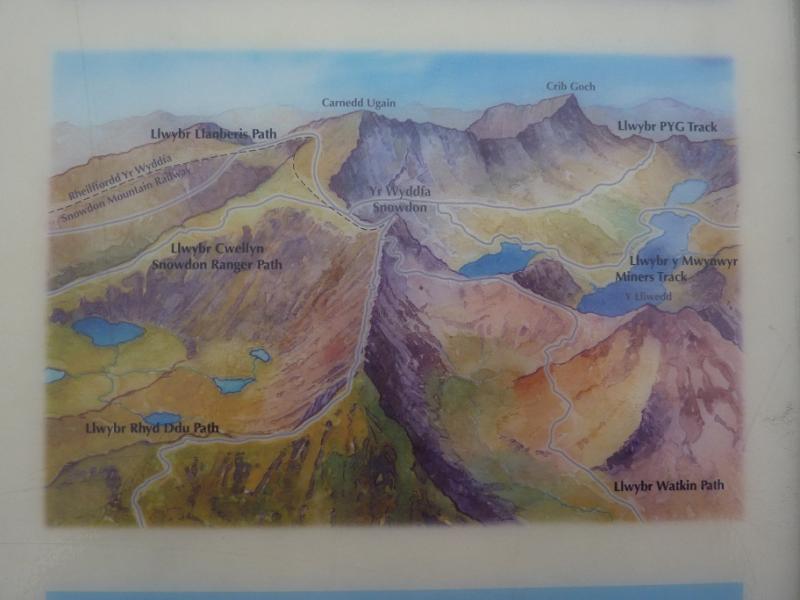
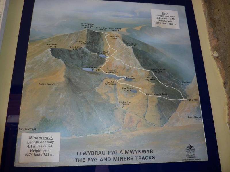
Crib Goch, 923 m, SH 624 551.
Crib-y Ddysgl, 1065 m, SH 610 551.
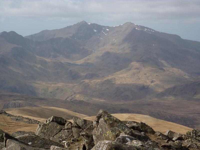
Snowdon (Yr Wyddfa), 1085 m, SH 609 543.
Y Lliwed, 898 m, SH 623 533. OL 17 Yr Wyddfa & Conwy Valley
Introduction
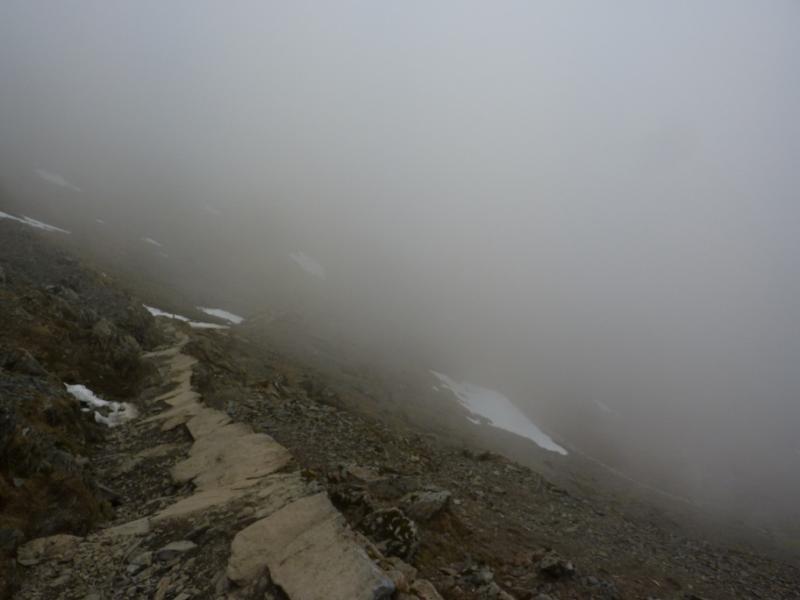
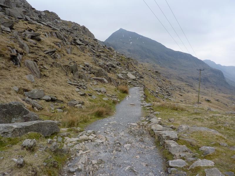
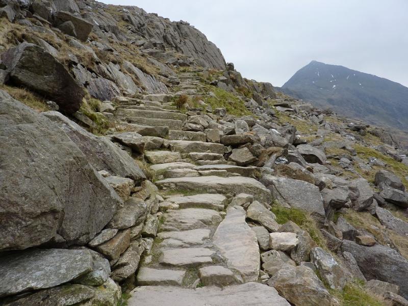
This is the most famous walk in North Wales and should be kept for a good day with clear visibility, dry weather and little or no wind. The entire route is well walked and navigation should not be a problem. Ascending from the Pyg path to the summit of Crib Goch requires care and good route finding as the route has become quite eroded and several “paths” now exist. In the wet this ascent is only for the very experienced and competent scrambler.
Route
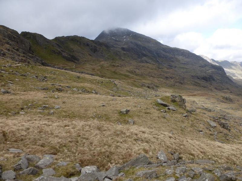
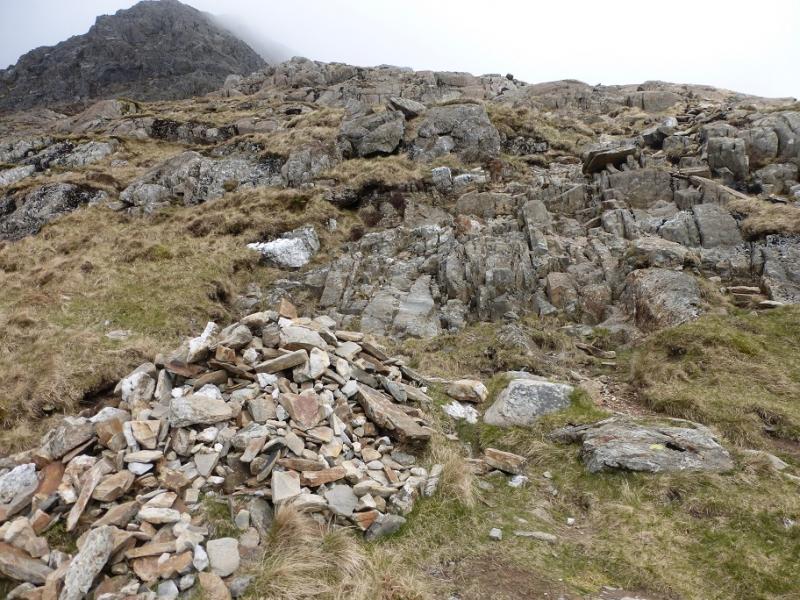
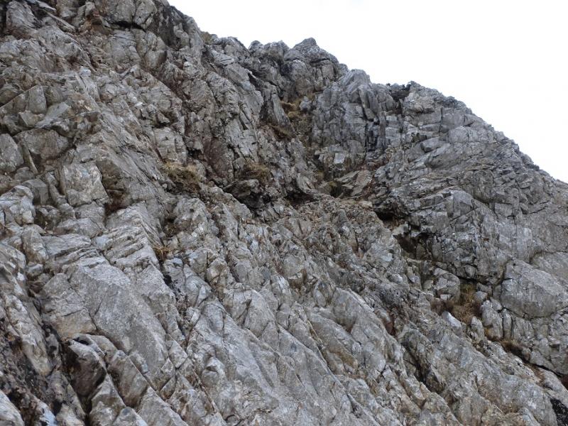
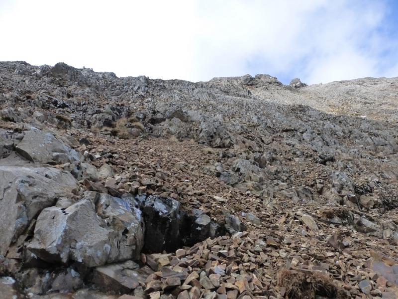
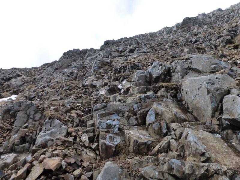
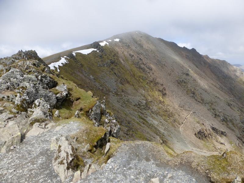
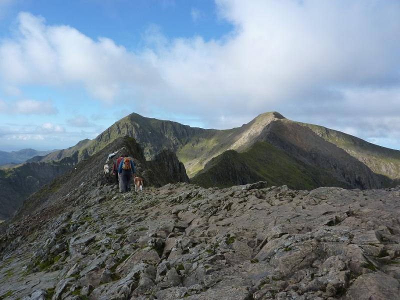
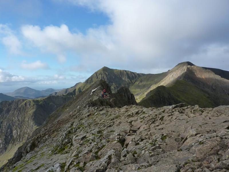
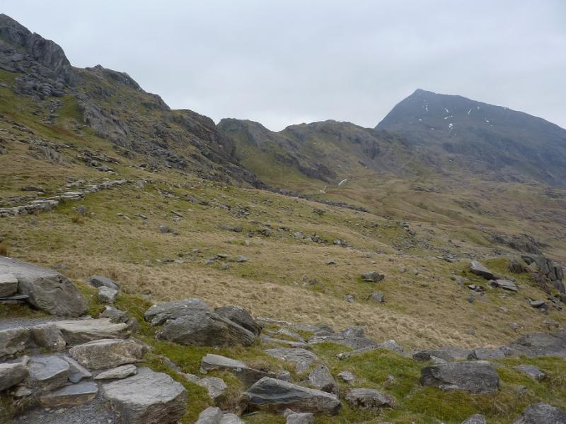
(1) From Pen-y-Pass car park, go to the NW (top right looking from entrance) corner of the upper car park where there is a “hole in the wall”. Follow the obvious path W which climbs gradually then passes into a col called Bwlch y Moch where there are two adjacent stiles. Leave the Pyg path here and take the path heading towards Crib Goch, almost immediately above and slightly to the right. The path is easy to begin with then becomes steeper and exposed in places. Over use has created multiple paths so good route finding is essential but some scrambling will be necessary to reach the summit crest which is narrow and rocky. The ascent is much more difficult in the wet. The first top is Crib Goch E Top, 921 m then further along the ridge is the true summit of Crib Goch at 923 m.
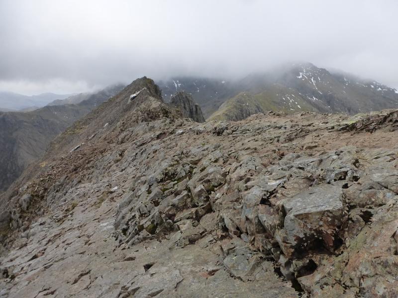
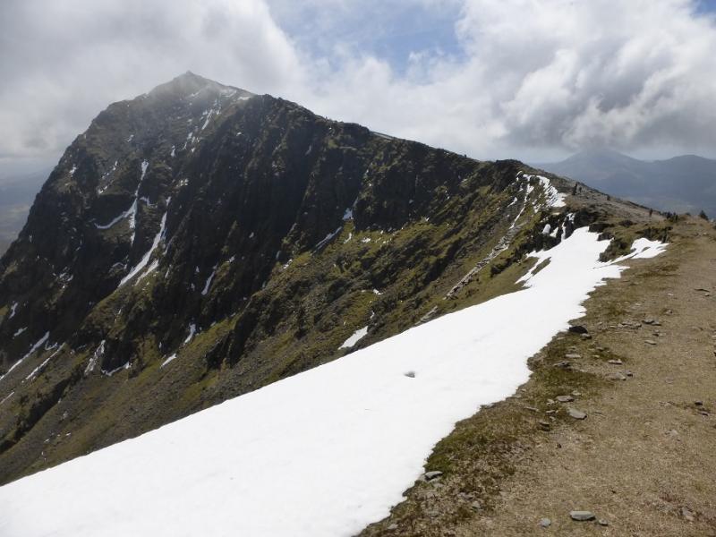
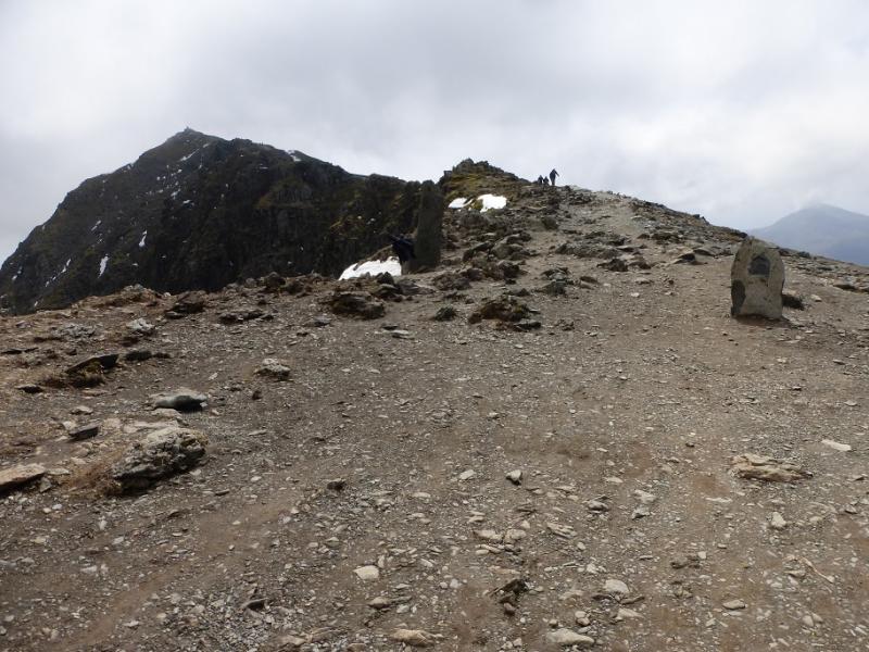
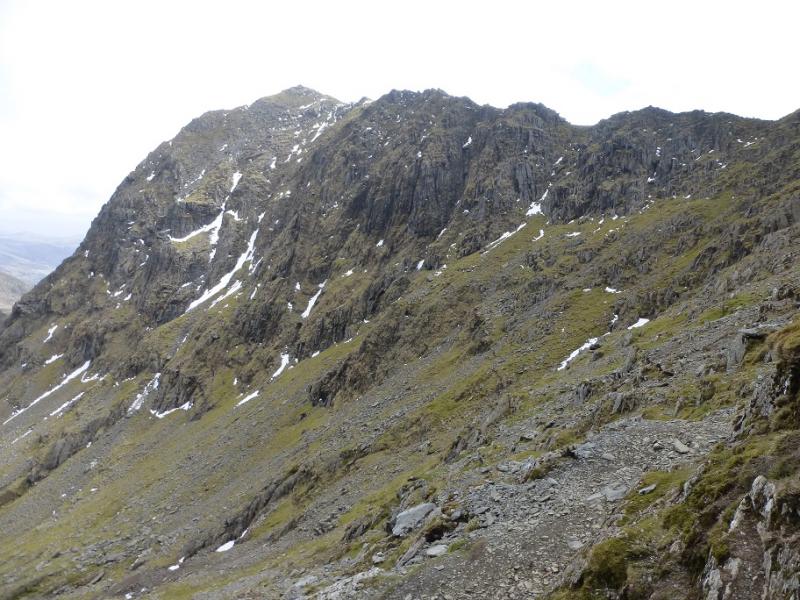
(2) Continue along the arête which is generally easy but there is some exposed short scrambling. It is usually easier to keep to the crest. Eventually, the difficulties end and you descend to the W col. Continue, on an obvious path, up the other side, with some scrambling to reach the summit cairn of Crib-y Ddysgl at 1065 m. Some people refer to this peak as Garnedd Ugain.
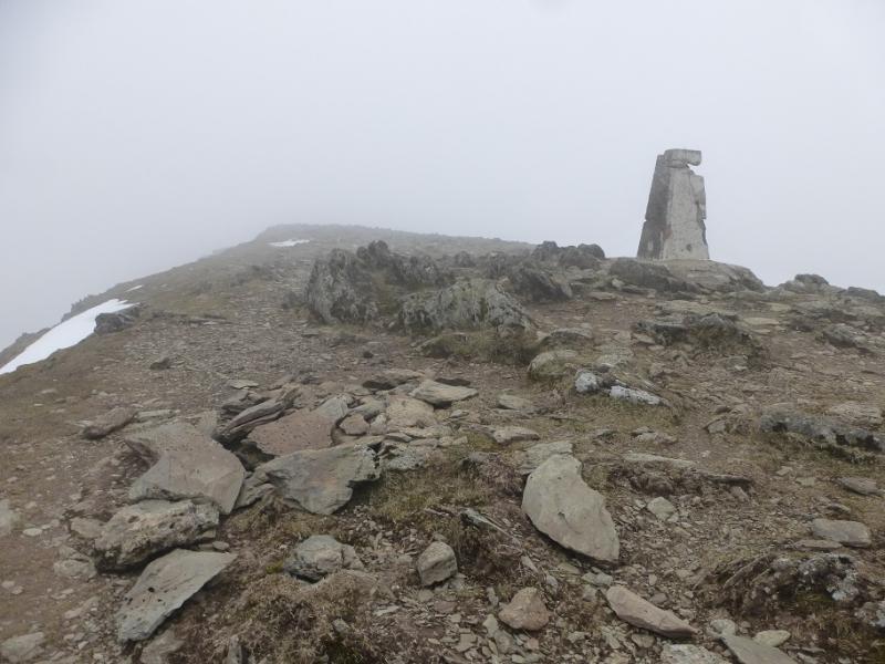
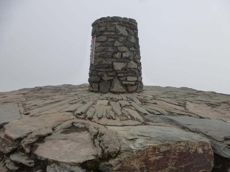
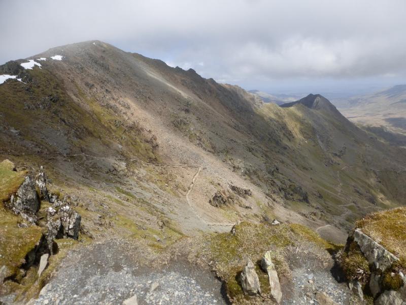
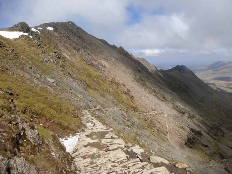
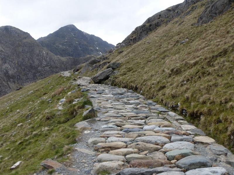
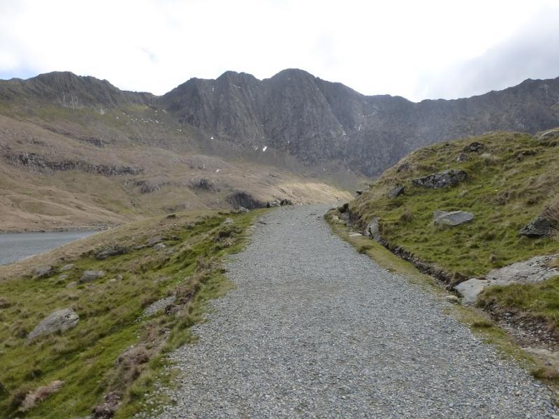
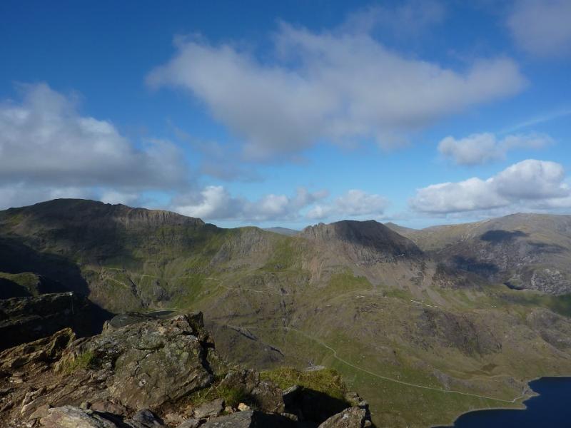
(3) Walk SW then S, descending slightly, on a broad grassy ridge to join the railway which is followed to the summit of Snowdon, 1085 m, where there is a café, not always open, and a large cairn on a plinth with steps.
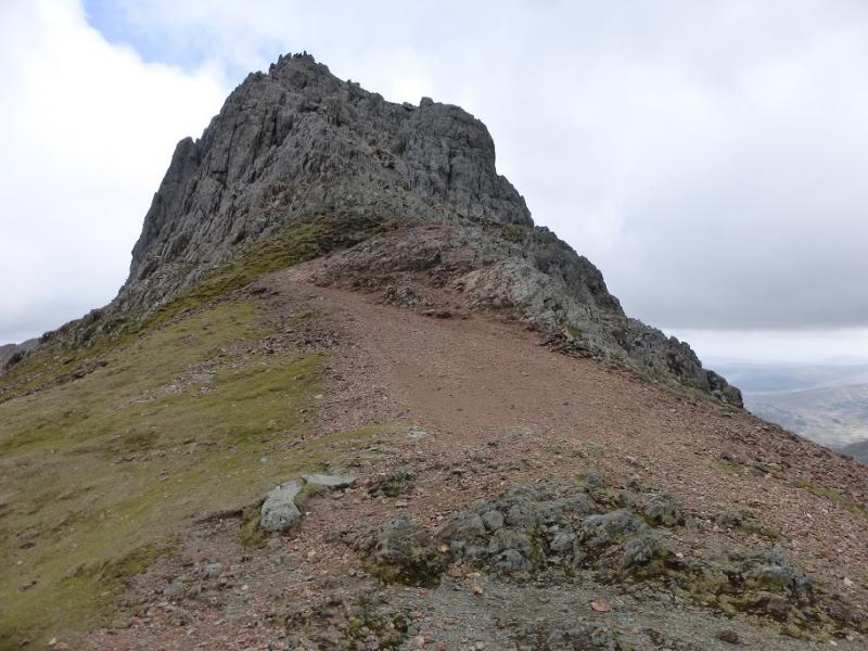
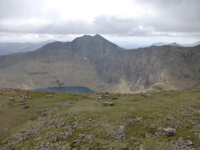
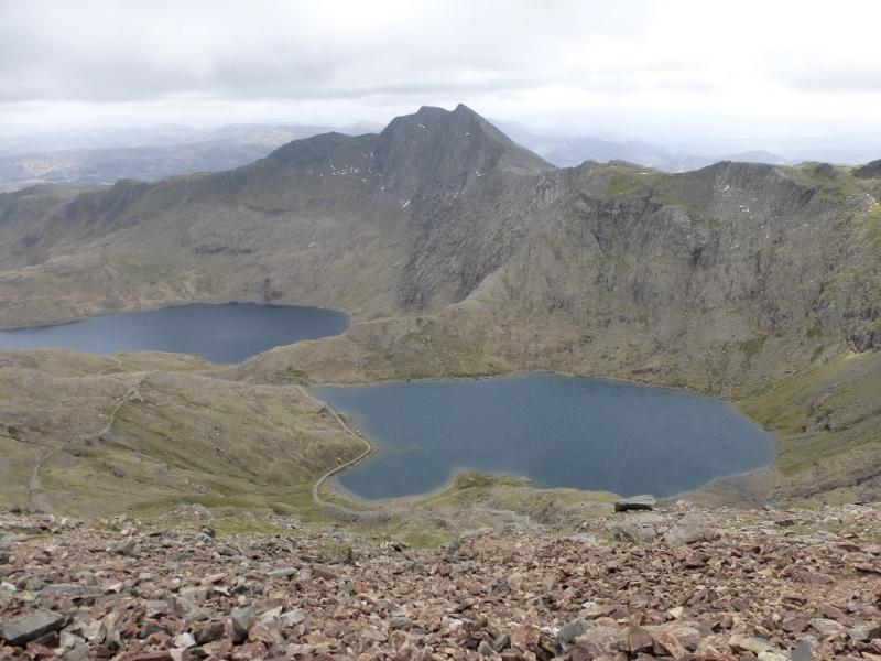
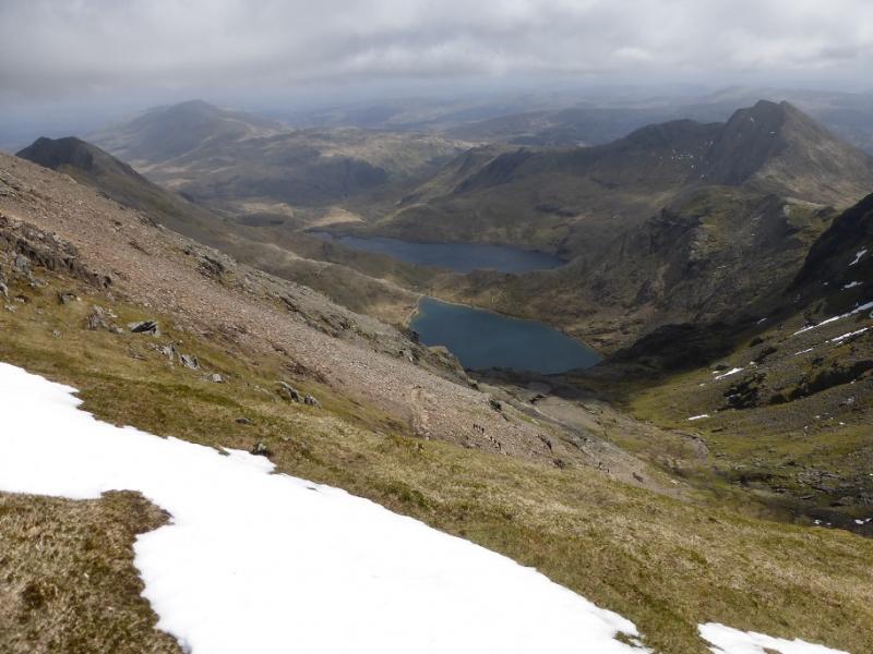
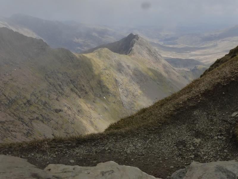
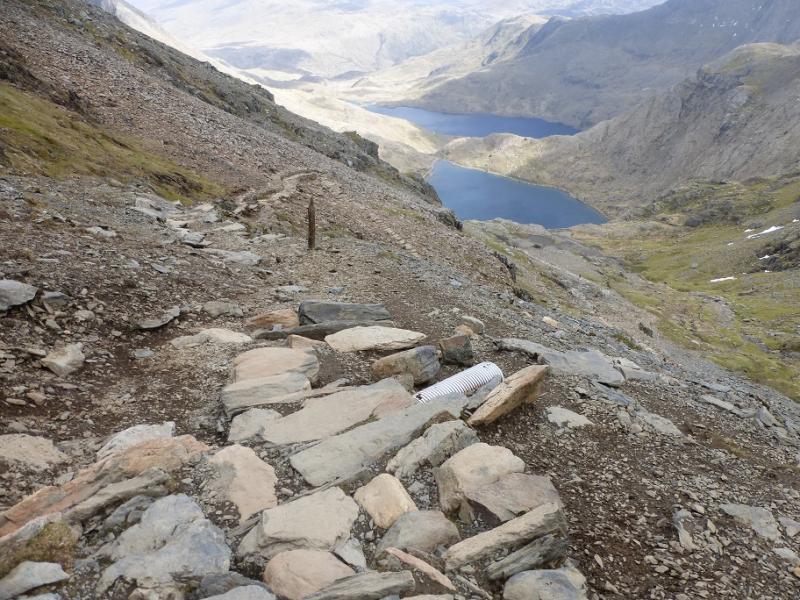
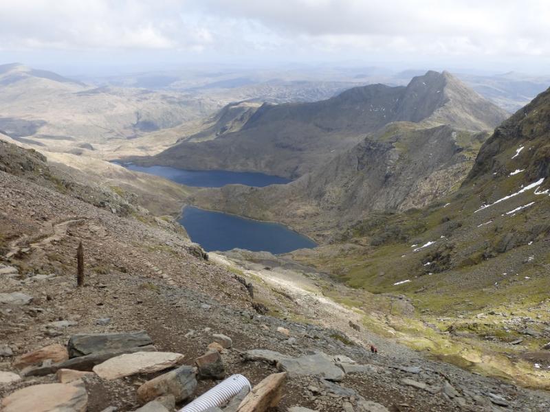
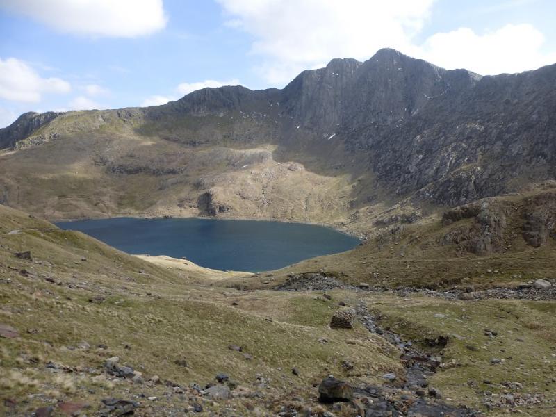
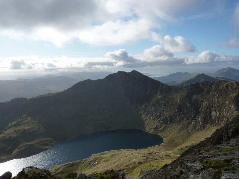
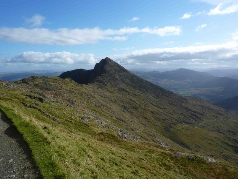
(4) Descend down SW ridge for a short distance until the first roughly level section is reached then take the main path which goes E across scree slopes, avoiding any earlier paths which are badly eroded including any route directly down from the summit. At the bottom of the scree the path becomes much more substantial. This is the Watkin path which eventually goes to Nant Gwynant but you are not going that far. When you reach the E col of Snowdon, stay on the crest. The now substantial Watkin path goes down SW but do not take it. The crest now leads, with some easy scrambling if you want it, to the summit cairn of Y Lliwed, 898 m. All the way up the crest is precipitous on the left, SW, with views down to (Lake) Glaslyn and Llyn Llydaw as well as to the Crib Goch ridge climbed earlier.
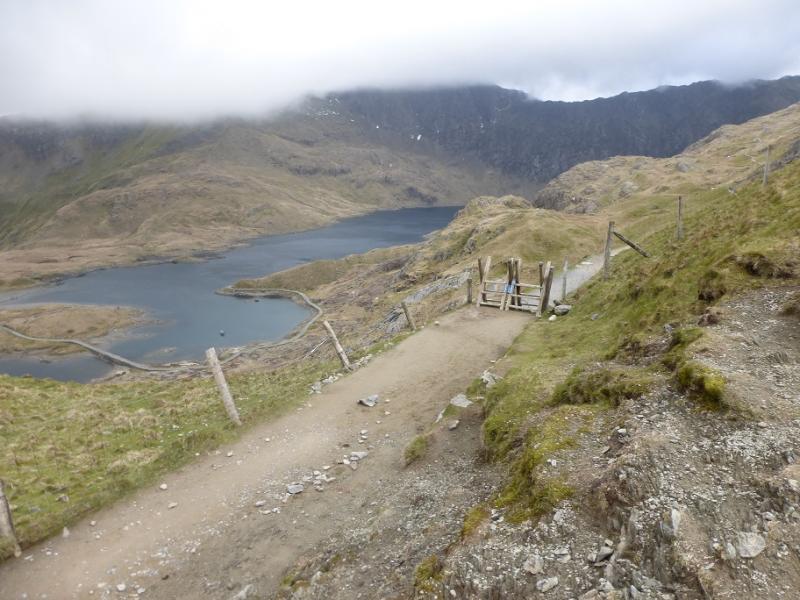
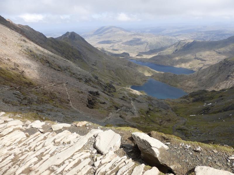
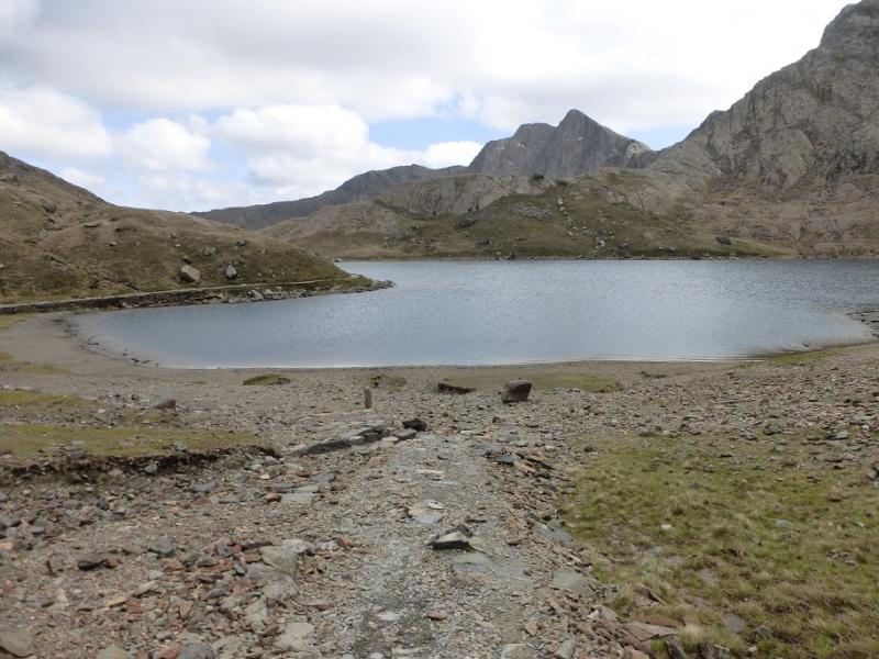
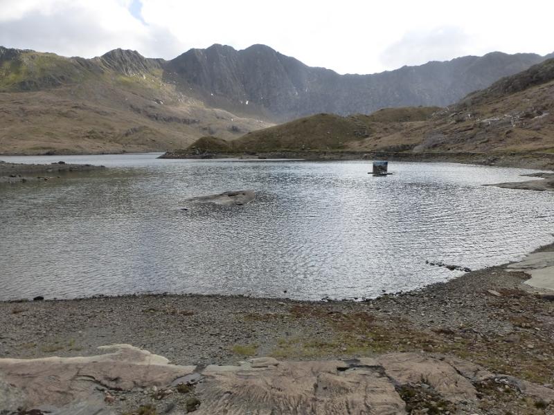
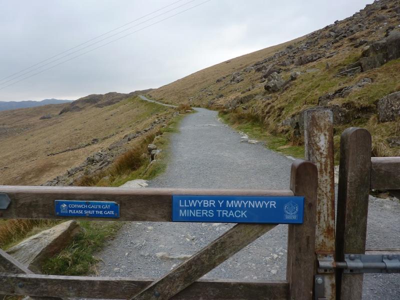
(5) Continue along the crest to the E top at 893 m and keep following the ridge SE then NE to reach a level section where the path descends N (steep and eroded in places) to reach Llyn Llydaw where the Miners’ Track can be joined at the S end of a causeway. Stay on the track, which goes around the hill at the start on the opposite side to the Pyg path, to reach the car park at Pen-y-Pass
Notes
(a) This walk took place on 8th October, 2009.
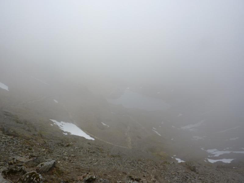
(b) This route would be a very serious undertaking in winter conditions and ice axe and crampons would be essential.
Photos - Hover over photo for caption. Click on to enlarge. Click on again to reduce.

.JPG)