Get Lost Mountaineering
You are here: England » Peak District » Kinder & Mill Hill from Snake Road
Blackden Brook & Kinder's Northern Edges
Blackden Brook & Kinder's Northern Edges from Snake Pass
Start/Finish
A57, Snake Pass, opposite the foot of Blackden Brook. This is about 4.8 miles up the pass from the west end of the Ladybower viaduct. There is rough layby, which involves driving over a rough kerb, on the left, S, of the road at the start of the walk. Just above here, the left verge is mainly gravel and can also be used for parking. About 500 m further up is a small milestone in another layby which means you need to back track. If you reach the Snake Inn, you have over shot by about 2 km.
Distance/Time
19 km Approx 7 hours
Peaks
No peaks as such since this is an ascent of a deep clough (gully) followed by a walk along the northern edge of the Kinder plateau then a descent down the upper Ashop valley.
OS Outdoor Leisure 1: Dark Peak
Introduction
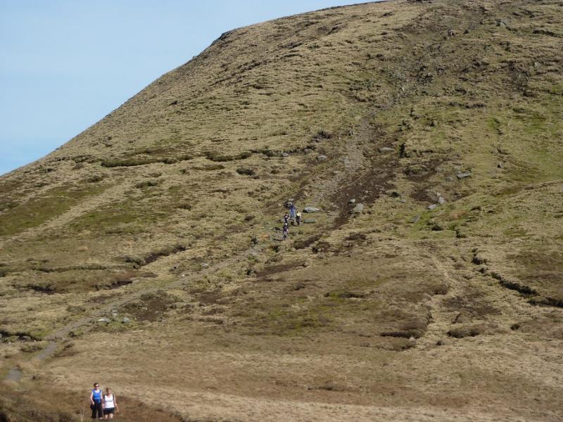
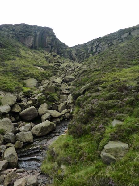
The path up Blackden Brook is generally sound but, in places, it is becoming eroded and some may be unhappy with the mild exposure which has resulted. A few sections are rocky but to call the ascent a scramble would be an exaggeration. The path is generally on the right, W, of the brook but, occasionally crosses and recrosses the stream. If the stream is swollen it is possible to avoid these crossings. If any sections seem difficult, they can be outflanked by gaining height on the right, W, of the stream. There are many peaty and boggy sections on this walk so gaiters are essential. There are excellent views across the Snake Pass to Bleaklow.
Route
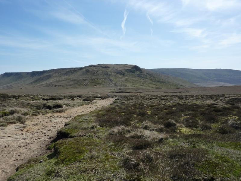
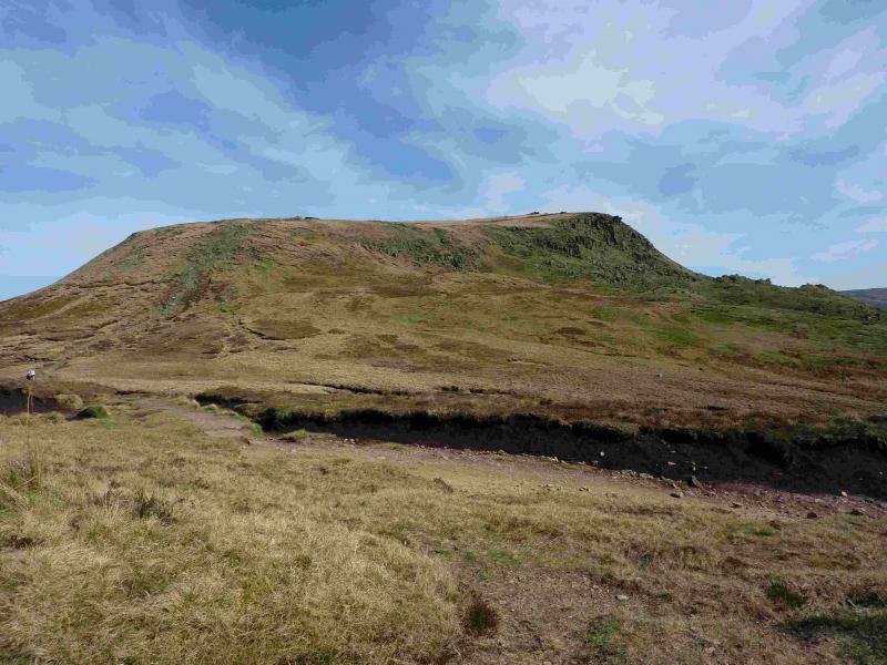
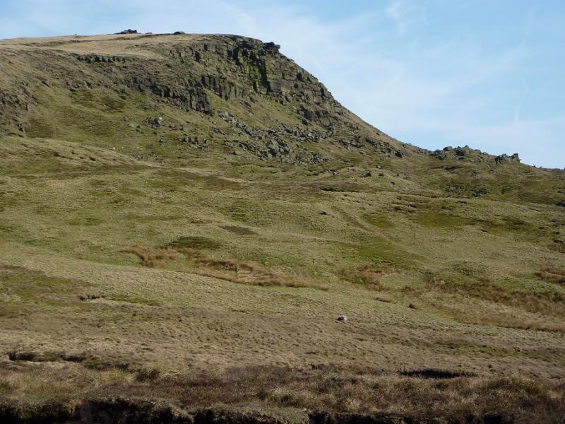
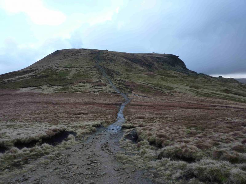
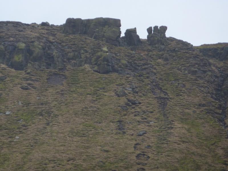
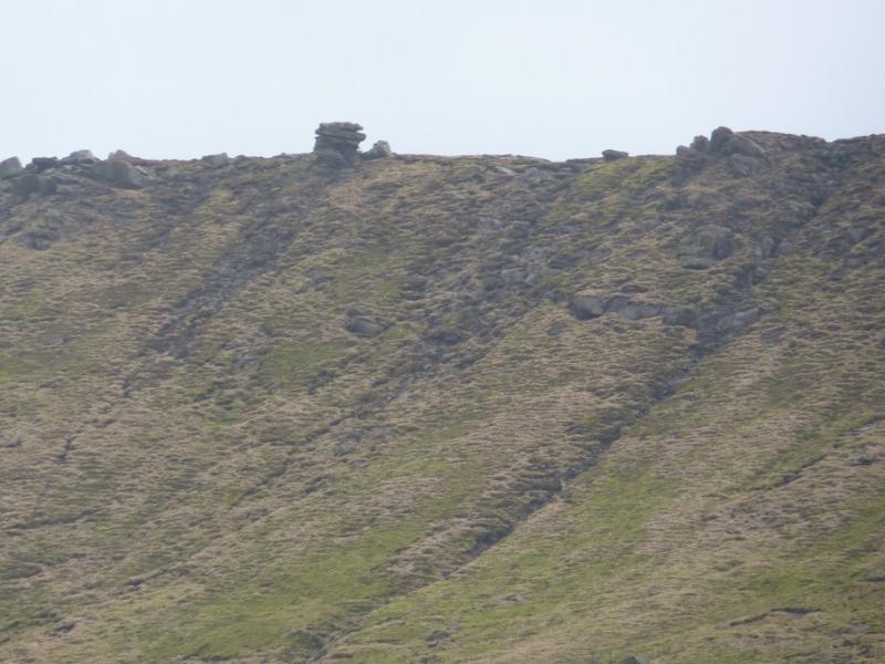
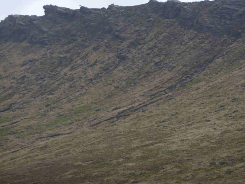
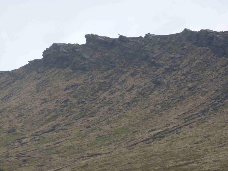
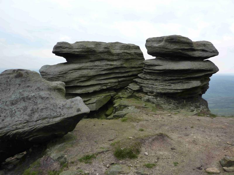
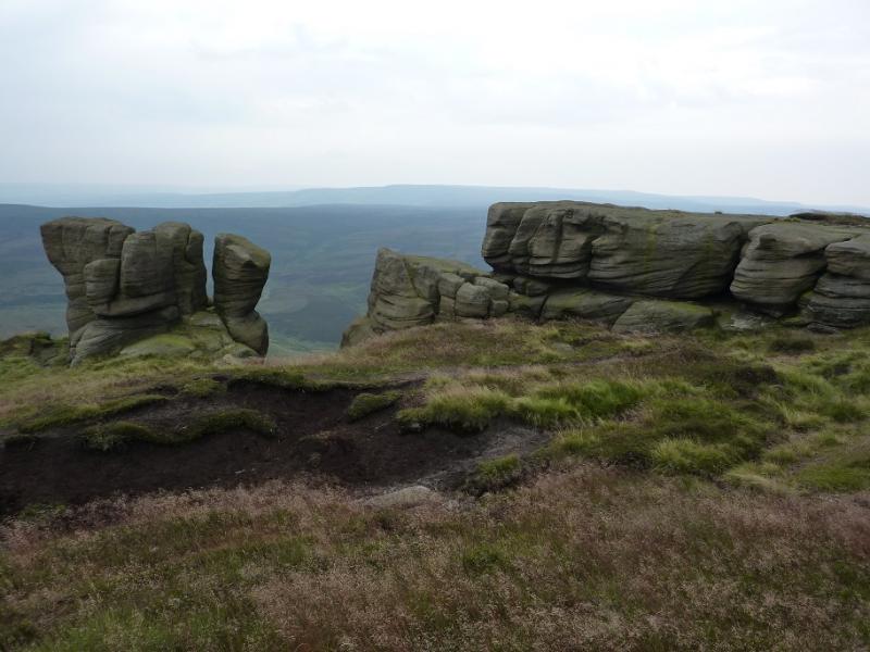
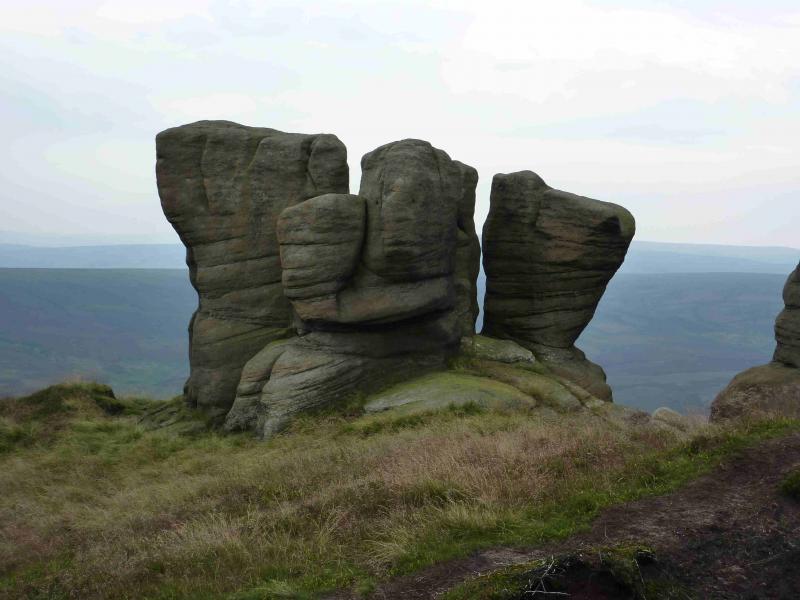
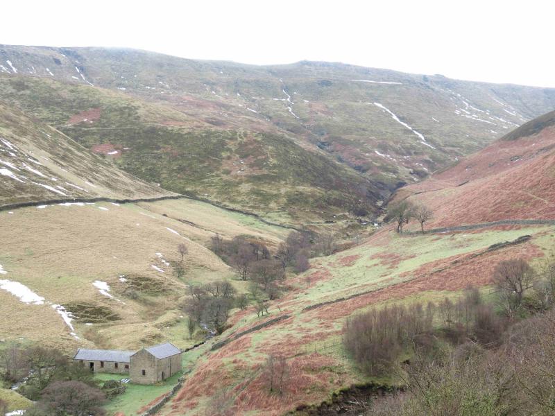
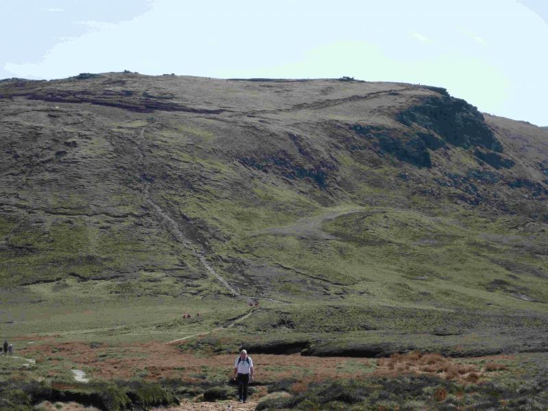
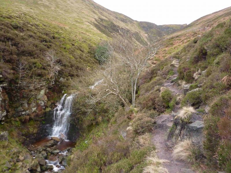
(1) The path starts at a notice board at the lower end of the rough lay by and leads down to an obvious bridge over the River Ashop. On the other side, there are two choices. Either continue ahead, on the obvious path, which follows a wall, above the stream on its E side before dropping down, by a wavy wall, to the stream; or, walk to the obvious buildings, two barns, crossing Blackden Brook en route, then walk up the W bank of Blackden Brook on an obvious path. This route will involve climbing over a low barbed wire fence and is not strictly a footpath whereas the first route is. The two route converge about 500 m past the barns. Continue on the path, mainly on the W bank. If the path seems too exposed, gain height to ascend higher up above the W bank. Higher up the stream, a prominent waterfall is passed after which the path climbs above the stream. In clear weather, the edge of the plateau and its many rock “sculptures” should be visible. The brook is now heading roughly SW and the final ascent is almost due W. The edge of the plateau is reached when the gradient suddenly eases and the distinctive, but boggy, path along the edge is reached.
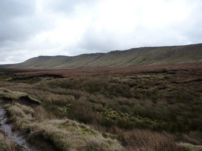
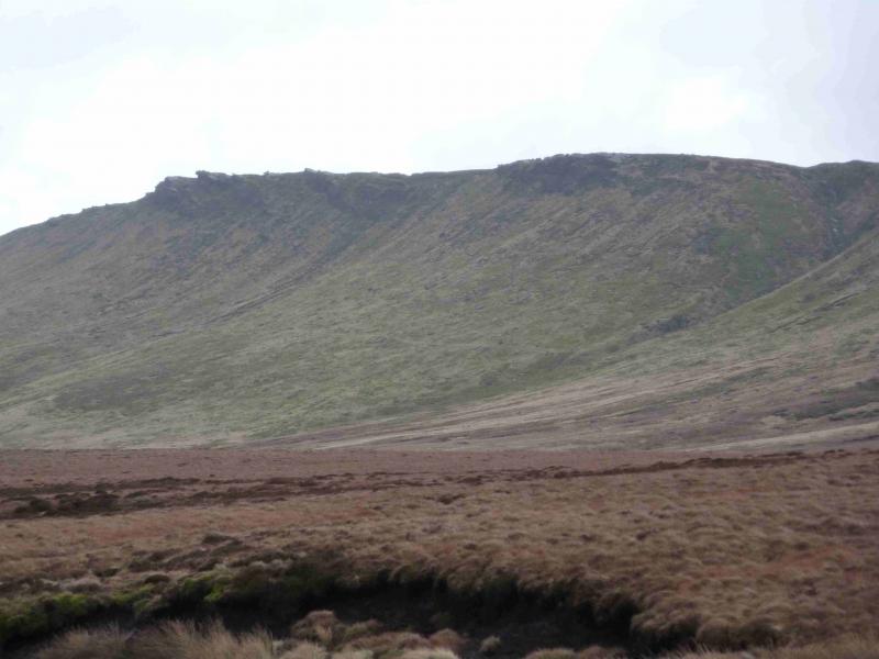
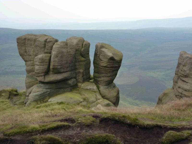
(2) Turn right, N, on to this path and follow it along the edge of the plateau for about 500 m where it turns W, still following the edge of the plateau. This is Seal Edge and there are many outcrops, ideal for a refreshment stop. There is usually a choice of paths. In general, the least boggy path is nearest to the edge. Continue for about 2.4 km, generally heading W but always on the edge of the plateau. A prominent gully is reached which is the upper section of Fair Brook. Cross this and regain the edge of the plateau on its far side. Alternatively, go around the top of the brook on the obvious path. The path now heads roughly N for about 600 m to reach a corner. This is the top of Fairbrook Naze which is the ridge from this corner down ENE to the Snake road. From the corner, the path again heads W along The Edge. The path is right on the edge here so try not to stray S. Continue for about 3 km. Either stay on the higher main path or drift down N to a slightly lower, but boggy path. Both paths eventually reach the Pennine Way (just after crossing a fence with stiles) which is now an engineered path. Turn right, NW, and follow the Pennine Way down to a crossroads of paths where there is a substantial green wooden post which indicates the Snake Inn path is to the right, N.
(3) Descend the Snake Inn path, slabbed higher up, as it follows the N bank of the River Ashop. This path can be very boggy in places and makes for slow going. After about 4 km, enter a wood* and stay on the path which shadows the river ignoring the stepped path off to the left. Cross a footbridge but do not go through a gate just after it. Instead walk along the path by the fence which is shadowing the river. Further on is another gate. Go through this on a path which leads towards the road. When the road is in sight, look for a faint, almost level, path forking off right through the trees and follow this to another gate. Go through this and walk on the left side of a barbed wire fence in a field used for grazing. There is an obvious path on the other side of the barbed wire fence. This might be gained from the previous gate or by holding to the bank of the river (not checked out) and not going through the gate before the previous one. It seems that none of these are rights of way, especially the grazing field. If in the field, walk to the end, where there is a “lift” gate which can be passed through to reach the path. Walk along the edge of the river on a faint path until the footbridge, labelled Fair Brook, is reached at SK 115 901. Turn left, away from the bridge and go through a gate. Follow the path for a short distance (it heads for the road) but look for a faint track on the right. Take this. It soon becomes more distinct and shadows the river before ending at a locked wide gate at the end of a short track off the road. The gate has to be climbed over. To avoid this, walk directly to the road from the Fair Brook footbridge.
(4) Walk on to the A57 road and follow it back to the start. It takes about 15 minutes. The road can be very busy and there is no real path to walk on. There is a verge most of the way and a short section of pavement. It looks like one could stay off the road by walking through the fields on the right but there are no footpaths or rights of way.
Notes
(a) This walk took place on 23rd January, 2012.
(b) *An alternative to the path into the wood is to cross the River Ashop by the old ruin at SK 091 906 using the obvious bridge. This path climbs higher than the path above but avoids encroaching on to possibly private land. In just under 3 km, it reaches the footbridge, at SK 115 901, over the River Ashop.
Photos - Hover over photo for caption. Click on to enlarge. Click on again to reduce.