Get Lost Mountaineering
You are here: Scotland » 12 Glen Cannich to Glen Carron » Glen Strathfarrar to Loch Monar
Strathfarrar 6 + 1
The Glen Strathfarrar 6 + 1 from Glen Strathfarrar
Start/Finish
The entrance to Glen Strathfarrar where there is a locked gate, at Inchmore, which is only opened for cars between certain hours on certain days so this access needs checking beforehand. The gate is kept closed when no cars are passing through and there is a limit on the number of cars allowed up the glen. There is a small car park before the gate for those wishing to cycle or walk up the glen. There seems to be no restriction on access on foot or by cycle although this should be checked beforehand. Being allowed to take a car up the glen saves about 16 miles of walking or cycling. Note that there is a closing time for the gate in the evening so be sure of getting back in time. Even with a car, it is about 9 km from the finish back to the start so it is well worth taking a cycle for this. The bicycle is best left at the end of the walk, below Beinn na Muice, at about NH 223 392, so the cycle back to the start is slightly downhill.
Distance/Time
19 km + 6 km bike. About 9 hours.
Peaks
Sgurr na Ruaidhe, 993 m, NH 288 426.
Carn nan Gonhar, 992 m, NH 273 439.
Sgurr a' Choire Ghlais, 1083 m, NH 259 430.
Creag Ghorm a' Bhealaich, 1030 m, NH 244 435.
Sgurr Fhuar-thuill, 1049 m, NH 235 437.
Sgurr na Fearstaig, 1015 m, NH 228 437.
Sgurr na Muice, 891 m, NH 226 417.
Beinn na Muice, 695 m, NH 218 402. OS sheet 25.
Introduction
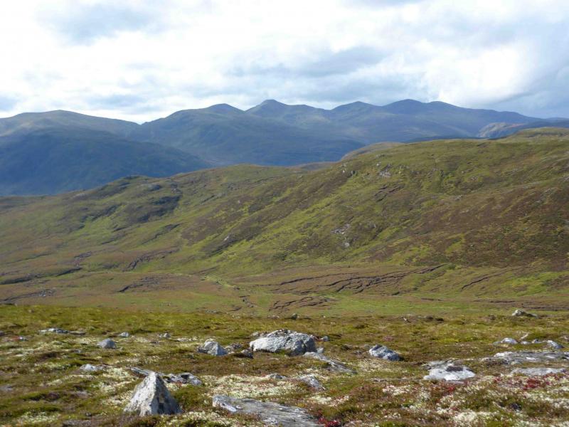
This is a classic ridge walk. It is a big ascent to the first top of Sgurr Ruaidhe then a very pleasant ridge walk taking in 4 Munros and 2 tops. There are excellent views especially along the ridge itself. Beinn na Muice is a Graham which can easily be added on to the end of the round if time and the gate allows. The finest peak in the range is Sgurr na Muice which is neither a Munro, Munro top or Graham so is not found in any “lists”.
Route
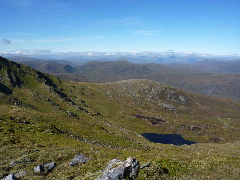
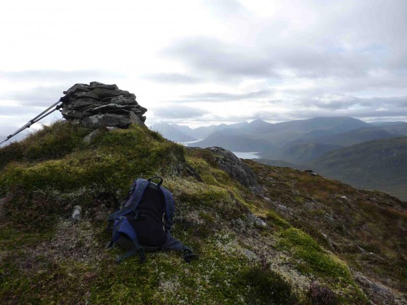
(1) Having dropped off the cycle, park at the foot of the glen from which the Allt Coire Mhuillidh flows. This is between Loch Beannacharan and Loch a' Mhuillidh. Walk up the good track which soon becomes a grassy and wet path but it is easy to follow and improves with height. The path follows the glen before ascending, roughly NE, to reach the large cairn which marks the summit of Sgurr na Ruaidhe, 993 m.
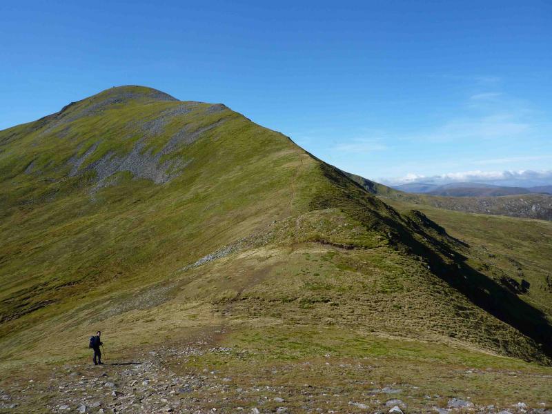
(2) Descend NW, on a good path, to reach a well defined bealach. Climb out steeply, N, until flatter ground is reached at the E end of the summit crest of Carn nan Gobhar. Turn W along the bouldery crest to reach the large cairn which marks the summit of Carn nan Gonhar, 992 m.
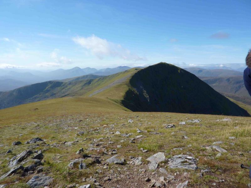
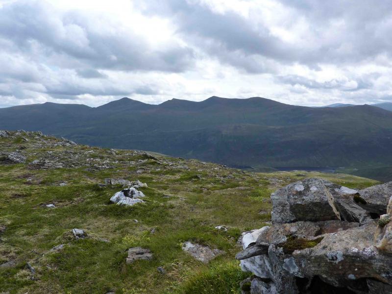
(3) Descend SW down short and very stony slopes to a fairly level plateau. The path is difficult to follow but if it has been “lost” then, when the plateau is reached, it is on the NW, right, side over a lip. The route turns W before reaching a long bealach. The path continues, gradually drifting to the SW and ascending a steep ridge, to reach the large cairns and trig point which marks the summit of Sgurr a' Choire Ghlais, 1083 m, the highest peak in the range.
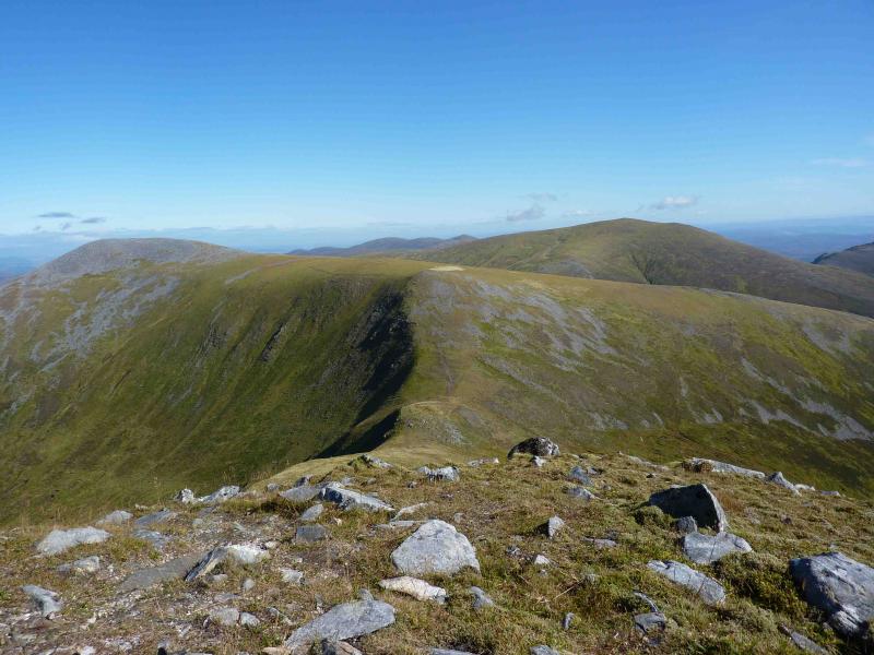
(4) The well defined ridge descends WNW then W to reach a well defined bealach before ascending W, still on a well defined ridge, turning towards NW just before the cairn which marks the summit of Creag Ghorm a' Bhealaich, 1030 m.
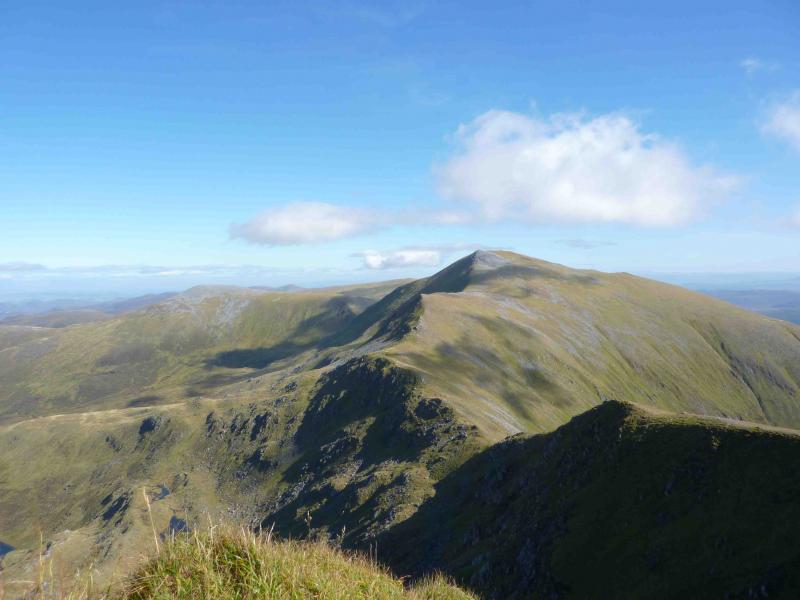
(5) The well defined ridge descends W to another obvious bealach before continuing upwards, drifting NW, to reach the cairn which marks the summit of Sgurr Fhuar-thuill, 1049 m.
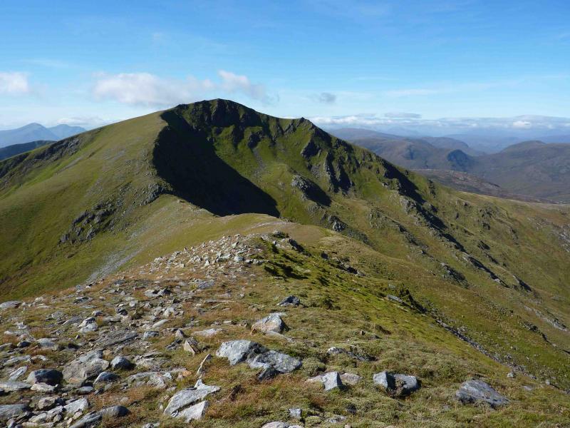
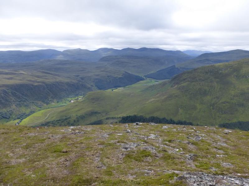
(6) Descend WSW then W to reach a long bealach then continue to the cairn on Sgurr na Fearstaig, 1015 m, passing the top of a Stalker's path just after the bealach.
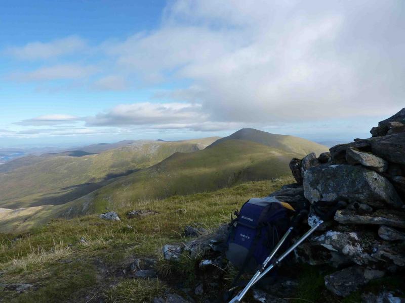
(7) Descend S, crossing a shallow dip, to reach Pt 880 where a cliff edge starts on the left, E. Follow the edge of the meandering cliff, roughly S, down to a bealach then up, leaving the cliif, the N ridge to reach a small plateau of Sgurr na Muice, 891 m. The obvious cairn may not be the highest point.
(8) From the cairn, descend S, keeping to the left of the ridge which is quite rough and rocky. There are some short sections of path on the left. Pass Carn an Daimh Bhain on its W side to be below Beinn na Muice. Use asy grassy lines to the E to zig zag up on to the crest about 500 m from the summit. It is also possible to ascend further to the W. A short squarish cairn marks the summit of Beinn na Muice, 695 m.
(9) Descend fairly easily down the E ridge to reach the Allt Toll a' Mhuic track and follow it S to the junction with the main track in Glen Strathfarrar then walk or cycle back to the start. A more direct descent, if time is prsssing, is to zig zag E, SE and S down steeper ground where there are several wet and slippery slabs to avoid to reach the Allt Toll a' Mhuic/Glen Strathfarrar junction.
Notes
(a) This walk took place on 24th July, 1993, 5th August, 2005, and 12th September, 2009.
Photos - Hover over photo for caption. Click on to enlarge. Click on again to reduce.