Get Lost Mountaineering
You are here: Ireland » East » Wicklow Mountains
Table Mountain from Glenmalur
Table Mountain from Glenmalur
Start/Finish
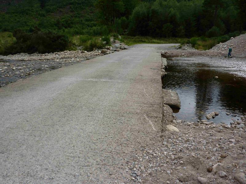
The car park at end of tarmac road (just before concrete ford) in Glenmalur at T 066 942. This can be reached from the village of Donard in about an hour on minor roads. Donard is a good base for the Wicklow Mountains and it is signposted off the N 81 road between Blessington and Baltinglass. Donard has a lovely camp site (see notes below) if you are not in a rush and can stay a few days. If driving from Donard, then take the road opposite Toomey's Bar and follow it to the crossroads – it bends right on the way at a junction – where the Glen of Imaal Stores is located and where you can buy sandwiches, etc. Take the road opposite the stores and follow it, going left at every junction until you are in Glenmalur. The return drive can be via the Wicklow Gap road which takes you through Hollywood!
Distance/Time
12 km Approx 5 hours
Peaks
Table Mountain, 701 m, T 019 973 (Irish National Grid System)
Irish OS Discovery Series Map 56 (1:50000)
Introduction
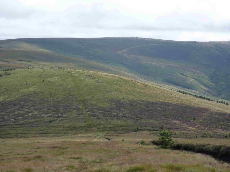
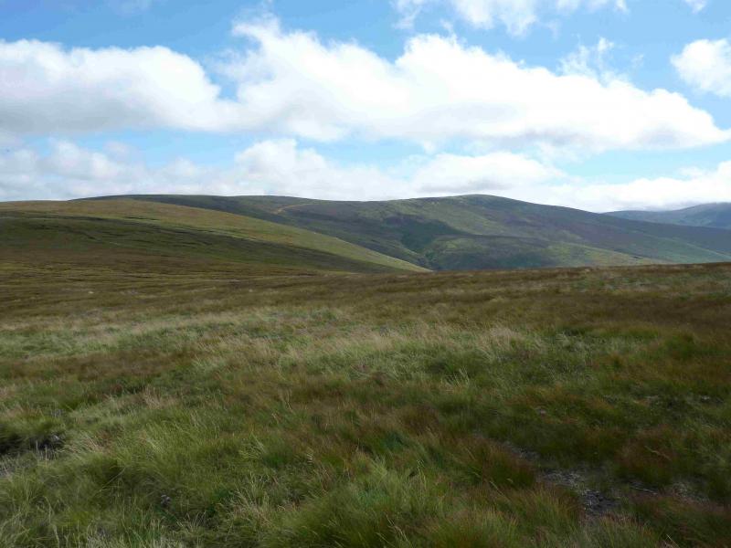
Despite its seemingly attractive namewhich make one think of its famous namesake above Cape Town, this Table Mountain is essentially a flat peat bog similar to Kinder in the Peak District. The summit cairn is set on the highest point of “normal” ground ignoring any peat hags which are slightly higher and it can be difficult to find in mist. This route does not enter the Glen of Imaal firing range. The summit plateau is rather featureless so care will be needed in mist. You should be able to easily reset your GPS to the Irish National Grid System.
Route
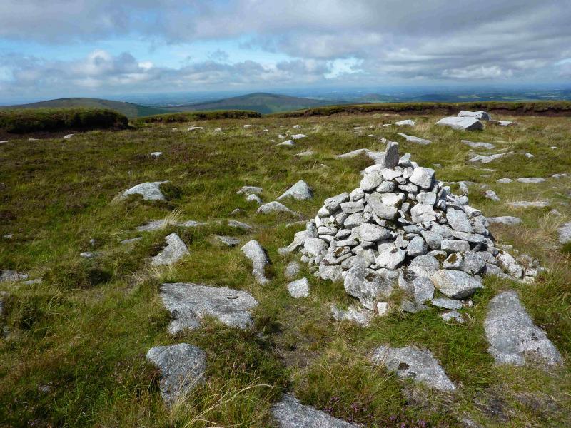
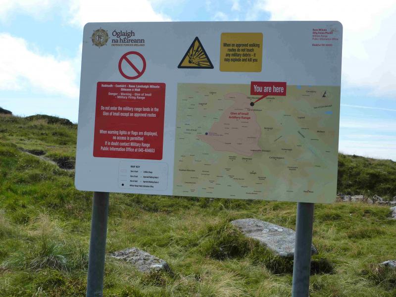
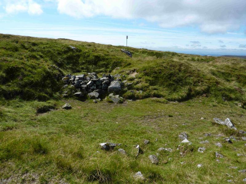
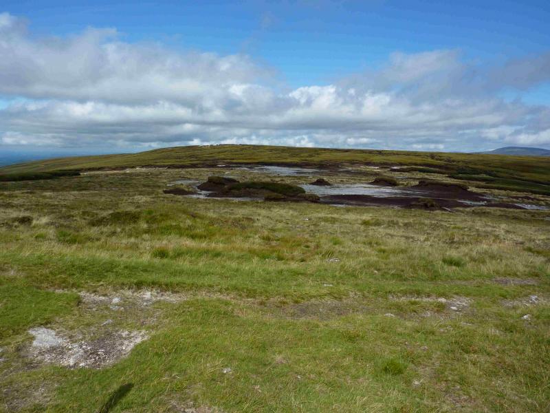
(1) From the car park, cross the ford and walk NW up the track past the Youth Hostel following the Avonbeg River. The track continues for a long way up the glen and only becomes a path after passing the conservation sign at about the end of the forest. The path is easily followed but the ground becomes wetter and more peaty. The path leads to a col at T 021 967 where there is a warning notice for the military firing range, a metal post on the left, a wooden post on the right and a small hollow, with a wall, on the left. Also on the left (marked by an old boot pointing the way on 9/7/10!) is an obvious path heading up towards Camenabologue, a route which could be continued to Ludnaquilla. A much fainter path on the right, near the wooden post, goes roughly N towards Table Mountain. The going is very peaty and boggy in places with only hints of a path but many boot prints in the peat. In poor visibility, great care is needed with navigation as the rise from the col to the summit is less than 20 m in about 500 m. The cairn of Table Mountain, 701 m, is on “normal” ground surrounded by slightly higher peat hags. If the path has been lost, it reappears just before the cairn.
(2) Retrace the outward route, taking care on the initial descent from the plateau to the col if visibility is poor.
Notes
(a) This walk took place on 9th July, 2010.
(b) Any alternative descents back to the Glen of Imaal should be checked at the Army advice centre beforehand as firing is often taking place somewhere.
(c) There is an excellent camping and caravan site, in the village of Donard, called Moat Farm. It has beautiful landscaped grounds, including a stone circle (!) and is very well laid out with free hot showers. There is a large campers’ kitchen with tables and sinks but bring your own cooking equipment and pans. There is a fridge and freezer. There is also a sitting room with a TV. The owner and staff are very welcoming, very friendly and very helpful. You would be hard pressed to find a nicer site. Donard is about 4 miles from the Glen of Imaal stores (where you can buy a sandwich). Donard is signposted off the N 81 main road between Blessington and Baltinglass. More about Moat Farm in its own section!
(d) In good weather, it is worth continuing either round to the east and returning over Conavalla and Lugduff or even ascending Camenabologue then Ludnaquilla returning over Cloheragh and down the zig zag path seen on the drive up the glen.
Photos - Hover over photo for caption. Click on to enlarge. Click on again to reduce.