Get Lost Mountaineering
You are here: England » Peak District » Baslow to Ladybower including Gardom's, Birchen, Froggat, Curbar, Burbage, Higgar Tor & Stanage
Burbage Edge, Stanage Edge, Robin Hood's Cave, Higger Tor, Carl Wark and Mother Cap
Burbage Edge, Stanage Edge, Robin Hood's Cave, Higger Tor, Carl Wark and Mother Cap
from Longshaw's Visitor Centre car park on the B6055
Start/Finish
Longshaw's Visitor Centre car park. The entrance is on the B 6055 about 300 m south of the Fox House Inn (very prominent on a right hand bend on the A 625 Sheffield to Hathersage road). Turn left at the Inn and the National Trust pay car park soon appears on the right. Parking is free for NT members. There is a good path downhill from the car park to the visitor centre (about 300 m) where there are toilets and a cafe. If coming from the south, reach Baslow then take the A623 to Calver. Turn right at the crossroads and after about 300 m, turn right for Froggatt. Follow this for about 3 miles, passing the Grouse Inn then, at the junction, going left on to the A 6055 with the car park entrance about 300 m before the main A 625 is reached. It may be worth going a little further to reach the Fox House before turning back to be sure of finding the correct car park as there are others nearby to add to the confusion! The proper name of this car park is Woodcroft but this name is not used in the car park itself! Slightly nearer Froggatt is Wooden Pole car park. The two can be easily confused.
Distance/Time
14 km About 5 - 6 hours
Peaks
Burbage Edge, c 420 m, ridge.
Higger Tor, 434 m, SK 256 819.
Carl Wark, c 380 m, c SK 259 814.
Over Owler Tor, c 380 m, c SK 251 808.
OS Outdoor Leisure 1: Dark Peak and OS Outdoor Leisure 24: White Peak
Introduction
This is a very pleasant walk, especially on a bright sunny day in Winter, which takes in a classic ridge and three tops. There are fine views in all directions including Winn Hill and the Losehill to Mam Tor ridge. The going is generally good although there are some damp spots and some paths are quite stony. The route is mainly on the Dark Peak map but the White Peak map will be needed as well.
Route
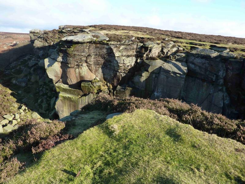
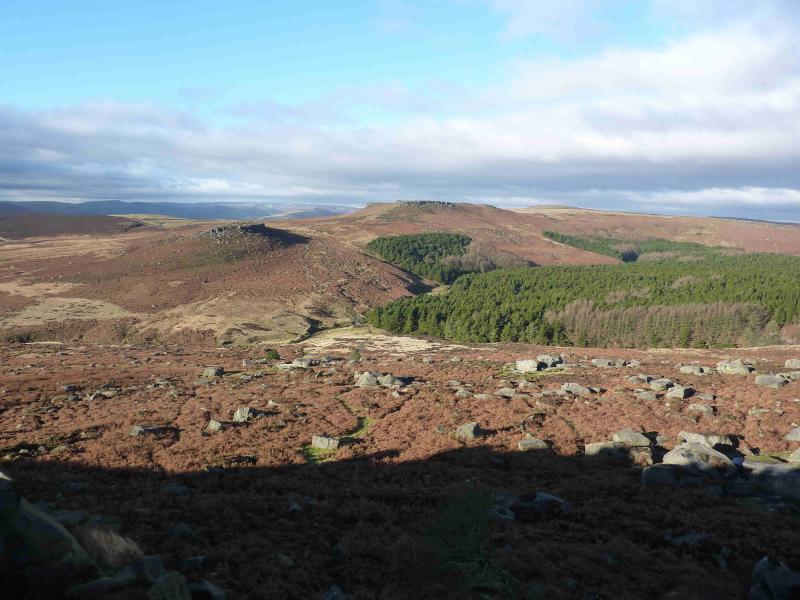
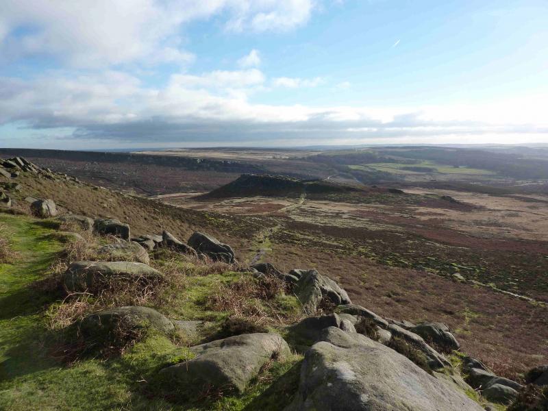
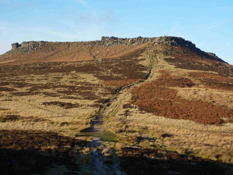
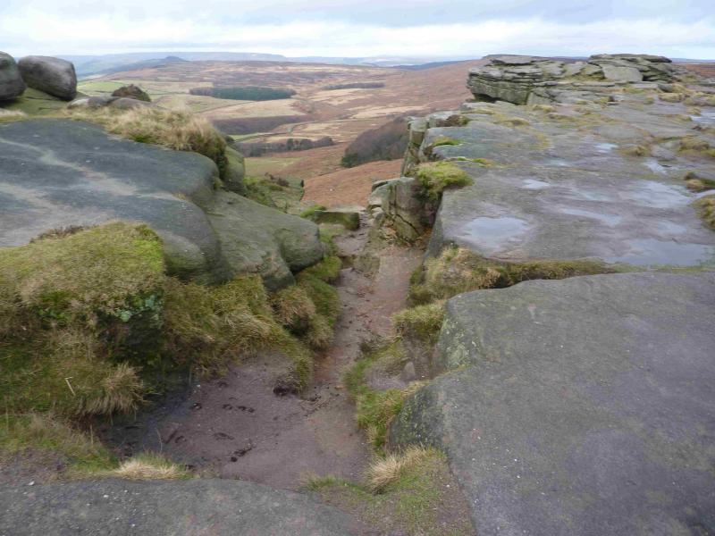
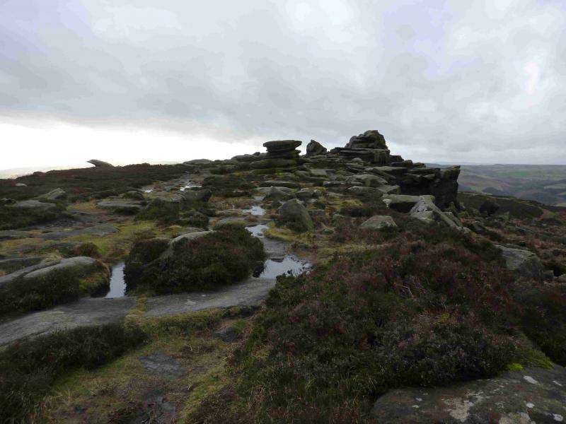
(1) Walk down the car park to the Visitor Centre. Turn right on the track, away from the Visitor Centre, and follow it to a white gate by a lodge on the right. Emerge on to a road. Cross over and take the path through the white gate signed for Burbage Bridge. In a while this splits. Take the right fork which emerges on the main road. Cross over where an obvious track starts but take the path to the right of the track and follow this up, on fairly obvious paths, to Burbage Edge where there is an even more obvious path heading roughly NE. Walk along the edge with fine views to Carl Wark and Higger Tor. There is no obvious summit. About halfway along the edge, the path descends slightly but soon regains the edge then continues to Upper Burbage Bridge where two streams need to be crossed, normally not a problem but the road is available if needed.
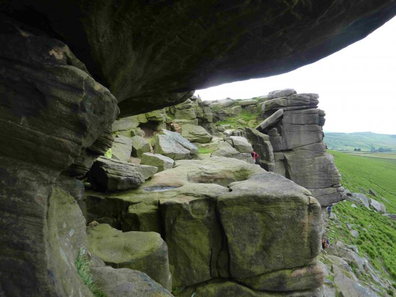
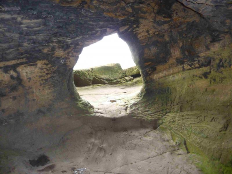
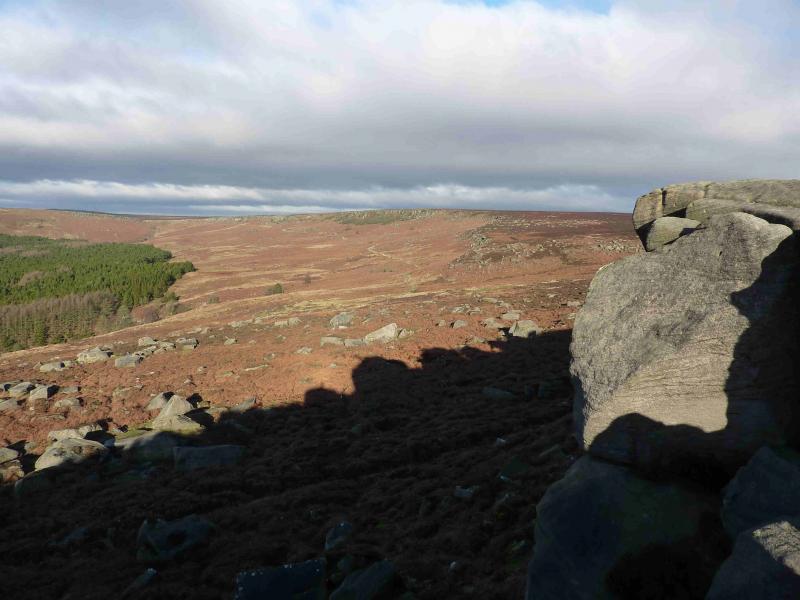
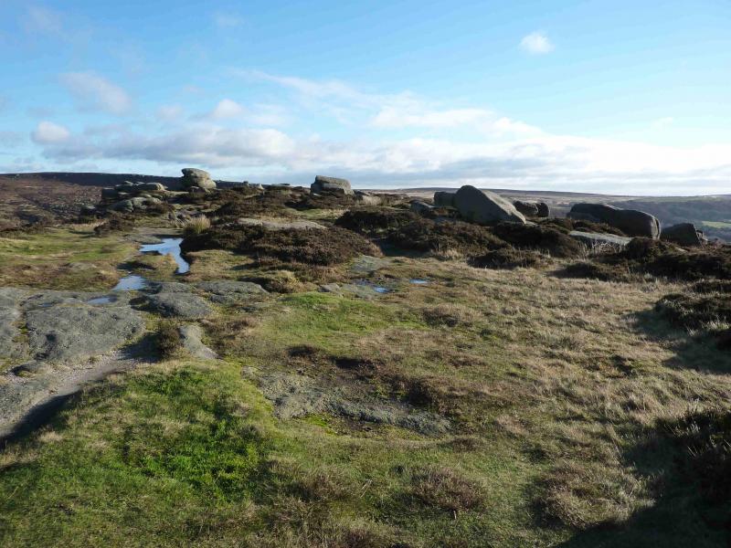
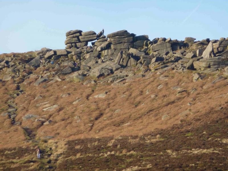
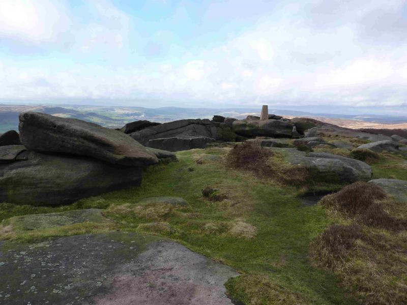
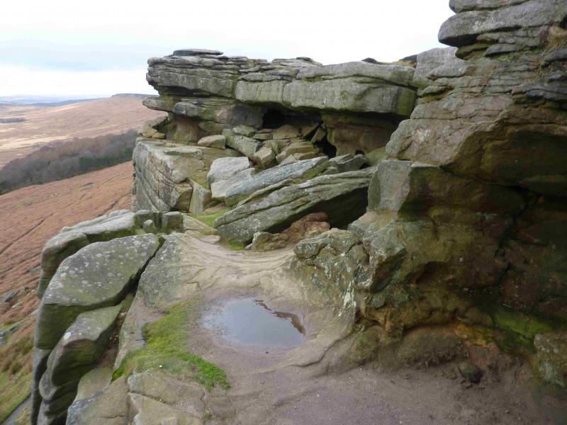
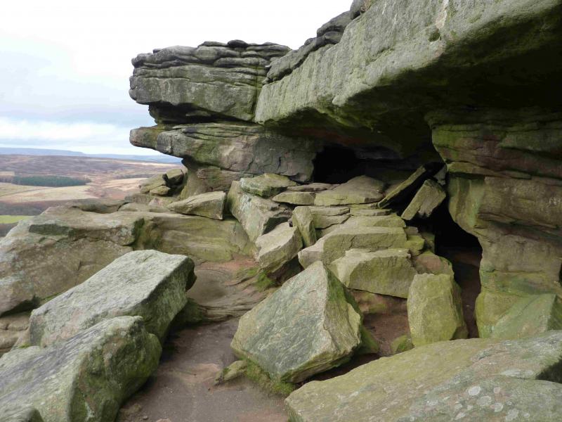
(2) Cross over the road and follow it to a left bend where a path continues ahead. Follow this gently ascending, sometimes boggy, path mainly W. In clear weather, the SE end of Stanage will be obvious as a wide but low cliff with a large boulder (Cowper Stone) at its right hand end. The main path leads up to the Trig Point. Follow the path NW along the edge for about 1 km until almost due E of the road junction at SK 240 836. This is the second junction seen and, if clear, is the one by a wood. A “path” slants off the edge, dropping less than 5 m, in a sort of long “notch”. Within 50 m, Robin Hood's Cave should be obvious. The safest way in is through the back but be careful of the low roof. Experts or idiots, depending on your point of view, can access the “balcony” directly by an airy step over a sheer drop!
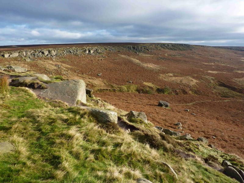
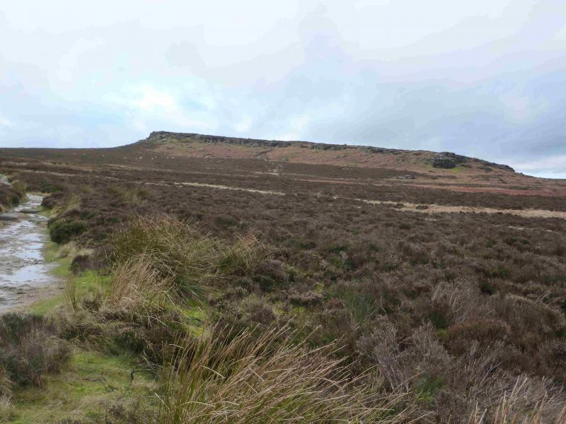
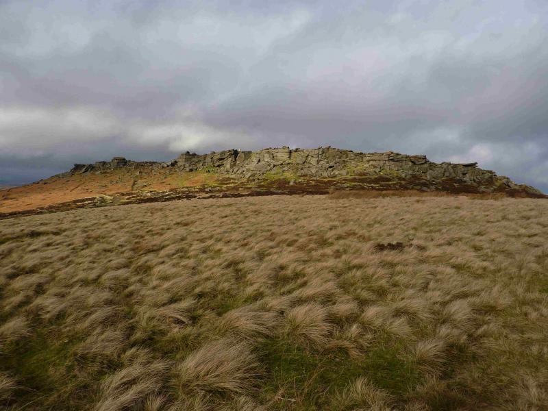
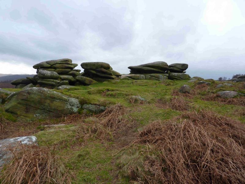
(3) Retrace towards the Trig point and either drop off the edge before the trig point on to an obvious track or go past the trig point, staying on the crest until a safe way down to this track can be found. Follow the track/path SE. crossing two roads, up on to Higger Tor. Stay on the left, E, of the plateau as this is the way to Carl Wark. Remember this if exploring the plateau. An obvious path, with little reascent, leads down, over to and up on to Carl Wark, once thought to be a prehistoric fort.
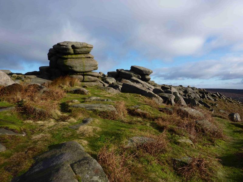
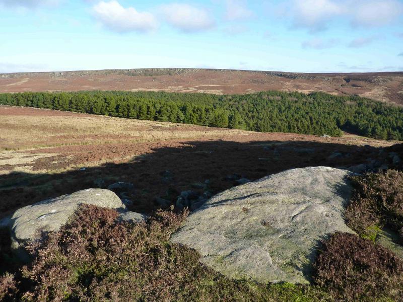
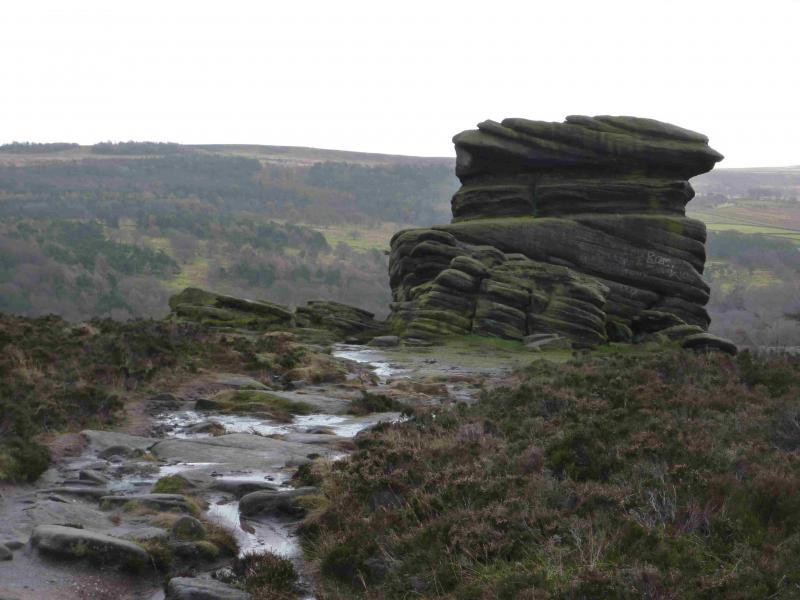
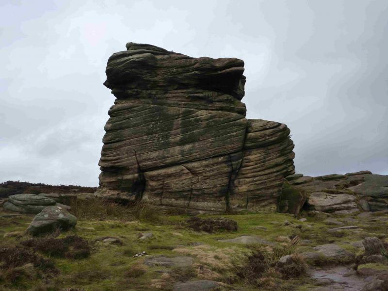
(4) There is a “valley” between Carl Wark and Over Owler Tor. To avoid losing height, retrace back to the “col” between Carl Wark and Higger Tor then take the path going W which is very boggy in places and merges with another path coming from Higger Tor. Follow the path up on the plateau of Owler Tor. Alternatively, it is shorter, but more height is lost, by walking W off Carl Wark aiming for the path just to the N of a line of small tors which then joins the col path. From Over Owler Tor, follow a path SE to Mother Cap, a large isolated tor then continue down to reach the A625 at the car park.
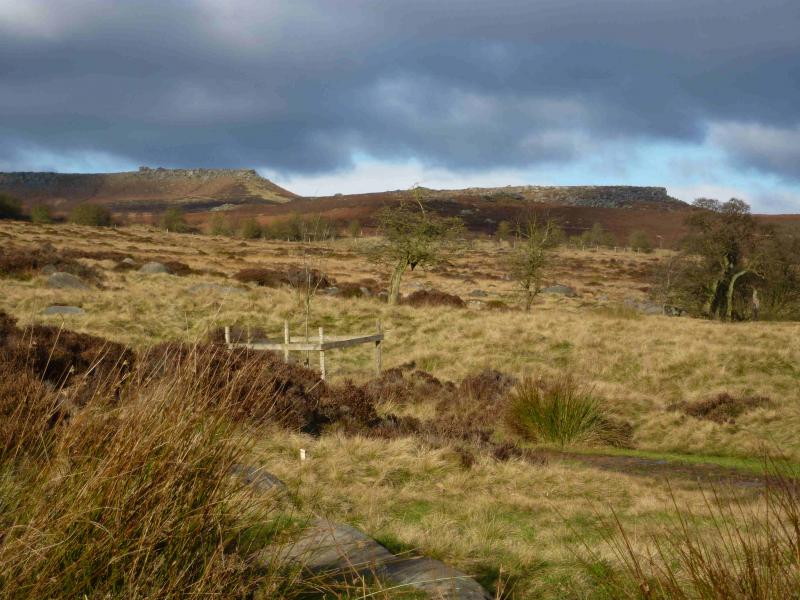
(5) Cross the road and look for a gate and a notice which are not obvious until the road is crossed. Take the path going left, initially shadowing the road and follow it on to Owler Tor – a small plateua of boulders/tors. Continue on the path, roughly E down to the bridge across Burbage Brook. If clear, a small stone barn will be seen across the brook and road beyond. From the bridge, ascend to the road. Cross over and take the path by the side of Granby Barn and follow this, past a large pond, to reach a house where the path spilts. Go left and within seconds, see Longshaws Lodge and cafe.
Notes
(a) This walk took place on 7th January, 2014.
Photos - Hover over photo for caption. Click on to enlarge. Click on again to reduce.