Get Lost Mountaineering
You are here: England » Peak District » Bleaklow & Howden Edge from Torside, Woodhead & Langsett
Wildboar Clough, Bleaklow Head, Torside Clough & Bramah Edge from Torside Car Park
Wildboar Clough, Bleaklow Head, Torside Clough & Bramah Edge from Torside Car Park
Start/Finish
Torside Pay and Display car park on B6105 on S side of Torside Reservoir at SK 068 983. This can be reached from Glossop by going N at the main traffic lights on the B6105. Alternatively, from the A628 Woodhead Pass road, take the B6105 between Woodhead and Torside Resrvoirs about 0.5 miles E of Crowden. The car park is obvious on the B6105 and has toilets.
Distance/Time
14 km About 5 hours
Peaks
Bleaklow Head, 633 m, SK 092 958. OS 1:50 000 Sheet 110
OS Outdoor Leisure 1: Dark Peak.
Introduction
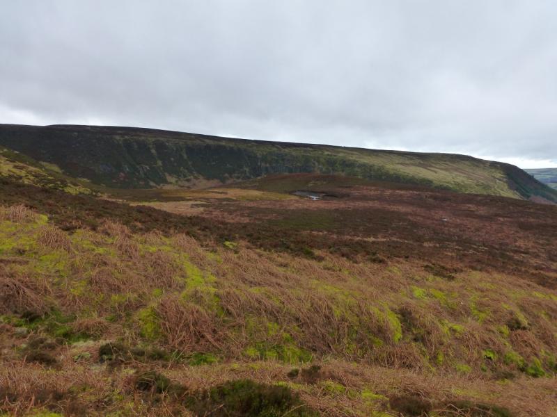
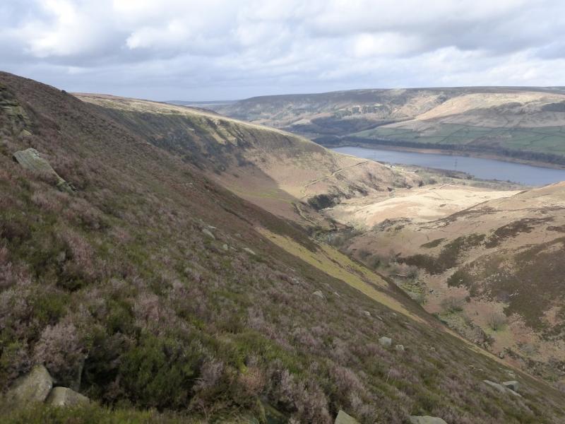
This is a pleasant walk which goes up a wild and rocky clough before a walk across the plateau on the south side of Bleaklow. The plateau can be very difficult to navigate but this route is relatively easy even in mist so long as there is not a deep snow cover which has obliterated the paths. The return uses part of the Pennine Way down Torside Clough. The going underfoot is reasonable, even after heavy rain. The worst sections are when Wildboar Clough levels out until the stream splits and sections of the Pennine Way on the return. The Bleaklow plateau is quite grassy and a pleasure to walk across. There are good views across to Black Hill, Higher Shelf Stones and Kinder. The Wain Stones, close to Bleaklow Head are worth the slight detour. This is one of the best routes up Bleaklow from the north.
Route
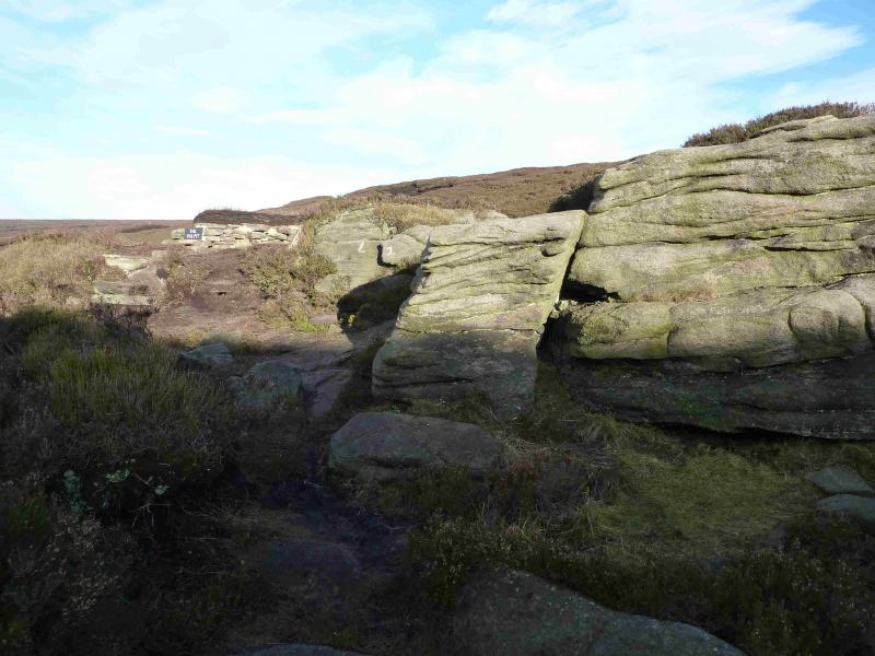
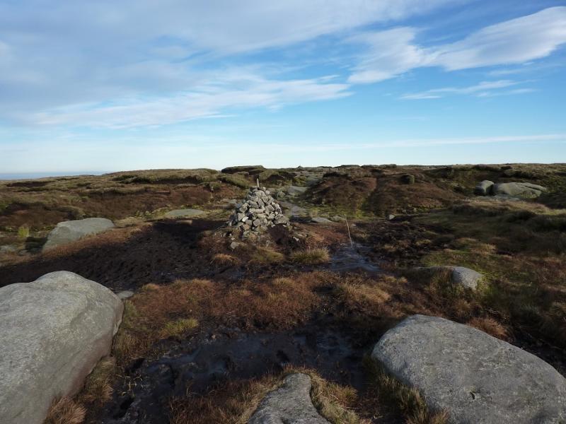
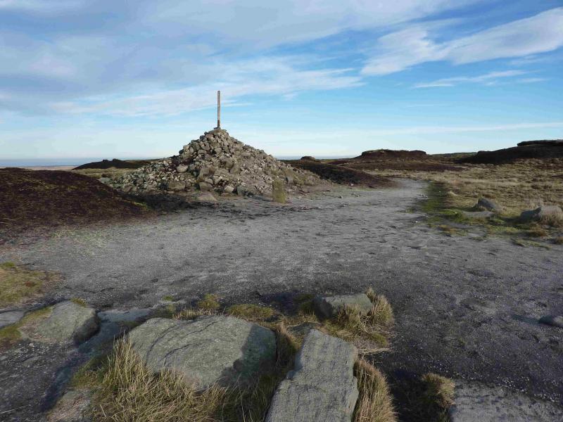
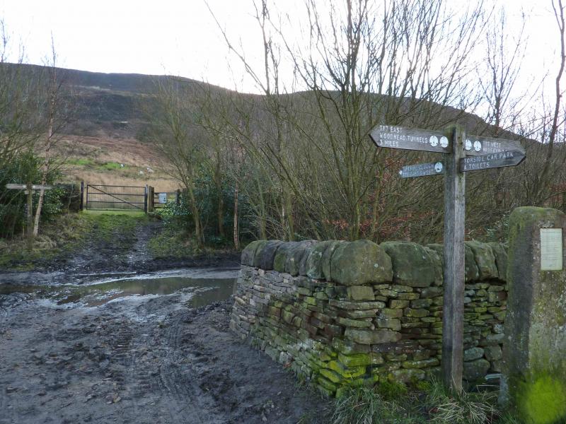
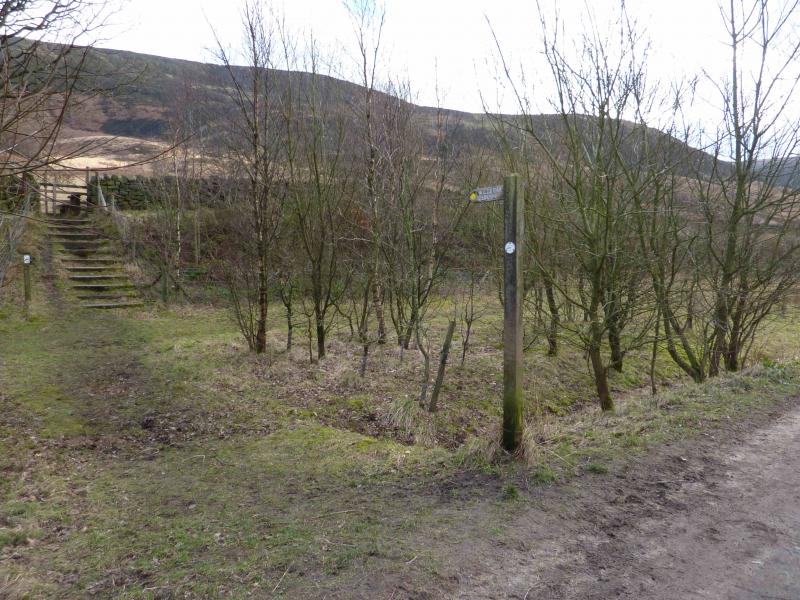
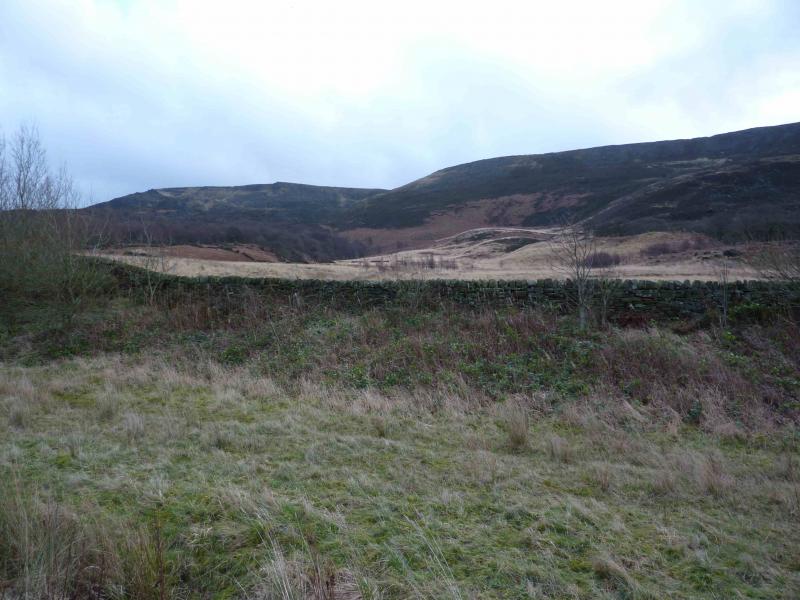
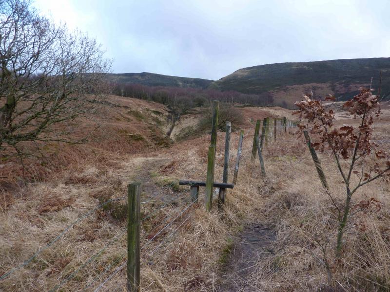
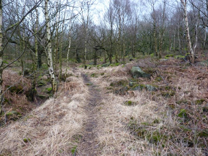
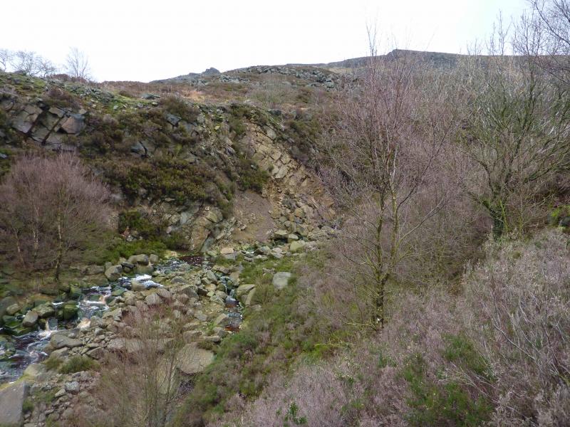
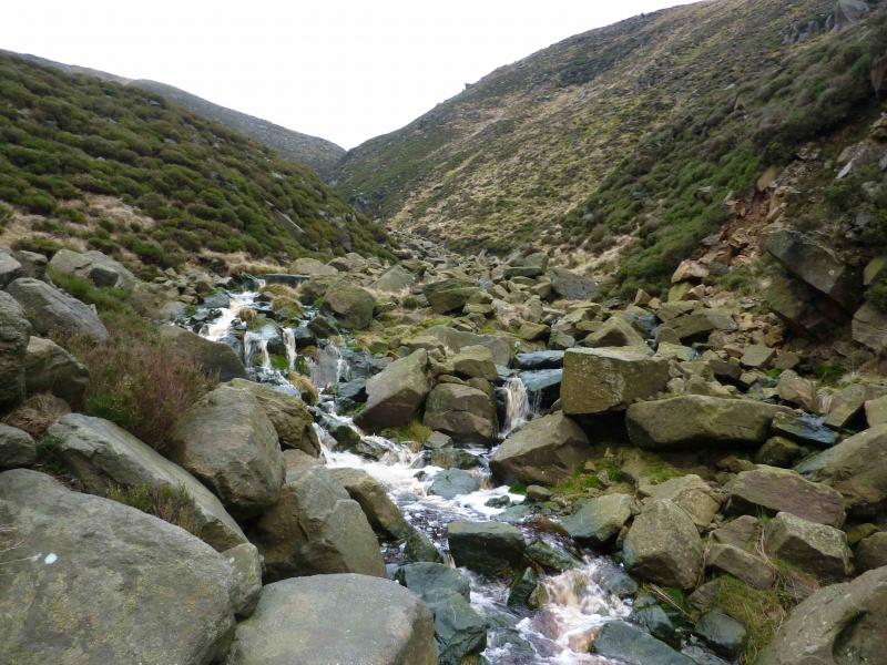
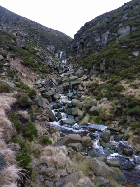
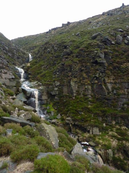
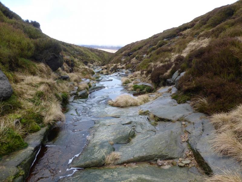
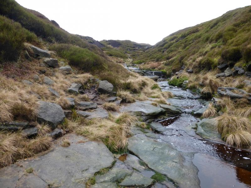
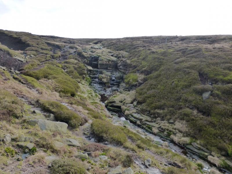
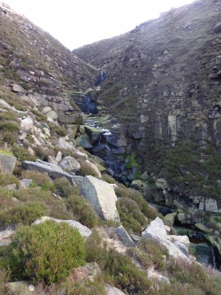
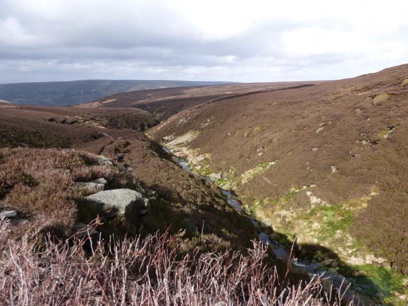
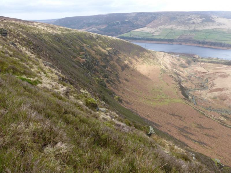
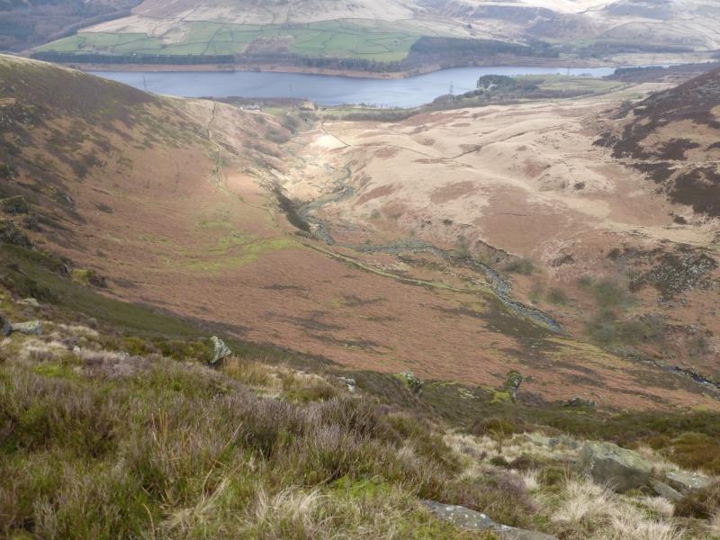
(1) From the car park, walk up the track (with benches) in the top left corner. Reach a “crossroads” with a sign post. Turn left and within a few minutes reach the signed path for Wildboar Clough on the right. Follow this lovely little path as it traverses the hillside, passing through a delightful wood of scattered Birch trees, before reaching the clough. The path continues on the W side of the stream before crossing over. Continue up. If the path seems too faint, ascend higher up the bank where you will almost certainly find a more distinctive path. The bank is very steep so be careful in wet and windy conditions. When the ground levels out, continue, with a fence, which has a few stiles, on the other side of the stream. Keep following the stream. When it goes left, cross the stream to reach a stile over the fence. A path goes from here keeping about 60 m to the right of the fence. Follow the path until a sharp corner where the fence goes left. A very distinctive path should be seen coming from the right. This is the Pennine Way. Follow it roughly S towards the Bleaklow Head. By now, if it is clear, you should be able to see a distant solitary stake on the furthest crest. Aim for this but the path goes there anyway. As you get closer, it is seen to be sticking out of a triangular shaped cairn. If it has a small stone direction marker by it then it marks the summit of Bleaklow Head, 633 m.
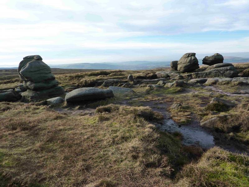
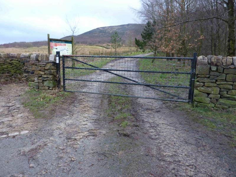
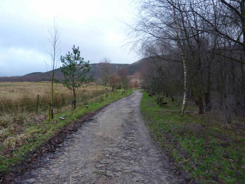
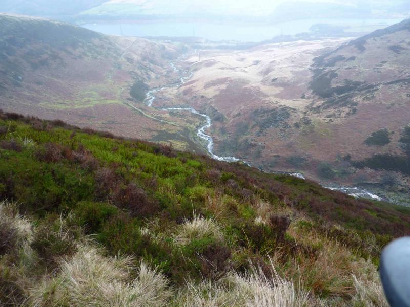
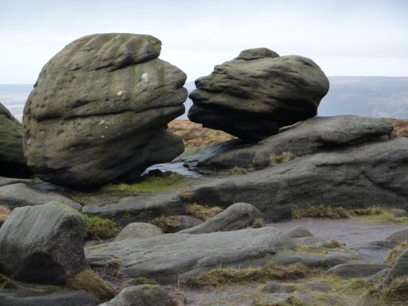
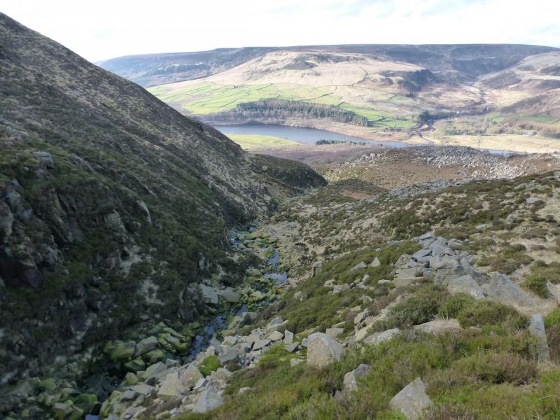
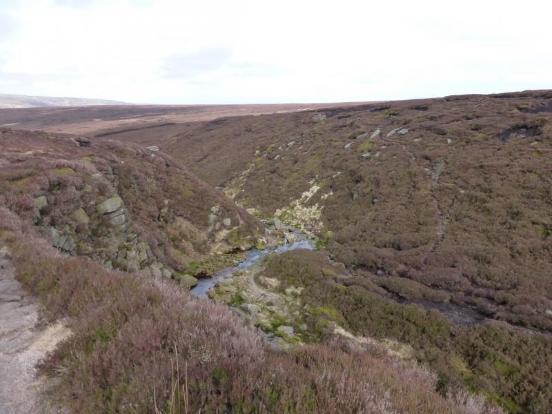
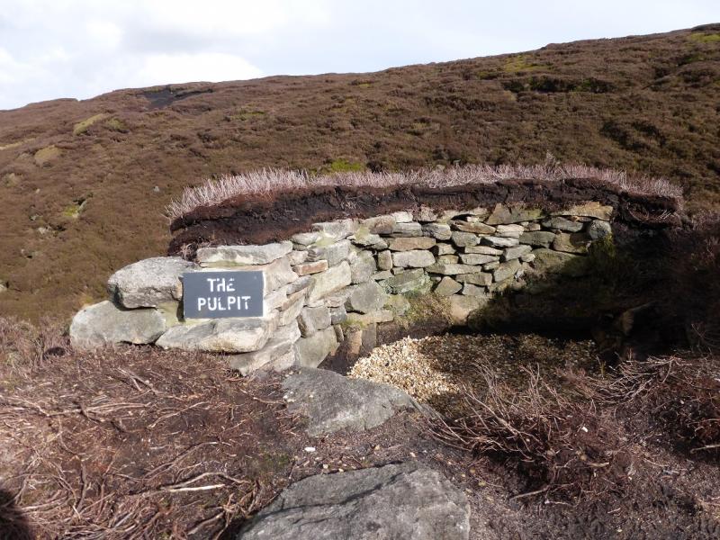
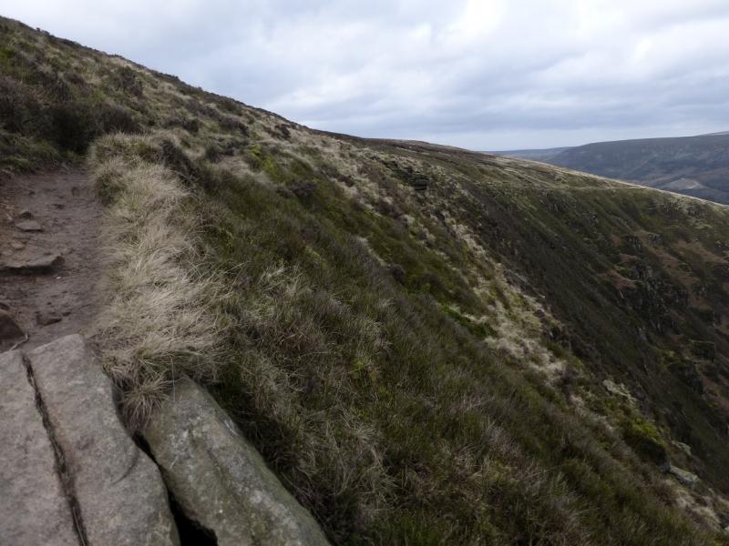
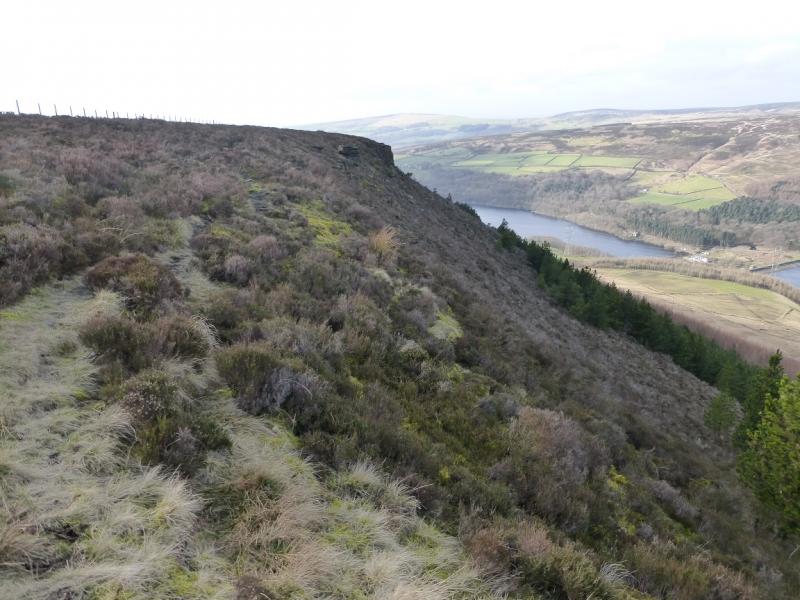
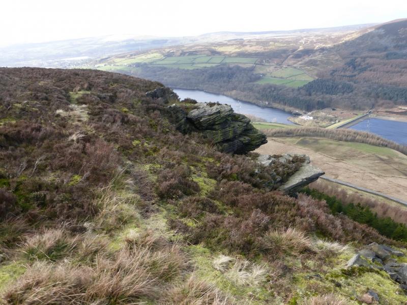
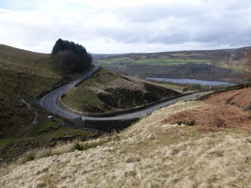
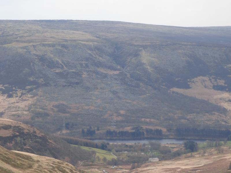
(2) Walk roughly W for about 200 m, to find another, slightly smaller cairn, near to some distinctive boulders known as the Wain Stones. The two closest ones are also known as The Kissing Stones and from the right viewpoint (and with a little imagination!) one can see why. Walk almost due W until in a shallow clough, still heading W. There is more than a hint of a path. The clough gradually swings N and becomes more defined; it is Torside Clough. Follow it down on a very distinctive path. If you have drifted to the N, right, too soon, you may pick up a shallow subsidiary clough which may take you into an extensive area of heather. If this happens, skirt around the top of the heather, going roughly W, and you will soon reach Torside Clough and its obvious path. Walk down the clough to where the Pennine Way comes in from a clough on the right. About here is a rock feature called, and labelled, “The Pulpit”. In thick mist, it may be advisable to reach this point by retracing from the Wain Stones to the summit then follow the direction indicated by the marker which is the Pennine Way. Unless under deep snow, this is a very obvious path and you will have walked up it to the summit. It goes roughly N then curves around to the W. It goes to, but does not cross, the fence followed during the ascent. Before too long, a stream appears on the left and the path, slabbed in places, leads down to Torside Clough where its two main feeder streams meet. Cross over. After heavy rain, the streams may have to be crossed separately. Follow the path up on to the edge above the W side of Torside Clough. Continue down Torside Clough on the Pennine Way path which follows the undulating edge with a steep bank below. The path follows the edge of the Clough all the way down to an access road near to a farm passing above some interesting rocky and vegetated ribs. Turn left on the road. Just before it joins the main road, there is a stile on the right which leads to the old railway. Follow this E back to the car park. However, this route avoids Bramah Edge. To include this, leave the Pennine Way as soon as it starts to seriously descend. You will have passed a fence high above the edge by now. Walk across pathless ground heading NW to reach a lower fence then a broken wall where you will pick up the Bramah Edge path. Follow this along the edge to its end where it crosses a stile. Follow a faint path down towards Ogden Clough and join the road at the Devil's Elbow by a small wood. Walk along the road which is not too busy and higher than the footpath option down below on the left. After nearly 2 km, reach the track for Reaps Farm. Just after this, join the track along the old railway and follow it back to the car park.
Notes
(a) This walk took place on 25th February, 2014.
(b) Omitting the Bramah Edge section, saves about an hour.
Photos - Hover over photo for caption. Click on to enlarge. Click on again to reduce.