Get Lost Mountaineering
You are here: England » Peak District » Baslow to Ladybower including Gardom's, Birchen, Froggat, Curbar, Burbage, Higgar Tor & Stanage
Grindleford start for Froggatt, Curbar & White Edges plus Padley Gorge from Grindleford Station
Grindleford start for Froggatt, Curbar & White Edges plus Padley Gorge from Grindleford Station
Start/Finish
Road bridge over railway at Grindleford station. Grindleford station is some distance from Grindleford, nearly 2 km! From Baslow, take the A623 to Calver crossroads. Turn right on to the A625 then soon fork left on to the B6001 and follow it to Grindleford then go right on to the B6521. After about a mile, fork left for Grindleford station and park as close to the bridge over the railway as possible. If coming from Sheffield on the A625, go past the Fox House (ignore left turn) and take the next left which is the B6521. Follow this for about 2 miles then take the reverse right fork for Grindleford station. Parking is on the road and, in the week, is quickly taken up by commuters to Manchester and Sheffield. There is a cafe near here. Toilets may be available for a small charge.
Distance/Time
15 km About 4 - 5 hours
Peaks
Froggatt Edge, c 300 m, ridge.
Curbar Edge, c 340 m, ridge.
White Edge trig point, 365 m, SK 264 768.
OS Outdoor Leisure 1: Dark Peak and OS Outdoor Leisure 24: White Peak
Introduction
This is a very pleasant walk which takes in three classic ridges and a gorge. There are fine views in all directions including Winn Hill and the Losehill to Mam Tor ridge. The going is generally good although there are some wet spots and some paths are quite stony. The route requires both the White and Dark Peak maps and this makes it a little awkward. This is the same walk as one which starts at Hay Wood. The only difference is the starting point.
Route
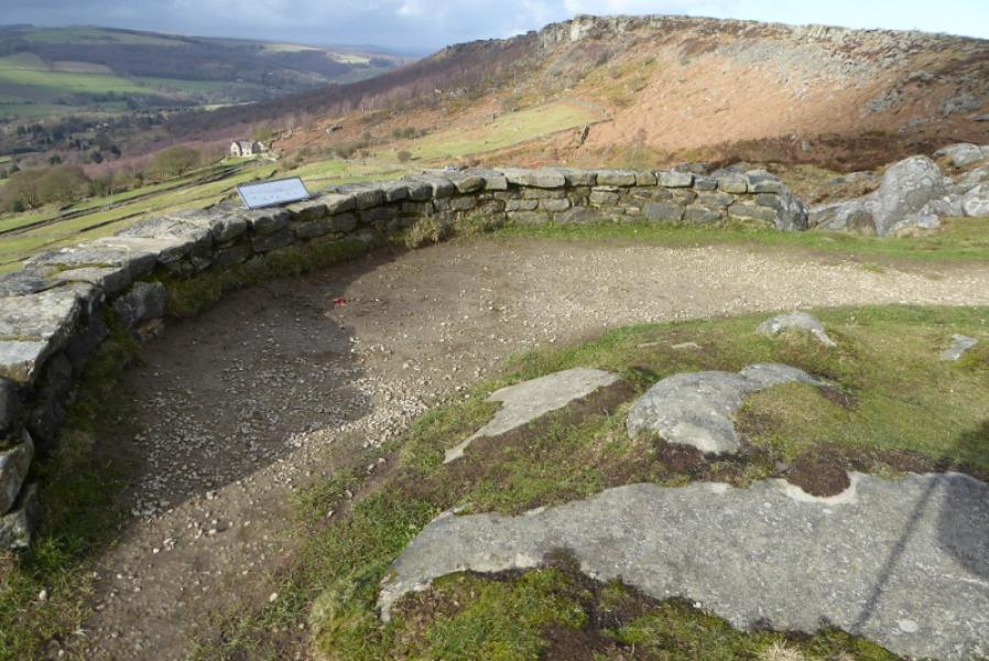
(1) From the railway bridge, continue walking along the road. Just past Totley tunnel but before the bridge over the river is a path going uphill through a narrow gap in the wall. Follow the path up to a road. Cross the road and follow another path up the side of a stream, soon passing through a gate. When level with the top of the wood on the right (on the other side of the stream), another path crosses the uphill path and goes across the top of this wood, crossing the stream then goes right, for a few metres, before going left through a gate into an open field where the path is still visible. When the path splits take the right fork to the top right corner where there is a gate in the wall. Go through the gate then go left and climb on to the ridge previously well seen from the field. There is a large cairn on the top. Walk roughly SE, on an obvious path, along the ridge until a wall is reached at a T junction. Turn right here, the Grouse Inn may be visible ahead, and follow the path and wall down to the car park at Haywood. The path is boggy in places but drier nearer the wall.
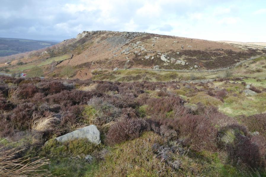
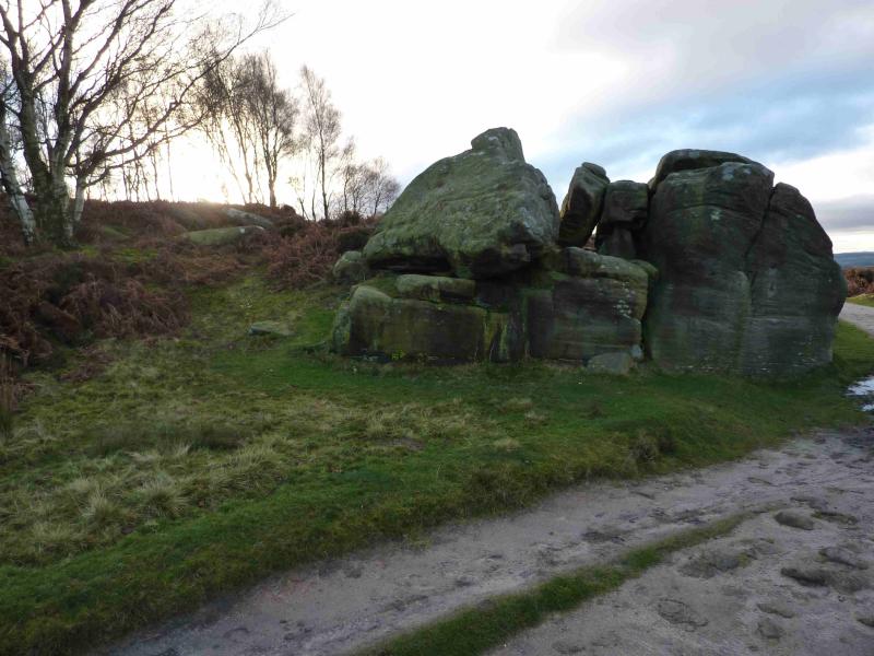
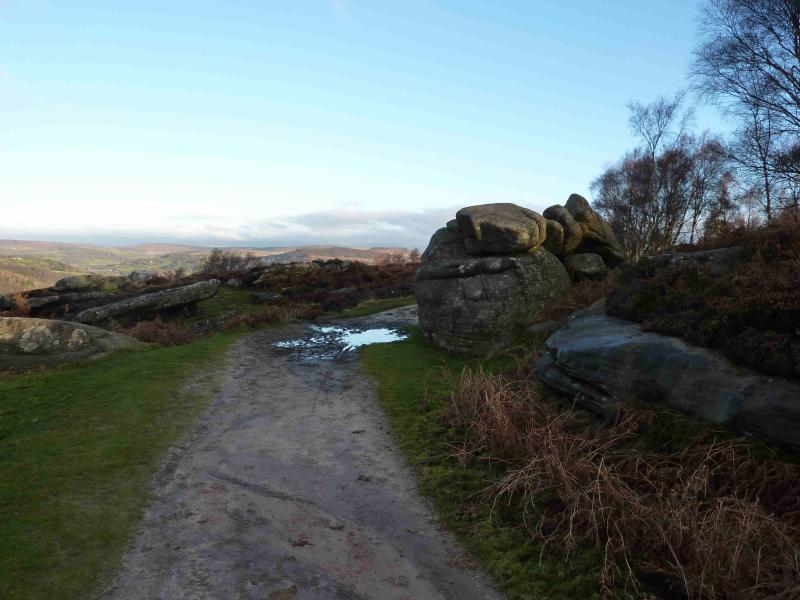
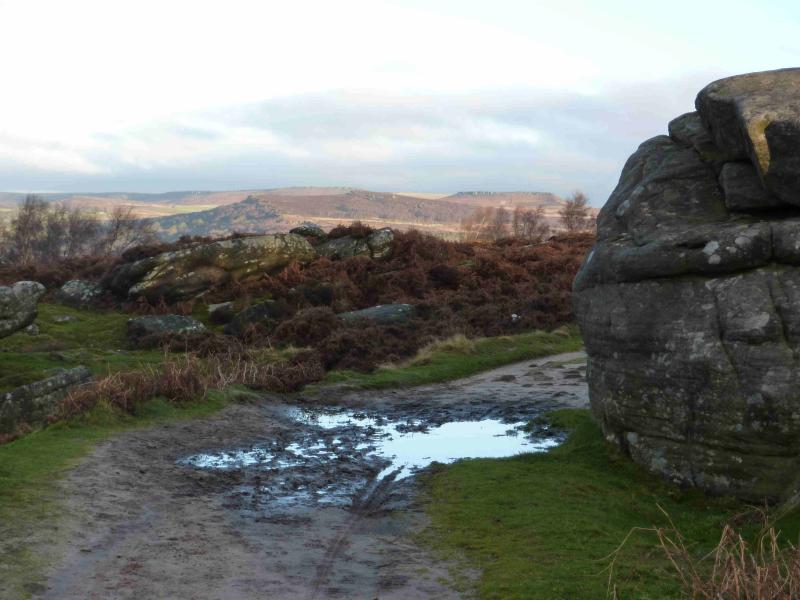
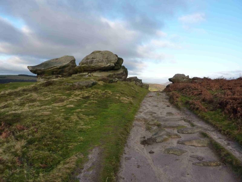
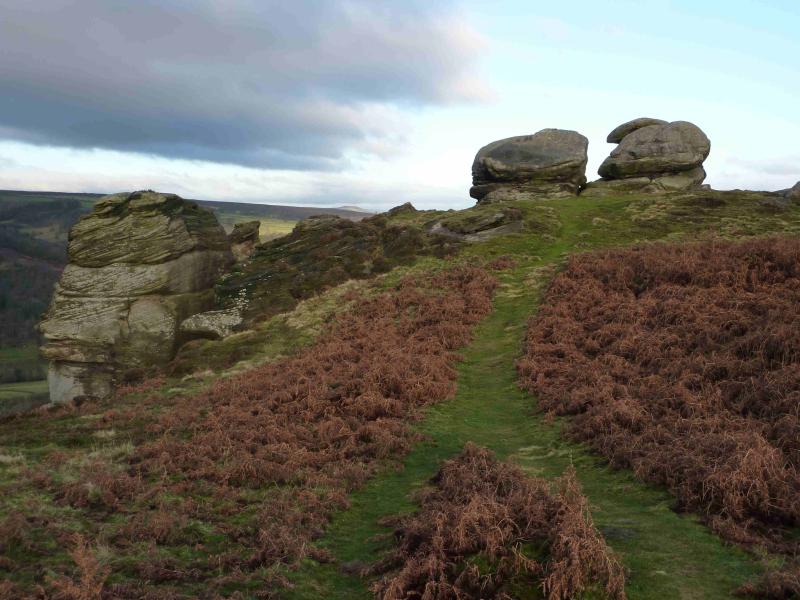
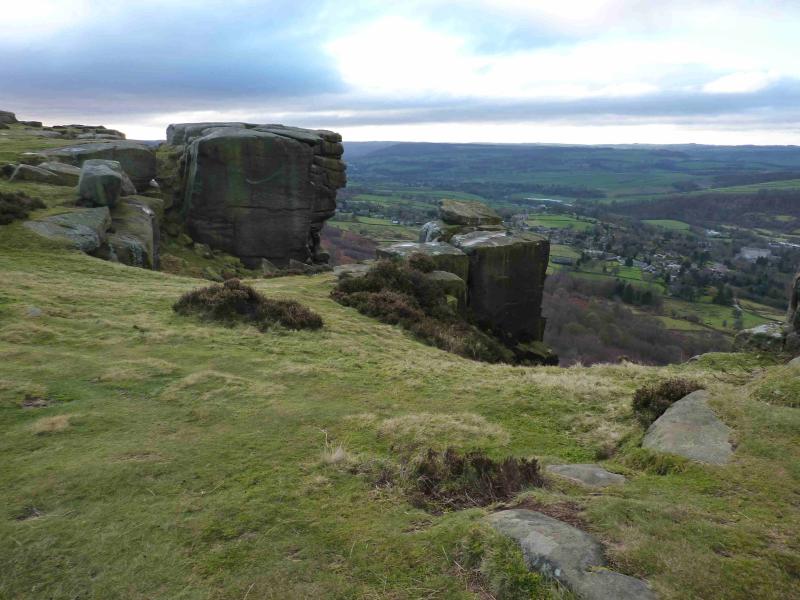
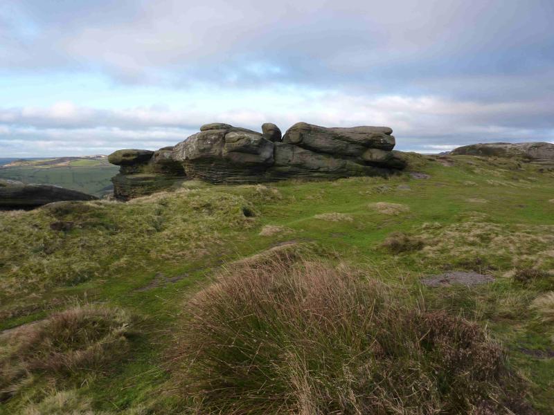
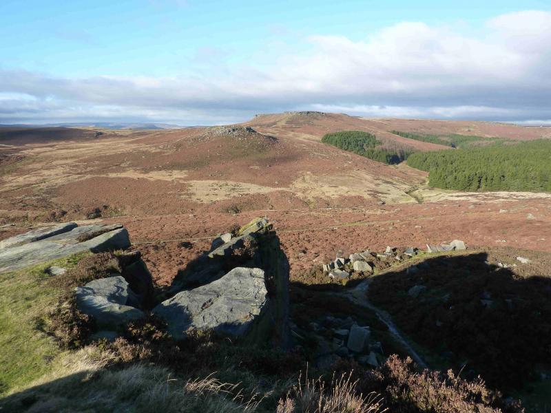
(2) Walk S out of the car park to find a path which drops down to a stream then climbs up to the A625. Cross the road and almost opposite is the gate for the track along Froggatt Edge. Follow the distinctive track along the top of the edge. In places one can leave the track and get closer to the edge where there are some interesting rock shapes. The track continues seamlessly on to Curbar Edge before emerging at a car park on a minor road.
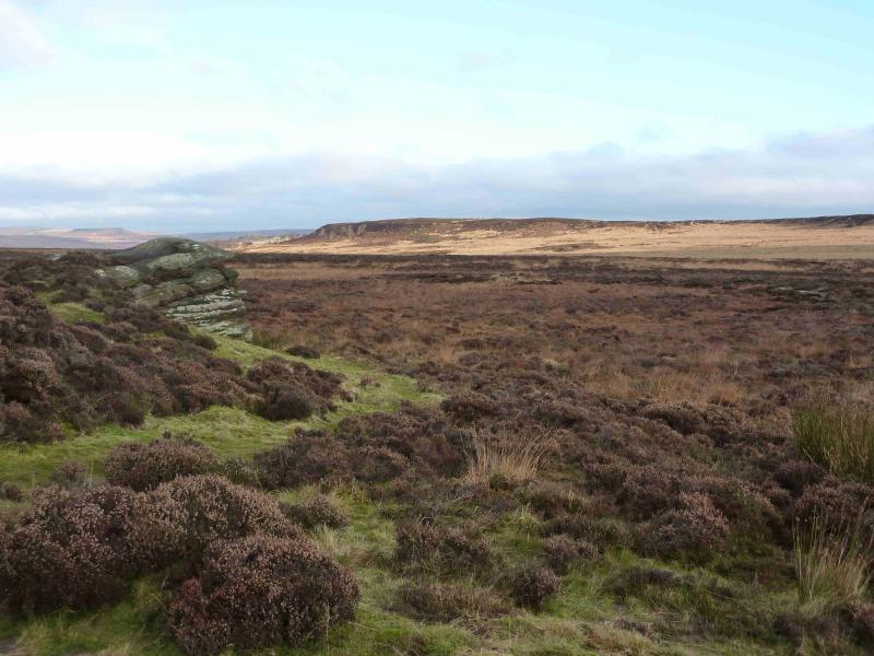
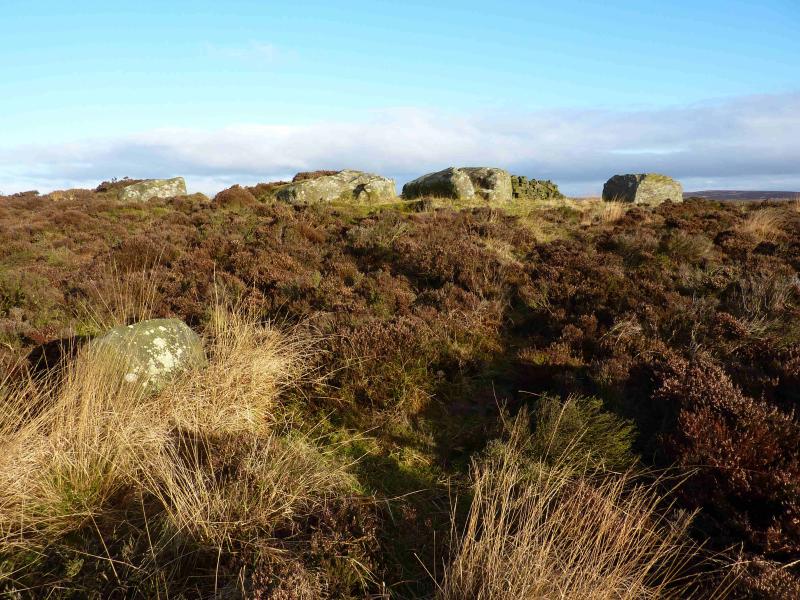
(3) Go through the car park – no need to go on to the road – and look for a gate at its eastern end (top right). Go through this and follow a path heading roughly NE. Do not be tempted to follow a wide grassy track which soon heads N. The path soon runs alongside a wall, at the top of which is a sign pointing left for White Edge. Follow the obvious path, roughly NNW. In clearish weather, the white trig point will soon be spotted which can be reached by a small diversion path to the right, NE. Return to the main path afterwards. Continue along White Edge. Further on, a cluster of stones lie to the right of the path and these are easily reached by a small diversion although paths are faint. Return to the main path afterwards and continue roughly N. A broken wall is next reached where there is a wooden pole. Go ahead signed Longshaw. (It is possible to cut the walk short here by going left and following the wall to the Grouse Inn.) Soon a fence comes in from the left and this can be followed, still on the path, to reach the junction of the A 625 and a minor road. Cross the road and follow the A625 N for less than 50 m then leave it on a signed path on the left. The path is a very pleasant, gently descending grassy track. Soon a junction is reached with a white gate under a large tree. Fork left here, through the small side gate, and follow the track down to a main track where a large stone building lies just to the left. This is the Longshaw Visitor Centre with cafe and toilet facilities. Turn right on the track, away from the Visitor Centre, and follow it to a white gate by a lodge on the right. Emerge on to a road. Cross over and take the path through the white gate signed for Burbage Bridge. This eventually emerges on to the main road but before then go left on a good path down to the river and cross the bridge to the W side.
(4) Stay on this side of the stream. Enter a wood with Padley Gorge below to the left. A fingerboard indicating the way to Surprise View and Bolehill is passed. Continue ahead and emerge on to a track with some stone houses. Walk down the track, turning left at the bottom. Pass some more houses then cross the bridge over the river. The road ahead goes to Grindleford Cafe and the bridge over the railway.
Notes
(a) This walk took place on 23rd March, 2014,28th November and 2nd December, 2012 and many times previously.
(b) It is also possible to start at the Longshaw's Visitor Centre car park, where there are toilets and a cafe, and walk down Padley Gorge first.
Photos - Hover over photo for caption. Click on to enlarge. Click on again to reduce.

.jpg)
.jpg)
.jpg)
.jpg)
.jpg)
.jpg)