Get Lost Mountaineering
You are here: Ireland » South West » Killarney to Bantry to Cork
Knockbrack & Dromderalough from SE near Baurearagh Forest
Knockbrack & Dromderalough from SE near Baurearagh Forest
Start/Finish
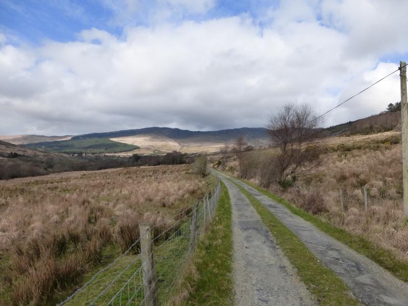
On the minor road to Baureagh Forest from the R569 Kilgarvan to Kenmare road. This minor road leaves the R569 about 0.75 miles W of Kilgarvan at, on 30/3/14, an orange painted house called Mountain View. There is a church shortly after this turning if you miss it. Follow the narrow minor road, generally N, until the wide junction at V 992 767. This is probably the best place to park as walkers do not seem welcome in this area and there are signs saying “Trespassers Will Be Prosecuted”. It seems that, in Ireland, landowners have the right to keep walkers, and anyone else, off their land. There is no “right to roam” as in the UK. On the day in question, there seemed to be no one around at the farm further along the road or the houses at the end of the public road just before Baurearagh Forest. Parking is very limited at this junction so try to arrive early or you may have to look around for somewhere to park. To reach Kilgarvan from Killarney, take the N22 road signed for Macroom. Go past the Glenflesk turning, by a garage, then look for the R569 for Kenmare which passes through Kilgarvan. Do bear in mind that if you do find someone to ask permission to park and walk, you may be refused! Because of the very featureless nature of some of the ground, this walk is best kept for a clear day.
Distance/Time
10 km About 4 hours
Peaks
Knockbrack, 610 m, V 954 779 (Irish National Grid System)
Dromderalough, 650 m, V 960 789. Irish OS Discovery Series Map 78 (1:50000)
Introduction
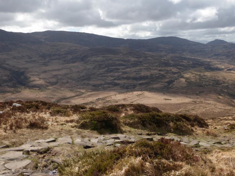
This is a pleasant walk over mainly pathless and rough terrain but there are no technical difficulties even though the grassy slopes are covered in outcrops. The ground is not particularly boggy but some is quite wet and mossy so gaiters are almost mandatory. The views are excellent especially to Mangerton Mountain: it would not be wrong to say both these tops are subsidiary tops of Mangerton Mountain on its SW ridge. There are also excellent views to Torc Mountain, Purple & Shehy Mountains, MacGillycuddy's Reeks, Stumpa Duloigh & Broaghnabinnia plus Beann & Mullaghanattin.
Route
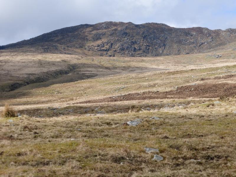
(1) From the junction, walk further along the road towards Baureagh Forest. Shortly after the bridge over the Owbaun River, there is a gate and track on the right with a sign saying “Trespassers Will Be Prosecuted”. Climb over the gate then pick a way roughly WNW up rough pasture. Some low fences may have to be climbed over but there is a stile over the first one after which there is a gate. Once some height has been gained head W and cross some minor streams before crossing the major stream higher up when it is no longer in a gully. The prominent edge of the main forest will be seen to the W but do not head for it or follow the fence just across the main stream. Instead, pick a way, roughly W or WNW, up the ridge which is moderately steep grass and heather. Soon reach a top which has a small cairn on it which marks the summit of Knockbrack, 610 m. There are two other tops of similar height but neither has a cairn and observations on the ground seem to suggest that the cairned top is the true summit. There are lochans around the summit area.
(2) Descend roughly NE from the summit, on some wet ground, to cross a broad ill-defined col. There are hints of a path but it is not easy to follow. The rise up to Dromderalough is fairly obvious but the terrain is quite complex and would be very difficult to navigate in mist. Ascend the other side of the col and continue to a medium cairn, made of large stones, which marks the summit of Dromderalough, 650 m. The summit would be hard to locate in mist. Slightly further to the NE, on a separate ridge across a small dip is another cairn of similar size which seems lower than the SW top but it would be prudent to visit both.
(3) Descend roughly S, down moderately steep grassy and rocky slopes but there are no technical difficulties. In clear weather, a track will be seen much lower down which leads to the gate climbed over on the road. Keep picking a way down looking for the best ground. Lower down, try to avoid the rough pasture where possible. You may cross a ditch just before a fence., in which case head left to go around the fence. By now a small fenced enclosure should be visible to the right of the track being aimed for. It is best to aim for the top of the track which follows the W bank of the Owbaun River otherwise you may have to climb some barbed wire fences. Follow the track down to the gate on the road then walk back to the junction.
Notes
(a) This walk took place on 30th March, 2014.
(b) The Fossa camp and caravan site, at V 910 923 is very good and very well situated for the Killarney mountains, especially Macgillycuddy's Reeks and Purple Mountain as it is only about 3 miles from Kate Kearney's Cottage. At Fossa, there are camping and caravanning facilities as well as a hostel and static trailer vans can also be hired. For campers, there are excellent showers (small extra charge) and there is a good campers’ kitchen with tables, sinks and cooking area if you have your own cooker and pans. Gas rings are available (small extra charge). There is also a TV room. Reception is open quite late in the high season and the staff are very helpful. A computer is available for hire and there is a freezer in reception. There is a bus stop outside the site for Killarney. There is a 24 hour Tesco which is off the northern bypass (turn right at 4th roundabout then right at next). Out of high season, it can be better for 2 people to rent a trailer van than to camp separately.
Photos - Hover over photo for caption. Click on to enlarge. Click on again to reduce.