Get Lost Mountaineering
You are here: Ireland » South West » Iveragh Peninsula
Coomloughra Horseshoe clockwise from NE of Lough Acoose
Coomloughra Horseshoe clockwise from NE of Lough Acoose
Start/Finish
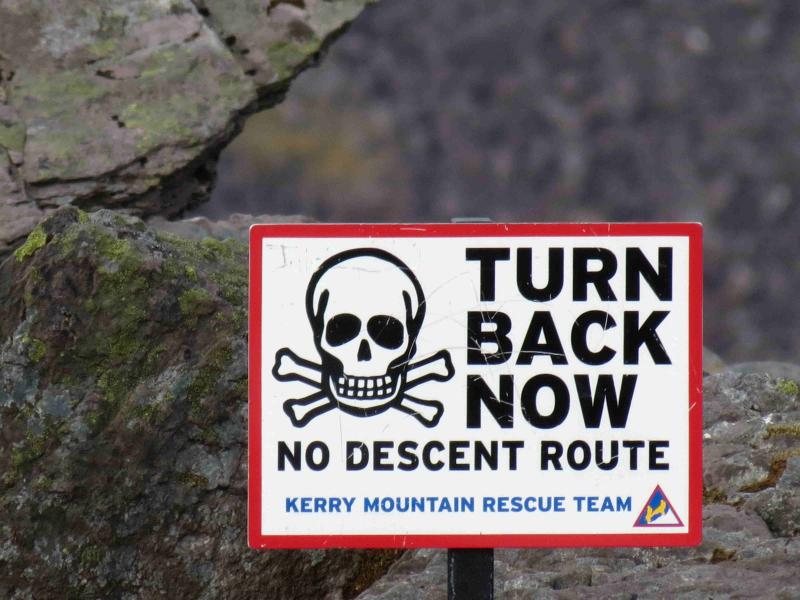
Start of Hydro road at V 771 870 on the Killorglin – Glencar road about 2 km NE of turning for Lough Acoose. This point has a wooden gate and a metal gate adjacent to each other with a Kerry Mountain Rescue notice on the metal gate. The “road” starts as a rough gravel track. There is limited parking about 400 km up the road towards Killorglin. From Killarney, drive towards Killorglin and take the first left after the Fossa camp site, signposted Gap of Dunloe. Follow this meandering road, ignoring all turns, past the Gap of Dunloe turn off, past the crossroads with petrol pumps and a store then past the Carrauntoohil turning for Cronin’s Yard. In fact, continue to the end of the road at V 776 889 where you have to give way to the Killorglin – Glencar road. Turn left, S, and it is about 2 miles to the start. You will pass the parking places en route to the start of the walk. 2013 update: There is now a new tarmac road just before the metal gates (on the Killorglin side) with plenty of parking up it. A rough track leads out of the car park to soon join the Hydro track.
Distance/Time
12 km About 7 hours
Peaks
Cnoc Iochtair/Breenlee, 747 m, V 785 859. (Irish National Grid System)
Skregmore NW, 848 m, V 792 860.
Skregmore SE, 851 m, V 796 858.
Beenkeragh, 1010 m, V 801 853.
Knockoughter, 959 m, V 801 847.
Carrauntoohil, 1039 m, V 803 844.
Caher, 1001 m, V 7931 838.
Caher NW Top, 975 m, V 790 840
Irish OS Discovery Series Map 78 (1:50000)
Introduction
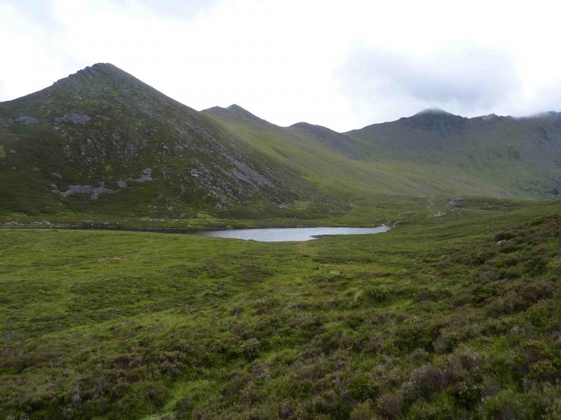
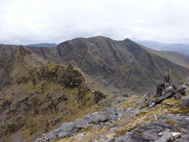
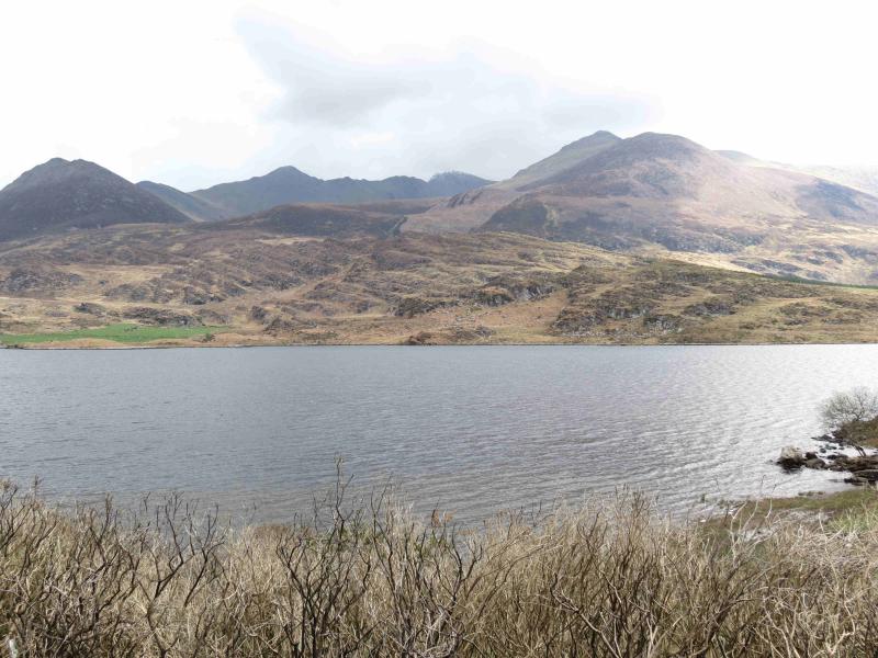
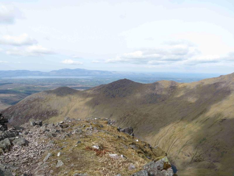
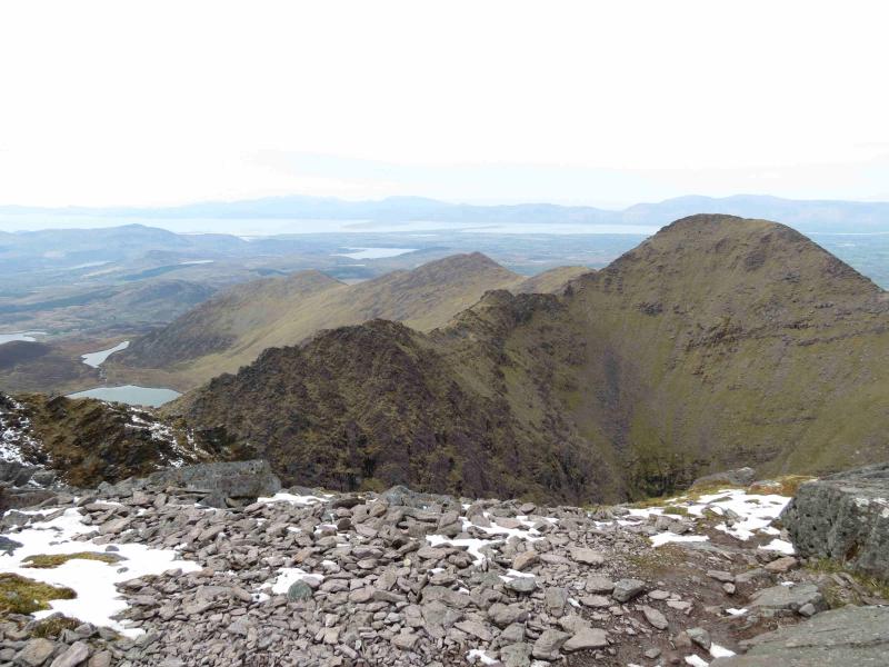
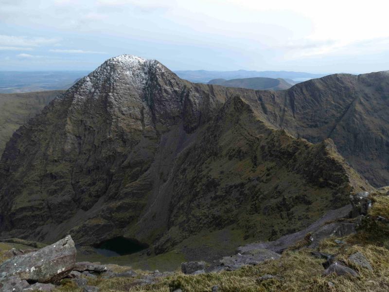
MacGillycuddy’s Reeks are the highest mountain range in Ireland and may well be the longest ridge over 3000 feet in the British Isles. The reeks are essentially “Y” shaped with Carrauntoohil (highest peak in Ireland) at the junction. This walk takes in the top of the “Y” as a horseshoe. Choose a good day as the Reeks can often be in cloud. The arete between Beenkeragh and Carrauntoohil is exposed in places and can be very unnerving in wind and if wet. Good views will be visible throughout this route on a good day. Navigation is relatively straightforward apart from the location of the ridge from Carrauntoohil to Beenkeragh but if you need to, you should be able to easily reset your GPS to the Irish National Grid System. Much of the horseshoe is in view from Lough Eighter on a good weather day.
Route
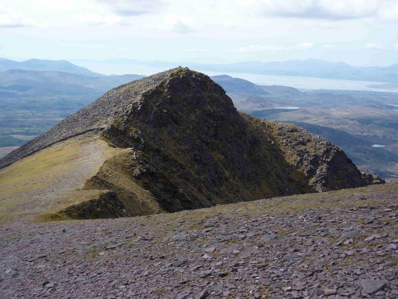
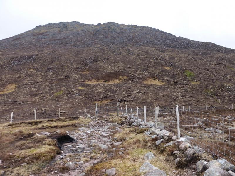
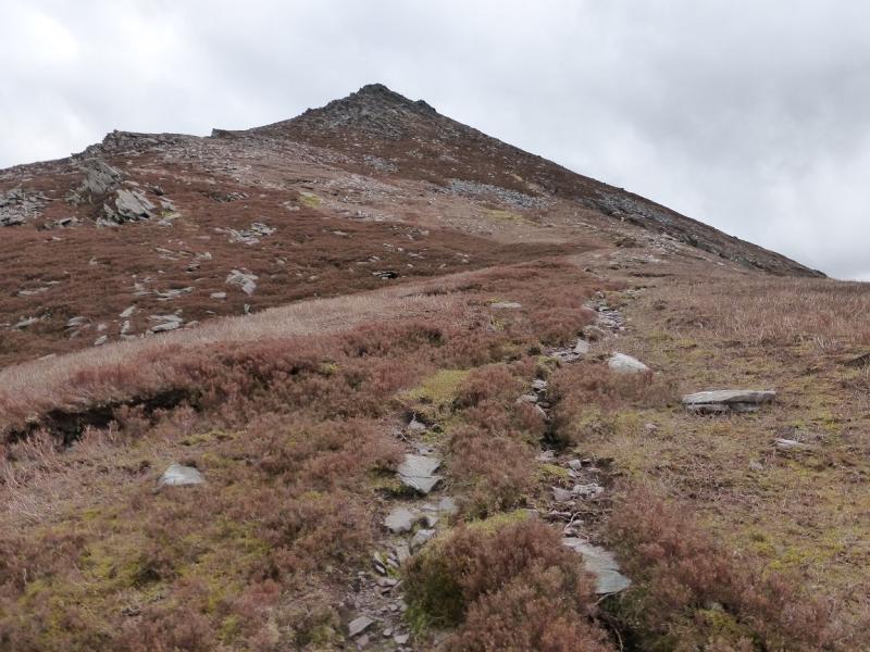
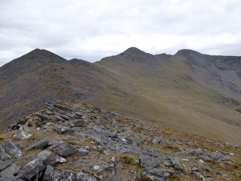
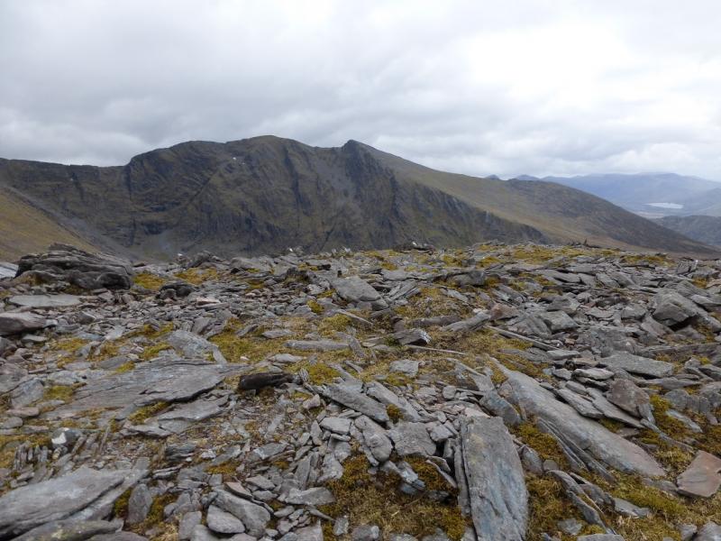
(1) Walk up the Hydro track which is steep in places. After a long gentler section, reach a gate, often locked. Go left here, following a fence and reach another gate which gives access on to an old and rougher track. Follow this roughly SSE. It soon becomes a path which starts ascending Cnoc Iochtair which looms above. The path goes up the WSW ridge picking a way through the heather and the path is not always obvious. One path continues up this ridge whilst another goes around the back, N side. They recombine higher up and one eventually reaches the medium cairn which marks the summit of Cnoc Iochtair, 747 m.
(2) Descend E, not losing much height, then ascend rocky slopes but still on the path to reach the top of Skregmore NW, 848 m.
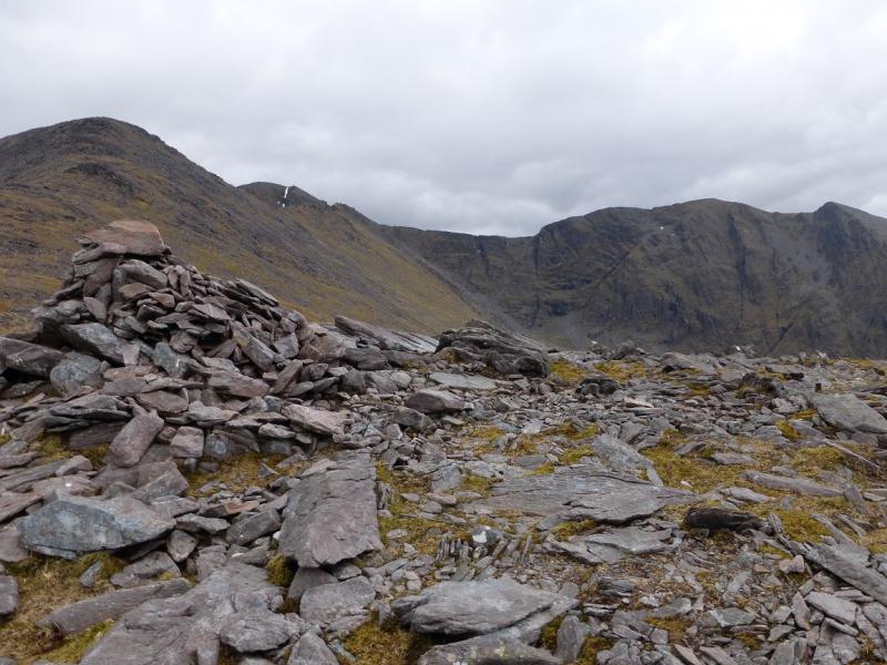
(3) Continue E along the crest losing about 50 m of height then ascend to reach the medium cairn which marks the summit of Skregmore SE, 851 m.
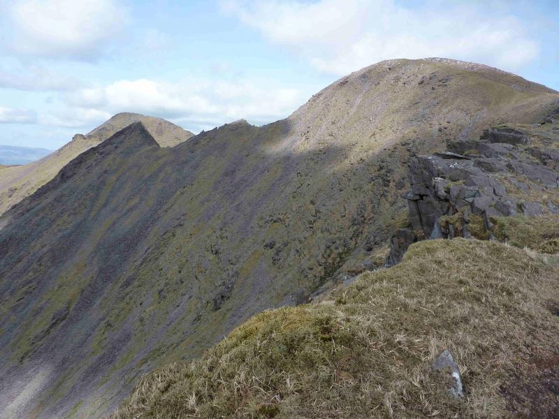
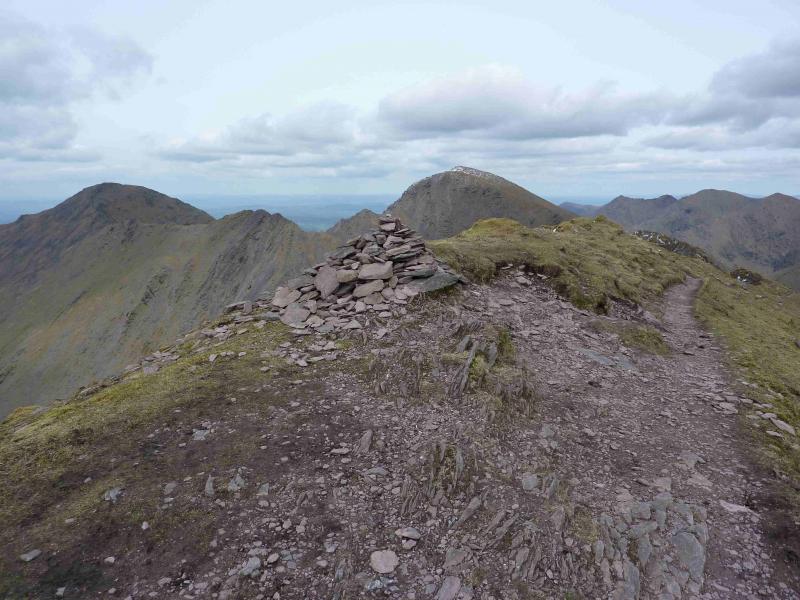
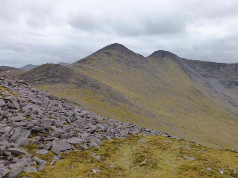
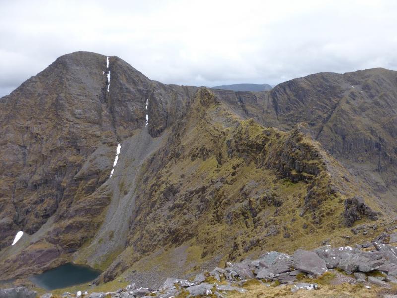
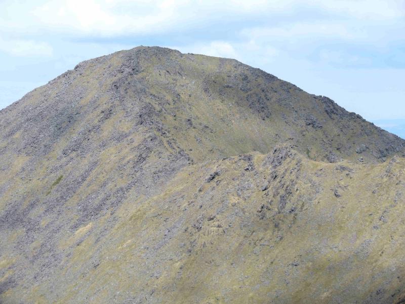
(4) The crest now turns SE so descend down about 30 m to a col then start the long ascent up the NNW ridge of Beenkeragh. The path is easily followed until the rocky section below the summit when various alternative paths take over and pick their way carefully through this rocky section before a much easier path leads to the large cairn which marks the summit of Beenkeragh, 1010 m.
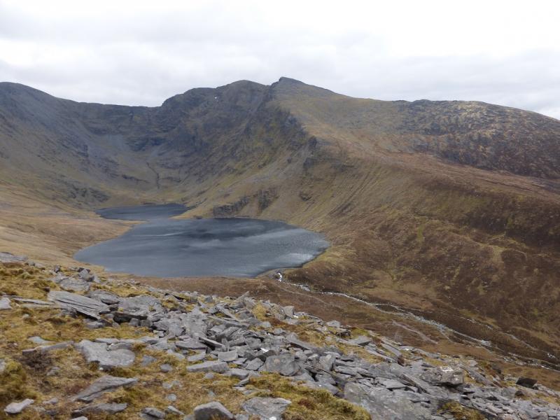
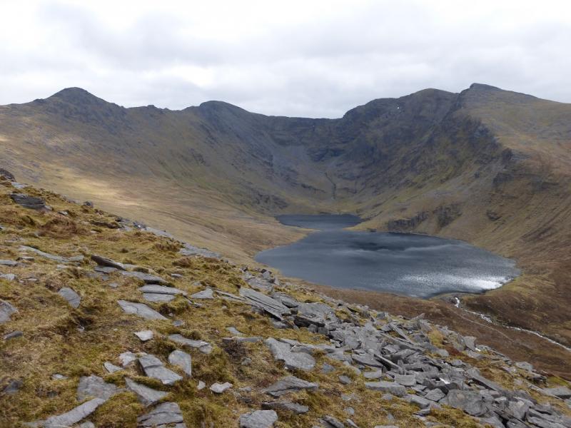
(5) The cairn sits at the Beenkeragh end of the arete to Carrauntoohil. Descend SW on to the arete then either follow the crest (very rocky and exposed in places) or follow one of the well worn paths below the crest. Even on the paths, hands will be needed. Continue along the arete. Just over halfway is the “irish Munro” top of Knockoughter which has no cairn but is not too difficult to reach the top of if the weather is reasonably kind.
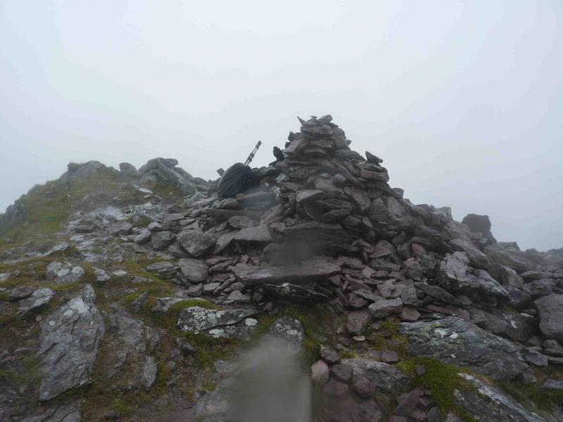
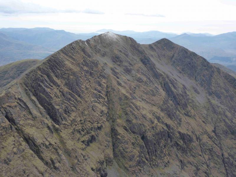
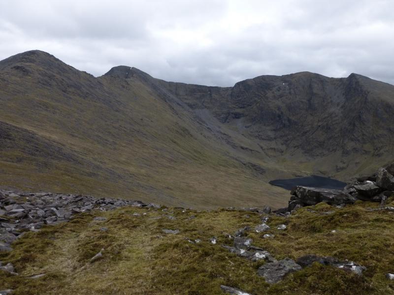
(6) Continue to a col which is the top of O'Shea's Gully – another route up Carrauntoohil. Continue over, or round another top, to reach the end of the arete at another col. Ascend SSE with a choice of paths up the rocky, grassy and scree slope. Reach a flat area with a cairn on it. Note the position as you will be back here soon. In clear weather, the summit cross of Carrauntoohil, made of girders, will be obvious. In mist follow the path near to the edge left, past a flatter cairn, until the large cross which marks the summit of Carrauntoohil, 1039 m, the highest peak in Ireland.
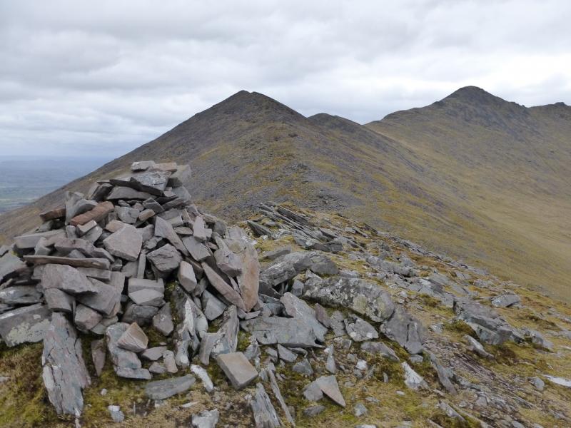
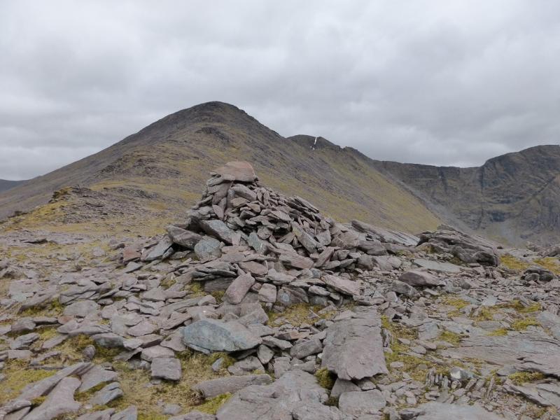
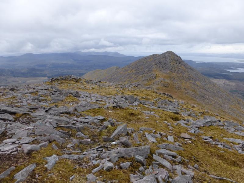
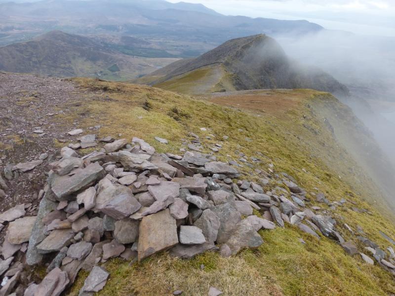
(7) Retrace to the cairn met at the top of the ascent from the arete but turn left and follow the edge |S, curving around to SW then W. A good path soon appears and there are a few cairns. Navigation is now very straightforward. The path reaches a col then ascends the other side. After a long ascent, a large cairn is reached which marks the summit of Caher, 1001 m.
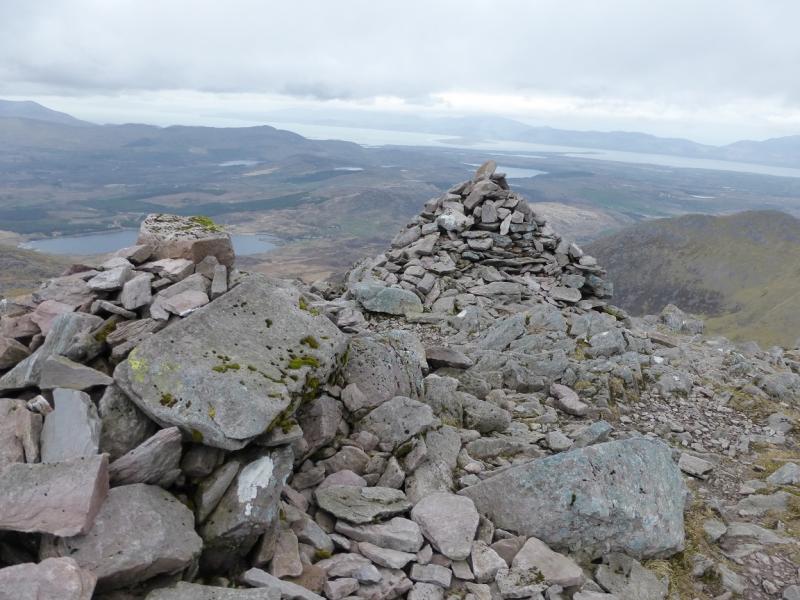
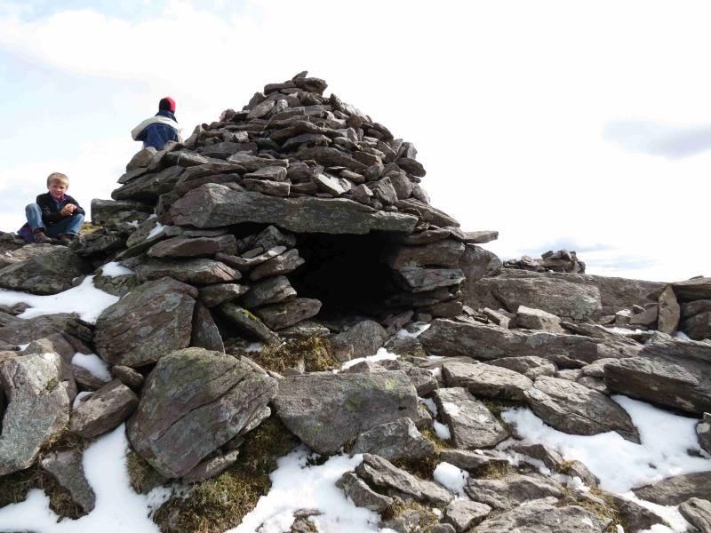
(8) Continue along the crest and descend to a col. A short ascent then leads to the NW top of Caher, 975 m, where there are two cairns, one of which has been made into a small stone hut with a roof.
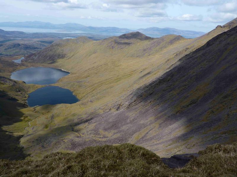
(9) Descend NW down moderately steep slopes but there is a very obvious, now eroded, path. Note that this is not, initially, a natural ridge as that goes W and should not be followed. The path leads down to less steep ground above the two loughs before descending NNW down to the dam by Loch Iochtair where the top of the hydro track is reached and followed back to the start.
Notes
(a) This walk took place on 9th April, 2014.
(b) The Fossa camp and caravan site, at V 910 923 is very good and very well situated for the Killarney mountains, especially Macgillycuddy's Reeks and Purple Mountain as it is only about 3 miles from Kate Kearney's Cottage. At Fossa, there are camping and caravanning facilities as well as a hostel and static trailer vans can also be hired. For campers, there are excellent showers (small extra charge) and there is a good campers’ kitchen with tables, sinks and cooking area if you have your own cooker and pans. Gas rings are available (small extra charge). There is also a TV room. Reception is open quite late in the high season and the staff are very helpful. A computer is available for hire and there is a freezer in reception. There is a bus stop outside the site for Killarney. There is a 24 hour Tesco which is off the northern bypass (turn right at 4th roundabout then right at next). Out of high season, it can be better for 2 people to rent a trailer van than to camp separately.
Photos - Hover over photo for caption. Click on to enlarge. Click on again to reduce.