Get Lost Mountaineering
You are here: Scotland » 16 Coigach to the Pentland Firth » Lochinver & Inverpolly
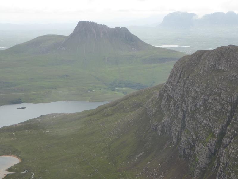
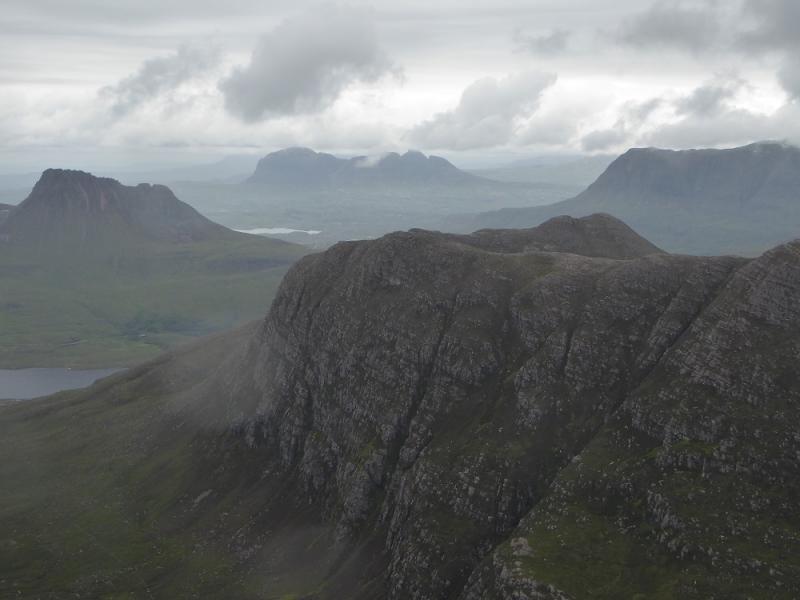
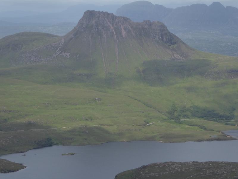
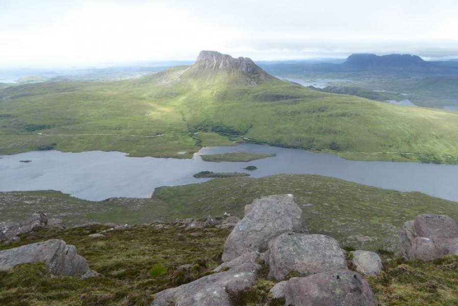
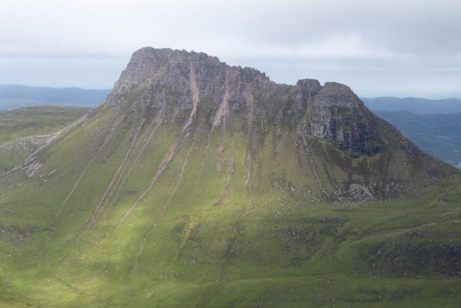
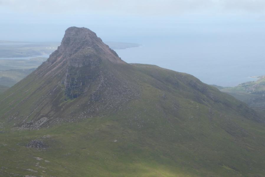
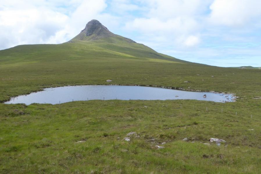
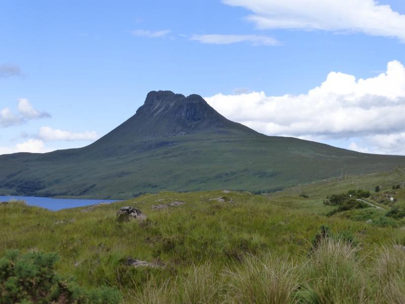
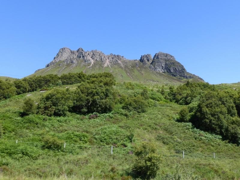
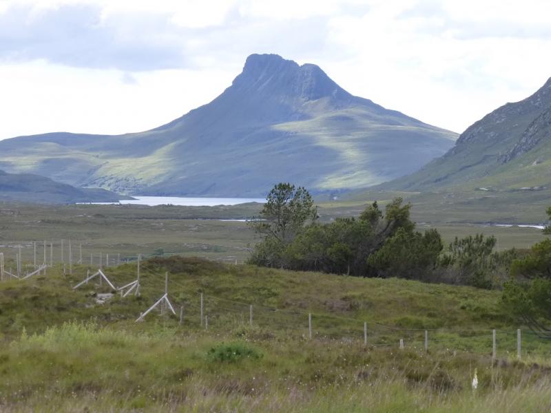
Stac Pollaidh
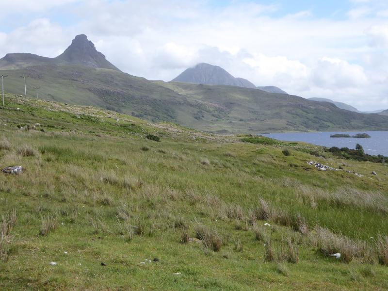
Stac Pollaidh from the road to Achiltibuie from A835 Ullapool to Ledmore road
Start/Finish
The purpose built car park about 5 miles down the minor road towards Achiltibuie which leaves the A835 Ullapool to Ledmore road about 10 miles north of Ullapool. This car park can soon fill up on busy days.
Distance/Time
4 km. About 4 hours.
Peaks
Stac Pollaidh, 612 m, NC 107 106. OS map 15.
Introduction
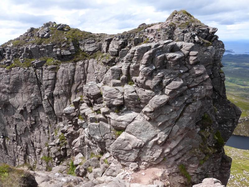
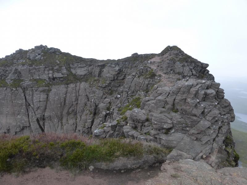
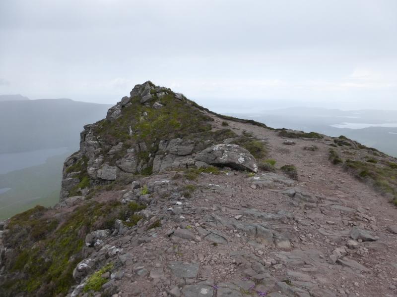
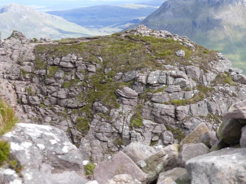
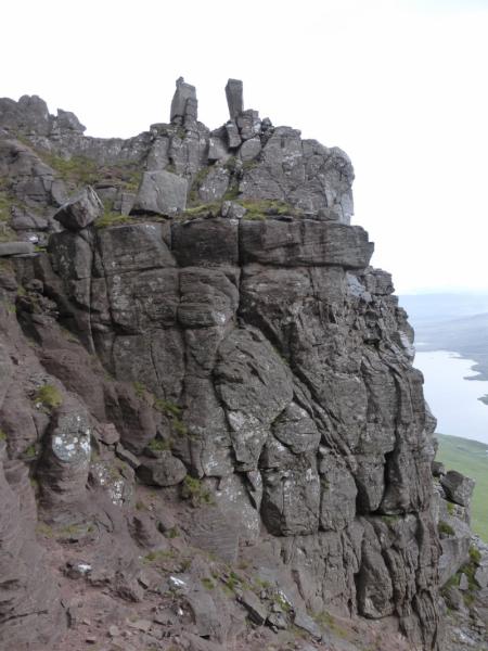
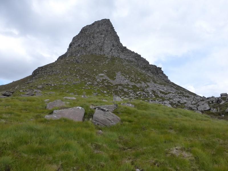
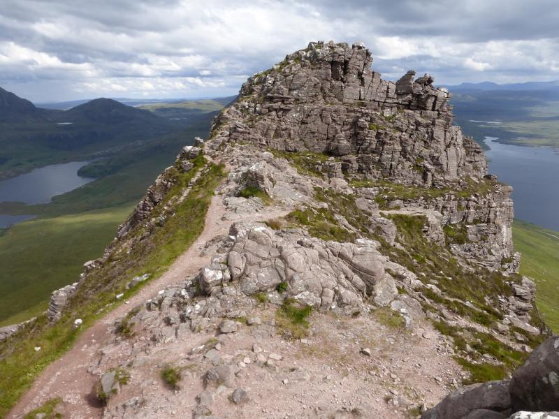
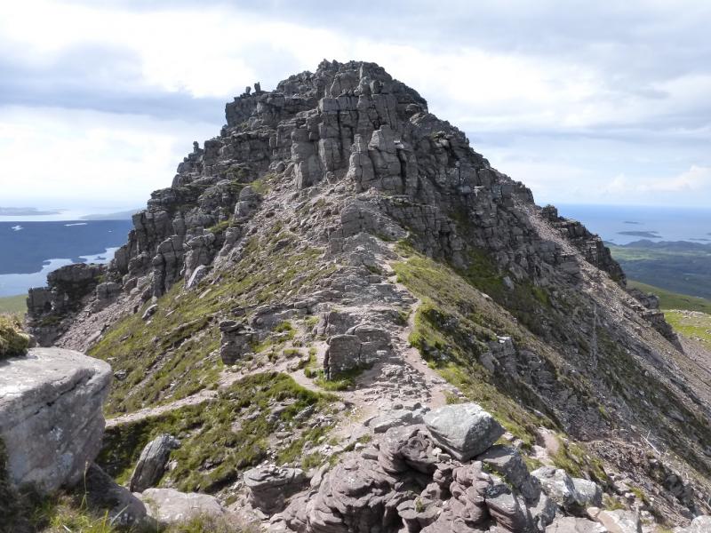
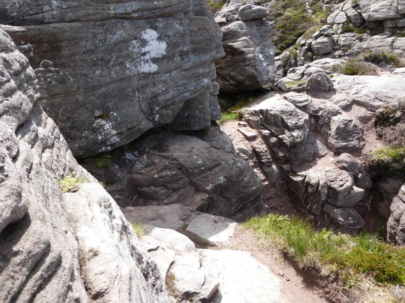
This is a magnificent rocky mountain, albeit in miniature, in an area of outstanding mountain beauty containing many individual mountain peaks and hundreds of lochans. It is famous for its pinnacles on its crest. Techically, it is a sandstone mountain in its final stages of erosion. The surrounding views are some of the best in Scotland and include the multi topped Ben Mor Coigach, Cul Beag, Cul Mor, Quinag, Canisp and Suilven. The distance and time given above is only a very rough guide as this mountain is worth wandering around on for some time. A new improved path has been built which starts across the road from the car path and goes around the east side of the mountain to its north side (no less attractive) from where the lowest part of the crest – known as the Saddle – is easily reached. The main path continues around the west end before returning to the car park. Even if one does not fancy going on to the crest, it is well worth the walk around this mountain. Note that, on older maps, another path is shown which goes straight up the south side. This has been removed at its lower end but still remains higher up. It is not recommended as it is on very loose scree and could well be dangerous to some. The actual summit is at the west end. Unfortunately, a short tower blocks the way, at the top of two gullies, about 50 m short of the top. For this reason, many do not actually reach the summit. Two ways of tackling the tower are given in the route. The rock is generally reasonably good to scramble on except when wet but there is a lot of loose rock. A significant hazard seems to be tiny stones rolling under one's feet which can turn boots into roller skates!
Route
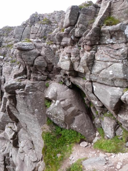
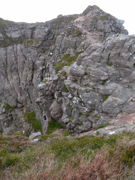
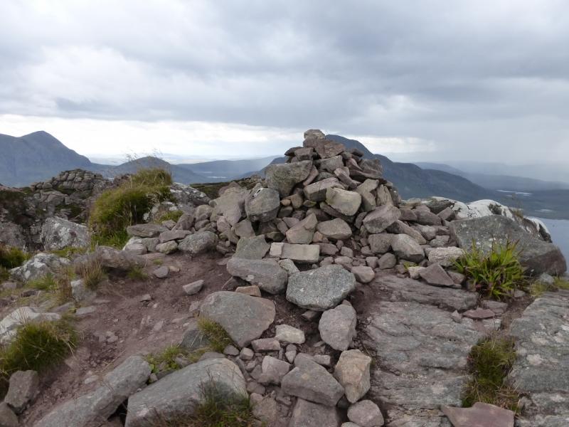
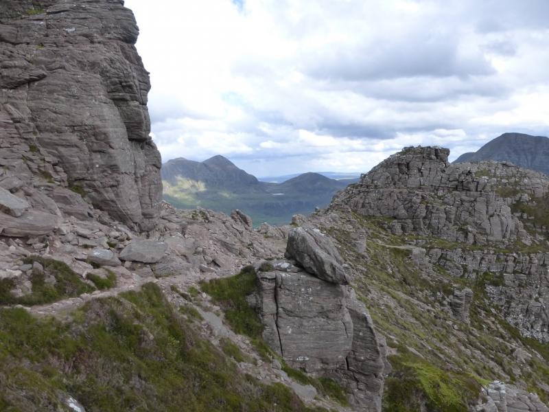
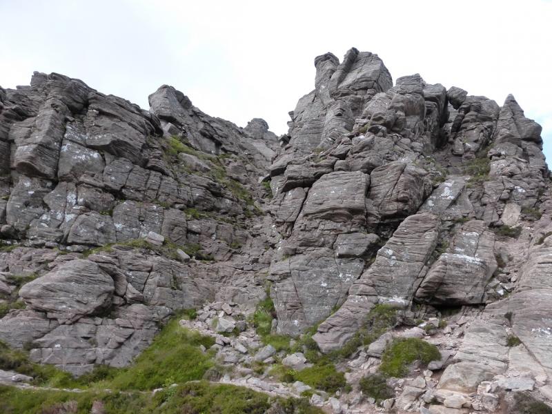
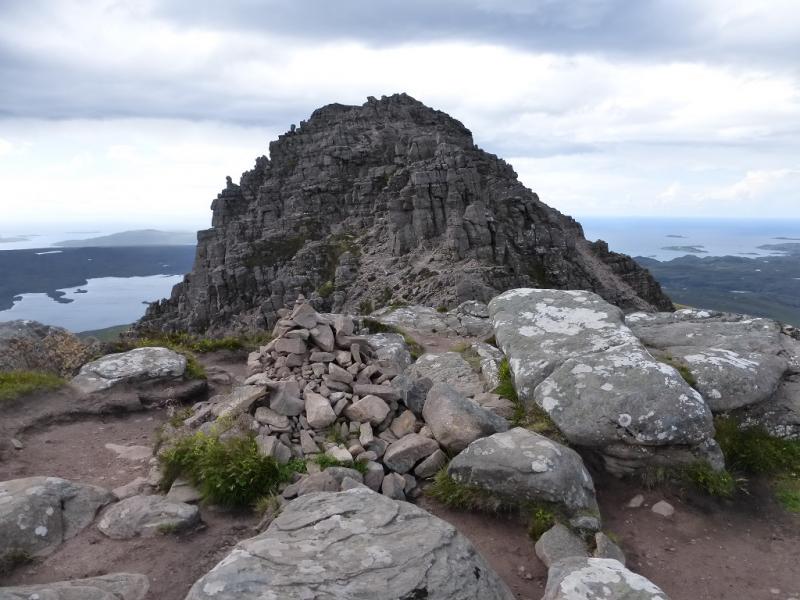
(1) Cross the road and follow the path up and around the east end of the mountain. On the N side, the path splits below the crest. Take the left fork and follow it up to the Saddle – the right fork goes around the W end of the mountain. Easily reach the Saddle from where the E Top can easily be visited by going left, E. To head for the actual summit, go W from the saddle. There is a choice of paths either on the S or N side of the crest. The S side is recommended but there is some exposure in a few places. The S side path eventually leads up on to the actual crest and crosses to the N side where there are many paths indeed. Continue W on one of these. Later on, the first “obstacle” is a rock/ledge with rocks above it making it difficult. This can be passed by descending about 2 m to the top of a steep gully then ascending back up. The second “obstacle”, soon after, is an exposed traverse across a ledge to the left (other routes are possible) which is straightforward unless it is wet and windy. Soon after, the rock tower is reached below the summit. The summit cairn is easily seen from here – ahead and left. One way to tackle the tower is to climb it directly from the “col” below it. The hardest move is getting off the ground after which it is easy. Standing in the “col”, there are no obvious good hand holds to pull up on. The first foot hold is up and slightly left. Once a foot is on there, a good hand hold should be found then one can almost walk around the left, S, side of the tower. A hand up may help or try building a pile of stones to stand on! The second way seems more awkward but is less exposed. From the “col” below the tower, descend a few metres on the S side (there is a path) to a small level section beyond which are very steep slabs. From this level section, there is a deep groove to the right of a slab with rocks for holds in it recesses. With care, it is possible to ascend up this groove to reach the other side of the tower. This is much easier in descent than the direct route. Once the tower is passed, it is an easy short stroll to the medium cairn which marks the summit of Stac Pollaidh, 612 m. If the tower is too much to take on there is a cairn on the S ridge before the tower.
(2) Retrace the outward route or explore the mountain. The best return is to rejoin the main path – various options – and walk around the W end of the mountain.
Notes
(a) This walk took place on 19th July, 1997, 21st July, 2003, and 6th July, 2014.
Photos - Hover over photo for caption. Click on to enlarge. Click on again to reduce.
 on approach to Stac Pollaidh summit.JPG)