Get Lost Mountaineering
You are here: Ireland » East » Wicklow Mountains
Turlough Hill (Tomaneena) from Wicklow Gap
Turlough Hill (Tomaneena) from Wicklow Gap
Start/Finish
Car park at the top of the Wicklow Gap. If full, there is a second car park further back on the south side. The Wicklow Gap is well signed from the N81 road between Baltinglass and Blessington. It can also be reached from Laragh. Warning: The official car parks in this area have warning signs about cars being broken into so do not leave anything of any value in your car and especially on view as you may come back to broken windows.
Distance/Time
5 km. About 2 - 3 hours
Peaks
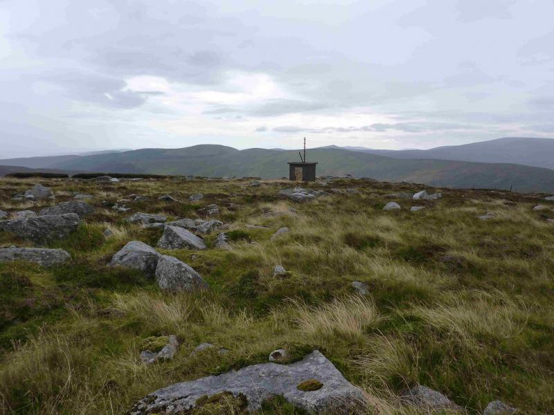
Tomaneena (Turlough Hill), 681 m, T 063 982. (Irish National Grid System)
Irish OS Discovery Series Map 56 (1:50000)
Introduction
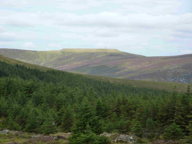
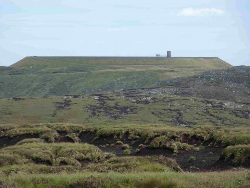
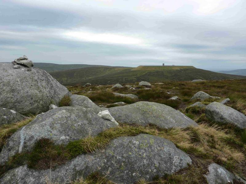
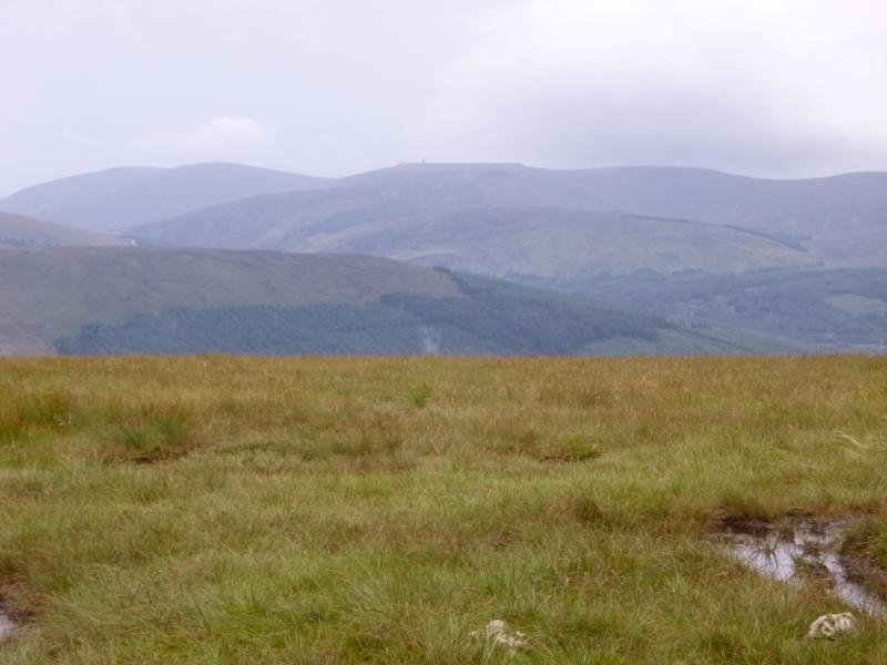
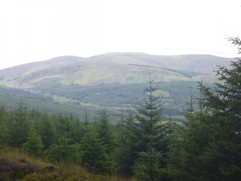
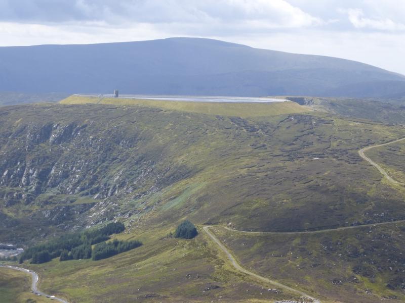
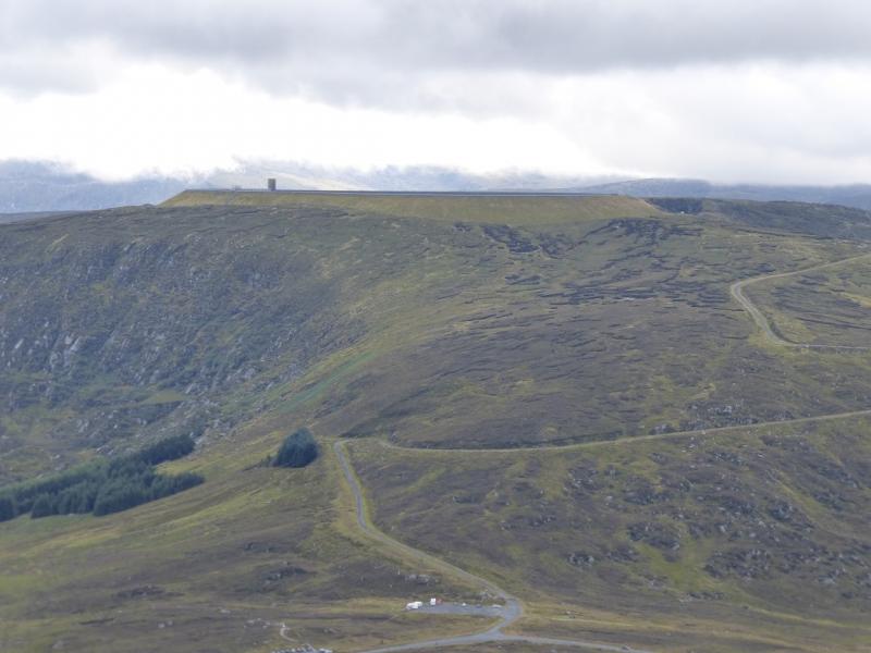
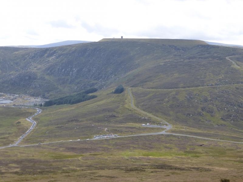
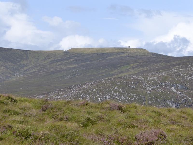
Turlough Hill is topped by a reservoir for a pump storage system. This has given it a very flat top which is now a good landmark.The easiest way to ascend Turlough Hill is by the obvious track from the top of the Wicklow Gap. This route is more adventurous and ascends from the lower reservoir up rough and rocky slopes. The easiest way to reach this is to take the track going down to the power station by the lower reservoir but this is security fenced. If you are not allowed through then this route is not really practicable. However, there are occasional open days when one can walk through the security area. Note that earlier visits suggested that Turlough Hill had an alternative name of Tomaneena but in 2014, Turlough Hill seemed to be in almost exclusive use.Views are good and include the Mullaghcleevaun range, Tonelagee, Scarr, and Ludnaquilla as well as the adjacent hills of Camaderry and Conavalla.A separate walk has been uploaded which includes the whole range from Mullacor to Camaderry. Navigation in mist should not be a problem except in locating the highest natural point which is lower than the pump storage reservoir. You should be able to easily reset your GPS to the Irish National Grid System.
Route
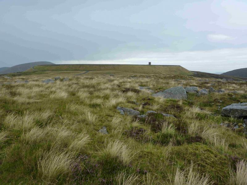
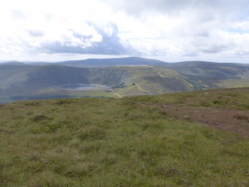
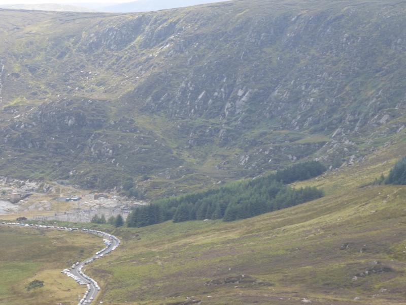
(1) Walk down the road to the power station by the lower reservoir. On the way, look for a grassy rake going from bottom right up left towards the col between Turlough Hill and Camaderry. Once past the last modern building, start picking a way up on rough ground then gradually work around the find the grassy rake. Follow this up – there is a faint path in places – weaving around to avoid the slabs and boulders. The ground can be very soft and may give way in places so take it steadily. There is no single obvious route but there are no serious obstacles to reaching the crest. Once there, go right and walk towards the pump storage reservoir embankment which has a security fence around it. A path goes around the fence. The highest natural point is SW of the top reservoir and has nothing to mark the summit of Tomaneena (Turlough Hill), 681 m.
(2) Walk back to the embankment and walk around it, in either direction. When a track is reached, follow it down to the Wicklow Gap.
Notes
(a) This walk took place on 10th August, 2014.
(b) There is an excellent camping and caravan site, in the village of Donard, called Moat Farm. It has beautiful landscaped grounds, including a stone circle (!) and is very well laid out with free hot showers. There is a large campers’ kitchen with tables and sinks but bring your own cooking equipment and pans. There is a fridge and freezer. There is also a sitting room with a TV. The owner and staff are very welcoming, very friendly and very helpful. You would be hard pressed to find a nicer site. Donard is about 4 miles from the Glen of Imaal stores (where you can buy a sandwich). Donard is signposted off the N 81 main road between Blessington and Baltinglass. More about Moat Farm in its own section!
Photos - Hover over photo for caption. Click on to enlarge. Click on again to reduce.