Get Lost Mountaineering
You are here: Ireland » East » Wicklow Mountains
The Spink, Mullacor & Derrybawn Mountain from Glendalough
The Spink, Mullacor & Derrybawn Mountain from Glendalough
Start/Finish
The top car park in Glendalough, at T 112 964, just before the Upper Lake at the end of the public road. In 2014, it cost 4 Euros to use this car park which is only open between 8 am and 10 pm (subject to change). There are hefty penalties if your car is “locked in”. The car park at the entrance to Glendalough is free with no restrictions but will involve extra walking. The road into Glendalough starts about 1.3 miles west of Laragh which is on the eastern side of the Wicklow Gap road. From Blessington, drive south and take the road for Hollywood which can be followed over the Wicklow Gap. The turning for Glendalough is a sharp reverse right fork and easily missed. There is a visitor centre at the start of the glen by the free car park. Donard is a good base for the Wicklow Mountains and it is signposted off the N 81 road between Blessington and Baltinglass. Donard has a lovely camp site (see notes below) if you are not in a rush and can stay a few days. From Donard, drive to the main road ,N 81, then go north and turn off for Hollywood and the Wicklow Gap.
Distance/Time
12 km. About 4 – 5 hours.
Peaks
Mullacor, 657 m, T 092 939. (Irish National Grid System)
Derrybawn Mountain, 474 m, T 119 954. Irish OS Discovery Series Map 56 (1:50000)
Introduction
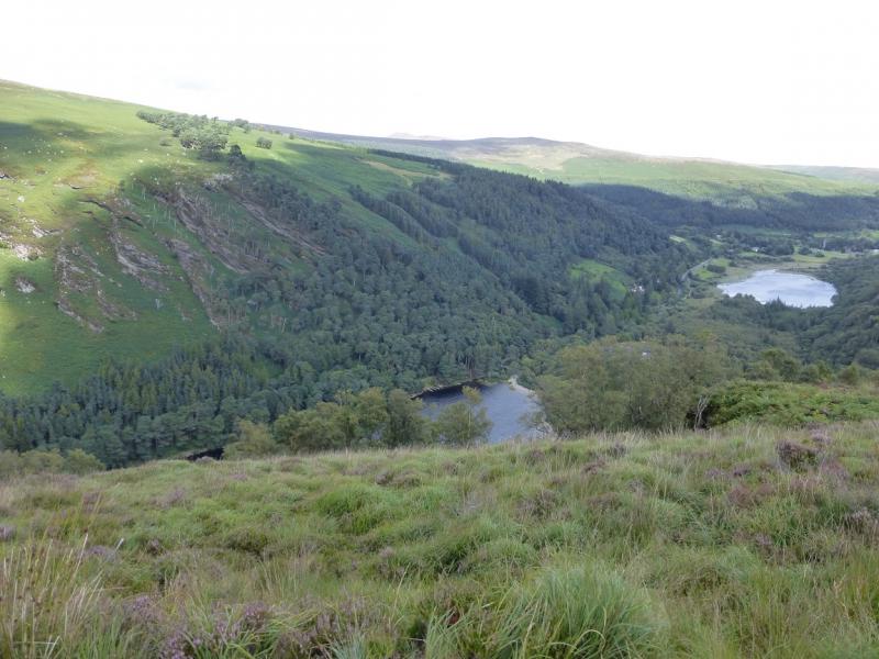
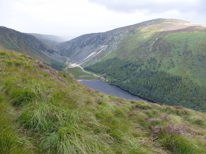
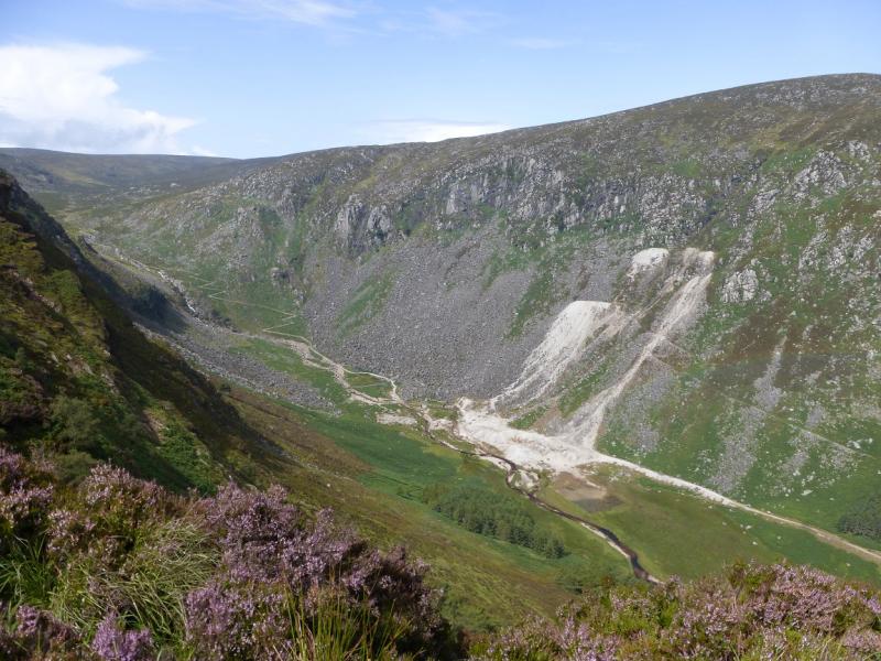
This is quite a scenic walk with good views from The Spink over the Glendalough Lakes and to Turlough Hill and Camaderry. Mullacor gives good views of Croaghanmoira, Lugnaquilla and the Fraughan Rock Glen whilst the ridge to Derrybawn Mountain gives good views towards the coast including Scarr. The path up The Spink is good and has boardwalks for much of the way. These climb fairly steeply, as steps, through the forest. The ascent of Mullacor form the Wicklow Way has boggy sections which are easily avoided. The continuation to Derrybawn Mountain is simialr but more mossy. The descent from Derrybawn Mountain is in a stony groove in places.Navigation in mist would be a little taxing but not especially difficult. You should be able to easily reset your GPS to the Irish National Grid System.
Route
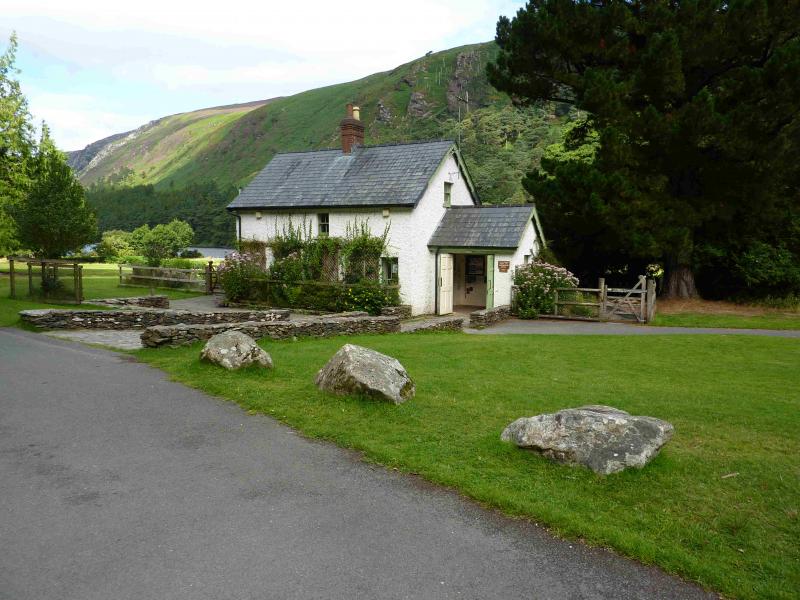
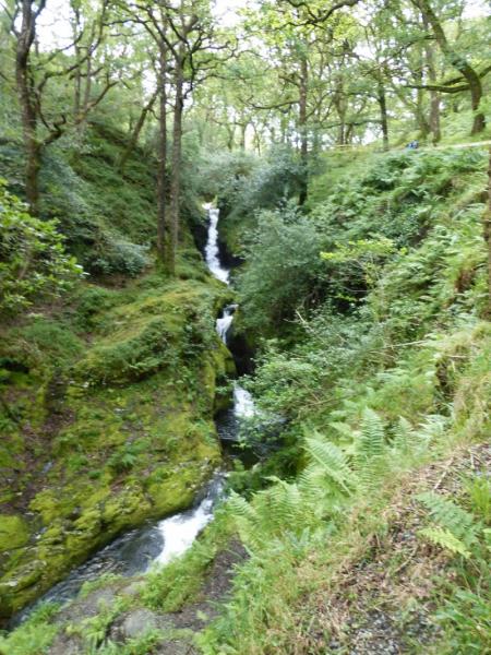
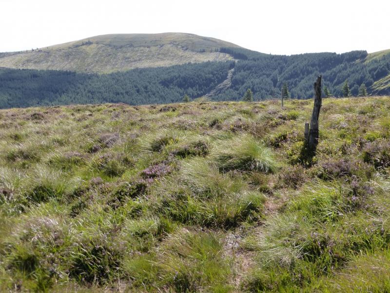
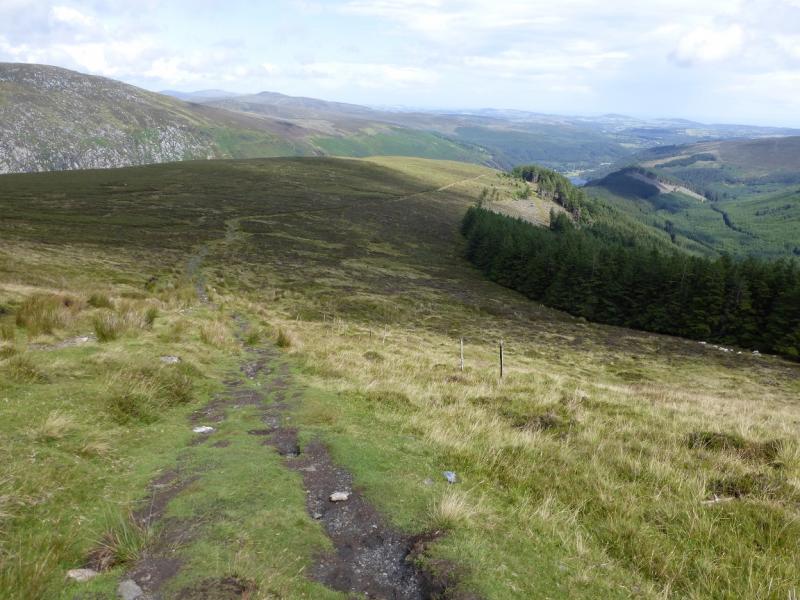
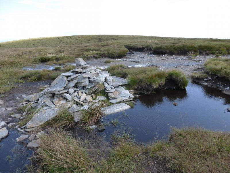
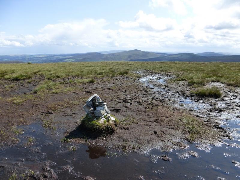
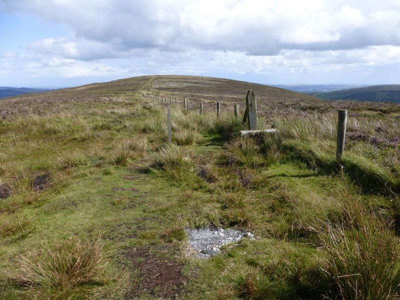
(1) From the top car park, take the path to the information office where the staff are very helpful. There is a large notice board outside with many way marked routes on it. From here go right, away from the car park, then ascend a track over the first bridge. This is stepped in places and goes up quite steeply to a viewing place for Pollanass Waterfall. When this path/track reaches a T junction, go left and soon reach a crossroads. Go right on a broad track and follow this to a left hand bend where a path, on board walks, goes into the forest. Follow this up, steeply in places, to emerge above the cliffs with views of Upper Glendalough with Camaderry across the glen. Continue up. When the top of the trees is reached, look for a minor path forking left which shadows the forest on the left. This path soon becomes more distinctive and traverses below Lugduff to reach the Wicklow Way in the col between Lugduff and Mullacor. If you miss this minor path then go no further than the top of The Spink path then go S to SW across some rough grass to locate the path below Lugduff. From the col a peaty path leads up easy slopes to the flat summit area where there are two cairns at roughly the same height with the second one seeming to be the higher. The third cairn along is definitely lower. Visit both to be sure you have reached the summit of Mullacor, 657 m.
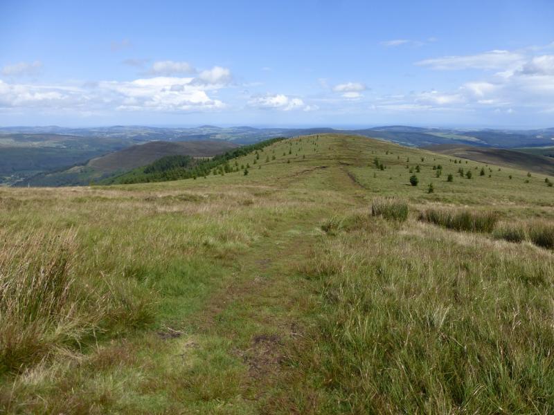
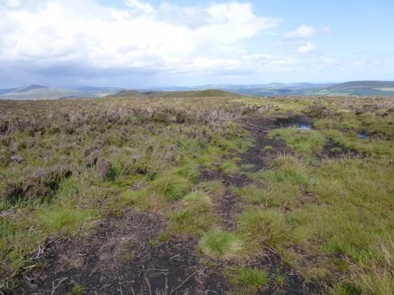
(2) Descend E from the second cairn on a reasonable path for nearly 2 km to reach a flat section by a fence. The path goes left, NNE, here and soon reaches the S ridge of Derrybawn Mounatin. Continue over some minor tops to eventually reach a medium cairn which marks the summit of Derrybawn Mountain, 474 m.
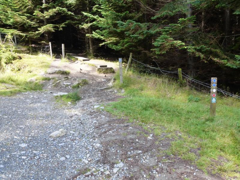
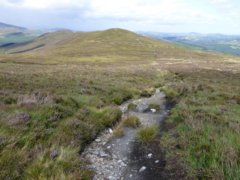
(3) Continue on the path which soon goes left towards the forest. The path is distinctive but is stony and in a groove some of the way. Reach a track. Cross over and follow the next path down to another track. Cross over again and continue down to a third track. Turn right here and follow the track down to the bottom close to the information office.
Notes
(a) This walk took place on 11th August, 2014.
(b) There is an excellent camping and caravan site, in the village of Donard, called Moat Farm. It has beautiful landscaped grounds, including a stone circle (!) and is very well laid out with free hot showers. There is a large campers’ kitchen with tables and sinks but bring your own cooking equipment and pans. There is a fridge and freezer. There is also a sitting room with a TV. The owner and staff are very welcoming, very friendly and very helpful. You would be hard pressed to find a nicer site. Donard is about 4 miles from the Glen of Imaal stores (where you can buy a sandwich). Donard is signposted off the N 81 main road between Blessington and Baltinglass. More about Moat Farm in its own section!
Photos - Hover over photo for caption. Click on to enlarge. Click on again to reduce.