Get Lost Mountaineering
You are here: England » Peak District » Kinder, Winhill, Castleton, Mam Tor, Rushup Edge, Brown Knoll & South Head from Ladybower/Bamford to Chapel-en-le-Frith Road
Mam Tor Ridge, Winnats Pass and Long Cliff from Castleton
Mam Tor Ridge, Winnats Pass and Long Cliff from Castleton
Start/Finish
Castleton village. Free parking is available on the E side of the village. Otherwise the best pay car park is the Visitor Centre on the W side of the village where there are information and toilet facilties.
Distance/Time
11 km About 4 - 5 hours
Peaks
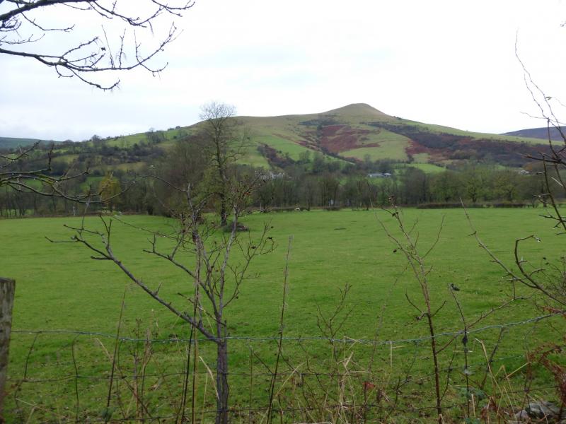
Lose Hill, 476 m, SK 153 853.
Back Tor, c 430 m, SK 148 851.
Mam Tor, 517 m, SK 127 836. OS Outdoor Leisure 1: Dark Peak
Introduction
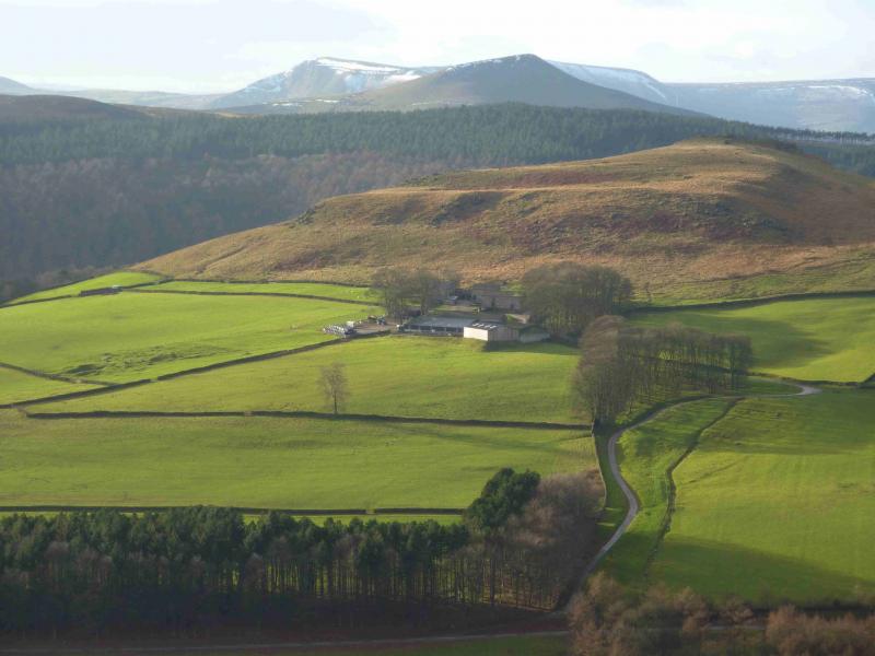
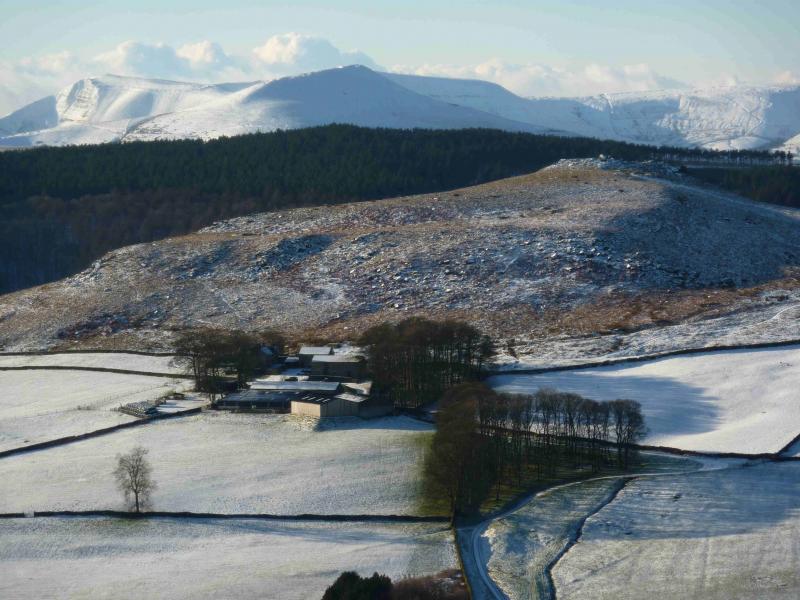
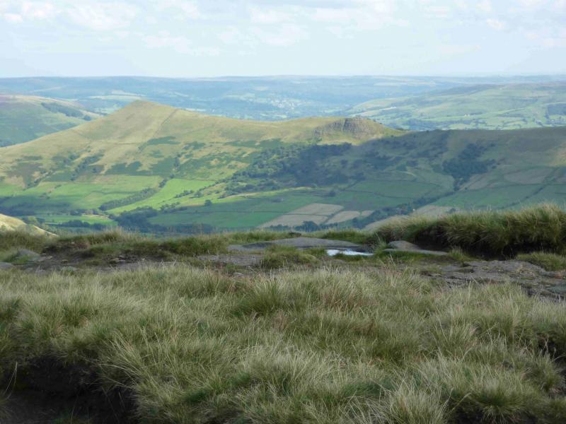
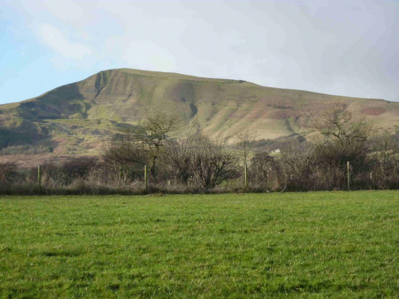
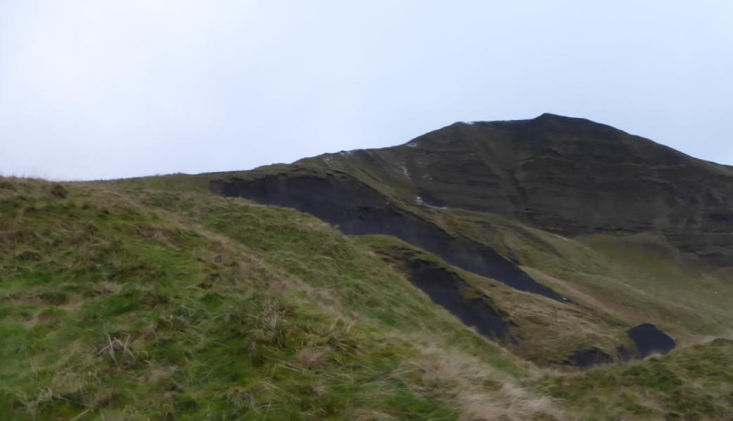
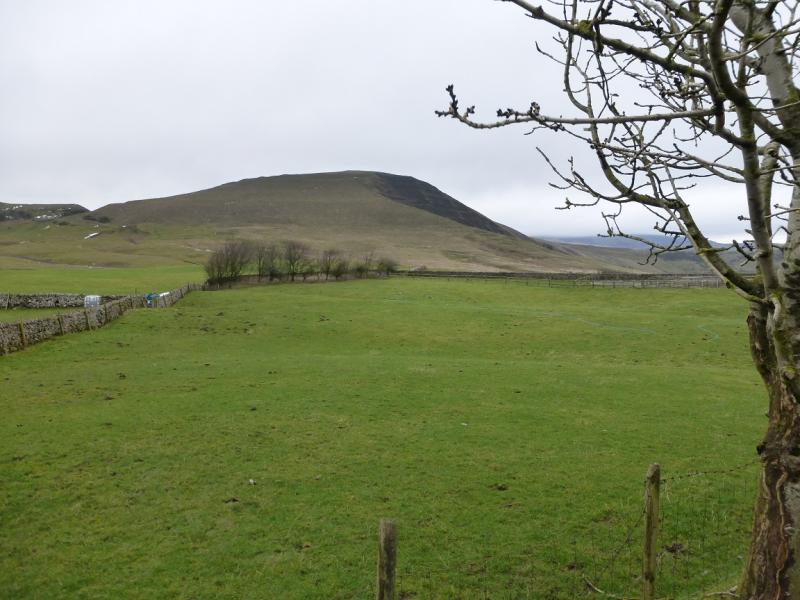
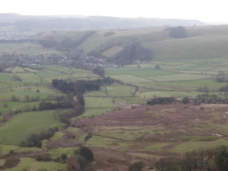
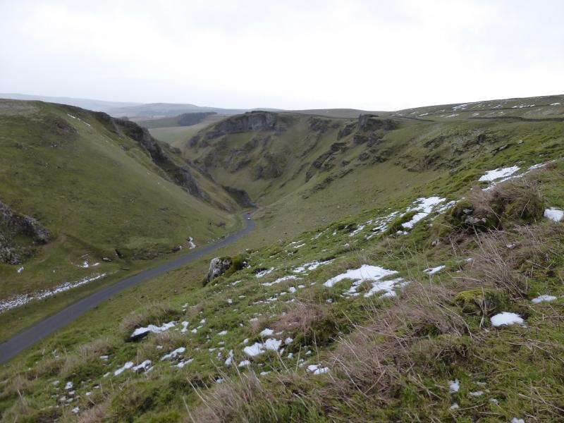
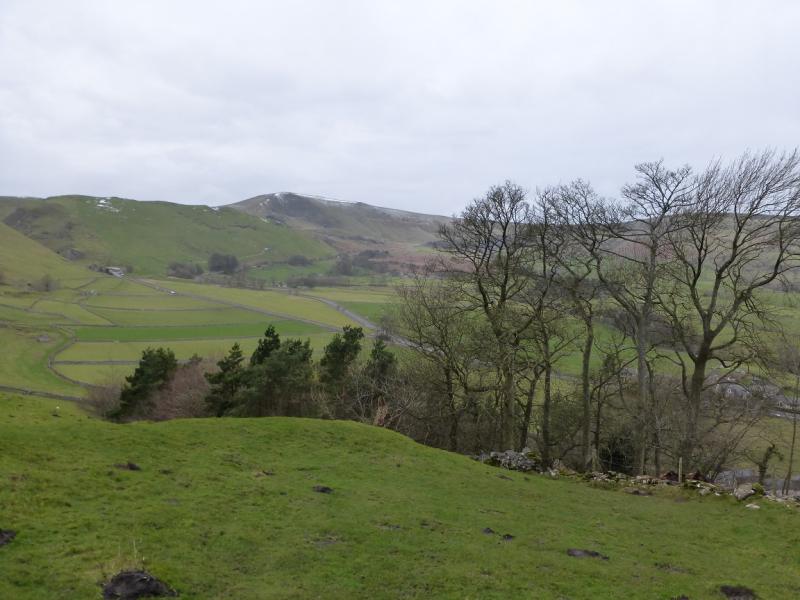
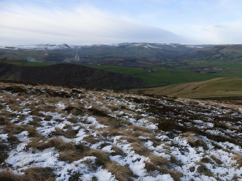
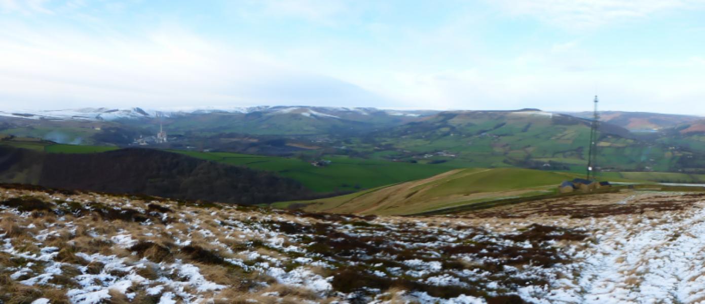
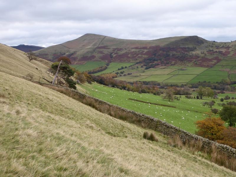
This is a short but very fine ridge walk in the Dark Peak which, in good weather has good views of Win Hill, Edale and Kinder as well as the local area around Castleton. The return route from Mam Tor is above Winnats Pass which is very steep sided. Because of its frequent land slips, Mam Tor is often referred to as “The Shivering Mountain”. Route finding should not be a problem even in bad weather but high winds can be very unnerving, especially on Mam Tor.
Route
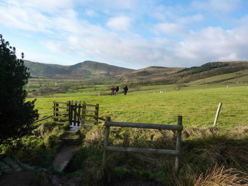
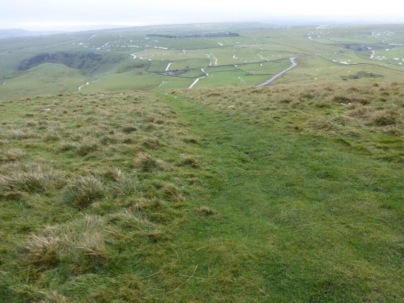
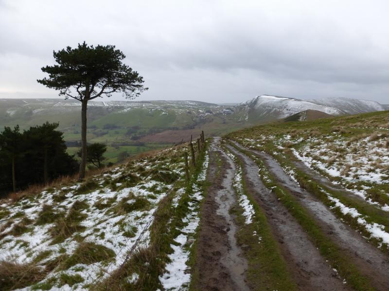
(1) Walk out of the back of the Visitor Centre car park following the stream along a path which becomes a minor road. At the first junction go left which is Hollowford Road. Follow this, ignoring the path which soon forks off left, until a fork is reached at the Training and Conference Centre. Go right here, heading roughly NE on a stony track. When the track swings left, almost due N, go straight on across a grassy field. There is a sign post but it is not very obvious. On the far side of the field, a small stream is crossed and one soon emerges on a lane. Follow this for about 150 m until a sign post indicates a path on the left going NNW. Follow the path, on the left, W, of a stream. The path can be boggy in places. After about 600 m, the path makes a right turn and heads roughly E, initially below a wall. After about 450 m, a path goes left, N, to avoid Losehill Farm. This climbs to soon reach a good grassy track. Turn left, uphill and NNW, on to the track and follow it up the SE flank of Lose Hill. Higher up, it merges with another track coming from Townhead Bridge in lower Edale. The higher part of the track/path is slabbed. Within 500 m, reach the summit of Lose Hill which is a splendid viewpoint. There is a small grassy hollow on the E side of the summit which can give shelter from strong westerly winds.
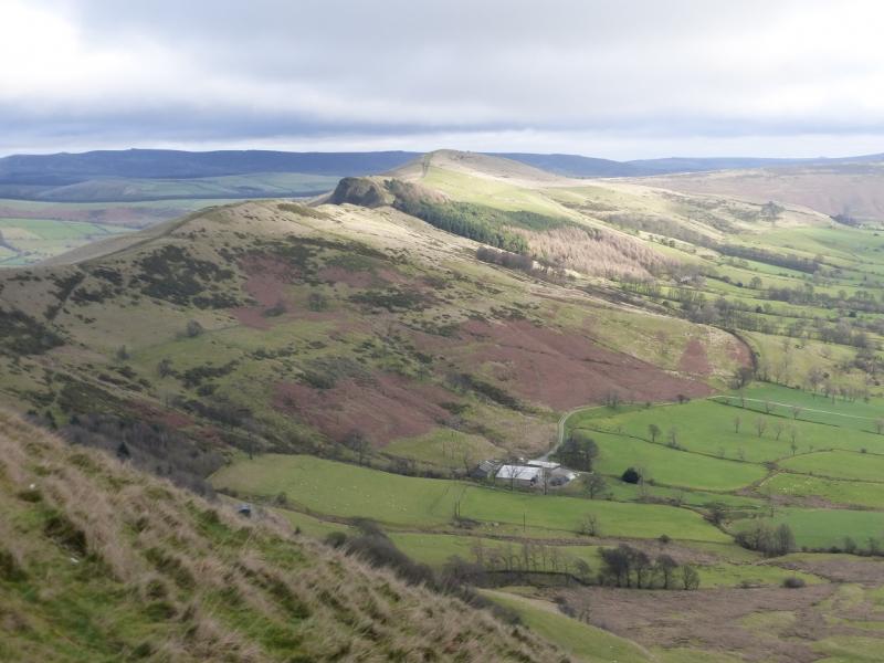
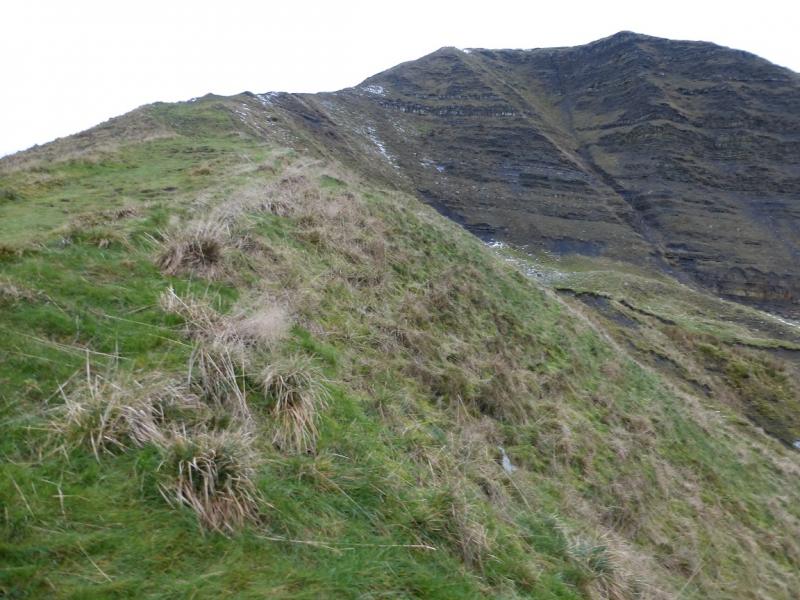
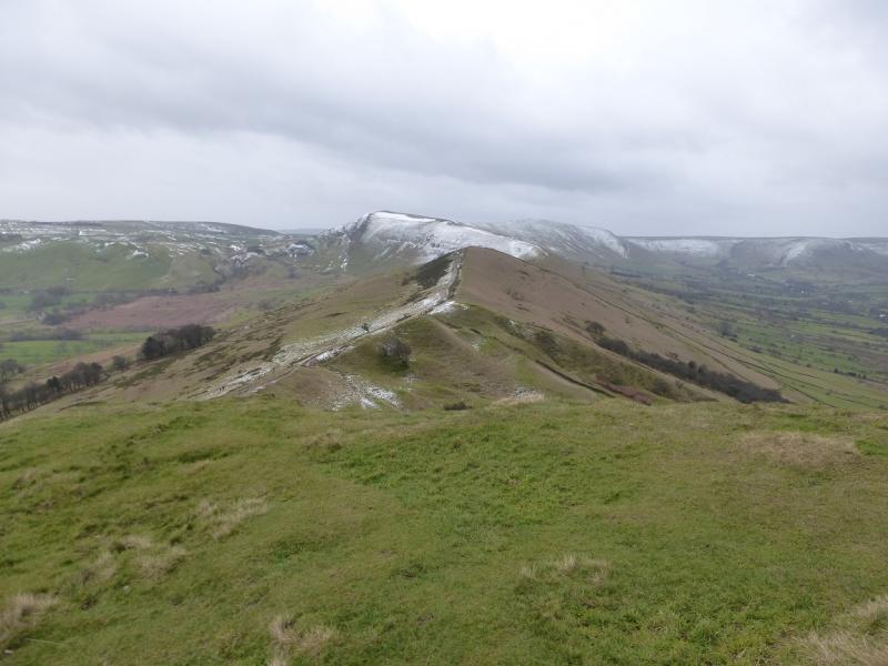
(2) Descend, roughly SW, on the obvious path which soon follows a wall. A shallow dip is reached followed by a short ascent to reach the top of Back Tor which is slightly to the N of the path.
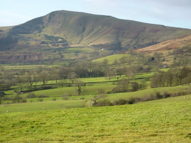
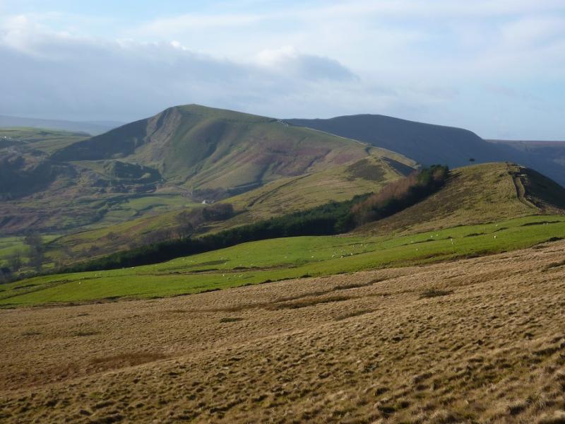
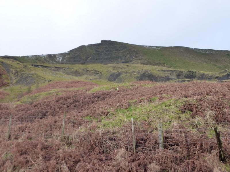
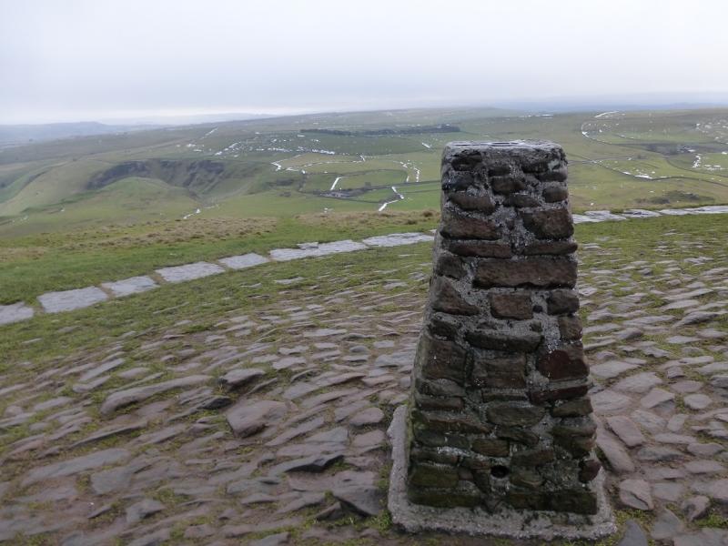
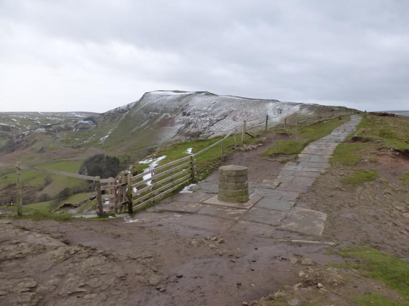
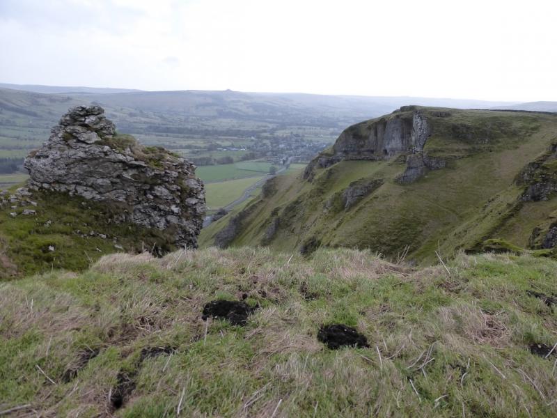
(3) Retrace to the path and follow it down into a deeper hollow. Note that to the right of the path, Back Tor has a cliff which is well worth looking back to. Continue along the crest, on the obvious path. Pass over a minor top before descending into a shallow dip known as Hollin's Cross which is another good viewpoint. Continue along the crest, gradually ascending until the trig point which marks the summit of Mam Tor is reached. This is the highest point of the walk and the best viewpoint. The path is slabbed on the summit of Mam Tor.
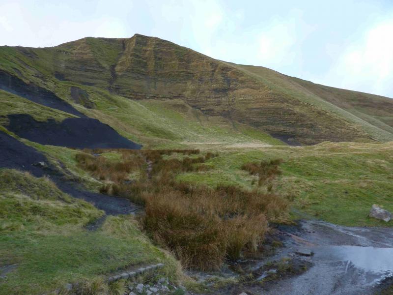
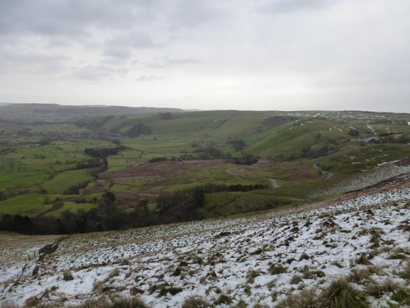
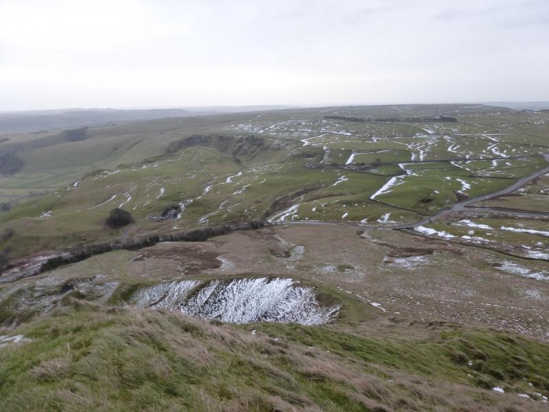
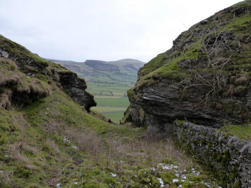
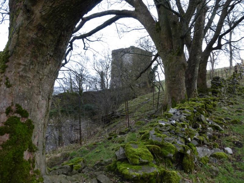
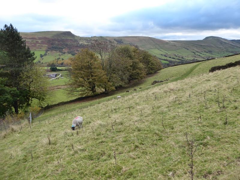
(4) From the trig point, descend SE, almost at right angles to the slabbed path on an obvious grassy path which soon becomes a ridge down the south side of the “corrie” on Mam Tor. The path can be greasy and slippery but there are no technical difficulties. Continue down to reach a small wood just before the old landslipped road. Go left here and walk around the wood to reach the old road. Turn right and follow the road uphill for about 200 m to reach the Blue John Show Cave. Walk to the cave shop/cafe then go right to a gate and follow a grassy path, mainly S, towards Winnats Head Farm. At the farm, go left until a pedestrian gate is reached on to the Winnats Pass road. Cross diagonally and follow a faint path which slants up on to the S side of Winnats Pass. Follow the path, with a wall on the right, past some interesting rock formations. Continue along Long Cliff until a deep gully is approached. The path is fainter here but the wall goes into the top of the gully although the ground can be quite greasy. At the top of the gully, a short wall has to be climbed over. Climb out of the gully on a slightly more obvious path. Soon leave the main wall and follow a broken wall (little remains of it). This heads towards a broader grassy gully but there is a path to the right which avoids any descent and re-ascent. Follow this path which soon joins a more prominent grassy path which descends gently across the side of the hill towards a wood, beyond which is Peveril Castle. A gully/gorge blocks access to the castle but one gets within about 20 m of it. Go left, downhill, and follow a path, roughly W, by the edge of a wood which leads down to a bridleway which leads to a road back into Castleton close to the main car park.
Notes
(a) This walk took place on 11th January, 2015.
Photos - Hover over photo for caption. Click on to enlarge. Click on again to reduce.