Get Lost Mountaineering
You are here: Scotland » 03 North-west Argyll, Appin and Glencoe » Glencoe
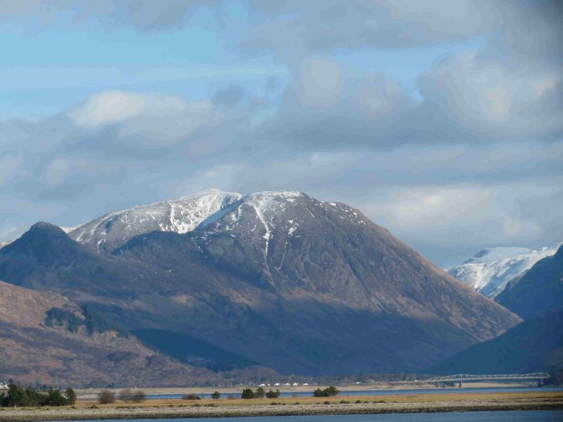
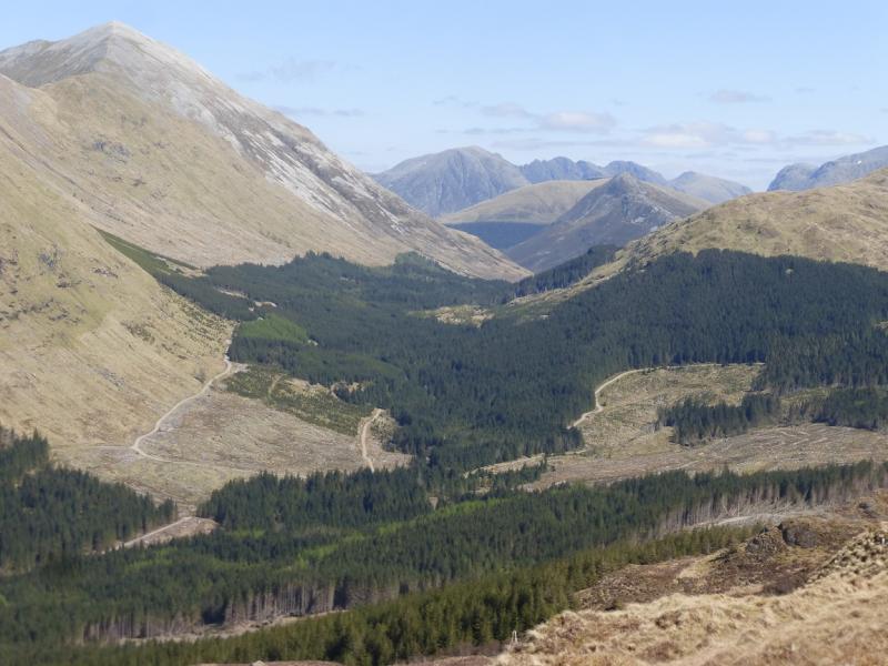
Aonach Eagach & Pap of Glencoe
Aonach Eagach and Pap of Glencoe from Glencoe Village Car Park
Start/Finish
Glencoe village car park next to the mountain rescue post where the Glenoce road meets the A82. There is free parking all day but spaces are limited. Catch the bus to the top of Glencoe where there is a small car park on the left about 300 m before the white cottage of Allt na-reigh. On 4.9.10, the bus stopped at Glencoe at 9.30 am and the fare was an extortionate £6.
Distance/Time
12 km Approx 8 hours
Peaks
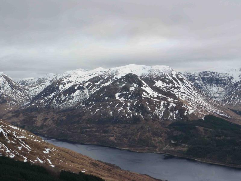
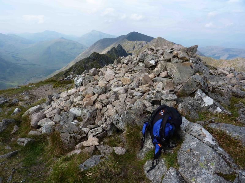
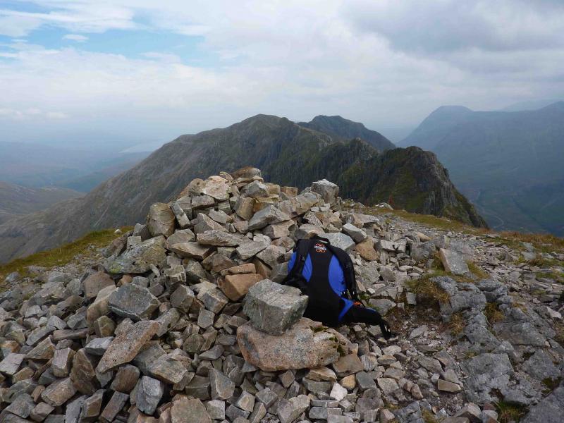
Am Bodach, 943 m, NN 168 580.
Meall Dearg, 953 m, NN 161 584.
Stob Coire Leith, 940 m, NN 149 584.
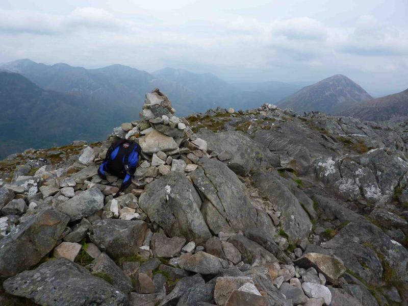
Sgorr nam Fiannaich, 967 m, NN 140 583.
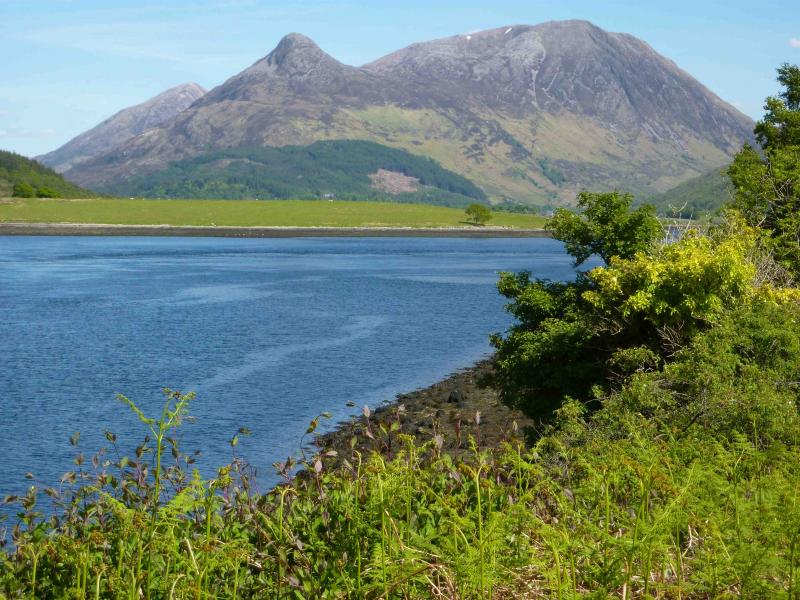
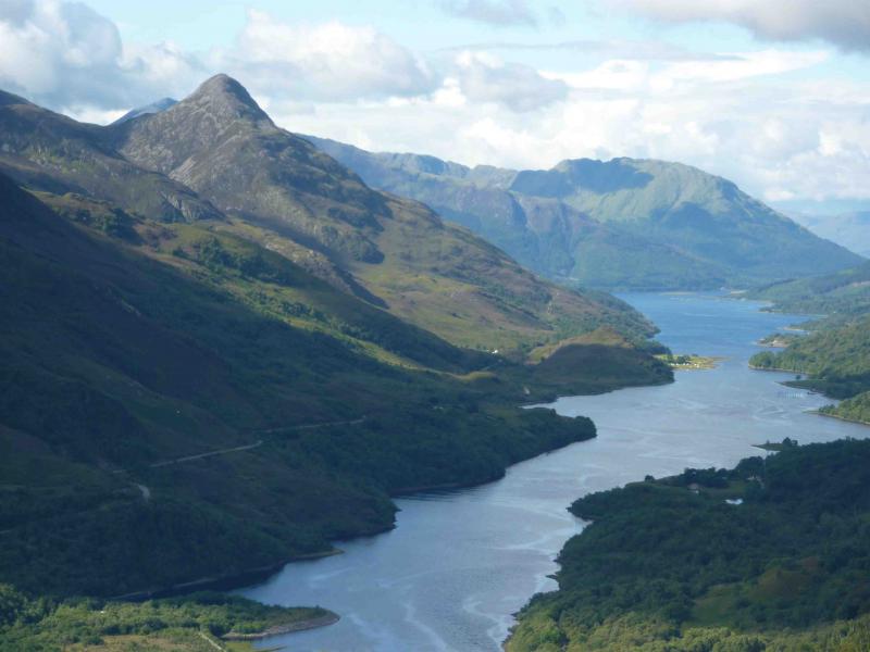
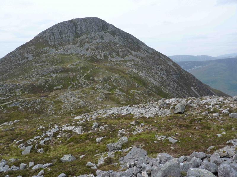
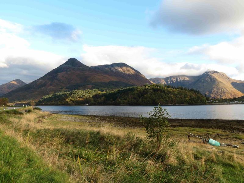
Pap of Glencoe, 742 m, NN 125 594. OS Sheet 41.
Introduction
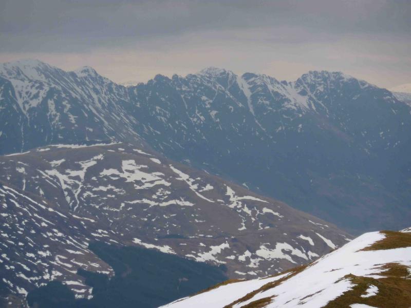
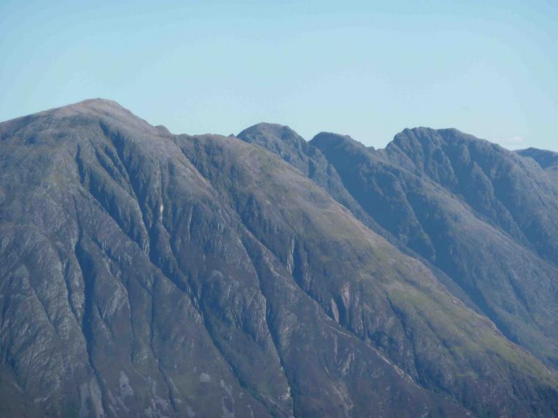
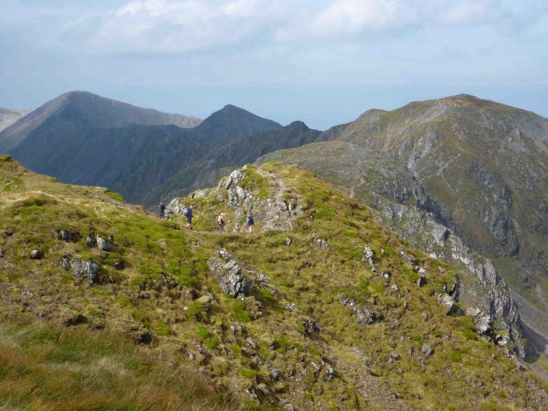
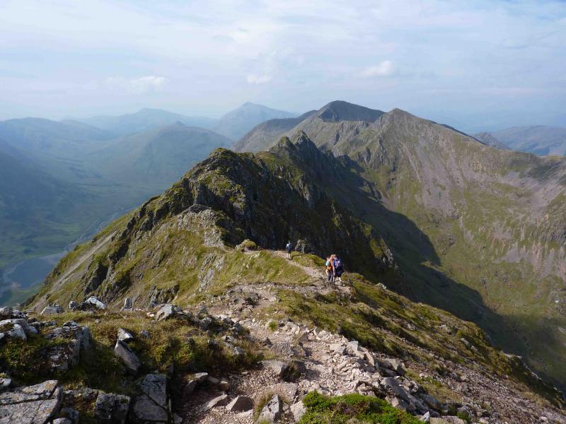
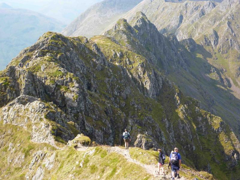
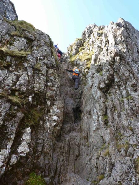
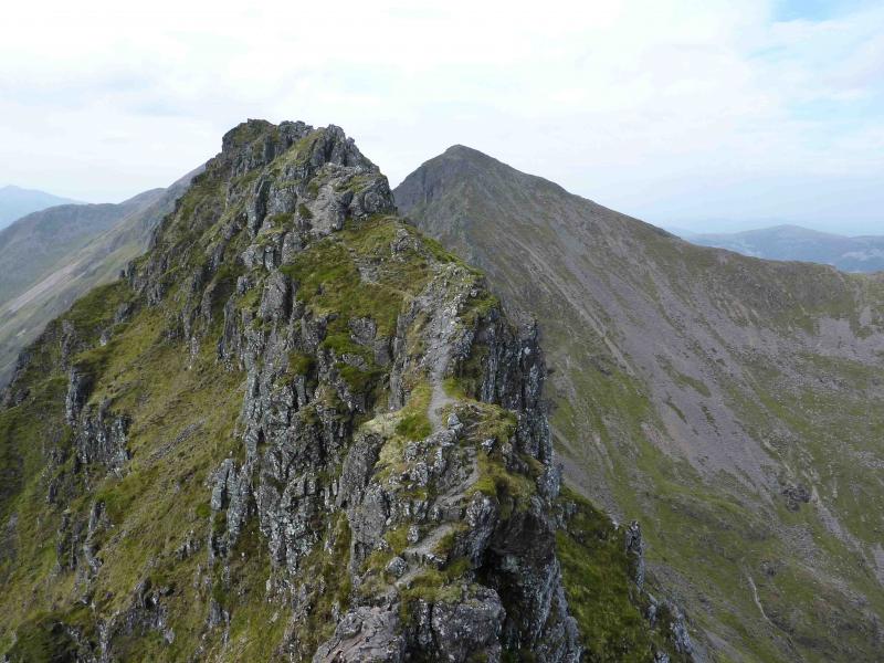
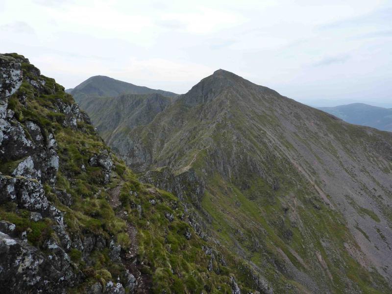
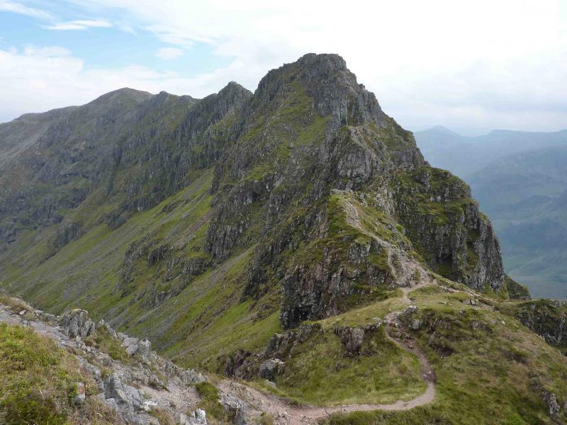
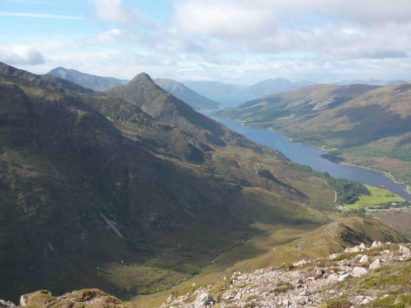
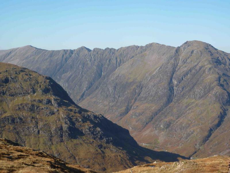
The Aonach Eagach is, arguably, Scotland’s finest mainland ridge. There are superb views to Ben Nevis, the Mamores, the other Glencoe peaks and across Loch Linnhe. Parts of this route involve tough and exposed scrambling, both up and down, but should be within the scope of an experienced scrambler on a dry summer’s day. If the rock is wet, parts of the route can become lethal. There are two tricky sections. The first is the descent from Am Bodach to its W bealach. The much longer second is from Meall Dearg over a series of exposed pinnacles to its W bealach. The rest of the route is little more than a walk.
Route
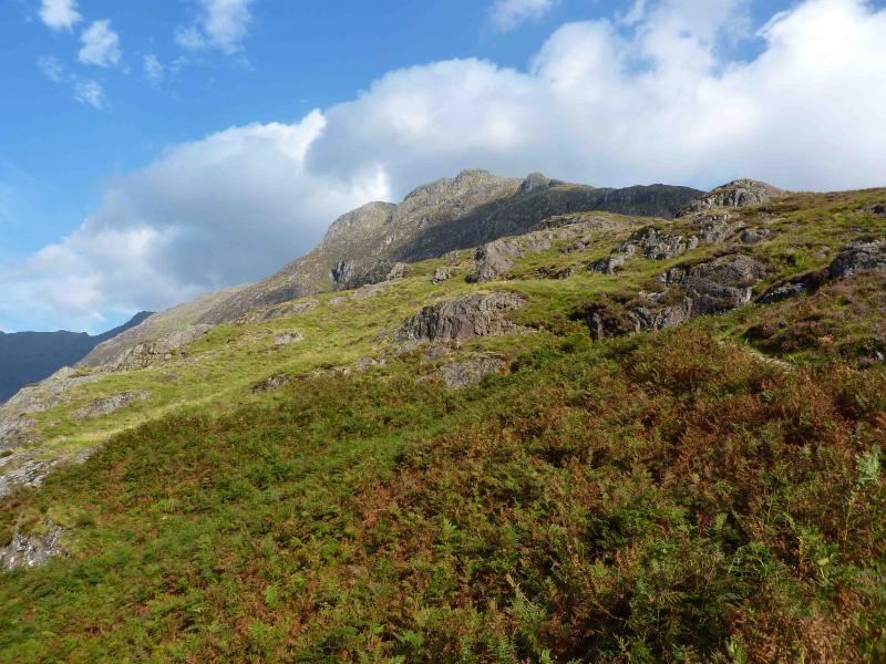
(1) Follow the obvious path out of the car park. This path has been improved in recent years and leads easily up some steep and rocky ground, with scrambles available, to level out at a medium cairn. About 100 m further is the large summit cairn of Am Bodach, 943 m.
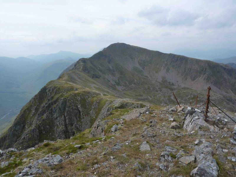
(2) Descend W along a narrow ridge and quickly reach a “bad step” which is an easy scramble down when dry. A short distance further is a larger “bad step” involving some down climbing with traverses on narrow exposed ledges. In the dry this is relatively straight forward with good holds. The rest of this section of ridge is little more than a walk, apart from one slightly awkward slabby descent, to reach the large summit cairn of Meall Dearg, 953 m.
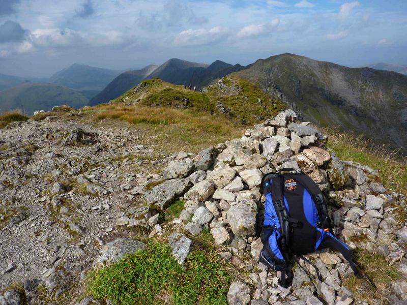
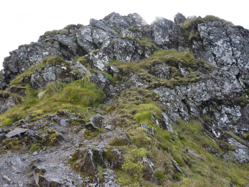
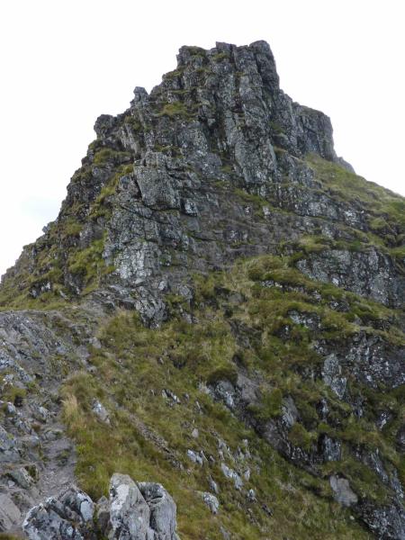
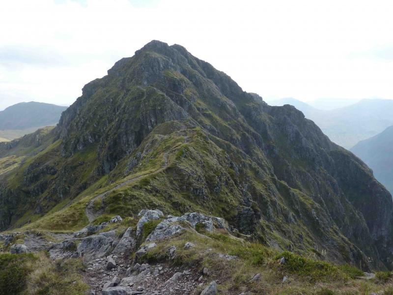
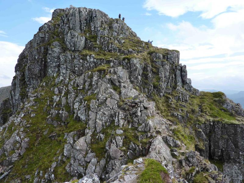
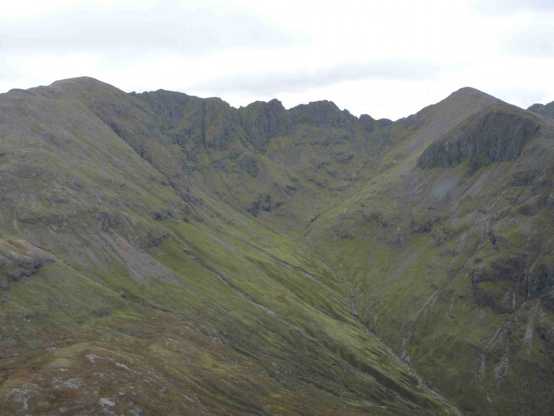
(3) The next section of ridge to the bealach involves hard and sustained scrambling. There is a lot of up and down climbing, on excellent rock when dry but lethal when wet, involving gullies, chimneys and slabs with a few pinnacles which have to be climbed over or around. One rocky chimney looks difficult on approach but is actually a delight to climb with excellent and plentiful holds. Try to stay on the crest although there are sometimes avoiding paths around the pinnacles. There is one pinnacle with an apparent avoiding path which drops well below the crest on the right (N). This particular avoiding path should not be used as it is loose and seems much harder than the crest. At the bealach, all difficulties end and a good path can be followed steeply up to the large cairn of Stob Coire Leith, 940 m.
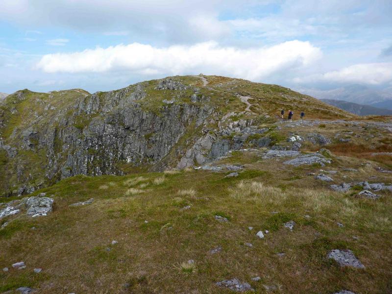
(4) Continue along the fairly level ridge to the large shelter cairn of Sgorr nam Fiannaich inside which is the remains of an old trig point.
(5) Descend W on gentle slopes following a path which soon becomes several paths. Take the path closest to the right hand (N) edge and follow it a long way down to the bealach below (S) the Pap of Glencoe. There is a minor ridge just before the bealach which can either be crossed or traversed on its left (W). Follow the very distinct path up the Pap which goes a long way right before cutting back left to the top of scramble easily, and more directly, up the rocks above to reach the large summit cairn of the Pap of Glencoe otherwise known as Sgurr na Ciche.
(6) From the summit cairn, walk W to another cairn and follow a faint path, initially W, down some way before it cuts back to the main ascent path. Either follow the main path down to the road or follow a minor path, encountered first, which heads more directly towards the village of Glencoe. The minor path is easily followed and lower down goes across soft, but not boggy, peaty ground which is easy on the feet. This path heads for an obvious track which is clearly visible below on a clear day. As the path nears this track, it becomes steeper for a short distance before reaching the end of the track at a small water catchment plant. Follow the track down to the road. Turn right and soon walk through Glencoe village and back to the car park.
Notes
(a) This walk took place on 22nd August, 1996 and 4th September, 2010.
Photos - Hover over photo for caption. Click on to enlarge. Click on again to reduce.