Get Lost Mountaineering
You are here: England » Peak District » Black Hill, Lad's Leap, Laddow, Longdendale, Ravenstones & Dovestone Reservoir
Raven Stones, Ashway Edge & Dovestone Edge from Binn Green
Raven Stones, Ashway Edge & Dovestone Edge from Binn Green
Start/Finish
Public car park at Binn Green, SE 017 044, which is off the the A635 Mossley to Holmfirth road above Dovestones Reservoir. This is signed as a Pay and Display car park but, on 19/4/15, there were no machines to pay! Binn Green is signed on the A635. If coming from Mossley, do not take the turning for Dovestones Reservoir. Binn Green is further towards Holmfirth. There are toilets in Binn Green car park which do not have water or electricity and are best described as “ecological”!
Distance/Time
15 km About 4 hours
Peaks
There are no peaks on this route as it is mainly on edges. Ravenstones Edge is about 470 m, the cross above Ashway Rocks is also about 470 m, the memorial cairn on Fox Stone is about 460 m and Chew Reservoir dam is about 480 m. OS Outdoor Leisure 1: Dark Peak.
Introduction
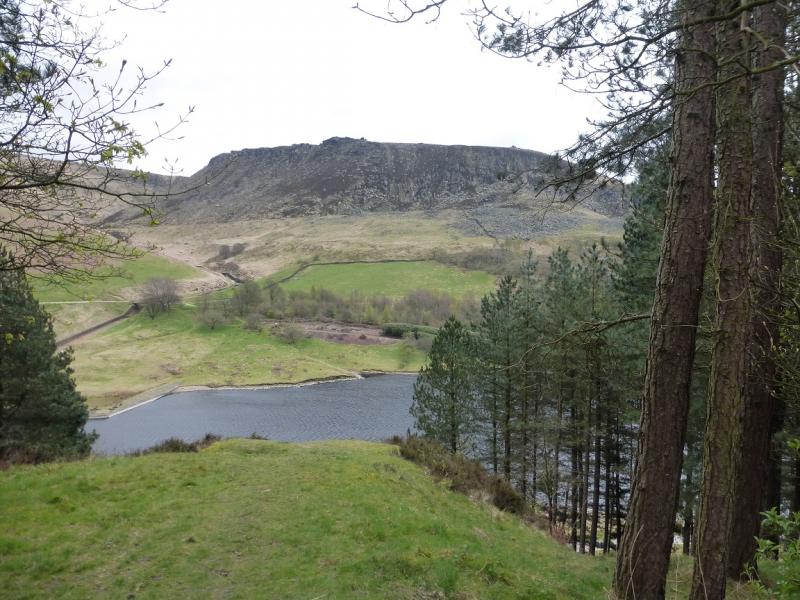
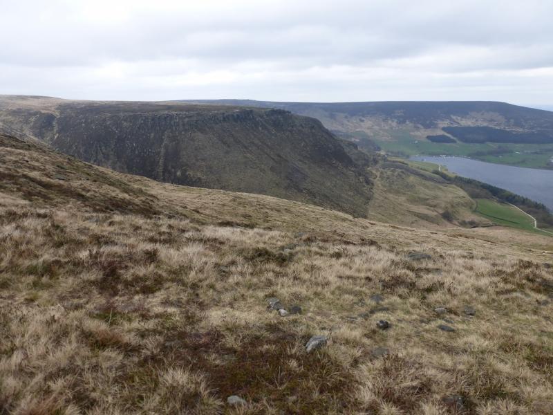
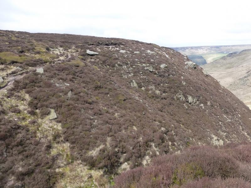
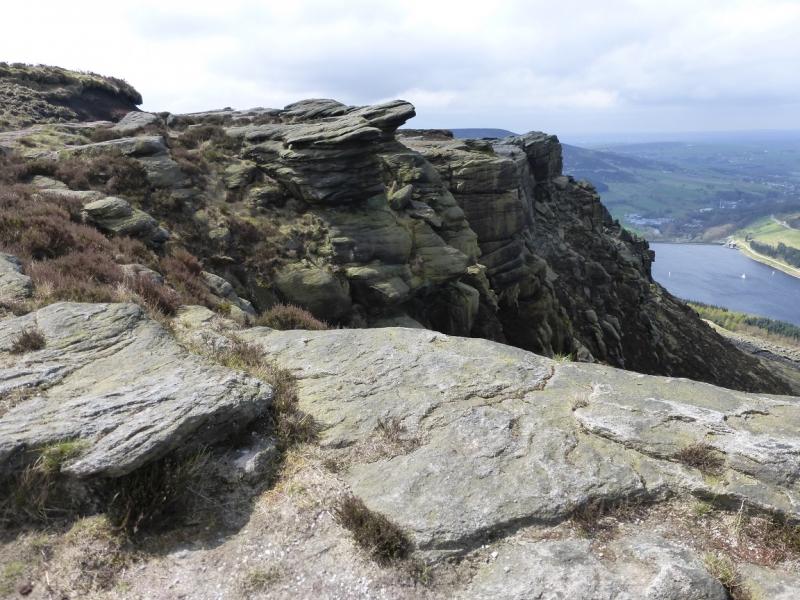
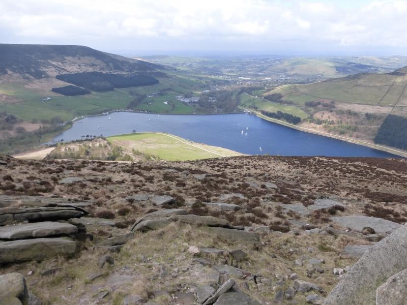
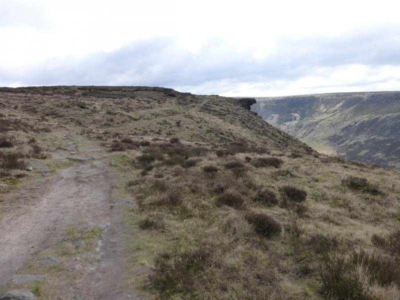
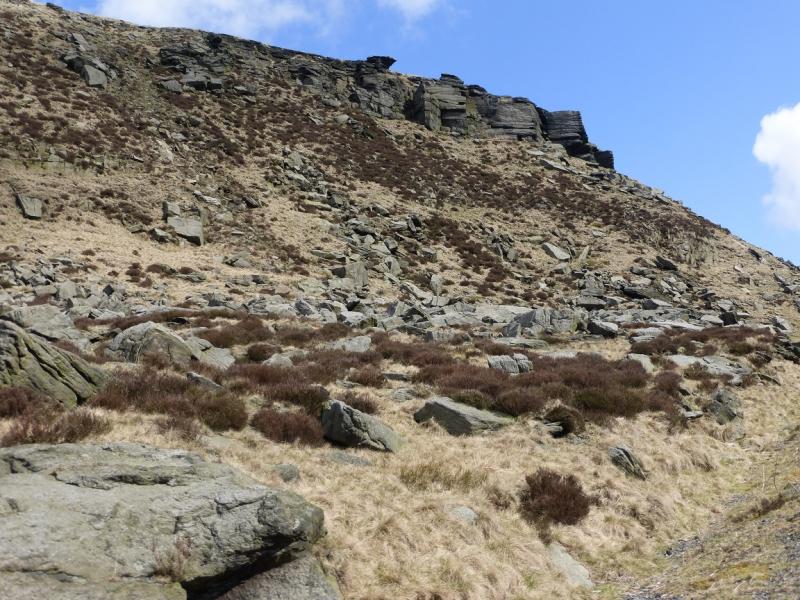
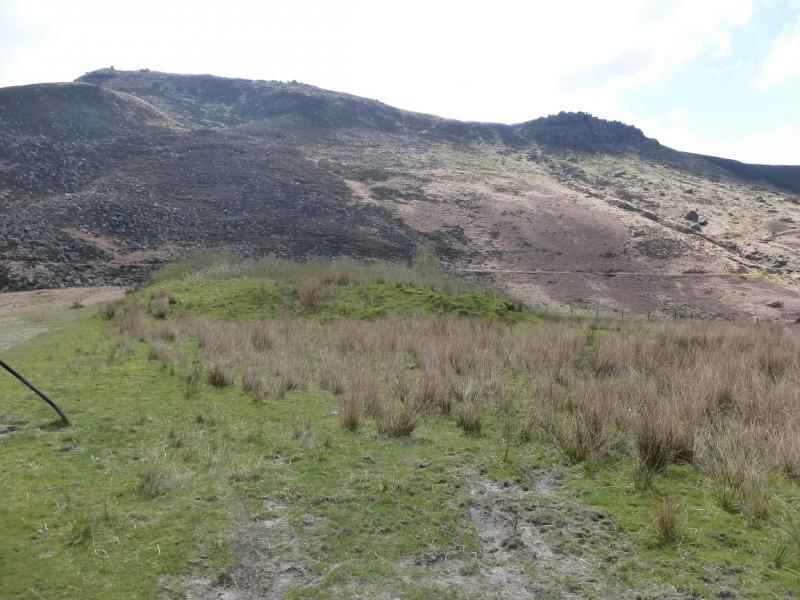
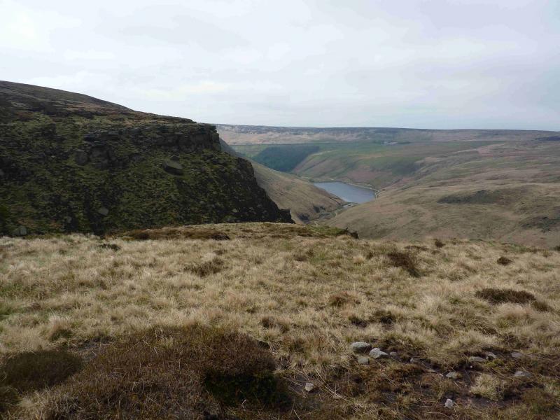
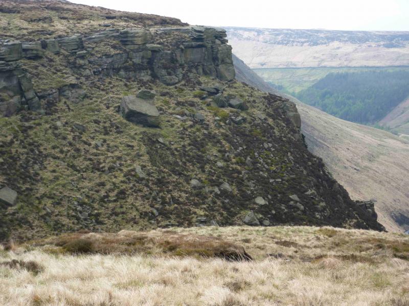
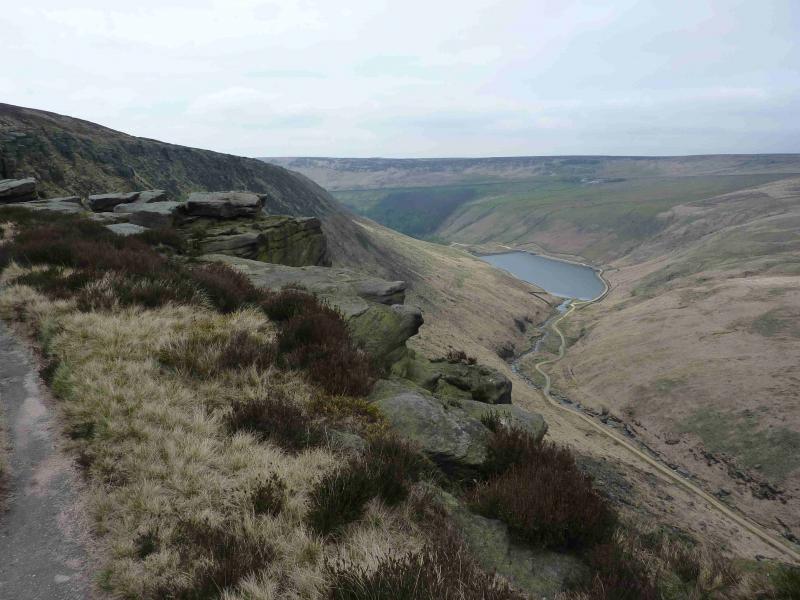
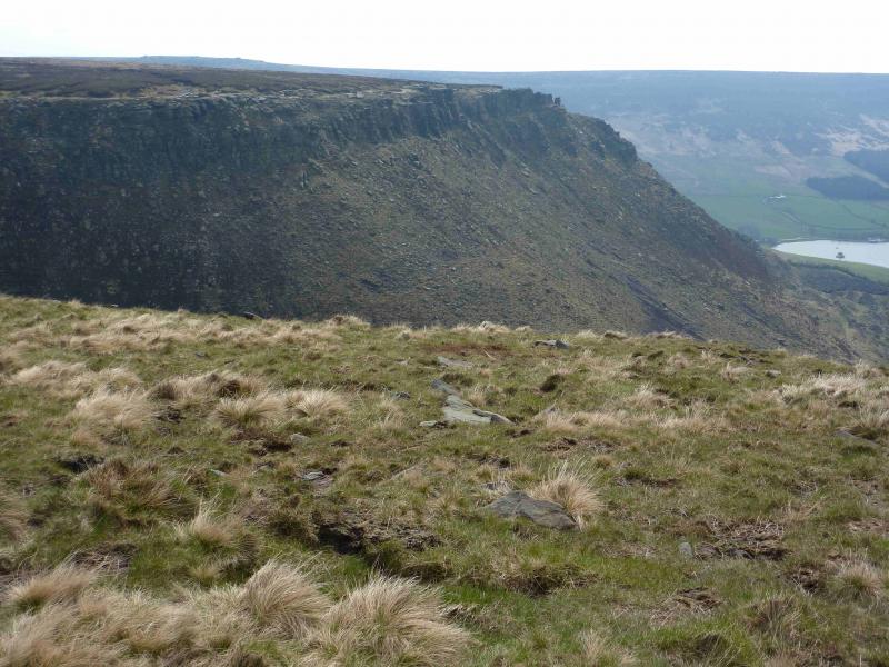
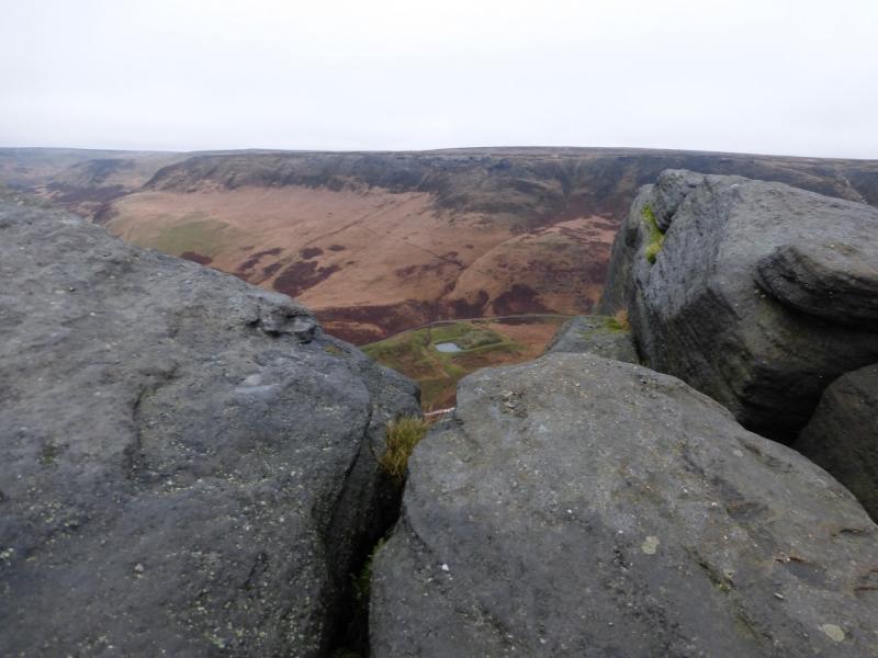
This is a fine and short ridge walk, which is a touch rugged in a few places, in the Dark Peak. In good weather there are good views of the surrounding Pennine Moors. The best views are around the Raven Stones area and the continuation of the edge to the S with rocky edges, deep valleys and scenic reservoirs. Some of the going is boggy, even in a dry spell, and gaiters are strongly recommended. The ascent of Birchin Clough is rocky in places but hardly merits being called a scramble. Some streams have to be crossed and these are usually straightforward except, perhaps, after heavy rain. There is a path, with several alternatives, along the edges.
Route
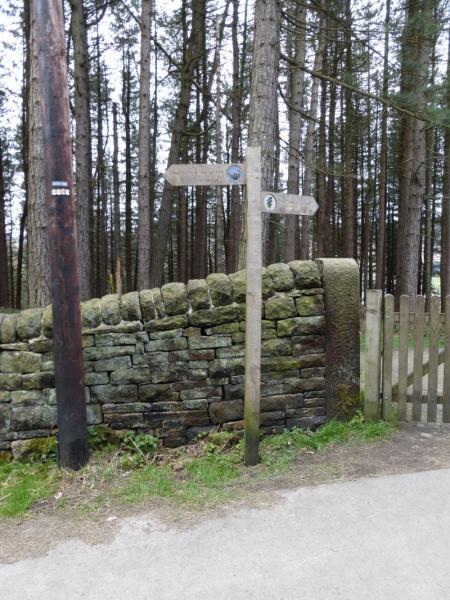
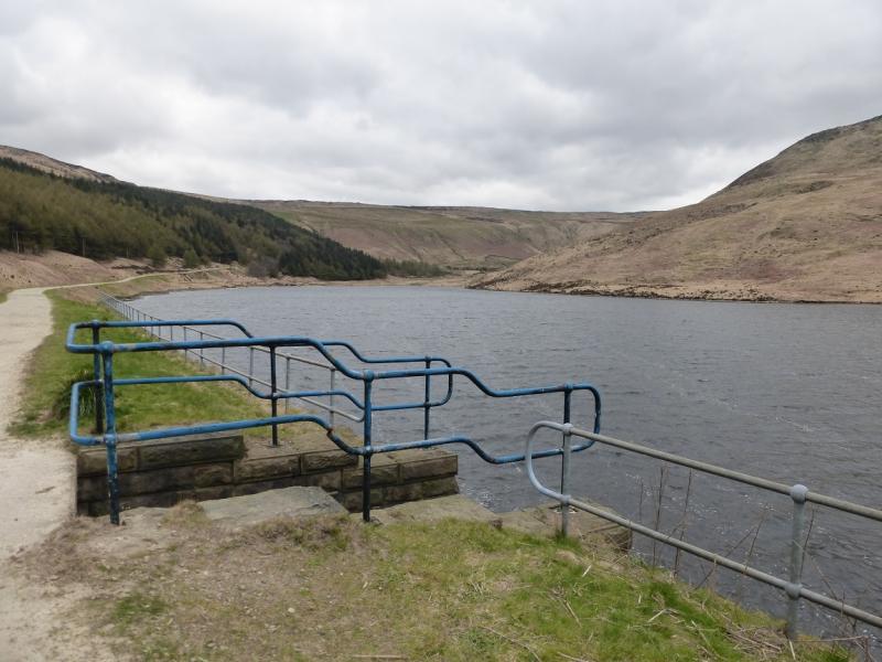
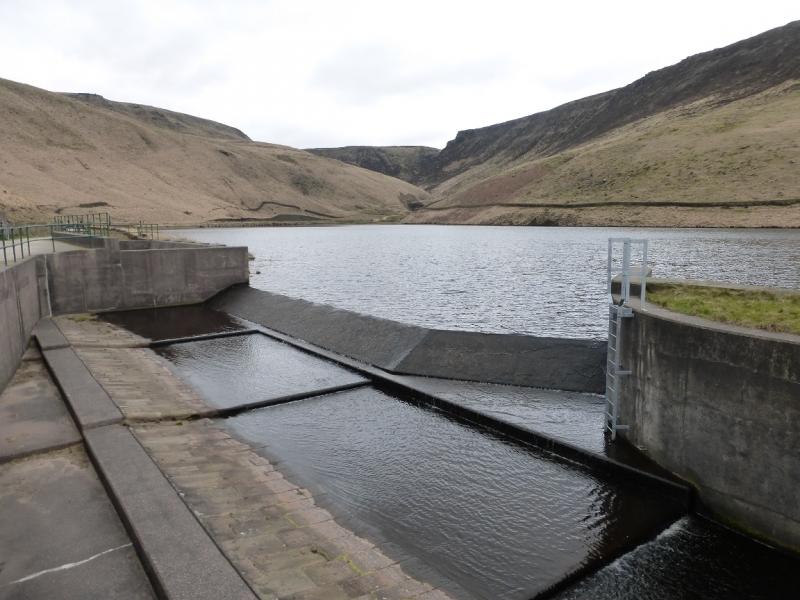
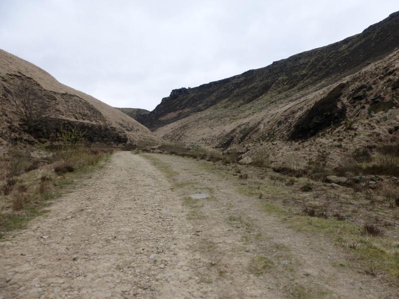
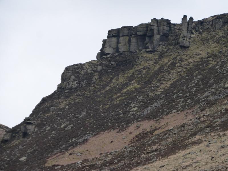
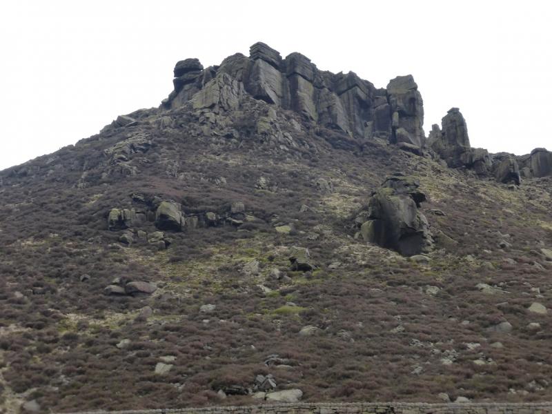
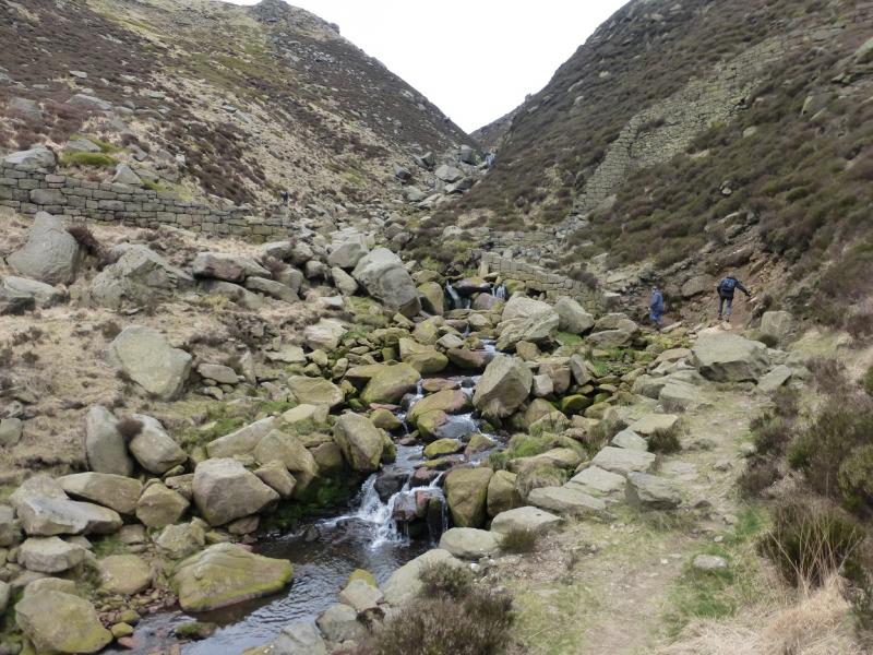
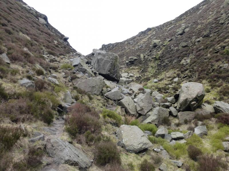
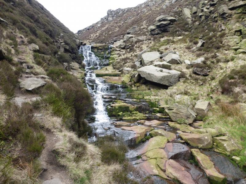
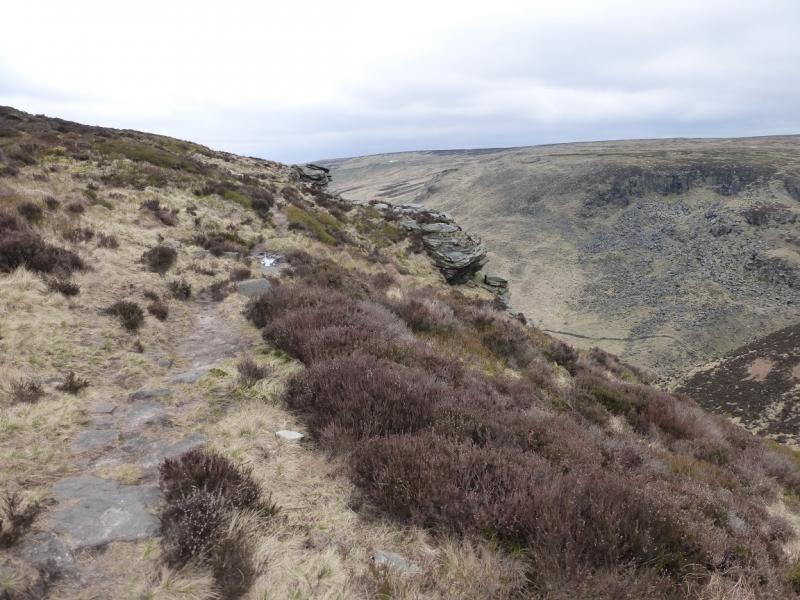
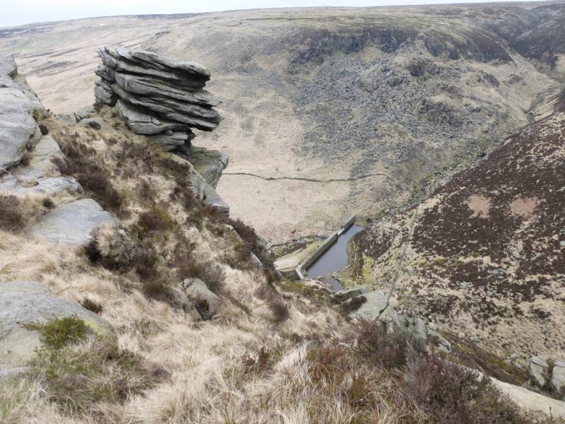
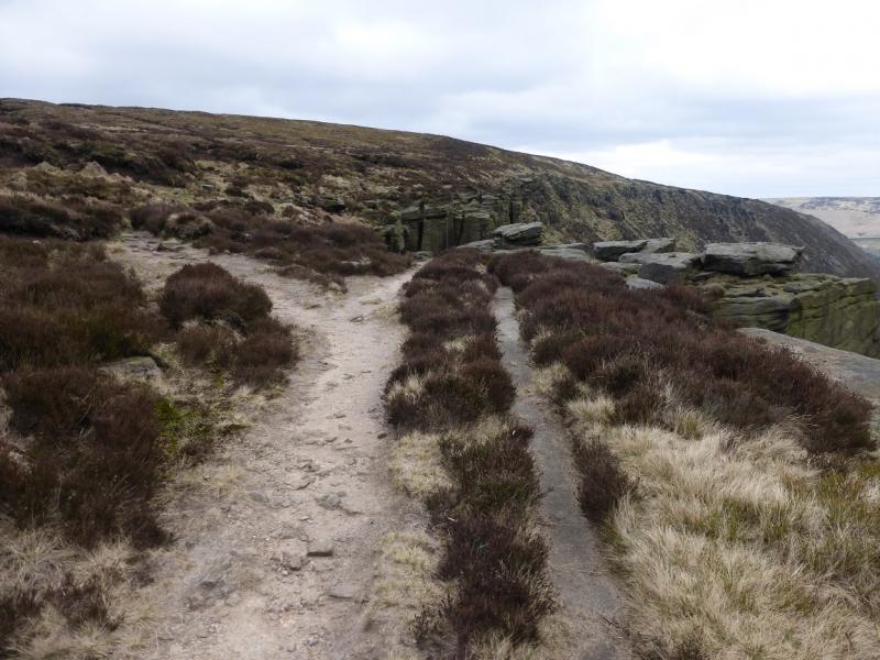
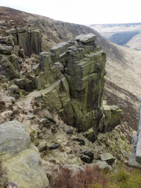
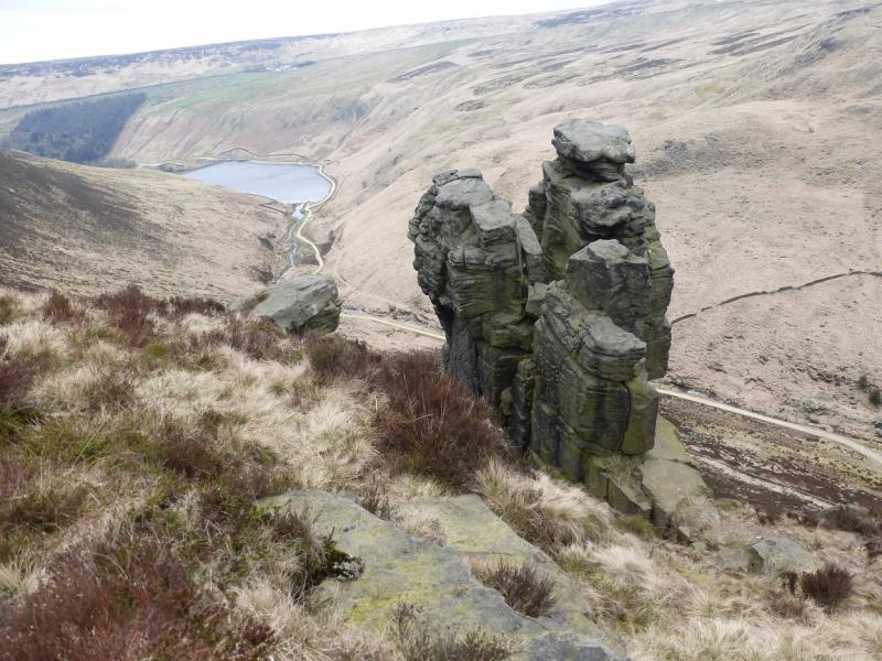
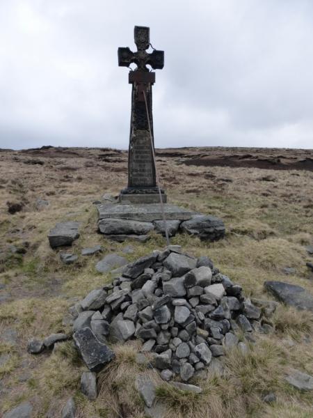
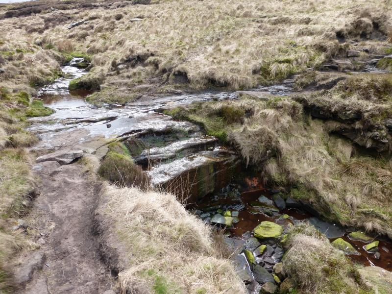
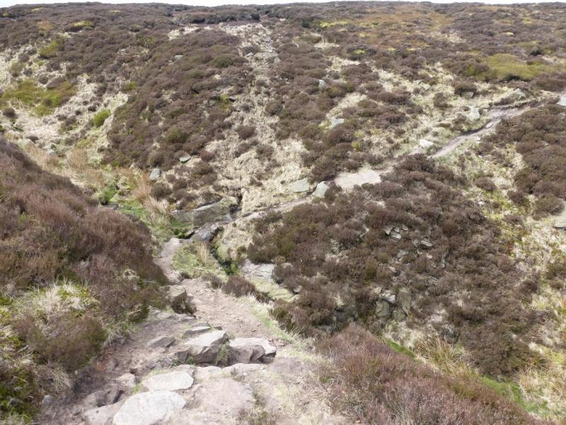
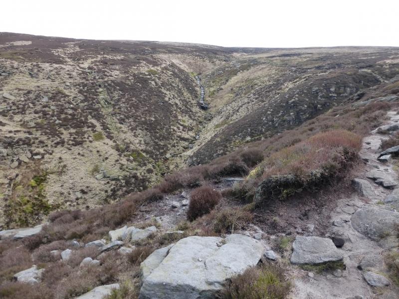
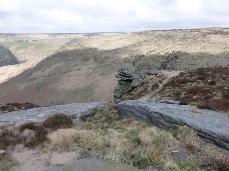
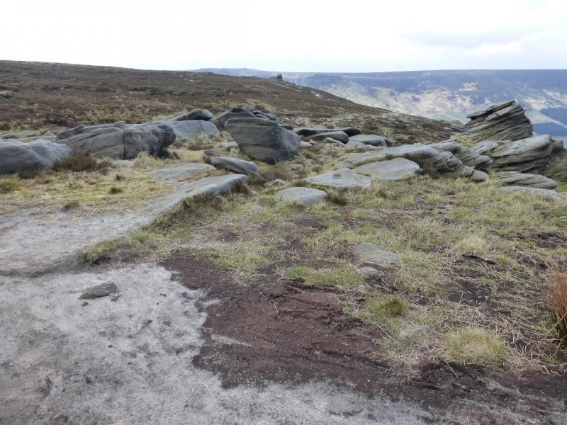
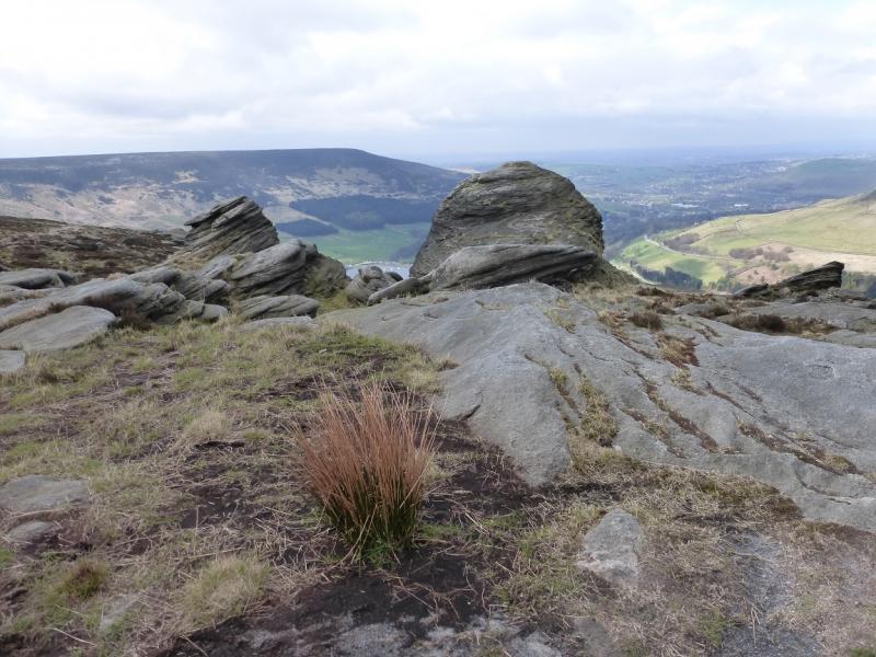
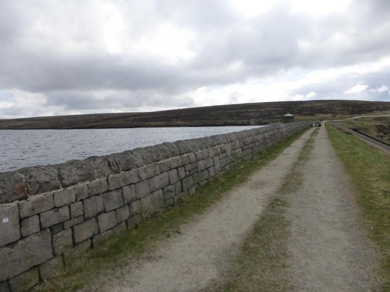
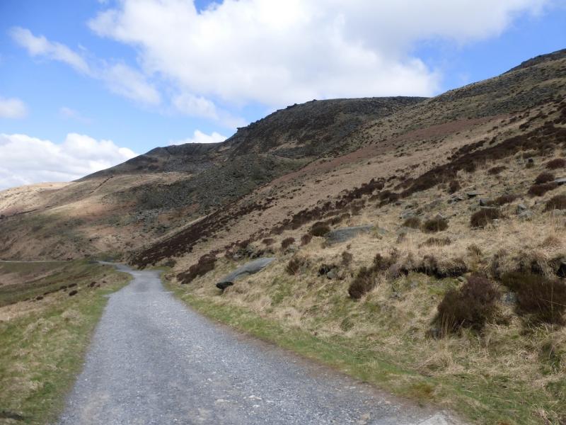
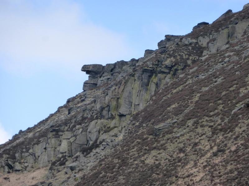
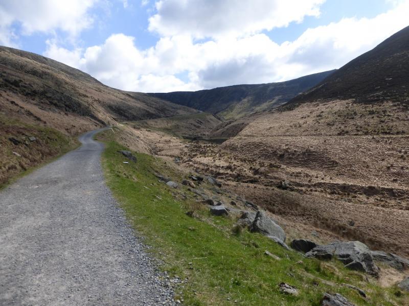
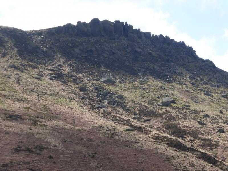
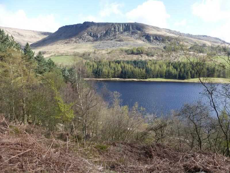
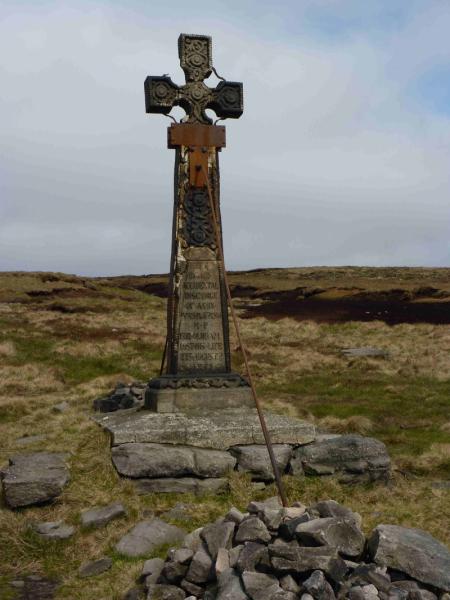
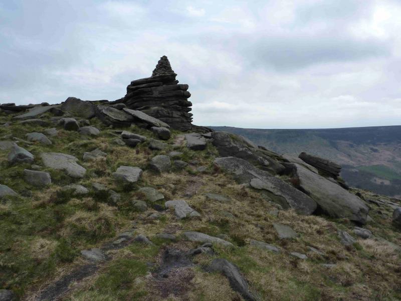
(1) Take the signed path from the car park which initially shadows the road and descends to a minor road. Turn left and walk down the road to the dam at the S end of Yeoman Hey Reservoir. Continue along the good track on the left, W, of the reservoir to reach the dam at the W end of Greenfield Reservoir. Continue on the track on the left, N, of the reservoir and follow it to the weir at its inflow then continue up, on the N side of Greenfield Brook, to reach the weir at the foot of Birchin Clough which goes S from here. Follow the path up the right, W, side of Birchen Clough but cross over the stream as soon as possible to follow the path on the E side. The further one goes on the W side, the rockier it gets. There is one short rock step on the E side higher up. Pass some pleasant waterfalls, after which, the clough levels out. Look for a path, after passing the rocky areas, which cuts back on the W side of the stream. This can be difficult to spot and is more obvious when looking back which means you have passed it! If you reach a minor stream on the right, you have gone too far! Follow the path up on to the edge where the path is well defined. Continue along the edge, roughly NW, and pass various rocky outcrops on the edge. The most famous of these is The Trinnacle which is a sort of triple pinnacle. Continue W, along the path. Once past the rocks, the path drifts away from the edge. Follow it until it starts to curve around towards the S and reach another path crossing it which goes uphill. Take this path and make the short ascent to a higher edge and soon reach the large memorial cross to the victim of a shooting accident. Continue along the path for about another 500 m where the path cuts into a prominent gully, known as Ashway Gap. crossing a stream on slabs, before coming out again.
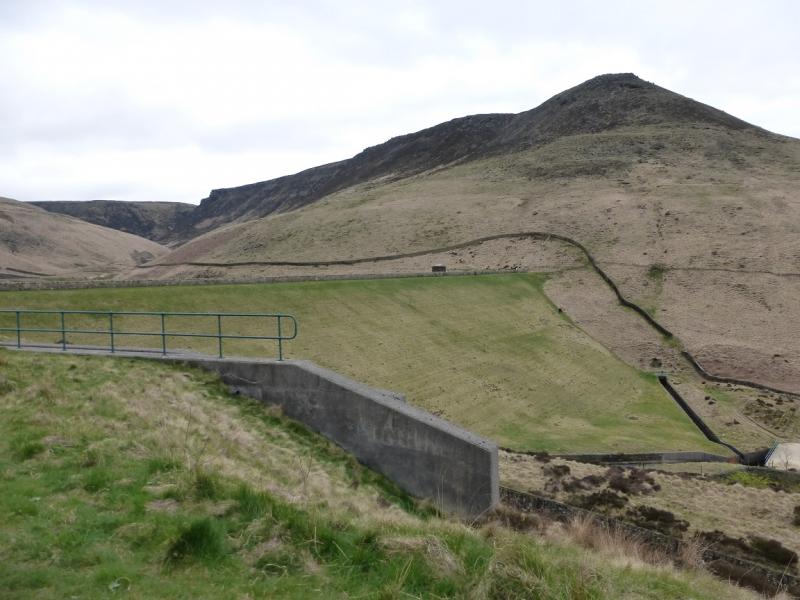
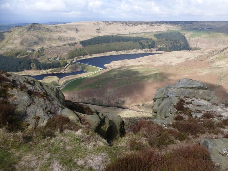
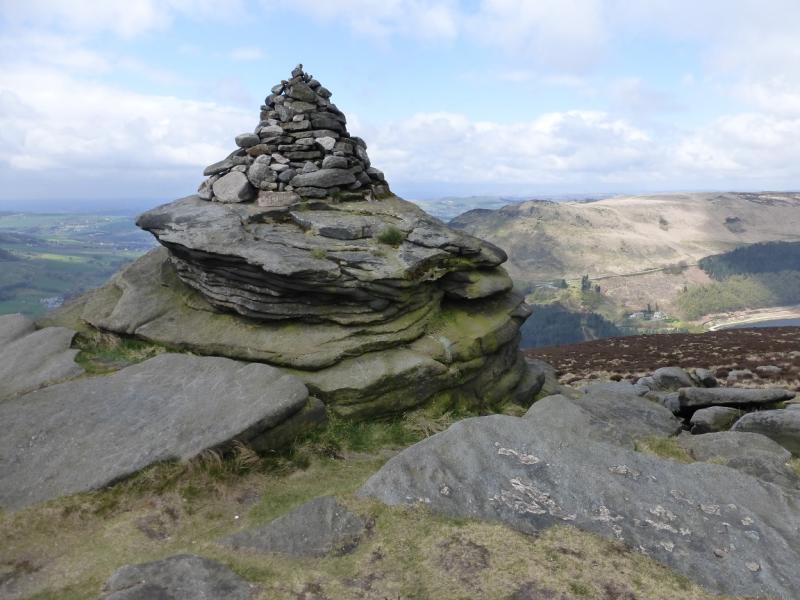
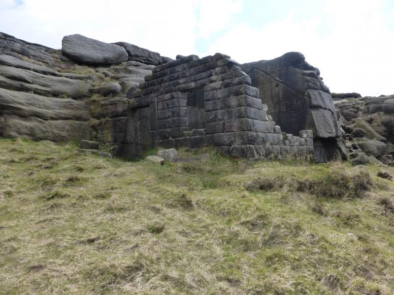
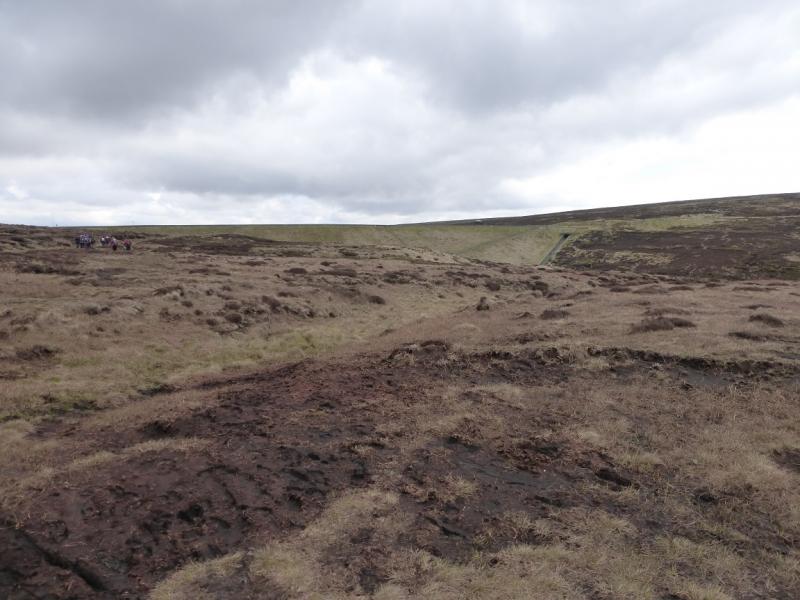
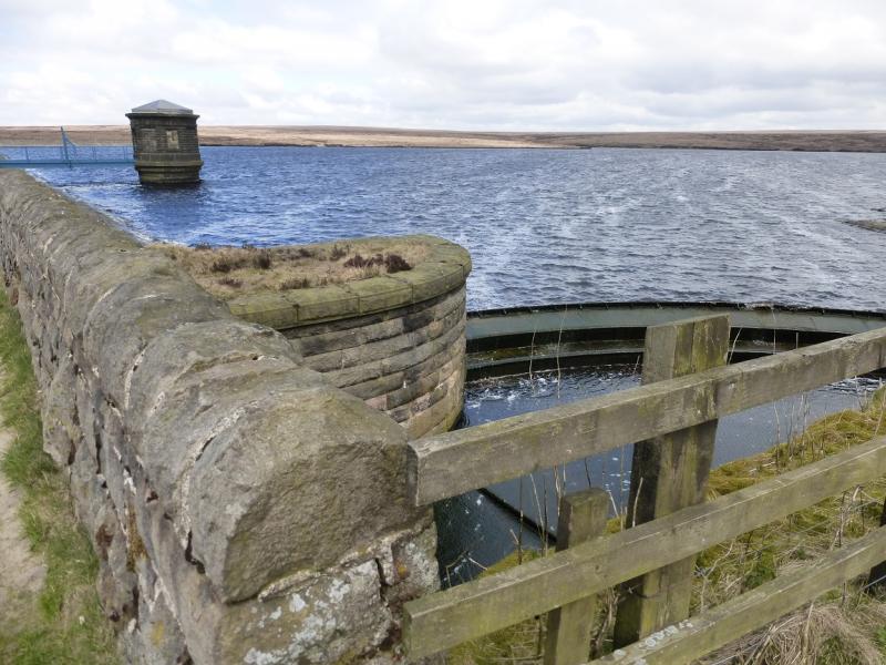
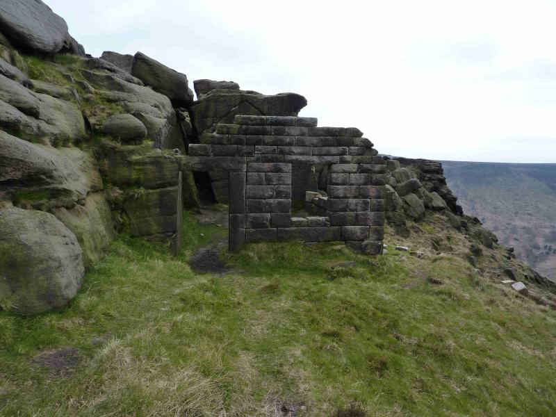
(2) Continue along the edge, W then S, soon crossing a minor stream which flows down Ashway Gap, then passing a pointed memorial cairn (to two climbers) on an outcrop known as the Fox Stone. Continue to an unusual 2 sided derelict stone hut with the other 2 sides being the vertical sides of an outcrop. Further on, about 1.8 km, the edge cuts in again with a very prominent gully. If clear, a road will be seen ascending up this gully. The path has now left the edge and heading roughly NE. It is still distinctive but quite boggy in places. If clear, a building will be seen which is in Chew reservoir. Continue. The path eventually climbs up the side of Chew dam on to the track crossing the dam. Turn right and head for the “building” end (S) to reach the top of the road seen earlier.
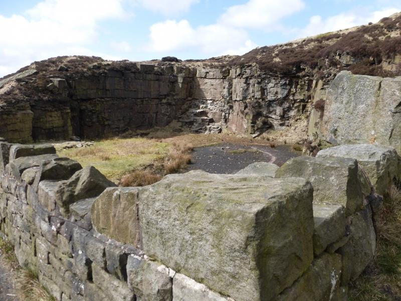
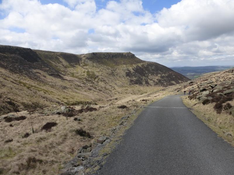
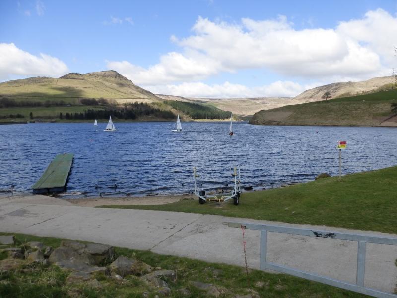
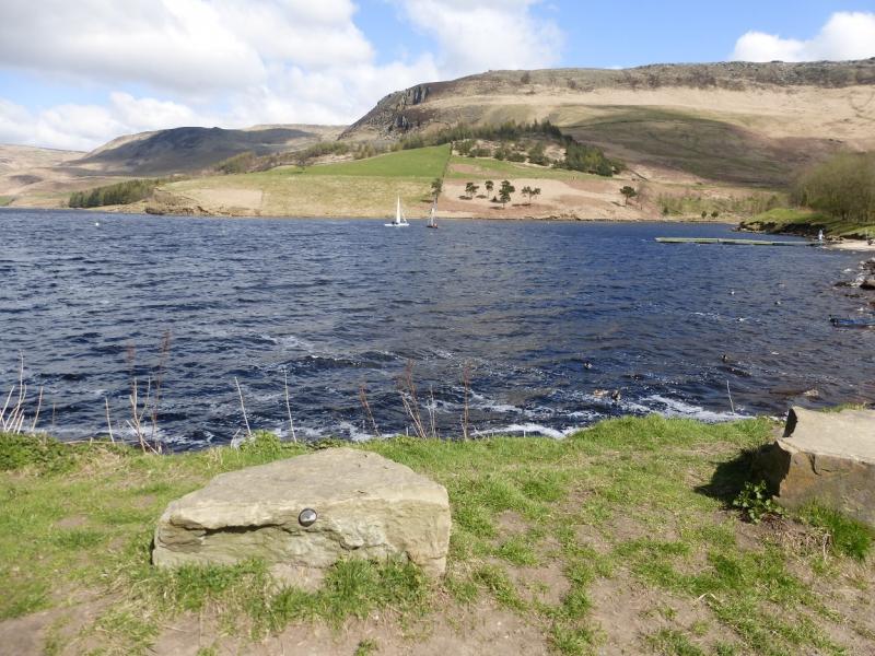
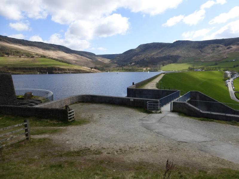
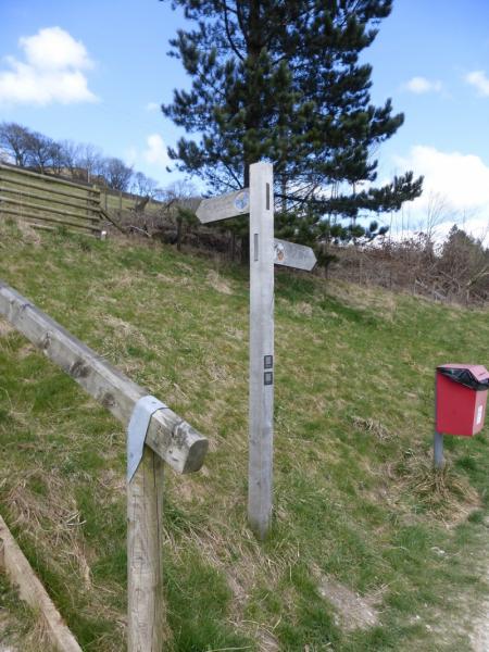
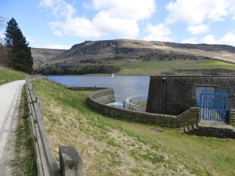
(3) Descend down the reservoir access road known as Chew Road. It is tarmac most of the way. Soon pass a disused quarry which can offer some shelter for a lunch stop. At the foot of Chew Brook, the track splits. Go left, along the S side of Dovestones Reservoir. Pass the Sailing Club then walk N along the dam. At the far end, pick up the track going along the N side of the reservoir. Follow this to a sign post which points uphill to return to Binn Green. Follow this path up and across to reach the minor road below Binn Green. Cross over and take the outward path back to the car park.
Notes
(a) This walk took place on 19th April, 2015.
Photos - Hover over photo for caption. Click on to enlarge. Click on again to reduce.