Get Lost Mountaineering
You are here: Scotland » 11 Kintail and Glen Affric to Loch Ness » Glen Affric to Loch Duich
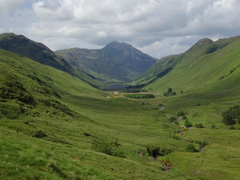
A' Ghlas-bheinn, Falls of Glomach & Carnan Cruithneachd from Morvich near Shiel Bridge
A' Ghlas-bheinn, Falls of Glomach & Carnan Cruithneachd
from Morvich near Shiel Bridge
Start/Finish
Falls of Glomach car park/National Trust Ranger Office at Morvich near Shiel Bridge. This is just before the Caravan Club Site where some camping is available and the facilities, including Wi-Fi, are very good. Morvich is a right turn just before the causeway at Shiel Bridge. There is also a turning after the causeway. Shiel Bridge is about 15 miles east of the Kyle of Lochalsh on the A87 road to Invergarry.
Distance/Time
22 km About 8 – 9 hours
Peaks
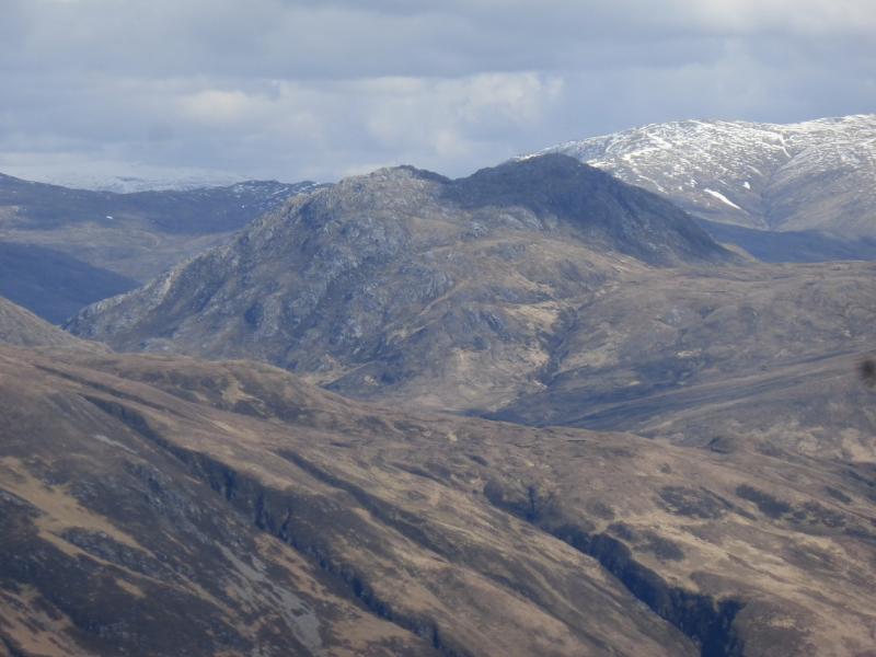
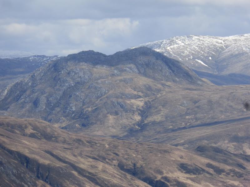
A' Ghlas-bheinn, 918 m, NH 008 230.
Carnan Cruithneachd, 729 m, NG 994 258. OS sheet 33.
Introduction
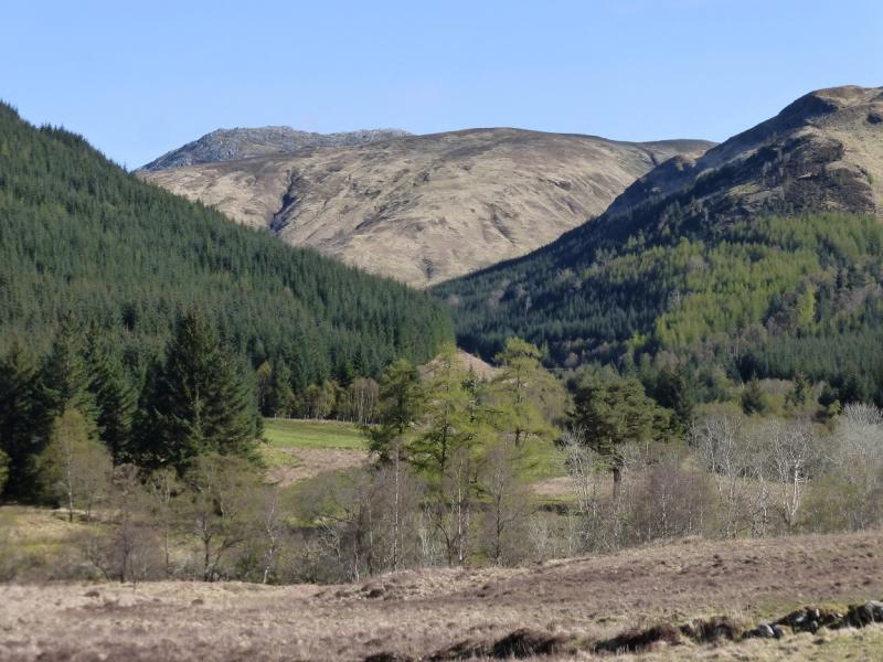
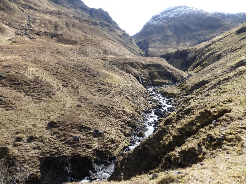
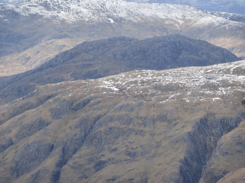
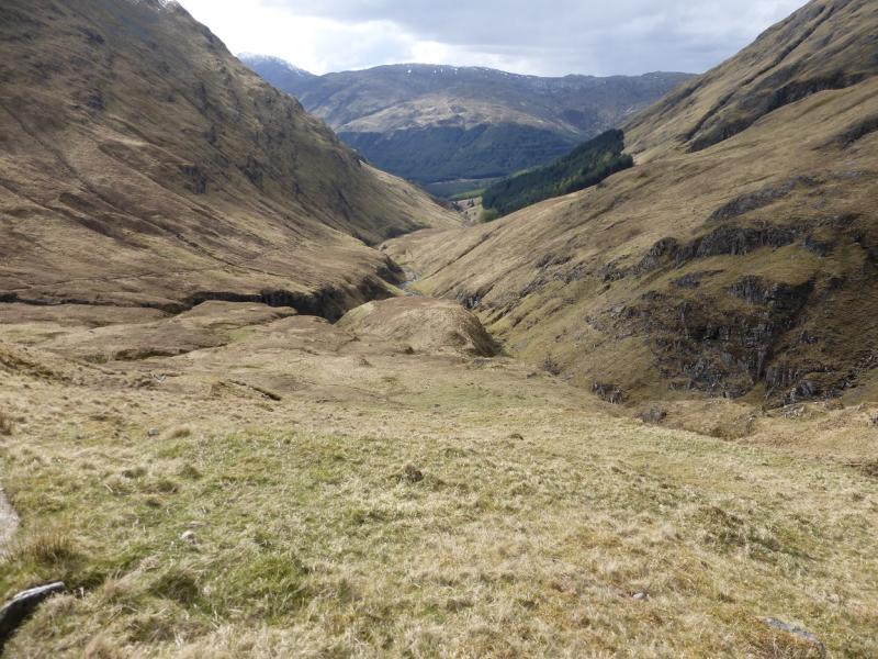
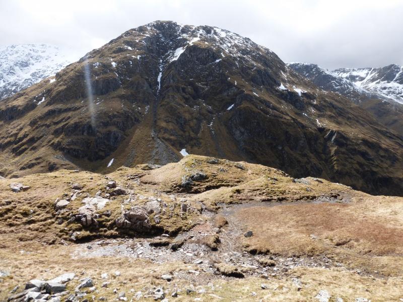
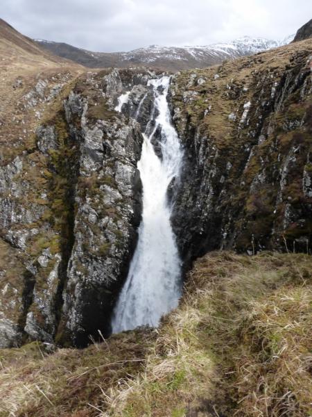
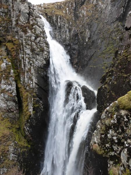
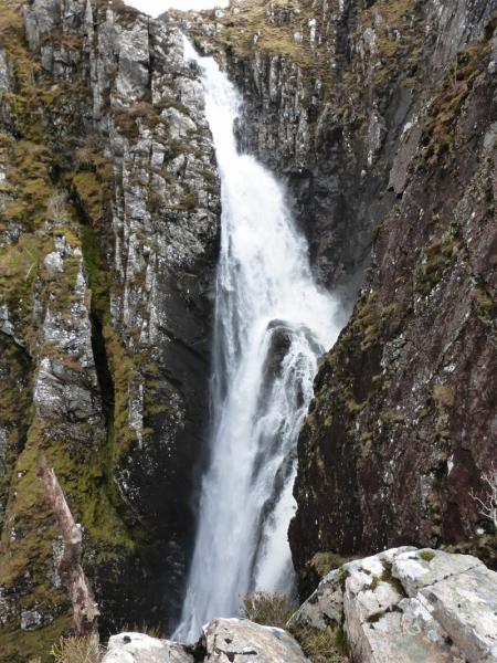
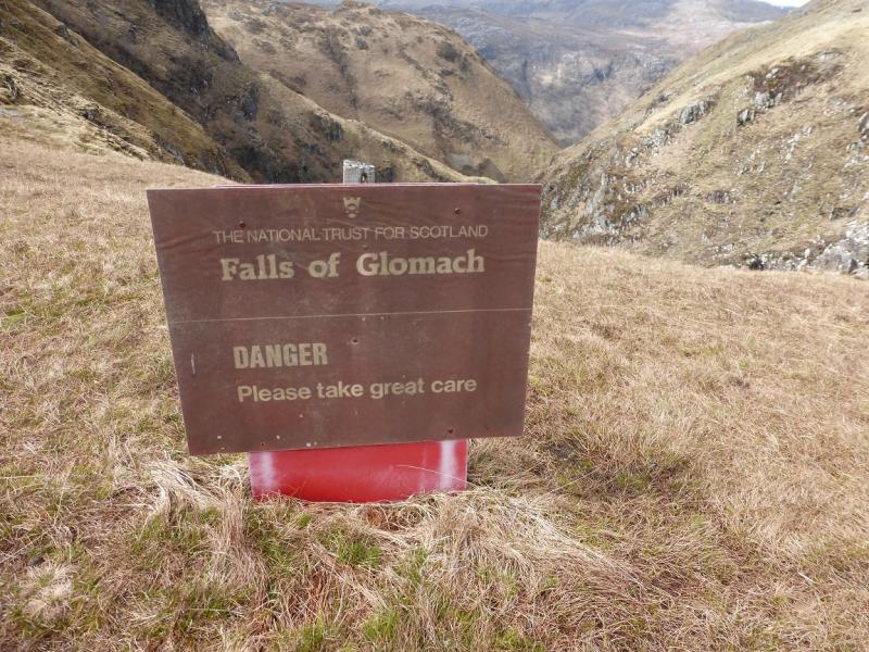
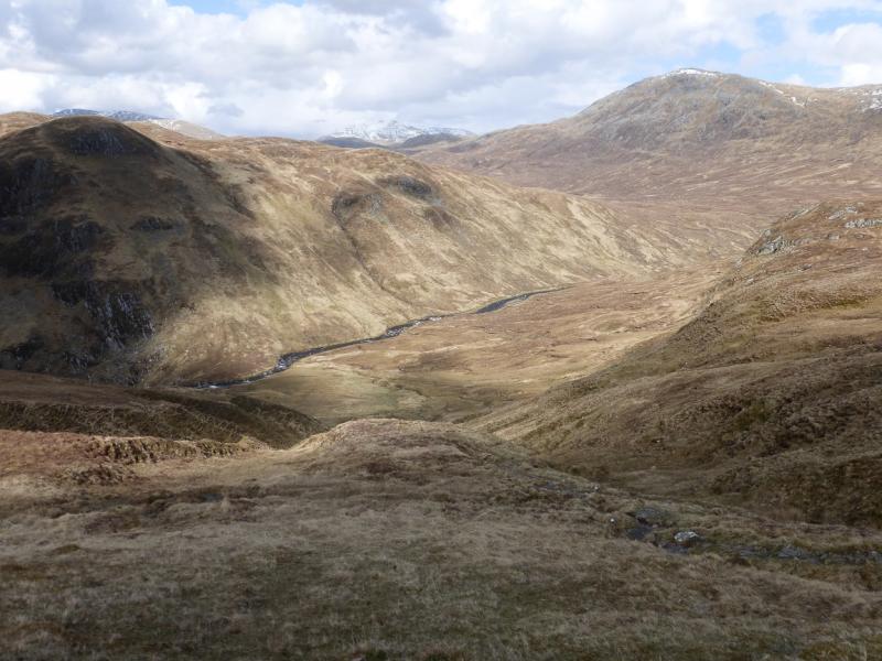
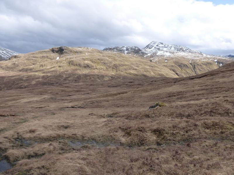
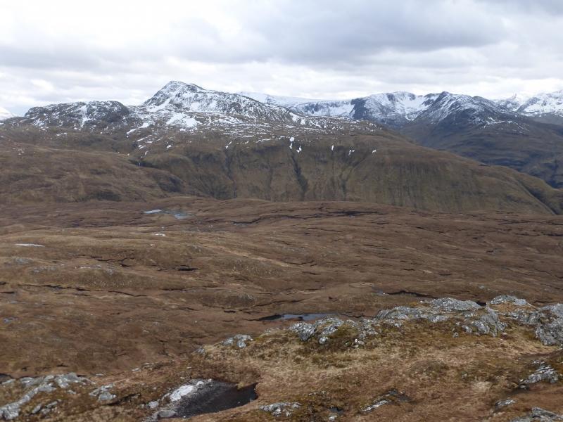
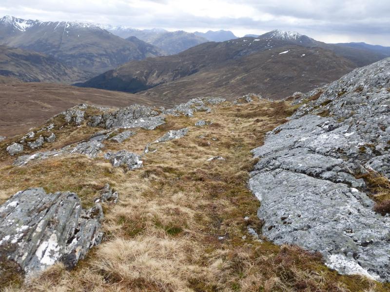
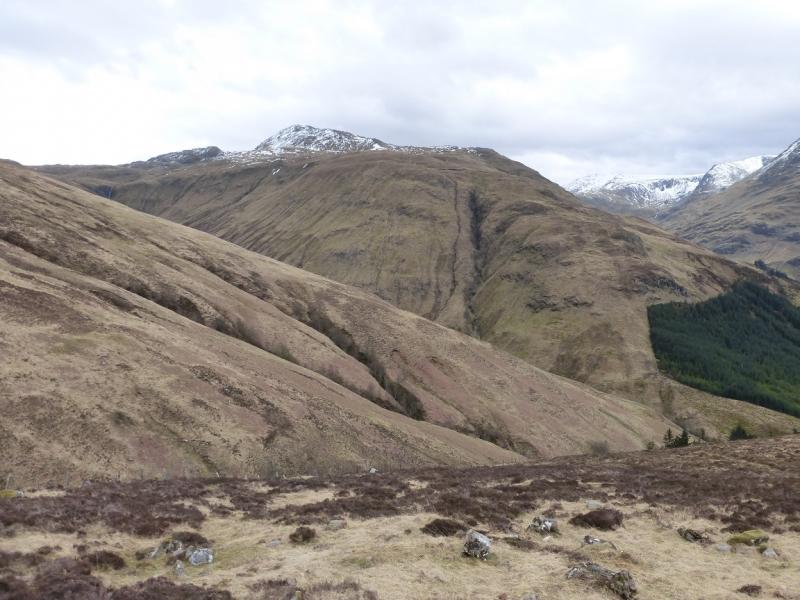
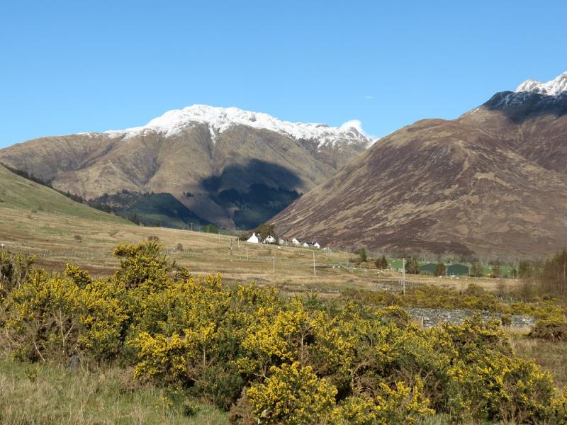
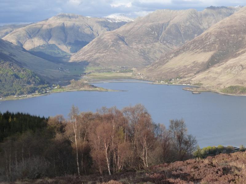
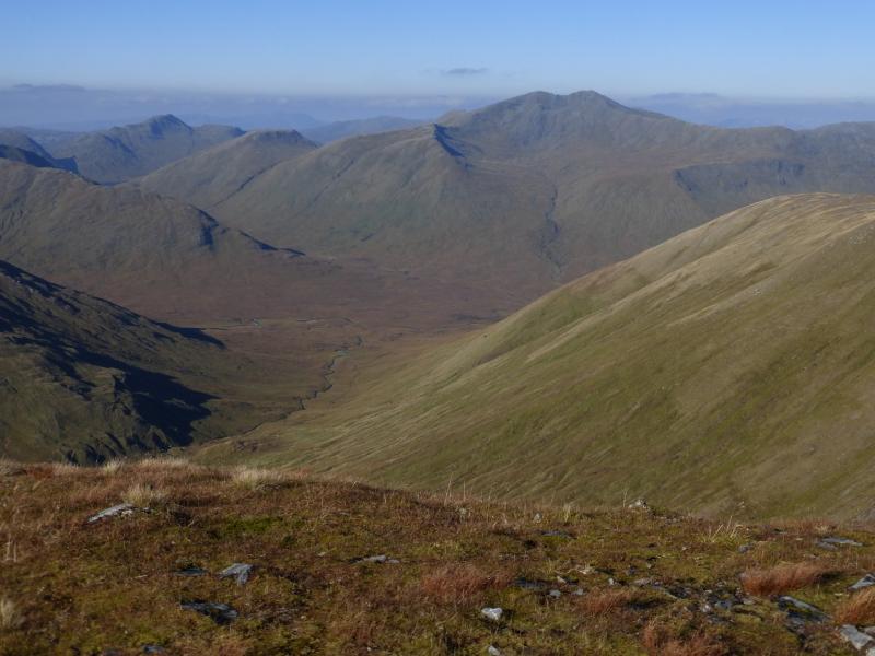
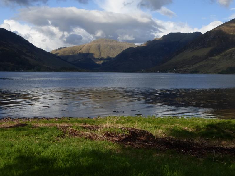
This is a longish walk which is tough in places and difficult to navigate in mist.. There are superb views which include the Sgurr Gaorsaic and Sgurr nan Ceanthreamhnan, Beinn Fhada and Glen Elchaig so save this walk for a clear day! Note that there is a stream crossing which can be very difficult after rain when this route is not recommended. Note also that going to the Falls of Glomach means a descent of about 200 m from Bealach na Sroine which has to be reascended on the return. The Falls of Glomach is a very dangerous place with no safety fences. It used to be regarded as the highest waterfall in the UK until a stream going off a cliff in Sutherland was discovered. A path goes down one side of the falls for some distance and gives good views of the falls but it is very exposed in places and a slip would almost certainly be fatal. It is no place to allow young children to roam unsupervised. This route effectively joins up three routes, each of which would take about 4 – 5 hours to complete.
Route
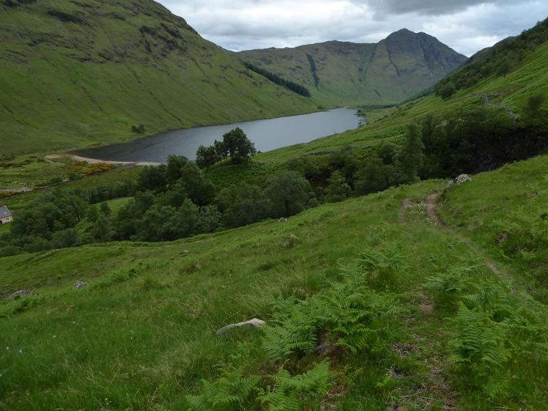
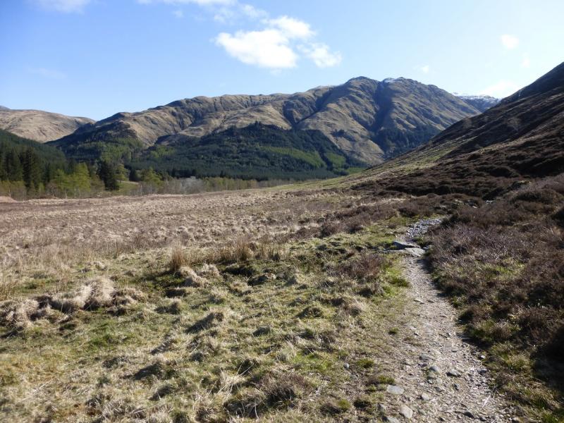
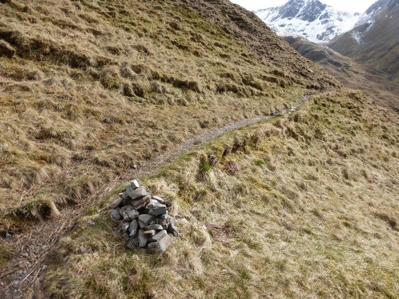
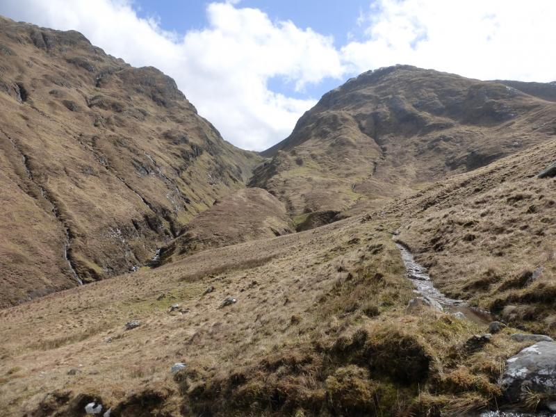
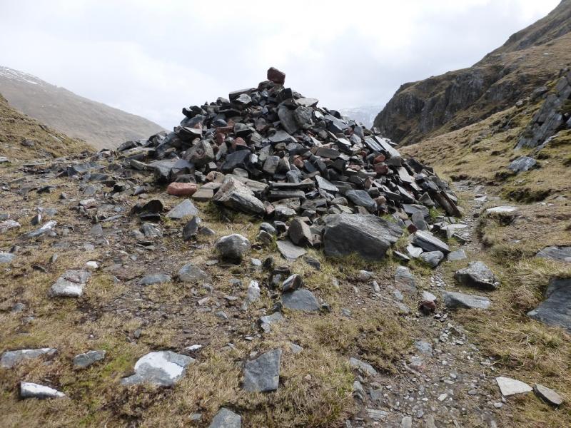
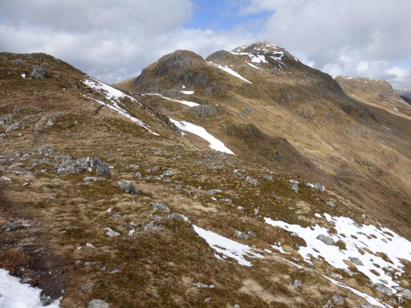
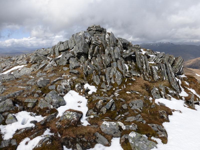
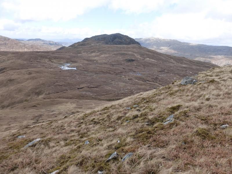
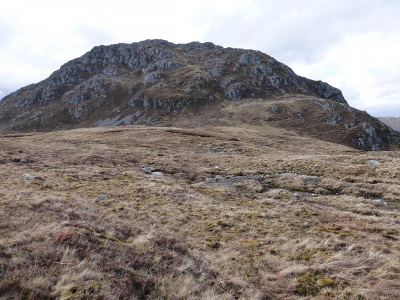
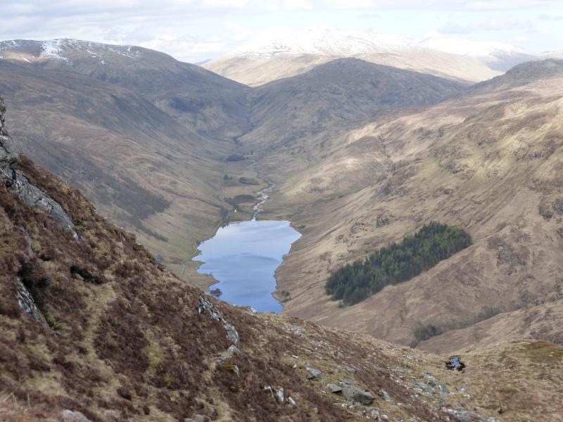
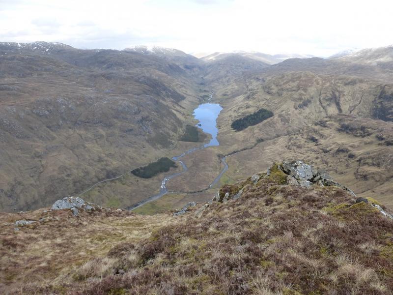
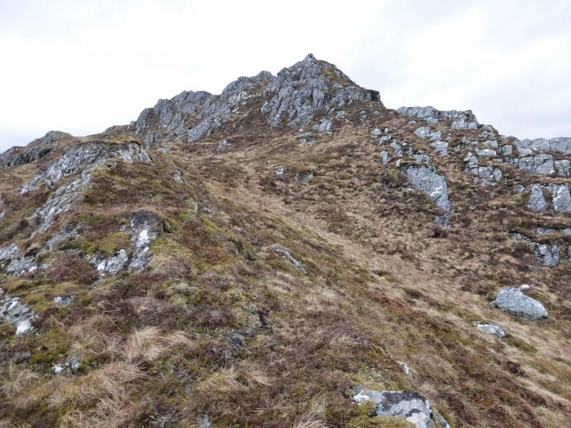
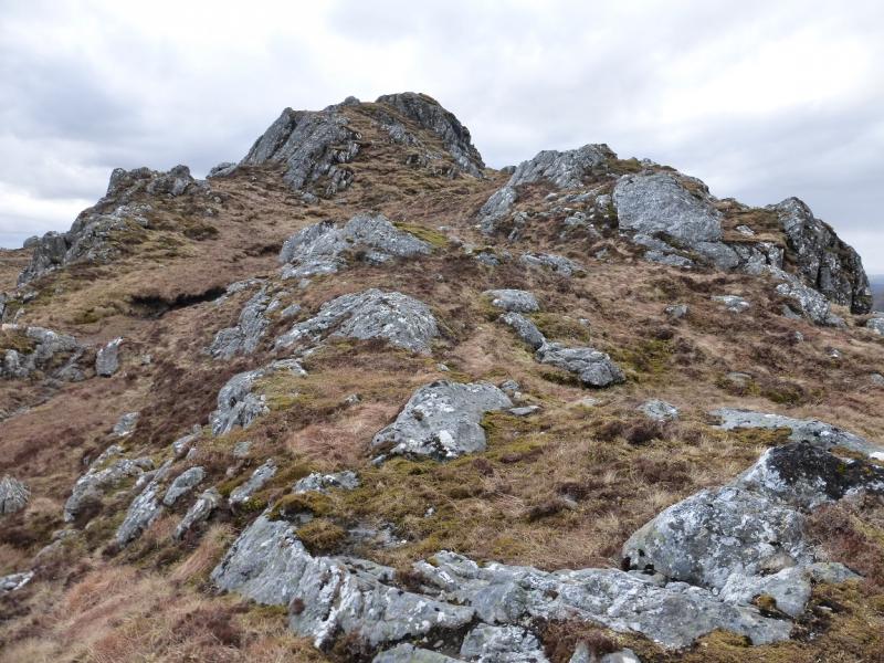
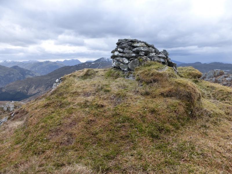
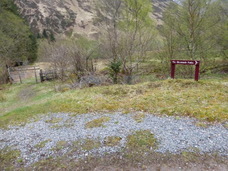
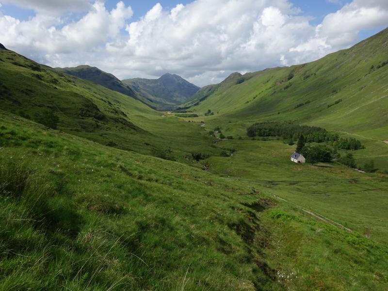
(1) From the car park, walk up the road to its end. Cross the bridge on to a track then, soon after, take the signed path for the Falls of Glomach which passes to the N of the Beinn Bhuidhe ridge. When the route for the Falls of Glomach goes left (signed), continue on the main path which heads up towards the Bealach an Sgairne between A' Ghlas-bheinn and Beinn Fhada. In just under another 2 km, the troublesome stream is reached. If you can cross, continue up the path towards the bealach ignoring the stalkers path which goes off right, into Coire Sgairne, at a small cairn. Reach Bealach Sgairne where there is a very large cairn. A path goes left here and starts the ascent of the S ridge of A' Ghlas-bheinn. The path is generally easy to follow but there are many minor tops which have to be ascended only to then lose some of the height gained. Eventually, one arrives at a medium cairn which marks the summit of A' Ghlas-bheinn, 918 m.
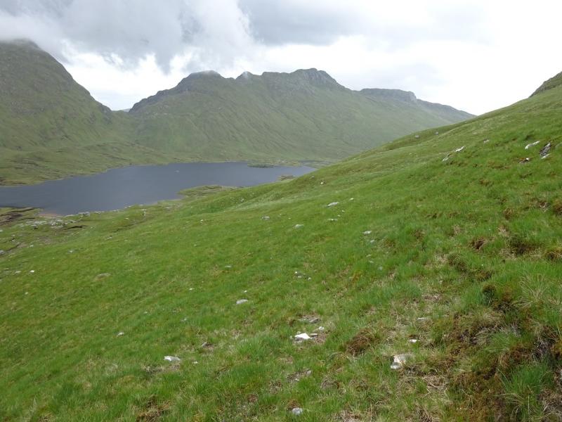
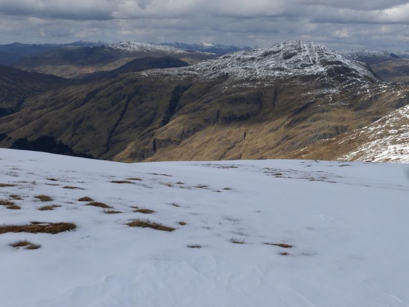
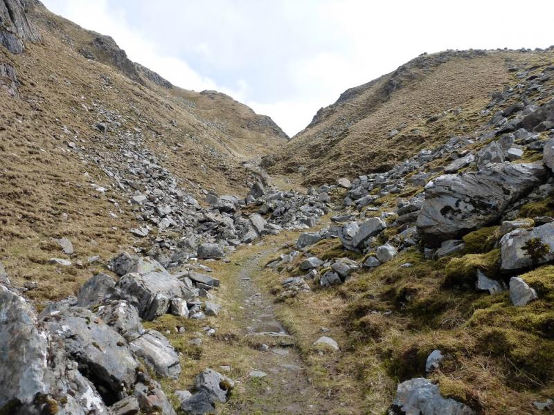
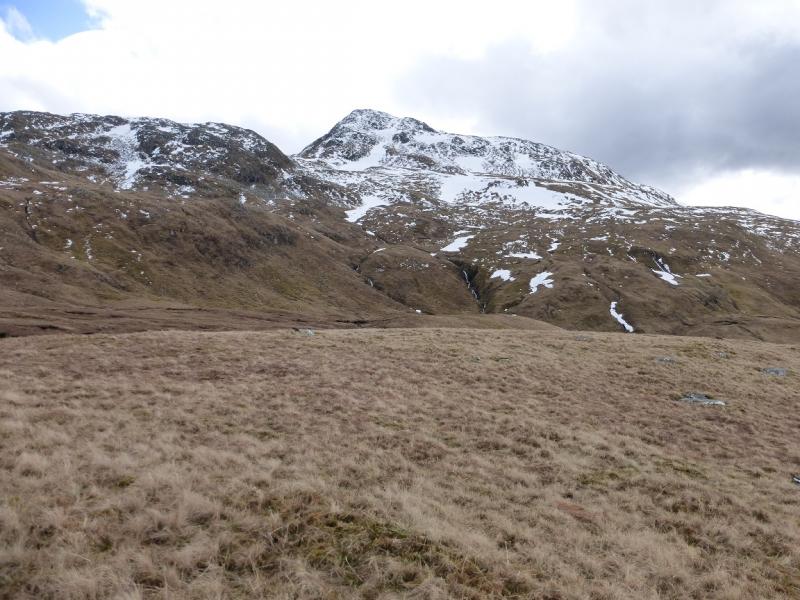
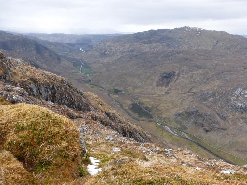
(2) The shortest continuation is to descend N from the summit but this is steep and will pose problems for some, especially under snow. It it easier to descend along the W ridge until a straightforward way down to the N can be found but, even so, some care will be needed. There is a very obvious large gully to the N which needs to contoured around. Continuing N, one soon reaches the path to the Falls of Glomach somewhere in the Bealach na Sroine although the path is not obvious until almost reached. Follow the path NE and down towards the obvious river then downstream a short distance to the top of the Falls of Glomach. There is a path down the left hand side which is quite exposed and ends on a small promontory. This gives good views of the falls.
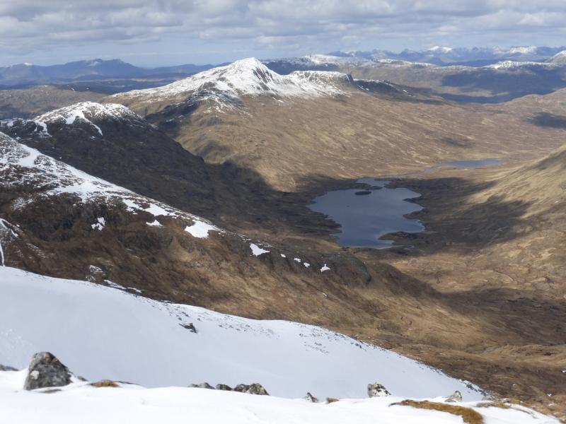
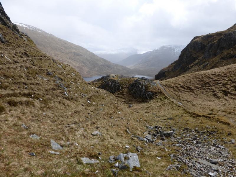
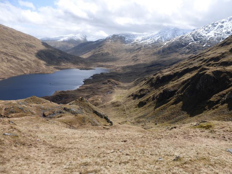
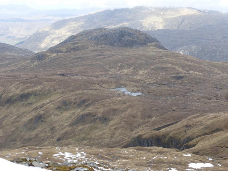
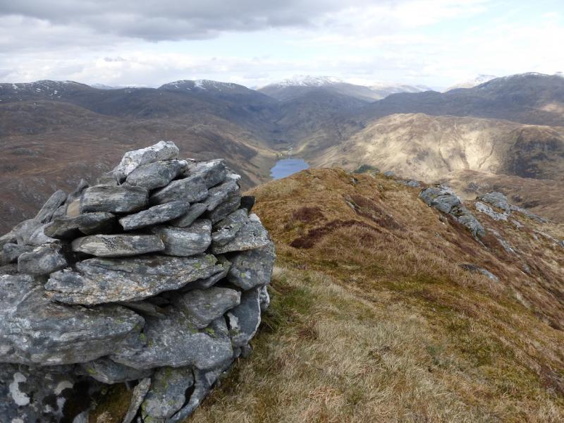
(3) Retrace back up the path to the Bealach na Sroine but leave the path when it levels out and head roughly N across pathless terrain aiming for the E end of Carnan Cruithneachd. There is an intervening low ridge which can be traversed on its right. Once below Carnan Cruithneachd, pick a way up its moderately steep slopes to gain its E ridge and follow this (W) to the medium cairn which marks the summit of Carnan Cruithneachd, 729 m. There are fine views up the lovely Glen Elchaig from the crest.
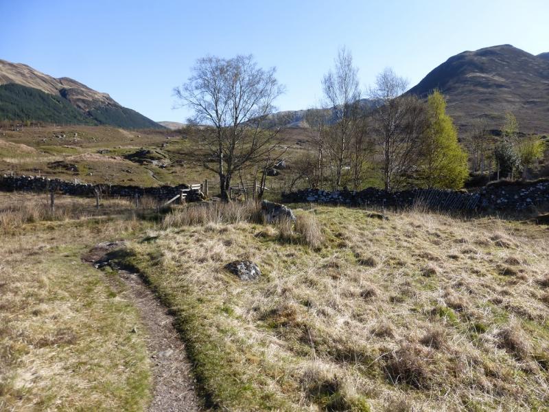
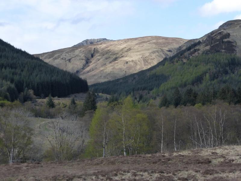
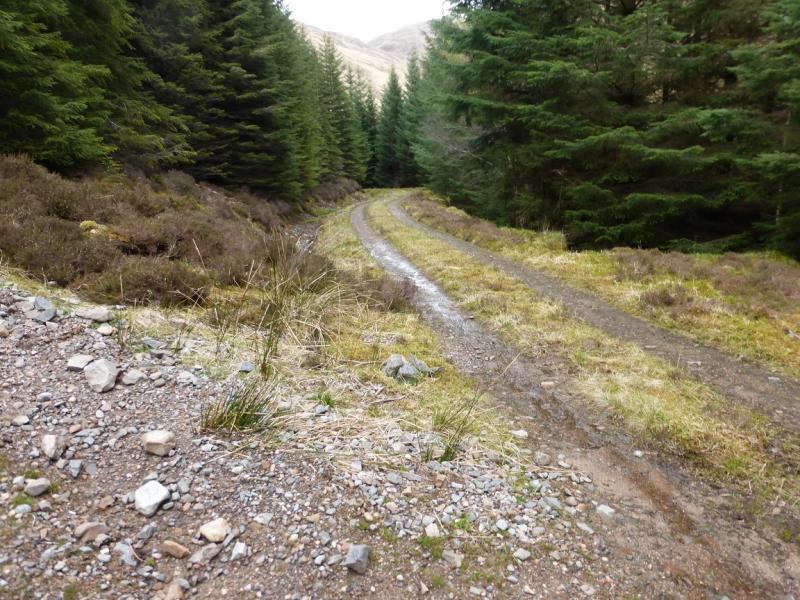
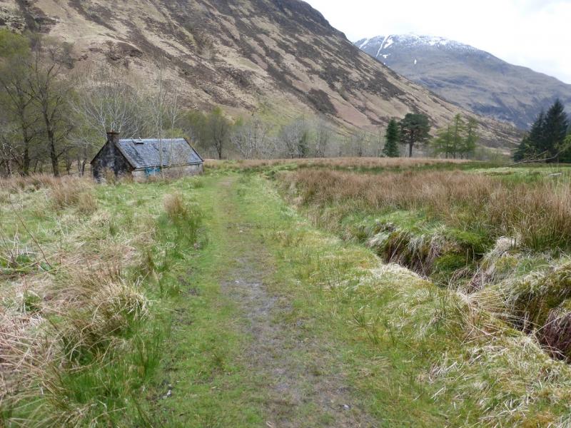
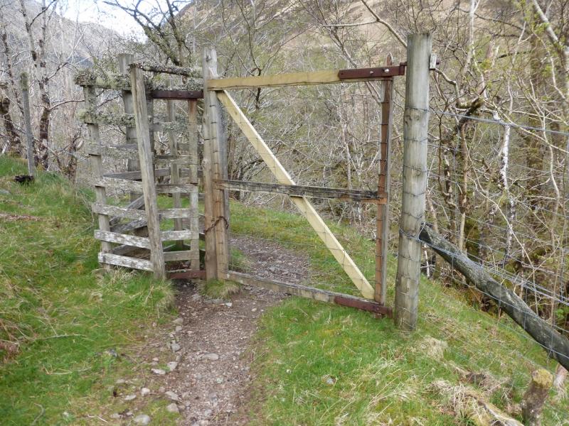
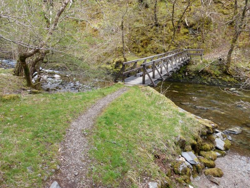
(4) Descend WSW, initially down a short grassy ramp. Aim for the stream running S, picking a way down the easy but pathless slopes. Eventually reach a stalkers path by the stream. This soon becomes a track and enters the forest where it becomes very steep and loose. Follow it down to a T junction. Go left on to the main track and follow it down until it is joined by the track from the Falls of Glomach (there is a sign). Soon after, fork left on to another track then soon go through a gate on the right where a path leads past an old building. Past here, look for an old high pedestrian gate on the left. Go through this and follow a path which cuts back and down to a bridge over the river. Ascend the other side and soon reach the outward route path coming down from the Bealach Sgairne. Follow this back to Morvich.
Notes
(a) This walk took place on 4th May, 2015.
(b) In wet weather, the awkward river crossing can be avoided by starting at Dorusduain. This approach is described for Sgurr Gaorsaic.
Photos - Hover over photo for caption. Click on to enlarge. Click on again to reduce.


.JPG)
.JPG)