Get Lost Mountaineering
You are here: Scotland » 11 Kintail and Glen Affric to Loch Ness » Invermoriston to North Glen Shiel
Sgurr na Ciste Duibhe, Sgurr na Carnach & Sgurr Fhuaran from Glen Shiel (Five Sisters)
Sgurr na Ciste Duibhe, Sgurr na Carnach & Sgurr Fhuaran (Five Sisters) from Glen Shiel
Start/Finish
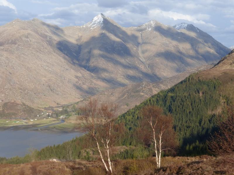
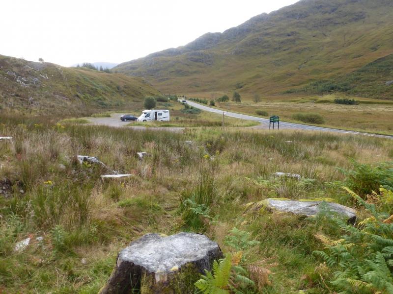
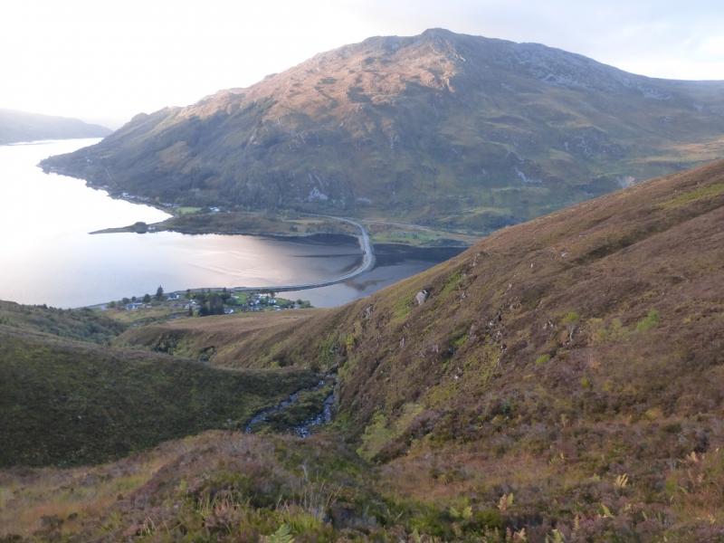
About 6 miles south east of Shiel Bridge garage on the A87 from the Kyle of Lochalsh to Invergarry. There is a rough car park signed Glen Shiel at about NH 007 137. This is just under 6 miles west of the Cluanie Inn. If the car park is full then there is a lay by a short distance to the west. The A87 is on a national bus route which could allow one to leave their car at the end of the walk and take the bus to the start. The best place to leave a car is at the Walker's car park close to the Jacobite restaurant by the turning for Morvich just before the south end of the causeway across Loch Duich. Buses can be caught here. On 12/10/15, the first bus was at 9.15 and the fare was £5.30. Check these in advance as there is not much information in local bus shelters.
Distance/Time
12 km About 7 - 8 hours
Peaks
Sgurr nan Spainteach, 990 m, NG 991 150.
Sgurr na Ciste Duibhe, 1027 m, NG 984 149.
Sgurr na Carnach, 1002 m, NG 977 158.
Sgurr Fhuaran, 1067 m, NG 978 166.
Sgurr nan Saighead, 929 m, NG 974 177. OS sheet 33.
Introduction
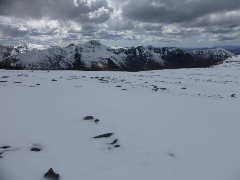
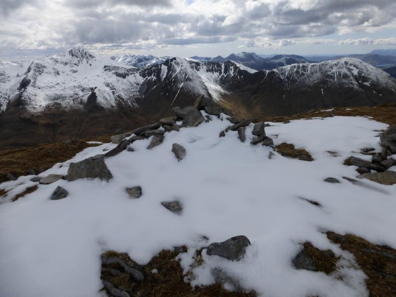
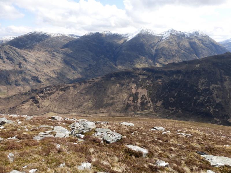
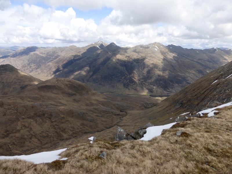
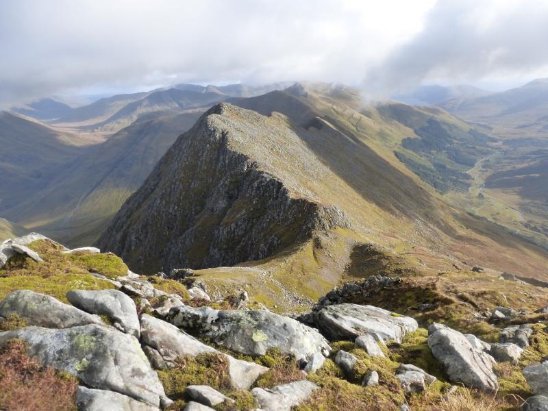
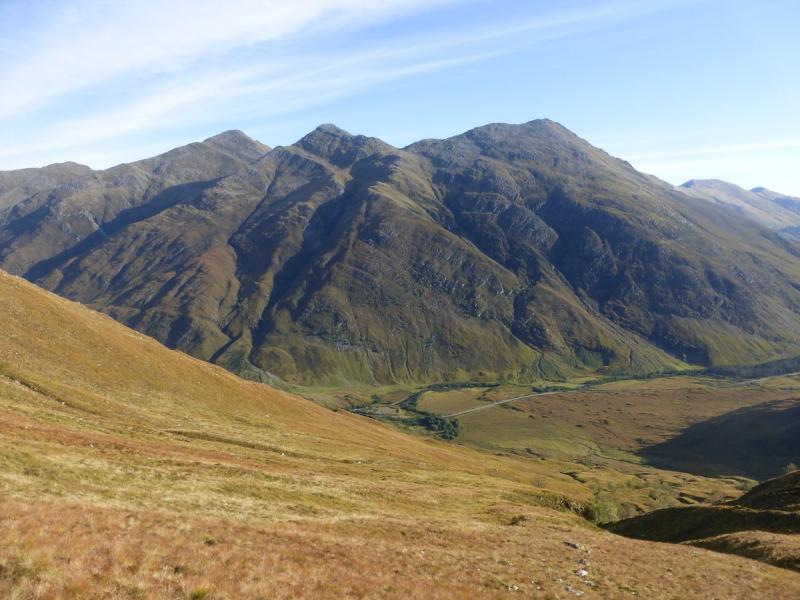
These hills are usually called “The Five Sisters (of Kintail)”. This route takes in four of them. Sgurr nan Spainteach is not one of the Five Sisters as it is not seen from the usual view point on the Ratagan Pass. The sister missed out is Sgurr na Moraich which most omit because, at 876 m, it does not have Munro height. This is a tough walk with steep ascents, especially to the ridge from the start, and a long, rough descent at the end of the day. There are deep gaps between the hills. The paths are rough and rocky which makes them very slippery when wet. If tackling this route in wet conditions then add at least 1 hour to the above time. The crest is often narrow but should not be a problem in dry summer conditions. It is a very serious undertaking in anything but dry summer conditions and is no place for the inexperienced in winter conditions. On a clear day there are superb views to the Brothers (eastern end of the ridge), South Glen Shiel Ridge, Ciste Dhubh, Mullach Fraoch-choire, A' Chralaig and beyond.
Route
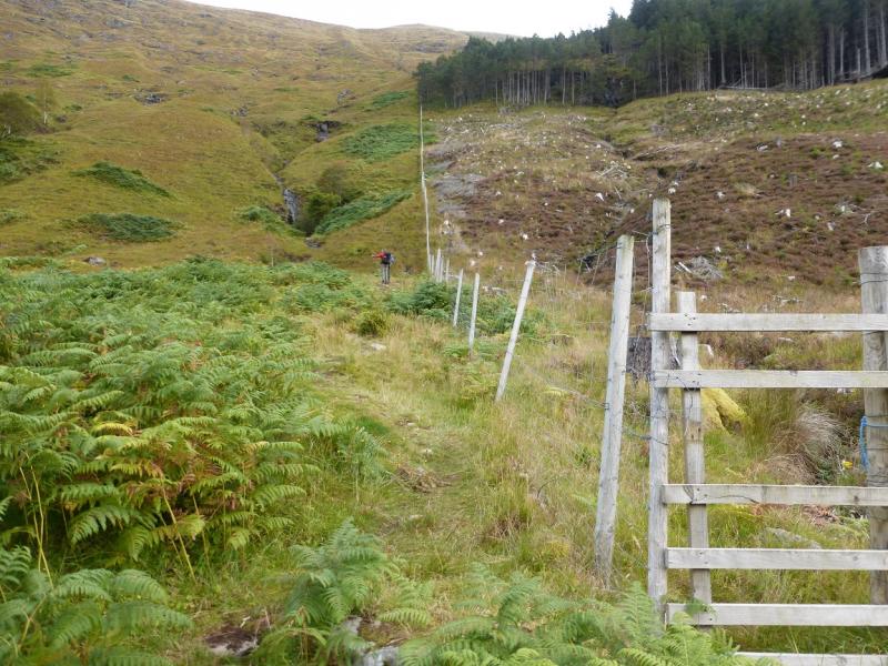
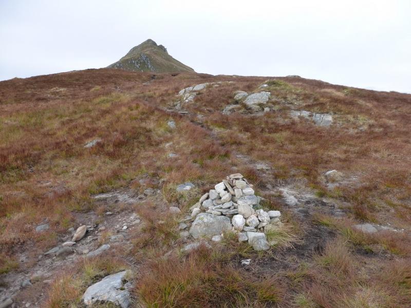
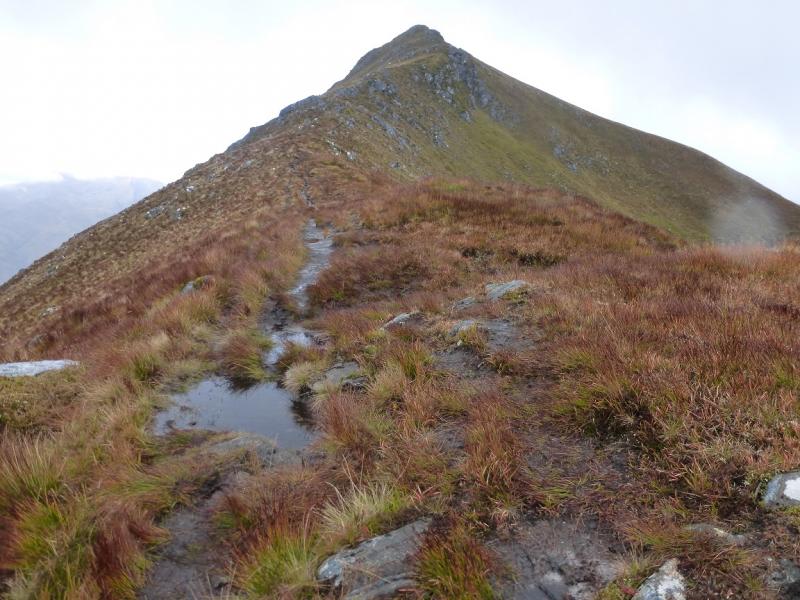
(1) Follow the path up the left side of the fence on the side of the forest. This can be steep and boggy especially lower down. The path weaves around and crosses some burns lower down. It is steep and unrelenting up to the crest but most will not need much more than an hour to reach the small cairn in the Bealach an Lapain. Turn left, W, and follow the fairly obvious path which ascends, levels out then finally climbs to the medium cairn which marks the summit of Sgurr nan Spainteach, 990 m.
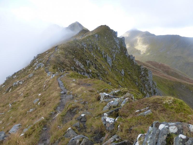
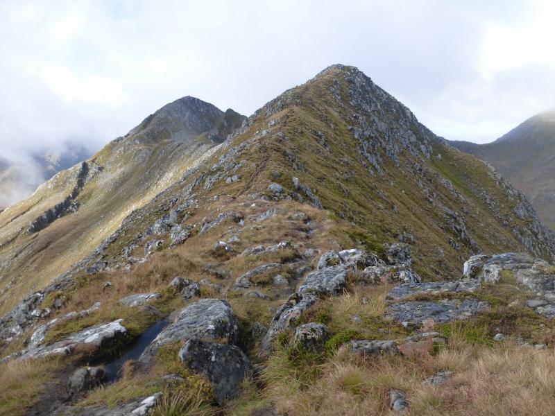
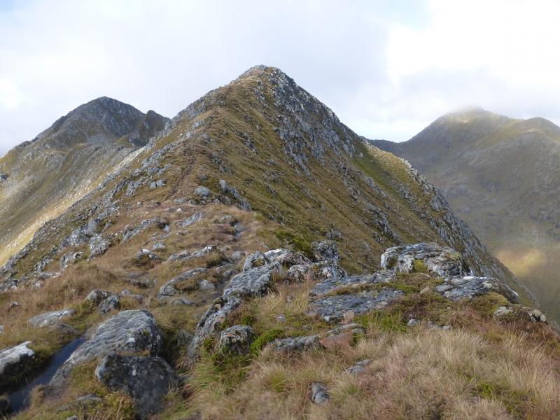
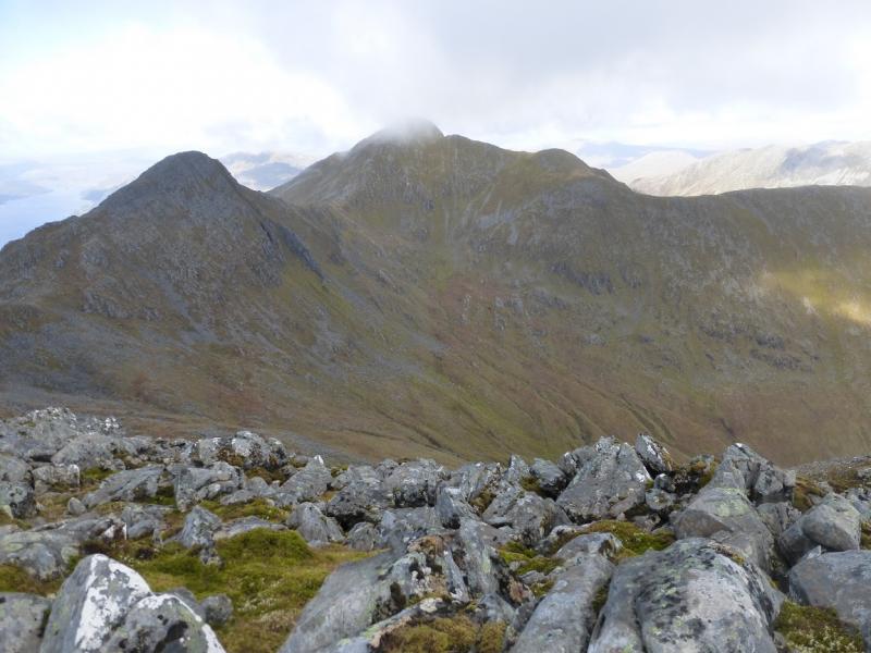
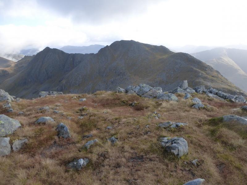
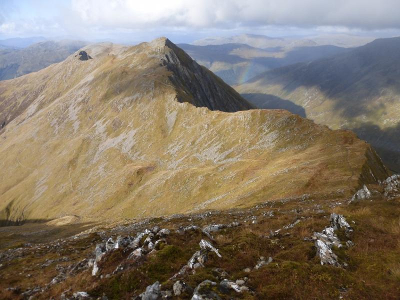
(2) Continue along the crest, descending without difficulty until the crest ends abruptly and one has to descend a series of rocky steps. This looks worse than it actually is and to call it a scramble may be overstating the case. Take it slowly and carefully and there should not be a problem. Those who are short of confidence in such situations may find it easier to face the rock as if climbing down. Once down, the ridge appears to split into two with a “scoop” between them. This can be confusing in mist. The path continues up the right hand ridge before crossing over at the top of the “scoop”. From there it picks its way up, faint in places, before levelling out and reaching a very large cairn which is the summit of Sgurr na Ciste Duibhe, 1027 m.
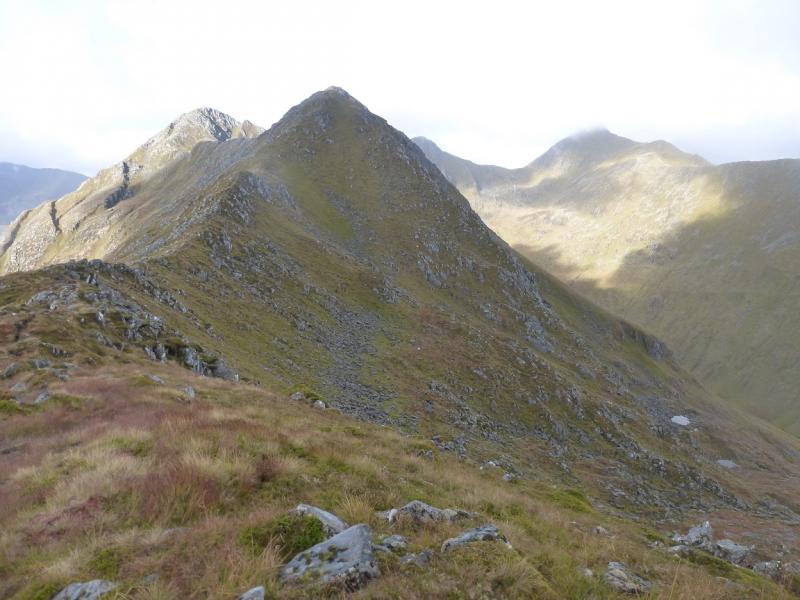
(3) Continue along the crest, descending easy stony slopes to the W which gradually curve around to the NW to reach a grassy/stony bealach (col). Ascend similar terrain, gradually turning N, to reach a large cairn which is the summit of Sgurr na Carnach, 1002 m.
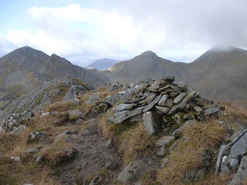
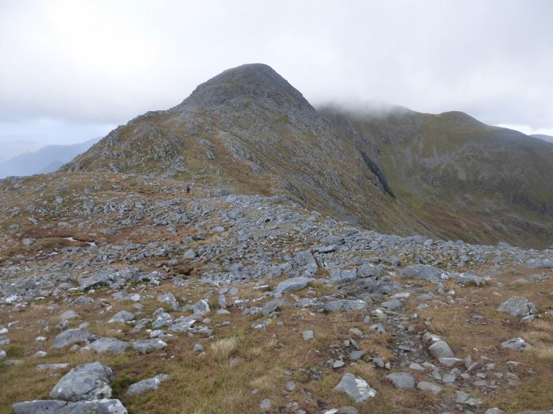
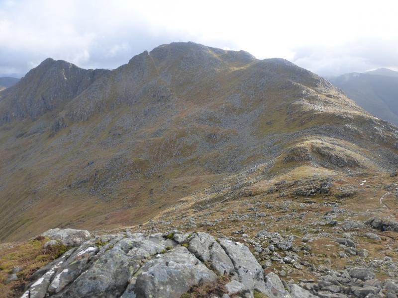
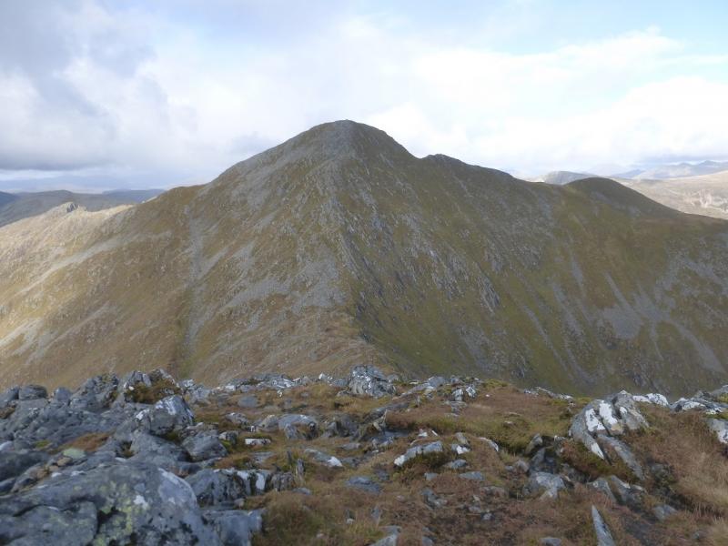
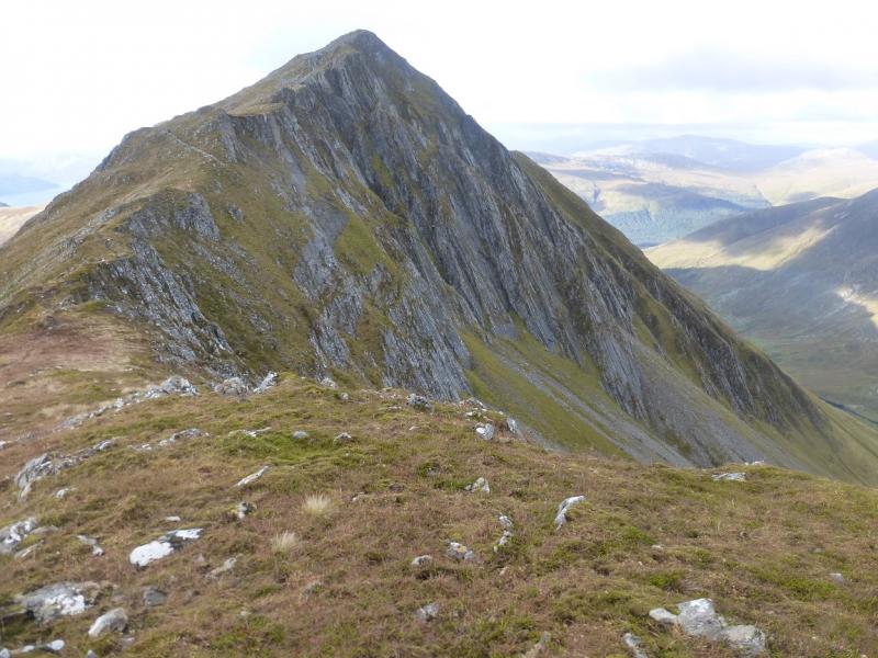
(4) Continue N along the crest, descending, steeply in places to reach another grassy/stony bealach. Go up the other side on a steep and eroded path which some will find unpleasant before eventually reaching a large cairn which is the summit of Sgurr Fhuaran, 1067 m.
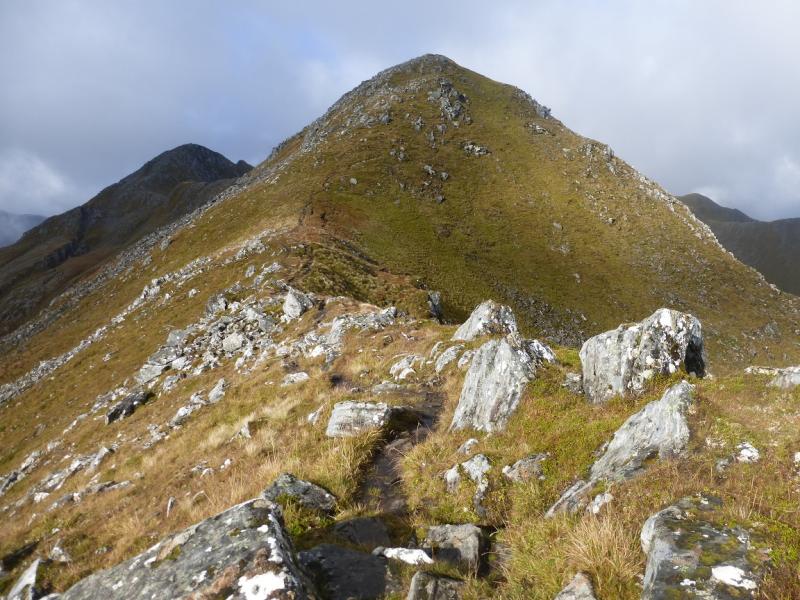
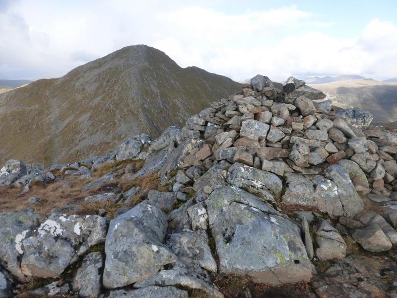
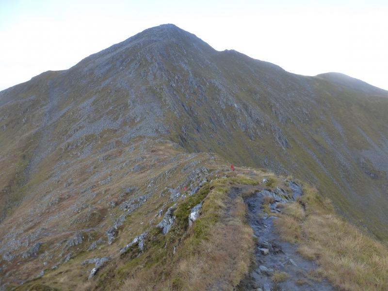
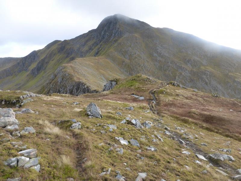
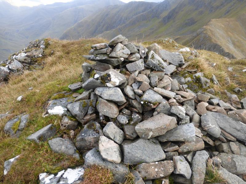
(5) An obvious path initially heads W then curves around to the N before swinging NW to reach a bealach on the obvious edge. This is a long and steep descent. Follow the path up the other side. Ignore the traverse path going off left which appears to be the main path and stay on the crest above some very long and steep slabs on the right. Reach a medium cairn which is the summit of Sgurr nan Saighead, 929 m.
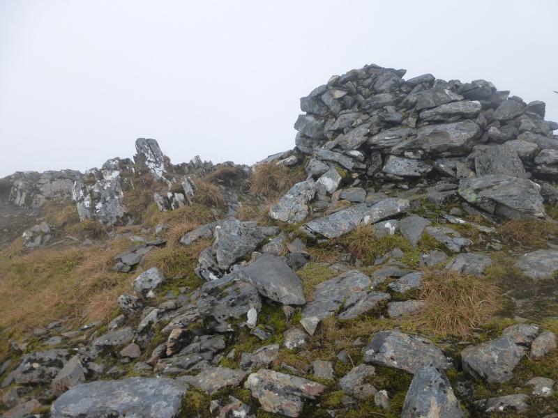
(6) Continue along the crest until the traverse (main) path is rejoined. Cross some minor tops until the path traverse below the crest on the left, W. Pass below Beinn Bhuidhe (not named on some maps) where the ridge splits. Stay on the path which descends W/NW, steeply in places, before the angle eases and the path drifts right towards the Allt a' Chruinn, the obvious burn (stream) on the right. The path can be faint lower down and the ground boggy. Reach the Allt a' Chruinn and cross over to reach a path. Follow this down, roughly NW. Soon, it becomes a much better path and can be followed by the burn before it starts to steepen and drift right for the final descent. The path is very obvious and can be followed down to a track then a minor road which meets the Morvich road lower down. Turn left and soon reach the Walkers' Car park.
Notes
(a) This walk took place on 12th October, 2015 and twice previously.
(b) Accommodation is limited at Shiel Bridge but there are two camp sites. One behind the garage, the other at Morvich on the old road around Loch Duich. The latter is run by the Caravan Club and has very good facilities including Wi-Fi.
Photos - Hover over photo for caption. Click on to enlarge. Click on again to reduce.