Get Lost Mountaineering
You are here: England » Yorkshire Dales » Western Area
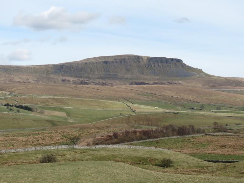
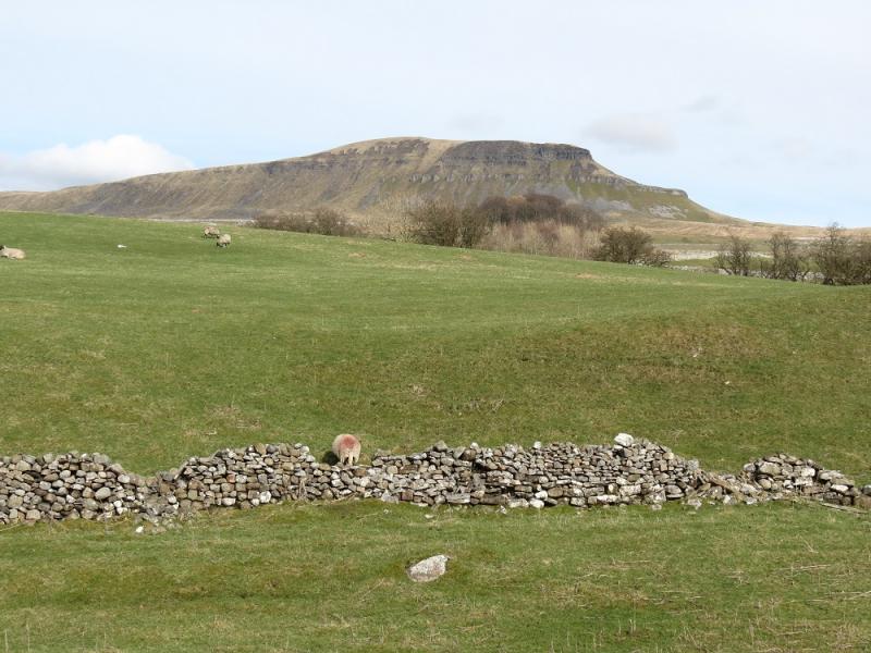
Pen-y-Ghent from Horton-in-Ribblesdale
Pen-y-Ghent from Horton-in-Ribblesdale
Start/Finish
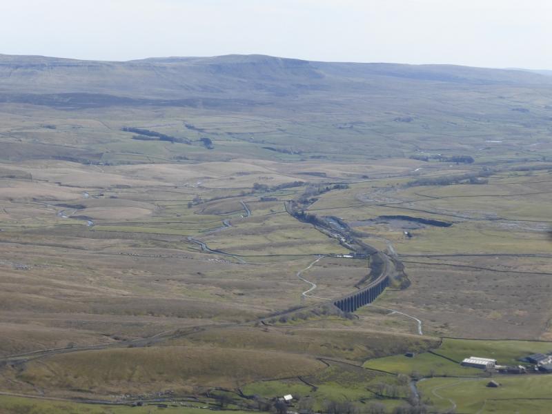
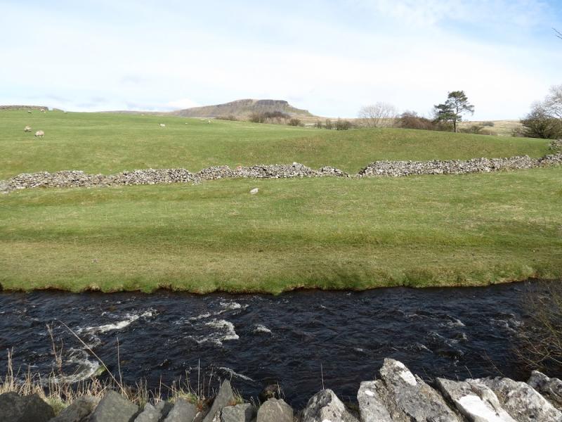
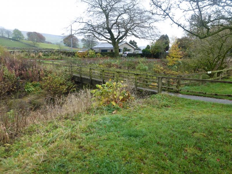
Horton-in-Ribblesdale which is about 6 miles north of Settle on the B6479. If approaching from the north, it is about the same distance from Ribblehead Viaduct which would be the approach if staying in either Sedbergh (via Dent and Dentdale) or Hawes (via Widdale). Horton can be very busy during the warmer months. There is a pay and display car park and a few extra private car parks. Out of season, it is best to park at the south end of the village just over Horton Bridge (on the Settle side) if possible. The famous Settle to Carlisle railway line goes through Horton-in-Ribblesdale and one could reach the village this way.
Distance/Time
9 km. About 3 hours.
Peaks
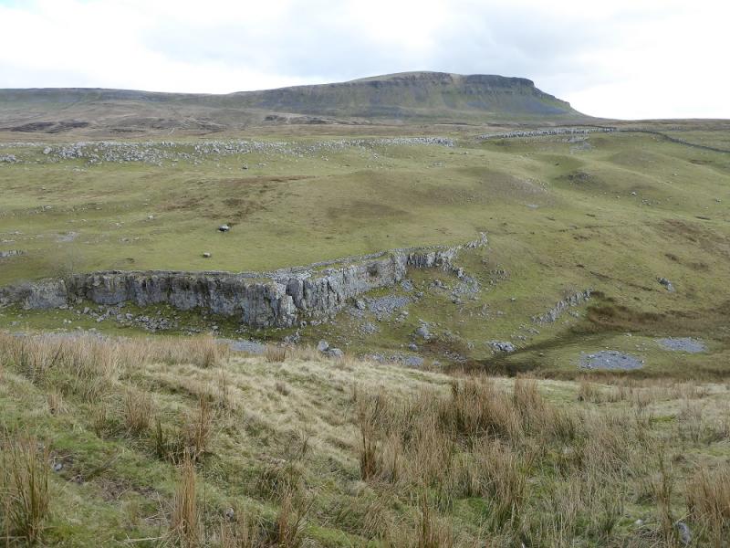
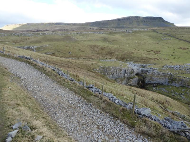
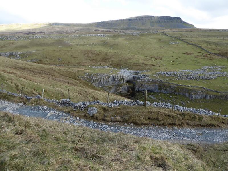
Pen-y-Ghent, 694 m, SD 838 734. OL2 Yorkshire Dales: Western Area
Introduction
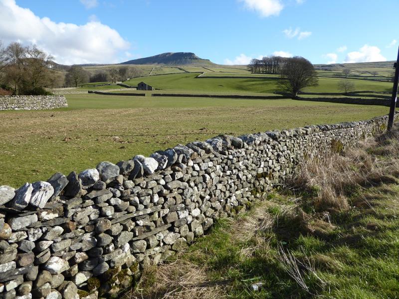
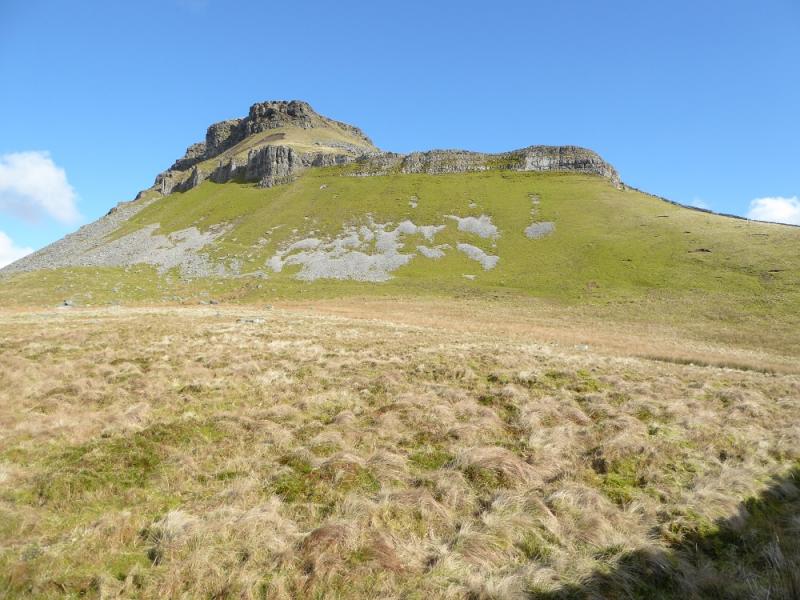
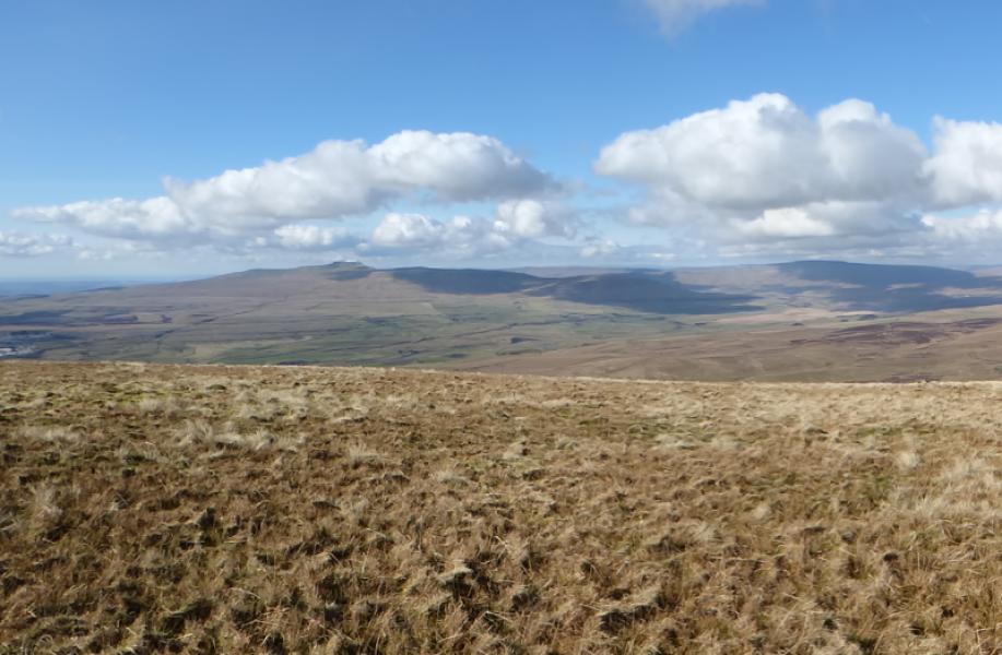
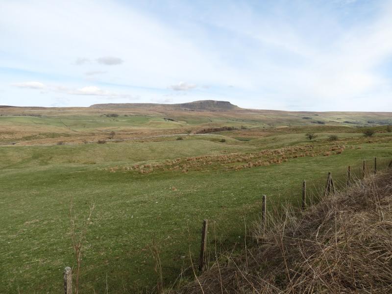
Pen-y-Ghent is the lowest of “The Three (Yorkshire) Peaks” with Ingleborough and Whernside being the other two. Despite this it gives the best ascent of the three with an attractive approach up its rocky southern shoulders. Navigation is very straightforward even in mist but it is best saved for a clear day when the views are superb in all directions. This is an ideal walk for a short winter's day and could easily be extended to include Plover Hill which is, essentially, its north top. Hands will be needed on the approach up the rocky shoulders but it is not a scramble unless one chooses to make it so.
Route
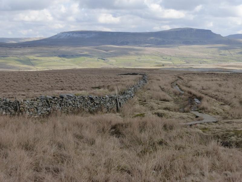
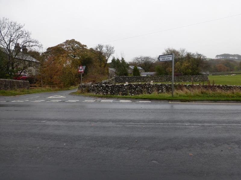
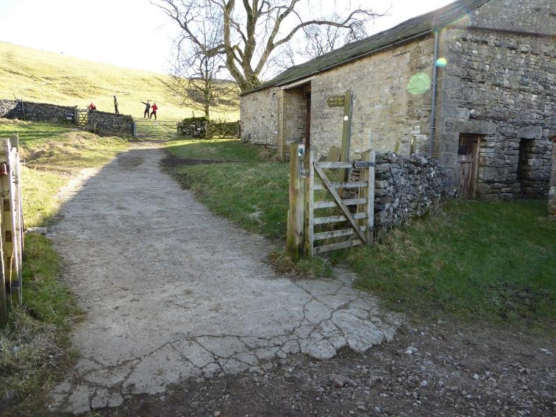
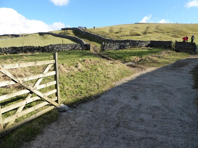
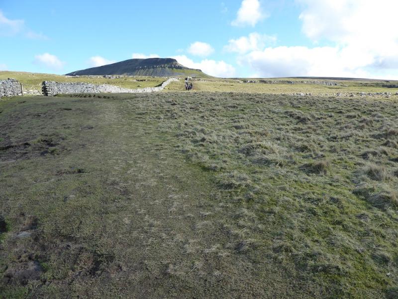
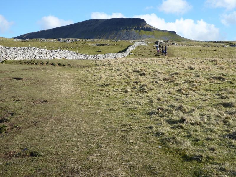
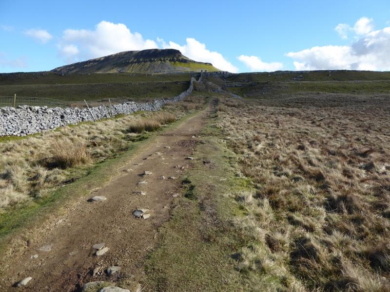
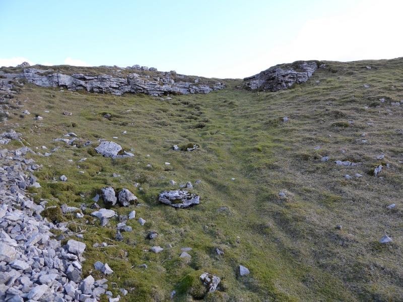
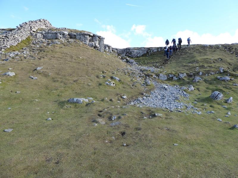
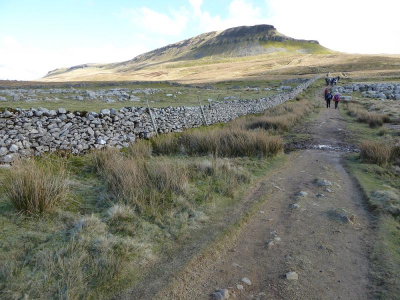
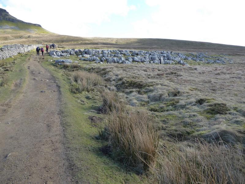
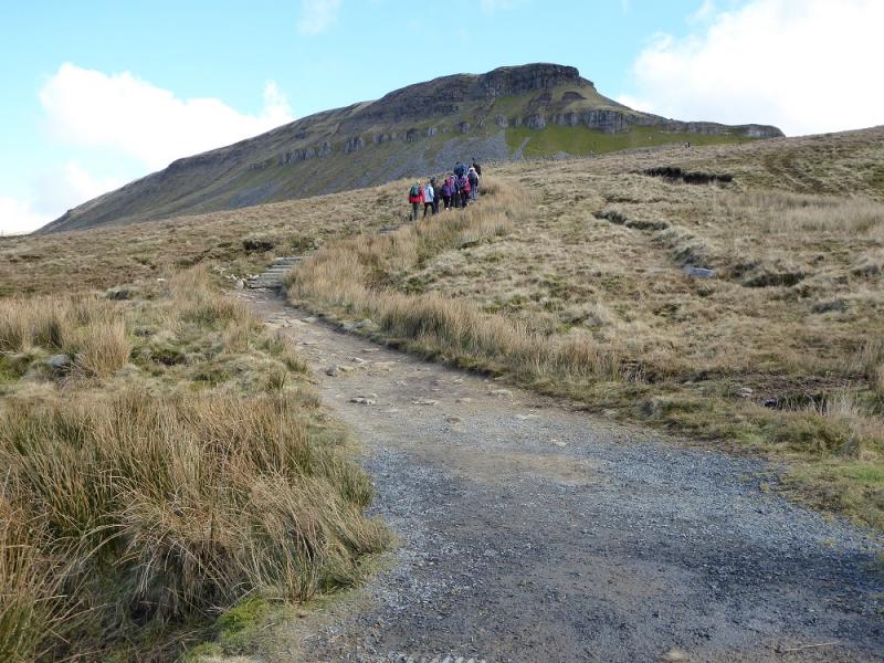
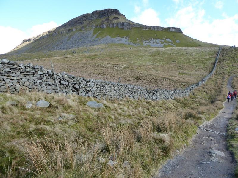
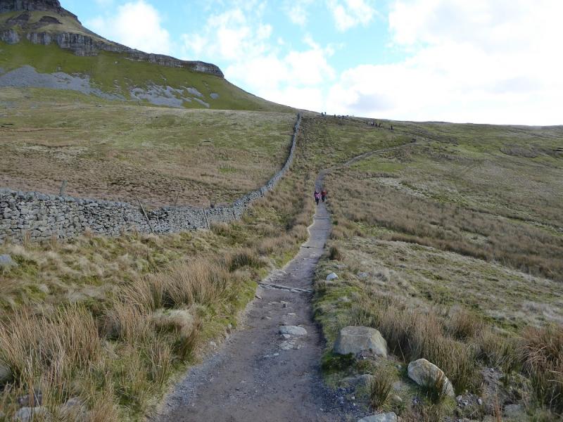
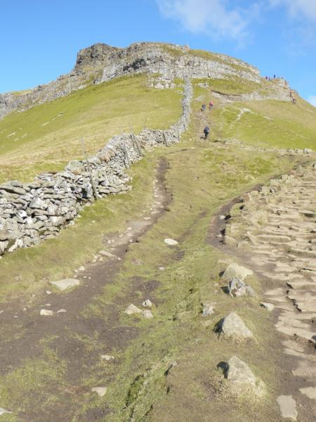
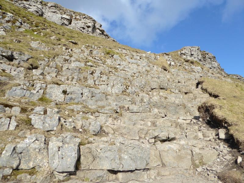
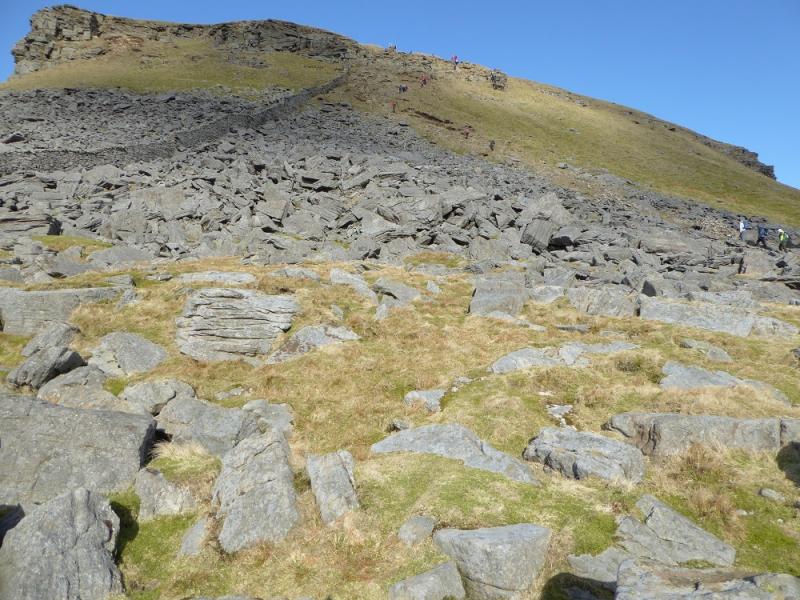
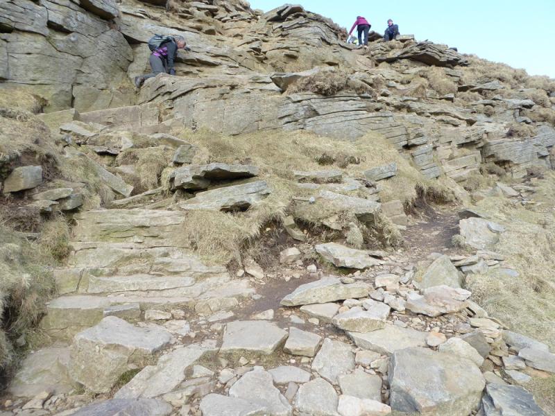
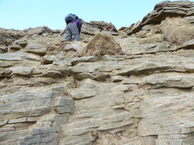
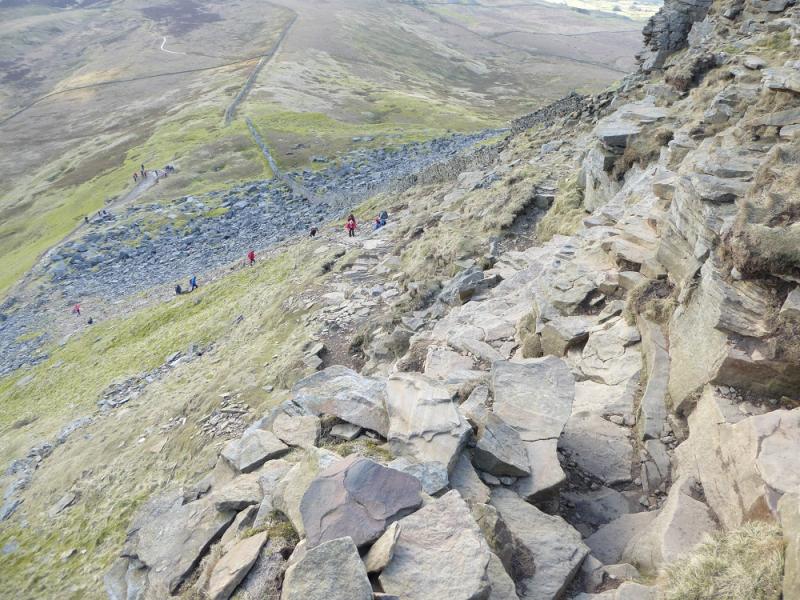
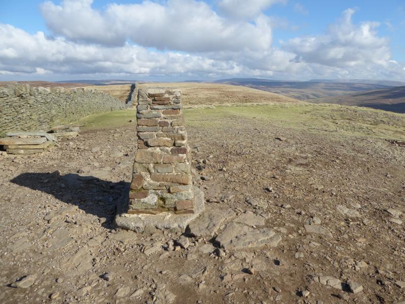
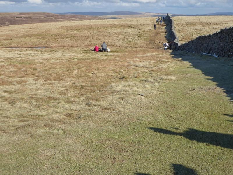
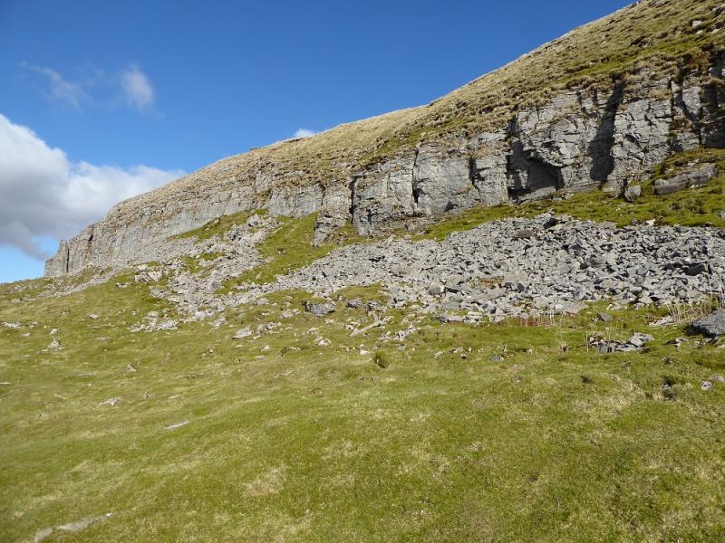
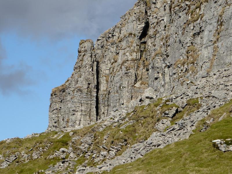
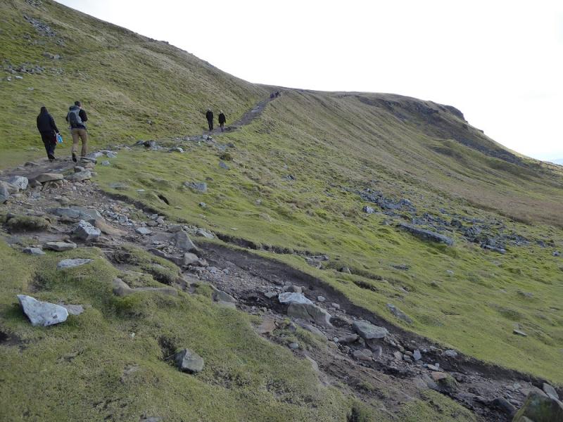
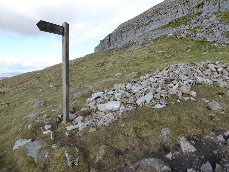
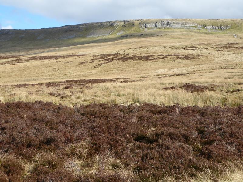
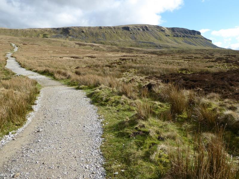
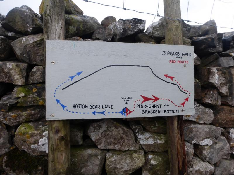
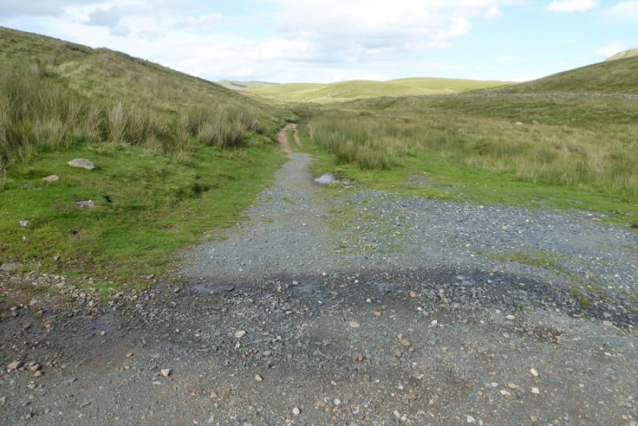
(1) From the E side of Horton Bridge at the S end of the village, take the minor road to the primary school (sign posted). Continue past, emerge from the trees and soon reach the stone buildings at Brackenbottom where a sign, on the left before the first building, points the way to Pen-y-Ghent. Within 100 metres, a gate is passed through and a good path initially follows a wall. Higher up, the path passes through Brackenbottom Scar which has a short easy cliff, easily avoided if one wishes. Continue up, on the obvious path, to reach a gate which gives access to the path going up the S ridge. (This path starts at the Silverdale Road and gives a shorter approach for those just wishing to get to the summit and back). Go N up the ridge which soon steepens. The path drifts to the right away from the wall on the crest to avoid the rocky nose. Higher up, there is a rocky section where there is a choice of routes and difficulty and scrambling can be avoided. Once above here, the trig point is soon reached which is the summit of Pen-y-Ghent, 694 m. This is very close to the wall on the crest which has a small seating area built into it. There is a very useful sign post on the wall.
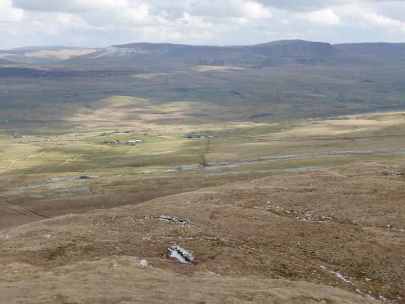
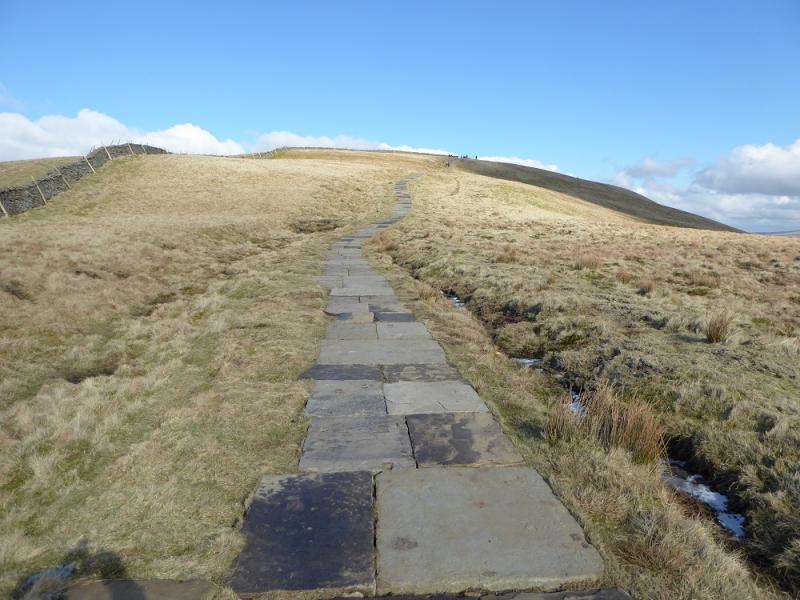
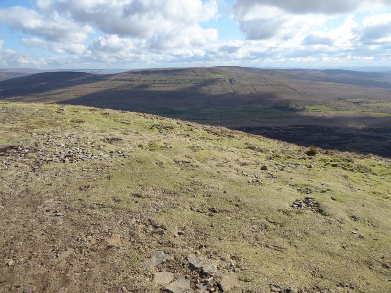
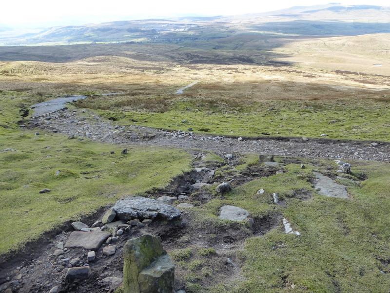
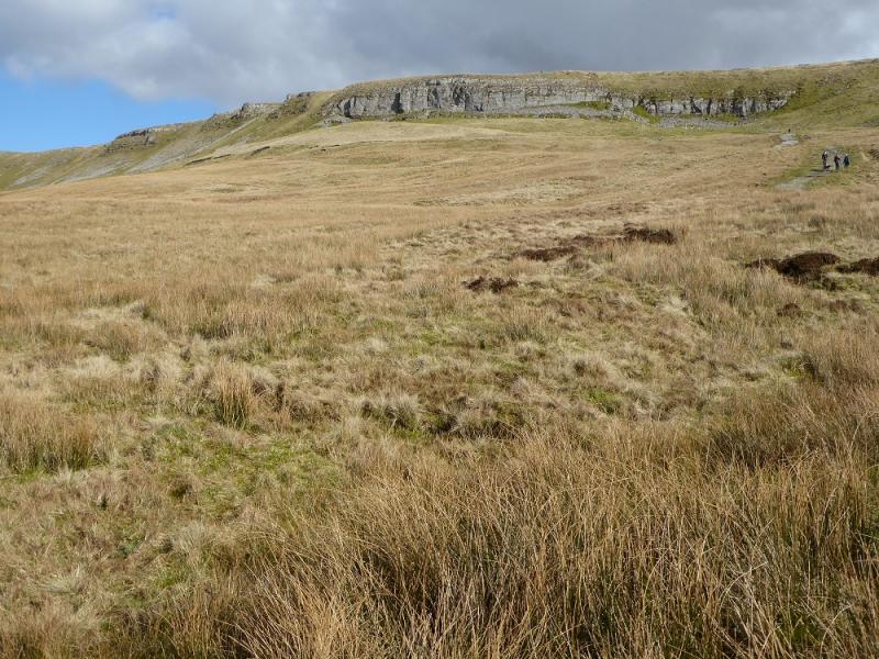
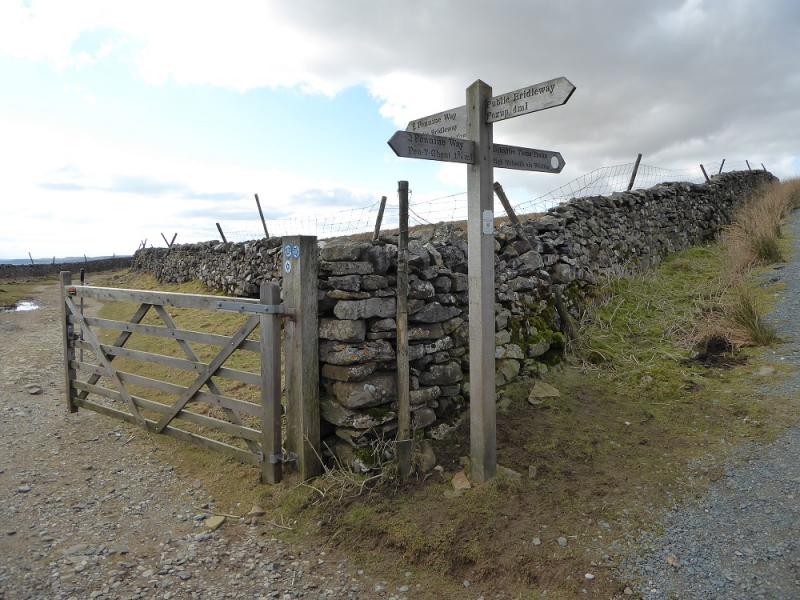
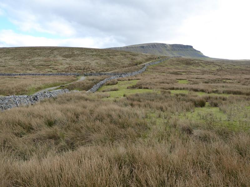
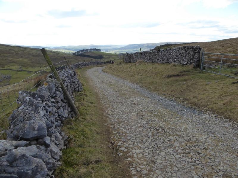
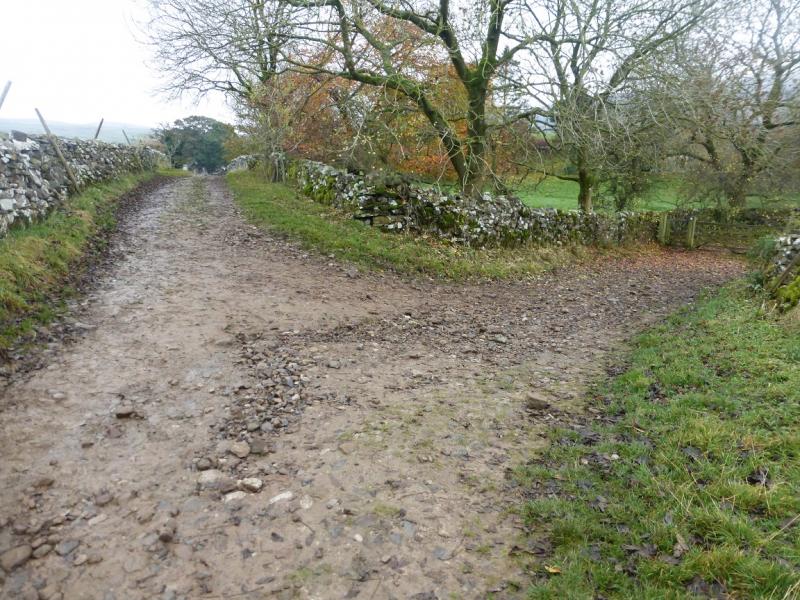
(2) Cross the wall and follow the sign for Horton, roughly NW. Initially the path is very wide but soon narrows as it turns N along the edge to the W. Further down, the path goes sharply left, again signed, just below a limestone crag (on the right). The path steepens for a while before easing and then, after about 1.8 km, reaches a crossroads where one goes left on to a track known as Horton Scar Lane from which there are good views of typical limestone scenery. This leads back to the village but splits just before the houses. Go left (only go right if parked in the centre or N end of the village) and soon pass through a farm and reach a minor road on the opposite side of the stream to the primary school. Either cross the bridge and walk back to the start or stay on the N side and follow the road to Horton Bridge.
Notes
(a) This walk took place on 5th November, 2015, and about 20 years earlier.
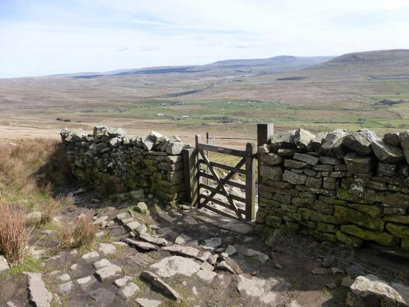
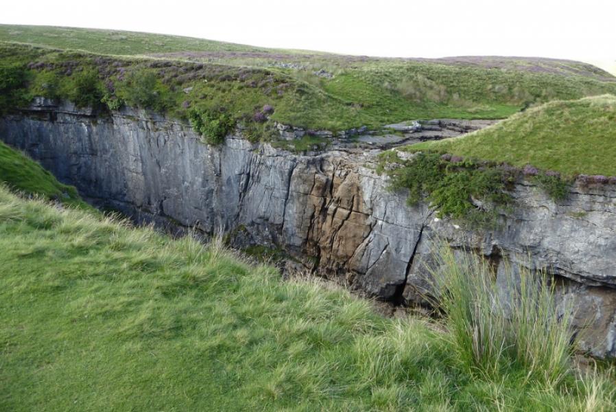
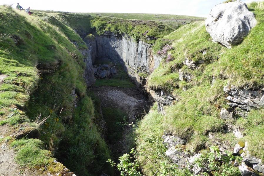
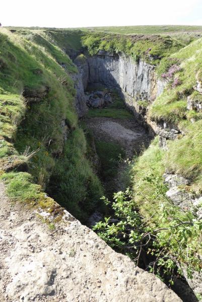
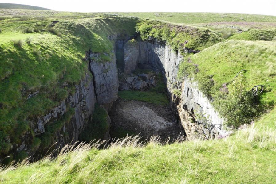
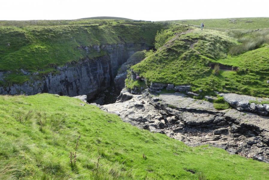
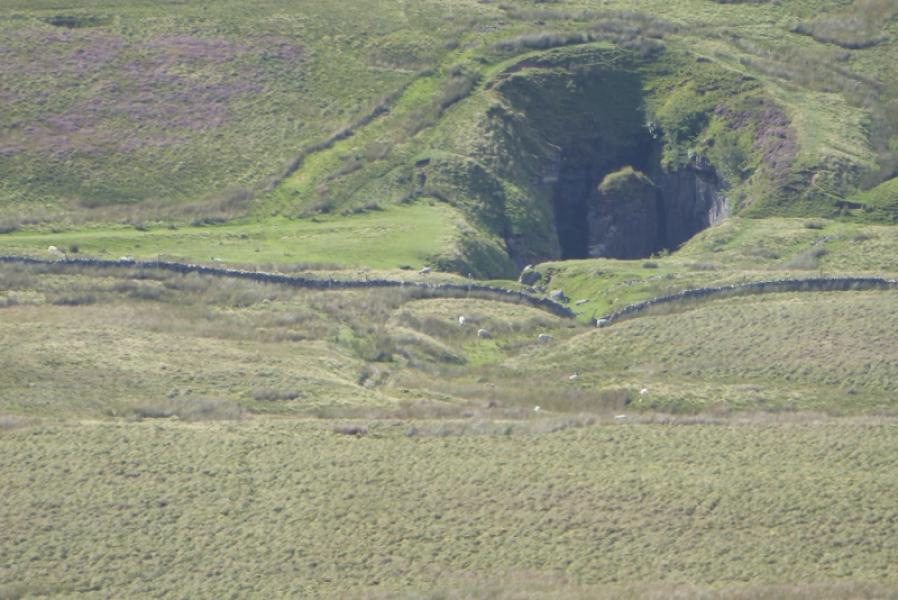
(b) From the *crossroads, it is well worth taking a short detour to Hull Pot which is a huge hole with cliffs for its sides. Hull Pot is well seen from the summit of Pen-y-Ghent. To reach it, simply follow the sign for Foxup for about 400 m. Be careful around the edges of Hull Pot.
Photos - Hover over photo for caption. Click on to enlarge. Click on again to reduce.