Get Lost Mountaineering
You are here: England » Peak District » Kinder, Brown Knoll & South Head from Hayfield
Kinder Reservoir, East Ridge of William Clough, NW Cliffs, Kinder NW Trig Point, Kinder Low & Kinderlow End from Bowden Bridge near Hayfield
Kinder Reservoir, East Ridge of William Clough, NW Cliffs, Kinder NW Trig Point, Kinder Low & Kinderlow End
from Bowden Bridge near Hayfield
Start/Finish
Hayfield campsite or Bowden Bridge car park. If coming from the south or east, take the A619 from Chesterfield to Baslow before picking up the A623 signed for Manchester. Those approaching from Buxton, on the A6, will meet this route at a roundabout just before Chapel-en-le-Frith. Soon after, take the A624 signed for Glossop. Continue on this road until the right turn into Hayfield village is reached. Turn in then go left and pass the church before crossing the river then follow the road on the N side of the river until past the Sportsman pub. Soon after there is a right turn, over a bridge, for the campsite. There are public toilets just across this bridge. The Bowden Bridge car park is a little further along the road after this turning. Those approaching from Glossop should fork left on the one way street into the village until the above route is joined. There are a few signs in the village for the campsite which may help.
Distance/Time
11 km About 4½ hours
Peaks
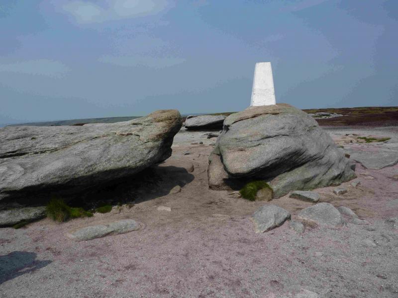
Kinder NW Trig Point, 624 m, SK 077 894.
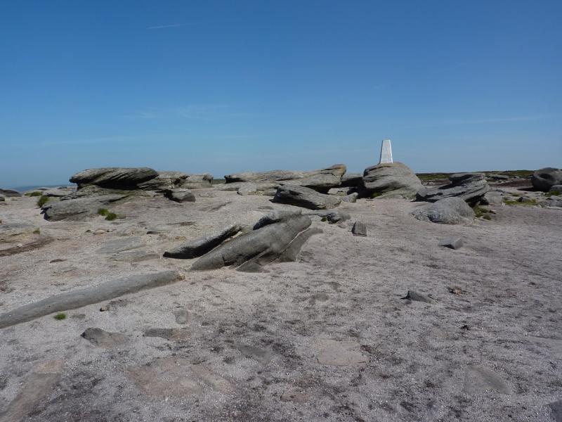
Kinder Low, 633 m, SK 079 870.
OS Outdoor Leisure 1: Dark Peak. OS 110 (1:50 000).
Introduction
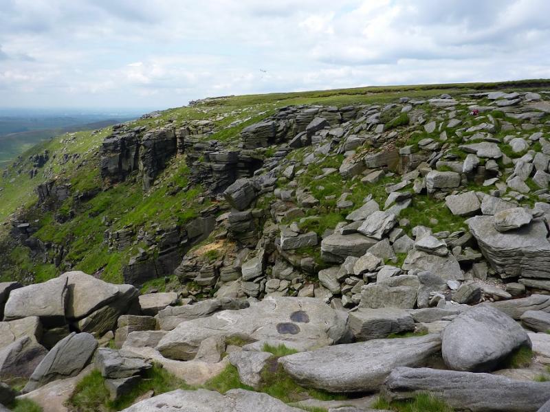
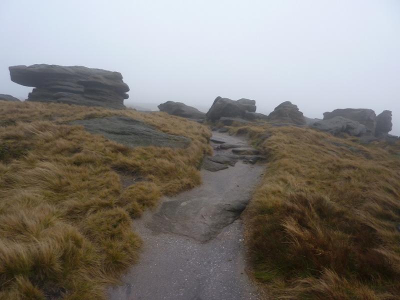
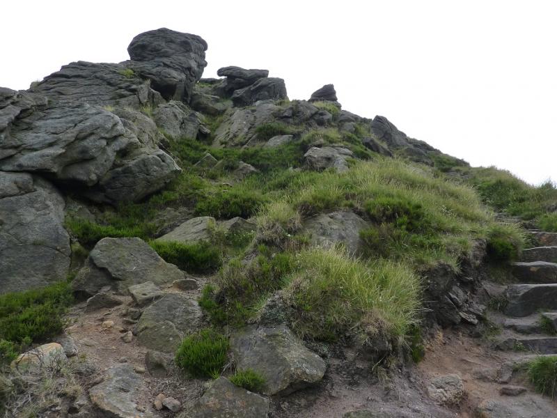
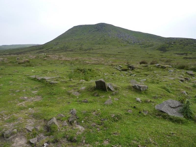
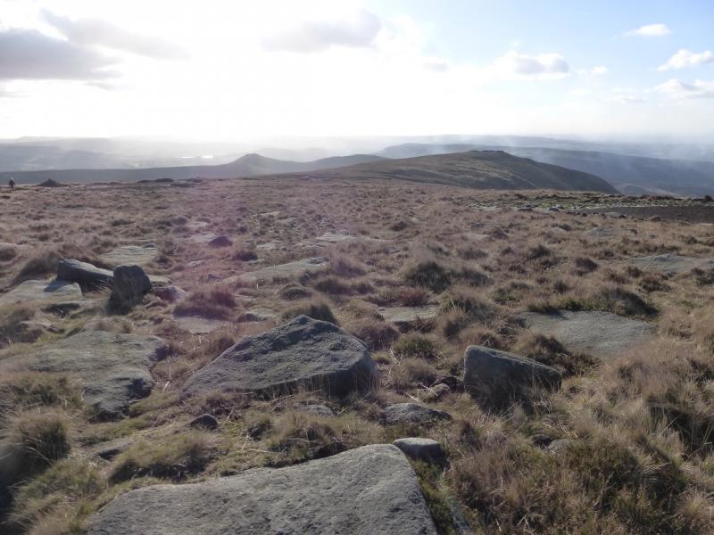
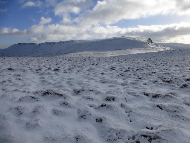
This is a very similar walk to one already posted, the difference being that this version tackles the cliffs on the NW corner of Kinder which offer various levels of difficulty including a “path” through them. There is both scrambling and climbing available for those with the appropriate skills and experience. If this is not for you, look for the same title without “NW Cliffs” in it; this only involves walking. This route is mainly a pleasant ridge walk which takes in Kinder Reservoir, much of the western edge of Kinder including the NW Trig Point, Kinder Downfall (which often blows back in a strong westerly!), and Kinder Low. For this part of the Peak District, most paths are good and fairly easy to follow. There are many unusual rock formations on the edge of Kinder which also provide good shelter, if needed, for lunch. The path to the foot of William Clough is boggy in places and the path up William Clough itself is very eroded and boggy so this route goes to the foot of William Clough then uses the “ridge” on its east side where there is no erosion as there is little trace of a path and the going is drier than in William Clough. At the top of the “ridge”, the route joins the path from the top of William Clough before using the engineered Pennine Way to ascend on to the edge of the Kinder Plateau where the route takes in not just Kinder Downfall and its cliffs but also the smaller Red Brook gully. The path then continues, along the western edge, to Kinder Low then descends down the steep nose of Kinderlow End which is now stepped but can be slippery when wet. This route is best walked in clear weather to make the location of the ridge up on to the plateau and the route through the cliffs much more obvious.
Route
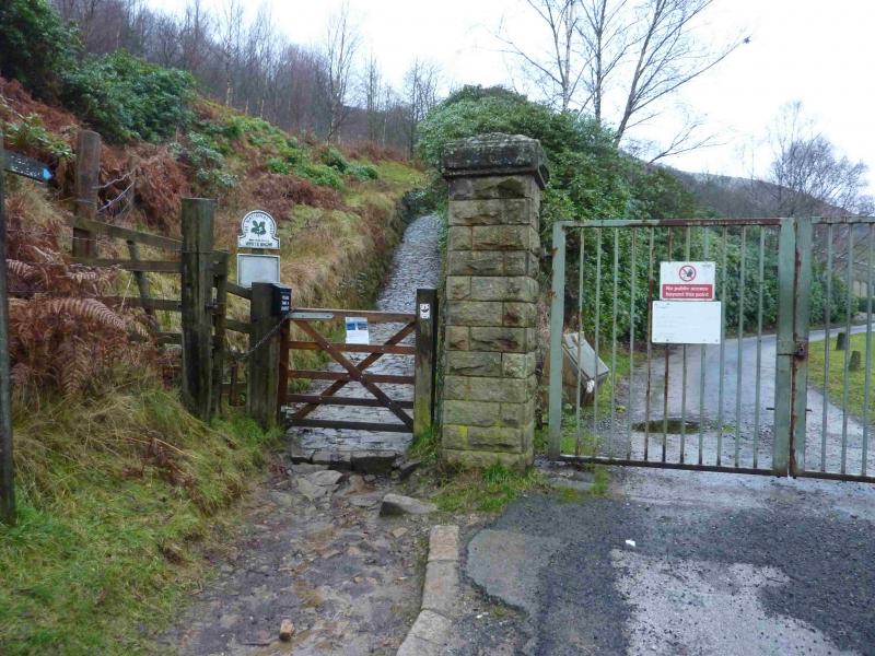
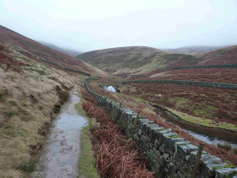
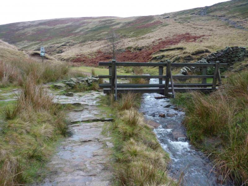
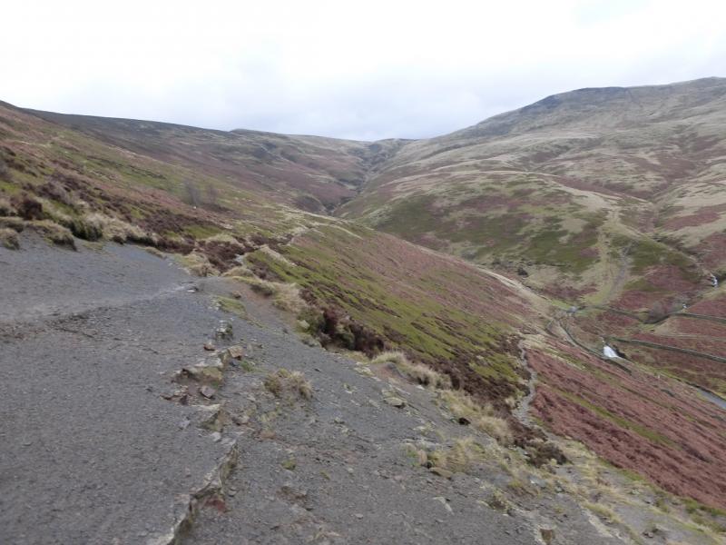
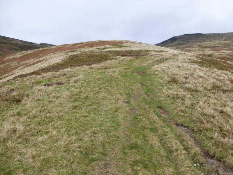
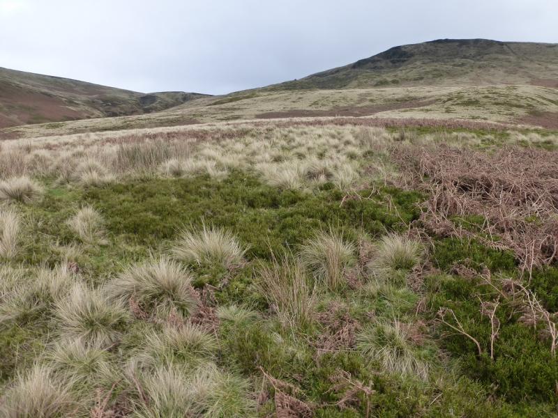
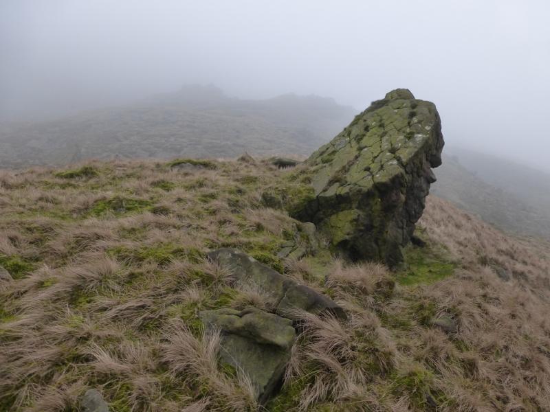
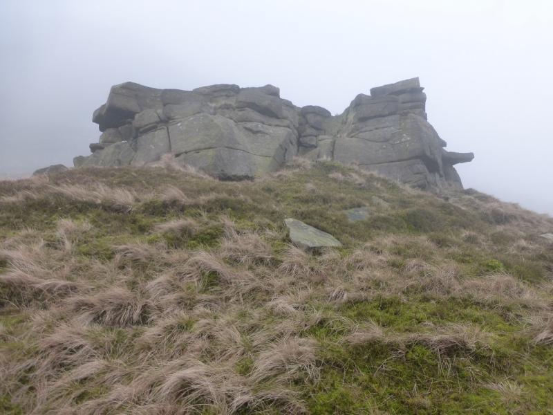
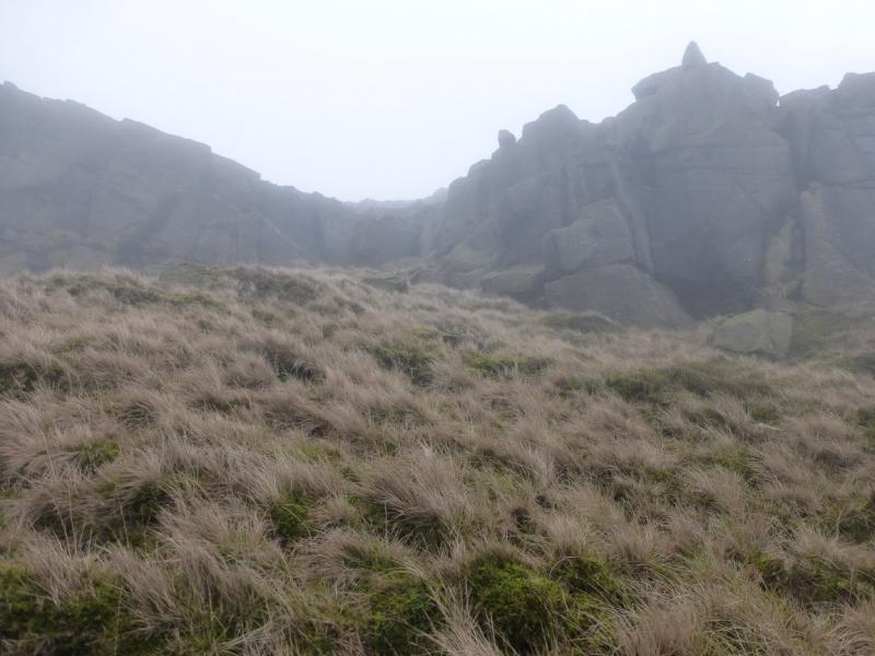
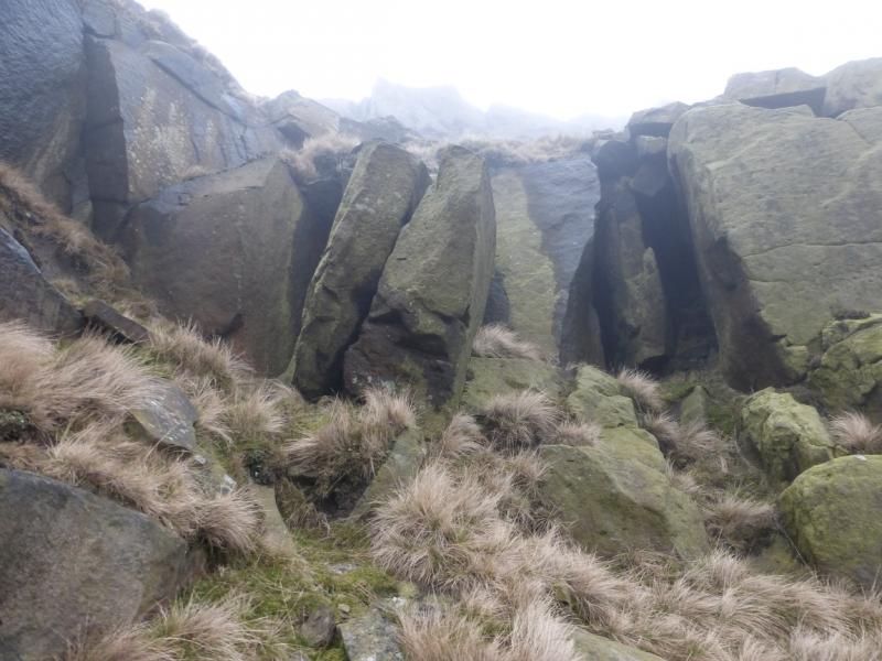
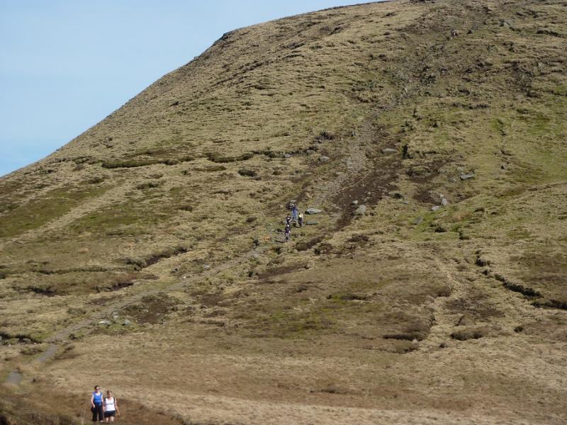
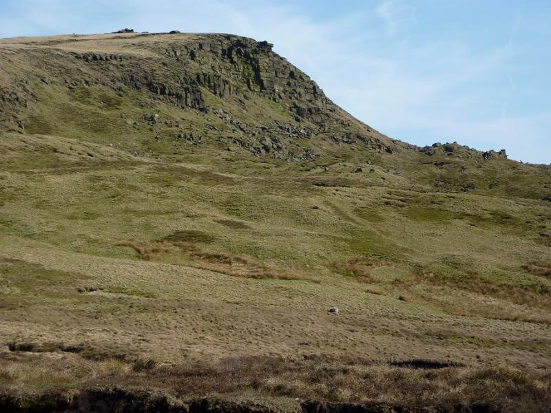
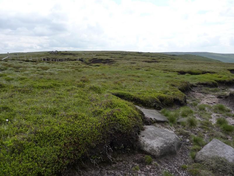
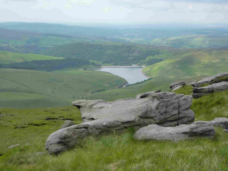
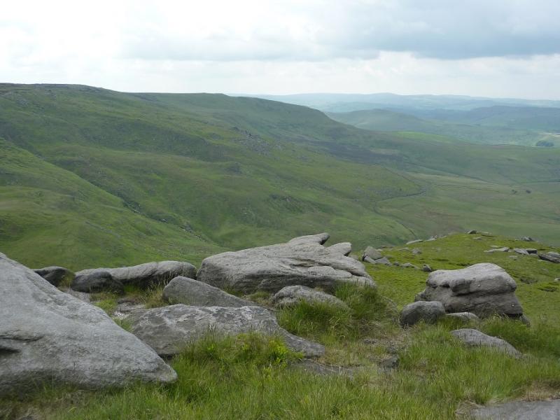
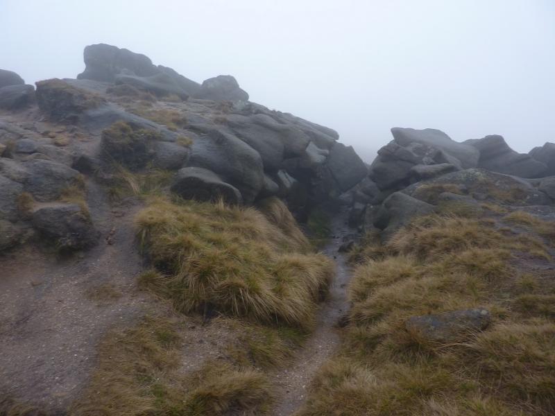
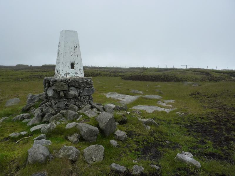
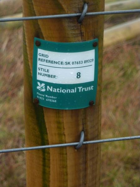
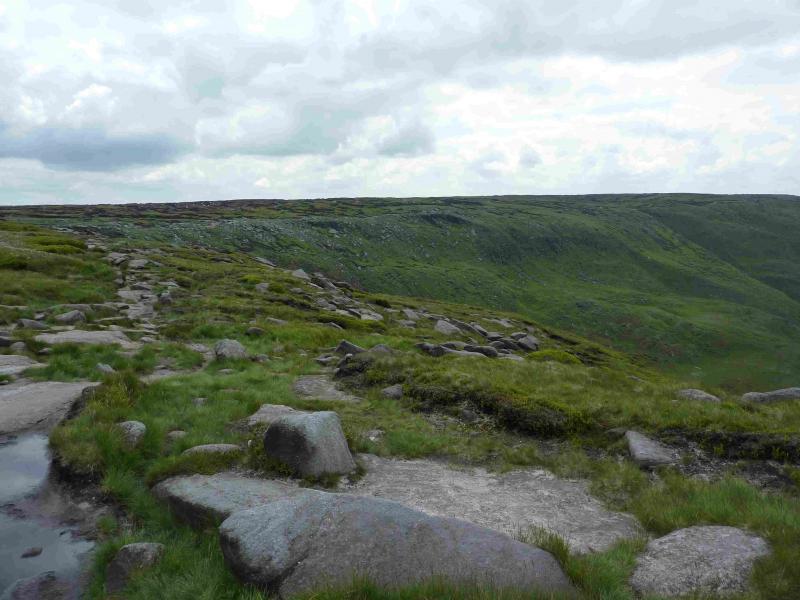
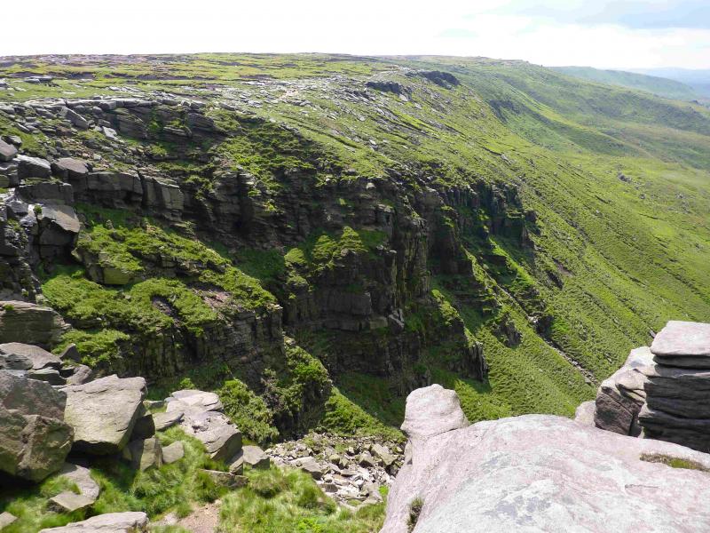
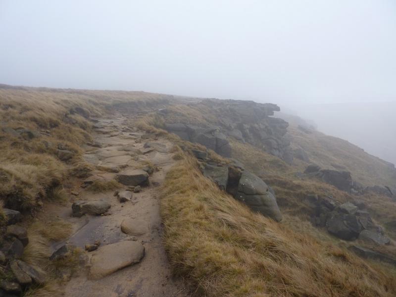
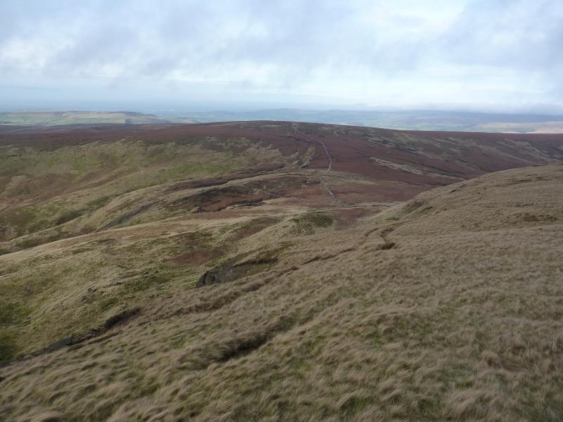
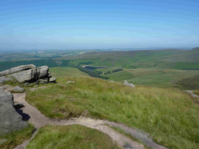
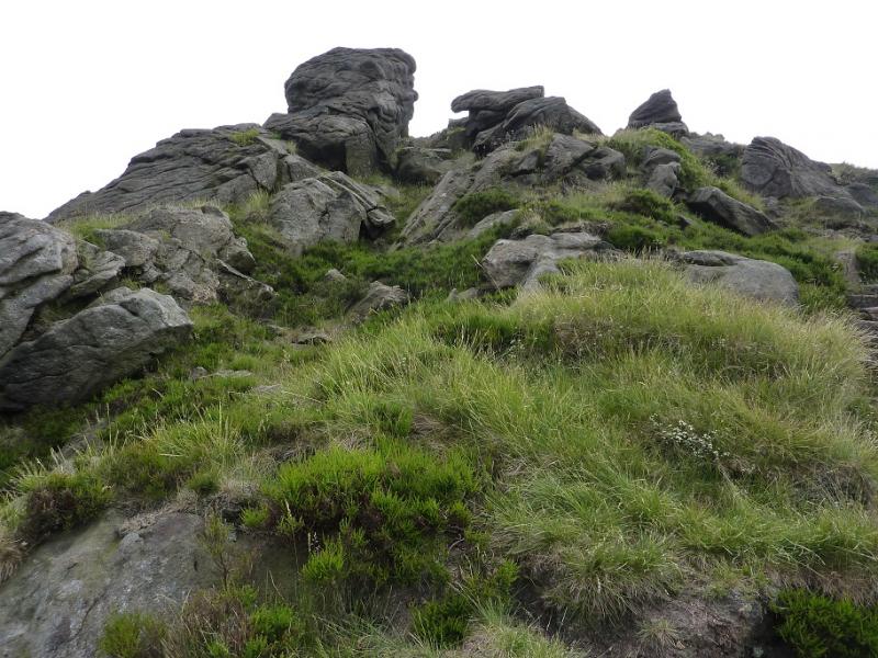
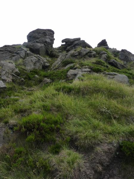
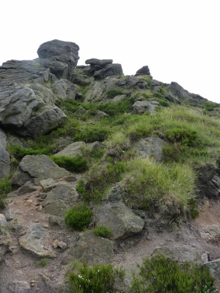
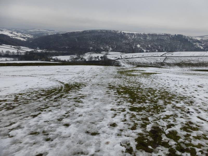
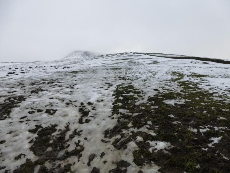
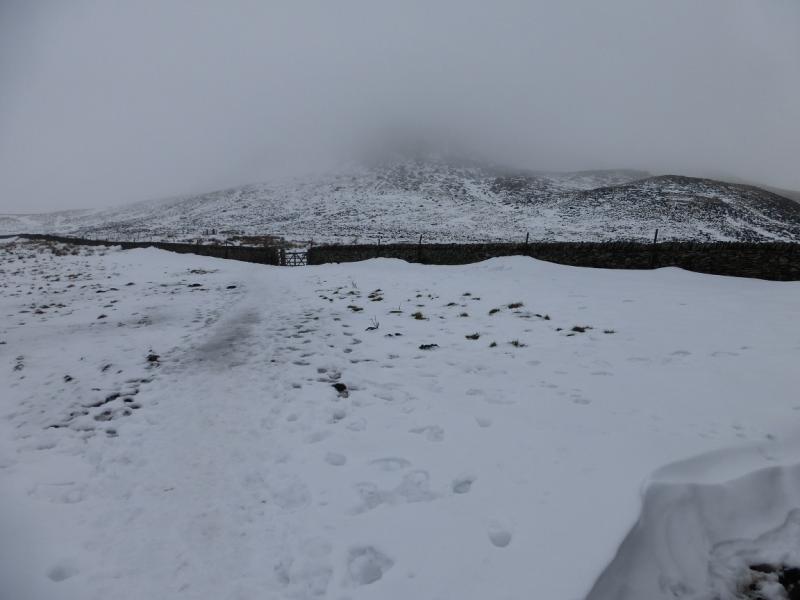
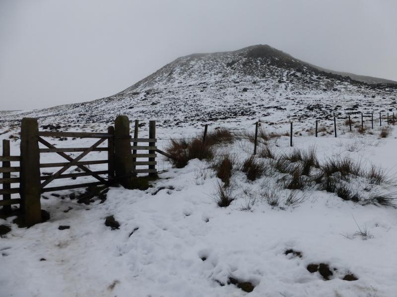
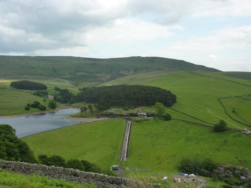
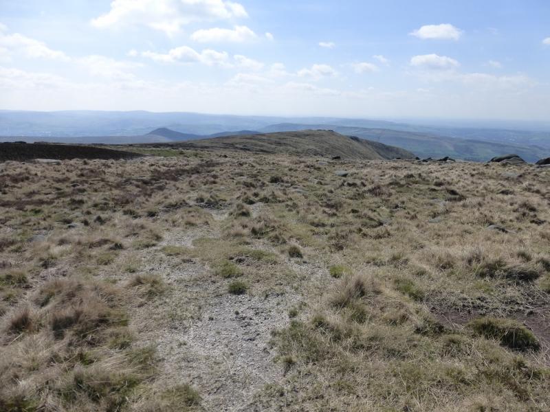
(1) From Bowden Bridge car park, continue up the road (do not cross the bridge by the car park). Soon the private road going up to Kinder Reservoir is reached. This usually has locked gates across it so turn right, cross the bridge then follow the footpath on the right of the river. This leads up to a footbridge which is crossed to gain the top of the private road by another gate. A small footpath gate is on the left of the large gate with a sign saying White Brow. Take this footpath, which is quite steep and cobbled. When it levels out, follow it along the wall on the W side of the reservoir and up the side of the N spur of the reservoir to reach a sign and footbridge which is crossed then follow the obvious path upwards for a short distance until one is on the crest of the ridge on the E side of William Clough. A faint path starts up this ridge. If you miss it and reach a small stream, you have gone too far. Follow the faint footpath up the ridge, heading roughly N. The path is very faint or non-existent but the going is not too rough not boggy. In places, the ground is more like a traverse across a slope (going down to William Clough) than a ridge. Try to hold the same line on the way up. Aim for the ridge, quite a way up this ridge, which has a prominent boulder on it and an outcrop further up. Reach this boulder which is on an ill-defined ridge, after a boulder strewn “scoop” on the right. Follow the boulder's ridge to the large outcrop further up. The outcrop offers scrambling and climbing but can be walked around on its left side. The cliffs guarding the edge of the plateau should now be obvious. A steepish grassy section leads directly up into the short cliff section where one can ascend either straight ahead or by going left first but there is some exposure. Above the short cliffs is a very wide ledge beyond which there are no difficulties. To avoid this, do not go up the grassy section but go around to the right to find a grassy ramp slanting back left to the top of the short cliffs. There is a hint of a path and less exposure leading one to the top of the short cliffs. Continue beyond here then trend around to the right and walk up easier grassy slopes to soon converge with the main path coming from the top of William Clough. Follow this obvious path, along the edge, generally S to SE. If the weather is bad, there are some useful rocks to shelter behind and, on the right of the path, there is a rocky groove which offers the best shelter. Continue on the path, gradually ascending. Kinder NW Trig Point lies off this edge path and is on the Kinder Plateau. Follow the edge path to a “summit” by an outcrop after which the path descends. Continue a very short distance along the edge path to go through the gate of a new fence then head off left to regain the height just lost. Another fence, visible much of the way from the NW corner should be seen to the left. In clear weather, the trig point itself may be seen. If not walk to the fence and follow it shadowing the edge. There are a few stiles but one is about 40 m from the trig point which is slightly to the right. This is actually labelled as Stile 8 and has its grid reference on it. Note that Kinder NW Trig Point, 624 m is not the highest point in this area. In thick weather, the fence may not be seen from the path “summit” so, if you are sure you are in the right place (!), walk at 1 o'clock from the “summit” to meet the fence then follow it to Stile 8. If you cannot see the Trig Point from the fence – it is white and does not stand out in mist – from Stile 8 then also walk at about 1 o' clock for about 40 m. An even surer way to reach Stile 8, although slightly longer, is to stay on the edge path until a fence crosses it then follow this fence to Stile 8.
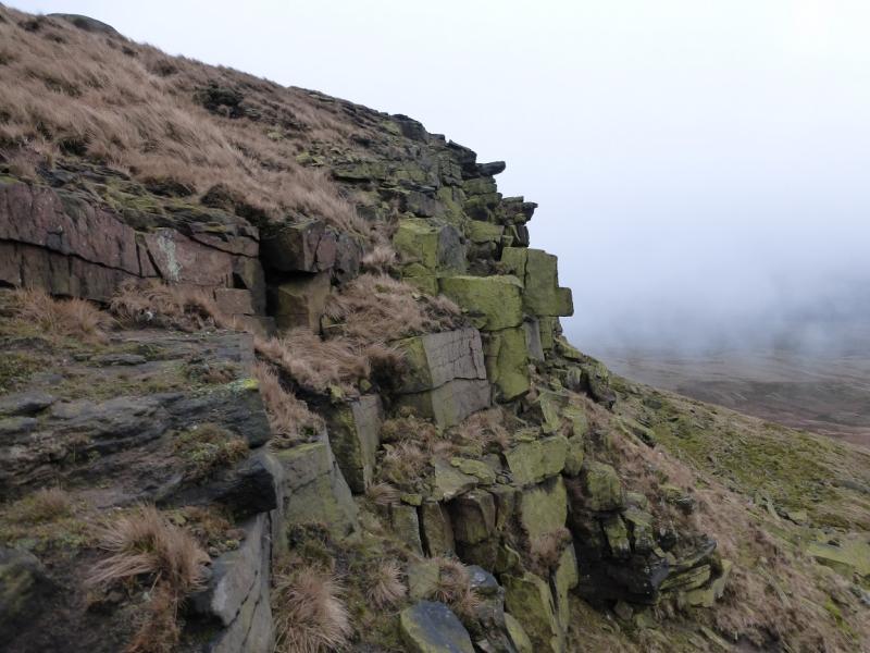
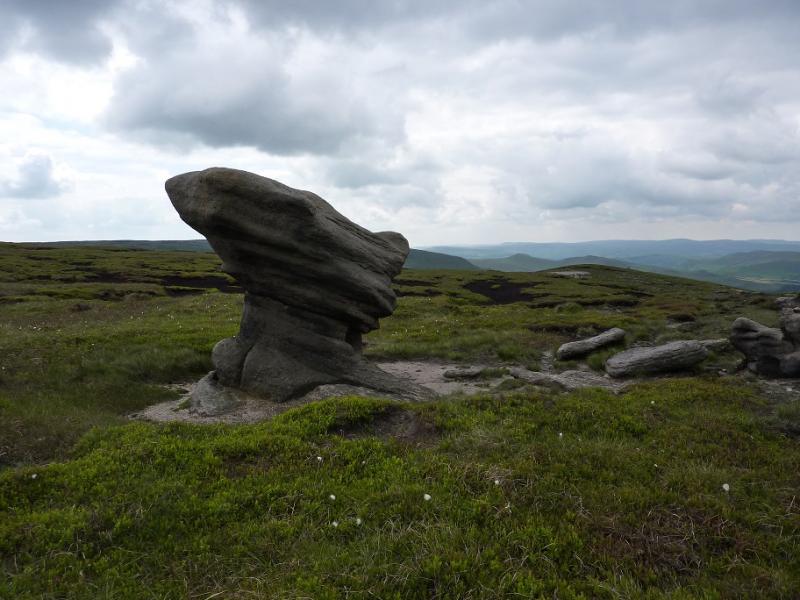
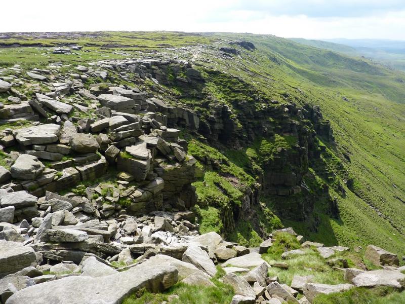
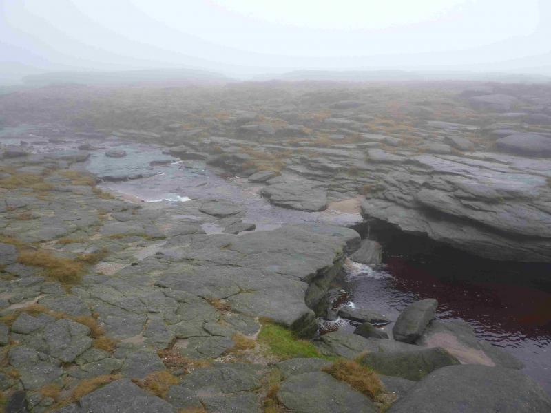
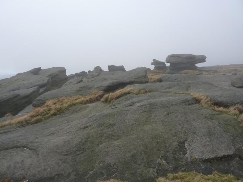
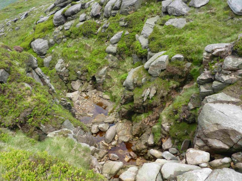
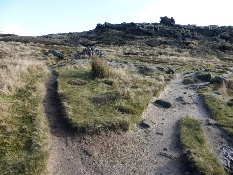
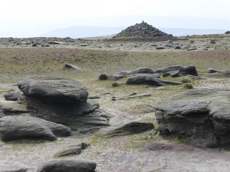
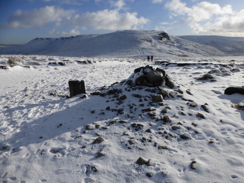
(2) From the trig point return to the stile then follow the fence the other way. It turns at right angles then meets the edge path soon after and this can be followed to the downfall. In just over 2 km from the NW corner, the edge path cuts into the plateau to reach Kinder Downfall with cliffs either side. Cross the River Kinder easily and follow the edge path again, this time S, for about 1 km, to reach Red Brook which is a smaller version of Kinder Downfall. Continue along the edge, still on a fairly distinctive path which gradually starts to gain height. Kinder Low is about 1 km S of Red Brook. As one approaches, cairns appear. When a very large cairn is reached (massive compared to the others), the trig point will be obvious in clear weather as it is only about 60 m away. In thick weather, walk on a bearing of about 70 degrees and soon reach Kinder Low, 633 m. The Trig Point sits on a low rocky outcrop. Some people describe the landscape here as lunar. A short cut is to fork left at a large cairn just before the final rise and follow this path to the trig point.
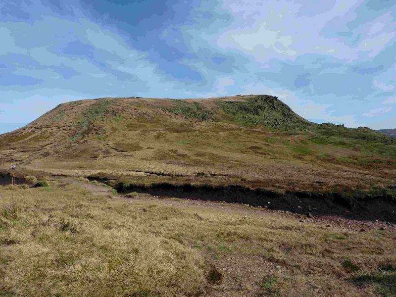
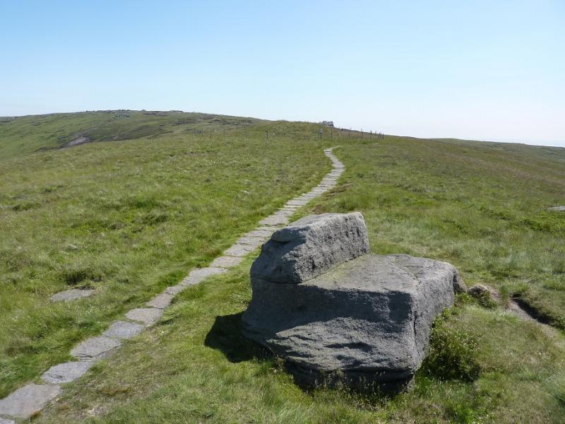
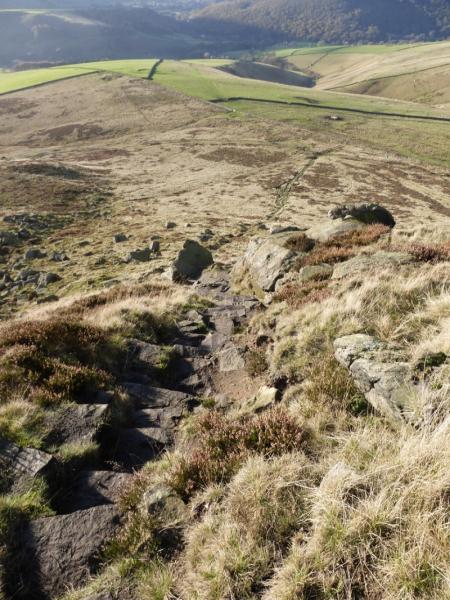
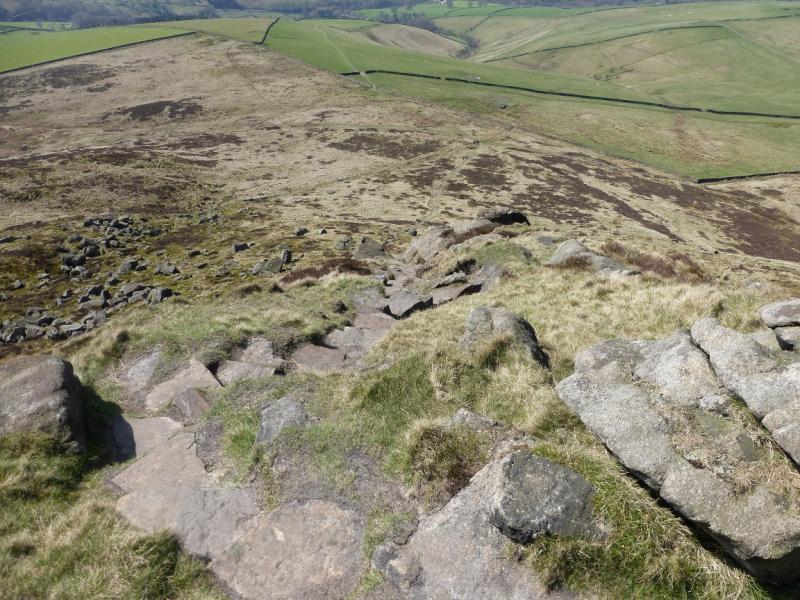
(3) Retrace to the very large cairn (approximate bearing, 290 degrees if you did not come this way) and follow the edge path S then SW heading for the Kinder Low End spur. The path has well spaced smaller cairns, easily seen in clear weather but too far apart in mist. The path leads to a slabbed path. When on this slabbed path, ignore the turn off left on to another slabbed path and stay on the Kinder Low End path. Follow this, descending gently until Kinder Low End is reached. This is steep and rocky but there is a very good stepped path which makes the descent very straightforward. At the bottom, continue ahead to reach a major path and go left through a gate. Drift right towards the wall and soon reach another gate where there is a notice. Go through the gate then the boggy gate less hole in the wall just beyond and diagonally to the right. Continue down, shadowing the wall on your left, passing through some gates. There is no obvious path at first. Continue down to reach a stile which is above Tunstead House. From the house, follow the road down. Go straight on at a crossroads and soon reach Bowden Bridge.
Notes
(a) This walk took place on 11th January, 2016.
Photos - Hover over photo for caption. Click on to enlarge. Click on again to reduce.