Get Lost Mountaineering
You are here: Scotland » 17 Islands » Skye
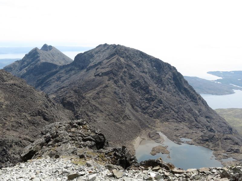
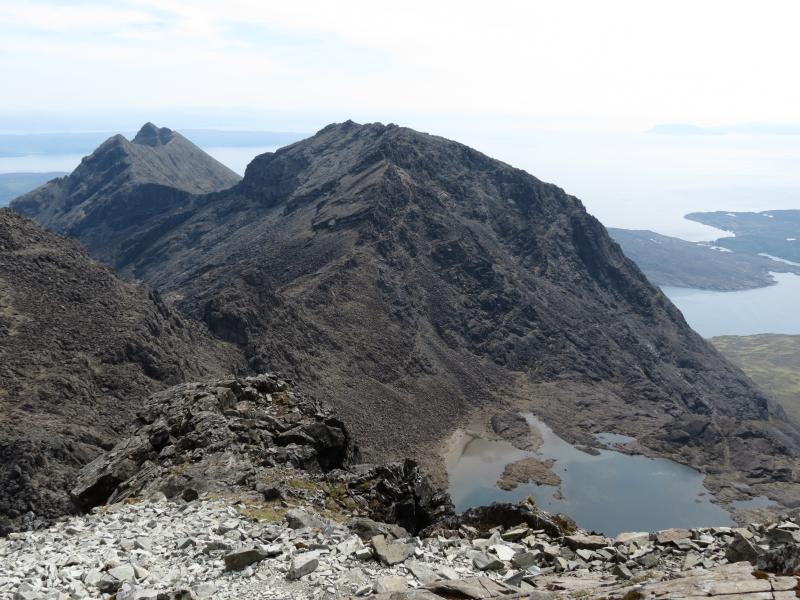
Sgurr nan Eag from Glenbrittle
Sgurr nan Eag from Glenbrittle
Start/Finish
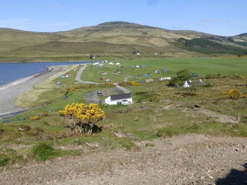
Glenbrittle BMC Memorial Hut (next to Mountain Rescue) or car parking before Glenbrittle Campsite. The campsite is nearer for access. Parking inside the campsite grounds is charged.
Distance/Time
12 km. About 8 hours.
Peaks
Sgurr nan Eag, 924 m, NG 457 195. OS sheet 32 but see below.
Introduction
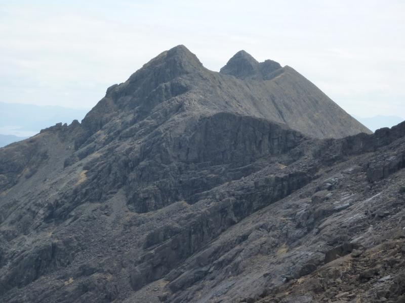
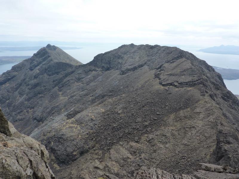
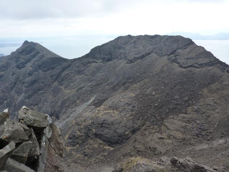
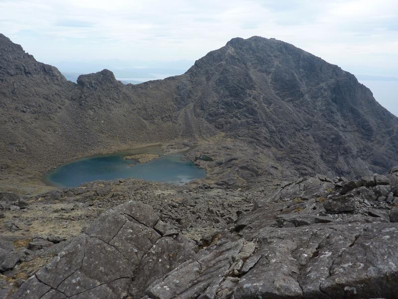
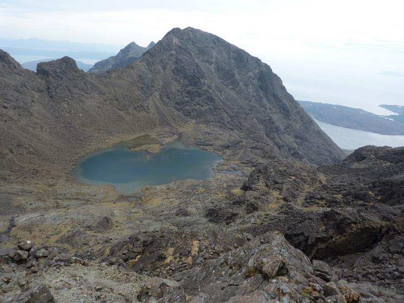
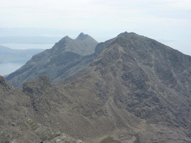
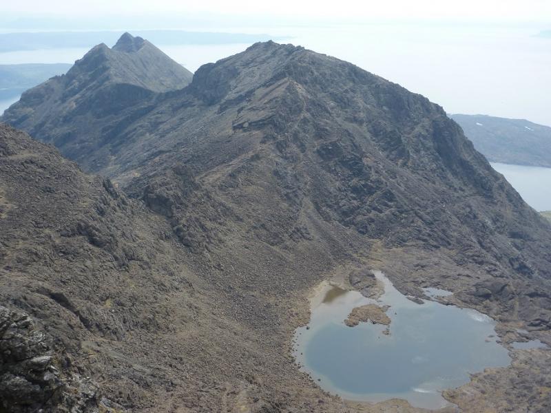
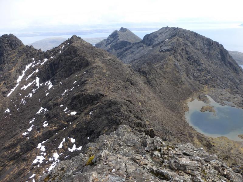
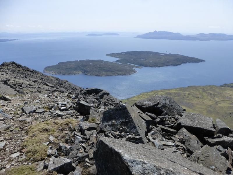
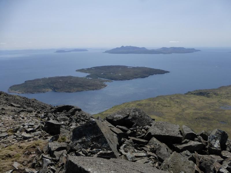
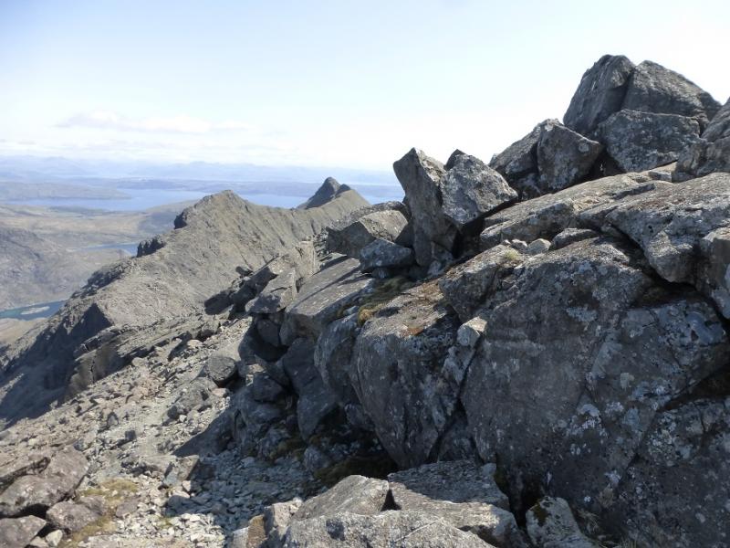
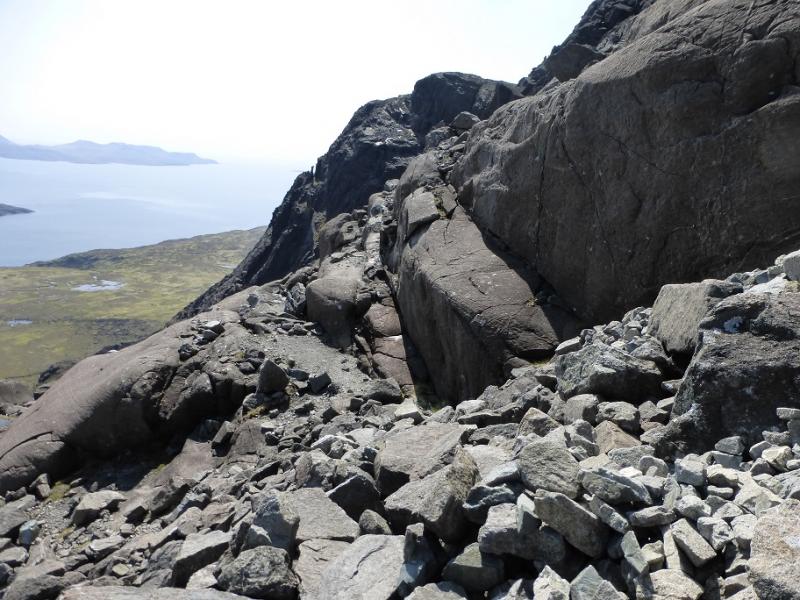
This walk involves scrambling, much of it easy but there is much rough and loose scree if the “paths” are followed. Many get off route going to Loch Coir a' Ghrunnda so even the walking needs care. Wet weather and poor visibility make this a much more demanding route. OS sheet 32 covers the walk but some will prefer the Harvey map of the Cuillin. The SMT used to publish a very good map of the main Cuillin (not including the Blaven range) which had the contour map on one side (unfortunately without grid lines!) and a diagram map on the reverse similar in style to that used in the SMC Munros book. In clear weather, the diagram map is probably the most useful as the others can be over powering with all their contours. There are many guide books for Skye but the most popular and comprehensive seems to be the SMC Skye Scrambles and is well worth buying. Note that a compass is unreliable on the Cuillin so be extra prepared in bad weather to cope without one. A compass needle may spin. In spate conditions, the Allt Coire Lagan may be very difficult to cross. The views on this walk are absolutely stunning, not just of the Cuillin peaks but also of Coir a' Ghrunnda, which many regard as the most attractive corrie in the southern Cuillin, as well as the islands of Soay, Rum, Eigg and Canna, however this is not a walk for the inexperienced especially in bad weather. The route up is unusual but no worse than the main “path”.
Route
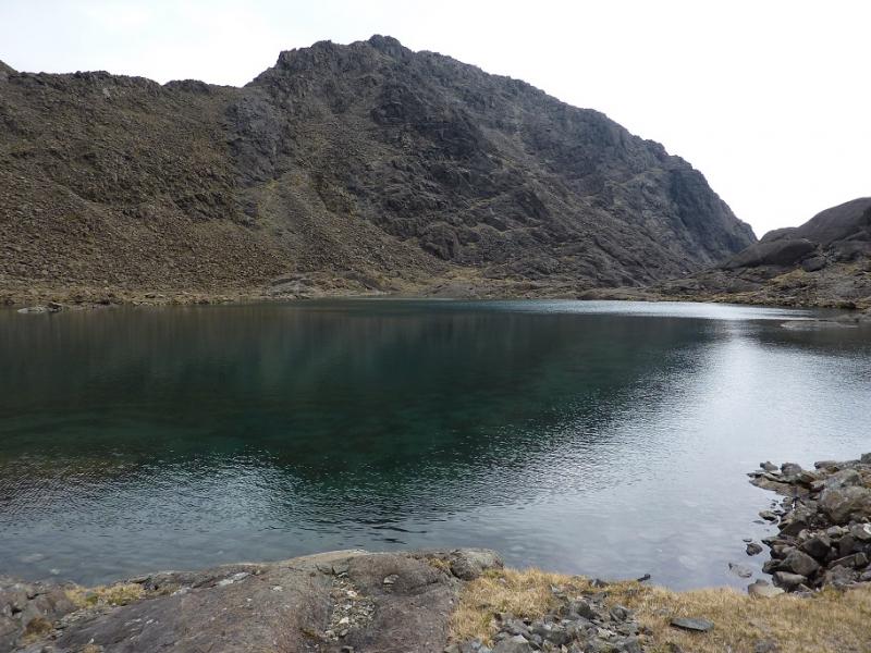
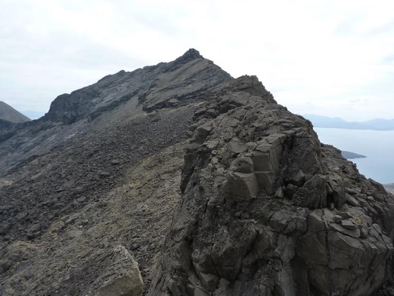
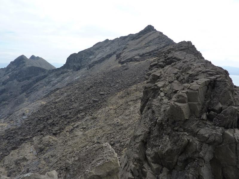
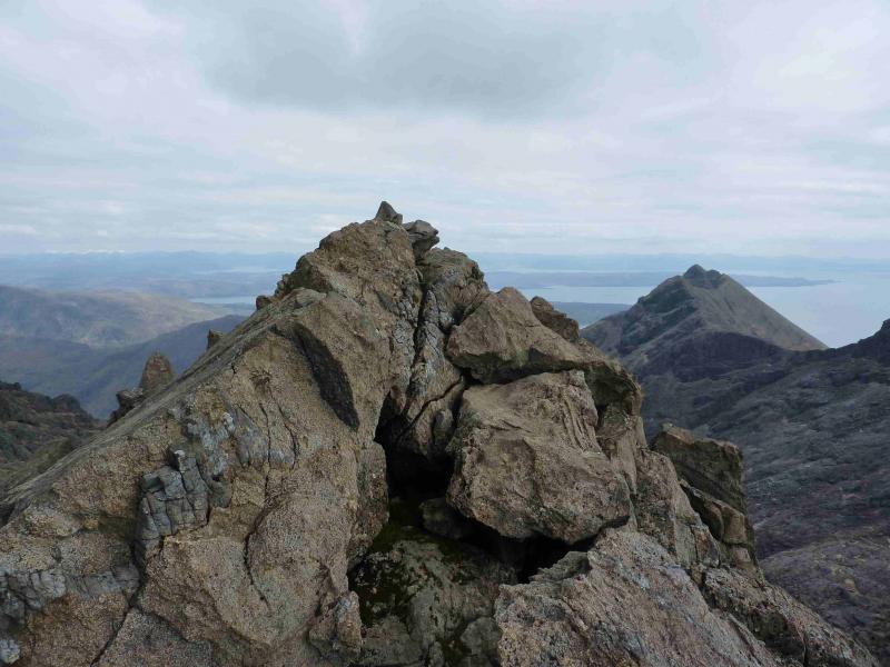
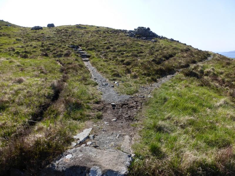
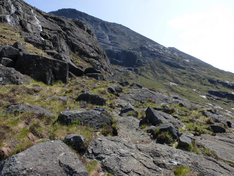
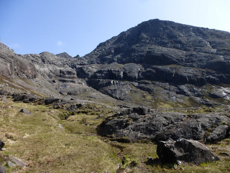
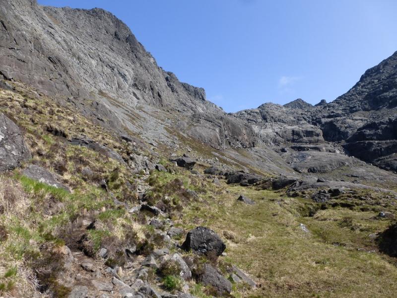
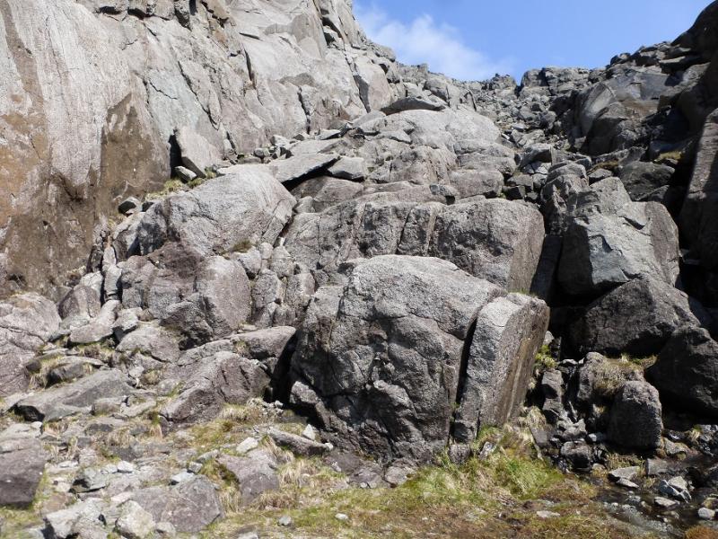
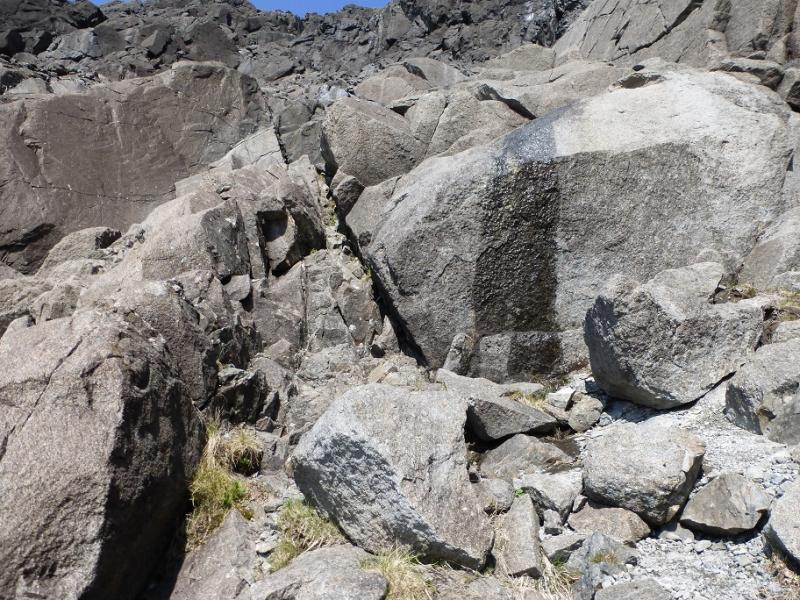
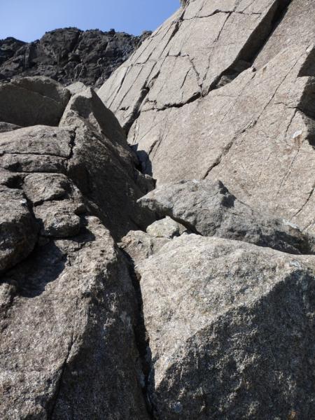
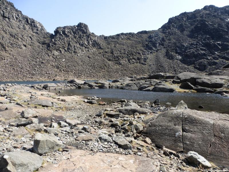
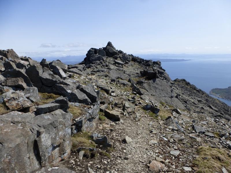
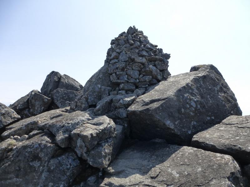
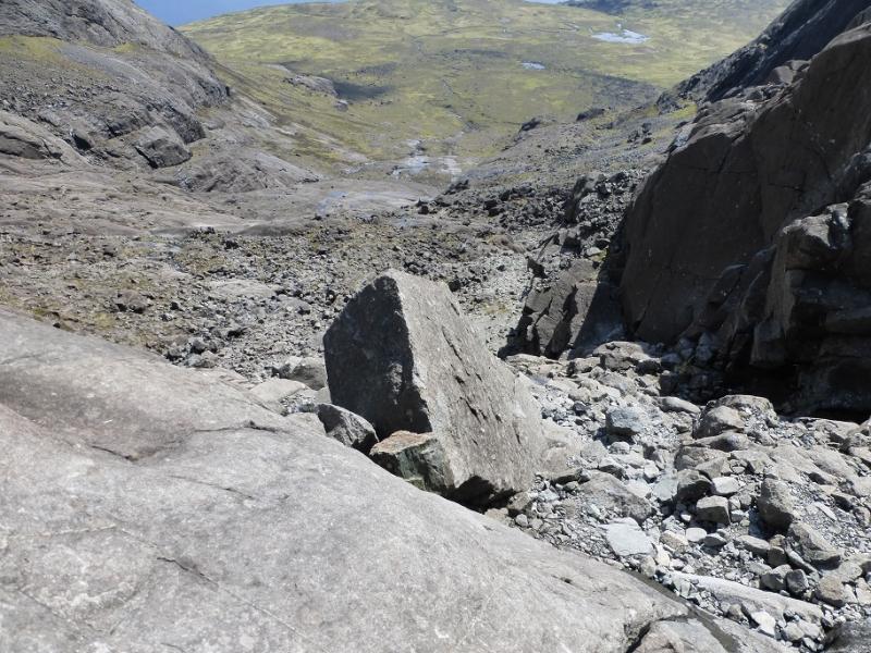
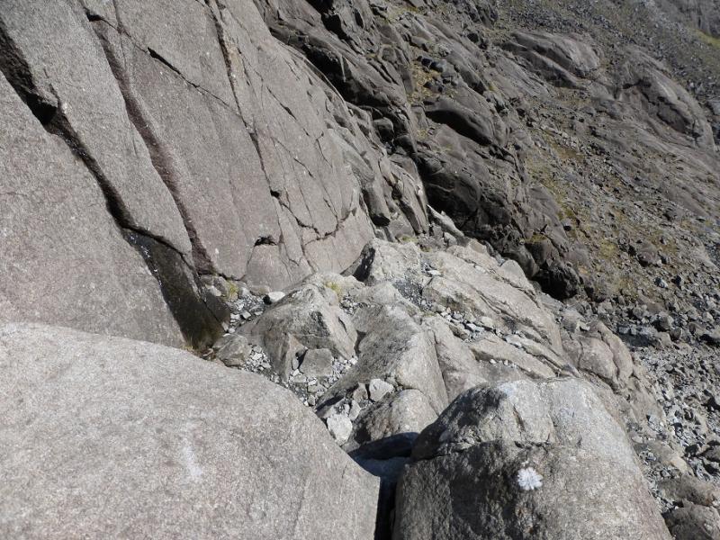
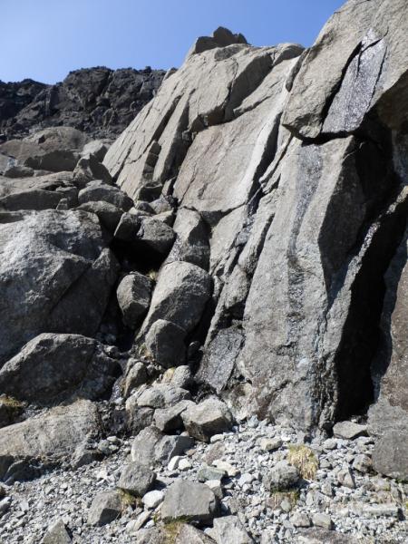
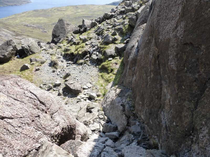
(1) From the Glenbrittle hut, walk down the road until it turns right and a track goes on ahead. Follow the track which soon climbs past the campsite. Alternatively, from the camp site, ascend the path behind the toilet block to reach this track. Almost immediately, leave the track and follow a good path E, cobbled in places towards Coire Lagan. In about 500 m, the path splits so take the right fork which descends slightly to cross a burn. If this burn is difficult to cross then the next will be much harder. Continue past a small lochan and cross a minor stream just before the Allt Coire Lagan which, in spate, can be a very difficult crossing. Continue on the distinct path. Further on, the path splits again so take the left fork which climbs around the foot of Sron na Ciche and into the lower part of Coir a' Ghrunnda. The path is easily followed until it levels out on a short grassy section (often boggy). Many go astray here but the path is still there, it is just well to the left just below the rock and distinct once reached. The golden rule here is do not cross a burn before Loch Coir a' Ghrunnda. The path continues and a few options are possible to avoid a boulder field higher up. Beyond the boulder field a rock band seems to bar progress to the last terrace below the ridge so follow the path just to the left, W, of the burn but do not cross it. A waterfall through the slabs should be reached. Go right to the foot of the rock band on the left of the waterfall where a narrow groove on the left should be seen which ascends a weakness in the rocks. Further left is a wider “gully” but the groove is the easier option especially if a narrower groove about 3 m to its left is ascended first then a “ledge” is used, before its top, to reach the main groove under a rock wall. Note well where the top of this groove is as it must be located in descent. At the top of the groove go left around a boulder then cut right up a “groove” to reach a path which leads to Loch Coir a' Ghrunnda which is a lovely spot to rest. Make a note of how to reach the groove on the way down to avoid a night by the loch! Go right, around the loch to where a path starts climbing. Follow this up, on rough and loose scree in places, into what seems a wild open corrie. Keep looking for the easiest line and drifting right slightly. Keep to the right of any rock walls and gullies/slopes leading up to rock walls. It is possible to keep to the right of all the steep ground on the left and there hints of a path in places. Straying too far right also leads to very steep drops. Keep going and, eventually, the cliffs on the left will be outflanked and a much flatter area reached from where the summit crest can be gained easily. Walk roughly S along this. The path is not always obvious but by passes the rocky parts of the crest on the right before reaching an outcrop on which a large cairn marks the summit of Sgurr nan Eag, 924 m. It is the only cairn on the summit crest.
(2) Retrace along the crest to reach a path going down the left side of the descending ridge. Follow the path which can be very rough and loose and passes through much steep scree. At one point, the continuation goes through an easy cleft which is not obvious. Continue, after much loose scree, down to the col before Caisteal a' Garbh Choire. Experienced scramblers and climbers are better off staying on the crest. From the col, descend, through yet more scree, to reach Loch Coir' a' Ghrunnda then retrace the outward route hoping you can find the corner groove!
Notes
(a) This walk took place on 25th May, 2016, and twice before by different routes.
Photos - Hover over photo for caption. Click on to enlarge. Click on again to reduce.