Get Lost Mountaineering
You are here: Scotland » 17 Islands » Skye
Sgurr nan Gillean (by W Ridge) & Bruach na Frithe from Sligachan
Sgurr nan Gillean (by W Ridge) & Bruach na Frithe from Sligachan
Start/Finish
Sligachan Mountain Rescue Post which is a little way up the Dunvegan road from the Sligachan Hotel. Plenty parking is usually available.
Distance/Time
13 km. About 7 – 8 hours.
Peaks
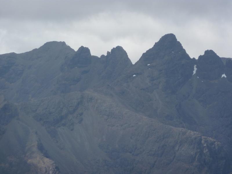
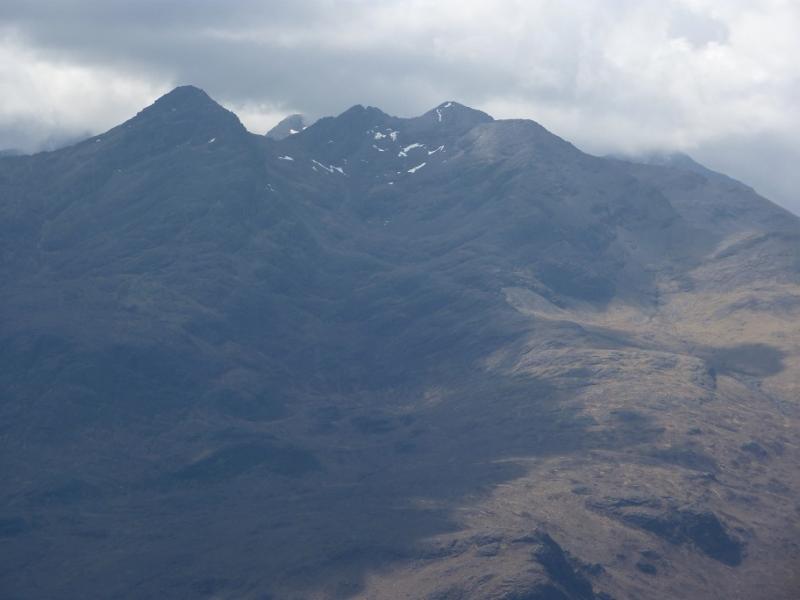
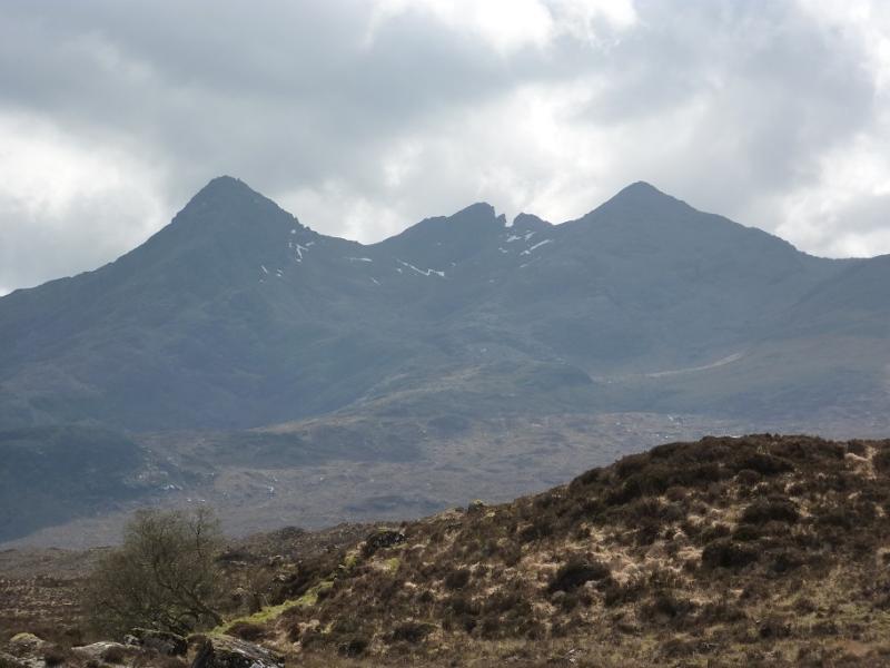
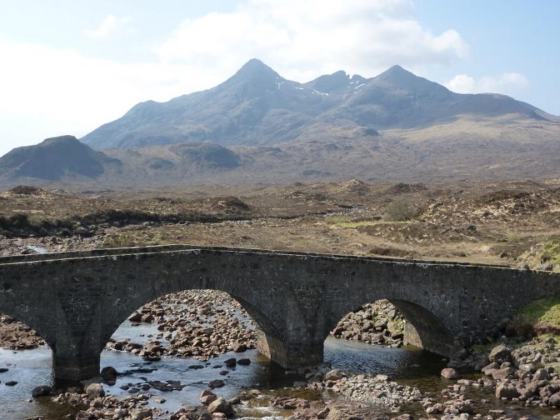
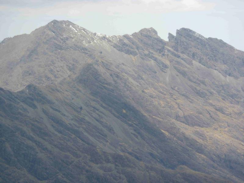
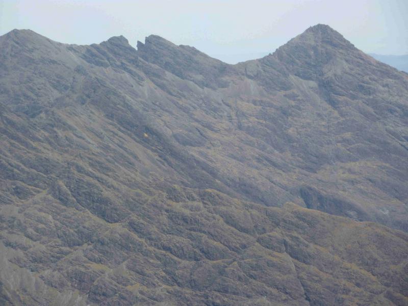
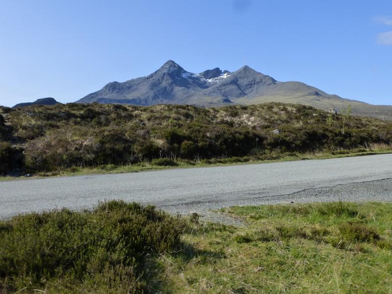
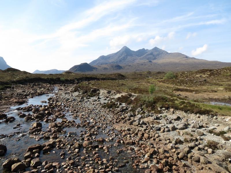
Sgurr nan Gillean, 964 m, NG 471 252.
Bruach na Frithe, 958 m, NG 461 252. OS sheet 32 but see below.
Introduction
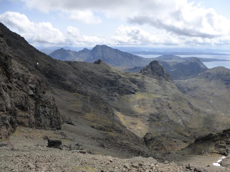
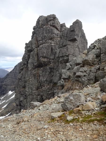
The ascent of Sgurr nan Gillean by its West Ridge from Bealach a' Bahsteir, is one of the hardest sections of the main ridge and is well beyond walkers who are not climbers or top scramblers. The West Ridge has to be descended as well. The other sections of this route are just walks albeit on loose scree at times. For walkers wanting to ascend to West Ridge of Sgurr nan Gillean, there are two options: either find a climbing friend or hire a guide (most take up to 4 people). Guides can be found on the Walking Highlands website. Bear in mind that even the guides may not take on this route in poor weather; many now lower clients rather than letting them abseil to save time. It is not unusual for queues to form at the foot of the West Ridge and one may have to wait for a while at busy times.OS sheet 32 covers the walk but some will prefer the Harvey map of the Cuillin. The SMT used to publish a very good map of the main Cuillin (not including the Blaven range) which had the contour map on one side (unfortunately without grid lines!) and a diagram map on the reverse similar in style to that used in the SMC Munros book. In clear weather, the diagram map is probably the most useful as the others can be over powering with all their contours. There are many guide books for Skye but the most popular and comprehensive seems to be the SMC Skye Scrambles and is well worth buying. Note that a compass is unreliable on the Cuillin so be extra prepared in bad weather to cope without one. A compass needle may spin. This route is unusual in that it does not include an ascent of Am Basteir as that is described in combination with the Basteir Tooth however it could easily be included and would add about an hour. It has a “bad step” but this is easier than most of the West Ridge.
Route
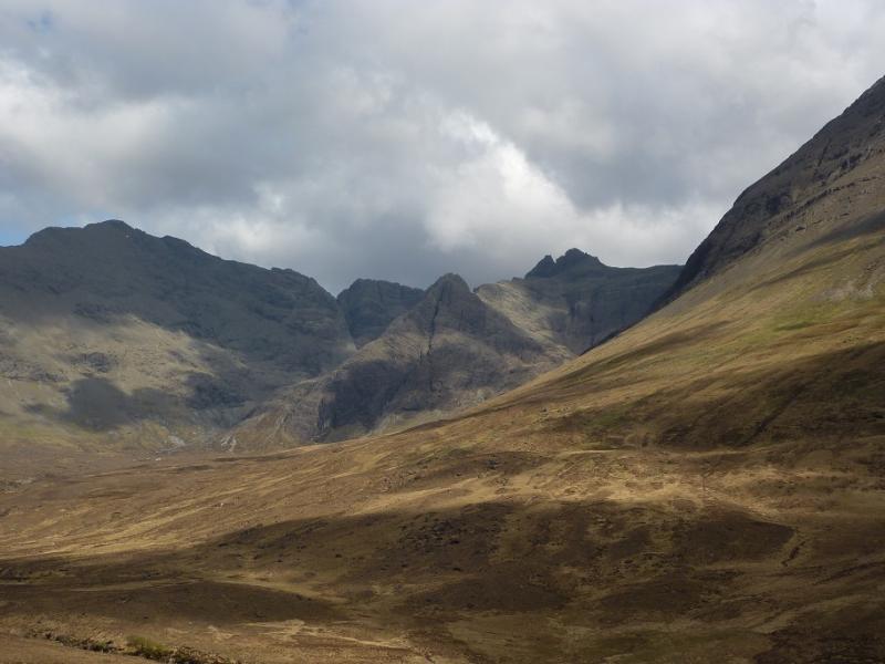
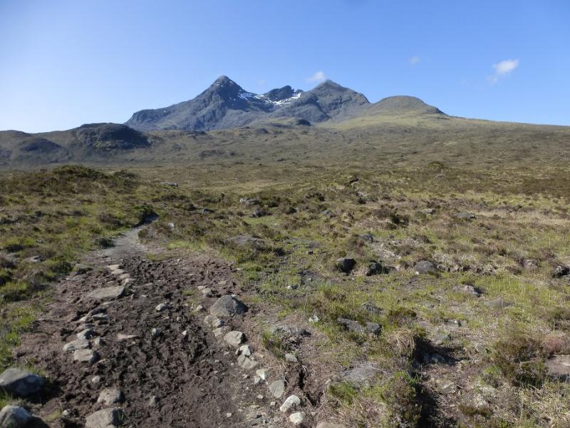
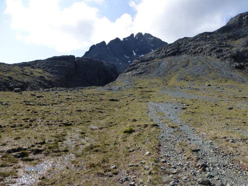
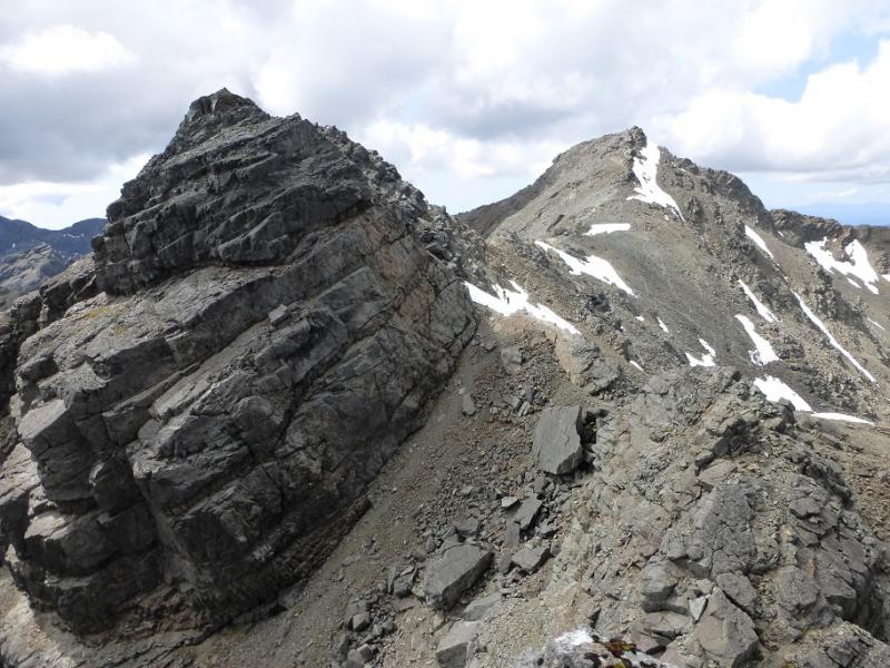
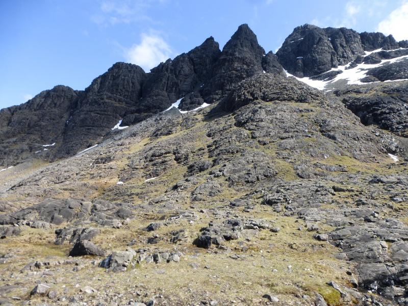
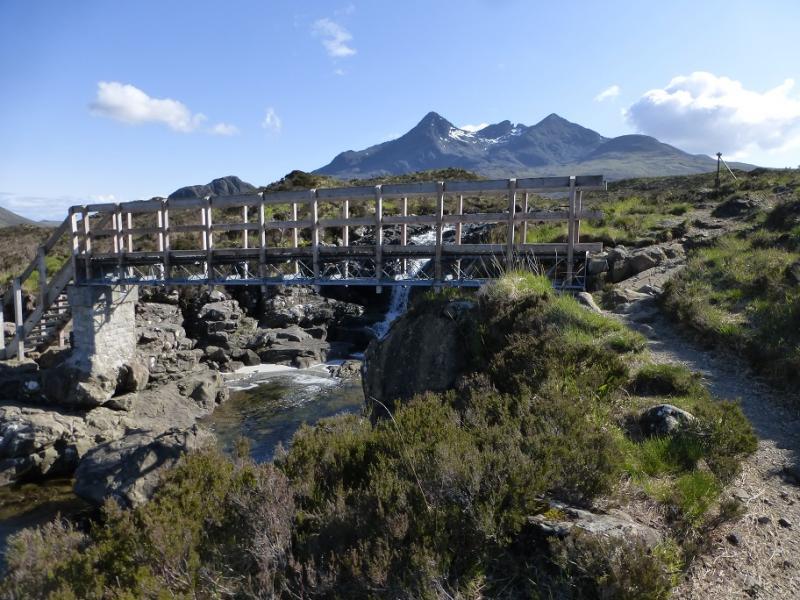
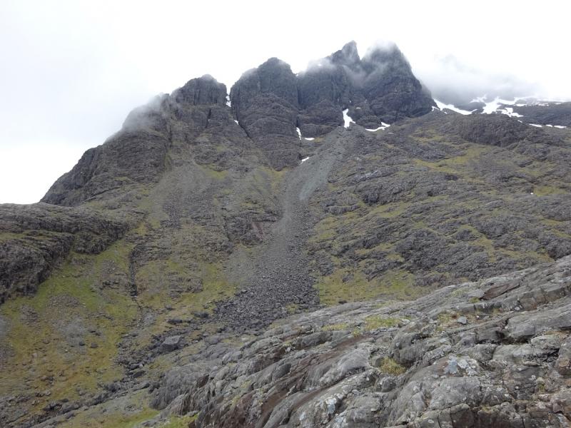
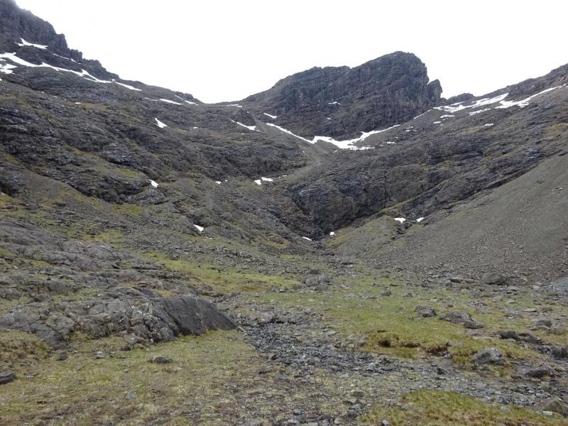
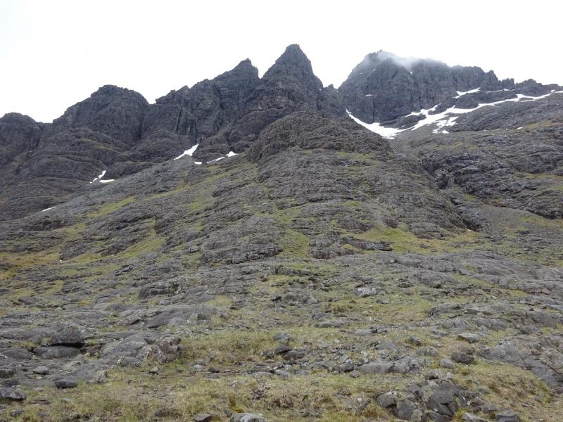
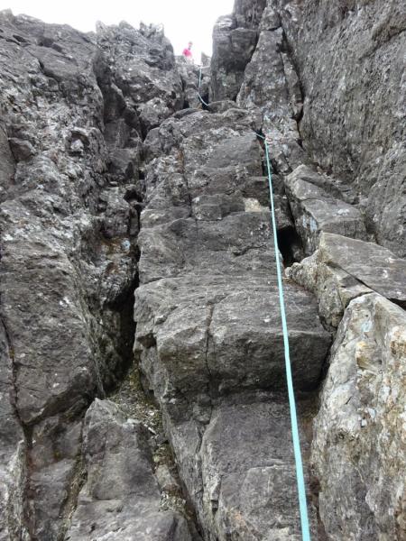
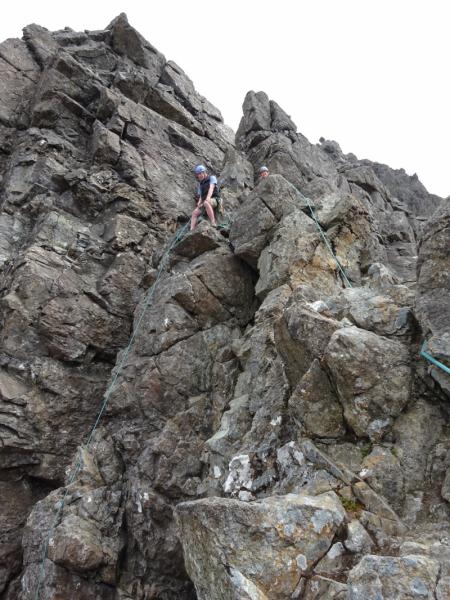
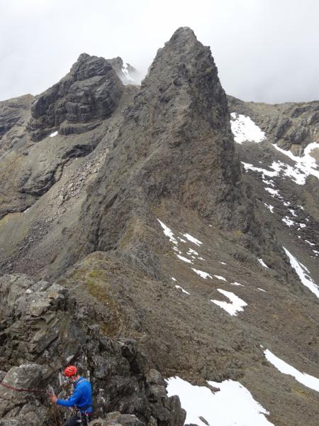
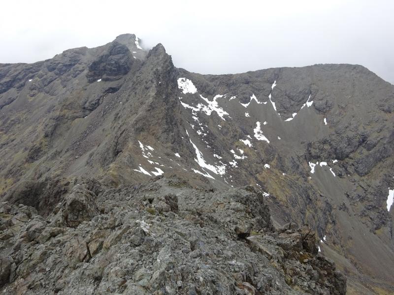
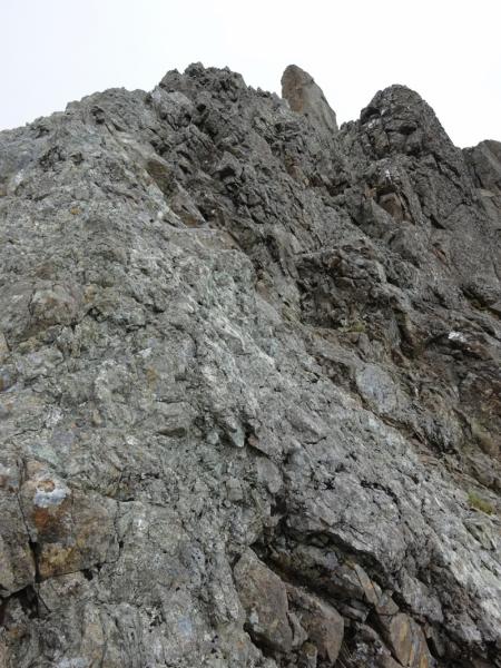
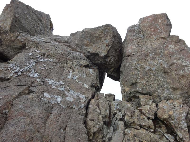
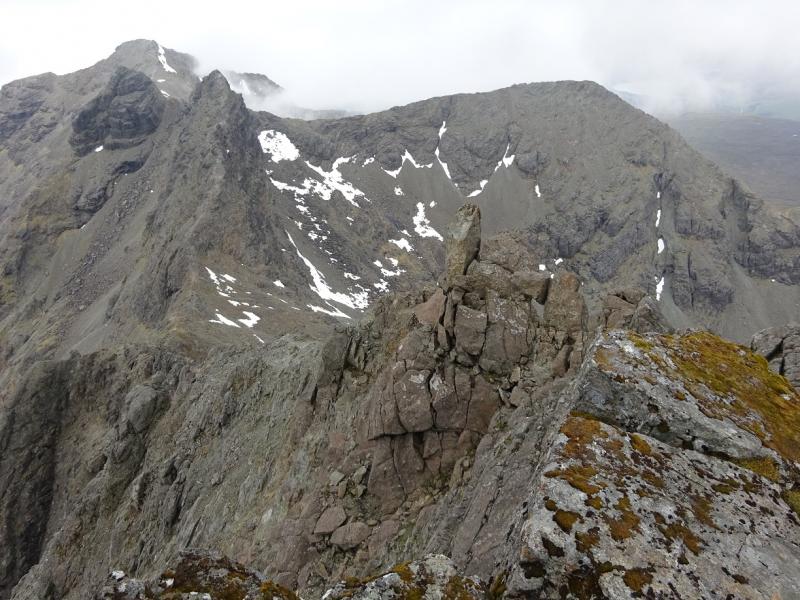
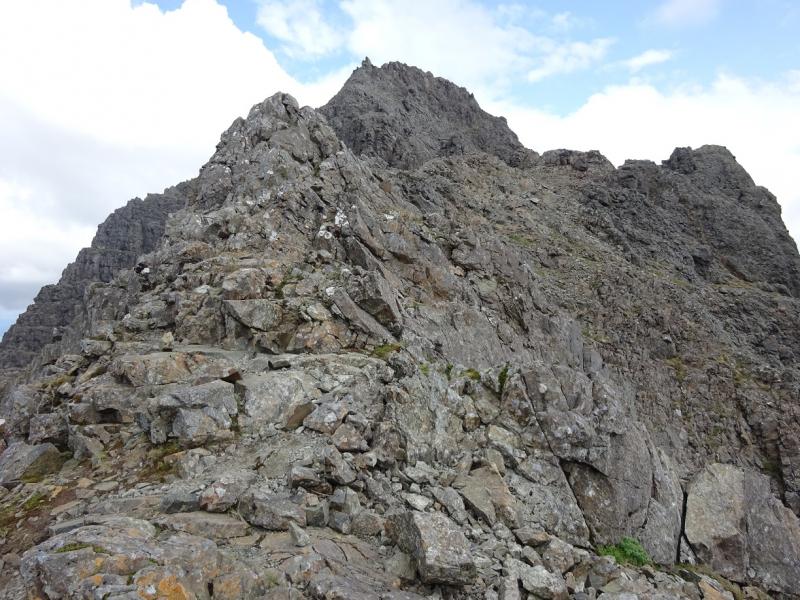
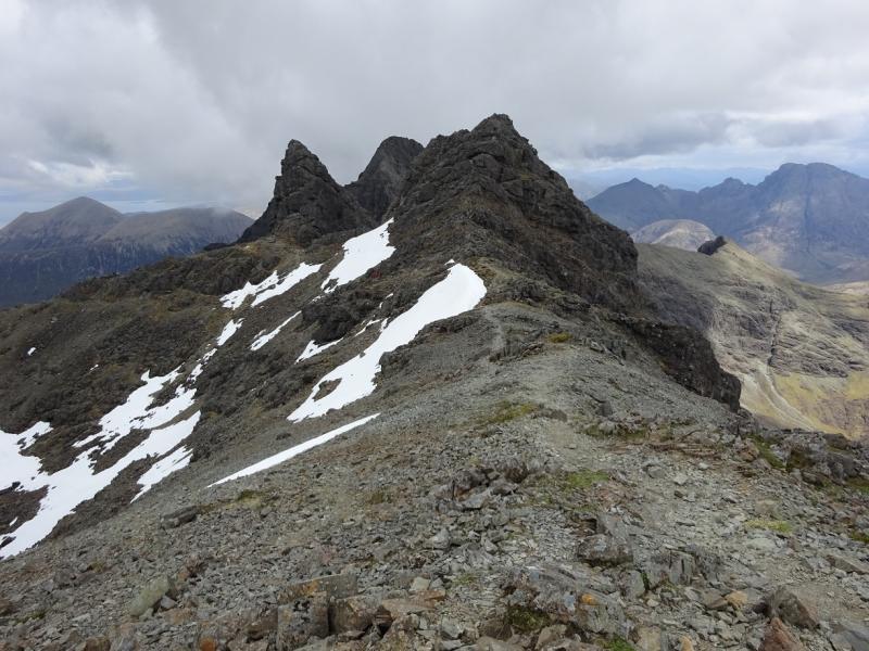
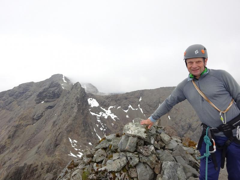
(1) From the Mountain Rescue Post, walk a little way up the road, towards Dunvegan, and take the first path on the left. This soon crosses a new bridge then continues towards Coire Bhasteir. Ignore the plank bridge further on as that path goes to the foot of Pinnacle Ridge and the South East Ridge – often called the “Tourist Route”. Further on, the path splits with the left fork going into Coire Bhasteir and the right fork picking its way up the ENE of Sgurr a' Bhasteir. Take the left fork with this path going over rock at times which means it is not easy to follow in places but there should be no problems in clear weather. Hands may occasionally be needed on rock. Soon one is in the lower reaches of Coire a' Bhasteir and the path starts picking its way up to the top left corner with Pinnacle Ridge above to the left. The path becomes increasingly steep on looser scree but leads to the Bealach a' Bhasteir – the col between Sgurr nan Gillean and Am Basteir. Start up the W ridge, clambering easily up the easy angled rocky crest to reach a path going to the left of the crest. This leads to several grooves and chimneys. The first is Tooth Groove which is a short climb of about Difficult standard. At its top are some exposed steps then the ridge continues up fairly obviously. The alternative to Tooth Groove is to ascend the next chimney along which is about twice the height, narrower, wetter and about Very Difficult standard. This joins the ridge above the exposed steps above Tooth Groove. Continue up the ridge on good rock (when dry) which gives excellent scrambling with some exposure. The ridge goes to an obvious pinnacle which is actually several rocks that, together, create a window. Go through the window and continue easily up to the smal cairn which is the summit of Sgurr nan Gillean, 964 m.
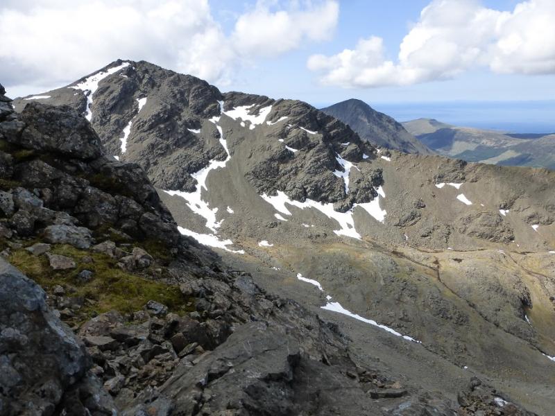
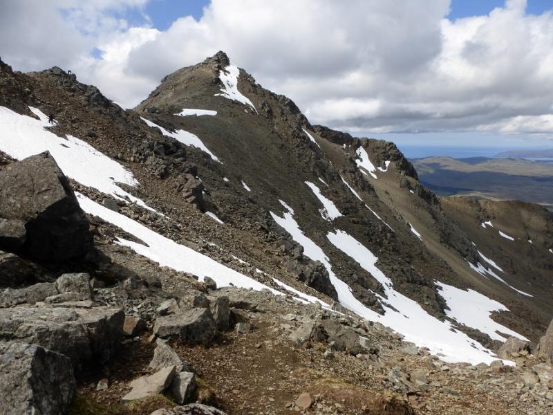
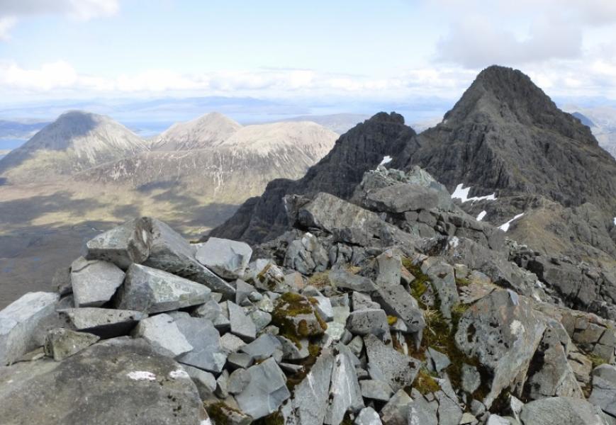
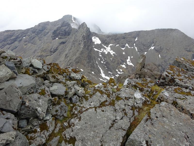
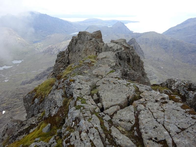
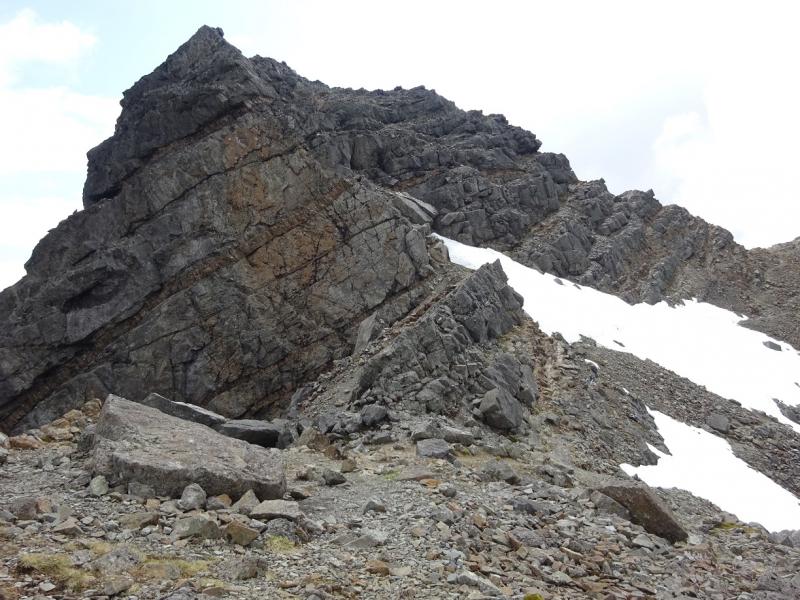
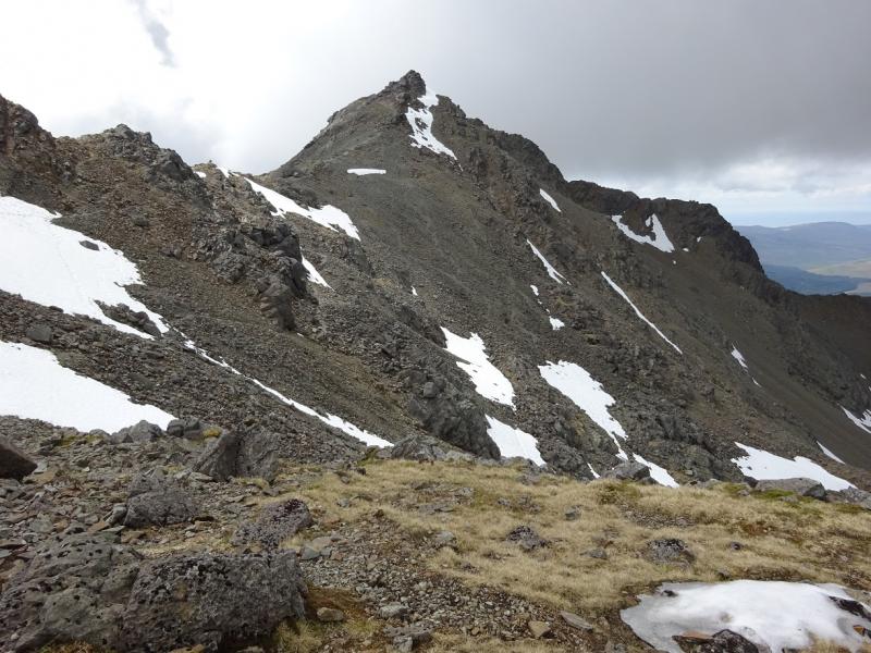
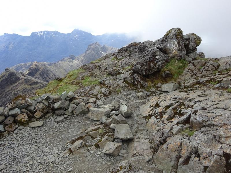
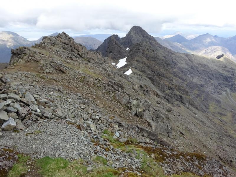
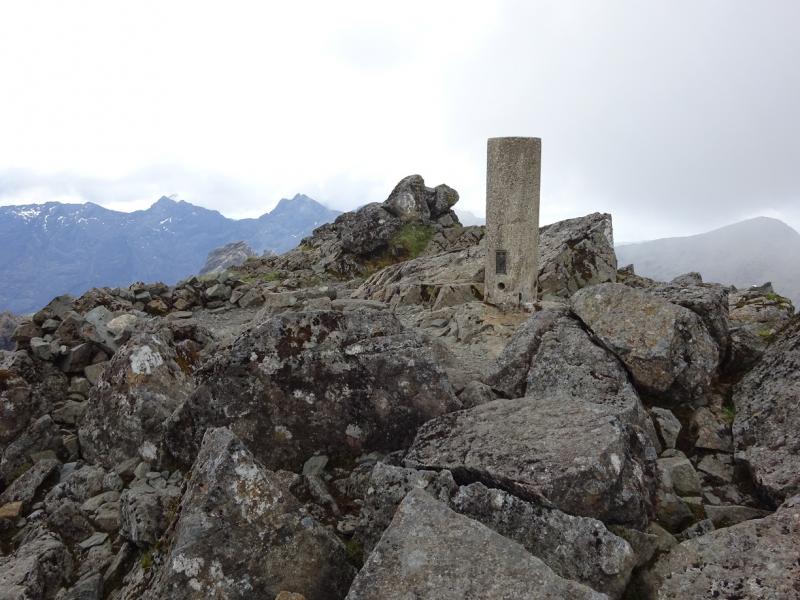
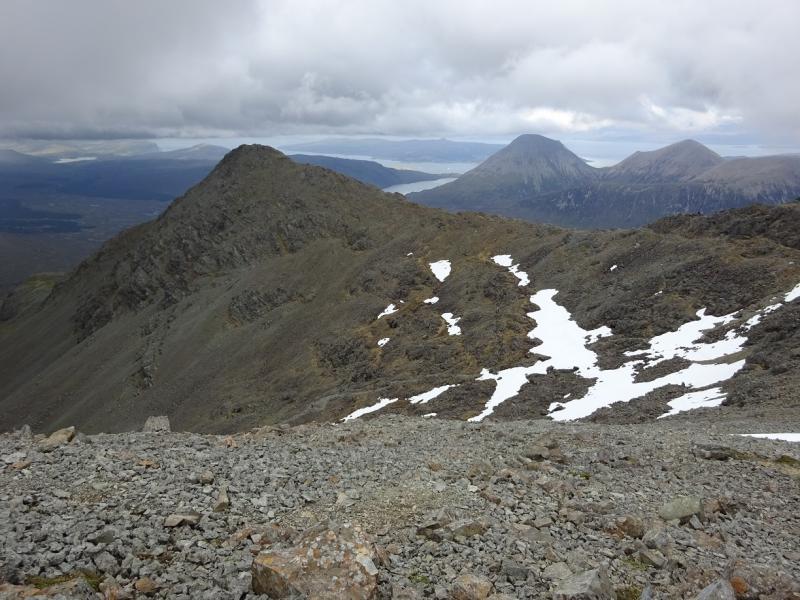
(2) Retrace down the W Ridge and either down climb or abseil down Tooth Chimney or Tooth Groove then walk easily back to Bealach a' Bhasteir. Descend down the ascent path into Coire a' Bhasteir to pass Am Basteir and the Bhasteir Tooth on this side then ascend back up to the main ridge at the Belach an Lice below Sgurr a' Fionn Choire (also in another route) which can easily be ascended by a very easily gully. Continue along the ridge and ascend W up the easy angled E ridge to reach the trig point and slightly higher rocks beyond which mark the summit of Bruach na Frithe, 958 m. This is an excellent viewpoint.
(3) Retrace back down the E ridge then down to the low point on the traverse of Am Basteir. From here, follow a faint path down to pick up the outward path down Coire a' Bhasteir. Cross the foot of Sgurr a' Bhasteir then retrace back to Sligachan.
Notes
(a) This walk took place on 28th May, 2016. Sgurr nan Gillean has been climbed before by this route, by the so called “Tourist Route” (Grade 3 serious scramble) and from Pinnacle Ridge. Bruach na Frithe has been climbed twice before when traversing part of the main ridge from south to north.
Photos - Hover over photo for caption. Click on to enlarge. Click on again to reduce.