Get Lost Mountaineering
You are here: Scotland » 03 North-west Argyll, Appin and Glencoe » Blackmount & East of Glen Etive
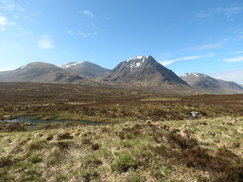
White Corries: Creise & Meall a' Bhuiridh
Creise and Meall a' Bhuiridh from White Corries Ski Centre
Start/Finish
White Corries Ski Centre car park which is situated up a minor road which leaves the A82 about a mile WNW of the Kingshouse Hotel
Distance/Time
14 km About 6 hours
Peaks
Stob a' Ghlais Choire, 996 m, NN 240 516.
Creise, 1100 m, NN 238 506.
Clach Leathad, 1099 m, NN 240 493.
Meall a' Bhuiridh, 1108 m, NN 250 503. OS Sheets 41 & 50.
Introduction
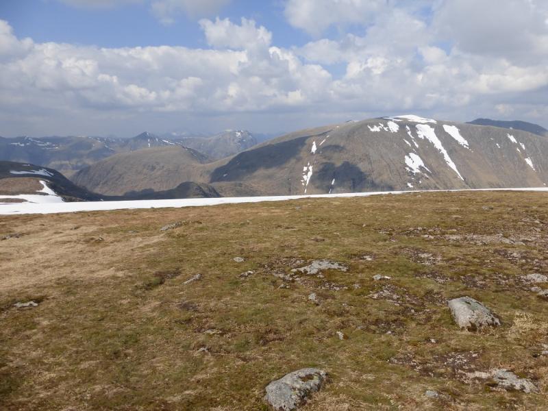
This round gives an enjoyable scramble, easy ridge walking, an easy arete and, on a clear day, excellent views. One can see the Glencoe peaks, the Ben Nevis range to the Easains, Stob Gabhar, the Glen Etive Peaks and even as far as Schiehallion and the Crianlarich hills. The Sron na Creise ridge is steep but in clear and dry Summer conditions, its ascent can be not much more than a walk although harder options are available. A high bealach connects Clach Leathad to the Corbett of Beinn Mhic Chasgaig but now that access to the latter has been eased, it is best climbed on a separate day from Glen Etive.
Route
(1) From the car park, walk roughly WNW across rough moorland, which can often be boggy, aiming to go around the foot of the Creag Dubh ridge. There is no path but the occasional hint of one. Once around Creag Dubh, cross the Allt Cam Ghlinne which is usually easy but would be a problem in spate conditions. Once across, aim to join the Sron na Creise ridge fairly low down then start picking a way up. Initially, it is quite grassy but soon becomes rockier and paths start to appear. There are plenty of outcrops on which to scramble or one can just walk. The easiest routes are generally on the right and the rocky scrambles on the left. Just below the top, a rocky band appears to block progress but there is a grassy path on its left side, almost on the edge, which takes one around any difficulties. There are plenty of scrambling options up this rock band with a good line being about halfway between the grassy path and the first steep grassy gully further right. Once above the rock band, continue ahead on easy ground, past a cairn marking the top of Sron na Creise then continue on the wide, rocky ridge to the medium cairn which marks the summit of Stob a' Ghlais Choire, 996 m.
(2) Continue around the rim of the corrie, descending slightly then ascending similar ground to reach the medium cairn which marks the summit of Creise, 1100 m. A little further along the crest is another cairned top which is slightly lower.
(3) Continue along the crest, descending slightly and passing a cairn which marks the start of the way to Meall a' Bhuiridh which will be used later. Continue descending to a bealach then ascned stony slopes to a shelter cairn which marks the summit of Clach Leathad, 1099 m. This used to be the main summit until it was found that Creise was slightly higher.
(4) Return to the cairn marking the way to Meall a' Bhuiridh. Descend a distinct but rocky path. There are no difficulties in clear, dry Summer conditions. Reach the bealach then ascend the other side. Higher up, the ground is more stony and the path is not so obvious but the ridge is well defined and there should be no navigational problems. Eventually, reach a large and wide but lowish cairn which marks the summit of Meall a' Bhuiridh, 1108 m.
(5) In clear weather, one can see Ski buildings lower down which can be reached by either descending almost due N down easy slopes to the dip below Creag Dubh then walking under the chairlift (path) back to the car park. Alternatively, one can pick a more direct line down the grassy/stony slopes with any crags easily avoided. In thick weather, it is probably easier to continue, roughly E, along the crest of Meall a' Bhuiridh to soon reach a ski tow which can then be followed down to another ski tow, etc, until the chairlift is reached.
Notes
(a) This walk took place on 27th May, 2012.
(b) If including Beinn Mhic Chasgaig, allow an extra 2 – 3 hours. This route was walked on 30th July, 2002, before the “locked gate” across the River Etive was “unlocked”. Beinn Mhic Chasgaig is now best ascended from Glen Etive which is a much more interesting route than from Clach Leathad.
(c) It is possible to walk all these peaks by ascending Meall a' Bhuiridh then going to Clach Leathad then on to Creise and Stob a' Ghlais Choire before returning over Creise and Meall a' Bhuiridh but this is not aesthetically pleasing and involves much back tracking but it can be done and was walked on 27th May, 1995.
Photos - Hover over photo for caption. Click on to enlarge. Click on again to reduce.