Get Lost Mountaineering
You are here: Ireland » South West » Iveragh Peninsula
Carrauntoohil via Brother O'Shea's Gully & Heavenly Gates
Carrauntoohil via Brother O’Shea’s Gully and the Heavenly Gates
Start/Finish
Cronin’s Yard at the start of the Hag’s Glen. From Killarney, take the road towards Killorglin. Take the first left after the Fossa camp site, signposted Gap of Dunloe, and follow the meandering road continuing past the turning for Gap of Dunloe. When a crossroads is reached with petrol pumps and a store, the signposted turning for Cronin’s Yard is within 200 m on the left. There is a small parking fee, 2 Euro in 2010. There is a cafe which is not always open but if it is, it is worth going in after the walk. The café has toilets and showers which are not available if the café is closed. The family running the café are very friendly and often have satellite TV on.
Distance/Time
15 km Approx 6 hours
Peaks
Carrauntoohil, 1039 m, V 803 844. (Irish National Grid System)
Irish OS Discovery Series Map 78 (1:50000)
Introduction
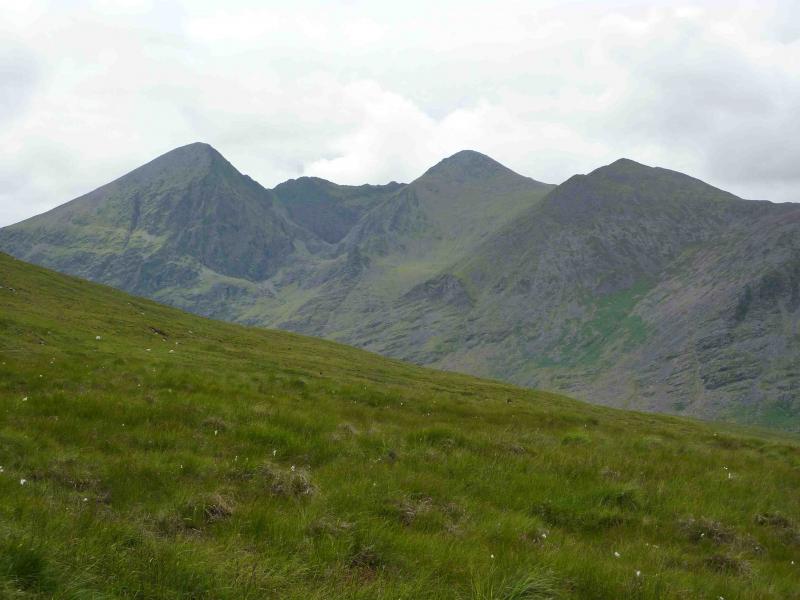
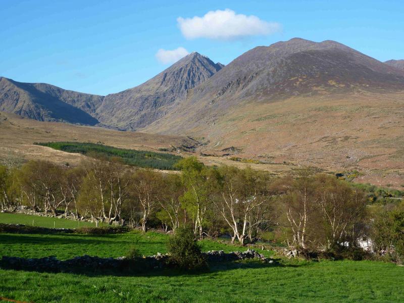
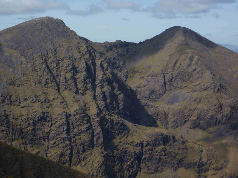
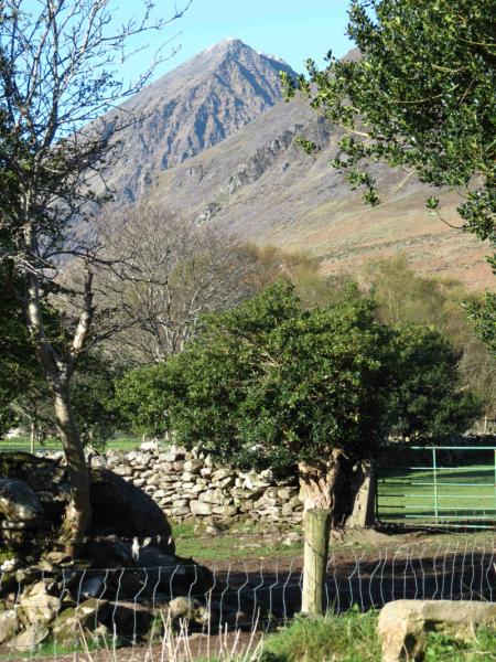
This is widely regarded as the best route for an ascent and descent of Carrauntoohil only. It is a lovely route up a strikingly, picturesque corrie with a descent which traverses below the cliffs of Carrauntoohil. Many walkers fail to find the start of Heavenly Gates but it is actually quite straightforward to locate. MacGillycuddy’s Reeks are the highest mountain range in Ireland and may well be the longest ridge over 3000 feet in the British Isles. The reeks are essentially “Y” shaped with Carrauntoohil (highest peak in Ireland) at the junction. Choose a good day as the Reeks can often be in cloud. Good views will be visible throughout this route on a good day. Navigation is relatively straightforward if you keep your wits about you but if you need to, you should be able to easily reset your GPS to the Irish National Grid System.
Route
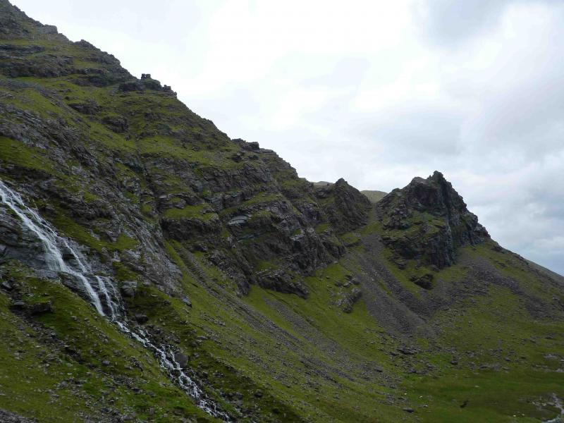
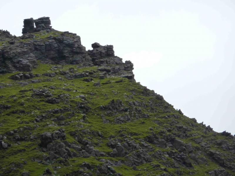
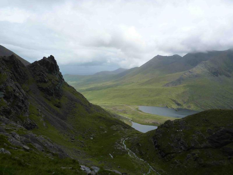
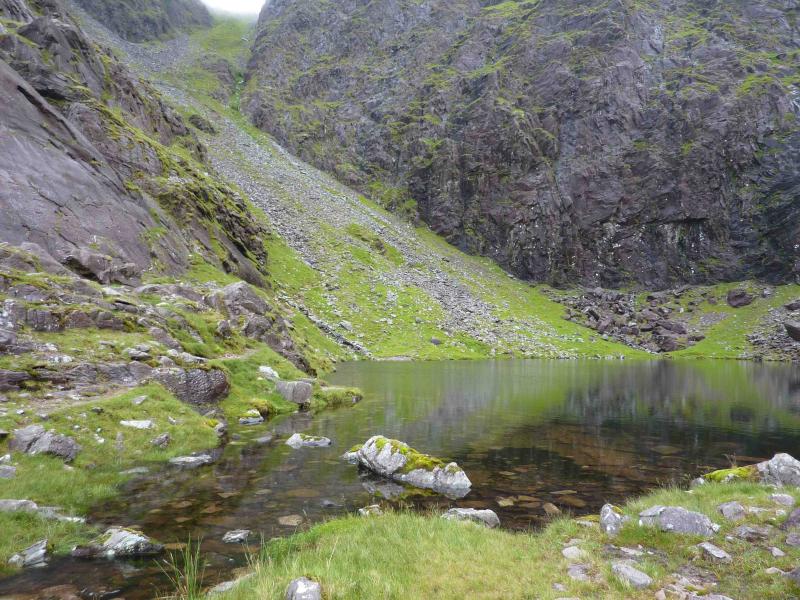
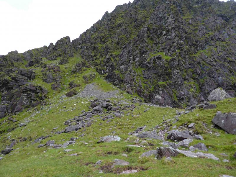
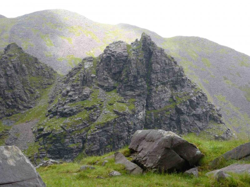
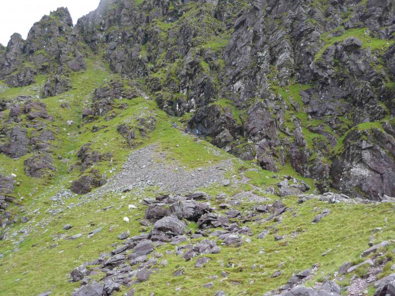
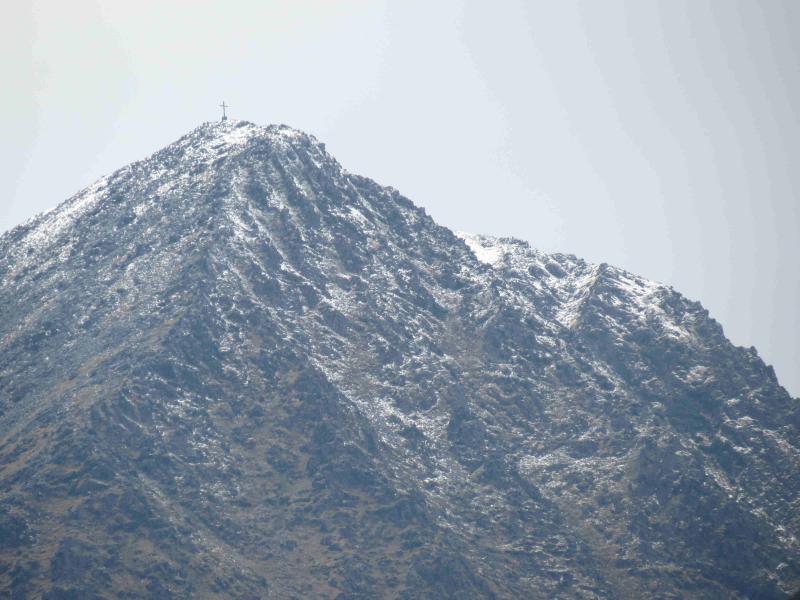
(1) From Cronin’s Yard, follow the signposted track up the Hag’s Glen over two footbridges to reach the obvious large stepping stones about 500 m N of Lough Callee. The main path/track crosses here but you do not. Follow an intermittent path, not far from the river, on its W side. Try not to go too high too soon as you will encounter boulder fields. The ridge on your right will have a large triangular crag sticking out which is the Hag’s Tooth. Pass well below this. The path will soon become more obvious. Make sure you locate it soon after the tooth. Where there seems to be a choice of paths, the lower alternative is less stony. Soon there is just one distinct path and it skirts around a few rocky spurs as it gradually gains height. Once you enter the corrie, there is a dramatic rocky ridge high above on the right. This is the Stumpa an t-Saimh ridge. Soon a 4 m high corner is reached which has to be climbed (and descended on the return). It is little more than an easy rocky staircase and there is a choice of routes up it. Further on, the path leads to an obvious, and almost as easy, 6 m high wall which is also well stepped but, again, has to be descended on the return. Both the corner and wall are no more than grade 1 scrambles and low to middle in the grade. These are the hardest parts of the route. The path soon flattens out on a boggy section by a stream. On 15/7/10, there was a large boulder almost in the stream with a path across the stream. This is the way to Heavenly Gates and you will come down to here on the return. Do not cross the stream but stay on the original path, which is very distinctive, climbing before swinging right over easy rock then left to reach Lough Cummeenoughter, an ideal place for a picnic on a nice day. From here an obvious path leads roughly S up a mainly broad and grassy gully known as Brother O'Shea's Gully. The path zig-zags up this gully but is eroded in places. The path emerges at a flat col between Carrauntoohil and Knockoughter on the Carrauntoohil to Beenkeragh ridge. Turn left and, after a short almost level section, ascend on a choice of paths to the summit of Carrauntoohil, 1041 m,passing a flattish cairn about 100 m before the summit. The summit is unmistakeable as there is a large cross made of girders, a trig point and a walled shelter cairn.
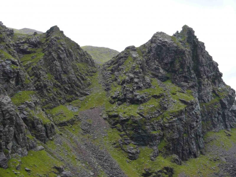
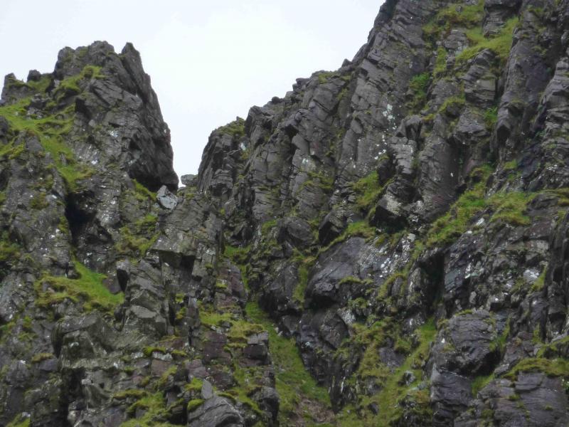
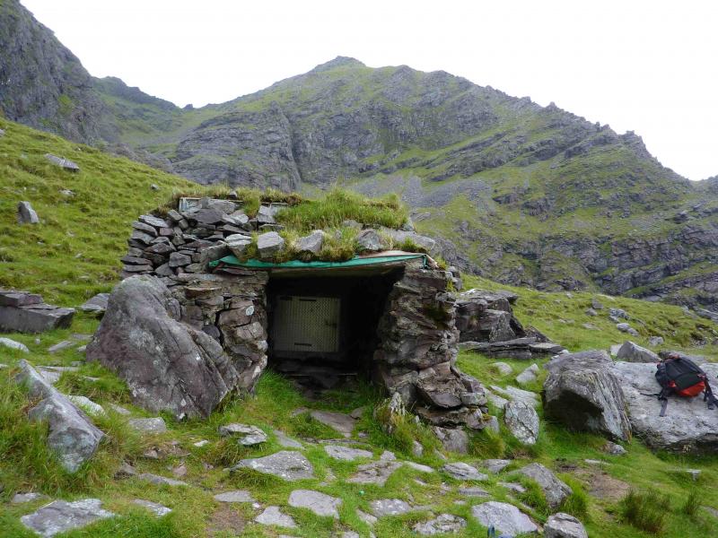
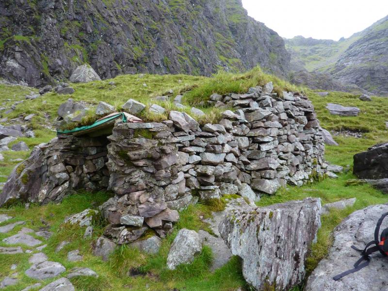
(2) To descend, stand with your back against the cross looking at the walled shelter. Beyond it is another shelter cairn (more of a stony hollow really). From there, you should be able to see the start of a well cairned and distinctive path going SE. This is the main path up and down Carrauntoohil. The path is a bit eroded in places and zig-zags down heading for the top of the Devil’s Ladder at the top of the Hag's Glen. The next problem, which fools a lot of people, is locating the start of the path to Heavenly Gates. In clear weather, look for the grassy plateau on the left just above the Devil’s Ladder, the lowest point on the ridge. Look left for a large outcrop just before the edge of the cliff – there is only one outcrop in this area. There may be a couple of cairns (was on 15/5/10) and there is a faint path leaving the main path towards the outcrop. In mist, wait until the ground is grassy and levels off then go to the left edge and locate the outcrop. If you, mistakenly, end up going all the way down to the top of Devil’s Ladder, turn around to face up Carrauntoohil then ascend following the edge on the right for about 300 – 400 m to reach the outcrop. At the outcrop, stand with your back to it, then look uphill towards Carrauntoohil. About 10 m away is a small cairn. From this cairn, an obvious level path heads off roughly N. This is the Heavenly Gates path and is very distinctive once located. At one stage it passes close to a waterfall. The actual Heavenly Gates are the entrance to a descending cleft. On 15/7/10, this entrance was partially blocked by a small fallen chock stone which is easily stepped around. Unfortunately, the path seems to go past this point and then drops off a cliff about 3 m later which means you will be at the Pearly Gates (ie dead!) not the Heavenly Gates so be alert here. The cleft is straightforward but steeper than the path so far. It levels out on a grassy shoulder where there is a mountain rescue hut covered in earth and stone but it is unlocked and could be used as a shelter in bad weather. Initially the path is faint from here but continue level from the hut and the route should be clear. You then start descending towards the stream which was not crossed on the outward journey. Care is now needed because if you drift too far left (some paths suggest going left) you could have some awkward rocky descent moves. It is better to drift right where the difficulties are much less. When the stream is reached, retrace the outward route remembering that you have to descend both the wall and corner. Once back on the main track, remember that, further down , the path/track splits. Take the right fork down to a new footbridge and continue over another footbridge back to Cronin’s Yard.
Notes
(a) This walk took place on 15th July, 2010.
(b) It might be possible to avoid the two down climbs on the return by going down the stream then walking around Lough Gouragh but this route has not yet been investigated and may not be feasible.
(c) The Fossa camp and caravan site, at V 910 923 is very good and very well situated for the Killarney mountains, especially Macgillycuddy's Reeks and Purple Mountain as it is only about 3 miles from Kate Kearney's Cottage. At Fossa, there are camping and caravanning facilities as well as a hostel and static trailer vans can also be hired. For campers, there are excellent showers (small extra charge) and there is a good campers’ kitchen with tables, sinks and cooking area if you have your own cooker and pans. Gas rings are available (small extra charge). There is also a TV room. Reception is open quite late in the high season and the staff are very helpful. A computer is available for hire and there is a freezer in reception. There is a bus stop outside the site for Killarney. There is a 24 hour Tesco which is off the northern bypass (turn right at 4th roundabout then right at next). Out of high season, it can be better for 2 people to rent a trailer van than to camp separately.
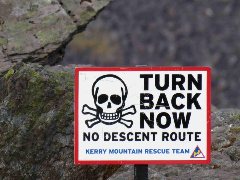
Photos - Hover over photo for caption. Click on to enlarge. Click on again to reduce.