Get Lost Mountaineering
You are here: Scotland » 13 Applecross, Coulin and Torridon » Achnasheen to Applecross
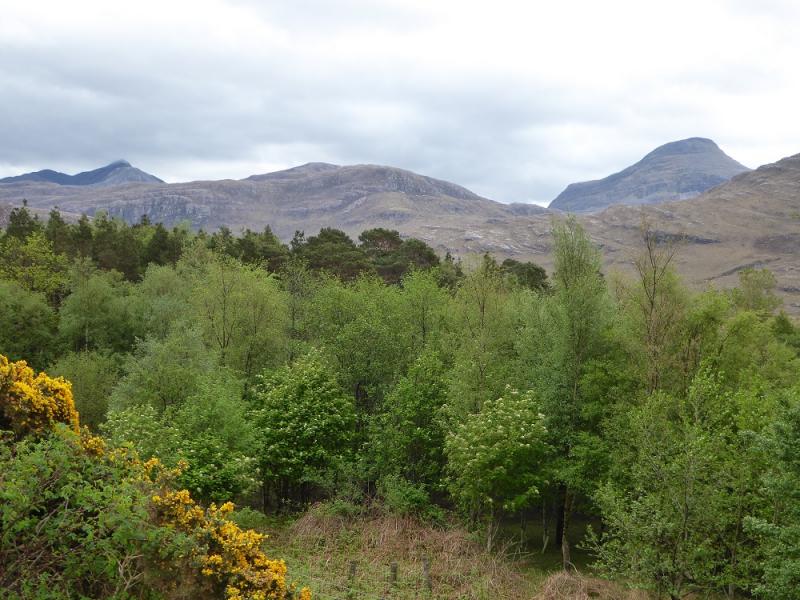
Maol Chean-dearg & An Ruadh-stac from Annat
Maol Chean-dearg & An Ruadh-stac from Annat
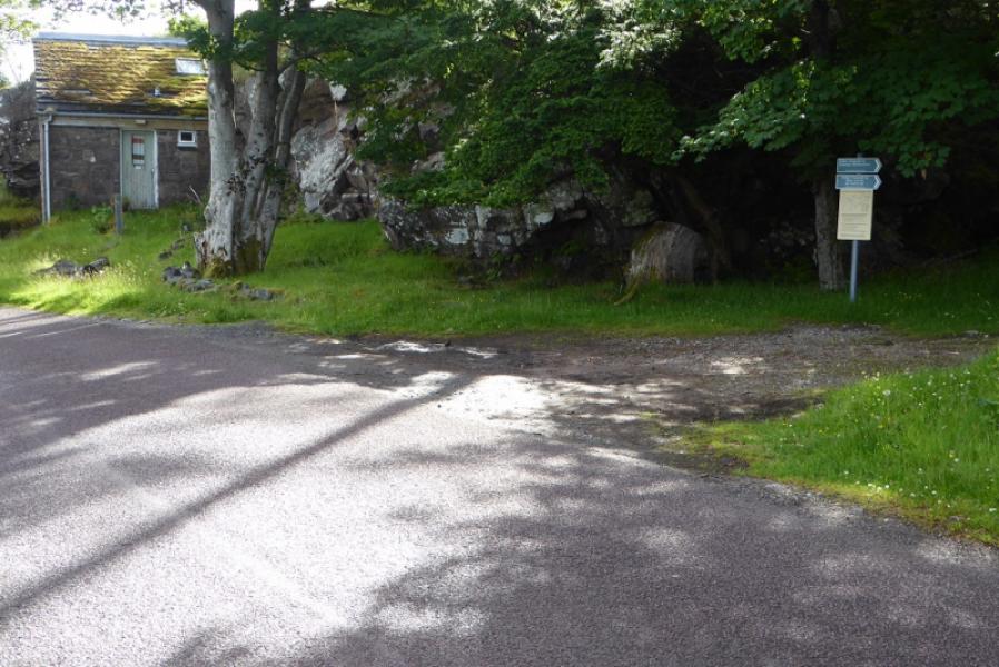
Start/Finish
Rough parking in a lay by on road side near start of the Annat path. If coming from the Loch Torridon Hotel direction, this is just before the 40 mph sign. If coming from the Torridon village side, it is just after the end of the 40 mph limit. The start of the actual path is close to the speed limit sign.
Distance/Time
20 km. About 10 - 11 hours.
Peaks
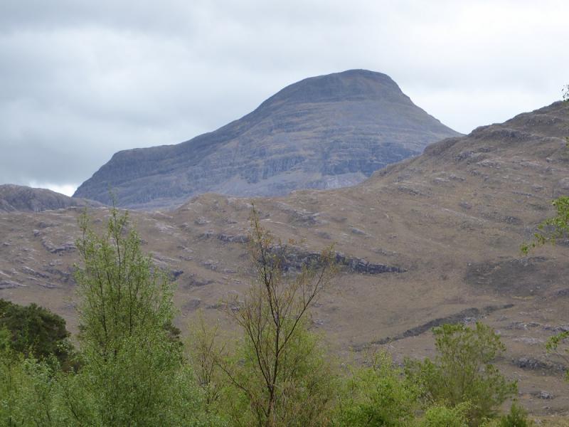
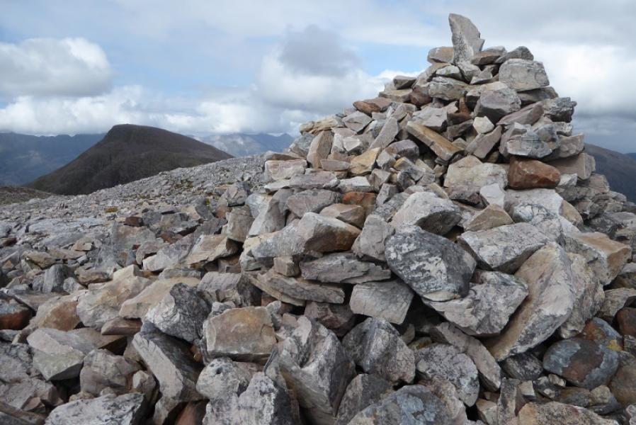
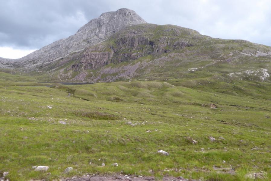
Maol Chean-dearg, 933 m, NG 924 499.
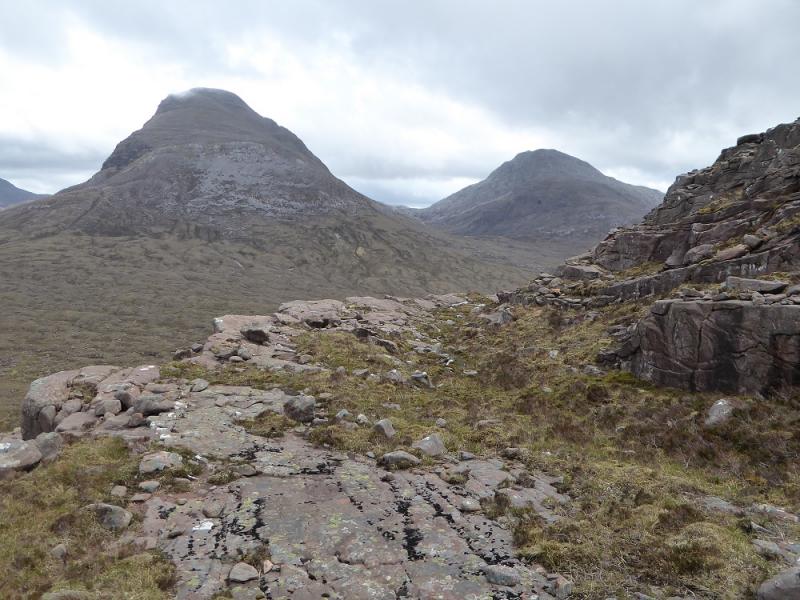
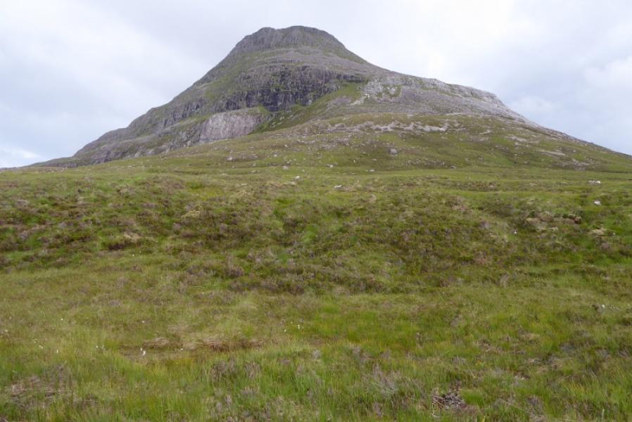
An Ruadh-stac, 892 m, NG 921 480.
OS sheets 24: Raasay, Applecross & Loch Torridon & 25: Glen Carron
Introduction
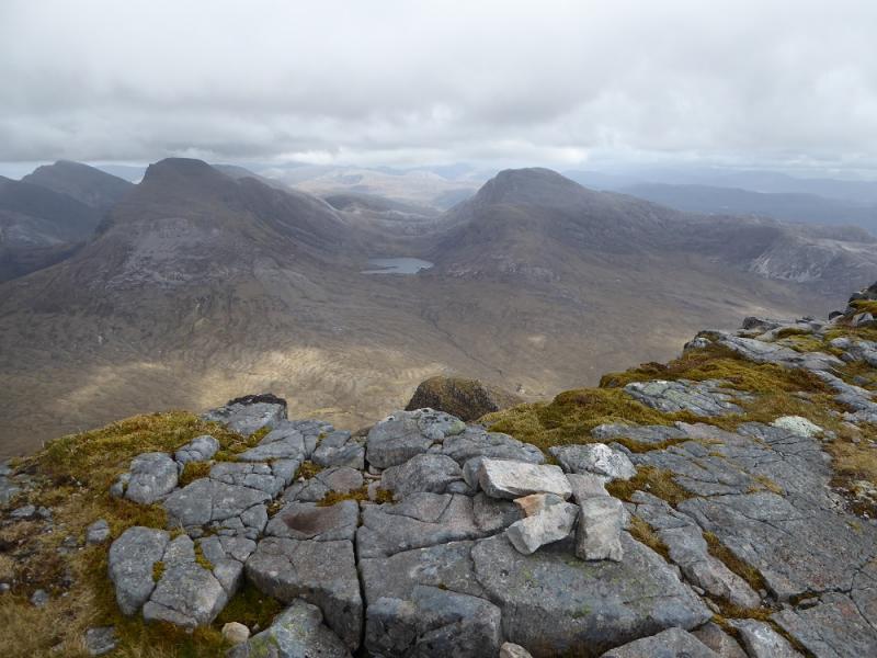
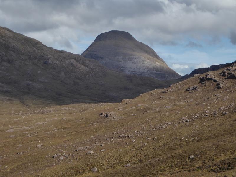
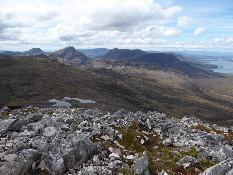
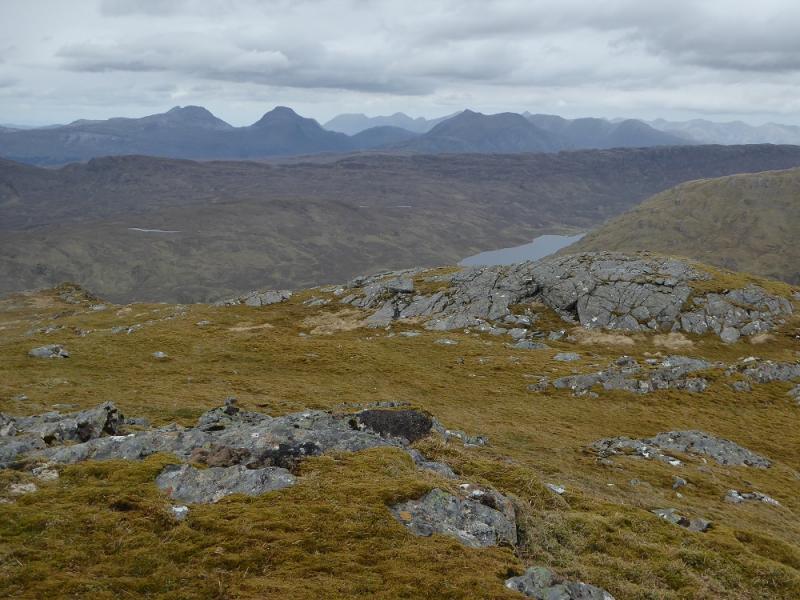
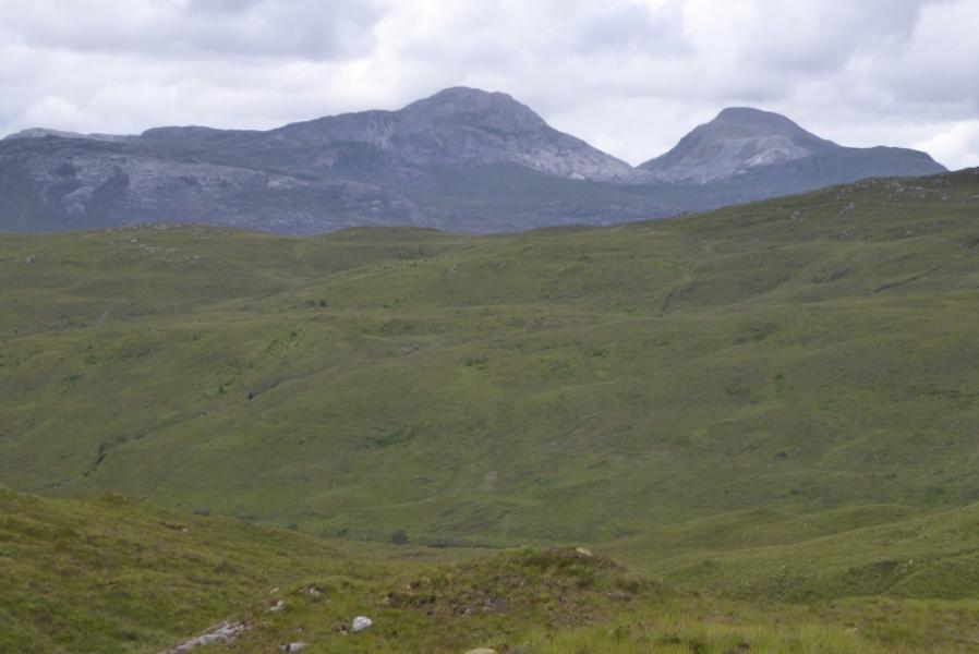
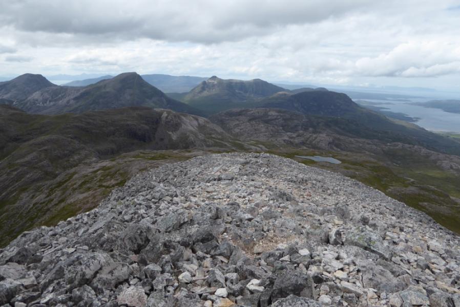
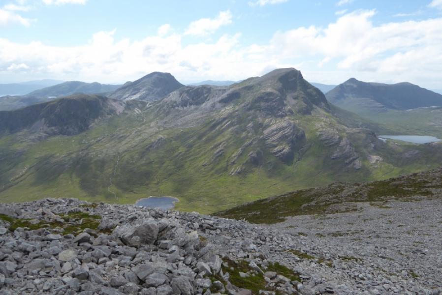
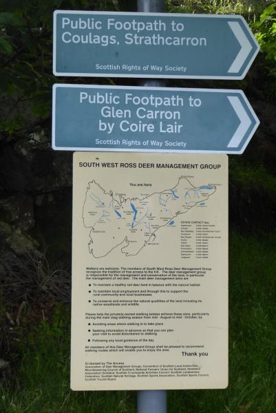
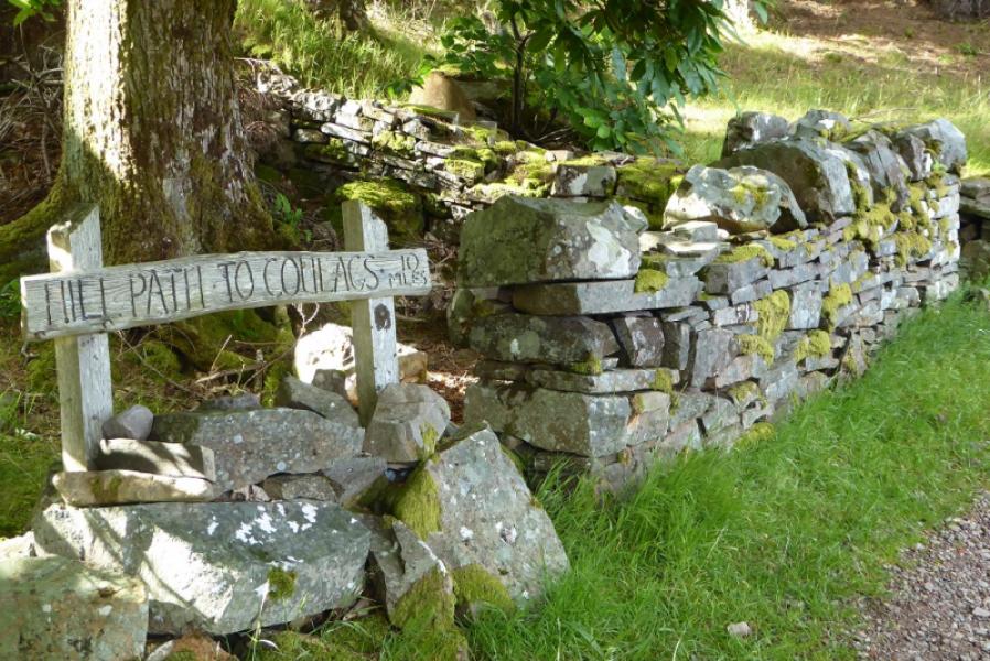
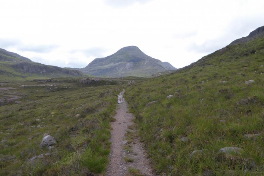
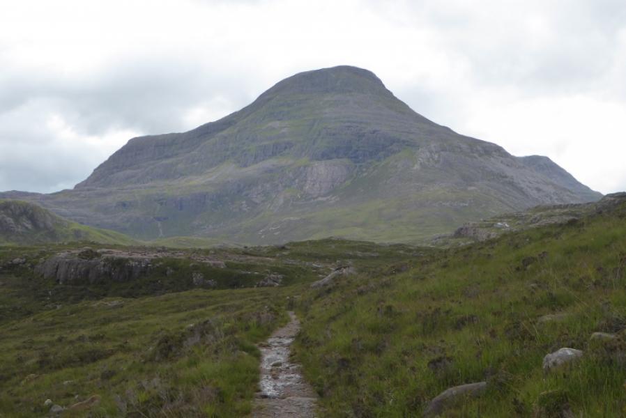
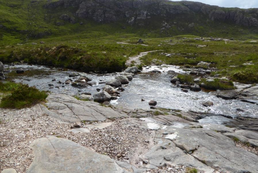
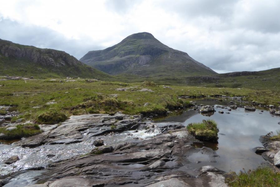
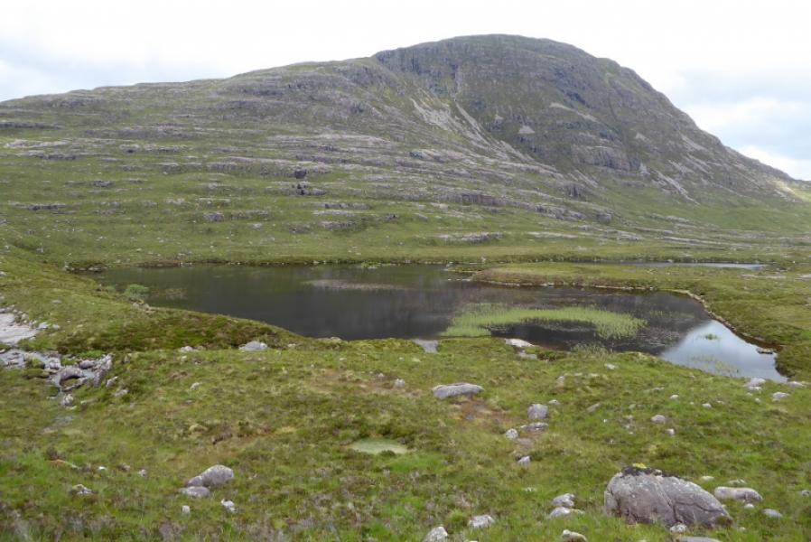
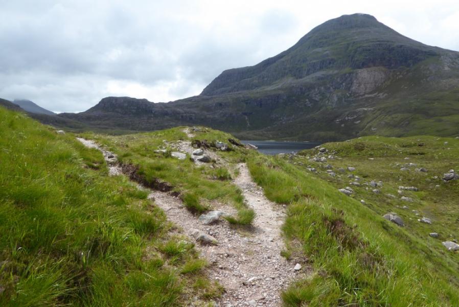
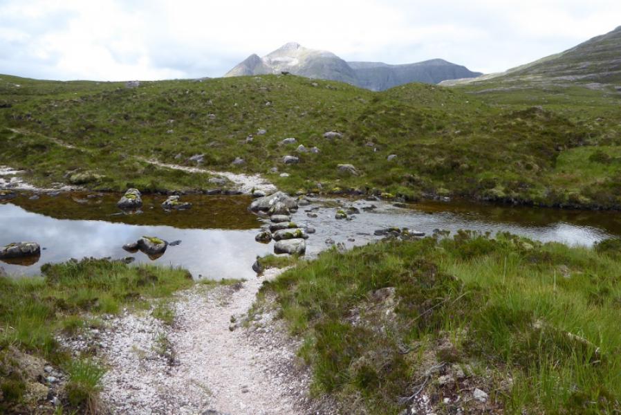
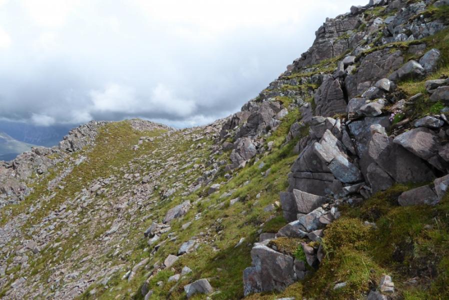
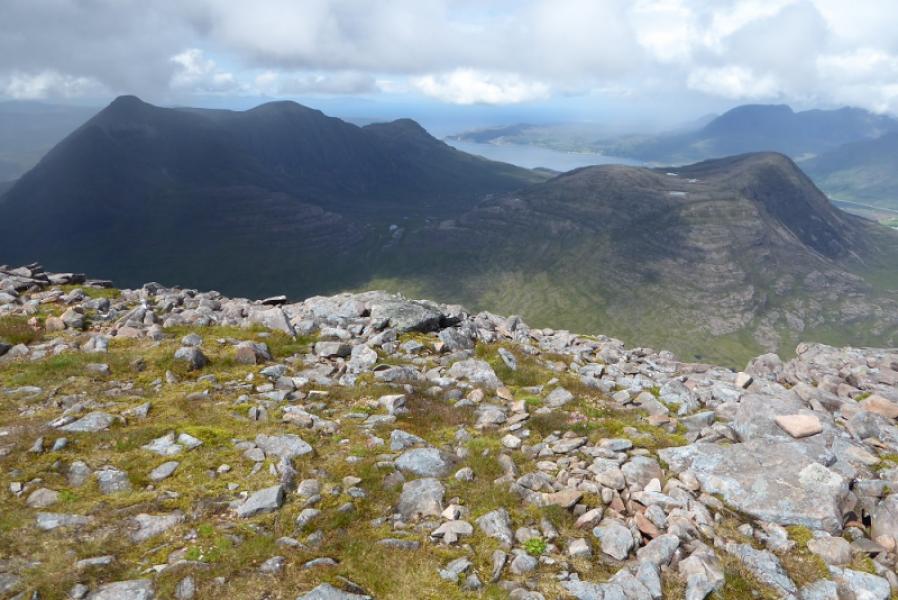
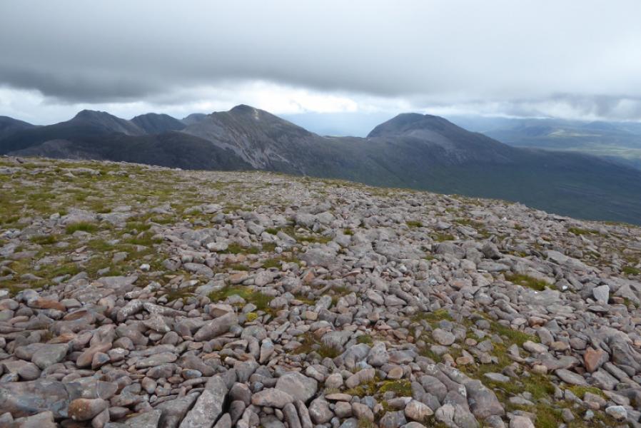
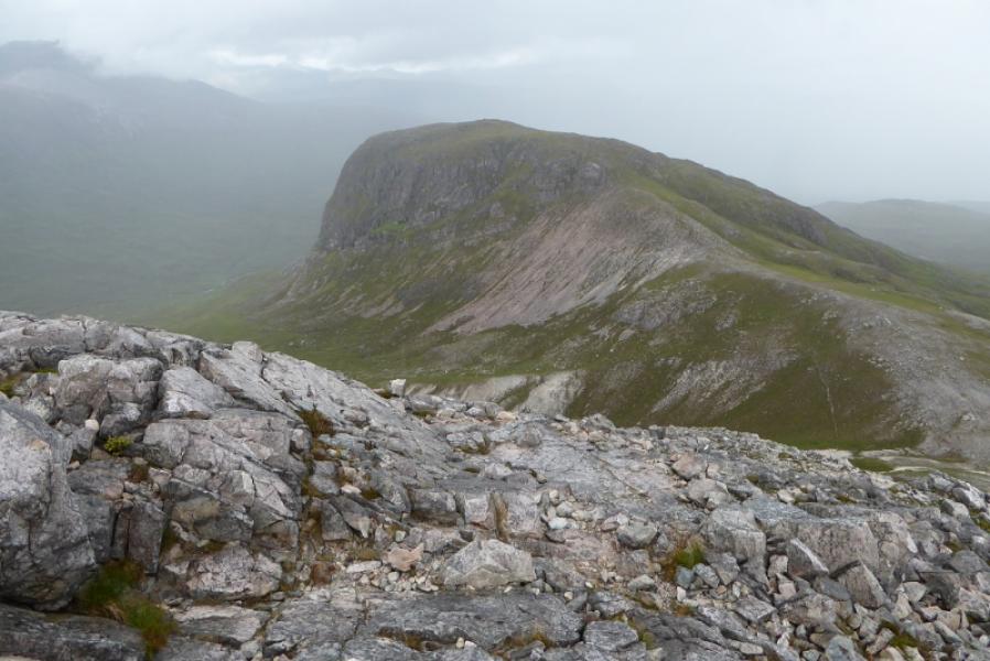
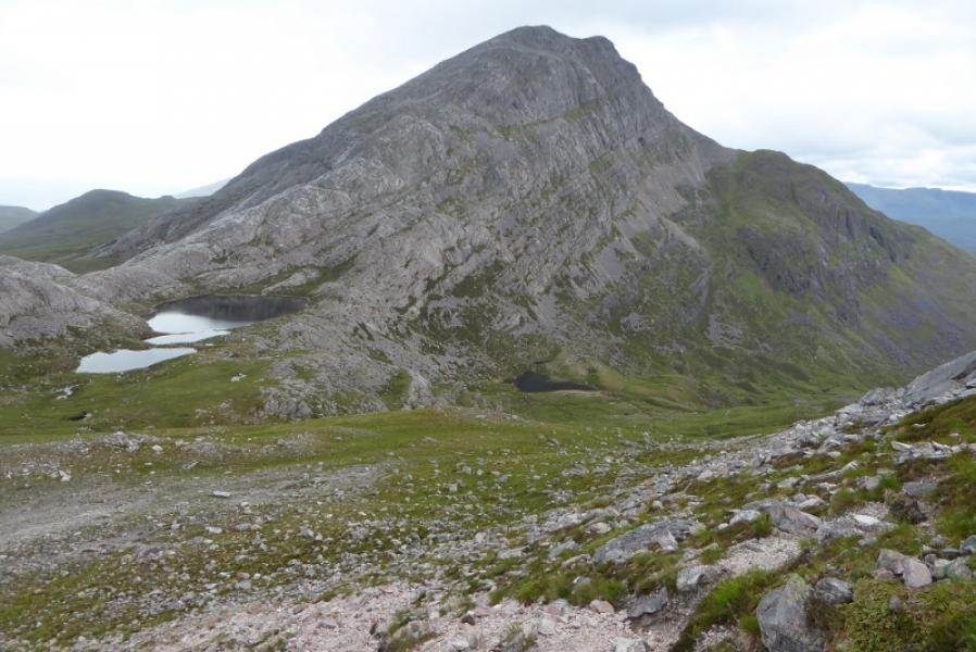
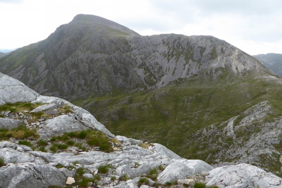
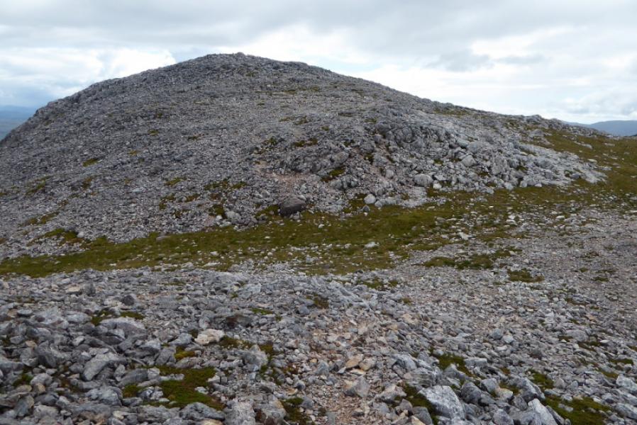
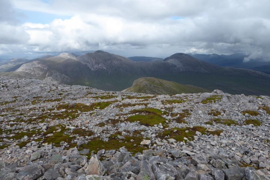
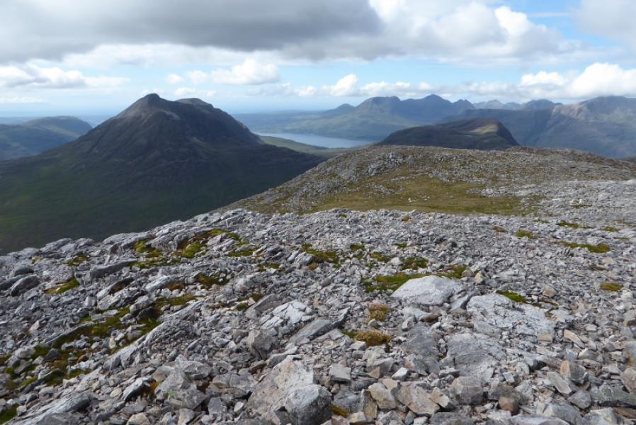
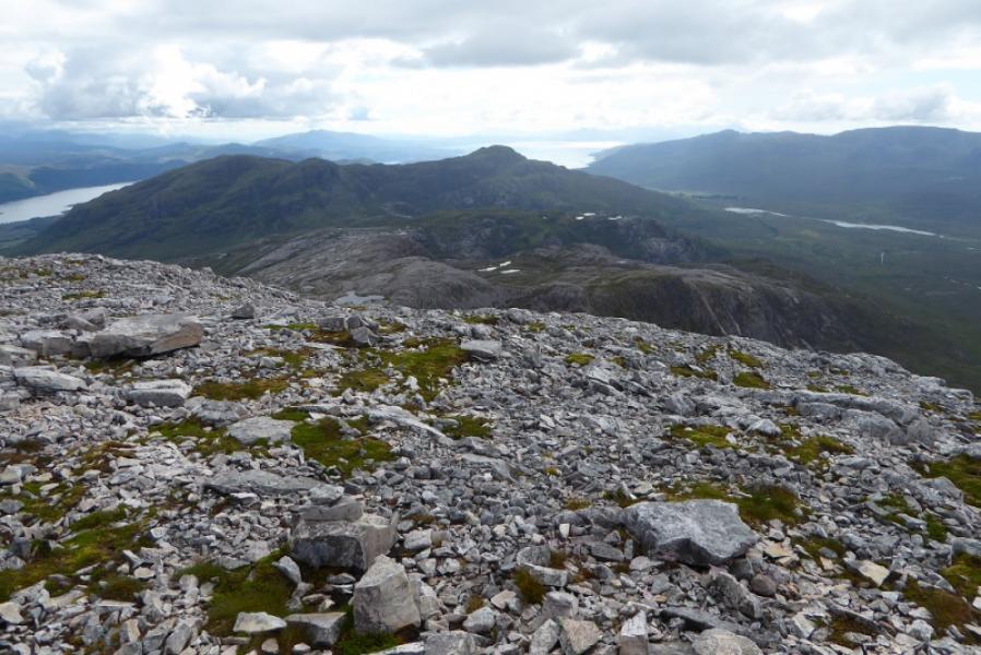
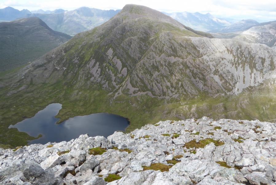
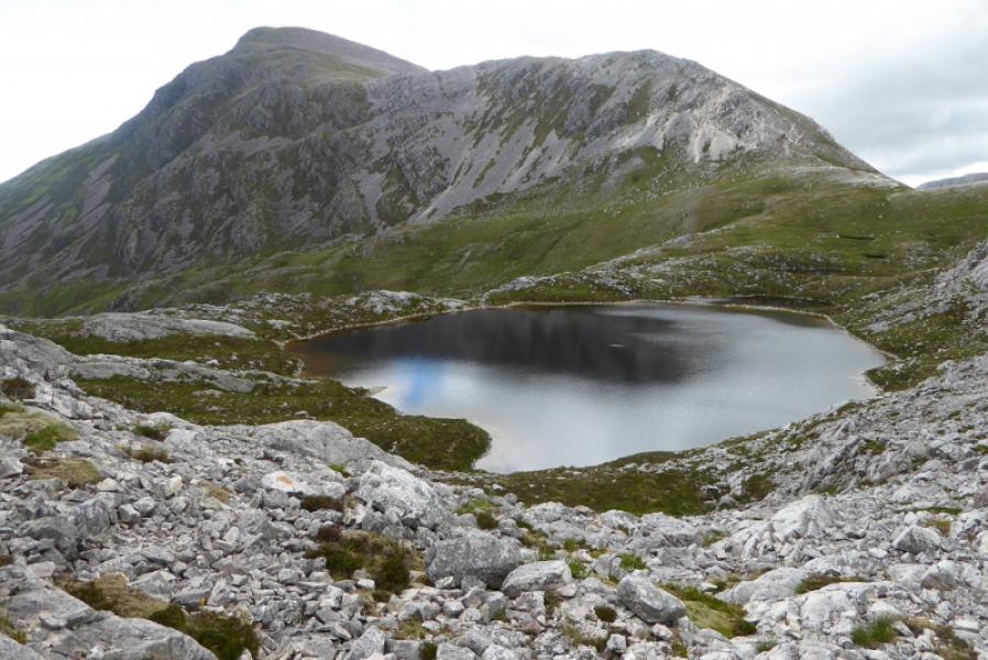
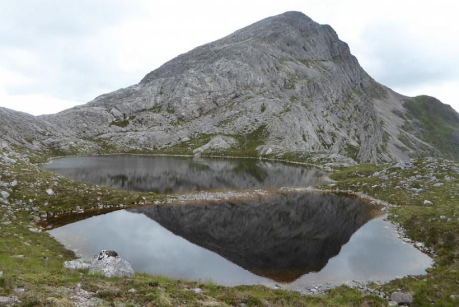
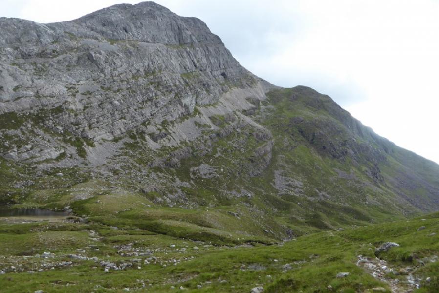
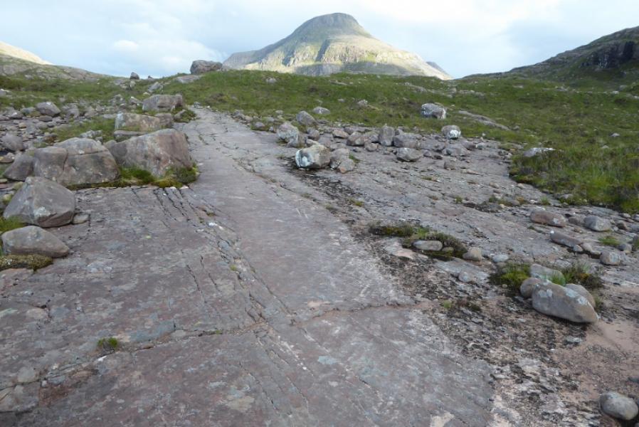
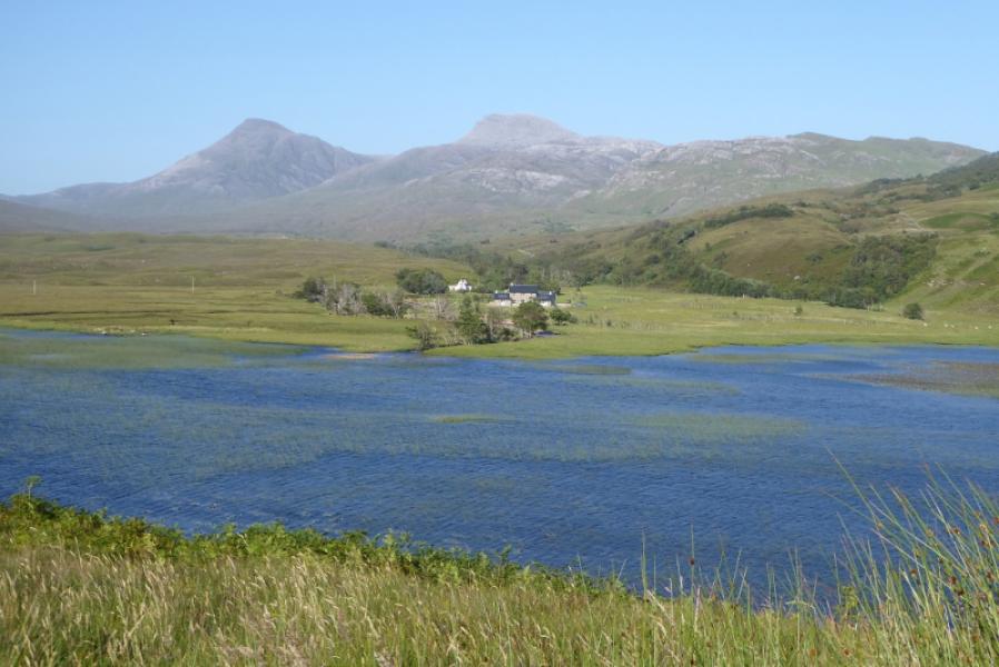
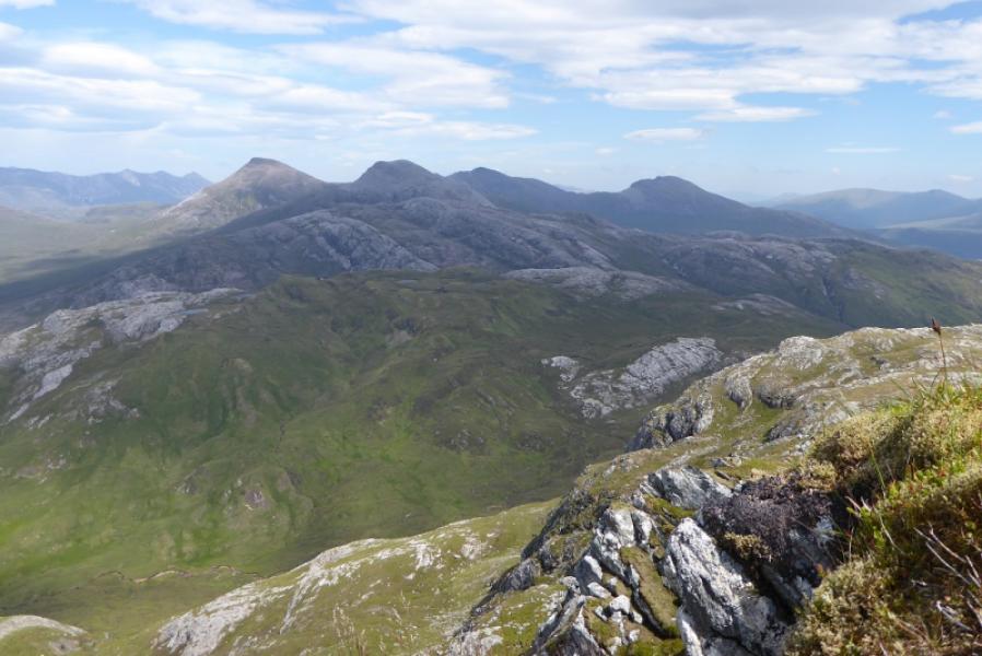
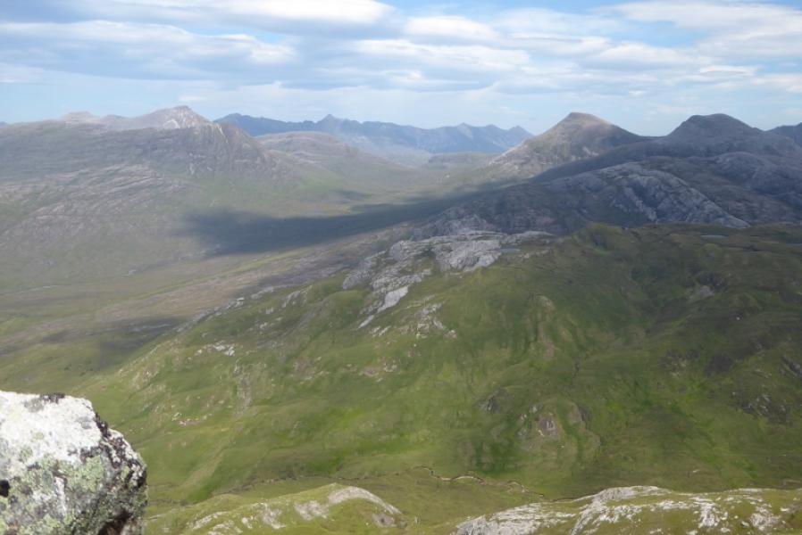
This is a very tough day and one which most people would choose to start form Coulags to the south. However, if staying in Torridon, it is about a 30 mile drive to Coulags on slow roads so some may wish to try this route. The Annat (to Coulags) path is quite good and easy to follow. The ascent of Maol Chean-dearg goes up its steep WNW flank but is mainly on grass. An Ruadh-stac is, arguably, the rockiest peak outside of the Cuillin and has slabs at its foot. These are easy angled but awkward when wet. There are excellent views from both summits especially to Sgorr Ruadh, Fuar Tholl, Beinn Liath Mhor, Beinn Damh and Beinn na h-Eaglaise. On a clear day the Torridon mountains are also well seen. Good route finding is essential so save this walk for a clear day. The river crossings should not prsent a problem in normal weather as large stepping stones have been well positioned.
Route
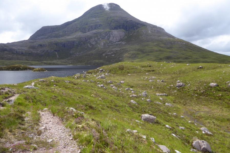
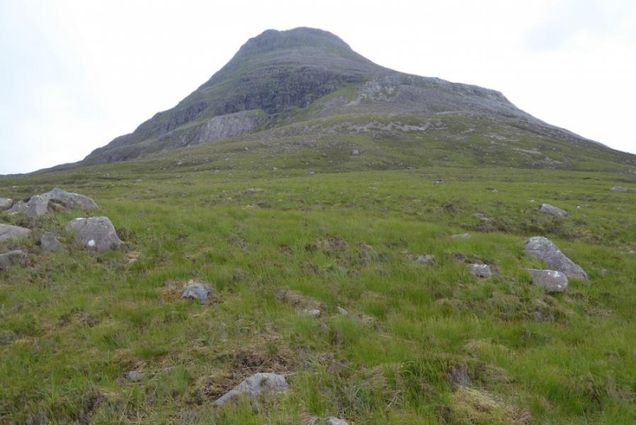
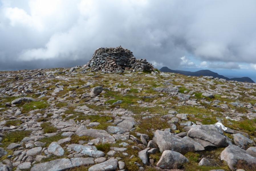
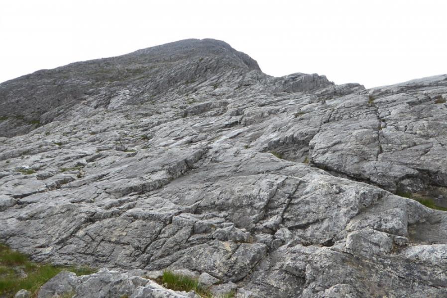
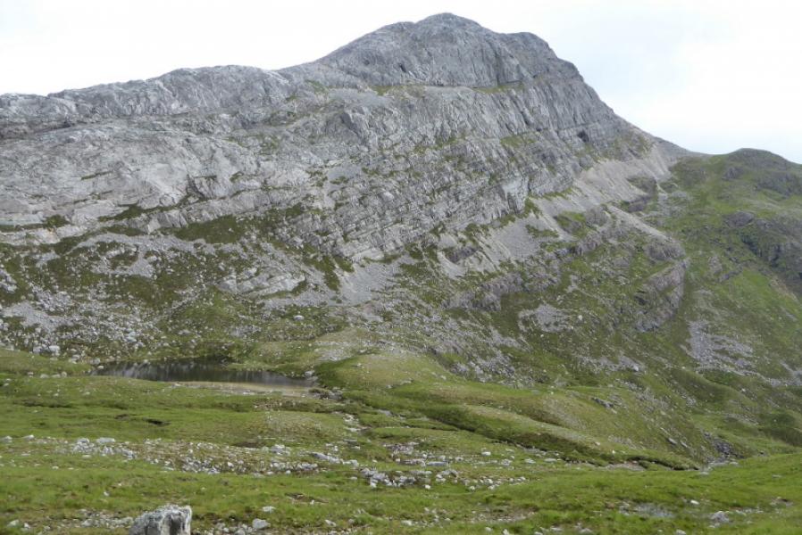
(1) Follow the path (towards Coulags) from Annat. It passes below Beinn na h-Eaglaise on its N and E sides before crossing the first river just to the N of Lochan Domhain then the second by Loch an Eion which is after the right fork at the path junction at the N end of the loch.. Soon after, the path starts crossing the lower W flank of Maol Chean-dearg which seems well guarded by tiers of crags. Leave the path when you are to the right of these and start picking a way up the steep grassy slopes. There are some boulder fields so try and avoid these as much as possible. All the tiers of crags, apart from the highest, are easily bypassed to their right. Eventually reach the last tier of crags which seem to guard the summit quite effectively. Follow the grass around to the left just below the rock. Initially, it looks like there is no easy way up but keep traversing on the grass, gaining height where possible. Go over a “lip” where a path takes over and continues the traverse across steep slopes to reach a grassy shoulder between the main mountain and a very minor top. Turn right and walk very easily up to the very large cairn which is the summit of Maol Chean-dearg, 933 m.
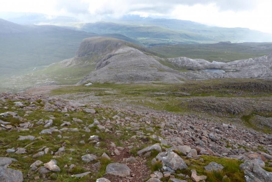
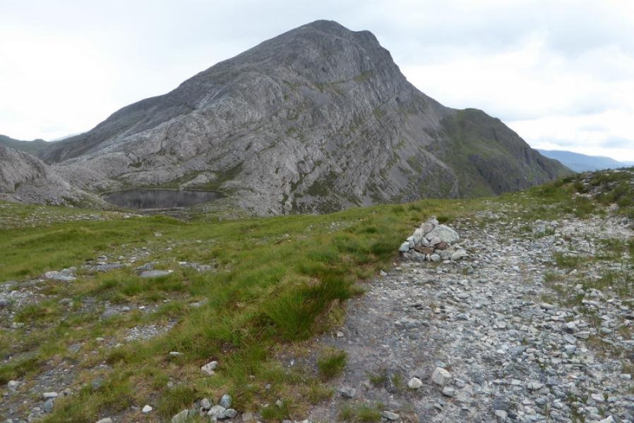
(2) Descend roughly S then SE across rough ground which is pathless in places and it is very easy to go the wrong way in mist. Continue down the SE ridge with a little reascent over a minor top then continue down to meet the Annat to Coulags path. The E ridge of An Ruadh-stac will be very prominent but it is quite undulating to begin with. These minor tops can be traversed by a faint path on the side where the two lochans are. Join the ridge and pick a way up the lower slabs which should not be awkward if dry. Higher up, there is a path, faint in places, which picks its way up and has very small cairns marking most of its route. The ascent is steep but is hardly a scramble. Reach the flatter summit area where there are a few tops. The E one, met first, has a small cairn but the highest point is the S Top where a large cairn marks the summit of An Ruadh-stac, 892 m.
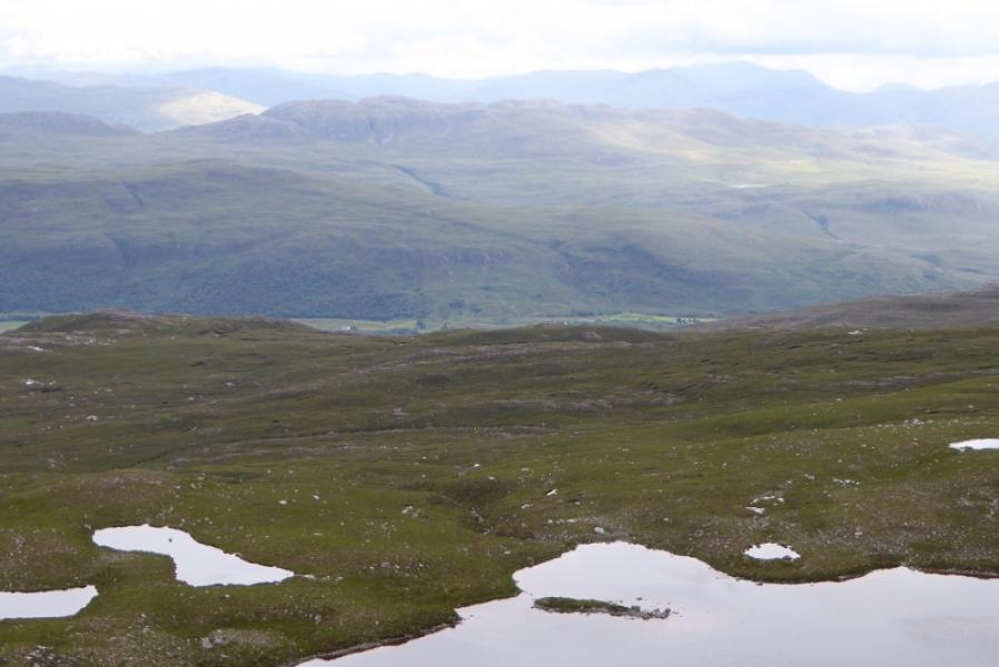
(3) Retrace down the E ridge and rejoin the Annat path. This is quite stony to begin with but improves later although it can be boggy. The path goes below the S flank of Maol Chean-dearg before turning N below the W flank to reach Loch an Eion when one can retrace the outward route back to Annat.
Notes
(a) This walk took place on 11th July, 2017, and about 15 years earlier but from Coulags. Maol Chean-dearg was also climbed about 20 years earlier also from Coulags.
(b) With two cars, it is possible to walk out to Coulags.
(c) The SYHA at Torridon is very well placed and a lovely place to stay. It is a modern purpose built building which is very well managed. It's only fault is that it is extremely popular so, if planning to stay there, book well in advance!
Photos - Hover over photo for caption. Click on to enlarge. Click on again to reduce.