Get Lost Mountaineering
You are here: Scotland » 17 Islands » Arran
Beinn Tarsuinn, Cir Mhor & Caisteal Abhail from Glen Rosa
Beinn Tarsuinn, Cir Mhor & Caisteal Abhail from Glen Rosa
Start/Finish
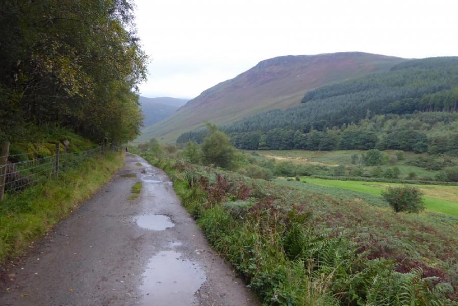
End of the public road up Glen Rosa by the camp site. Parking is very limited and it is not possible to get cars on to the camp site. The road into Glen Rosa is narrow. If coming from Brodick, on the road to Corrie and Sannox, turn left on the sharp bend as if going to Blackwaterfoot but, almost immediately, turn right for Glen Rosa. It is almost a mile to the camp site.
Distance/Time
19 km. About 9 – 10 hours.
Peaks
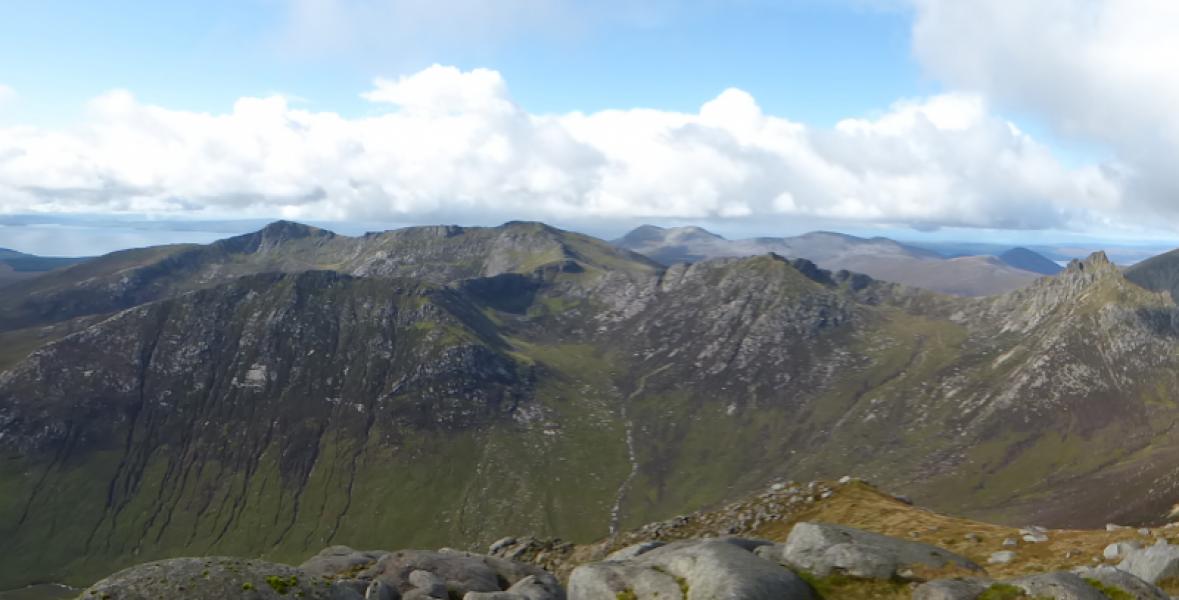
Beinn Tarsuinn, 826 m, NR 959 412.
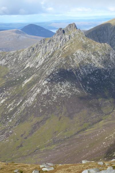
Cir Mhor, 799 m, NR 973 430.
Caisteal Abhail, 847 m, NR 968 443. OS sheet 69: Isle of Arran
Introduction
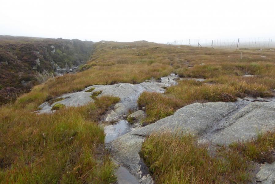
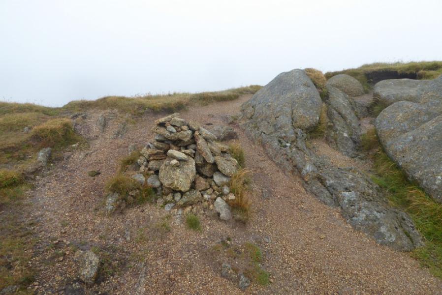
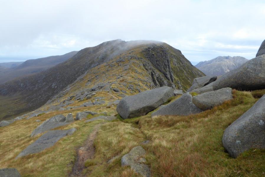
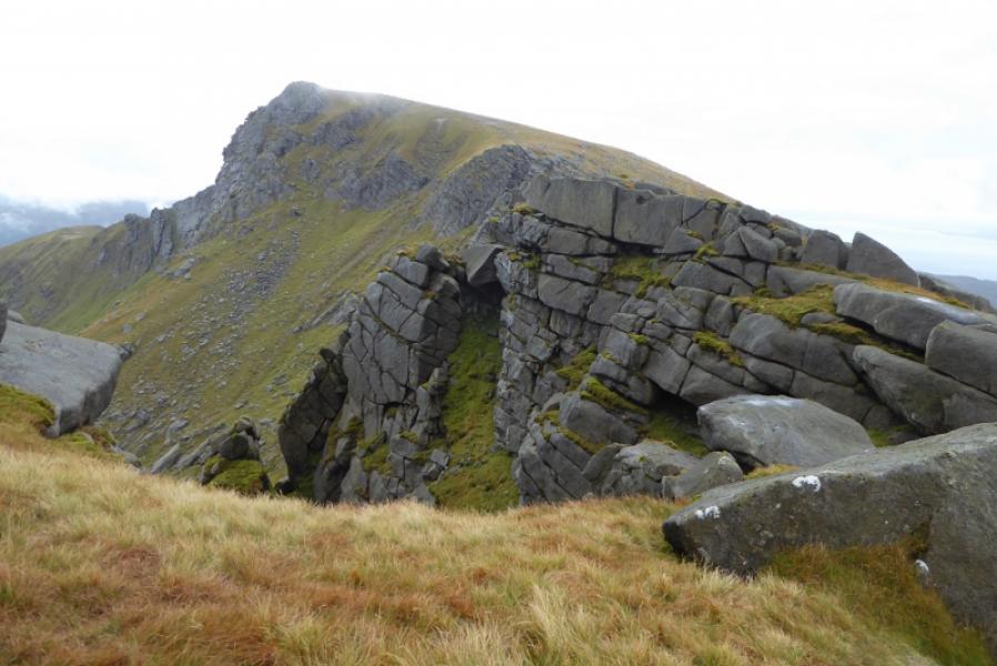
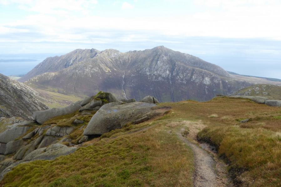
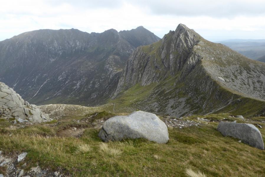
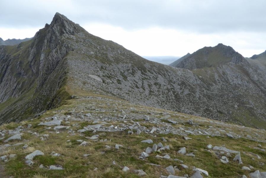
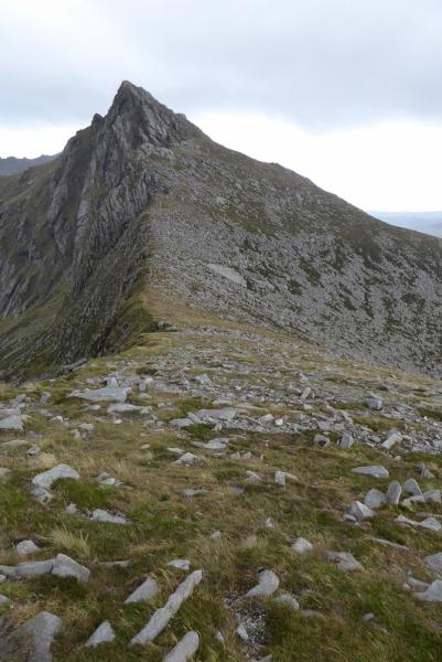
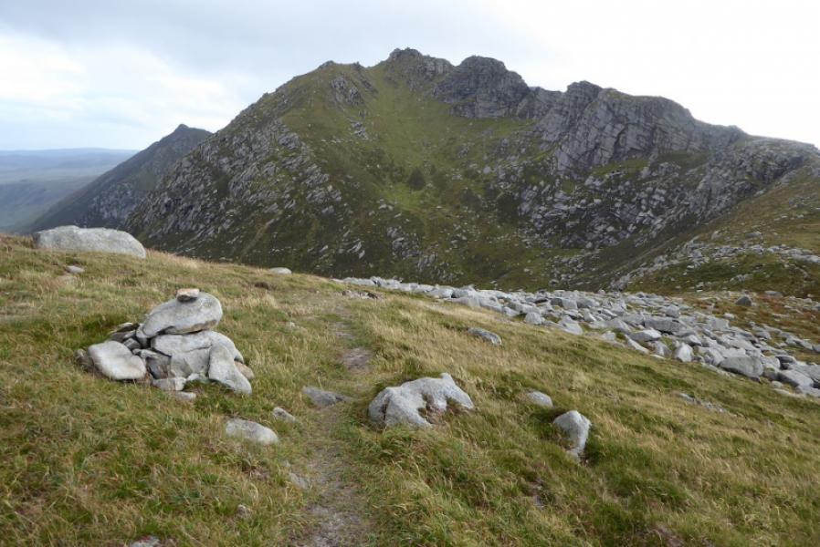
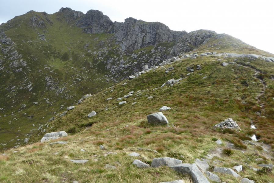
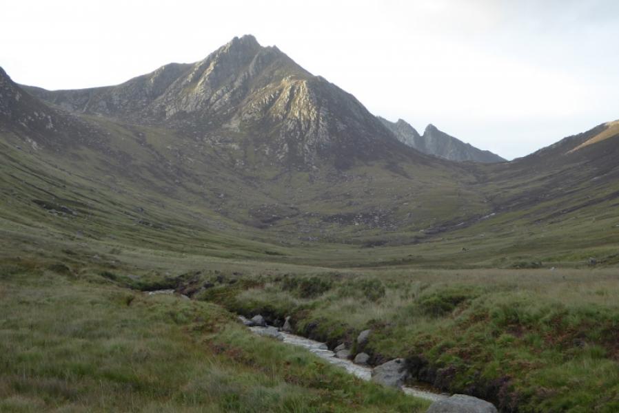
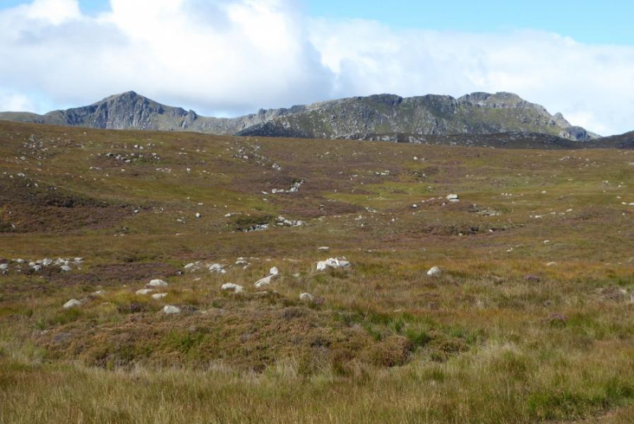
This is a long and tough route but a very rewarding one. Arran is, arguably, the rockiest area outside of the Cuillin. Many guide books considerably underestimate the time needed, possibly because they are simply applying Naismith's rule with little thought for the terrain. Clear weather will be needed by most for this route as the terrain is quite rocky. Unusually, none of the three Corbetts has a summit cairn. Much work has gone on to improve the paths which helps considerably in places. A tributary of the Garbh Allt has to be crossed and this can be very difficult in spate conditions after rain and may mean crossing further upstream then crossing rough moorland to regain the path. The descent of Beinn Tarsuinn's north east ridge twists and turns through rocks and has a few awkward steps especially when the rock is wet as there are quite a few small sloping slabs. Cir Mhor is straightforward apart from the last few feet where it gets quite airy. Caisteal Abhail is reached by a lovely curving ridge, similar to Beinn a' Bheithir (Ballachulish) but it has a short wall, just over a metre high, below the summit. Various return options are in note (b) below.
Route
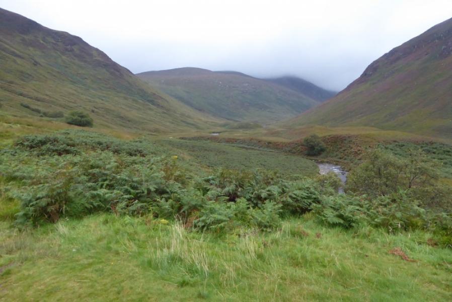
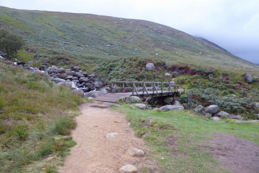
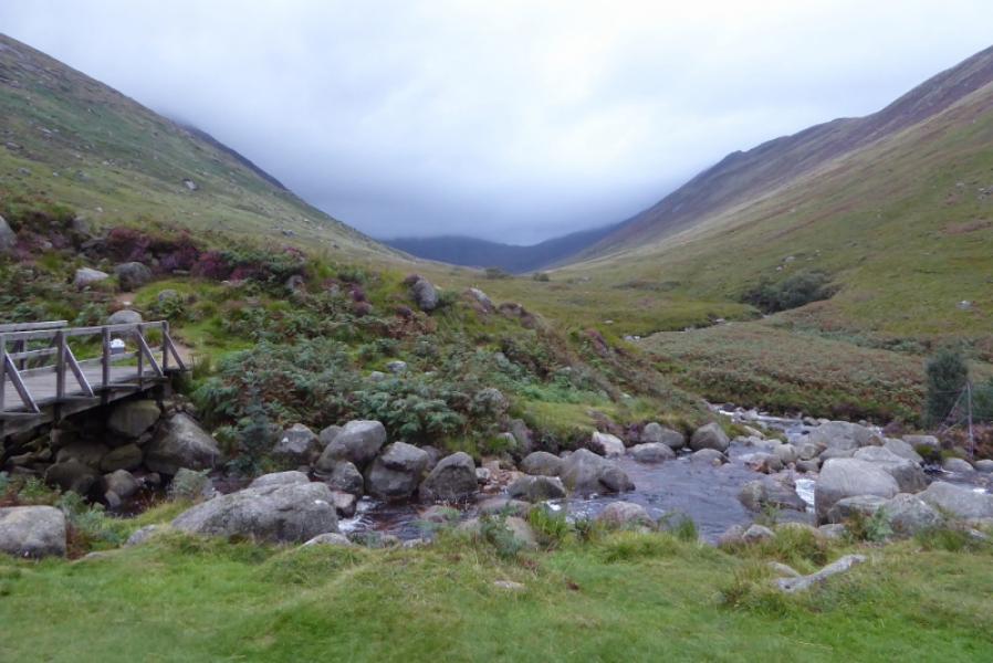
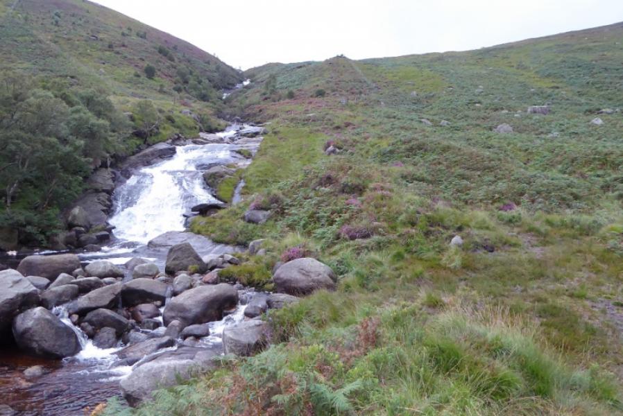
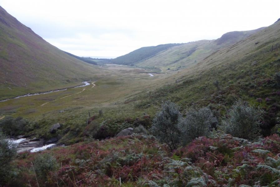
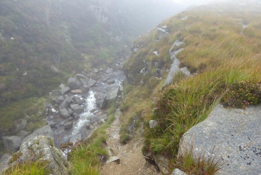
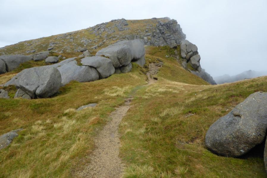
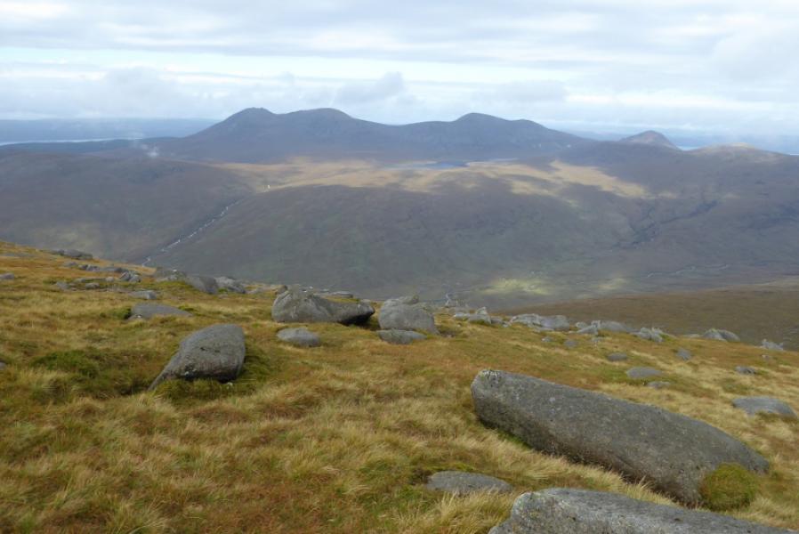
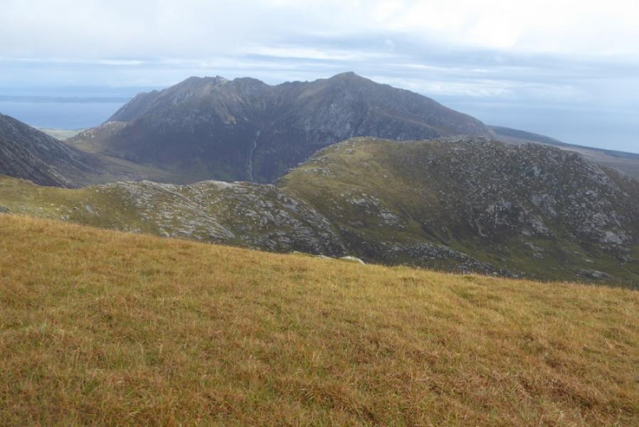
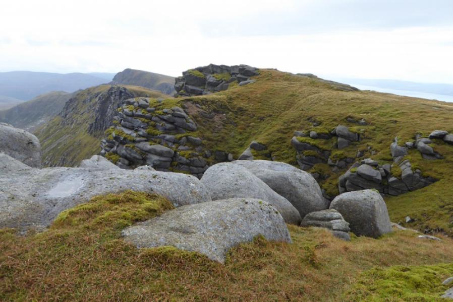
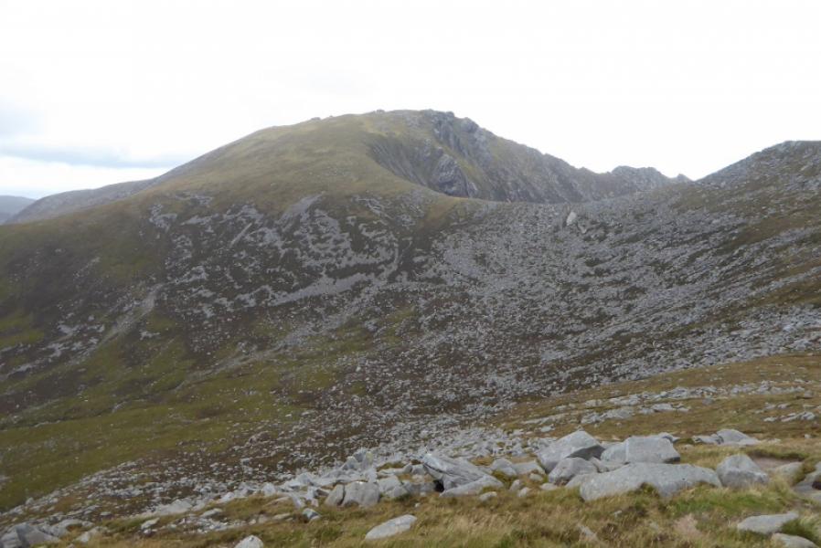
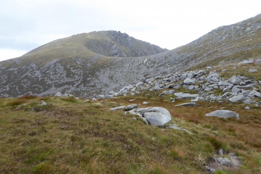
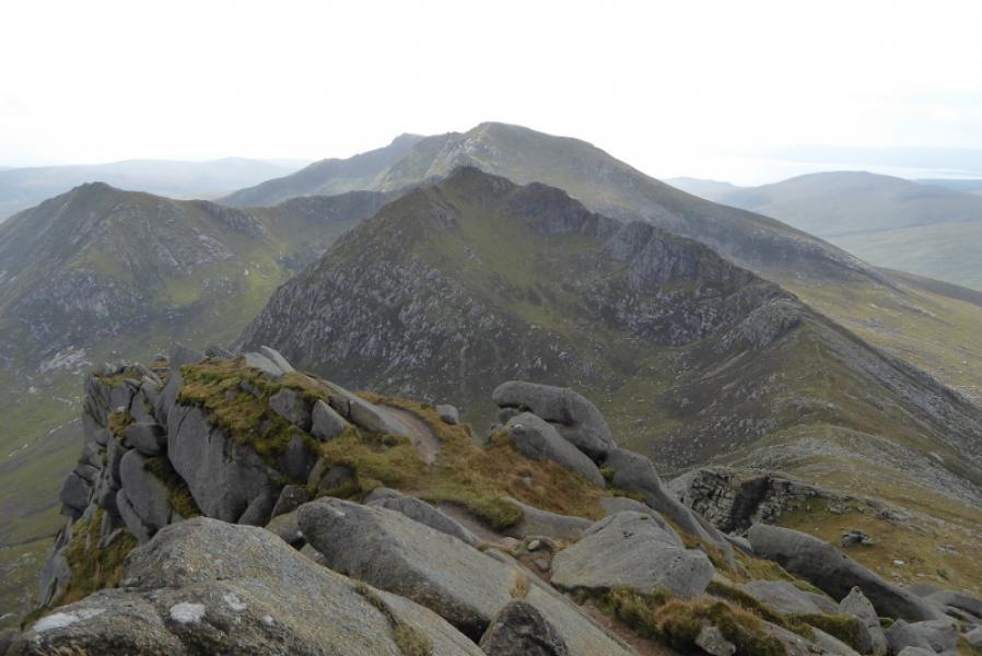
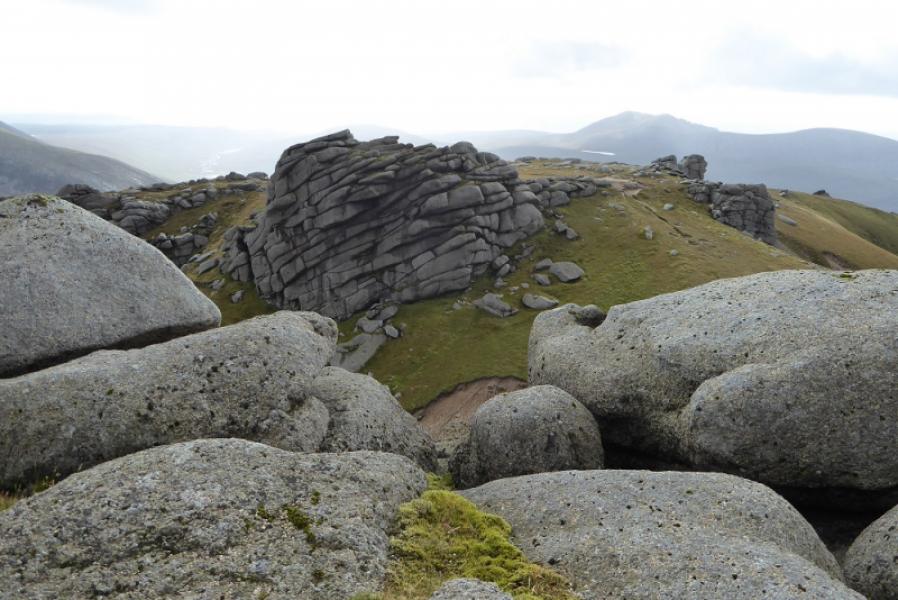
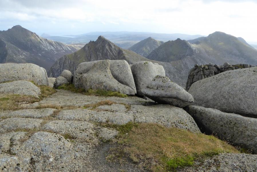
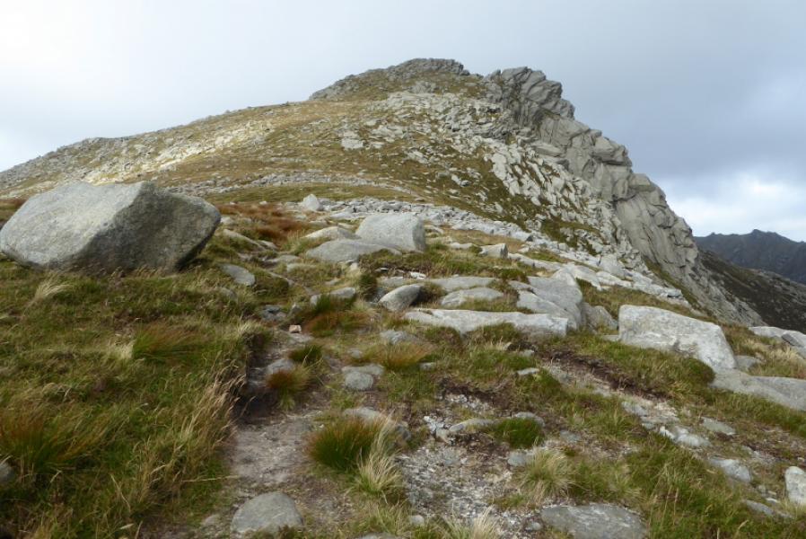
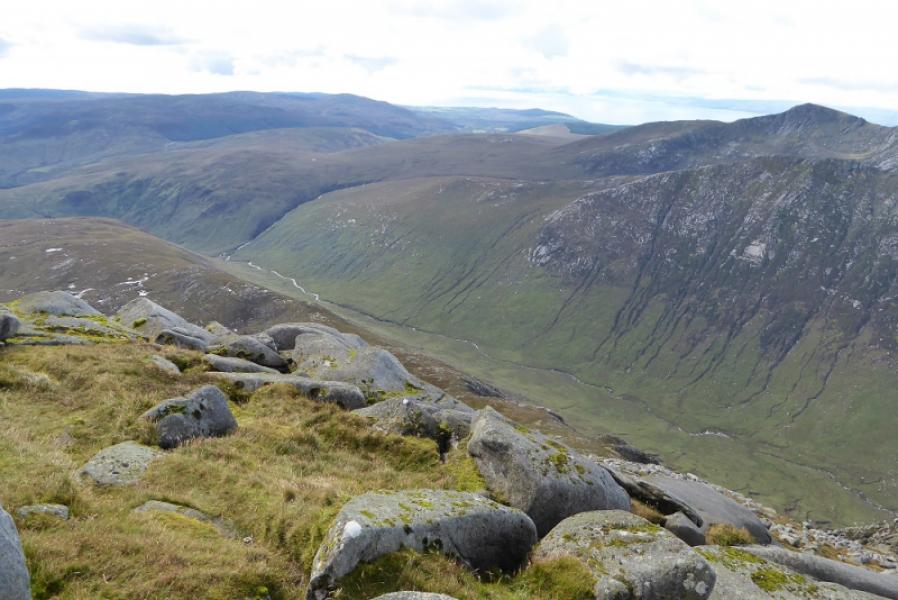
(1) Continue along the track from the camp site. After just over 2 km, reach the footbridge across the Garbh Allt. Cross over then follow the path up the side of the stream (not immediately obvious). The path is good but often overgrown in the summer. When the angle eases, the path becomes more muddy. Continue to where the stream splits. Follow the right fork. Almost immediately, it looks as if there is a crossing but ignore it and continue to where the path obviously descends to the stream. Cross here if possible and continue on the path towards the SE flank of Beinn Nuis. If this crossing is not possible then continue, along a vague path, until a safe crossing can be made. Once across, aim, probably W, to rejoin the path by walking across rough moorland. Continue up Beinn Nuis on the obvious path to reach a cairn just below the highest point which has no cairn. Descend, roughly N, still on the path to a col then continue up, past several rocky towers and over a few minor tops to reach the highest point. There is no cairn but a low embedded long boulder seems to be the highest point on Beinn Tarsuinn, 826 m.
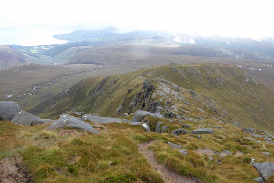
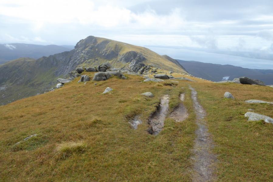
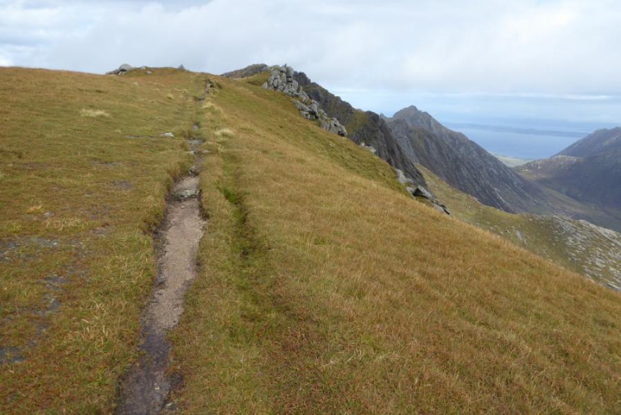
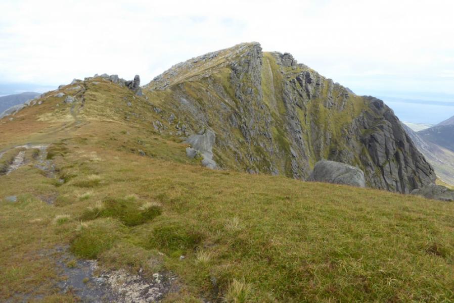
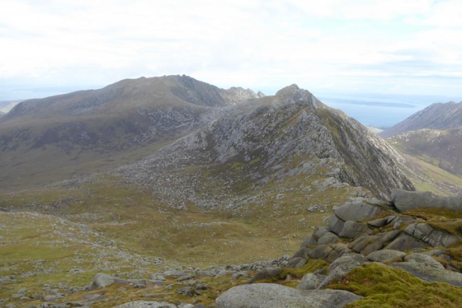
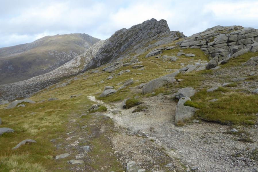
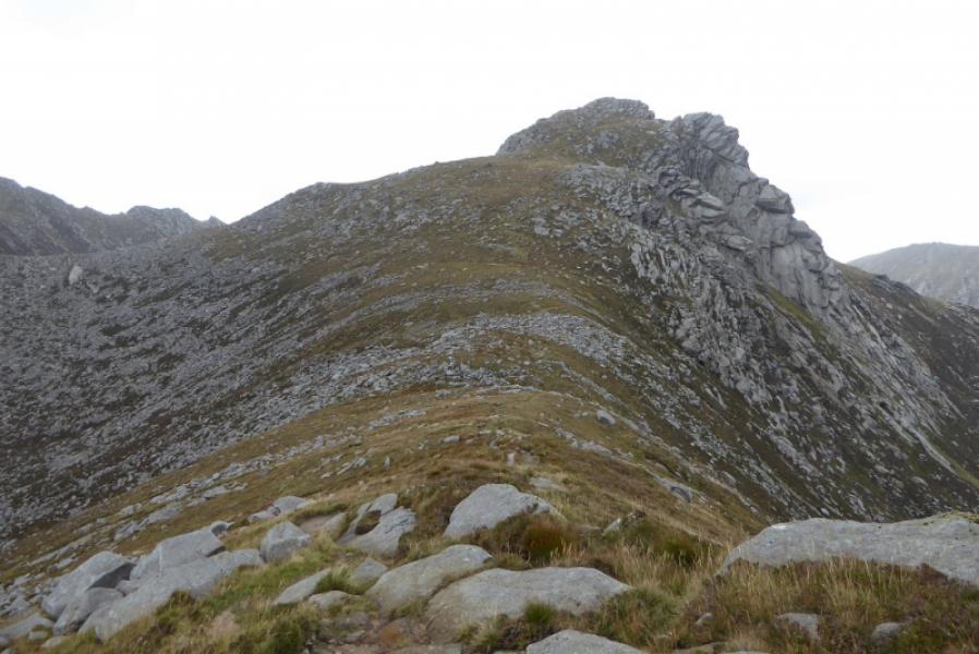
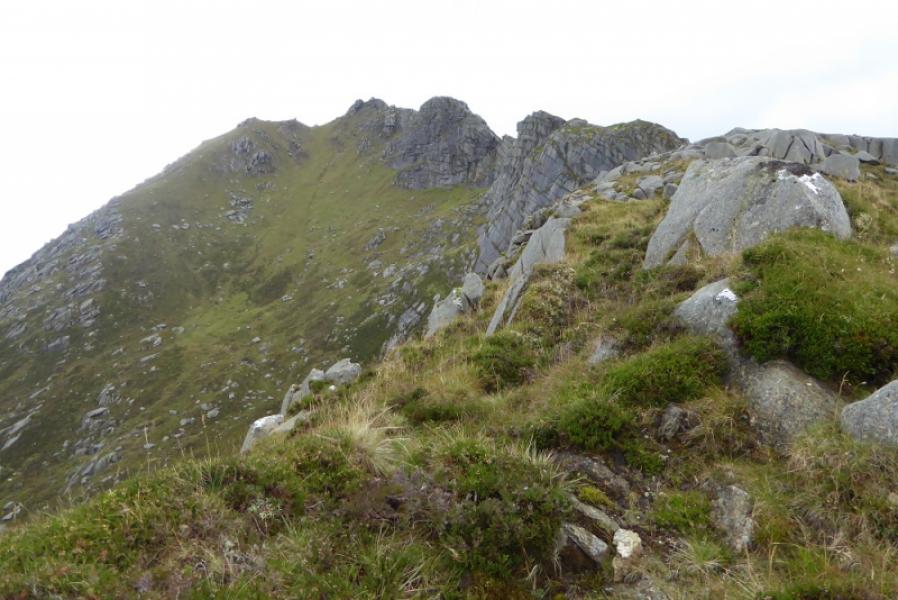
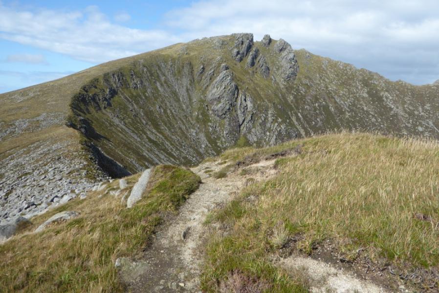
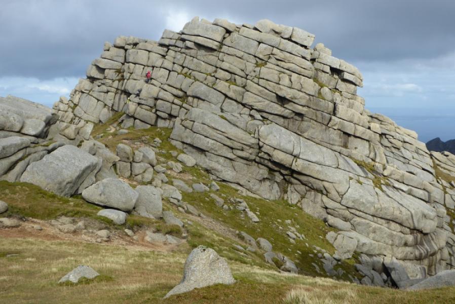
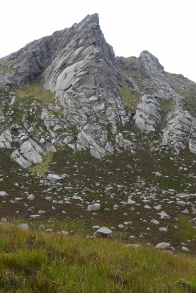
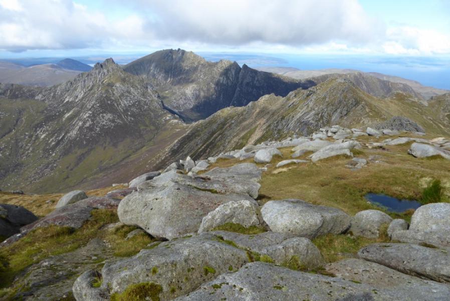
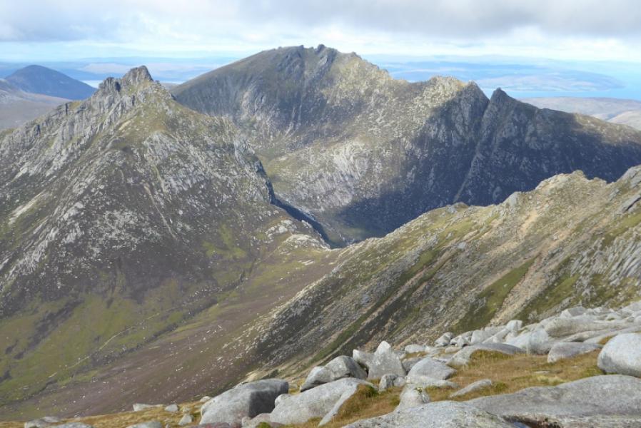
(2) The direct route down to the next col goes down the NE ridge. There is a path which weaves around avoiding the worst of the rock but there are a few small awkward steps especially when the rock is wet so descend carefully. It might be easier to go further W where the ground is more grassy. When the col is reached, the path splits. The right fork goes up A' Chir and is only for climbers as its ridge is quite technical and includes a rare stone trench. Walkers take the left fork which traverses below A' Chir on its W side with only a little extra loss of height. The path is fairly obvious most of the way and leads to the col between A' Chir and Cir Mhor. Head up the SW ridge of Cir Mhor. Higher up, the path is more obvious, stepped in places and one can get to within about 3 m of the summit with little difficulty. Care is needed for the final part as there is some exposure which will be unnerving in windy conditions so be prepared to weave around looking for the easiest way. There is no cairn but the highest point is fairly obviously on a rock so this is the summit of Cir Mhor, 799 m.
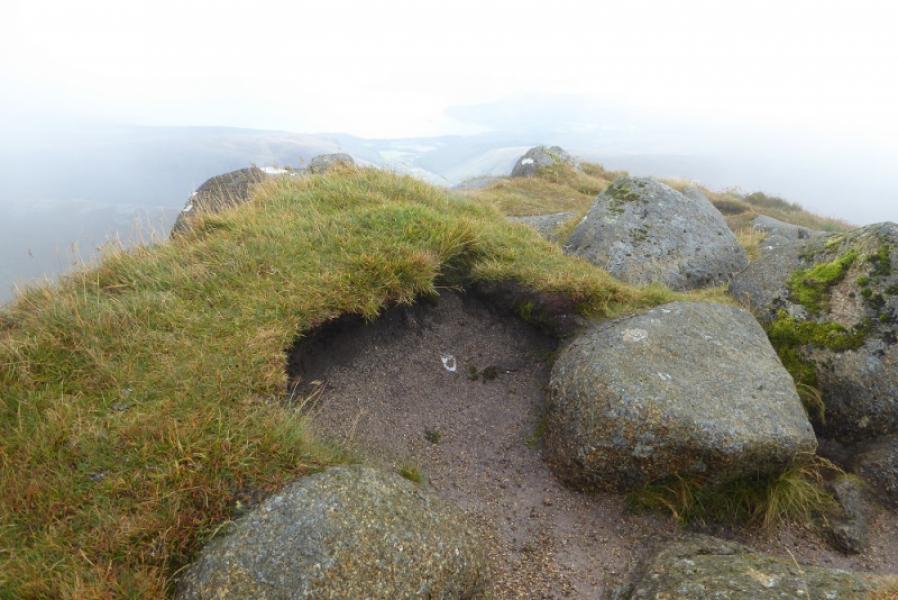
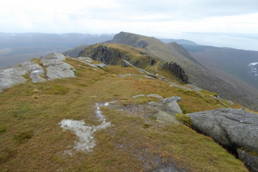
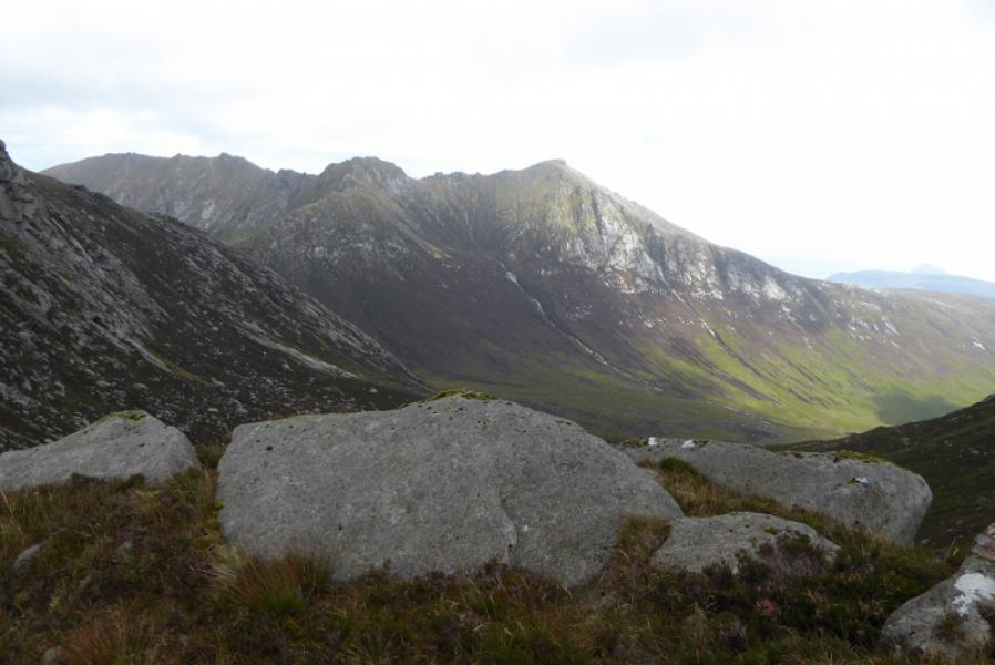
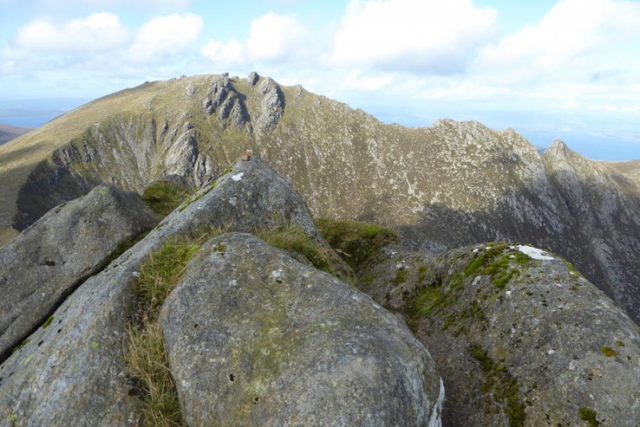
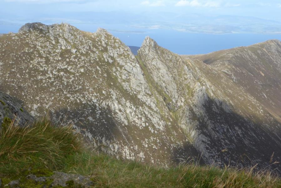
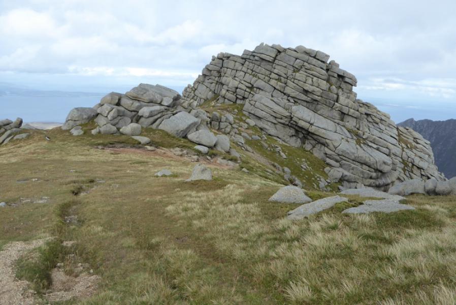
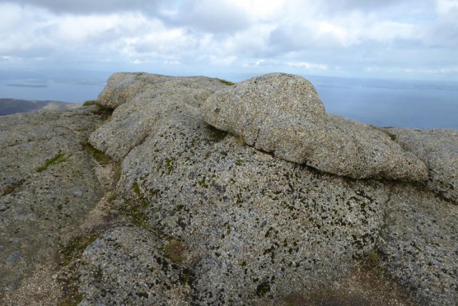
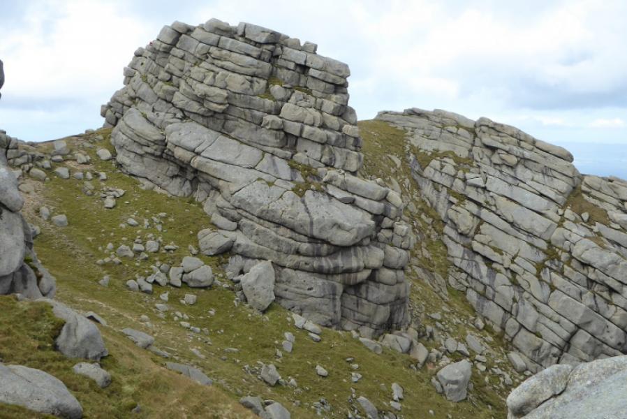
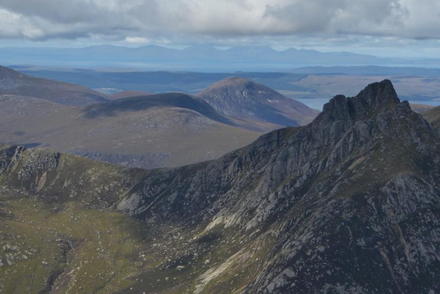
(3) Retrace down the route of ascent until it is possible to traverse across to the NW ridge. There is a faint path going across but it is not easy to find. A more obvious path goes down the NW ridge from below the obvious rocky prow. From the col the summit of Caisteal Abhail is the right hand side of the obvious notch although it doesn't look it from below! Reach the col to Caisteal Abhail then continue up the curving ridge to reach the flattish summit area where the path almost disappears. Find another path going left then right around the back of the first rock tower where it descends and passes below the back of the notch (a path cuts back into the notch for climbers) then passes the summit tower, on its N side, before regaining the crest. A path picks its way up from the E side. About 3 m below the summit, a short wall, about 1 m and not too exposed, has to be climbed. Above this it is straightforward to reach the highest point where, again, there is no cairn, but the highest point is fairly obvious which will be the summit of Caisteal Abhail, 847 m.
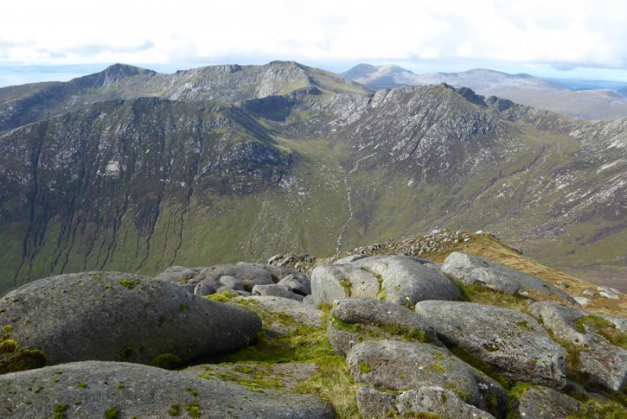
(4) Retrace to the crest on the E side of the tower. If returning to Glen Rosa then retrace to the col before Cir Mhor. Continue as if ascending Cir Mhor but, at a cairn above the col, take the traverse path which passes belwo Cir Mhor to reach its col with A' Chir where there is another cairn. A good path, stepped in places, leaves the crest here and descends into Glen Rosa where it joins the path coming from The Saddle and follows the river down. This path is well made and good underfoot but often well hidden by long grass so don't lose it! Reach the footbridge then rejoin the outward track back to the camp site.
Notes
(a) This walk took place on 5th September, 2017 and on 1st April, 2007 when the return was down the E ridge of Cir Mhor to The Saddle then down Glen Rosa.
(b) The route can be shortened by using two cars then descending to the second car from Caisteal Abhail. If the second car was left at the car park in North Glen Sannox then one could descend down the N ridge (not checked out) which is frequently walked. If a car was left at the entrance to Glen Sannox then one can either go down the east then north east ridge to the cleft before the Witch's Step which is quite a steep descent, probably a scramble, then descending about 15 m down to the north before traversing around the worst of the rocks or descending even further for an easier route before continuing along the ridge to Suidhe Fhearghas. It is then possible to continue down to join Glen Sannox about 1 km from the road. This descent was walked on 3rd April, 2007, but memories are too sketchy to give any more detail. It is also possible to descend N from Suidhe Fhearghas aiming for the car park in North Glen Sannox but there is no path down the final descent to the road. Another option is to retrace from Caisteal Abhail to the col to Cir Mhor where there is a cairn. A path, initially steep, drops down into Coire na h-Uamh then on to the main path down Glen Sannox. Another option might be to go to Caisteal Abhail before Cir Mhor then descend its E ridge to The Saddle. This is steep and involves scrambling just below the summit. From The Saddle, one can walk down Glen Sannox. Another option could be to ascend North Goatfell from The Saddle then descend to either Corrie or Cladach. Cladach is about 2 miles from Glen Rosa campsite. It is also possible to descend from Goatfell by returning over North Goatfell then along the NNE ridge to Cioch na h-Oighe before descending into Glen Sannox. This route has been ascended, 3rd April, 2007, and needs good route finding skills so many may find it awkward. If using two cars, it is probably easier to avoid the awkward descent of Beinn Tarsuinn by doing the route in reverse so that section is ascended.
(c) As stated above, parking above Glen Roas campsite is very limited. There are 2 spaces by the “bins”, 1 a little further on the left, a parking “bay” for about 3 cars (at right angles to the road) just before a white building a little further on where the tarmac road ends. It might be possible to go a little way along the track where there is possible parking at what might be an old turning point.
Photos - Hover over photo for caption. Click on to enlarge. Click on again to reduce.