Get Lost Mountaineering
You are here: Ireland » South West » Iveragh Peninsula
Coomloughra Horseshoe anti-clockwise from NE of Lough Accose
Coomloughra Horseshoe anti-clockwise from NE of Lough Accose
Start/Finish
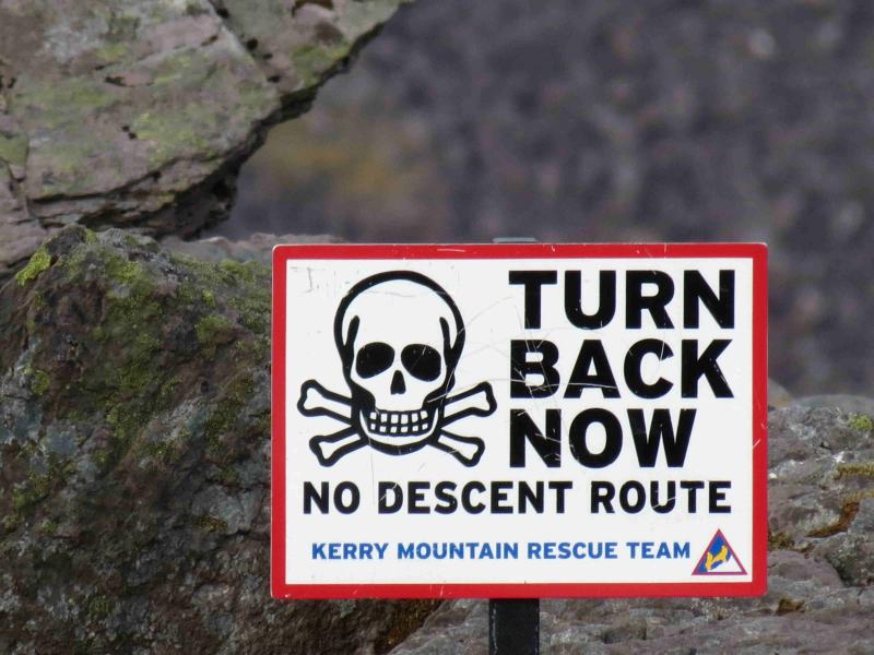
Start of Hydro road at V 771 870 on the Killorglin – Glencar road about 2 km NE of turning for Lough Acoose. This point has a wooden gate and a metal gate adjacent to each other with a Kerry Mountain Rescue notice on the metal gate. The “road” starts as a rough gravel track. There is limited parking about 400 km up the road towards Killorglin. From Killarney, drive towards Killorglin and take the first left after the Fossa camp site, signposted Gap of Dunloe. Follow this meandering road, ignoring all turns, past the Gap of Dunloe turn off, past the crossroads with petrol pumps and a store then past the Carrauntoohil turning for Cronin’s Yard. In fact, continue to the end of the road at V 776 889 where you have to give way to the Killorglin – Glencar road. Turn left, S, and it is about 2 miles to the start. You will pass the parking places en route to the start of the walk. 2013 update: There is now a new tarmac road just before the metal gates (on the Killorglin side) with plenty of parking up it. A rough track leads from the car park to soon join the Hydro track.
Distance/Time
15 km Approx 10 hours (shorter if horseshoe not retraced)
Peaks
Caher NW Top, 975 m, V 790 840 (Irish National Grid System)
Caher, 1001 m, V 7931 838.
Carrauntoohil, 1039 m, V 803 844.
Knockoughter, 959 m, V 801 847.
Beenkeragh, 1010 m, V 801 853. Irish OS Discovery Series Map 78 (1:50000)
Introduction
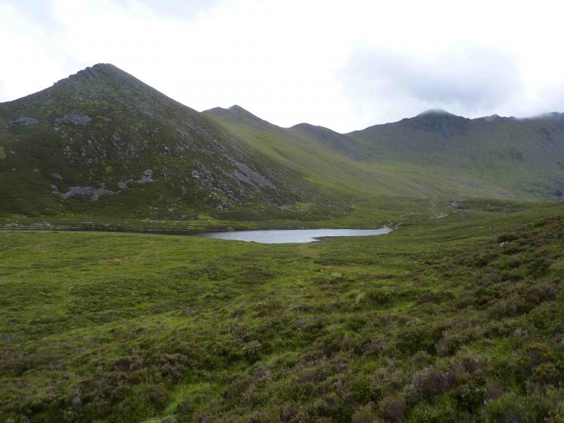
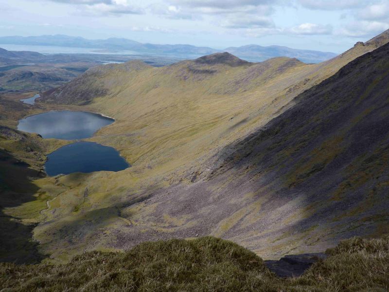
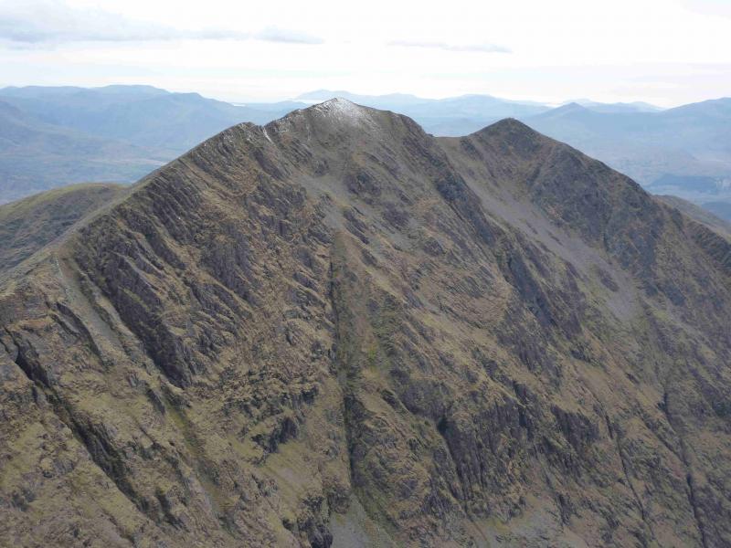
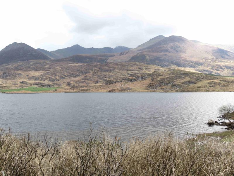
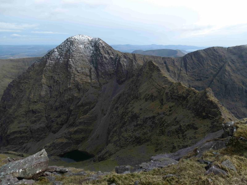
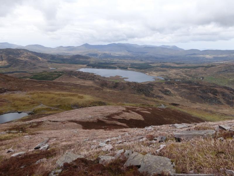
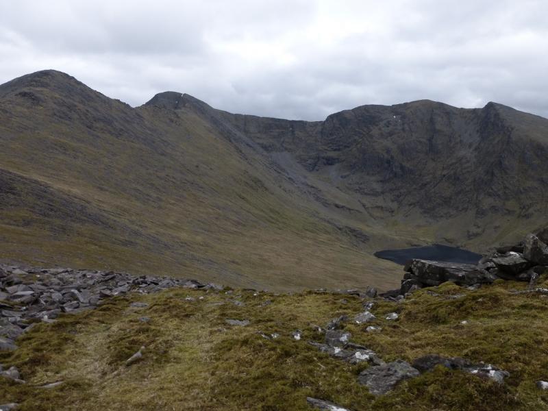
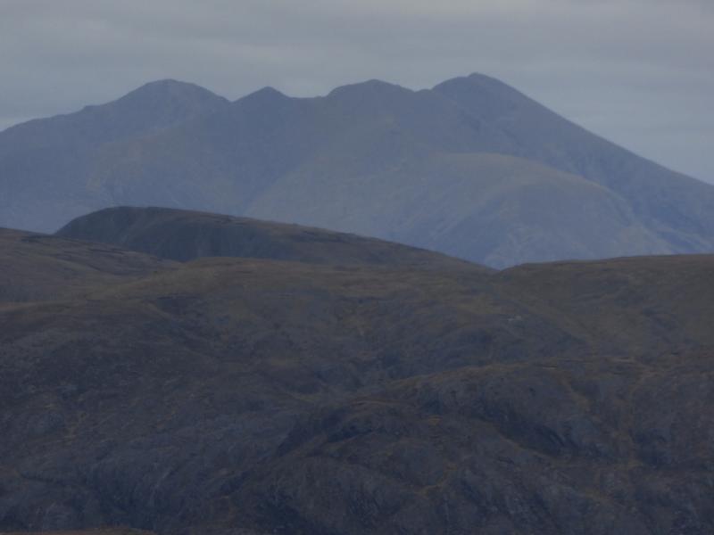
MacGillycuddy’s Reeks are the highest mountain range in Ireland and may well be the longest ridge over 3000 feet in the British Isles. The reeks are essentially “Y” shaped with Carrauntoohil (highest peak in Ireland) at the junction. This walk takes in the top of the “Y” as a horseshoe. Choose a good day as the Reeks can often be in cloud. Good views will be visible throughout this route on a good day. Navigation is relatively straightforward apart from the location of the ridge from Carrauntoohil to Beenkeragh but if you need to, you should be able to easily reset your GPS to the Irish National Grid System. The unusual aspect about this route is that, when Beenkeragh is reached, instead of continuing the horseshoe, the outward route is reversed as this is arguably more scenic but it does considerably lengthen the day. Much of the horseshoe is in view from Lough Eighter on a good weather day.
Route
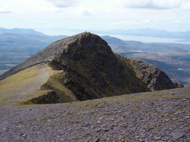
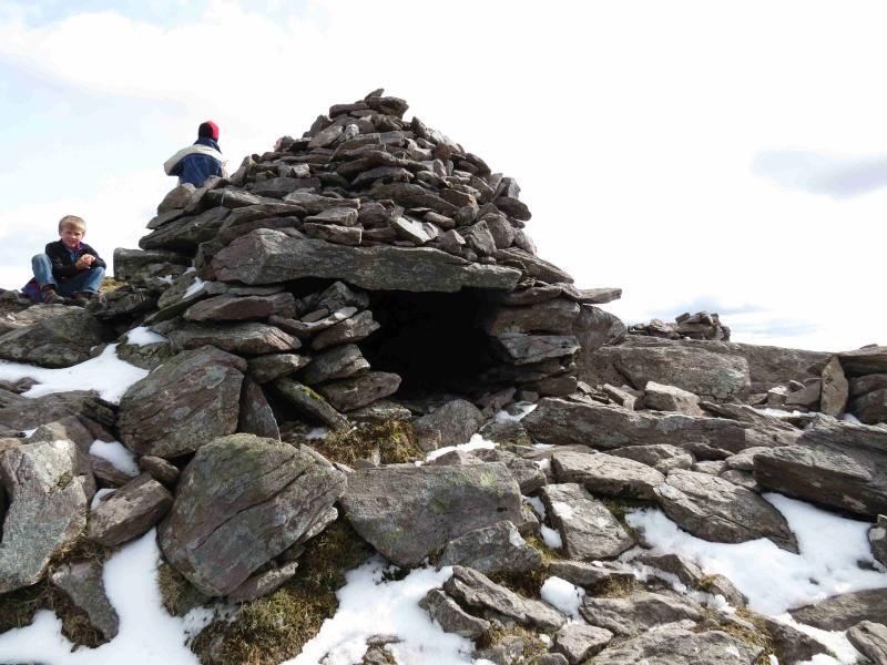
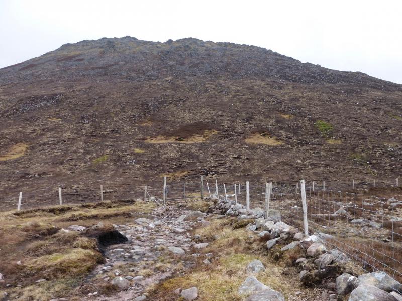
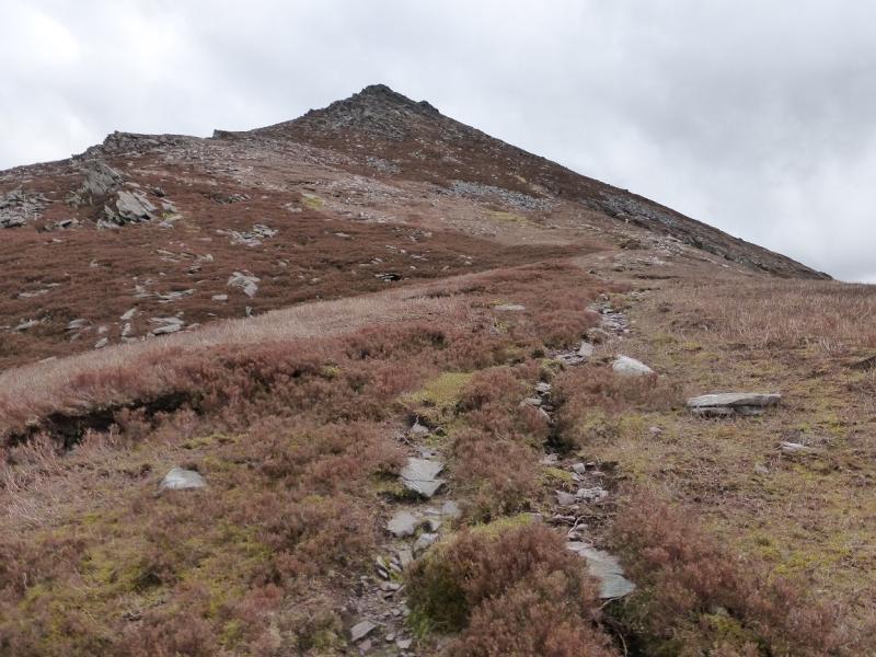
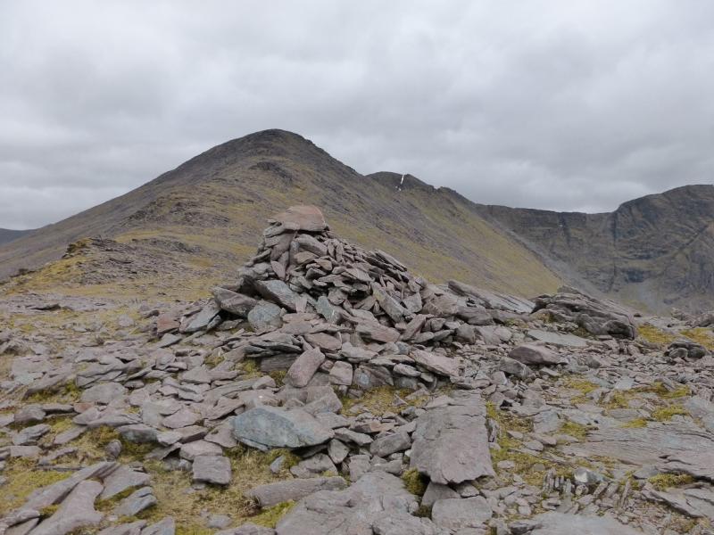
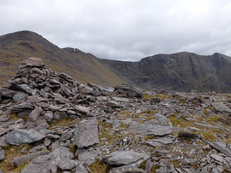
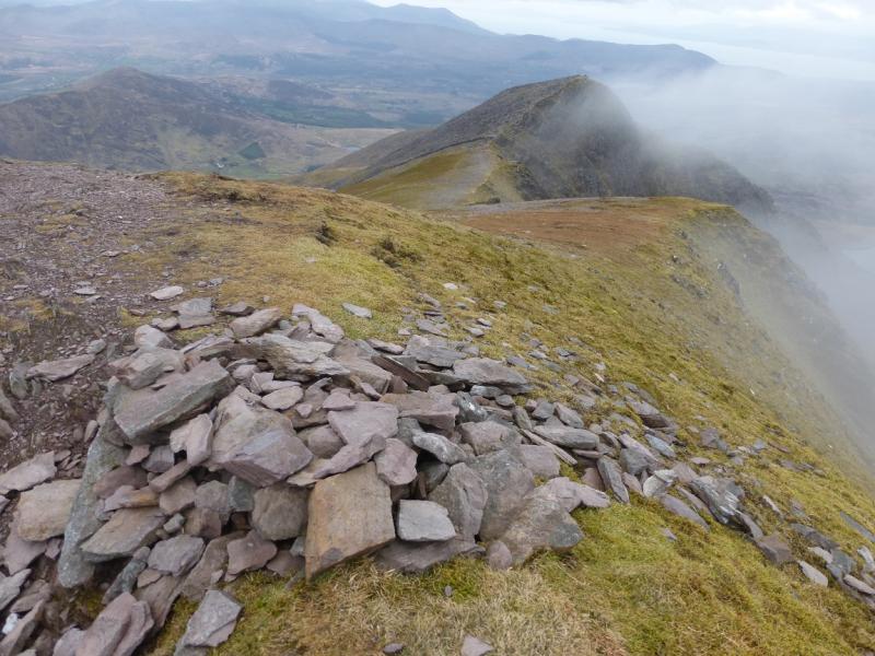
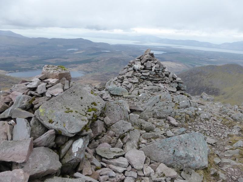
(1) Walk up the Hydro track, steep in places, to its end at a small dam at Lough Eighter. Continue, roughly S on a mainly distinct path over flattish boogy ground, after which the path climbs SE on boggy, peaty slopes before the path becomes more stony and steepens. After a fairly long pull, reach the NW top of Caher, 975 m. There are two cairns, one of which has been made (14/7/10) into a small stone hut with a roof.
(2) Descend SE, still on the good path, past the end of a wall, then ascend ESE to a short ridge with a large cairn which is the summit of Caher, 1001 m.
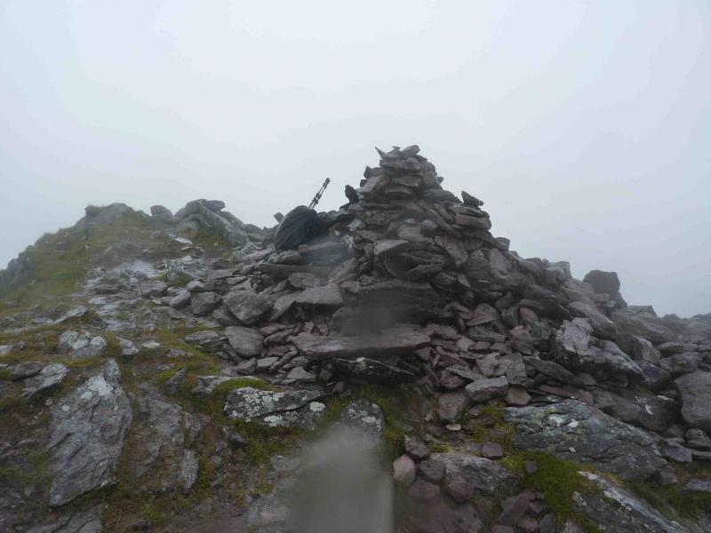
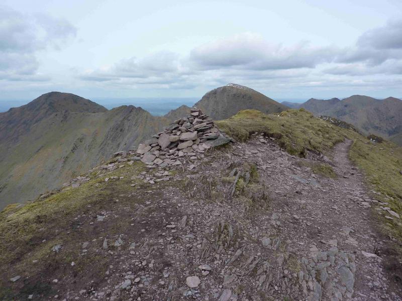
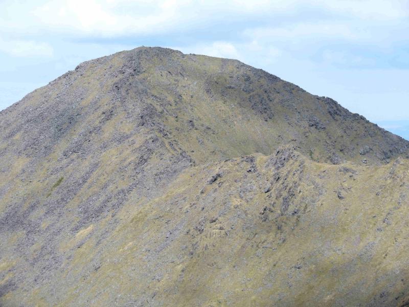
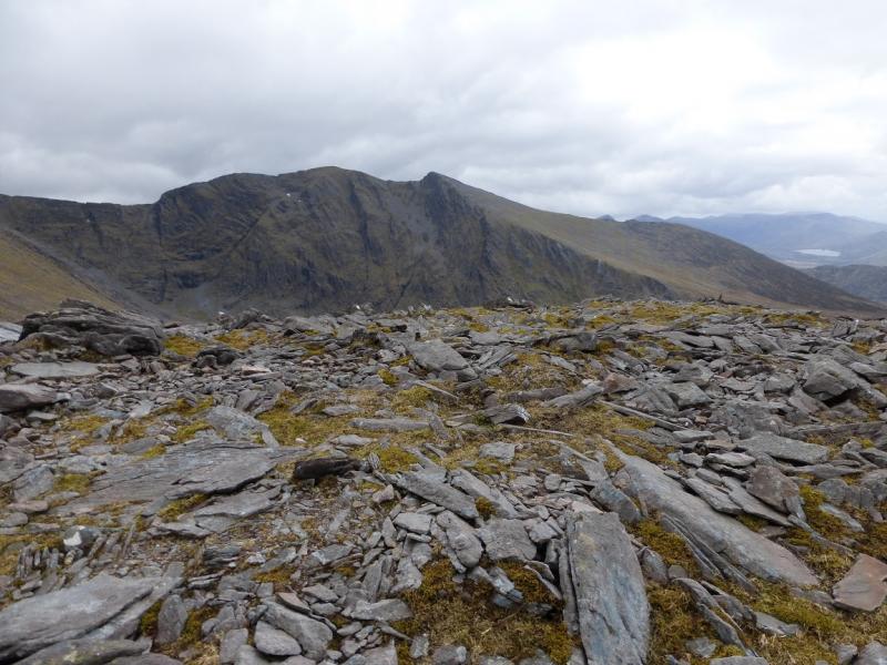
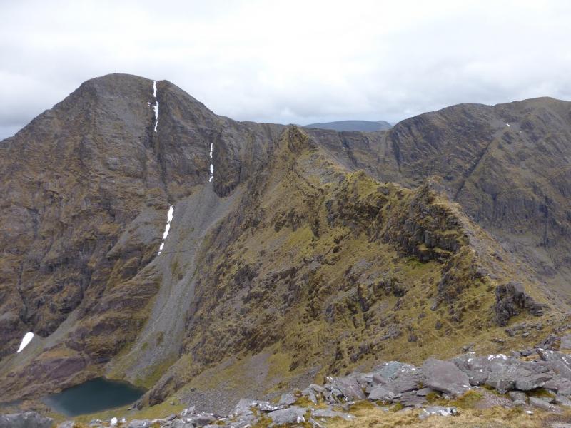
(3) Descend E, still following the path which undulates along a narrow ridge before dropping to a col then climbs, swinging NE, up mainly grassy slopes towards the summit of Carrauntoohil. The path follows the left hand edge and turns right just after an obvious cairn (but before a much flatter cairn on a flat spot) about 100 m before the summit of Carrauntoohil, 1041, the highest point in Ireland, where there is a large cross made of girders and a walled shelter plus a trig point. There can be no doubting where you are!
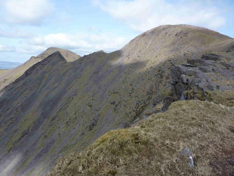
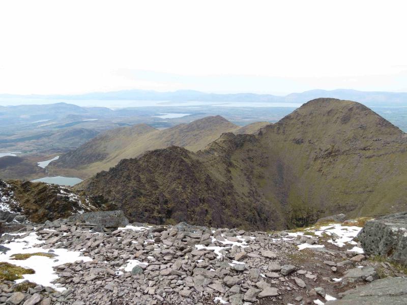
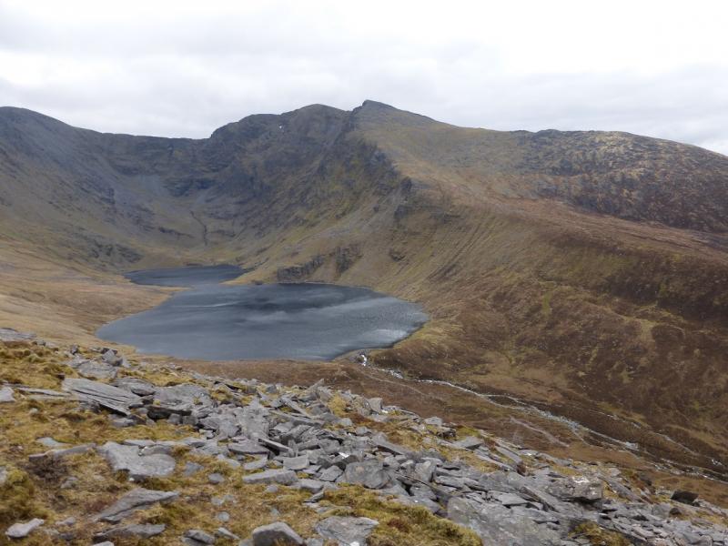
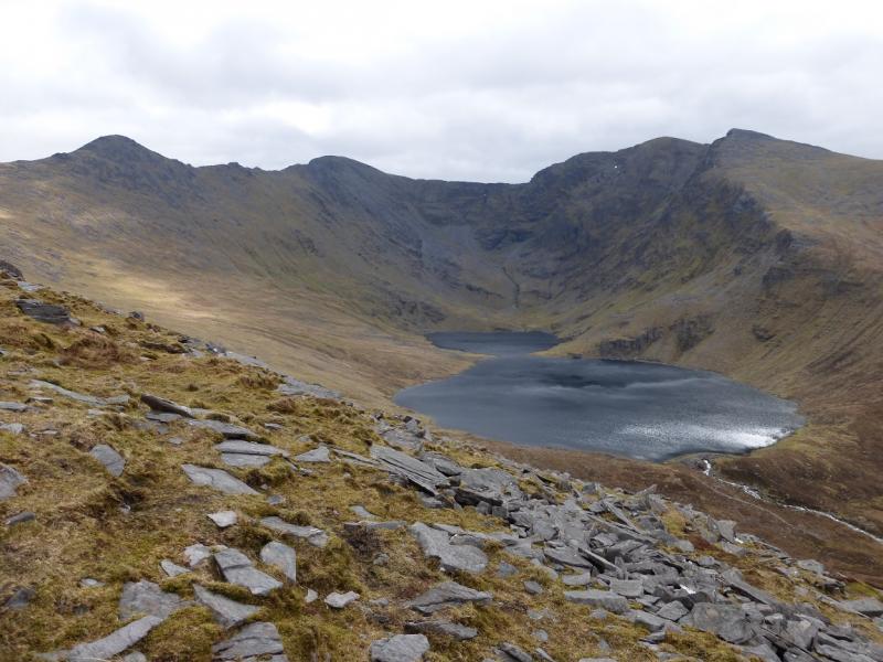
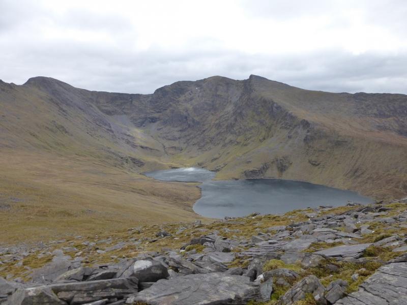
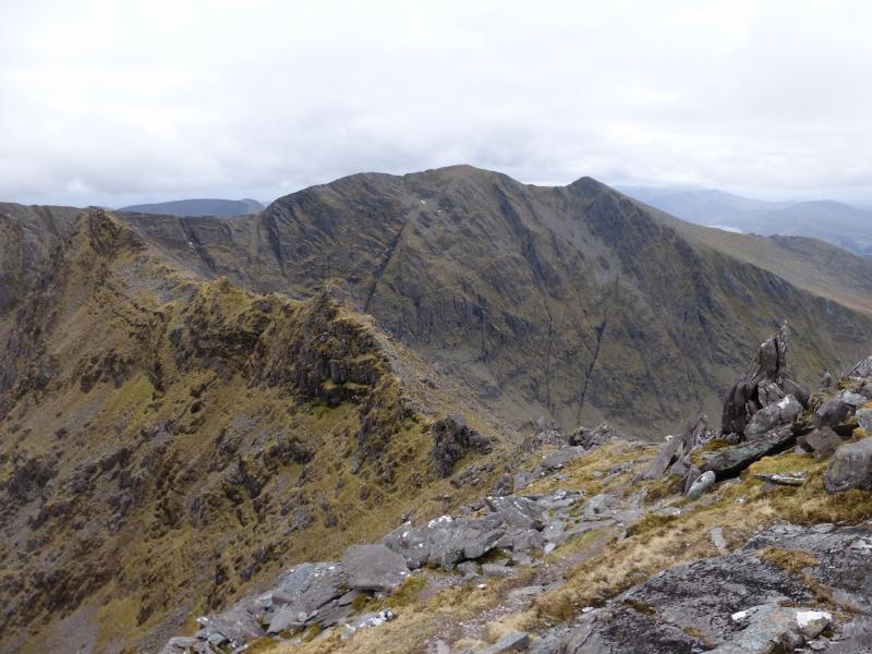
(4) This is the part which can catch many people out but it is quite straightforward if you keep your wits about you! Retrace the 100 m and go to the flatter cairn (right at the turning as opposed to returning to Caher which is left) near to which there are two distinctive paths going down. Follow either down (more appear), descending about 100 m until the paths converge and level off along a grassy ridge where there is a very distinctive path going down a grassy gully into a corrie with a small lake. This gully path is Brother O’Shea’s Gully. It is not your route today. Note that you may well have encountered another short level section (shoulder) just before this one but there is no path down a grassy gully here. The top of Brother O’Shea’s Gully is a small grassy col. Beyond the top of O’Shea’s Gully is an obvious peak called Knockoughter, 959 m. Follow the path along the narrow ridge, NW to Knockoughter (no cairn) then swinging round to NE to climb Beenkeragh. The narrow ridge is very rocky but there is a path to follow although some easy scrambling cannot be avoided without descending some way down on W side. The path criss-crosses the crest of the ridge. There are quite a few tops. Knockoughter is slightly nearer to Carrauntoohil than Beenkeragh. If in doubt, ascend each top! After about 2 km, the ridge starts to climb and becomes less rocky to reach the large summit cairn of Beenkeragh, 1010 m, which is on the first flat spot after the climb and just before a boulder field. In clear weather, the ridge from Carrauntoohil to Beenkeragh is very obvious.
(5) Retrace the route back to the start.
Notes
(a) This walk took place on 14th July, 2010.
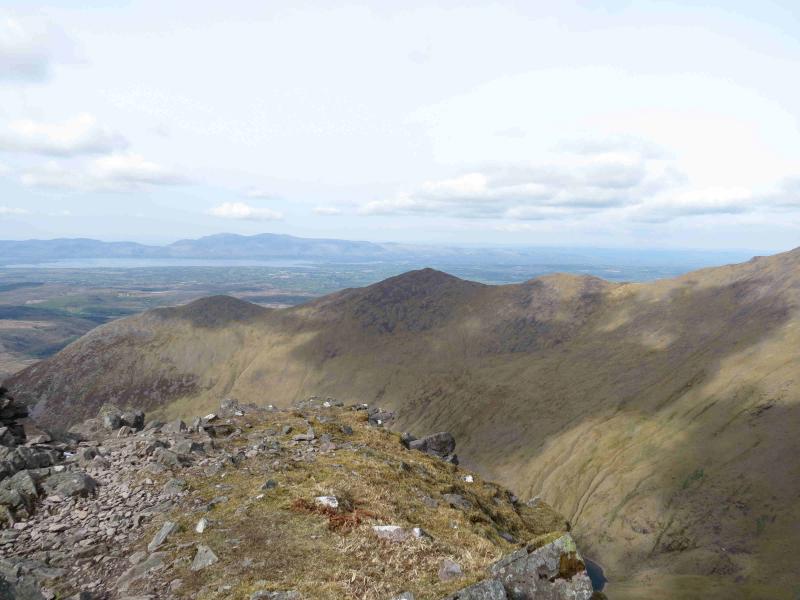
(b) To complete the horseshoe from Beenkeragh go NNW then NW to its col with the E top of Skregmore. There is a path along the Skregmore ridge over the W top then to Breenlee and down its SW ridge to the dam at Lough Eighter. Alternatively, there are other paths off the Skregmore ridge down towards Lough Eagher and Loch Com Lothair. In good weather, these will have been visible during the ascent of Caher.
(c) The Fossa camp and caravan site, at V 910 923 is very good and very well situated for the Killarney mountains, especially Macgillycuddy's Reeks and Purple Mountain as it is only about 3 miles from Kate Kearney's Cottage. At Fossa, there are camping and caravanning facilities as well as a hostel and static trailer vans can also be hired. For campers, there are excellent showers (small extra charge) and there is a good campers’ kitchen with tables, sinks and cooking area if you have your own cooker and pans. Gas rings are available (small extra charge). There is also a TV room. Reception is open quite late in the high season and the staff are very helpful. A computer is available for hire and there is a freezer in reception. There is a bus stop outside the site for Killarney. There is a 24 hour Tesco which is off the northern bypass (turn right at 4th roundabout then right at next). Out of high season, it can be better for 2 people to rent a trailer van than to camp separately.
Photos - Hover over photo for caption. Click on to enlarge. Click on again to reduce.